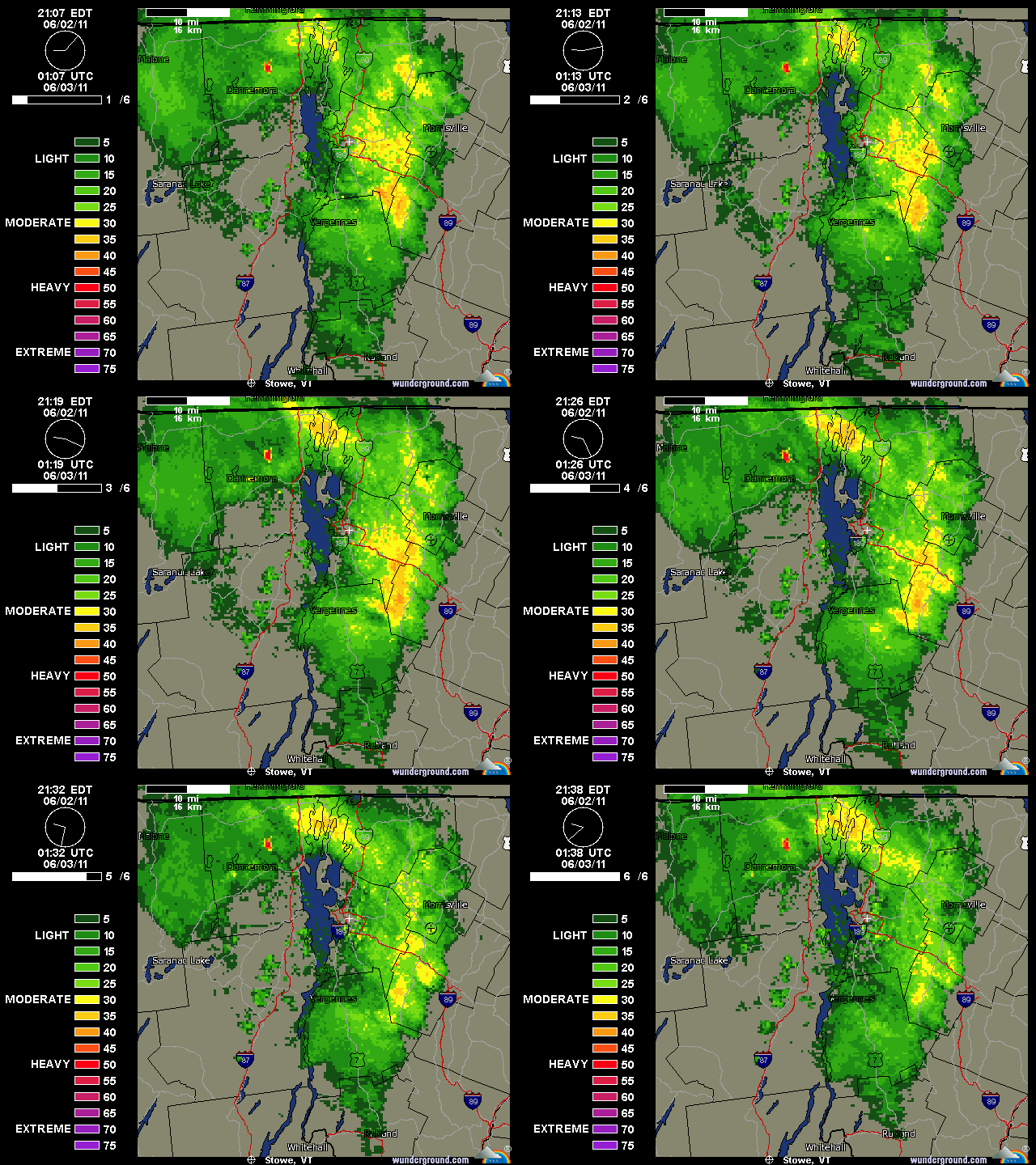
After drying out to amazing low humidity on Wednesday, temperatures got really cool on Thursday and we got into a classic Northern Vermont upslope flow. There was actually some snow falling in the highest elevations of the Greens, and certainly over in the Whites. There were just a few spits of rain in Burlington when I left yesterday afternoon, but of course I got to the house and it was a steady light rain with a tenth or two of an inch already in the gauge. This morning the gauge contained 0.27” of liquid in it and I thought, heck, that’s a half foot of upslope snow right there when the temperatures are appropriate. I was looking at the radar image posted by Powderfreak at Americanwx.com and could see how at one point it exploded with 35 db and even a few 40 db echoes over our area at the junction of I-89 and the Chittenden/Washington county line, and then dissipated on the east side of the mountains once it dropped its payload:

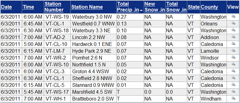
When I submitted my report to CoCoRaHS this morning, I took a quick look at what some of the other stations had reported. I sorted the list below from around 7:00 A.M. by total precipitation, but even without that, it was pretty easy to see the locations that got the liquid:
I haven’t been able to check out the local peaks to see if they have any white on them because they’ve been socked in, but Mt. Washington got some new snow and they must have been whitened. It’s 26 F up there now with freezing fog and 50+ MPH winds. With such a good-looking forecast for tomorrow, we may head over for some turns, but these past couple of days certainly should have been good for snow preservation.


Jspin… how do you embed the historical radar? Can I do the same for New York?
Harv, I grab the radar images from Weather Underground (although as far as I know they are only available in real time); I learned it from Powderfreak. If you open up the Current Burlington NEXRAD Radar Map page, you’ll see a little link in the lower left of the radar box that says “View / Save This Image” click on that and it brings the radar image up by itself in a format that you can right click and save. They are animated .gif files, but seem to work fine on websites, forums, etc. We use these images a lot to visualize upslope snow in the Greens, and Powderfreak said that “composite” is the one that you want to go with for that – I believe it puts all the various angles of reflectivity together. For the radar options, look in that box in the upper right that says “Select Radar Type”. Also, you can zoom in on the radar by drawing a box in the area you want. I’m sure Weather Underground has the radar for other locations too if you need them. Good luck trying it out, let me know if you have any additional questions.
I found the Albany version of the NEXRAD, but it didn’t seem in motion. Maybe it’s just having an issue tonight. Would love to save radar from the most epic storms.
They may default to static view, but you can click in the upper left on the “Animate Map” link and it should get moving. There are also lots of additional options if you scroll down below the map – I like to set them to the maximum 10 frames of motion.