
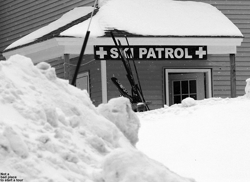
Since the storm that came through in the midweek period, we’ve moved under the influence of an upper level low pressure system that is off to our northeast. It’s keeping snow showers in the area, but as of this morning the Northern Vermont ski Resorts had only picked up 1 to 3 inches of snow. Without much in the way of new powder, it was a little hard to get the boys motivated to head up to the mountain today, but E thought that they might be excited by some swimming at the Bolton Valley Sports Center. Indeed that was enough to get them excited, so while E and the boys spent time at the pool, I planned to get in a quick sidecountry and backcountry ski tour. My plan was to head off the back side of the Wilderness Summit to explore a line that I’d seen before, and then connect back onto the trails of the Bolton Valley Backcountry Network and return to the village via a front side run. Dylan had to get to a birthday party at 3:30 P.M., so I had to fit my tour into a two to three hour window.
 E and the boys dropped me off at the base of the Wilderness Lift as they headed down to the pool, and light snow was already breaking out after a morning lull. Temperatures were comfortable in the low 20s F, and winds were fairly minimal. Rime still coated the trees all over the mountain, and clouds shrouded the upper elevations, leaving the overall views very white. As I approached the Wilderness Summit, the chairs ahead of me began to disappear into the clouds, but visibility at the summit itself would up not being all that bad.
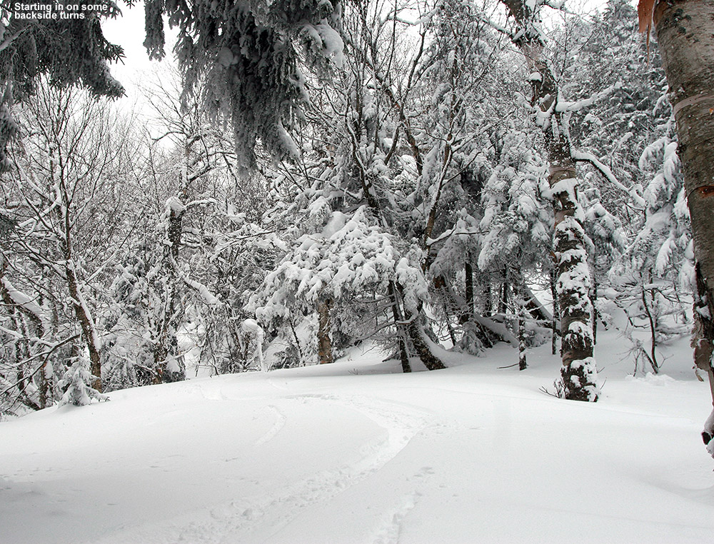
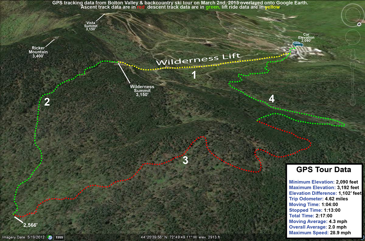
I followed the main route off the back of the Wilderness Chair that I’d taken before, and found a skin track ascending as I began my descent. I initially followed the main drainage right below Ricker Mountain, but continued to head off to the north because I kept finding the terrain much more open. The skiing was quite good, even if the powder was a rather dense, Pacific Northwest style snow, but it covered everything below the snow with such effectiveness that it really proved its worth. There were numerous and continuous open areas, allowing for some big turns. I’d pulled my fat skis out after a couple weeks on skinnier gear, and they were absolutely the call today. The dense snow was accommodated well with girth and rocker, and there were minimal worries about catching a ski under the snow. I continued to descend, heading generally northward when the appropriate opportunities arose, until I’d hit the 2,500’ elevation mark after descending close to 700’. The snow was getting a bit of crust on it down at that elevation, and the terrain was flattening out, so it was the perfect place to stop. I found myself in an area that I knew fairly well from previous tours, and with a little GPS guidance I was able to plot a course up toward Paradise Pass.
As I’d done on the descent, I continued to check the depth of the snow as I skinned up. I generally measured depths between 20 and 30 inches before reaching a real solid subsurface, and although I was only skiing on the top several inches due to its density, it was still quite impressive. All that wind that I mentioned in my Bolton report from February 18th had to put the snow somewhere, and plenty of it got thrown to the leeward slopes. Combined with all the recent snowfall from various storms, it’s mighty deep out there. The Mt. Mansfield Stake is at 63” as of yesterday evening, which is actually about a half foot below average, but at this time of year even being a bit below average means a pretty deep snowpack. The intensity of the snowfall had picked up quite a bit since my tour began, I just about had to wear my goggles even while ascending because of the snow intensity at times.
I got myself up to Paradise Pass, and had to pull out my map a few times and I wound my way over to the section of Heavenly Highway where I planned to make my front side descent. After a couple direction changes, I met my goal, and hit a glade I’d found that brought me right down to Snow Hole. I couldn’t believe that the front side snow in the high elevations was even slightly better than I’d found on the back side. I think that a little more of the recent snow had fallen there, creating a thicker coating atop the denser snow. Whatever the case, it was sweet and allowed me to rip my way down through the terrain. Once down to Snow Hole I called E to check on their status – they were done swimming and were having lunch at the Village Deli. With that info I was able to head toward the base of the Wilderness Lift, and then onward to the deli for some lunch of my own. I was pretty bushed from keeping such a high pace on the tour to ensure that I got back to the village in time, and boy did I devour that sandwich.
Later in the evening we went for a snowshoe tour around the neighborhood and across the Winooski, and the snowfall picked up, providing an excellent wintry scene. We’ve already had more snow tonight than last night, and all these small rounds of snow are going to really help in keeping the slopes fresh.


3 Replies to “Bolton Valley and Backcountry, VT 02MAR2013”
Comments are closed.