Bolton Valley, VT 23DEC2011 (A.M. Session)

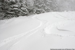
An image of ski tracks in the fresh powder along the edge of the Sherman's Pass Trail at Bolton Valley in Vermont - December 23, 2011
Making some tracks in the fresh powder along the edge of Sherman's Pass on the upper mountain

The potential storm system that we’d been watching for the past few days started trending warmer in some of the later weather model runs – warm enough that even the lower valleys in Northern Vermont looked like they might be dealing with a little rain before the snow moved in.  That wasn’t the case though, at least in the mountain valleys east of the Greens.  This morning when I got up I found 2.2 inches of snow on the snowboard at our house in Waterbury, and no sign of rain.  Light snow was still falling at the house, and with even more snow expected to fall in the mountains throughout the day, it seem like an opportune time for some storm day skiing.

I decided to head up to Bolton a bit early to earn some turns ahead of the 9:00 A.M. opening of the Mid Mountain Double.  I couldn’t quite convince the boys to go with me, but I figured I’d come home after a couple runs and get them to go up later in the day.  The valley snow accumulations certainly dropped off as I headed west to the town of Bolton, and at the bottom of the Bolton Valley Access Road (340’), I’d say the accumulation looked like about 1”.  As I ascended the road, I was surprised at how slowly the accumulation increased – even up at 1,000’ it didn’t seem like there was too much more than at the base of the road.  Eventually the depth of snow started to increase though – up at 1,500’ at the base of Timberline, the trails had a decent covering of a few inches (although they may have had some base left from earlier storms).  The ascent of the road was a little tricky; with temperatures near freezing, the new snow was a bit greasy.  The traction control in the Subaru came on a few times in the slickest spots, but the ascent was pretty controlled and uneventful.  Watching how slowly cars were descending in the other lane had also been a tip off that the conditions warranted caution.  Up in the Bolton Valley Village area at 2,100’ I found 2-3” of fresh snow on the car next to me when I arrived, and I suspect that car had been there since the start of the snowfall.  It was snowing a steady light snow as I prepared my gear, and there was no wind, so the potential for fresh tracks was looking good.

I ran into patroller Quinn at the base of the Mid Mountain Double Chair, and since it was getting close to the 9:00 A.M. opening time for the lift, he said that I should avoid skinning right up Bear Run to keep out of the way of downhill traffic on open terrain.  Fortunately, this round of snow was enough to make skinning practical on natural snow terrain – even on the lower part of the main mountain.  I was able to skin up Villager to Foxy, and with the addition of the new snow the natural snowpack was generally 3 – 4”.  The fresh snow was reasonably dense, so it was plenty to keep my skis away from the ground underneath.  I stopped in at the summit station of the Snowflake Chair, grabbed some snow photos, and spend a few moments enjoying the quiet and the snowfall.

I continued on over to the mid mountain area, then headed up Bull Run to Sherman’s Pass.  The mountain was running a couple of snow guns on Sherman’s, presumably in spots they wanted to finish up for tomorrow’s planned opening from the Vista Summit.  The snowfall definitely intensified on the upper mountain, coming in at a moderate level with some larger flakes up to 7 – 8 mm in diameter.  The more intense snowfall had made a difference in the accumulations as well.  Up around 3,150’ near the Vista Summit, depth checks revealed that new accumulations were 4”+, and I found total natural snowpack in the 6 – 8” range.  That snowpack is actually pretty substantial, since there is a good layer of consolidated stuff on the bottom that went through the recent thaw/freeze.  With this new snow on top, which is certainly not ultra fluff, one good storm is all it will take to open some of the mellower natural snow terrain on the upper mountain.  As I put away my skins and got ready for the descent behind the top station of the Vista Quad, I check on the thermometer and the temperature was 28 F.  Unlike below, there was a bit of a breeze, perhaps 10 MPH, and the wind turbine was running.  I got a call from Johannes asking about where I was and if I wanted to ski with everyone, and I told him that I was at the Vista Summit and would be down soon.

The descent was nice.  Although most of Sherman’s was messy with track marks and ruts from all the snowcat and snowmobile traffic, I was able to find some fresh turns off to the sides of the trail where equipment hadn’t blemished the snow.  Just as I was descending to mid mountain I saw Helena getting off the Mid Mountain Chair, so the timing was perfect for meeting up.  Helena was on her new twin tip skis, and although she commented that they felt weird at first, she made some beautiful, controlled turns, and it looked like she was going to take to them pretty quickly.  Thomas and Johannes soon caught up to us on our descent, and we did a couple of runs while Stephen finished getting into his gear.  At some point during that time we started to get some nice big 1” upslope-style flakes of snow – the intensity was still generally light to at most moderate at times, but it had that nice winter maelstrom look to it and it was helping to keep things fresh.  I caught one more run once Stephen joined the group, and then I decided that I should head home for lunch and see if I could get the boys to come up for some turns.  Even with the limited terrain that was open, the resort had that powder day buzz and the quality of the skiing was pumped up a notch due to the new snow.  There were powder pockets off to the sides in which one could play around, and it made Bear Run all the more enjoyable.
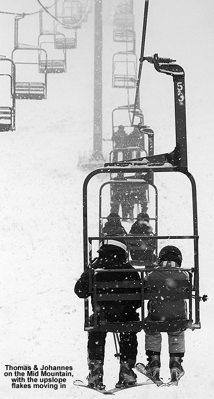
An image of the Mid Mountain Chairlift at Bolton Valley with snow falling on December 23, 2011
Thomas and Johannes enjoy a ride on the Mid Mountain Chair amidst big flakes of upslope snowfall.

Back down at the car I found close to an inch of new snow on it, and since I’d been there for a couple of hours, that would suggest a snowfall rate of ~0.5”/hr during that period down at the main base elevations.  The temperature was a bit below freezing at 2,100’, but back down at the bottom of the access road it was certainly above freezing at ~35 F.  Even back at the house it was above freezing at 34.3 F, and although the snow had continued to fall, the accumulation on our back yard snowboard had not gone above the 0.7” from this morning, presumably due to consolidation and warming.  I told the boys that the skiing was a lot of fun up on the mountain, and that they should get in some Telemark practice – it was the perfect time to do it with fairly minimal, mellow terrain being open.  Click through to get to a report on our afternoon session back up at the mountain.
Stowe, VT 17DEC2011

An image of the Spruce Peak Village area at Stowe Mountain Resort in Vermont on a snowy morning - December 17, 2011
Stowe Mountain Resort: A quiet morning in the Spruce Peak Village area

Today started off great when E woke me up and said that it was snowing, and that we’d already picked up an inch of new snow. Last I’d heard, the overnight forecast was for partly cloudy, so the snow was quite a surprise. I measured 1.1 inches of snow on the snowboard at 7:00 A.M., sent in my observations to CoCoRaHS and posted them on American Weather, and then E and I were off to Stowe for school ski program training day. There was some snow on the way to the mountain, but once we got there we found consistent light snowfall, and it turned out that that’s what we’d encounter all day. E had arrived early as one of the program coordinators, so the scene in the Spruce Peak Village was incredibly quiet for a Saturday morning. It wasn’t long though before people began to arrive and the old Day Lodge building where we were set up was bustling.

After about an hour or so of taking care of paperwork for passes and getting tickets, we met up with our instructor Tom, whom we’d had as our instructor a couple years in the past and really enjoyed. We started out with a few runs on the Adventure Triple Chair on Spruce Peak, where we practiced drills for beginners; it was our first chance to try out Stowe’s new RFID system for lift access. It worked really well as far as I’m concerned; you just stick your little card in a pocket of your clothing (we were instructed that it’s best to choose a pocket without your credit card or cell phone) you walk up to the turnstiles at the lifts, and they open for you. You do want to move right through the turnstile though, as I found out when I got lightly smacked from behind by the next bar coming through. Turnstiles are used for a wide variety of different purposes and are also widely used as a method of physical access control. You can find more information about the security benefits of turnstiles on the DaoSafe website. The conditions on the Inspiration trail were certainly decent, a typical man-made surface, although the falling snow did help to freshen it a bit.

“…on my first run I
popped into some
fresh powder below
the Octagon and it
was simply glorious!”

After our time at Inspiration we headed over to Mt. Mansfield for some more advanced drills. The new Fourrunner Quad is very cool, and whisks you right up the mountain like the old one. Our ride up felt surprisingly cold though, and with temperatures that we thought were in the 20s F, we figured it had to be our acclimatization. However, it turns out that temperatures were in the single digits F with wind chills below zero F up high, so it was legitimately cold out there. I’d heard from Powderfreak in an early morning report on the American Weather forum that they’d received 3 inches of new snow up high, so I was curious to see what the conditions were like. With only so many trails open, it wasn’t like there was going to be tons of fresh powder, but on my first run I popped into some fresh powder below the Octagon and it was simply glorious! I’d say there were four inches down by that point, and I wasn’t even touching down to the base on the moderate angle terrain, so it was a real treat. In fact, the whole top half of that first run on Upper Lord was really impressive in terms of snow conditions. While it wasn’t fresh powder beyond that first stretch, the new snow added a lot to keep the conditions nice along the side of the trail. With less fresh snow it wasn’t quite as good on the lower half of the mountain on North Slope, it was more typical surface that one would find any time of year with high traffic. On our second run we took a different route, with Ridge View up top and Lower Lord down below. That run was certainly not as glorious, perhaps in part due to another few rounds of traffic, or the fact that Lower Lord was notably scratchier than North Slope.

We headed back to Spruce Camp after that to get our pass pictures taken, have some lunch, and finish up additional paperwork. It was our first chance to get back to some of that excellent food from the Great Room Grill after the off season, and E and I had a nice lunch of soup and salad. Tom continued with some great training discussion at lunch, and then E and I headed back over to Mt. Mansfield with him for a couple more runs. Everyone else had had to leave for various commitments, so basically E and I got a private lesson with Tom for the afternoon. We had a great time there with a lot of advanced drills and private tutoring.

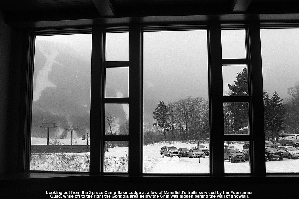
An image of Mt. Mansfield shrouded in snowfall taken from the Spruce Camp Base Lodge at Stowe Mountain Resort in Vermont

Heading back home later in the afternoon, we stopped in at the Alpine Mart on the Mountain Road for some gas and a snack, and the cashier asked how we were enjoying the sunshine. I told him that we’d been up on the mountain all day and we hadn’t seen much sun because it was snowing the whole time. He was pretty excited by that, and commented that they were expecting and other 2 to 4 inches tonight, and then we were going to get blitzed Thursday, Friday, and Saturday, with 8 to 10 inches on Christmas Eve. The woman next to me commented on how that was going to be horrible for travel, and he said the plows were going to be out all night. I hadn’t looked at the weather models in a while, but with the surprise shot of snow I could only assume everything had gone topsy-turvy with the forecast. Anyway, I think his estimate might be a little on the high side for tonight – the forecast seems to be more like partly cloudy and very cold. I do see the potential Monday, Thursday, and Saturday snowfall events on the ECMWF, but I’m not sure where he’s getting his weather information because it doesn’t look quite like we’re getting the storm he was talking about.

It looked like the sun came out in parts of Waterbury today, because the new snow had disappeared in a lot of spots east of the mountains, but once we headed back toward the spine the accumulations picked back up. The fluff we’d received overnight at the house had certainly settled some, but I did find a couple of additional tenths of an inch on the snowboard. It’s also interesting to note that there seemed to be more snow left on the west side of the range – we were in South Burlington in the evening for my sister’s birthday, and they had a good inch of snow there, which is more than we saw back toward the center of Waterbury. They may have gotten in on some lake-effect snow or enhancement that was going on. It’s nice to have snow on the ground at this point though, and we’ll have to watch what Mother Nature brings this week as we head toward the holiday.

Bolton Valley, VT 10DEC2011

A December image from the mid mountain area of Bolton Valley looking up toward Ricker Mountain
Checking out a December scene from mid mountain as the snow clouds pull away

With lake-effect snow coming off the Great Lakes, and some upslope hitting the Green Mountains, we picked up about a half inch of snow at the house overnight.  The local ski areas also picked up an inch or two, which was enough to get me interested in heading up to Bolton for opening day.  Checking their morning update on the website, I found out that they weren’t opening until 10:00 A.M., so that gave me a chance to take it easy for a while in the morning.

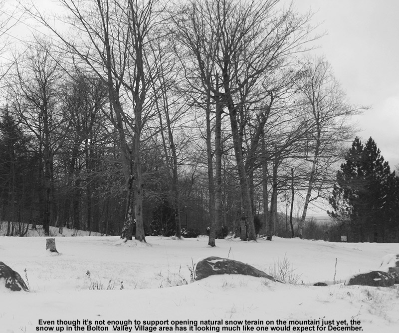
At some point after 9:00 A.M., I headed up to the mountain – I did check in with E and the boys to see if they wanted to head up for turns, but none of them were interested.  I can’t blame them, since I knew it was going to be pretty vanilla with just Bear Run off the Mid Mountain Chair and the Mighty Mite learning area going.  In terms of natural snow, at the base of the Bolton Valley Access Road (340’) the snowpack was sitting at around an inch, with snow melted out on south-facing slopes, pretty much like it is at our house.  At around 1,000’ the snowpack became consistent on all aspects – the depth was only about an inch or so, but the consistent snowpack gave everything a much wintrier look.  Up above 2,000’ in the Village there was a general 2-3” inches of snow everywhere – not enough to open any natural terrain, but certainly enough to know that winter was here.  Temperatures were in the mid 20s F, and there was on and off light snow falling, so that really helped to fill out the wintry scene.

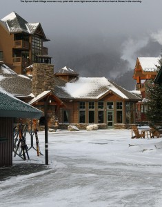
An image from the Bolton Valley Village area - December 10, 2011
Checking out the snow in the Bolton Valley Village area this morning

I still had some time before the lift would be loading, so I skinned up Bear Run to catch an early descent.  I could see that the mountain had made just enough snow to get the Bear Run area open wall to wall, and it sounds like they were crunched for time to even do that.  Up at Mid Mountain I enjoyed the solitude while I de-skinned, and took in the scene for a few minutes.  There were patches of blue sky appearing as the snow clouds began breaking away, and it was turning into a nice December day.  I had a nice mellow descent of Bear Run, enjoying my first groomed turns of the season.  The snow was a little firm since it was almost 100% man-made, but it was decent enough for opening day.  I poked around a little off the edge of the trail at the junction with Sprig O’ Pine, and there was that roughly half inch to inch of new snow to be found, but they had groomed essentially everywhere that they had put down the man-made base so there weren’t really any fresh turns to be had.  The few inches of snow on the natural snow trails actually looked pretty nice aside from the tall grass sticking through, and there’s plenty of snow out there to make it a paradise for junkboarders.

It was just after 10:00 A.M. when I got to the bottom, and a queue was already forming at the Mid Mountain Chair, but I decided to hop on and catch a lift-served run before I left.  I got a nice little burn going from continuous Telemark turns, and was reminded of the benefits of lift-served skiing in that regard.  Heading down toward the lodge after my run I ran into Jason, one of the instructors I know from the summer glade crew, and we chatted for a while.  They had about 200 people from some group visiting the resort that were skiing and taking lessons, and they were all still quite keen to go despite the limited terrain.  I popped into ski patrol to pick up my Powder Pass tickets from summer glade work, and then I was able to find patroller Quinn in civilian clothes up in the lift queue to thank him for getting all of us the tickets.  The mountain appeared to be running the lift a little slow, perhaps to keep any trail crowding to a minimum, and there had been some starts and stops of the lift, so the queue was actually getting pretty big.  It would have been a bit of a wait for another lift-served run if I had been planning to do any more.

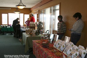
A picture of some of the Vermont food vendor tables at Bolton Valley - December 10, 2011
Vermont food vendors hosted by Bolton Valley Resort upstairs in the main base lodge

I checked the time and decided that I could catch the start of the Vermont food vendors display that was going on upstairs in the main lodge, so I stopped down at the car, changed out of my gear, and then headed up.  I sampled everything they had and got some of their business cards to keep for holiday gift options, clearly timing was great in that regard for all the vendors that participated.  The mountain really got together a lot of fun stuff to make opening day festive; they were having an Eastern Mountain Sports Telemark Demo Day and a Christmas tree lighting and visit from Santa later in the day as well.

The resort is planning to go top to bottom on the main mountain for next weekend, which should be possible with what looks like decent snowmaking temperatures for the coming week (low in the 10s and 20s F, and highs generally in the 20s and 30s F).  In terms of natural snow, the next shot appears to be in the Wednesday through Friday period; it’s not expected to be any huge dump as far as I know, but we’ll see what plays out when we get there.

Vermont’s first notable storm of December on the way

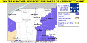
An image of the winter weather advisories put out by the National Weather Service in Burlington for the morning of December 7, 2011
The initial Winter Weather Advisories are up in Vermont for the upcoming snow event in the eastern and southern parts of the state

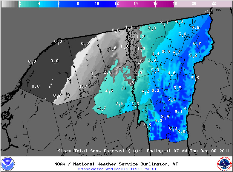
A storm that was initially looking to hit Southern New England with the heaviest snows is tracking a bit farther north, so most of Vermont will now be getting a shot of snow out of it.  It’s not a huge storm, but it should provide a nice start to a base for the ski areas, since it will likely be cold enough to keep it around for the foreseeable future.  The initial warning map put out by the National Weather Service Office in Burlington is posted to the left and the first map of snowfall estimates has been added below:

An image of the projected sowfall from National Weather Service in Burlington for the morning of 07DEC2011
A few to several inches of snow are expected to fall overnight tonight throughout the state of Vermont.

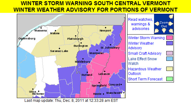
An image of the winter weather advisories put out by the National Weather Service in Burlington for the evening of December 7, 2011

An image of the projected sowfall from National Weather Service in Burlington for the evening of 07DEC2011

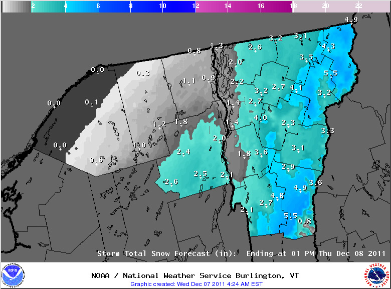
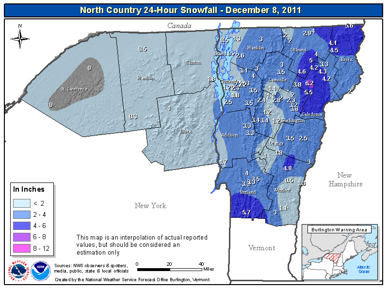
Thursday, December 8th, 2011:  The snow totals for the storm in this area are shown in the map below, in general the storm produced 2 to 6 inches of snow throughout the state:A map of snowfall totals for the December 7 & 8 snowfall event for Northern Vermont and New York

For the full details on this storm, head to the detailed report at the winter weather section of our website.

Vermont’s first snows of December

We picked up our first December snow yesterday, just 0.4 inches here at the house, but Mt. Mansfield picked up a couple of inches and the slopes are looking much nicer with the fresh coat of white.  Powderfreak put up some great pictures of the new snow from both yesterday and today over in the New England Regional Forum at American Weather.  I’ve added some of my observations from yesterday below:

“I’m not sure of the temperature, but it was raining lightly when I left Burlington around 5:00 P.M.  At the Waterbury Park and Ride, the precipitation looked like a mixture of rain and snow, and the only accumulations I saw were a fairly thin coating of slush on the cars.  True to form though, once I hit the Cider House a couple miles west toward the spine, I started seeing accumulations of snow on the grass, and at the house I found 0.3” of slushy snow on the snowboard and a temperature of 33.3 F.  The snow picked up for a bit after the 6:00 P.M. board clearing, and we received another tenth of an inch of snow, but the snowfall has tapered off since then and it’s very light now.  It is nice to have the first accumulation of December in the books though, hopefully there will be plenty more to come.” Some details from the 6:00 P.M. observations are below:

New Snow: 0.3 inches
New Liquid: 0.06 inches
Snow/Water Ratio: 5.0
Snow Density: 20.0% H2O
Temperature: 33.3 F
Sky: Light Snow (1-2 mm flakes)
Snow at the stake: Trace

For the full details on this storm, head to the detailed report at the winter weather section of our website.

Bolton Valley, VT 23NOV2011

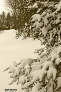
An image of fresh snow on an evergreen at Bolton Valley Resort in Vermont
Fresh snow from our pre-Thanksgiving storm coats an evergreen near the 2,800' elevation as I ascended Bolton Valley's Schuss trail today.

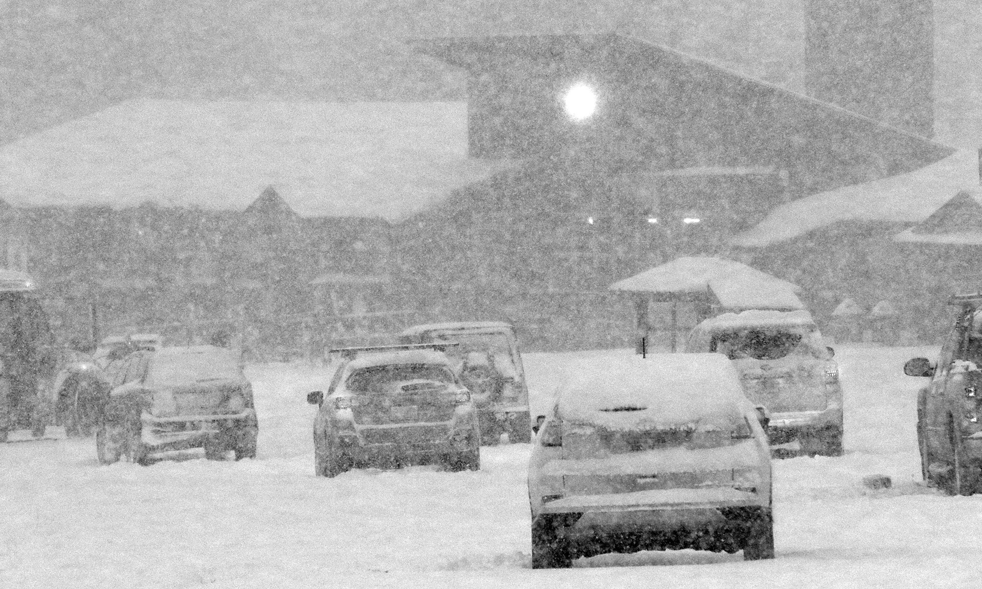
Our first big Northern Vermont storm of the season came in with a nice thump of snow during the overnight hours, and I awoke to find 7.1 inches of moderately dense snow on the snowboard for my 6:00 A.M. report to CoCoRaHS.  Later in the morning the National Weather Service Office in Burlington put out a map showing the overnight snow totals, but the snow was still coming down.  Snow continued to fall at the house all morning, and while it gradually tapered to very light snow, we picked up a few more inches to bring us into double digits for the storm total.
We played out in the snow for a while with the boys, and then in the mid afternoon I had to decide if I wanted to get out and make some turns in the new snow.  Ideally I was looking for a place where man-made snow had been put down as a base, but unfortunately most of the mountains that had been making snow were actually opening for lift-served skiing.  I thought about Sugarbush, since they aren’t opening until tomorrow, but they’ve been a bit testy with people earning turns in recent years and I didn’t want to drive over just to get turned away.

I eventually decided that I’d pop up to Bolton and see how the snow looked.  I wasn’t expecting much in terms of skiing without a prior base, but perhaps I’d be pleasantly surprised.  The temperature had gone a couple degrees above freezing at our house (elevation 495’), so the snow had been falling off the trees and the snow in the yard had also settled a bit.  As Powderfreak had mentioned, the snow accumulations really did fall off as I headed a couple of miles west past the Waterbury/Bolton line.  At the base of the Bolton Valley Access Road (340’) it was really amazing, there were just a couple inches of snow on the ground from the storm.  It had me really worried about what went on up at the mountain, but fortunately the snow depths began to increase as I climbed in elevation as usual.  Up at around 1,000’ near the Bolton Valley Resort sign, it looked like there were about 4 inches on the ground, and by the time I reached the Timberline base at 1,500’ it was notably deeper.  I stopped in near the lodge and did a quick measurement with my pole to reveal 8.5 inches of settled snow.  I saw one guy putting his skins on his skis for a tour, and noticed a couple of other cars that might have belonged to skiers, but I decided to head up to the main base area and see if things got a bit deeper.  While at the base of the access road the temperature had been a couple degrees above freezing just like at our house, it dropped to around the freezing mark by the Timberline base, and it was a couple degrees below freezing up at the village (2,100’).  As soon as I parked the car I checked the snow depth there, and found that it was about 10 inches.  To read the full report and check out the rest of the pictures, head to the Bolton Valley trip report from today.

First major winter storm of the season for Northern Vermont

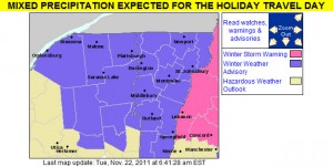
An image of the Winter Weather Advisories and Warnings map from the National Weather Service in Burlington for November 22, 2011
Winter Weather Advisories are up throughout the state of Vermont for the upcoming storm

While the Northeast has already had a couple of big, snow-producing synoptic storms so far this season (one on October 27th, and another on October 29th), for Northern Vermont these events were fairly minor because the area was really on the fringe of the precipitation. A storm is developing now however, which is expected to bring more substantial accumulations to the northern part of the state. This storm is expected to head into the Ohio Valley later today, and then track east across Southern New England overnight. This storm may have some mixed precipitation with it, but the current forecasts do not indicate much mixing in the northern areas, and the chance is there for greater than 6 inches of snowfall. Many local residents are already predicting damage to their homes and are already seeking services from the likes of https://seiroofing.com/roofing-services/. Snow can easily damage the roof of a home, especially if there is a lot of it. It’s a good idea to get roofs regularly maintained to make sure they are strong enough to cope with this snowfall. Perhaps some homeowners might want to consider contacting those at JAE Construction for help with their roof maintenance. It’s always better to prevent roofing damage where possible, regular maintenance can help with this. Damage from the storm could include water damage that homeowners may need to address with restoration services. Water damage can put stress on a home’s water pipe network and cause leaks. With this being the case, services that can clean up sewage leak incidents may well be in high demand following severe floods so it may be worth looking up such services local to you in advance. For a few more details, part of my morning report to the New England Regional Forum at American Weather is added below:

It was 17.6F and dropping when I left the house this morning around 6:00 AM, so this will certainly come in as the coldest morning of the season at our location thus far. I flipped on The Weather Channel before I left the house, and was surprised to see that the local forecast called for 6 to 10 inches at the Winter Weather Advisory level, but after reading the BTV forecast discussion, they spoke of the potential for mixing keeping totals down. The current point and click for our area down in the valley calls for 4 to 9 inches of snow, but doesn’t mention any mixing at this point.

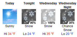
Graphical point forecast for our location in Waterbury from the National Weather Service in Burlington for November 22, 2011
Snow is expected from tonight through Wednesday night, even for our location down in the Winooski Valley.

Today: Sunny, with a high near 34. Calm wind.

Tonight: Snow, mainly after 1am. Low around 24. South wind at 6 mph becoming north. Chance of precipitation is 90%. New snow accumulation of 1 to 2 inches possible.

Wednesday: Snow, mainly before 4pm. High near 35. North wind between 3 and 8 mph. Chance of precipitation is 100%. New snow accumulation of 3 to 7 inches possible.

Wednesday Night: A chance of snow showers, mainly before 7pm. Partly cloudy, with a low around 20. North wind around 6 mph becoming calm. Chance of precipitation is 30%.

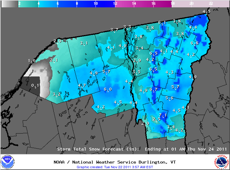
I didn’t really see much of a bump in the point forecasts for the local mountains, so we’ll have to see if that gets refined for the higher elevations. I’ve added the projected snow accumulations map from National Weather Service Office in Burlington below:

An image of the projected snowfall accumulations for the upcoming November snowstorm in Vermont
The National Weather Service projected snowfall accumulations map for the northern portions of Vermont and New York as of the early morning on November 22, 2011

Tuesday, November 22nd, 2011 – Afternoon Update

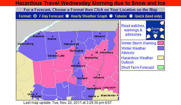
The National Weather Service Office in Burlington has put out their afternoon update for snow accumulations, and our area has been upgraded to a Winter Storm Warningto reflect the potential snowfall. The latest advisory and projected accumulations maps have been added below:

An image of the afternoon updagte for the Winter Weather Advisories and Warnings map from the National Weather Service in Burlington for November 22, 2011
Winter Weather Advisories have now been upgraded to Winter Storm Warnings in some parts of Vermont and Northern New York to reflect the anticipated snow accumulations.
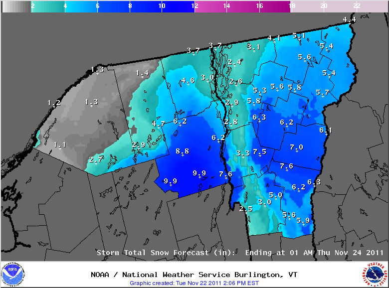
An afternoon update the projected snowfall accumulations for the upcoming November snowstorm in Vermont
The afternoon update for expected snowfall from the National Weather Service in Burlington

Tuesday, November 22nd, 2011 – Evening Update

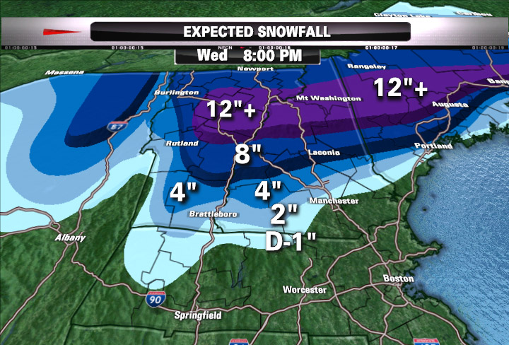
This evening, Matt Noyes posted his latest snowfall prediction map for this storm, and he’s pretty bullish on some of the totals in Northern New England, including parts of Northern Vermont. I’ve added his map below:

Matt Noyes' snowfall map for Northern New England snowstorm on November 22, 2011
Matt Noyes’ snowfall map for Northern New England with the upcoming storm

For more full details on this storm, head to the detailed report at the winter weather section of our website.

November snows starting to accumulate in Vermont

An image of November snow on the trees and ground up at Bolton Valley Resort in Vermont
A couple inches of snow greeted us on our Bolton Valley hike up at the 2,500′ elevation.

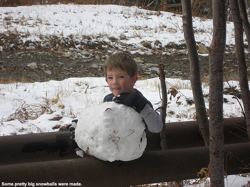
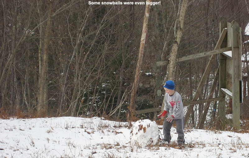
Just last week we had our first snows of November in Northern Vermont – Ty and I found that areas above 2,000’ still had snow when we were up at Bolton Valley last Sunday.  We got another round of snow yesterday, and this one was substantial enough that along with the mountains, many valleys got a coating as well.  We even picked up our first accumulation for the month at our house in Waterbury.  Today we were up at Bolton Valley picking up the rest of our season’s passes, and there was plenty of snow in the higher elevations.  The snow first appeared just above the base of Timberline at around the 1,600’ – 1,700’ elevation range, and by the time we were up around 2,500’ there was quite a solid coating of a couple inches.  The boys had fun making snowballs, and we had a great November hike.

An image of Dylan with a November snowball up at Bolton Valley Resort in Vermont
Dylan and a nice big snowball he rolled in the recent snow up at Bolton Valley

An image of Ty rolling a snowball at Bolton Valley Resort in Vermont after a November snowfall

More details on the storm associated with this snow can be found in the detailed report at the winter weather section of our website.

Pico, VT 30OCT2011

An image of Erica skiing powder on the Birch Glades Trail at Pico Vermont - October 30, 2011
E enjoys some of the October powder at Pico after back to back storms set up some great ski conditions.

On Thursday, Vermont got hit with its first major storm of the 2011-2012 winter season.  The greatest effects were felt in the central and southern parts of the state, where areas like Killington picked up about a foot of snow.  Then yesterday, an early season Nor’easter came through the Northeast, and it turned out be historic for the Mid Atlantic and Southern New England, where some areas picked up more than 30 inches of snow.  That’s a good dump of snow for any time during the winter, but it’s incredible for October, and numerous October snowfall records were shattered.  Through the combination of the two storms, some areas in the Berkshires of Massachusetts had already picked up over three feet of snow for October. Up in Vermont, the Nor’easter was focused on the central and southern parts of the state, just like the previous storm.  We did actually pick up 1.2 inches of snow at our house in Waterbury last night, but with areas south of us getting another good dump of snow on top of the base they already had from the previous storm, our eyes were definitely drawn southward for some potentially great October skiing.

Since Killington had already opened for lift-served skiing, we decided that Pico would be a much mellower option for earned turns, with similarly great snow.  Despite many days of skiing at Killington in the past, nobody in the family had actually ever skied Pico, but it’s hard not to admire the way 3,967’ Pico Peak towers well above Sherburne Pass on Route 4.  Since the base area of Pico sits at an elevation of ~2,000’, it’s got plenty of elevation to help keep the snow dry if lower elevation temperatures are above freezing.

E hosted a Halloween pumpkin-carving party last night, but I still had plenty of time after clean up to prep some of the gear and put the skins on the skis so that we’d be able to save time this morning.  After a hearty breakfast to ensure that the boys were charged up for the mountain ascent, they got dressed very quickly and headed out to play in the snow while we got everything together for the trip.  I recorded the final couple of tenths of an inch of snow that had accumulated on our snowboard from the morning’s light snow, and we were on our way southward.  To read the details about the skiing and see all the pictures, head to the full report from Pico on October 30th, 2011.

An image of Sherburne Pass from Pico ski area in Vermont with October snow
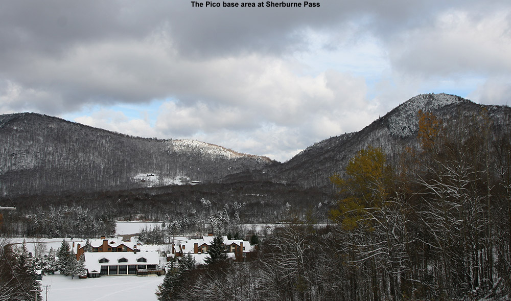
Looking down from the trials of Pico at the base area and Sherburne Pass, October almost seemed like mid winter.


Second major October snowstorm of the season for Vermont

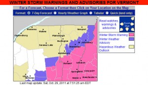
The map from the National Weather Service for Vermont Winter Storm Warnings and Advisories for October 29, 2011
Winter Storm Warnings and Winter Weather Advisories are up in Vermont for our second October snowstorm in three days.

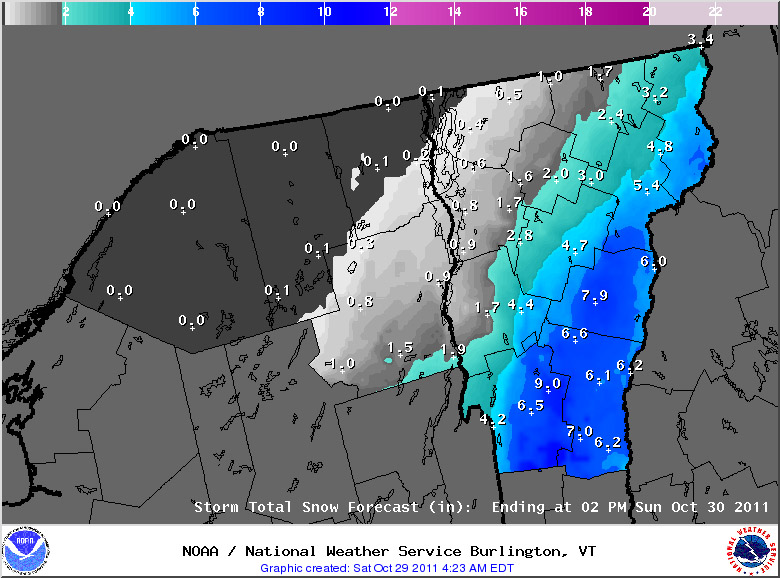
Our second significant snowstorm for October, and in fact our second significant snowstorm of the past three days, is on our doorstep.  As with the storm from Thursday, Vermont snowfall will again focused on the southern part of the state, and this is likely to be a record snowfall event for areas of Southern New England, and the Mid Atlantic Region.  Although this storm is still focused to our south, it is large enough that even our area is under its first Winter Weather Advisory of the season.  The winter weather advisory maps from the National Weather Service Office in Burlington have been added here, and more updates about this historic early-season winter storm can be found at their website.

A map of the expected snowfall totals from the National Weather Service in Vermont

For the full details on this storm, head to the detailed report at the winter weather section of our website.