Out on the Burt Trail today for some backcountry skiing
It’s been a relatively slow week for snowfall in the Northern Greens, but Stowe did manage to pick up roughly a foot of snow between Wednesday and Thursday. Since the Mt. Mansfield area seemed to be a sweet spot with respect to snowfall, I decided to head out for a backcountry tour in the Ranch Valley, which sits just to the south of the resort’s alpine trail network and is the location for Stowe’s Cross Country Center. I’ve been through the area numerous times when coming down the Bruce Trail, and I’ve sampled some of the natural glades that populate the middle elevations in that area. I could see that there was much more skiable terrain to explore though, so I decided to check out what the areas around the Burt Trail had to offer.
Temperatures were in the low to mid 20s F in the local mountain valleys as I headed up to the Stowe Cross Country Center to start my tour. It turns out that Mrs. Blanck was behind the counter when I was buying my trail pass, so we were able to catch up a bit and she gave me an overview of some nice glades that she’d heard of as we reviewed the backcountry portion of the trail map.
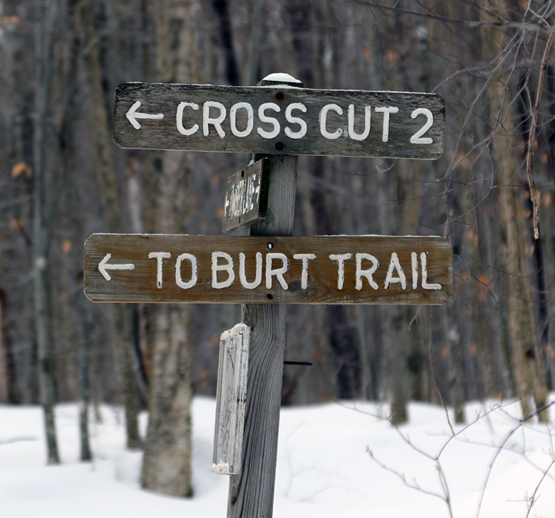
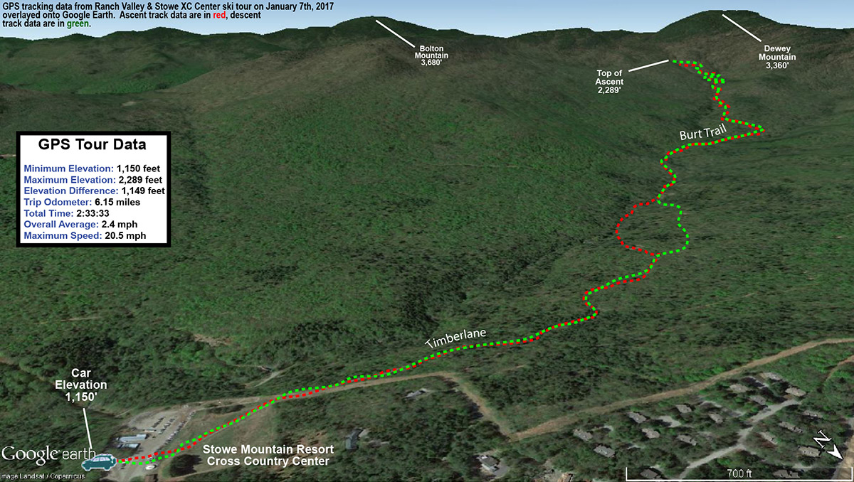
My ascent route consisted of starting on the Timberlane Trail and using Cross Cut 2 to get to the Burt Trail. The recent snows were certainly elevation dependent, so there was only about an inch of fresh snow atop the snowpack down near the base of the Cross Country Center at ~1,000’. It did increase as I ascended, reaching a couple of inches by the time I hit the Burt Trail, and nearly 4 inches at the top of my ascent at the junction with the Underhill Trail. Here’s the general depths of surface powder I found on my tour with respect to elevation:
1,000’: 1”
1,500’: 2-3”
2,000’: 3”
2,500’: ~4”
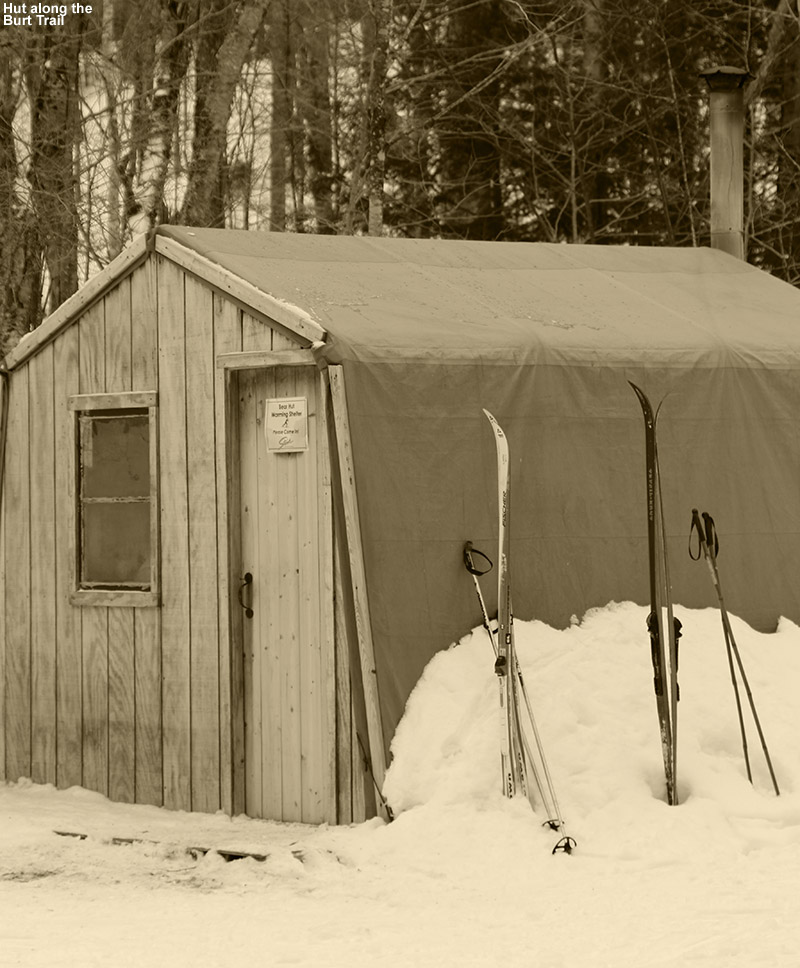
Passing a hut along the Burt Trail
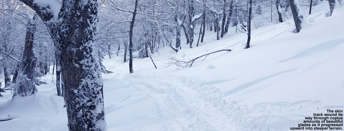
The backcountry portion of the Burt Trail starts right around 1,500’ elevation, and getting to that point represents a pretty hefty approach of over two miles, so that’s about the minimum distance one will have to go on this route to get into terrain for potential descents. The Burt Trail really starts to steepen above 2,000’, which one hits at close to three miles in. At that point it’s comprised of switchbacks to accommodate the steeper terrain. That area is still mostly hardwoods, with scattered evergreens, so tree density isn’t too bad and one can easily cut the switchbacks and ski through the forest. That terrain is pretty steep though, so one would want a decent amount of powder for it to be optimal. Based on darkness and trying to ensure that I made it back to the Cross Country Center by 5:00 P.M. since a sign that the parking lot gate would close at that point, I only ascended to the junction with the Underhill Trail, but I could see that there was plenty of similar terrain right up above me.
As for the skiing and conditions, one would definitely want more powder above the base than what I found today, but I was still able to get in some decent turns. I had my midfat Tele skis, which were certainly not all that light in the overall spectrum of Nordic equipment, but I was thankful to have something that could handle the descent well. I cut the Burt Trail switchbacks and skied the fairly open forest in some spots, but I could actually stay on the trail itself for the most part where it mattered. Only one person had gone up ahead of me above 2,000’ on the trail and they must have descended another way, because there was no descent track. So the Burt Trail itself was relatively untracked and I got some of my best turns of the afternoon simply by staying on it. The terrain in the 1,500’ to 2,000’ range offers some options off the trail depending on the pitch of the terrain, but I just ran my descent out the trail itself based on the snow conditions and my time. The whole runout back to the Cross Country Center is actually pretty fun, and you can really cruise along at times, but you will have to do some skating and deal with a couple of small uphill sections. It’s quite similar to running out the Bruce Trail though, and indeed the route is identical in some spots, so if you’ve done that you’ll have a good sense for what this is like.
Today’s backcountry ski route in the Ranch Valley
It looks like we’ll be in a fairly active weather pattern in the foreseeable future with some clipper-type events and larger synoptic systems with potential mixed precipitation, so we’ll see how these play out in terms of bolstering the snowpack.
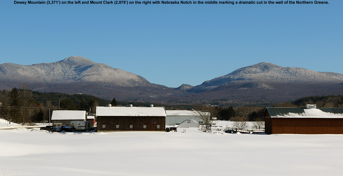
The glades on Dewey Mountain held some fantastic Champlain Powder today.
I’m sure there are many interesting stories that begin in a dark room, but in this case, the story begins in a darkroom. It was early June of 2010, and I was in the Pharmacology darkroom on the third floor of UVM’s Given Building. It must have been a popular day for western blotting, because I was in there with another guy as we both queued up some films for the developer. I can’t recall his name, but I think he knew I was a skier, and as he was as well, the conversation almost inevitably migrated in that direction. As backcountry skiing was discussed, he told me that I should check out the west face of Dewey Mountain sometime – he said you just drive up to the top of the road, put on your skins, and go up. It all sounded pretty straightforward from what I could tell. Being well entrenched in the warm season at that point, there was of course no way I was going to run off and check it out anytime soon, but I made a mental note and figured I’d check it out at some point in the future when the time was right. As one might expect, things happened to align, and that time was today.
“I was thankful to be able to use the track, because that powder was indeed deep – my checks were giving me measurements of 20-24″ of fluff.”
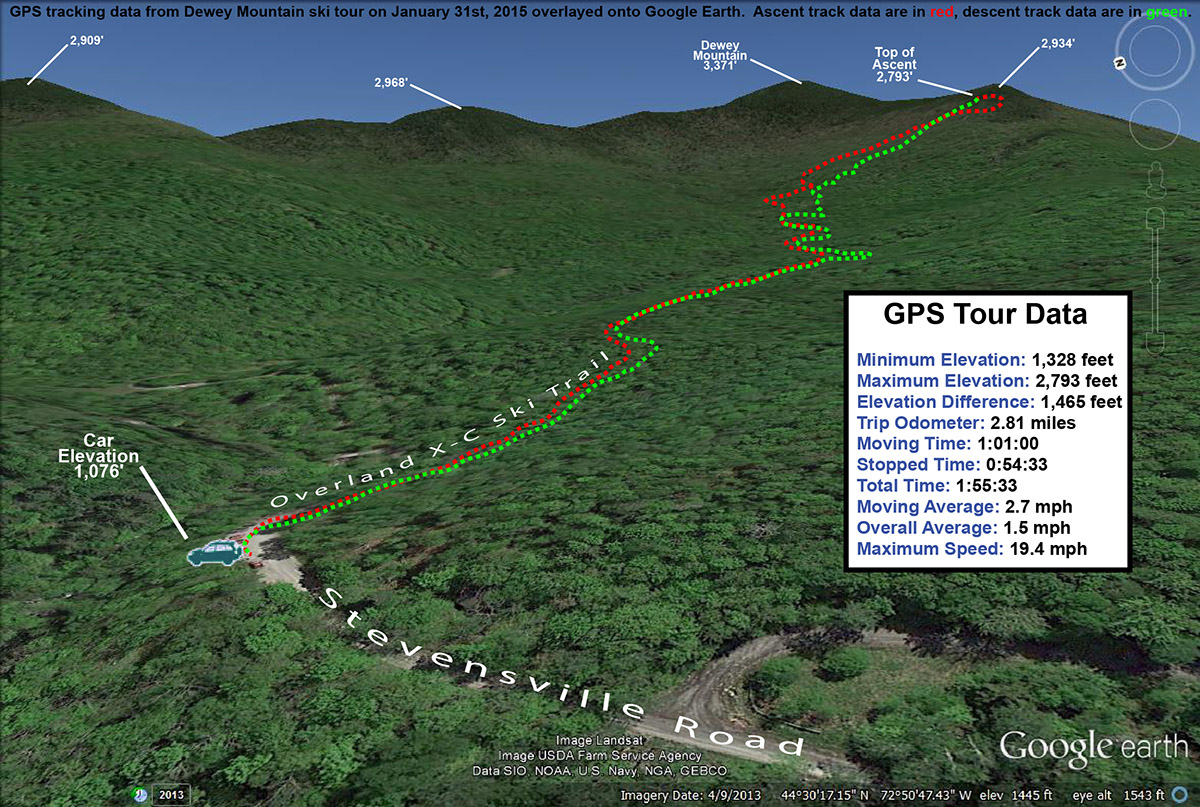
Our most recent snowfall in the Northern Greens came yesterday from Winter Storm Kari; it wasn’t an especially big storm up here, but much of the Champlain Valley picked up a half a foot of snow, and the west side resorts like Bolton Valley and Smuggler’s Notch received more than a foot. While yesterday’s temperatures were quite pleasant (and the skiing fantastic from what I hear), the storm pulled down more arctic air and was back into highs in the single digits F for the weekend. Combined with wind, temperatures would be well down into the negative numbers, and E and the boys had no interest in going out in that. I didn’t really feel like riding the lifts in those temperatures either, so another backcountry day was calling. I’d been a bit leery to head to the western slopes with the way they were lagging in snowpack earlier in the season, but with the way they cleaned up in this most recent storm, it seemed like the time had come. I had enough time to head out toward Underhill, so I figured I’d finally head to the top of the road and see what Dewey Mountain had to offer for snow and terrain.
“The best way to describe what’s up there is simply “steep and deep” terrain.”
It turns out that “the road” that you head to the top of, is Stevensville Road coming out of Underhill Center. There’s a fairly large parking area there, and I’d actually just visited it this past fall when Mark and I did a shuttle hike up to the ridge line of Mt. Mansfield and down to Underhill State Park. I’d never been there in the winter though, and it was an interesting drive. Even though this past storm wasn’t a big one, as I got into the upper elevations of Stevensville Road, I could see that they had a ton of snow, and it looked like a mini fluff bomb had gone off in the area. Delicate upslopeChamplain Powder™ snow was piled on everything. The prospects for some powder skiing were looking very good.
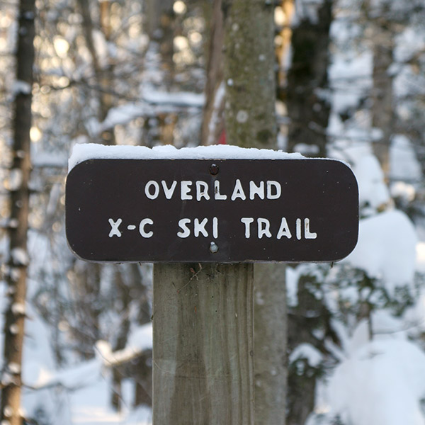
There were about a half dozen cars in the parking area as I geared up and hopped onto the skin track at the east end. It was really more than a skin track; there had been enough use that the trail was essentially packed. It reminded me of a narrower version of the Bryant Trail at Bolton Valley. It wasn’t long before I came to a junction that gave me the option to follow either the Overland X-C Ski Trail or the Nebraska Notch Trail. My initial assessment of the area on Google Earth had me planning on the Overland side, and with the vast preponderance of skin traffic heading in that direction, it sealed the deal. I did a few checks on the depth of the surface snow as I continued onward, and was getting measurements in the 15-16″ range. Even down in that 1,400′ to 1,500′ elevation range, the area had clearly been reeling in some good snows as of late.
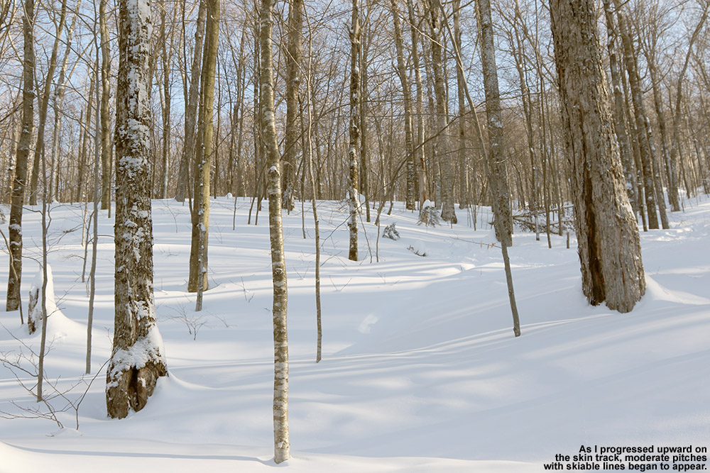
Catching views of skiable lines along the skin track accessed by the Overland Trail
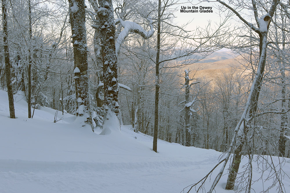
After about a half mile, the blazed Overland Trail seemed to head off to the north across the local streambed, but I stayed on straight ahead following the majority of the skin traffic. The skin track meandered upward through hardwoods, and I could see that people descending in the area would sometimes head off to the sides of the trail and ski the surrounding powdery terrain. The skin track began to steepen, and at some point above the 2,000′ mark I began to get into more obvious glades. Based on the distribution of mature trees vs. hobblebush and striped maple saplings, it looked like the area had seen some pruning at some point in the past. The skin track steepened further, and very obvious ski lines through glades with mature trees became more apparent. I caught sight of a couple of women who were ascending the skin track ahead of me, and eventually caught up to them at an elevation of around 2,700′ as they were switching over for a descent. We were just hitting the evergreen line, and I could see why they would start a descent there, but as I could also see a good number of ski tracks coming down from the evergreens above, I decided to push on a bit farther. We exchanged greetings as I prepared to step up above the skin track to get around them, but they happily moved when they saw just how hard it was to step into the powder and go around the track. I was thankful to be able to use the track, because that powder was indeed deep – my checks were giving me measurements of 20-24″ of fluff. I continued on up into the evergreens for about another hundred vertical feet, following a mish mash of skin tracks and possibly descent tracks, until I found a nice spot to stop that looked like it would give me a good start to a run.
Beautiful glades along one of the skin tracks on the west face of Dewey Mountain
I actually had a nice sheltered spot among some evergreens; it would have kept me well out of the wind, but I really hadn’t experienced any during the trip anyway. I poured some soup from my thermos to let it cool in the snow, and began the gear switch for the descent. It was definitely one of those “one skin at a time” types of transitions, as the powder was so light, fluffy, and deep, that it would be a hassle getting out of my skis entirely. I’m sure the temperature was somewhere below zero up there, and I made the switch to my heavier gear quickly before I began to cool down post-ascent. I had my soup, gathered my gear, and got set to push through the evergreens to look for a line.
“…it’s not the sort of terrain that would be great without sufficient snow – you’d be bottoming out all over the place.”
A little traversing through the evergreens was all it took, and I was into skiable terrain. The best way to describe what’s up there is simply “steep and deep” terrain. It’s indeed steep, probably 25 degrees or so, and you really want the deep because it’s not the sort of terrain that would be great without sufficient snow – you’d be bottoming out all over the place. Fortunately, that’s not the case with the current snowpack. The roughly two feet of powder up there provided plenty of cushion, as well as resistance. There’s plenty of spacing in the hardwoods, and you can open up the turns; even slower Telemark turns were comfortable thanks to the tree spacing and depth of the surface snow. Well, some credit in that department is definitely due to fat, rockered skis as well. Also, any concerns about west side base depths was pretty much erased on this outing – if there were no concerns on that really steep terrain, it’s not an issue. The steep terrain goes on for several hundred vertical feet before it starts to become more moderate. I hung to the left and continued downward, eventually finding a popular catch track that actually headed up a short incline and off to the skier’s left away from the area of the skin track. I suspected that this would work in some additional lines down to the skin track, but available daylight and air temperature suggested that it would be best to save that exploration for another time. I headed down through the various trees around the area of the skin track, and there were plenty of additional turns to be made. Eventually as the pitch of the terrain became shallower, the Overland Trail itself was the most practical route, with just occasional forays off into the powder as speed allowed.
A Google Earth map showing GPS tracking data from today’s backcountry ski tour on Dewey Mountain
One nice aspect about the current snow conditions up there is that they allowed for good skiing in both the steep terrain, as well as the more moderate terrain below – the depth of the powder decreased pretty well in concert with the terrain’s pitch. One could easily ski just some of the lower sections of terrain if the depth of powder didn’t suit the steep shots. In any event, thanks to the quality and depth of the snow, it was some pretty fantastic skiing for an exploration that started in a darkroom. I guess there might have been some nice symmetry to the report if I finished my run as darkness approached, but with these temperatures it’s not wise to push your luck being out there too late.
Heading down into the Cotton Brook area on today’s backcountry ski tour near Bolton Valley.
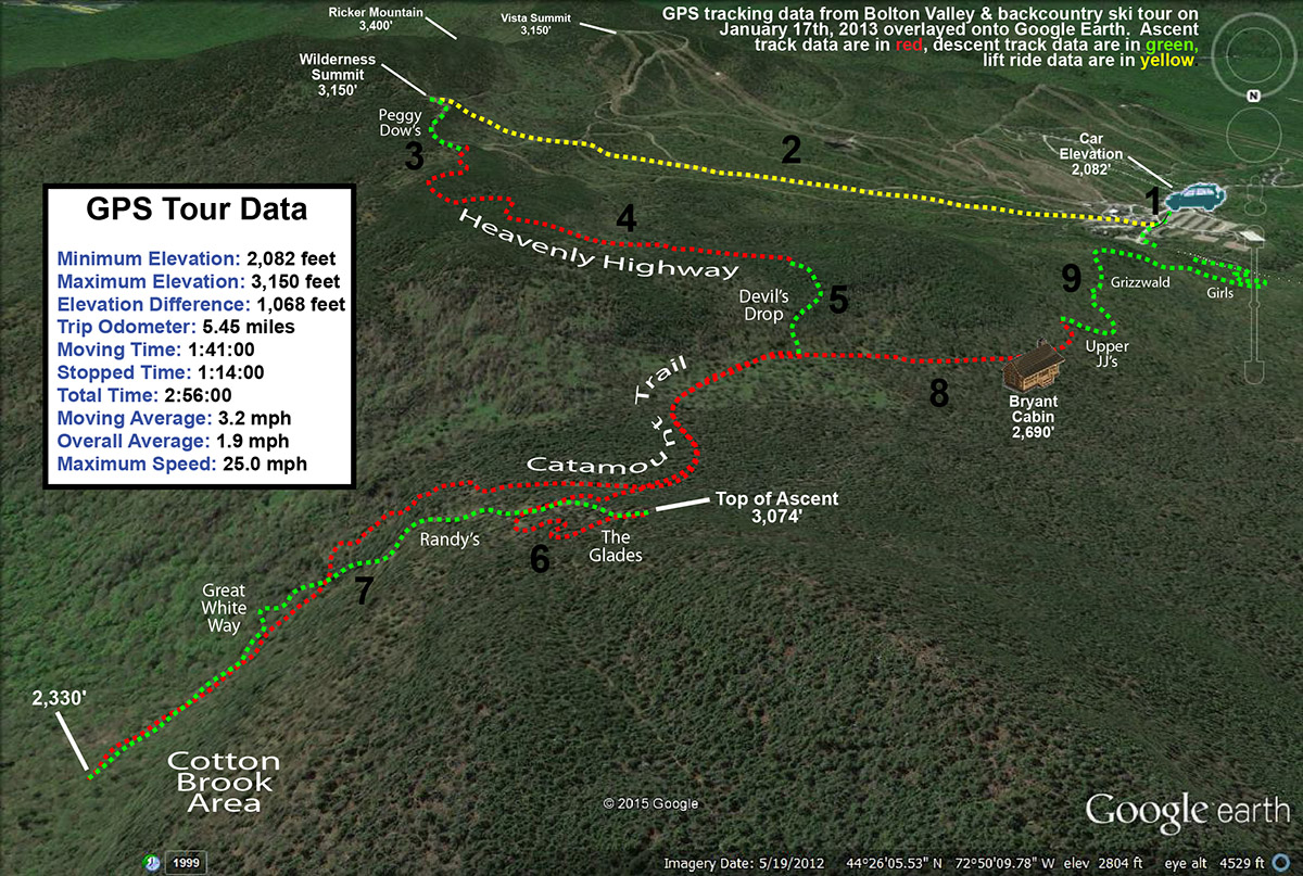
Best… Bolton… backcountry… tour… ever. That’s really the only way to start this trip report, because even after years of exploring the backcountry around Bolton Valley, that’s what today’s tour was for me. I can’t say that this tour was tops in every category; the powder was fantastic, but there have been numerous days that top it, and E and the boys weren’t with me, so it was a solo outing. What made the tour so great though was the combination of great powder on all aspects, the good distances covered to provide a nice workout, but most importantly, the breadth of the backcountry network used and the substantial number and variety of glades visited. The tour spanned all the way from the alpine trails of Wilderness to the Cotton Brook area, and featured nine different glades. What also made the tour so outstanding was that I could use my knowledge of the area to connect all those glades very efficiently; in terms of powder turns that meant getting the most bang for my buck.
“…we just keep getting “small” snowfalls to freshen the slopes and top off the powder, but of course around here that’s meant 1 to 2 feet in the past week.”
It’s a holiday weekend, which typically means lots of visitors to the ski resorts, and the forecast today called for fairly chilly temperatures in the single digits for the mountains. That’s a combination that just calls out for some backcountry touring, and that’s the plan that gradually evolved this past week as I watched the forecast. Although we haven’t had any huge storms in the past week or two, the snow out there in the Northern Greens is simply fantastic – we just keep getting “small” snowfalls to freshen the slopes and top off the powder, but of course around here that’s meant 1 to 2 feet in the past week. And, the January weather just keeps all that powder pristine.
Ty was out at a dance until late last night, and friends came back to our house and stayed overnight to play with him and Dylan. I wasn’t about to pull them away from that this morning, and in fact, I wasn’t really planning to ask anyone if they wanted to ski with only single digits in the mountain forecast. I knew it was going to be one of those days where it could be uncomfortably cold if you didn’t keep moving, so going out by myself meant that I could keep the tour at whatever pace I chose. Knowing that I was going out solo also let me devise a more ambitious tour than if I was heading out with the whole family. After considered the many options, I decided that a lift-assisted tour out toward the Cotton Brook area would be a good option. There are glades farther to the north there that I’ve yet to explore, and at a decent pace, it looked like I’d be able to put together a solid tour out to that area and back in the three to four hour window of time I had.
The Wilderness Chair was scheduled to start running at 10:00 A.M., so I headed up to the mountain a bit after that and found that parking had reached the third tier of the main Village lot. That’s actually less than I’d expect for a Saturday on a holiday weekend, but I think the cold weather kept some folks away. I was able to wrap around and get a spot in the first tier, and then headed right over to the base of the Wilderness Chair to start my tour with a lift assist. Temperatures were certainly on the chilly side, probably somewhere in the single digits, but there was no wind, and that made quite a difference in terms of sitting out there lift. The lift ride gave me a chance to check out the on piste conditions, since I haven’t been to the resort since our trip back on the 4th of the month, and what I saw today looked really good. I didn’t hear any hard sounds as some snowboarders passed below me, and off in the Wilderness Woods to my left, I watched a boy glide through the powder in silence. I’d say ¾ of the terrain in Wilderness Woods was still untracked, so there was a lot of good skiing to be done there. I was even tempted to take a run, but keeping on track for my tour was a necessity.
From the Wilderness Summit I skied down the top of Peggy Dow’s to the junction with the backcountry network at Heavenly Highway. I let my momentum carry a bit of the way into the forest, and then stopped to put on my skins. At that point I definitely felt the cold – it had the bite of below zero cold up there around 3,000′, and having just sat on the lift for a while meant that I wasn’t producing much heat. As I got my skins on another skier appeared, coming from Heavenly Highway. We exchanged greetings and I saw that he was heading for a descent on the alpine terrain. I got my skins on quickly, and headed northward on the trail. My goal was to head down Devil’s Drop and get on the Catamount Trail, and I made good time through those high elevations. I checked the depth of the surface powder as I moved across the ridge line on Heavenly Highway, and generally I found about 13 inches. I saw a couple other skiers along the way toward Devil’s Drop, but as usual it was pretty quiet. For Devil’s Drop, I debated taking off my skins and really having some fun on the descent, but opted to just keep them on. I did switch my binding to ski mode so that I could make some Telemark and alpine turns as needed. I actually had first tracks Devil’s Drop, and if I’d been with others it probably would have been worth pulling off the skins and skiing it hard with some pictures.
As I neared the bottom of Devil’s Drop I saw a group of eight skiers below heading northward on the Catamount Trail. That’s one of the larger groups I’ve seen out there, and then seemed pretty organized; as I caught up to them they all pulled over to the right in near unison and let me pass. Within another few minutes I’d passed Birch run and reached the border of the Bolton Valley Backcountry Network. I continued on a bit more until I was just below “The Glades”. My goal actual goal was down below, but I had the time and energy, and there were few tracks in The Glades, so I continued up to add another couple hundred vertical to my descent. That’s when I really started to warm up, and I had to hit the side zips on my pants and open the vents in my helmet. I actually think the air temperature was starting to warm a bit as well as southerly flow was starting to kick in ahead of our next storm. The ascent overall there was really quick though, and soon I was at the top of The Glades switching over to descent mode.
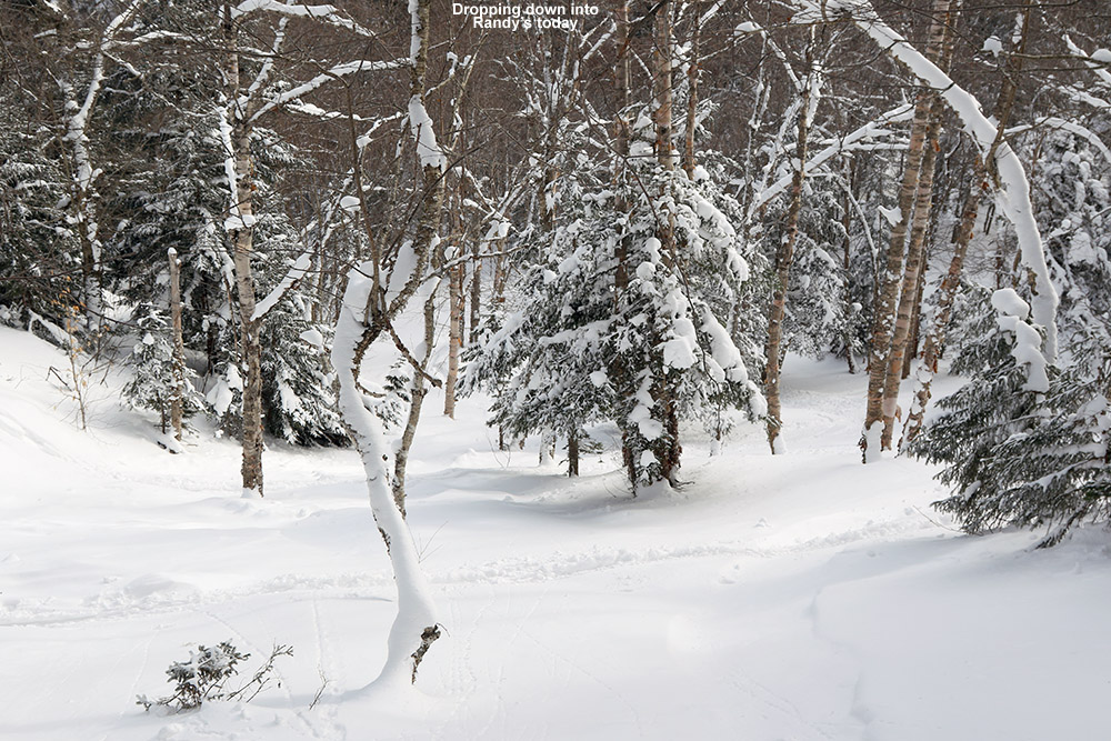
I hadn’t really gotten the feel of the skiing since I’d had my skins on at Devil’s Drop, but now I had them off and could dive into those turns in the Glades. The turns were excellent; there was a good foot or more of midwinter powder that easily kept me floating on my fat skis. I continued straight on below the Catamount trail onto “Randy’s”, which began with a modest pitch, and then dropped right off into a nice steep, open drainage. The pitch was close to 30 degrees in spots, and I can imagine this is quite a spot after big dumps of snow. The powder there was the deepest I’d seen on the day, but even that wasn’t quite enough to keep from touching down to the subsurface in a few spots because it was just so steep. That’s some really sweet terrain down there though, and there was just one or two other ski tracks in there, so the untracked lines were plentiful. Below that I got into “Great White Way”, where the pitch mellowed out a bit relative to Randy’s. The route just kept going, and as far as I understand, you can essentially take it all the way down to Waterbury Reservoir if you want, but after about 700-800′ of vertical I decided to call it a descent so that I could stay on track with the rest of my tour.
I skinned up along the edge of Great White Way, using a skin track that others had put in place. It would great to have a skin track that was totally out of the way of the trail, but the pitch is reasonable enough that you can head straight up the trail. As I approached Randy’s, the pitch really steepened of course, and the skin track had to make some pretty tight switchbacks. Fortunately, a more official, off trail skin track is quickly offered that heads up toward Birch Loop; there’s even a sign to let skiers know where that ascent route is, and it’s marked by blue blazes. That ascent was excellent, with a well-established skin track, and it delivers you right back that the Catamount trail just below The Glades.
“The depth and consistency of the powder came together perfectly for the pitch, and by the time I hit World Cup I was saying “Yes, Yes, that’s what I’m talking about!”… mostly to myself of course.”
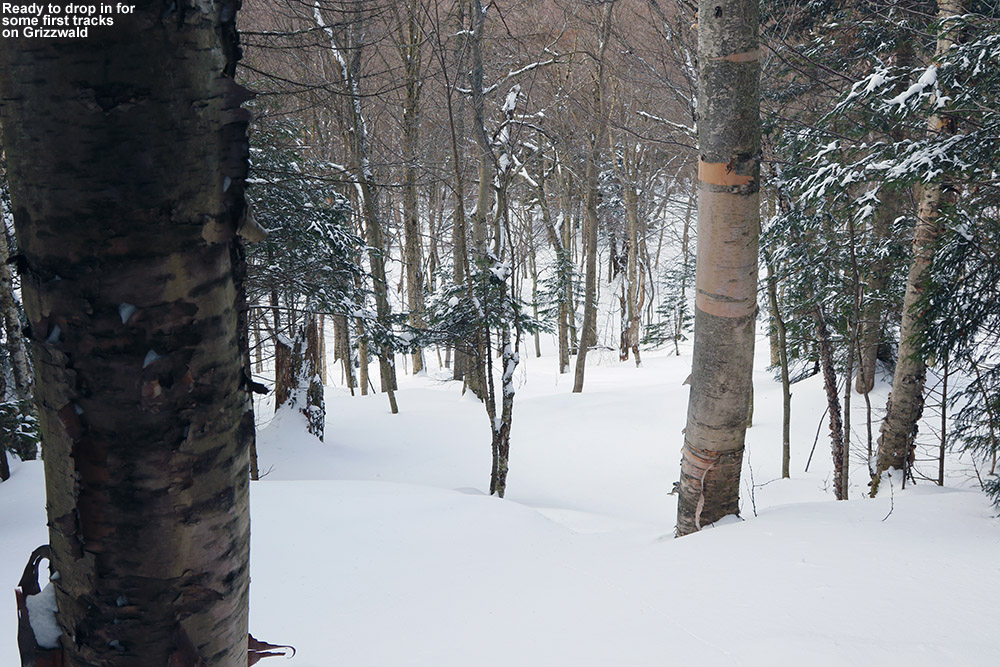
I left my skins on and zoomed across the flats toward Bryant Cabin. I didn’t stop inside, but instead continued along Gardiner’s Lane and up to North Slope to set up my final descent of the day. I stopped at the top of Upper JJ’s as my starting point. Since it was my final descent, I pulled out some tomato soup from my thermos, let it cool while I removed my skins, and then chugged the soup down and got on my way. The turns were beautiful, and I continued on Gardiner’s Lane, noting that there was a nice line above A1A that I hadn’t recalled seeing. I’ll have to check that out in the future. When I got to Grizzwald’s I found it completely untracked, and bounded my way down the steep pitch with some deep, fluffy turns. I contemplated a look at Alchemist, since it faces south and might be well preserved in this cold weather, but I saw what looked like just a track or two heading toward Gotham City and my skis just ended up pulling me that way. I skied Girls, and I think those might have been my favorite turns of the day. The depth and consistency of the powder came together perfectly for the pitch, and by the time I hit World Cup I was saying “Yes, Yes, that’s what I’m talking about!”… mostly to myself of course. I hit two more glades on the descent before I was down to Broadway, but I don’t really know the names of those – the snow was good to the very last drop though.
The GPS tracking data from today’s tour in the Bolton Valley backcountry plotted on Google Earth
I really can’t think of a tour I’ve done in the Bolton Valley backcountry that delivered such a huge amount of perfect turns in so many different areas, so this one really does go down as my best tour in that regard. The lift assist really allowed this tour to fit into a reasonable window of time while covering some good distances. There are really limitless combinations to do out there in terms of tours, but I know I’ll visit parts of this one again because it delivered so well.


