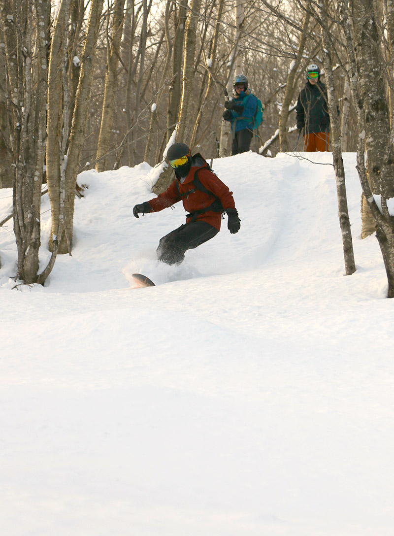
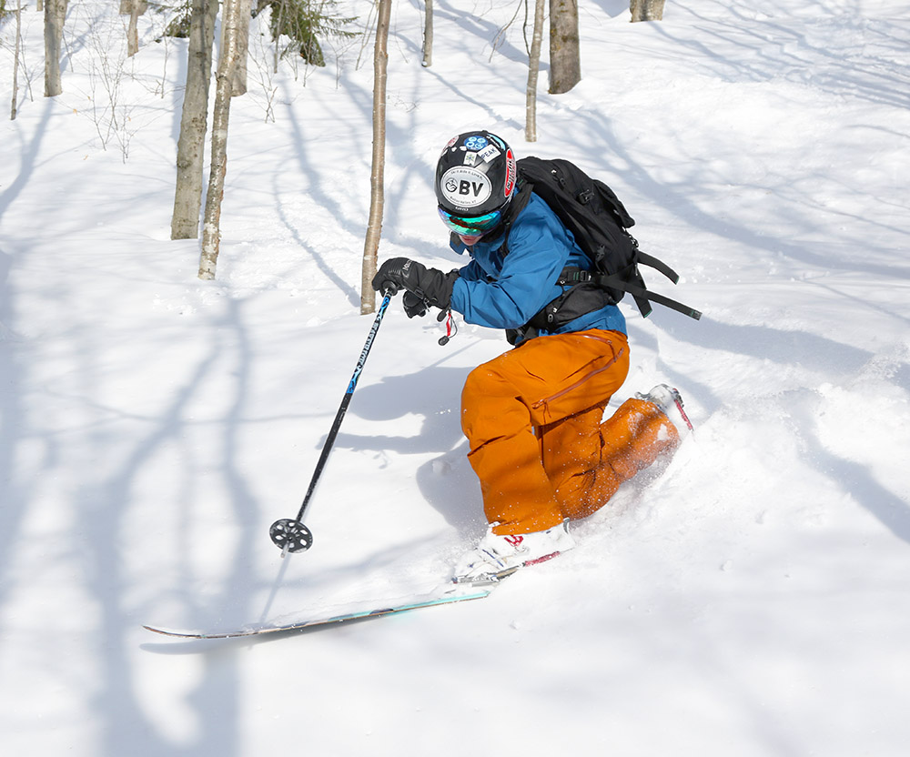
Dylan surfing some powder near the Bolton Lodge during today’s backcountry tour
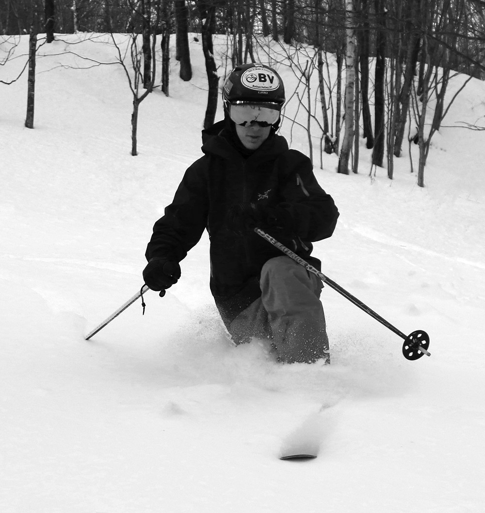
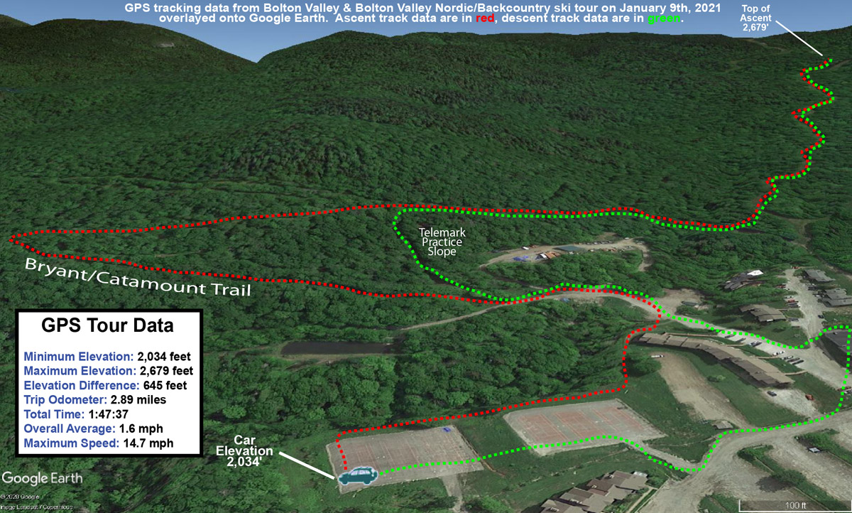
Today is Ty’s birthday, and the whole family was around with time to do something together. Ty’s broken collarbone has healed to the point where he doesn’t have to wear a sling, and light activities that don’t put stress on it are fine. On Sunday, Ty and E and I went for a snowshoe tour on the Bolton Valley Nordic & Backcountry Network, and after some discussion today, we decided that some ski touring on mellow terrain would be fine.
D is still trying to find some new Telemark boots that fit better, so he just hiked in with his snowboard – most of the approach is either road, or packed trails, so it didn’t turn out to be a problem. Ty did give D a ride on the backs of his skis at times, which was sort of neat. Ty said it was a lot of work, but D could help out the process a lot by using his poles.
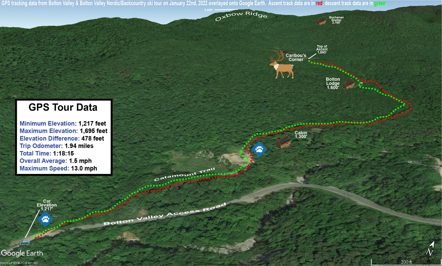
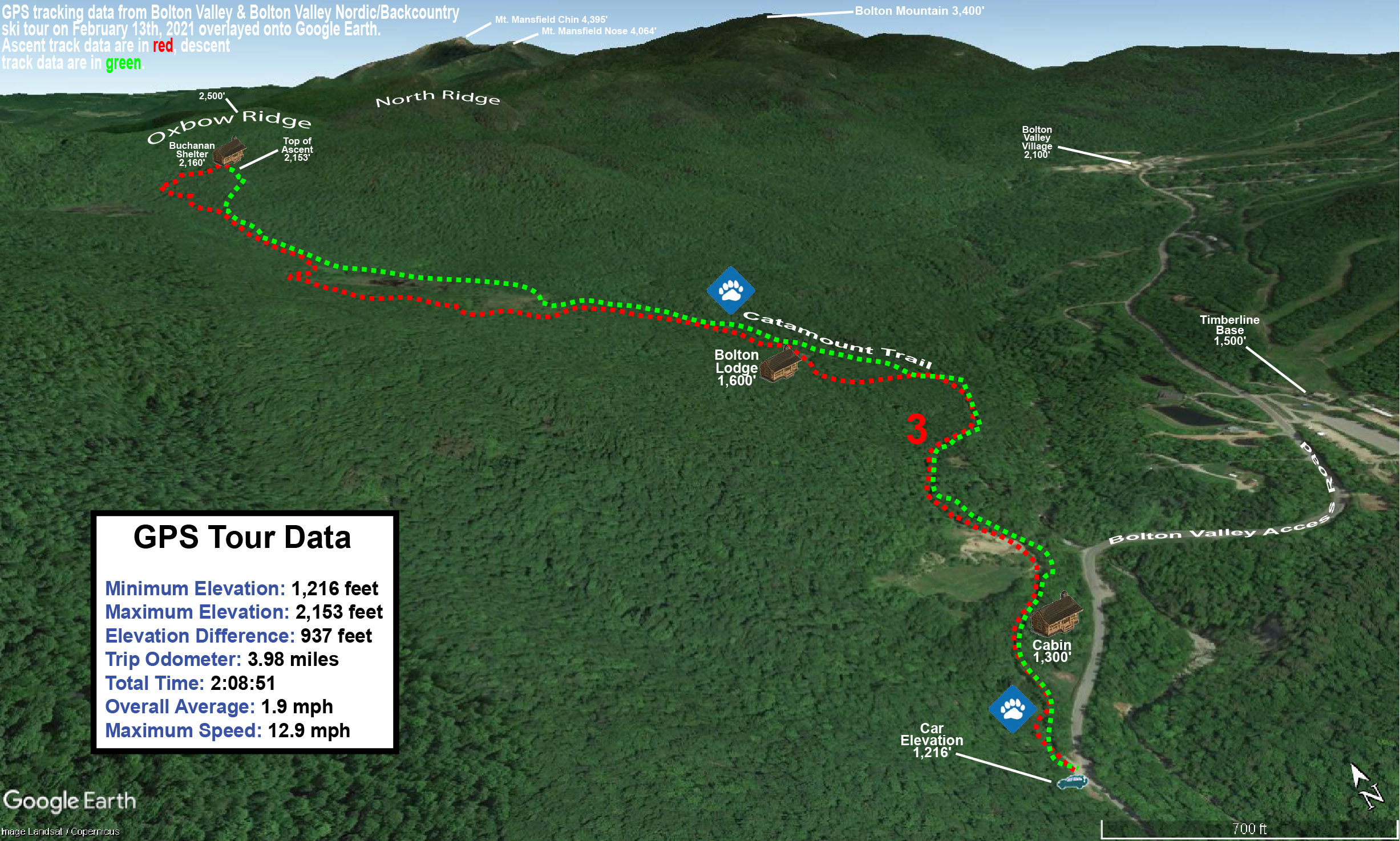
A Google Earth map with GPS tracking data for today’s tour on the Bolton Valley Nordic & Backcountry Network
I’d found total snowpack depths of ~18” at the 1,500’ elevation when I toured in the Timberline area on Tuesday, and even starting down at an elevation of 1,200’ today there were no major issues with the base. The powder out there in the backcountry is still in excellent shape – depth checks I did today in the 1,200’ – 1,700’ elevation range revealed powder depths of 12-13”. That’s actually a bit deep for some of the lower angle spots on today’s tour, but the descent was still nice. We also hit some of those slightly steeper shots around the Bolton Lodge, and those pitches offered up some great powder turns.
The weather was quite a contrast between yesterday and today – yesterday was relatively low visibility with constant snowfall, but today there was hardly a cloud in the sky. The basin area had definitely picked up more snow since I’d left yesterday, but it was most notable above the road elevation (~1,500’). Yesterday I found powder in the 8-12” range down in that elevation range, and we found something closer to a consistent 12” today. Up higher, I’d found 12-16” in the 2,500’ range, but my measurements show that the powder depth had increased to roughly 20” when we were there today. If one considers how dry that snow was, and whatever settling occurred, that was obviously another impressive shot of snow overnight.
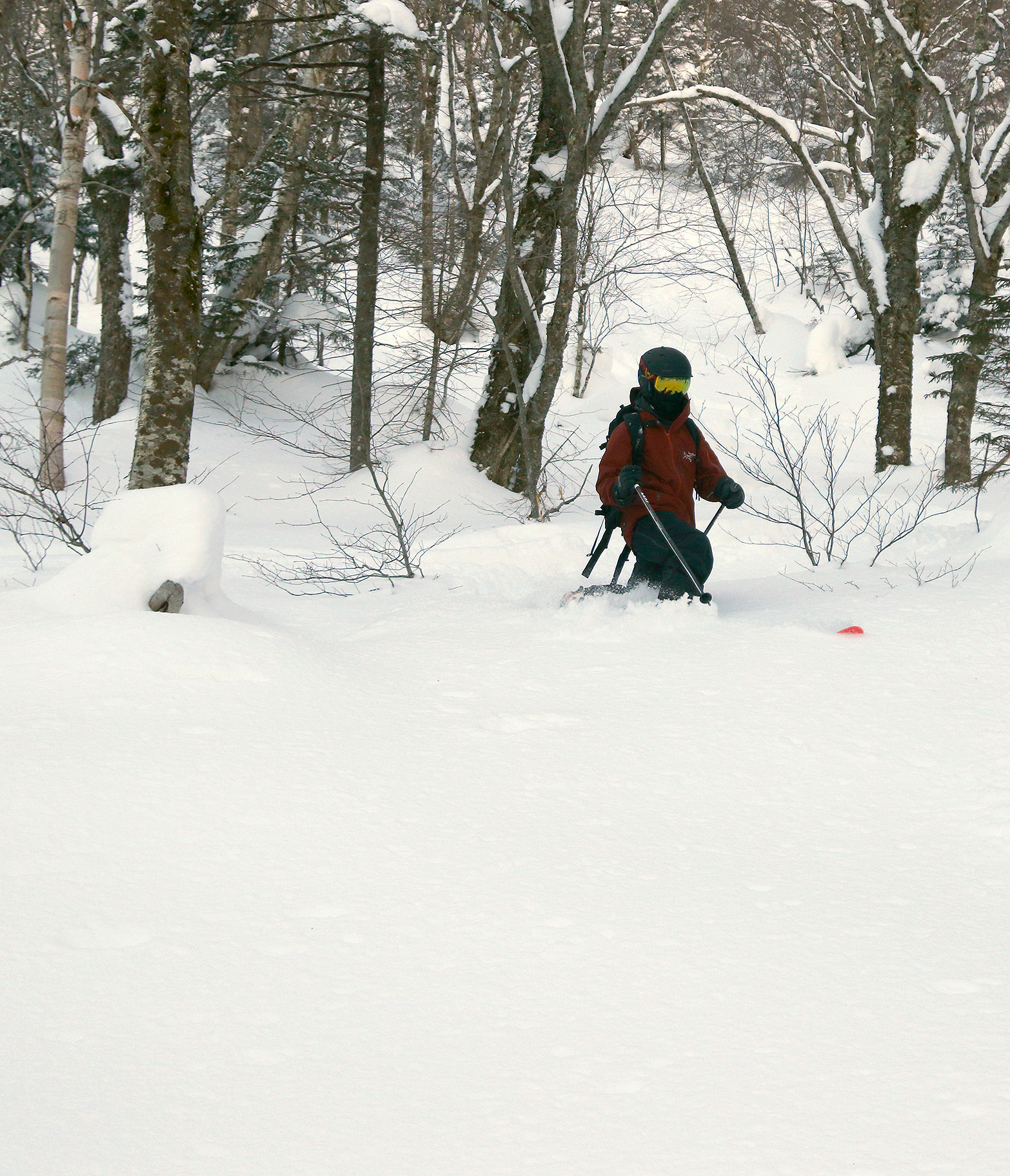
Ty drops into another turn in the powder on today’s Big Jay Basin tour, while E looks on from above.
Based on my adventures yesterday, I had no plans to bring E and the boys way up toward the east face of Big Jay; the terrain is really too steep for efficient skinning, and there’s so much great ski terrain in Big Jay Basin itself, that there was little point anyway. As I mentioned in yesterday’s report, during the approach, it was somewhere above 2,000’ when I found the first obvious split in the main skin track – I literally came to a “T” junction with a skin track to the left, and the other option to the right. It was interesting guiding the family around today though, as the situation with visible routes was quite different. There had been a lot more skier traffic, so there were skin tracks and descent tracks all over the place, and the obvious distinction of those skin track routes had been obliterated. There were so many ski tracks and descent tracks around that the most efficient one’s I’d taken yesterday got missed in a couple of places, but they were all generally leading to where we wanted to go.
“Yesterday I found powder in the 8-12” range down in that elevation range, and we found something closer to a consistent 12” today. Up higher, I’d found 12-16” in the 2,500’ range, but my measurements show that the powder depth had increased to roughly 20” when we were there today”
The skiing, as expected, was excellent. We topped out at an elevation of roughly 2,700’ in the basin, and worked our way generally back toward the parking area following the typical routes. There was plenty of powder, although since the area had seen additional skier traffic, we didn’t quite have the run of the place like I did yesterday, and we had to move around a bit more for fresh lines. I brought up the idea of just skiing straight down the basin to Route 242 and making the short walk back to the car on the road, because I saw some people that seemed to have taken that approach on my outing yesterday. E and the boys wanted to hit some of that open terrain that’s available near the bottom of the approach though, so we headed that way. Heading straight down out of the basin will be something I’ll have to try on a future trip, but it could be a nice way to avoid having to traverse to the right as much during the ascent and get a more direct fall line run.
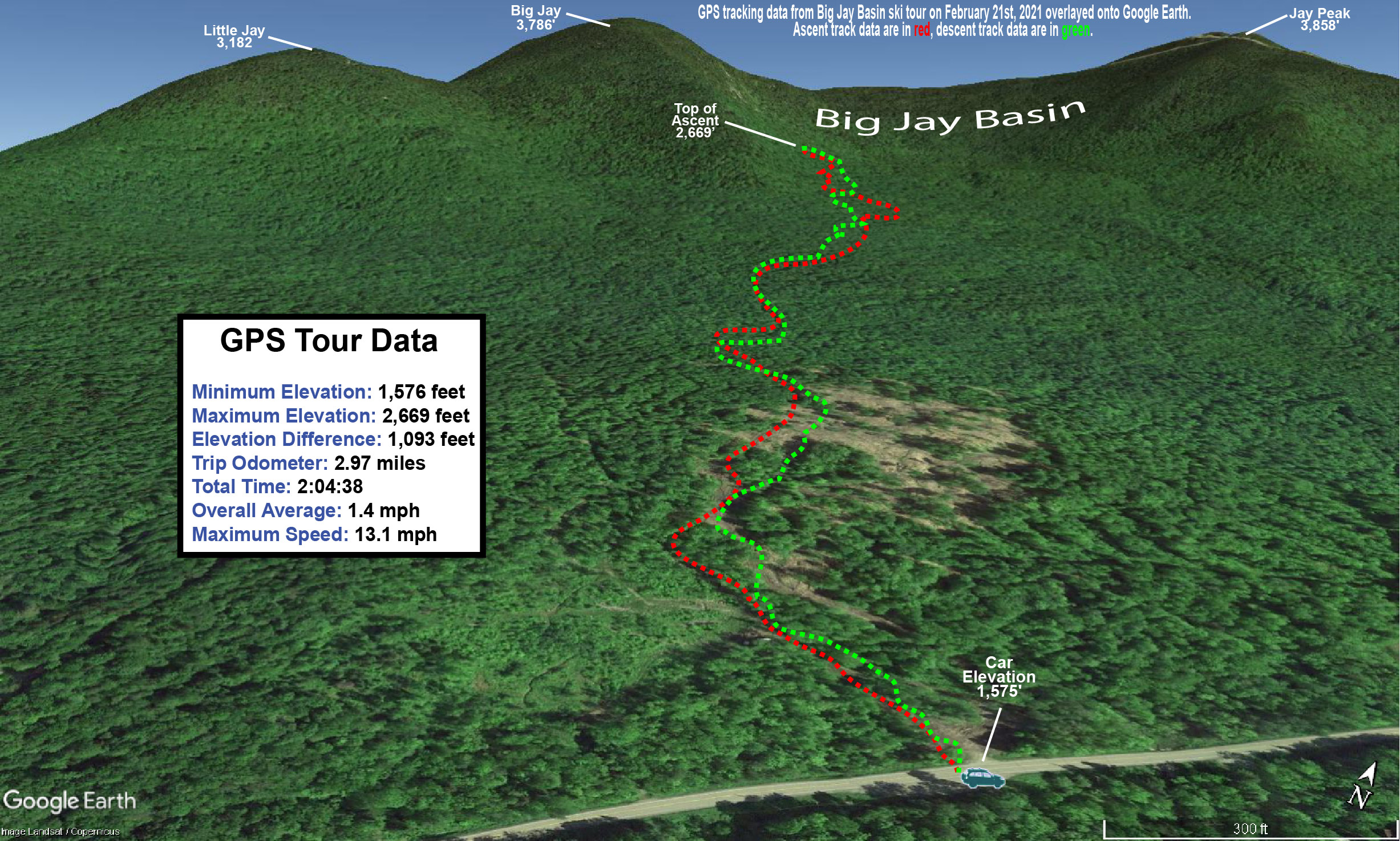
A map of our backcountry ski tour in the Big Jay Basin area today with GPS data mapped onto Google Earth
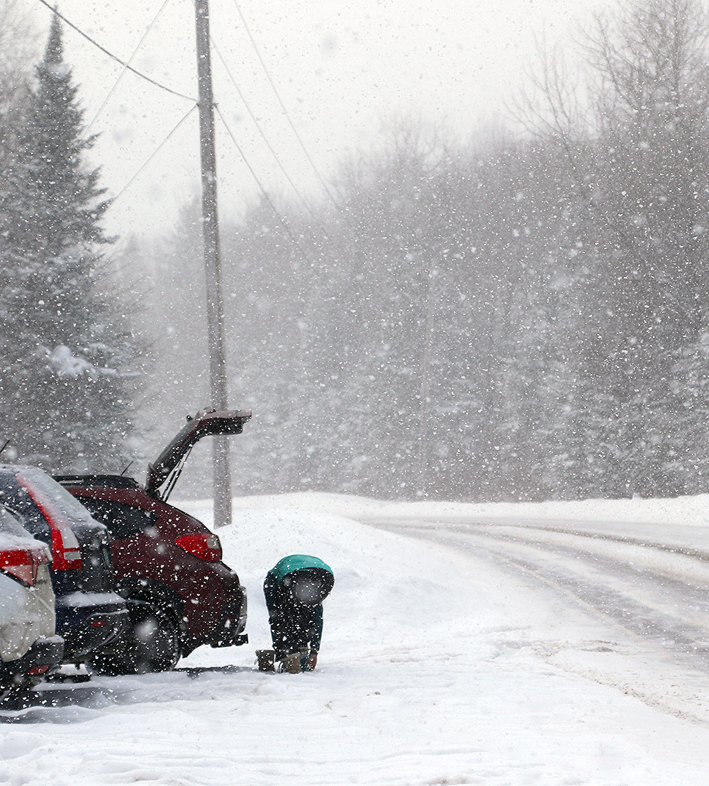
Since the trip is an hour or so from home, we used it as an opportunity to get Dylan some of his required driving hours, and that was a win-win. There was still some snow to navigate on the roads so that he could work on dealing with slushy areas, but it was probably good that he wasn’t dealing with the heavy snowfall and low visibility that I had frequently encountered yesterday.
The snowfall was quite heavy at times today, including a the Route 242 parking area when I was starting my tour.
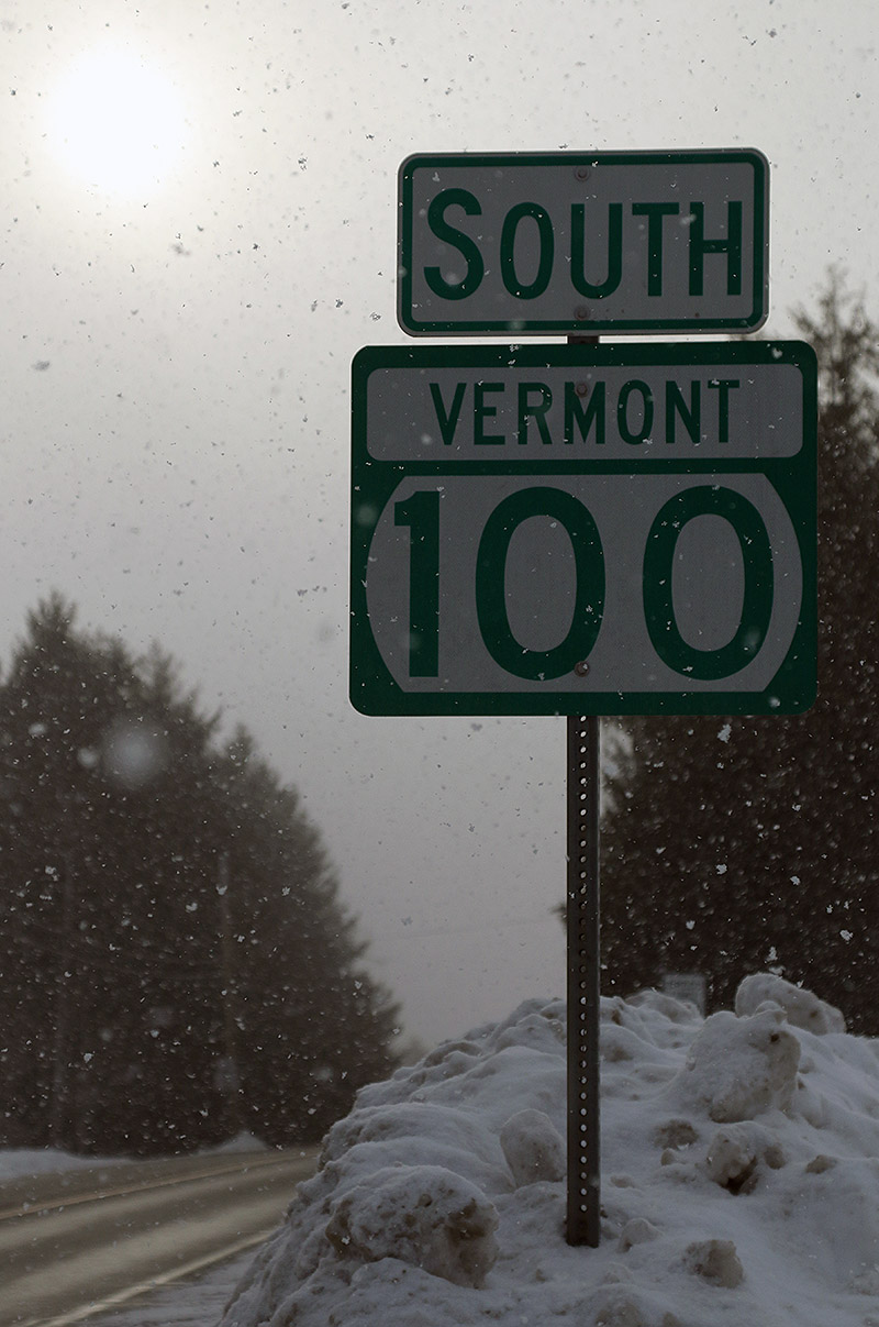
My drive up toward the Jay Peak area gave me a chance to see what had happened with respect to accumulations from Winter Storm Viola thus far. The Froude Numbers have been forecast to be relatively low, meaning that the western slopes were more likely to pick up accumulations than areas east of the spine, and indeed my travels showed that there have definitely been some notable differences in snowfall around the area. The rounds of fluff we’ve been getting here along the spine at our house have covered up the old snow pretty well, and monitoring that aesthetic during my travels today turned out to be a decent way to see who’d recently gotten snow. Heading east from our place, accumulations definitely dropped off toward the Waterbury Village area, and indeed, all along through the east slope towns of Waterbury Center, Stowe, and Morrisville, there really hadn’t been much new snow that I could see. Either that, or what’s fallen had sublimated and disappeared quickly off the snow banks. I’m sure accumulations increase as one heads westward up the mountain road and Mt. Mansfield, but down in Stowe Village, I could see that they need a refresher. There was still light snow falling in all those east side towns, but once I left Morrisville and rose up into the Hyde Park area, the increase in snowfall intensity was obvious. That continued right on through Eden. The snowfall was squally, and quite heavy at times, and I was continually having to turn on my headlights and fogs when I’d get into those more intense areas of snowfall. That increased snowfall definitely showed itself with accumulations – up in that area, all the roadside snowbanks were covered up with a solid coating of new snow. I’d say the snow was in general a bit less through Belvidere and Montgomery Center, but once I headed toward the pass on Route 242… well, we know what happens up there. Even from just a quick glance at the side of the road, it was obvious that even down at the roadside elevations, a lot more snow had fallen than I’d seen anywhere else on my drive.
Today’s drive yielded lots of midwinter Vermont views, including this one in Waterbury Center.
As we’d done on our last backcountry ski trip in the area, I parked at the lower access lot on the east side of the pass to start my tour. The elevation there is about 1,500’ and right from the start of the tour, I was finding 8-12” of new champagne atop the older snow. Above 2,000’ there was 12-16” of accumulation.
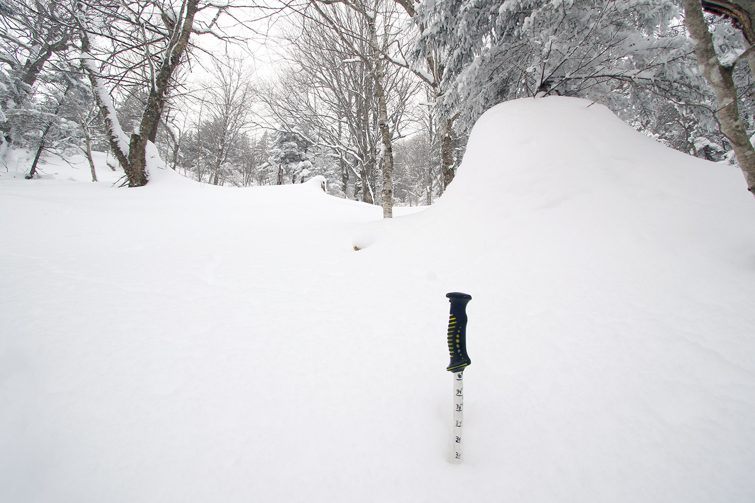
Finding a snowpack depth of nearly 40 inches as I make my way up through one of the glades in Big Jay Basin
I was also checking snowpack depths along my tour, and I was already getting 40” snowpack readings at just 2,000’. On top of that, it snowed the whole time I was there – most of the time it was what I’d call moderate, probably in the 0.5”/hr range, but there were also stints where it bumped up to the 1”/hr range. The snowfall was typically large, upslope-style flakes, which can make it a little tough to gauge the snowfall rate because they just stack up so fast.
It’s firsthand experiences like this though that have me rolling my eyes every time somebody gets going with the smack talk about Jay Peak and their snow reporting. My actual experiences reveal again, and again, and again that they really get a ridiculous amount of snow in that area.
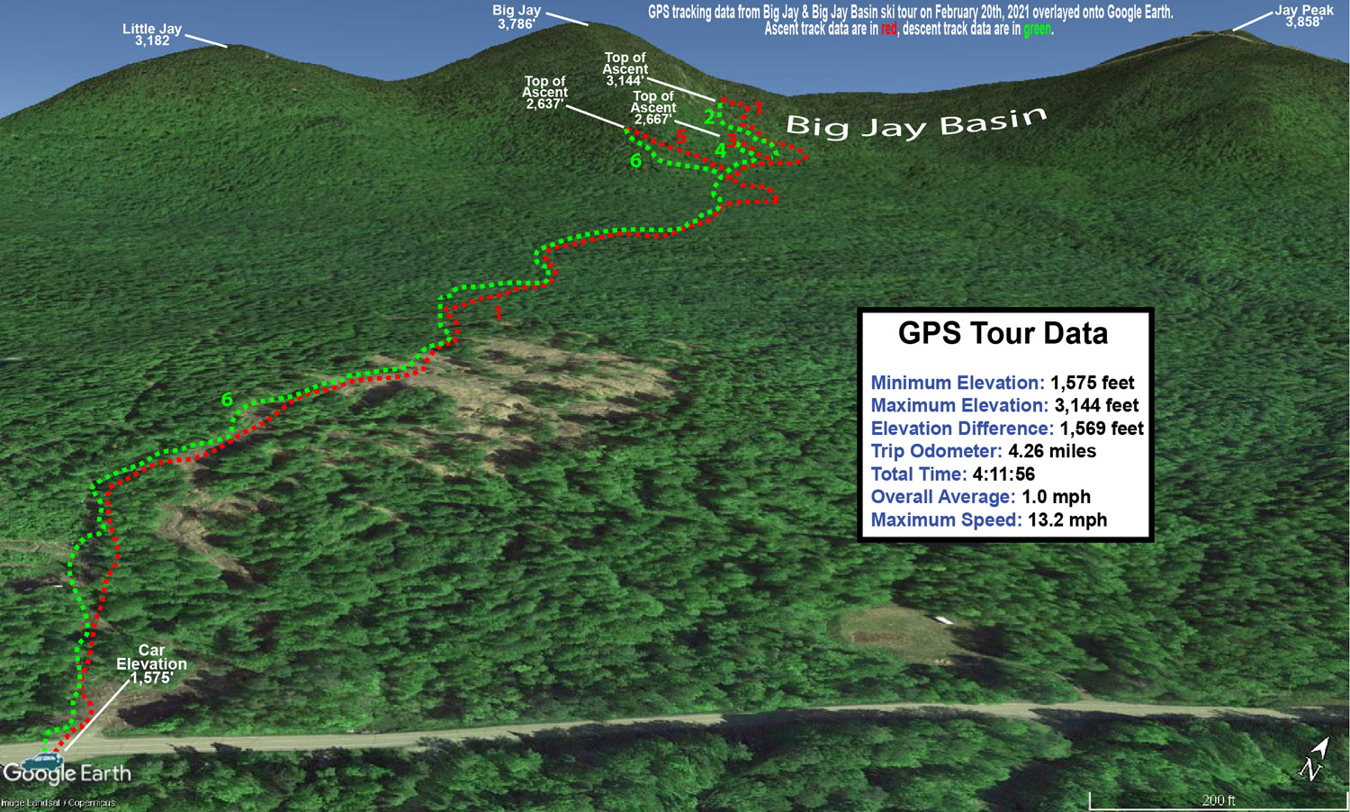
My ski tour had me on Big Jay itself, and in the Big Jay Basin area today, and that southeast side of Jay Peak really seemed to be the epicenter for this shot of continuing snowfall. I can’t say when all of it fell, and I believe I only saw 3” new on the snow report for the resort this morning when I checked. Reports I heard about said that the resort side of the peak didn’t pick up nearly what the east side did, so the Jay Peak cloud was dropping its bounty there. Whatever the setup has been in terms of wind direction and Froude, etc., that Big Jay Basin area today was definitely getting hit. Something similar was going on with Hyde Park and Eden as well, to a lesser degree of course.
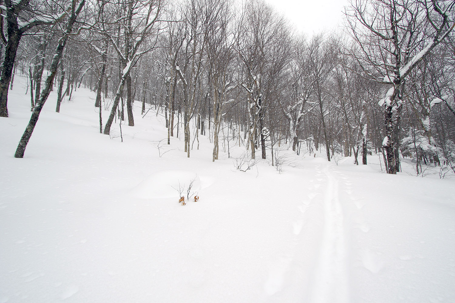
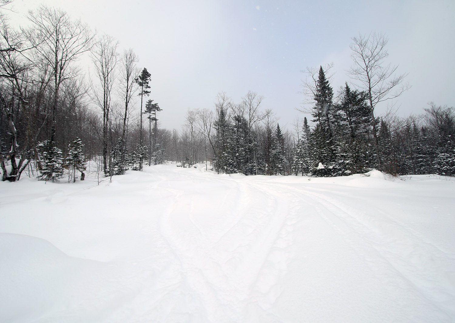
The lower areas of the approach offer lots of open terrain for skiers returning to the parking area
Indeed, my numerous checks on the snowpack today revealed that the area definitely avoided any real crust from Winter Storm Uri, so obviously that’s going to help a lot with respect to the quality of the subsurface. The resort reported 6-8” from that storm, and although there wasn’t a crust, that snow was still dense. The skiing was indeed fantastic with as much as 16” of that champagne powder in that area, but compared to last weekend, one can definitely nitpick a bit on the quality of the powder skiing. This most recent snow is so ridiculously light that it’s easy to get down to the dense Winter Storm Uri snow if you’re on more than moderate/blue pitch. Then you get to that region of dense snow, and if you pressure hard enough, you’ll collapse that layer a bit because the powder below it is less dense. Essentially, the snowpack’s got an upside down issue with respect to those second and third layers down. We’re very much talking first-world powder problems here of course, but I figured it would be good to get the beta out there for anyone else thinking of heading out. Naturally, going as fat as you can will help with respect to staying up in the champagne layer, and heck, if it dumps more tonight, that surface layer of powder will be bolstered to make it even better.
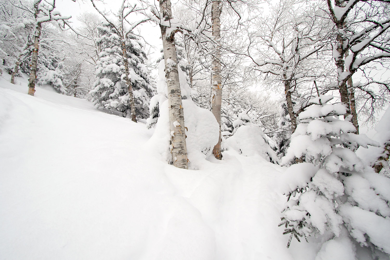
The glades were just everywhere in Big Jay Basin, with a skin track providing access right across the bottom.
Relative to Big Jay, I could definitely see the convenience of hitting Little Jay when coming from that lower parking lot on Route 242. Last time I was up there with the family in the general Big Jay Basin area, we actually did head more toward Little Jay, and we were in that drainage between Big Jay and Little Jay. I specifically went out today with the intention of just making turns in Big Jay Basin, but I left the option open to head up toward the main lines from Big Jay (in that general Jailbird Chute area) depending on what skin tracks were in place. There turned out to be a well-established skin track that headed right to that area, so my plan was to continue on it until it either disappeared, or I felt that ascending on skins was getting pointless.
On today’s tour, it was somewhere above 2,000’ when I found the first obvious split in the skin track – I literally came to a “T” junction with a skin track to the left, and the other option to the right. I was heading to the right toward Big Jay Basin, but the left option would have been a good choice for the Little Jay area.
“…right from the start of the tour, I was finding 8-12” of new champagne atop the older snow. Above 2,000’ there was 12-16” of accumulation.”
As I approached the 3,000’ elevation mark on Big Jay today, the ascent was starting to get pretty silly on skins because progress was just so slow. It was around that point when I found myself sidestepping up a steep, narrow area between some trees where the person setting the skin track had essentially done the same. It was basically just a ski’s width area, so you really couldn’t even make any sort of switchback. That was the point where I knew I wasn’t going to push too much longer on the ascent. The skin track still continued a bit farther, and I stuck with it a little while longer until the track really just became hard to follow in the packed snow of the main chute area. I followed a skin track (perhaps the same one, perhaps not) off to climber’s right briefly before that seemed to disappear, and then I decided I would stop my ascent as soon as I found a reasonable spot for deskinning. I side-stepped up about an extra 30 feet or so through fairly deep powder to a nice sheltered spot where I deskinned and had a snack.
I’d been there for just a few minutes when a group of five skiers, ascending on skins, appeared below me. They said hi, and thanked me for setting the skin track. I let them know that I was just following an old one made by others and was stopping where I was. It seemed like they were just going to stop there as well, but they started breaking their own trail above me and continued pushing on. I actually debated putting my skins back on and following now that someone else was breaking trail, but after watching them get maybe another 50 feet or so over the course of 5 to 10 minutes, I knew I’d made the right choice. As a group, I think they were having fun together with respect to the challenge of trying it on skins, and that’s probably the way to approach it.
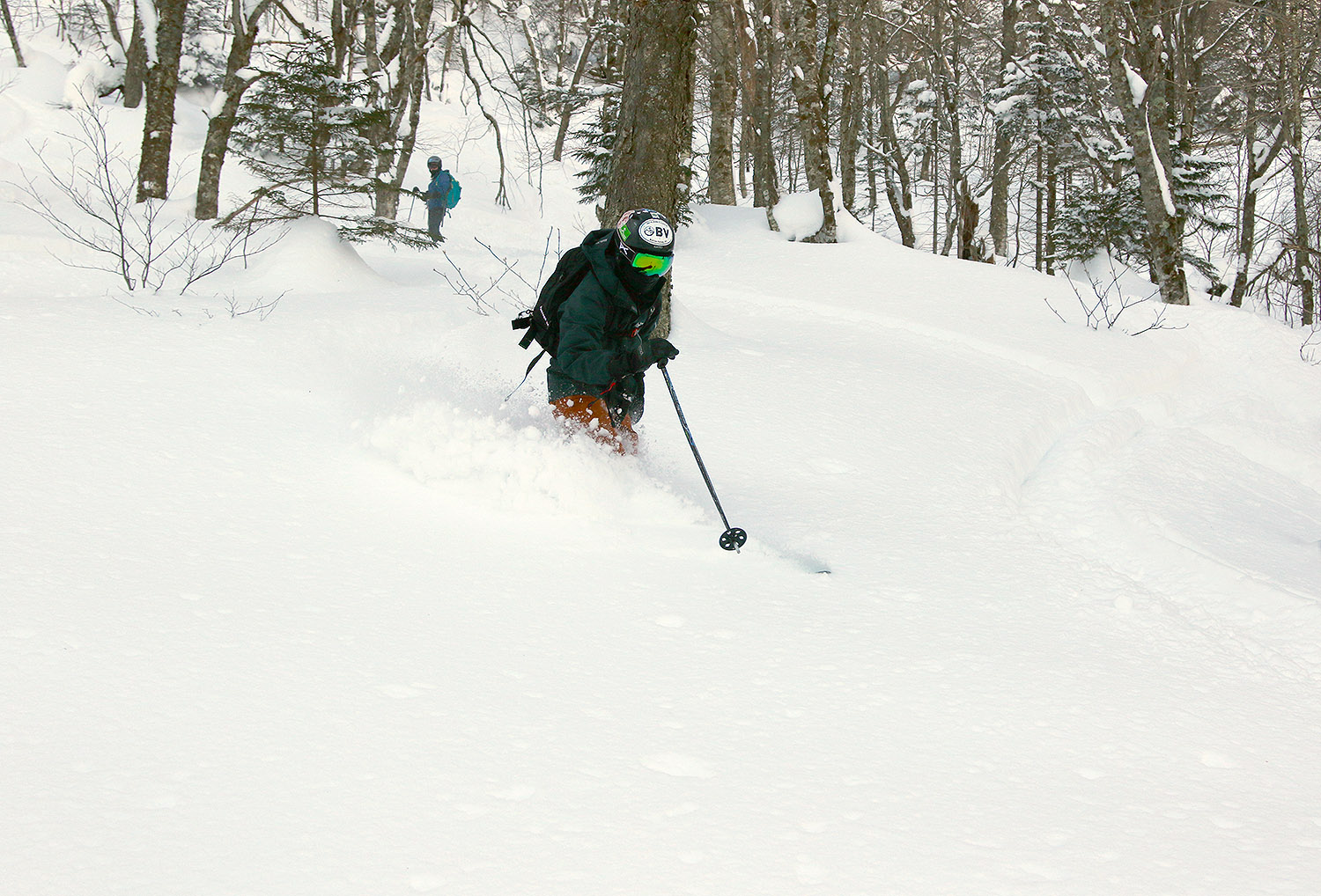
The terrain was getting steep, and the powder quite deep as I made my way up the east face of Big Jay today
I wanted to get back down into the lower basin because the powder skiing was far better down there anyway, simply because it’s just so steep up on that face of Big Jay. You’re not getting bottomless turns up there unless there’s 2 to 3 feet of powder. The 12-16” of champagne was really nice up there, but you want even more for that upper terrain. Overall it’s some fantastic steep skiing of course, but I was on fat Tele gear and planning for undisturbed powder on more blueish and blackish pitches, not semi-tracked super steeps.
So where I topped out was in the 3,000’ – 3,100’ elevation range, and I’d argue that it was already boot pack territory. Boot packing up there would also be quite slow though because you’re pushing up very steep terrain with lots of powder. It would be a serious slog through the snow once you were off your skis if someone hadn’t already broken trail, although you could stick to the more packed snow in some of the main chutes and that might offer some efficiency. I don’t know how far that group of five went, but if they were going all the way to the summit at ~3,800’, it must have been a lot of work. I’m sure one can make it up to the Big Jay summit by skinning that route, but it’s probably something to do if you’ve got a lot of time and want the challenge, it’s certainly not the efficient way to go. I do wonder if there’s an approach from the Little Jay side that perhaps gets it done in a practical way.
A Google Earth map with GPS tracking data for today’s tour in the Jay Peak Backcountry
One definite theme out there today was a lot of visages of the sun through moderate to heavy snow with big flakes. It was pounding snow a lot on both my tour and my drive, so it made for some nice, snowy scenes.
“…the powder I found was so exquisitely good, that I had to get E out there for some turns as well.”
Thanks to my explorations on trails like Moose-Ski and Grand View, I knew the most efficient and direct approach route to the Buchanan Shelter was to simply take the Catamount Trail to Beaver Pond. I’d taken this as my final route out on yesterday’s tour, and it really worked well as a rather direct and efficient gravity traverse back to the car. Indeed, it was quite the efficient route for the approach today, and it’s such a gradual incline that before you know it, you’ve gained several hundred feet of elevation.
During yesterday’s tour, I was pressed for time, so on my descent from the Buchanan Shelter, I had to stick near Upper Beaver Pond. Today we had plenty of time, so we were able to explore more to the east to find the best lines. There’s plenty of open forest for turns, and we were able to pick some fantastic lines that brought us right back down on Deer Run near the junction with Beaver Pond. We also had plenty of time to enjoy additional turns in some of the low-angle powder on the return to the car.
GPS Tracking for today’s tour on the Bolton Valley Nordic & Backcountry Network overlaid onto Google Earth
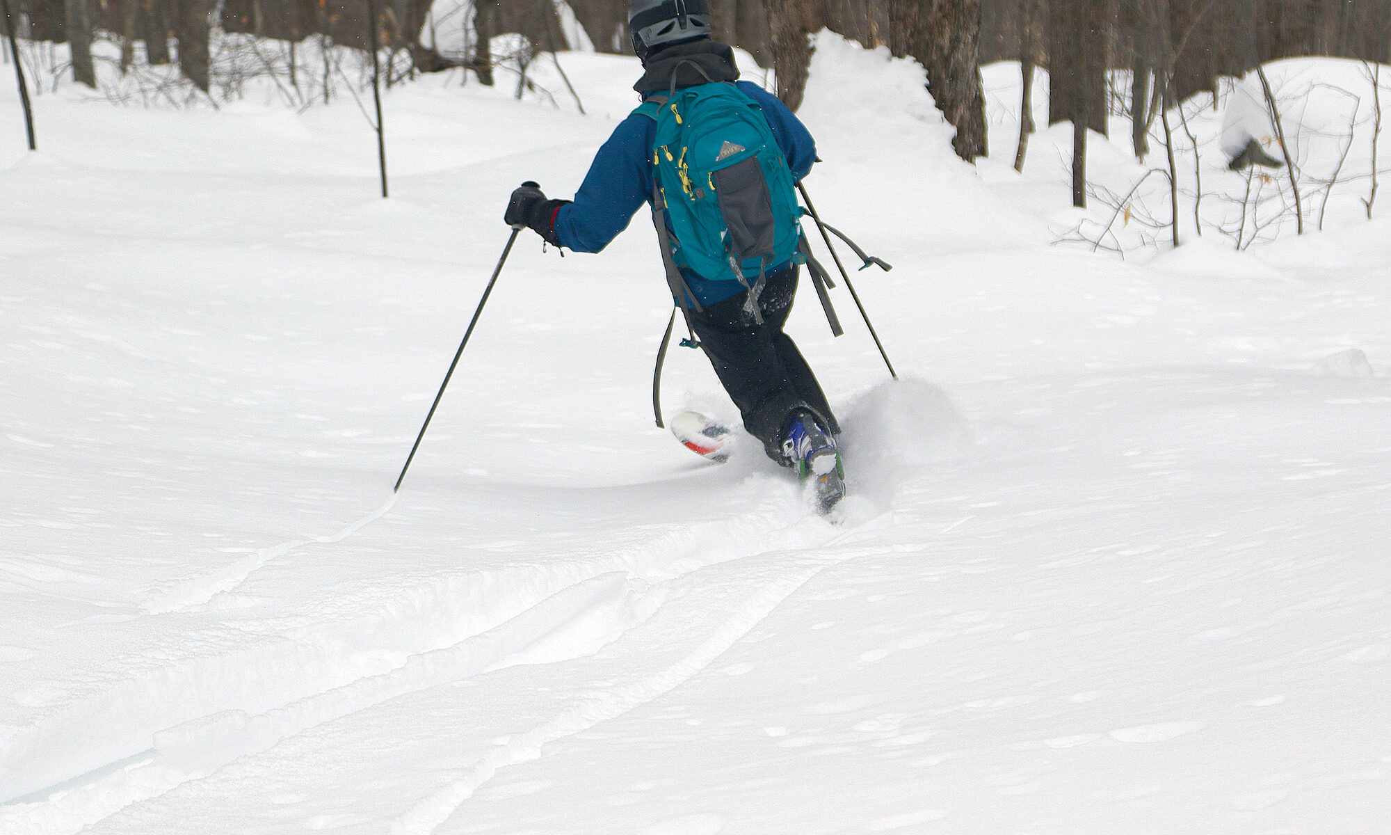
The powder was just as excellent today as it was yesterday, so it was a great ski outing. And, the fact that it just ended up being the two of us was sort of neat in the context of Valentine’s Day.
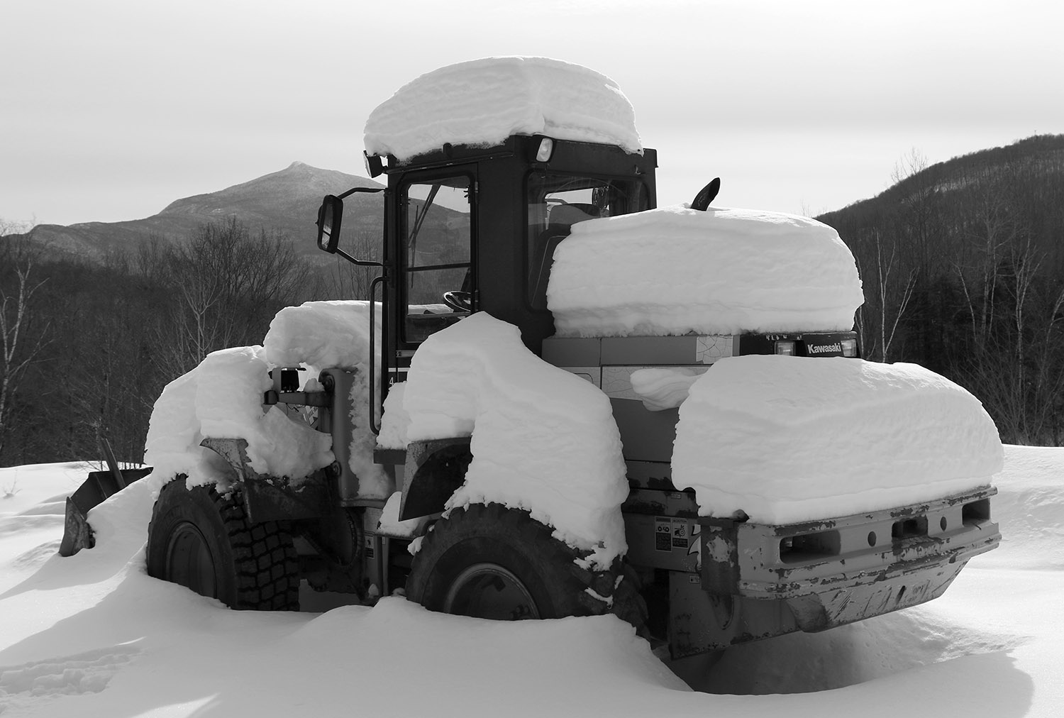
Views along today’s ski tour – a bucket loader covered with snow shows the various layers in the snowpack that have accumulated from recent storms.
Today was expected to be fairly chilly, with temperatures topping out in the teens F, and without any fresh snow in a couple of days, backcountry touring seemed to be the call.
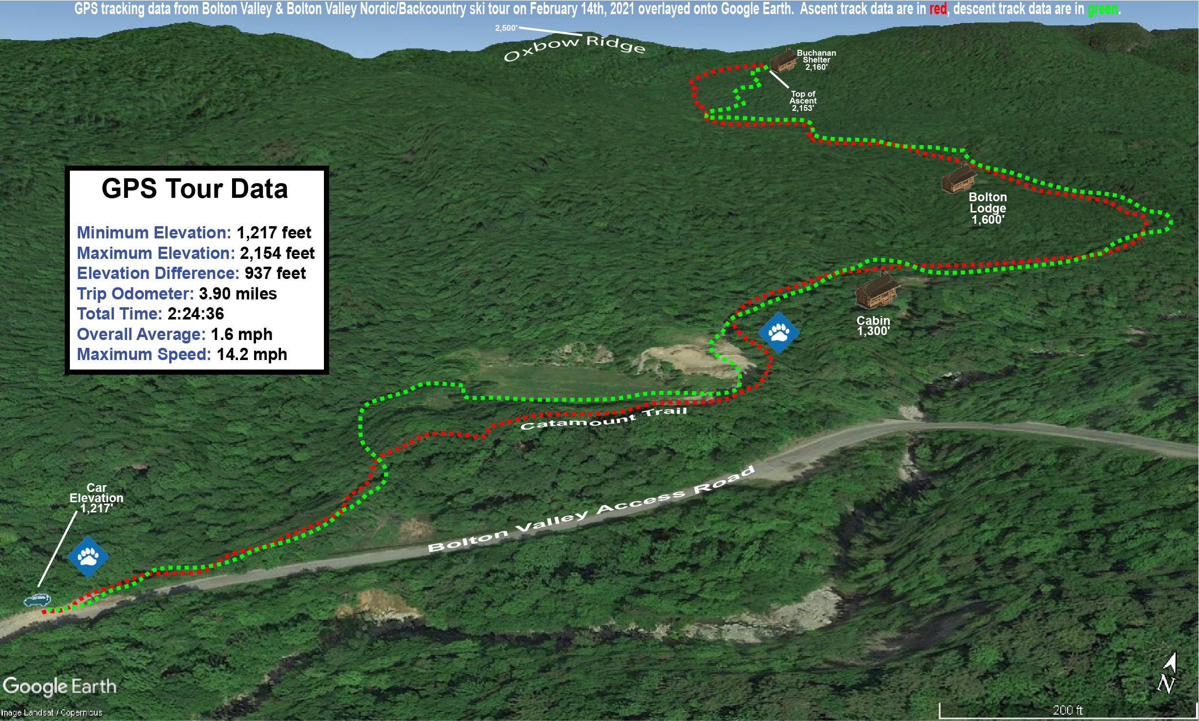
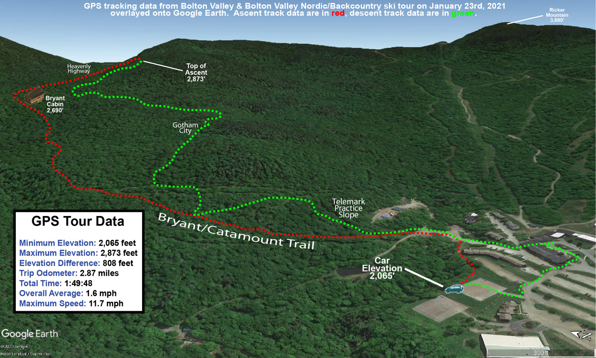
I was looking for something new to explore, so I planned a tour in the southwest corner of Bolton’s Nordic & Backcountry Network. I’ve only just scratched the surface of this part of the network in previous visits, so I was eager to see what options there were for descents with good tree skiing. My anticipated route was to start from the Catamount Trail parking lot on the Bolton Valley Access Road at ~1,200’, head up through the expansive beaver pond meadows in the Mt. Mansfield State Forest, and top out around the Buchanan Shelter at 2,150’ below the Long Trail.
On my ascent I was on the lookout for potential descent options, exploring trails on the network such as Moose-ski. The terrain was nice, but generally rolling, so while there were some nice short descents, it would be challenging to incorporate these into an efficient tour once my climbing skins were removed. The views from that area across the beaver ponds did provide some great views back toward the alpine trails and the Village area.
Beginning my descent through the powder today near the Buchanan Shelter.
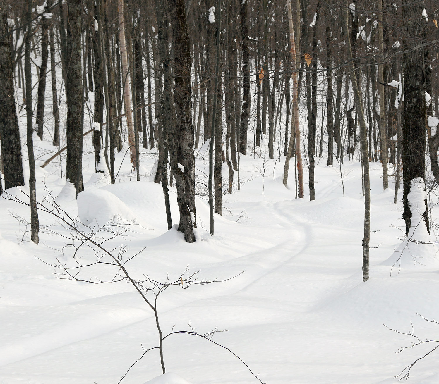
The best powder skiing terrain on the tour was definitely on the slopes below the Buchanan Shelter, with some nice areas of open forest. The only sign of skiing in that area was an old ski track from someone that must have been there at least a couple of storms ago. I suspect traffic is generally light in this area because it requires an approach that’s close to two miles, vs. much quicker access in many other spots on the network. There’s a vast area of terrain for good descents off the ridge where Buchanan Shelter is located, enclosed by the Long Trail, Goat Path, Lower Maple Loop, Deer Run, and Beaver Pond.
Even without new snow in a couple of days, the snow preservation has been so good, that the quality of the powder is simply spectacular. The snowpack I found was generally in the two- to three-foot range, but there’s such good density in the bottom layers that anything of concern is well covered.
A Google Earth map with GPS tracking data of today’s ski tour on the Bolton Valley Nordic & Backcountry Network
I was unsure how smooth the traverse out was going to be via the direct route back to the Catamount Trail, since I’d come in by an alternate route using Grand View and Moose-Ski. Indeed, the direct route out on Beaver Pond is quite quick – it’s essentially a gravity traverse with a few spots that require glide and kick or double polling, but there are even spots below Caribou’s Corner where it’s steep enough that you can get additional turns in the powder outside the skin track.
Out on my ski tour today at Bolton Valley, I found that there was still lots of powder stuck to everything.
I hadn’t been up to the mountain for a couple of days while I waited for the arctic hounds to head out of town, but things were definitely warming up this afternoon, so I hit the Bolton Valley Nordic & Backcountry Network for a tour. Temperatures were in the mid-teens F, and with brilliant sunshine and no wind, it was definitely getting much more comfortable out there.
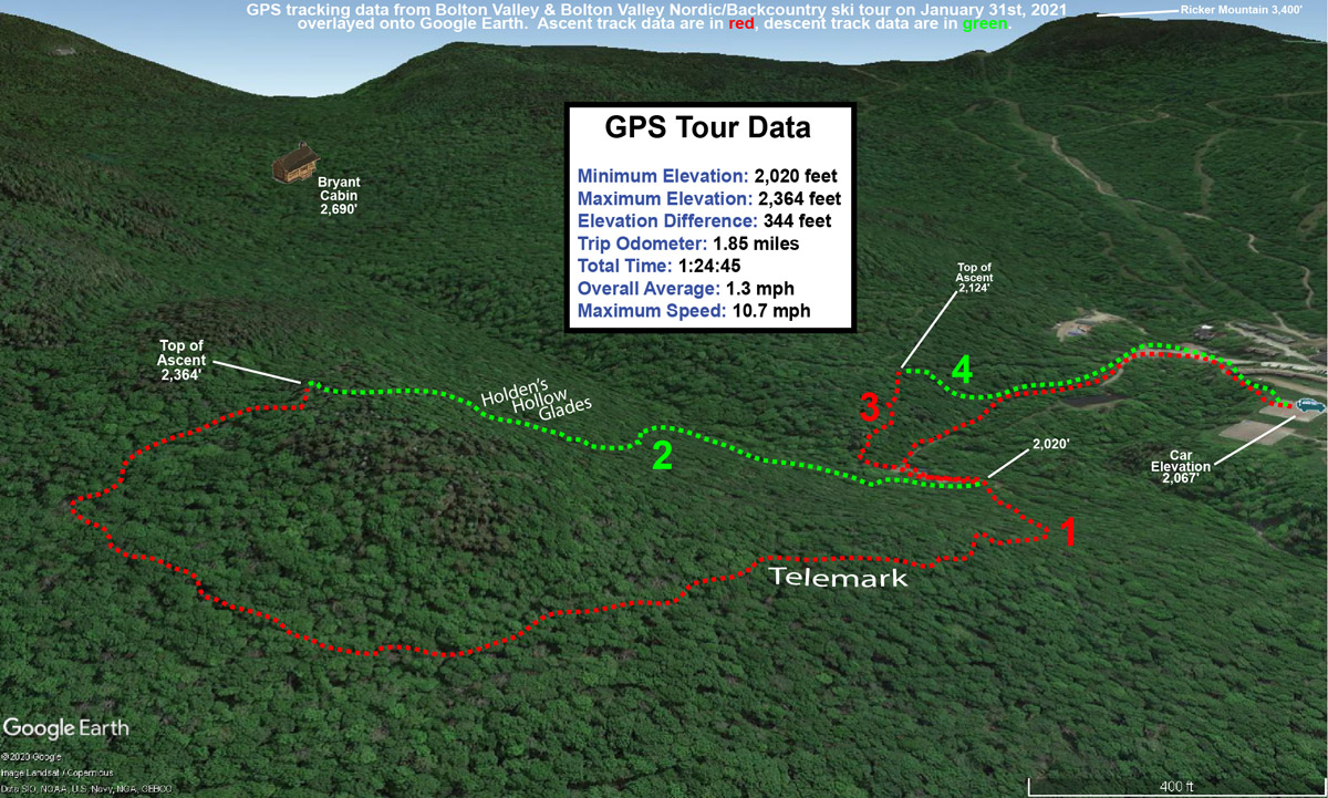
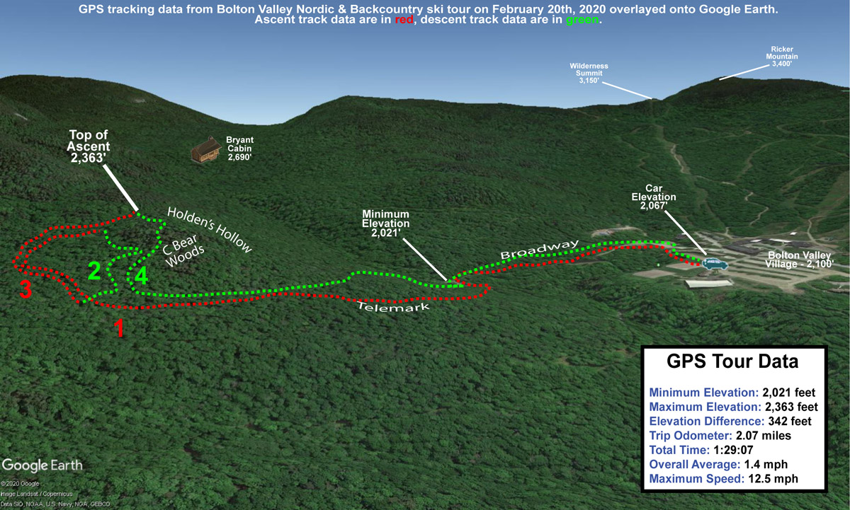
I wanted a relatively quick tour and hadn’t yet visited the trails on the western side of the network below the North Ridge this season, so I headed out in that direction. At the 2,000’ elevation around the Village I was quite consistently getting settled snowpack depths right around 24”, and in the 2,300’ – 2,400’ elevation near the top of my route, I got a 26” measurement. Although that’s not especially deep, there’s a lot of liquid in the snowpack, so everything is surprisingly well covered and there aren’t any major ground obstacles to worry about. Even steep terrain like C Bear Woods and the Holden’s Hollow Glades had plenty of coverage. I’m sure there would be a few coverage issues on steep terrain for lift-served levels of skier traffic, but with just backcountry traffic, there’s more than enough coverage to ski everything without concern. Although it had only been a couple of days since the last snows, there had actually been a pretty good amount of traffic on the main routes I traveled, so I had to go off the edges for fresh powder.
The GPS track of today’s ski tour on the Bolton Valley Nordic & Backcountry Network superimposed onto a Google Earth map
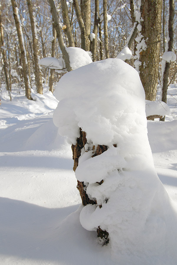
There has definitely been some settling of all the fluff in the forest over the past few days, but there’s still a lot of snow covering everything. It will be interesting to see what the snow from this next storm does in terms of sticking to what’s out there already.
The recent upslope snows were seen covering and clinging to everything today while I was out on a backcountry ski tour at Bolton Valley.
The consistent snows and temperatures we’ve had over the past several days had me pretty certain that the snow quality was there for lift-served skiing today, but the arctic hounds coming in on those northwest winds led me to go touring instead. When I saw projected highs in the single digits F for Bolton Valley today, there was no way I wanted to sit still on the lifts in the wind vs. generating my own heat down in the protection of the forest.
I got up to the Village around midday, and temperatures were indeed in the mid-single digits F as the forecast had suggested. Between all the backcountry touring and Nordic folks that I saw, there were plenty of people out on the lower trails, but farther out into the higher trails by the Bryant Cabin, I saw probably a handful of groups. Overall, you could tell by the vibe that people felt it was great weather for these types of activities.
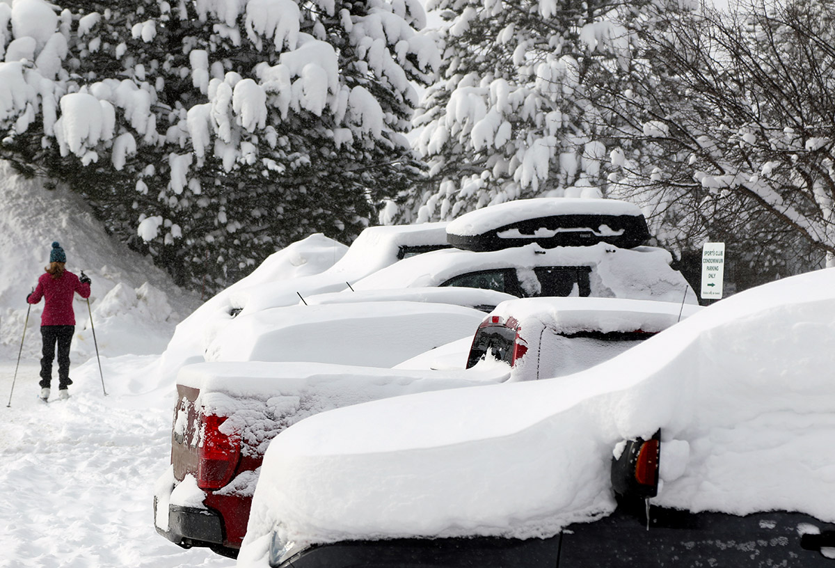
Snowy scenes were everywhere today around the Bolton Valley Village.
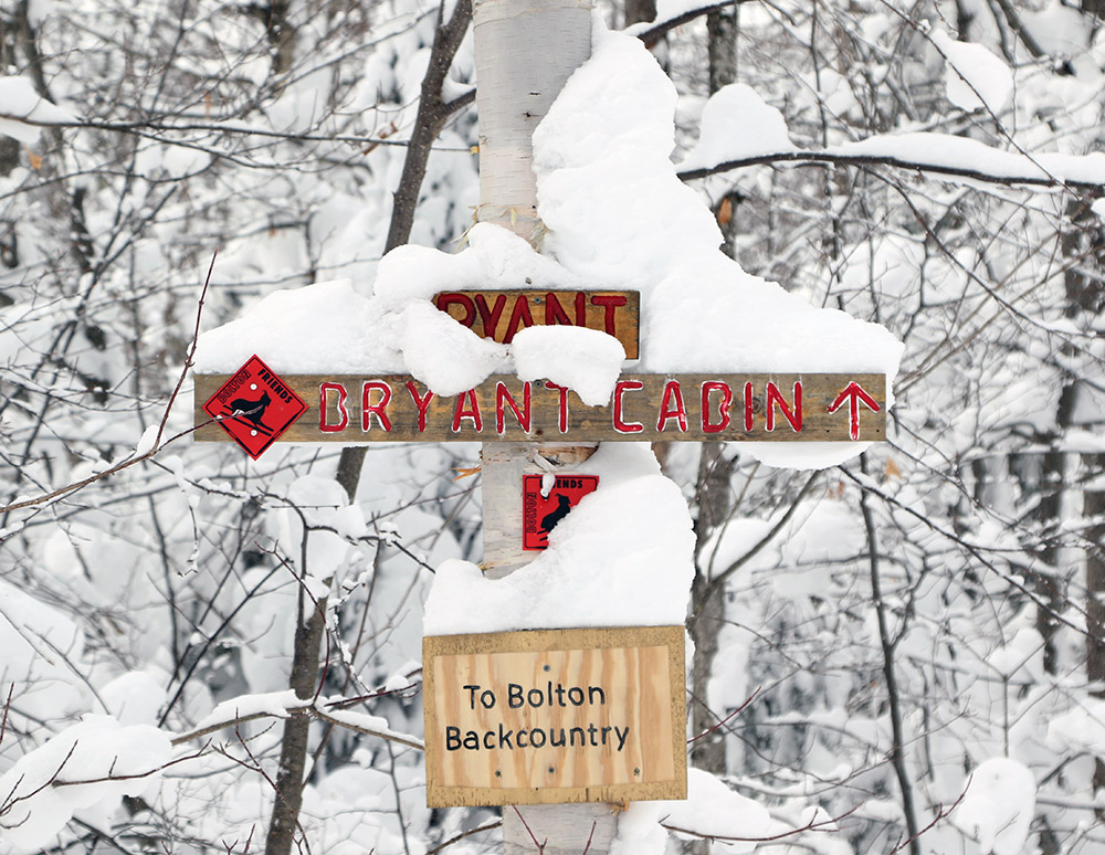
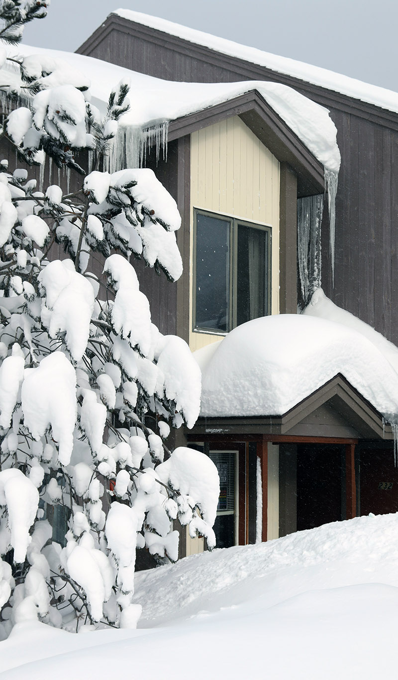
The additional 4 inches of fresh champagne that the resort had just picked up really served to top off the already crazy levels of fluff that covered everything. I saw some great images of the recent snows as soon as I arrived in the Village, so before gearing up for my tour, I took a quick walk around the Village and grabbed some scenic shots. Once I started my tour and got into the forest, the amount of snow on all surfaces was just amazing – it was caked so heavily on the trees that you were surrounded by it on all sides. Starting up the Bryant Trail was like walking into some sort of white cathedral.
I made depth measurements of the snowpack during my tour, and I found generally 26-27” around the 2,000’ level, and many spots that are getting dangerously close to 40” up near 3,000’. That’s pretty consistent with what the Mt. Mansfield Stake is showing. The powder skiing was great, although we could still use another storm or two just to push the snowpack depth past that 40” benchmark.
A Google Earth map showing GPS tracking data from today’s tour on the Bolton Valley Nordic and Backcountry Network
At the start of my tour off Heavenly Highway I was on some steep, 30+-degree slopes, and I was setting off sloughs that definitely spoke to the relative snowpack instability from the continuous day after day after day of snows without consolidation. I was perfectly safe where I was the very dense forest, but I immediately though about how I wouldn’t want to be exposed in spots like the ravines of the Presidentials. So I guess it wasn’t entirely surprising when I discovered posts in the American Weather New England Skiing Thread about slides in Tuckerman.
Although the base is still quite shallow, the mountains are definitely beginning to have that midwinter look after a week with some additional snows and excellent temperatures for snow preservation.
I was last out at the mountain on Sunday, and although we’ve only had a few additional inches of snow since then, it seemed like today was a good day to head on up for a tour and check out the conditions. We’ve continued to be treated to temperatures that are well above average, which in January around here actually makes for some very nice temperatures in the 20s F.
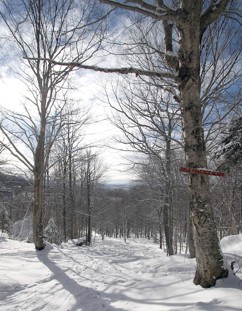
I didn’t check out any of the manmade or lift-served terrain today, but I started my tour on the Bolton Valley Nordic and Backcountry Network and then connected over to the Wilderness area. After several outings following the standard Wilderness Uphill Route right from the base over the past few weeks, I wanted to mix things up today. So, I started out down by the Nordic Center, headed up Bryant until I got to World Cup, and then continued over to Lower Turnpike via the connector trail used by the mountain operations crew. It was a fun variation with some new views, and it let me check out the conditions across a number of trails, including the Telemark Practice Slope, which looked to be in such good shape that I skied it on my descent. Starting out on my tour in one of the tennis court lots, I actually had my pass scanned by a resort associate with a handheld scanner. This was the first time I’ve been checked since Bolton Valley has switched to RFID. It’s great to see that they’re checking, and it’s a good reminder to be sure you bring your pass, even if you’re going to be touring!
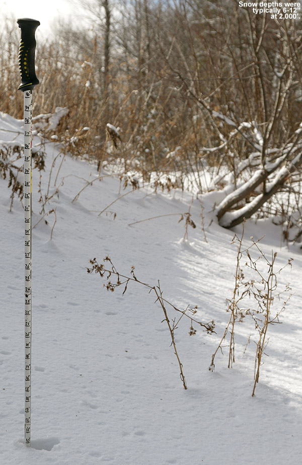
The GPS tracking data plotted on Google Earth for today’s tour, which brought me from the Nordic trails over to the Wilderness area.I generally found 6-12″ of surface snow at the 2,000′ Village elevations today, but in some places there’s little to no base snow below that.
The Colorado-esque weather regime over the past few days has definitely been outstanding with respect to snow preservation. In areas that haven’t been skied, all the recent snows are just sitting there in the form of midwinter powder, and I found depths of generally 6-12” at the 2,000’ elevation and 8-12” up around 2,700’, which was as high as I went on my tour. I toured on my midfats today instead of my fat skis, assuming powder would be fairly hard to come by after a week of modest snowfall, settling, and skier traffic. I’d still go that route again based on what I chose to ski, but there is definitely some fat ski-worth powder out there in many areas. I’d say the main issue is still the base below that snow. It’s quite variable, and down at 2,000’ in the Village elevations there’s nothing at all below the powder in unprotected areas. In the higher elevations the base is a bit less variable, but there’s still nowhere near enough base for steep terrain. I could tell that the mountain had opened up some of the natural snow terrain on Wilderness for lift-served skiers connecting over from Vista, because there were surprising number of people skiing the Wilderness Lift Line and Wilderness Woods. I saw a group of four kids in Wilderness Woods having a lot of fun, although it’s still a bit thin and you could hear them hitting the occasional stump or rock.
“I toured on my midfats today instead of my fat skis, assuming powder would be fairly hard to come by after a week of modest snowfall, settling, and skier traffic. I’d still go that route again based on what I chose to ski, but there is definitely some fat ski-worth powder out there in many areas.”
What I saw that impressed me most on today’s tour was the state of skier-packed natural terrain. Areas like Lower Turnpike, Telemark Practice Slope, Bryant Trail, and Nordic trails like World Cup (some of these may have been machine-packed) were in very good to excellent shape. Presumably, these areas of packed snow held up well against the warmth around Christmas, and now the additional snows of the past week or two have reinforced that base. Lower Turnpike had nearly perfect coverage, and all this packed terrain is going to make for some excellent powder skiing when the next storms come.
All in all, though, you could definitely feel that winter has settled in for the mountains, even if the snowpack/base is on the low side. The water bars I encountered today were all sufficiently frozen, although most of them are still visible and require a bit of navigation.
Ty drops into a line through some of the great snow we found today on the Bolton Valley Backcountry Network
Dylan and E were off to a sledding party this afternoon in Morrisville, but it was such a gorgeous day that getting out for a ski tour was definitely on my mind. Ty had to work until noon, and was heading to a friend’s house at 4 P.M., but we definitely had enough time to sneak a tour in that window. Once Ty was back and we’d gear up, we headed right to Bolton Valley.
You almost couldn’t ask for better weather today – we had blue skies, and temperatures at Village elevation were right around 30 F. That’s nice and comfortable for touring, but not warm enough to really start adversely affecting the powder. Visitation at the resort looked strong, but there were still available parking spots and we were able to get one right along the trails in the upper tennis court lot.
“The mountains have had several more inches of snow since then though, and today we really didn’t encounter any signs of that crust because it’s probably just buried deep enough.”
We toured over toward Holden’s Hollow today, and the theme was definitely efficiency. Ty is in really great shape, so his pace is even faster than mine, and within about 25 minutes we were already in position for a descent. Based on how fast we’d moved, I said we’d easily have time for a couple of laps, so we set up for an initial descent through a nice glade on the back side of the ridge. Ty worked on deskinning with his skis still on, and was quite fast with it, so our transition speed only enhanced just how efficient and quick we were overall.
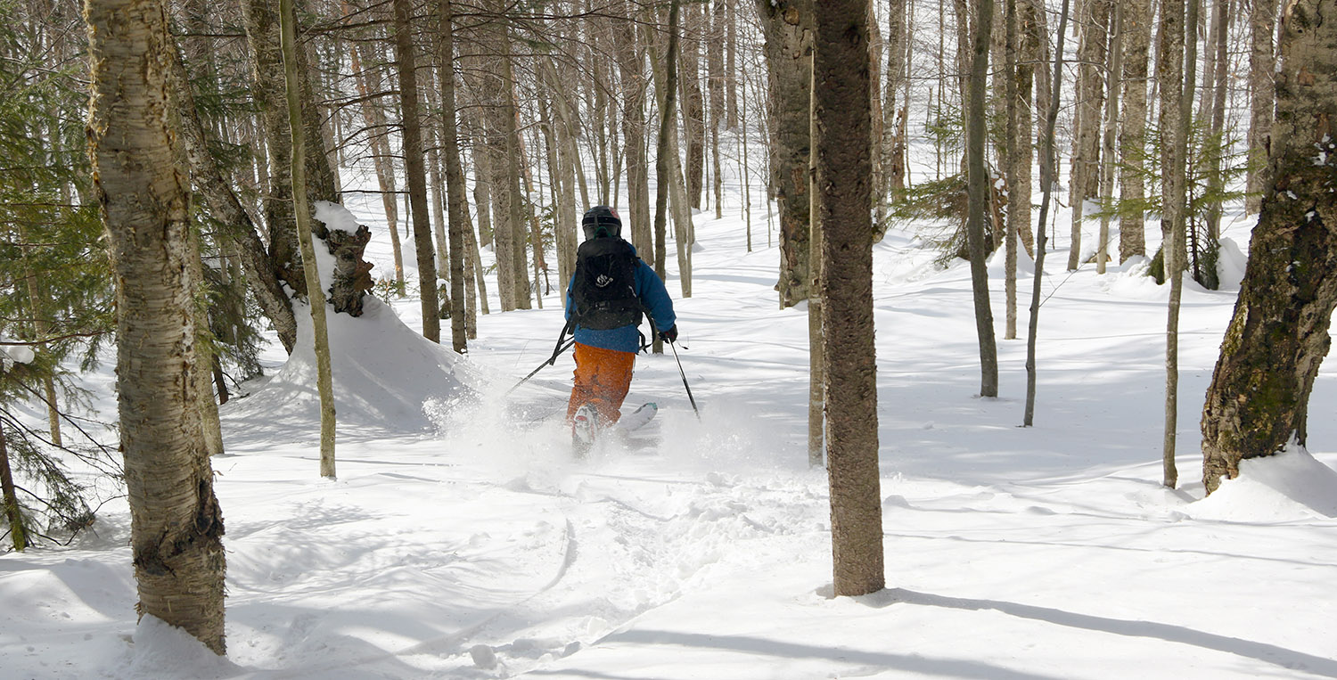
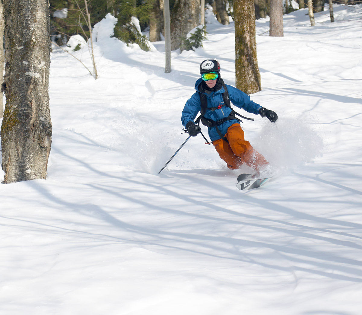
We had first tracks for our descent of the glade, and the conditions were excellent. I’d actually describe the conditions as even better than what we encountered last Saturday when I was out at Bolton with Dylan – and that already wasn’t too shabby. The powder skiing on that outing with Dylan was decent, but there was a marginal buried crust present in some areas that knocked the overall feel down a notch. The mountains have had several more inches of snow since then though, and today we really didn’t encounter any signs of that crust because it’s probably just buried deep enough. Surface powder depths we found were right around 20 inches before getting down to the base, which is basically what we found last weekend. The powder was more consistent today though with any crust buried deeper. That 20 inches of powder is fairly settled at this point of course, so we’re not talking about sinking down 20 inches into fresh champagne, you’re more like 6 to 12 inches down in the powder, but the rest is serving as fantastic cushion above the base. Our first run was on a fairly south-facing slope, but the trees offered a good amount of protection from the sun. A few spots were just starting to get that first phase of the powder being affected by the sun, but those were few and far between.
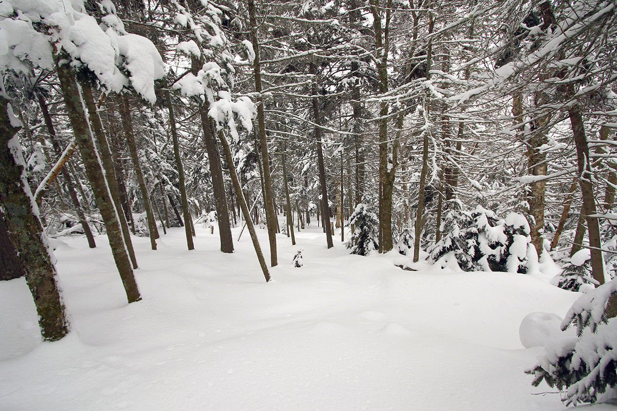
An unblemished canvas for Ty to get first tracks on our initial descent of the tour
Once we were back down at the Telemark Trail, we switched over for another ascent, and I was much more efficient at the transition, so told Ty I’d start the ascent and he could catch up. This time, I broke trail through the powder beyond our previous lap, and headed up to the top to access the east side of the ridge. Ty caught up to me just as I was cresting, so it worked out perfectly.
“Surface powder depths we found were right around 20 inches before getting down to the base, which is basically what we found last weekend.”
We descended in the C Bear Woods area that I’d visited back during my tour on the 1st of the month. We had first tracks there as well, but the powder wasn’t quite as good as what we’d found on our first ascent – I think wind effects up on that part of the ridge were the main culprit. The sun was also doing a bit more work on that snow, so in some areas it had lost a bit more of its winter fluff texture.
Back down at the bottom of that run, Ty and I skinned up for the final return to the car, and we found that we’d less than 90 minutes for the whole tour. It was fun getting things done so efficiently, and we really weren’t even pushing ourselves, it was just overall solid pace and good transitions between skinning and skiing.
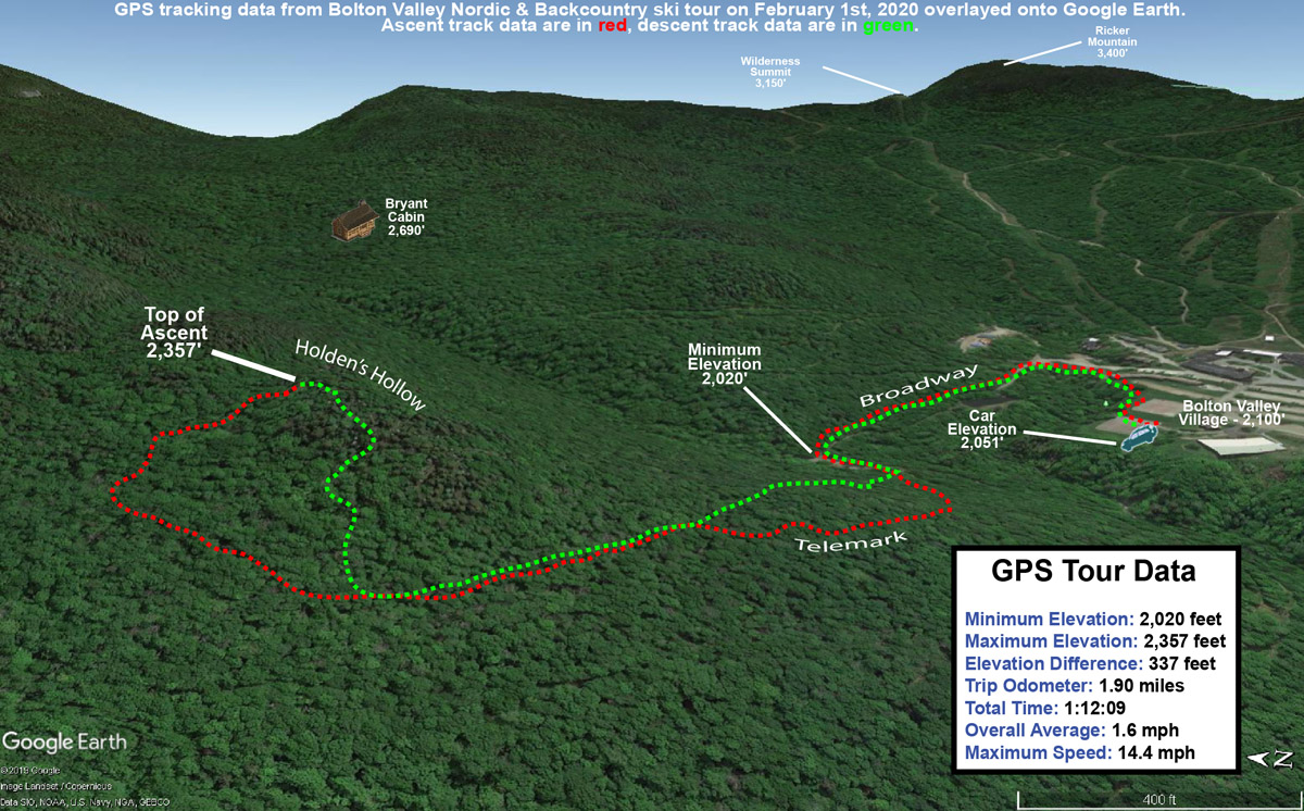
GPS Tracking data mapped onto Google Earth for today’s ski tour on the Bolton Valley Nordic & Backcountry Network
We’ve got another potential winter storm coming later this week, and it looks pretty nice for the mountains around here from what I’ve seen on the models. The initial snow might be dense since it not an especially cold storm, but unless things change dramatically it looks like another nice shot of liquid equivalent for the snowpack. Some of the models also show extended upslope snow on the back side of the cycle, which would be great to top off the powder skiing conditions.
Temperatures were really in a sweet spot today – they were just a bit below freezing, which meant that they were extremely comfortable, but not warm enough to ruin any of the powder. I think a lot of people know that today was going to be spectacular out there, because even the lots down by the Nordic Center were filling up when I arrived around 10:00 A.M. The upper tennis court lot was already filled, so I had to head to the lower one, but I got a nice trailside parking spot that let me gear up and jump right onto Broadway.
“The depths of powder I’d found down at the ~2,000’ Village level were generally in the 10-15” range, and up there in the 2,300-2,400’ elevation range I was finding a fairly consistent 16” of powder.”
I needed to pick up Ty from work at noon, so my plan was a quick tour out to the Holden’s Hollow area to get in some powder turns. Consistent with the parking lots, there were people all over the Nordic trails, and a number heading out onto the backcountry trails as well. Once I got up onto the Telemark Trail I didn’t see anyone else around however, and based on the skin track it looked like only about 3 or 4 people had even been out on that part of the network recently.
I had to break trail on the final stretch up to the ridgeline above Holden’s Hollow, and once I’d crested I found myself with a vast area of untracked snow below me. The depths of powder I’d found down at the ~2,000’ Village level were generally in the 10-15” range, and up there in the 2,300-2,400’ elevation range I was finding a fairly consistent 16” of powder.
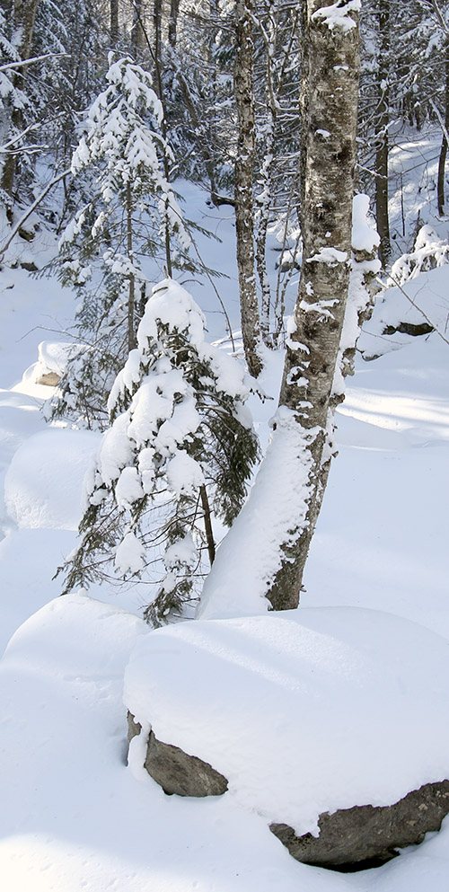
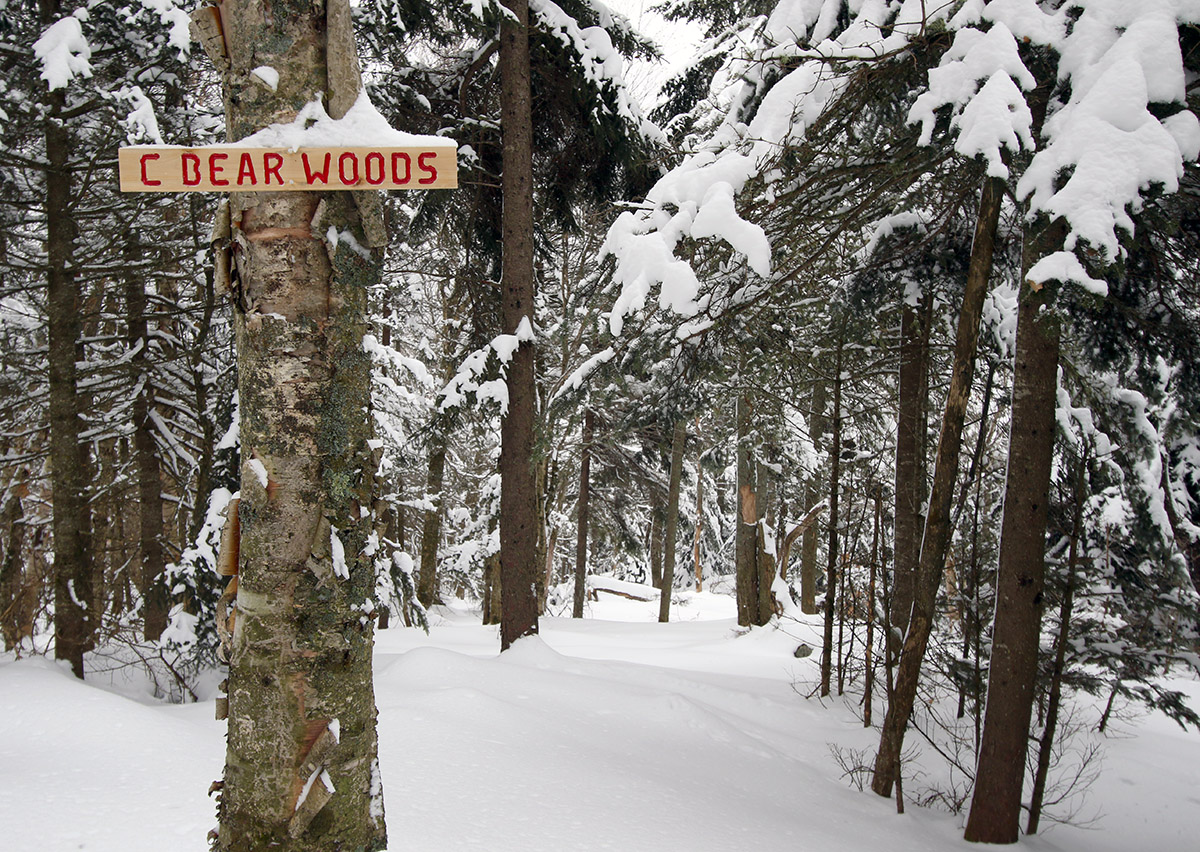
Getting ready for some untracked turns through the C Bear Woods area today.
As I switched over for the descent, I noticed a trail sign just down the ridgeline from me, and figured it was one of the markers for some of the Holden’s Hollow Glades. Once I headed over to it though, I saw that it read “C Bear Woods”, and I realized it was a sign I’d never seen before. The sign looks new, so it’s either an area that was recently updated for skiing, or perhaps folks just got around to putting up a sign. Whatever the case, the glade below me was entirely untracked, and the powder was excellent. As I encountered on Thursday, there was a bit of a crust buried within the pack in some spots, but in this case it was either absent or buried deep enough that it was inconsequential.
I was surprised to find that the run actually brought me down on the back side of the ridge, which would have been great for doing another lap, but unfortunately I didn’t have time. I cut eastward through the trees and got myself over to the east side of the ridge where I was able to descend back to the Telemark Trail and Broadway with more untracked powder turns.
From the pump house/bridge area, I re-skinned my skis for my return to the Village – I’ve learned the investment of a couple minutes into putting on your skins is well worth it for that return trip with its slight uphill inclines.
A Google Earth Map with GPS Tracking data of today’s ski tour on the Bolton Valley Backcountry Network
When I got back to my car a bit before noon, even the lower tennis court lot had filled, and the parking lots in general looked packed to the gills. The mountain was definitely doing a booming business, and I guess that shouldn’t be surprising on a midwinter Saturday with a recent resurfacing of the slopes, full operation, and perfect temperatures.


