Temperatures were really in a sweet spot today – they were just a bit below freezing, which meant that they were extremely comfortable, but not warm enough to ruin any of the powder. I think a lot of people know that today was going to be spectacular out there, because even the lots down by the Nordic Center were filling up when I arrived around 10:00 A.M. The upper tennis court lot was already filled, so I had to head to the lower one, but I got a nice trailside parking spot that let me gear up and jump right onto Broadway.
“The depths of powder I’d found down at the ~2,000’ Village level were generally in the 10-15” range, and up there in the 2,300-2,400’ elevation range I was finding a fairly consistent 16” of powder.”
I needed to pick up Ty from work at noon, so my plan was a quick tour out to the Holden’s Hollow area to get in some powder turns. Consistent with the parking lots, there were people all over the Nordic trails, and a number heading out onto the backcountry trails as well. Once I got up onto the Telemark Trail I didn’t see anyone else around however, and based on the skin track it looked like only about 3 or 4 people had even been out on that part of the network recently.
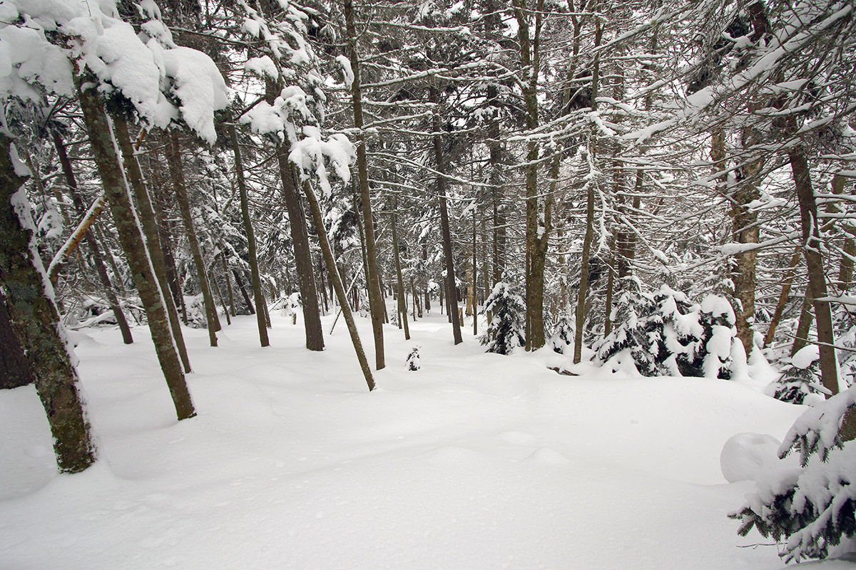
I had to break trail on the final stretch up to the ridgeline above Holden’s Hollow, and once I’d crested I found myself with a vast area of untracked snow below me. The depths of powder I’d found down at the ~2,000’ Village level were generally in the 10-15” range, and up there in the 2,300-2,400’ elevation range I was finding a fairly consistent 16” of powder.
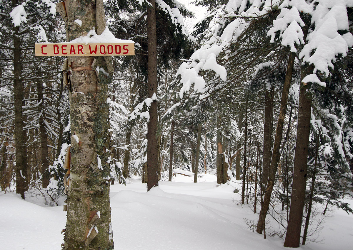
Getting ready for some untracked turns through the C Bear Woods area today.
As I switched over for the descent, I noticed a trail sign just down the ridgeline from me, and figured it was one of the markers for some of the Holden’s Hollow Glades. Once I headed over to it though, I saw that it read “C Bear Woods”, and I realized it was a sign I’d never seen before. The sign looks new, so it’s either an area that was recently updated for skiing, or perhaps folks just got around to putting up a sign. Whatever the case, the glade below me was entirely untracked, and the powder was excellent. As I encountered on Thursday, there was a bit of a crust buried within the pack in some spots, but in this case it was either absent or buried deep enough that it was inconsequential.
I was surprised to find that the run actually brought me down on the back side of the ridge, which would have been great for doing another lap, but unfortunately I didn’t have time. I cut eastward through the trees and got myself over to the east side of the ridge where I was able to descend back to the Telemark Trail and Broadway with more untracked powder turns.
From the pump house/bridge area, I re-skinned my skis for my return to the Village – I’ve learned the investment of a couple minutes into putting on your skins is well worth it for that return trip with its slight uphill inclines.
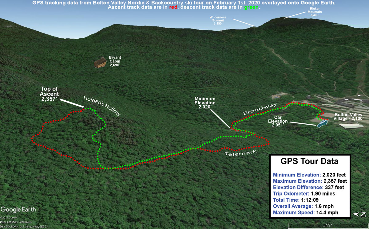
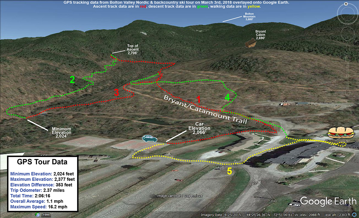
A Google Earth Map with GPS Tracking data of today’s ski tour on the Bolton Valley Backcountry Network
When I got back to my car a bit before noon, even the lower tennis court lot had filled, and the parking lots in general looked packed to the gills. The mountain was definitely doing a booming business, and I guess that shouldn’t be surprising on a midwinter Saturday with a recent resurfacing of the slopes, full operation, and perfect temperatures.
Heading down through a bit of fresh powder today on the Prayer Flag trail on the Bolton Valley Backcountry Network
Yesterday the Northeast was affected by Winter Storm Riley, a whopper of a system with wind gusts reaching 93 MPH in Barnstable on Cape Cod. On the winter side of the storm, the Catskills were the epicenter for big snowfall, with accumulations reaching 40 inches. Here in Vermont, the snow totals weren’t quite as outrageous, but the southern resorts still pulled in over a foot of accumulation. Bolton Valley was reporting 4 inches of new snow from the storm, which seemed like just enough to temp me out for a tour in the new powder.
“I didn’t have first tracks, but I did catch second tracks, and they were generally bottomless thanks to the dense snow and 115 mm fat skis.”
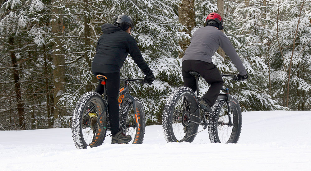
I headed up to the Village in the mid-morning timeframe with temperatures in the upper 20s F and mostly cloudy skies. The parking lots were already getting quite full, but there were still a number of parking spots right along Broadway, and I was able to grab one of those. I actually saw a few folks riding fat bikes on some of the lower Nordic Trails, and it looked like a perfect day to be out on those. Actually, with the fresh snow, comfortable temperature, and peeks of sun, it was just a gorgeous day to be out on anything – I saw all manner of folks on the trails varying from the bikers, to snowshoers, to Nordic skiers, to backcountry skiers.
With only a few inches of new snow, I was looking for some low-angle glades for today’s tour, and I decided to venture across to the west side of the valley for a change. I kicked things off with a run on Prayer Flag, augmented by ascending a bit farther up the west wall of the valley above the flags to get some extra vertical. I didn’t have first tracks, but I did catch second tracks, and they were generally bottomless thanks to the dense snow and 115 mm fat skis. Only when I had to cut hard to stop or adjust for a major obstacle would I get down to the subsurface. Lower angle was clearly the way to go today though, because down on Brook Run I could see that steeper terrain like the Holden’s Hollow Glades will definitely need another storm before they’ll be back in top form.
Down at the pump house on Broadway, I reskinned my skis and headed back up World Cup to Bryant. I skied the first half of Cup Runneth Over to start my next run, skipping the steeper bottom half because the new snow just wasn’t sufficient for that pitch. Cup Runneth Over had seen a couple of skiers, but there was ample fresh snow remaining and the turns were generally very nice. I finished out with some of the usual glades in the World Cup area, and even caught part of the Telemark Practice Slope, which had actually seen minimal traffic.
A map of today’s tour on the Bolton Valley Nordic & Backcountry Network
The classic end to the tour was of course a visit to the Village Deli to grab some subs with that fantastic new bread they’ve got. I didn’t see Gus today, but the Deli was really hummin’ with just about every table filled. It sounds like we might have another storm affecting the area this coming week, so we’ll certainly be watching that potential over the next few days.
Trying to get to some of that Bolton Valley backcountry powder today before temperatures warmed up too much.
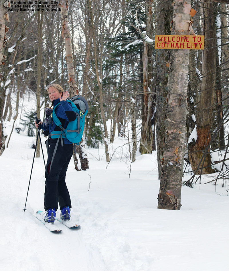
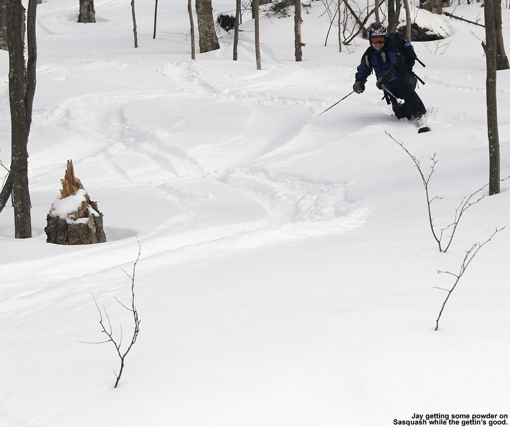
The boys both ended up staying over at the Handler’s house last night, and we wouldn’t be picking them up until the Warren Miller ski movie (No Turning Back) in Stowe this evening, so that gave E and I a chance to get out for a bit of skiing together today. I got a really good sampling of the snow and glade conditions on my solo ski tour on the Bolton Valley Nordic and Backcountry Network yesterday, and I found some spots that I thought E would really like, so I planned on a mini tour that would let us focus on just those glades. The Gotham City area and the glades below that looked like a very good option; based on the pitch, tree spacing, and depth and consistency of the powder, it felt like a good fit for E’s off piste Telemark skills.
Temperatures were rising today ahead of our next incoming winter storm, and they were right around the freezing mark when we arrived up in the Bolton Valley Village at midday. The resort was absolutely packed with the cars of visitors; now that the temperatures were nice and comfortable, presumably everyone was making their holiday trips to the slopes. The Village lots were actually all full and they were parking people down at Timberline, but since we’d be visiting the Nordic side of the resort, we figured we’d be able to find something down by the Nordic Center. Even down there it took some creative parking to get a spot, but we managed one in the lowest tier of the main area.
We walked over to the tennis court area, strapped on our skis and began following a short skin track that others had made that quickly merged onto Broadway. From there it was up to the Bryant trail, where we stopped at the highest junction with World Cup to drop some layers and open some vents. We continued on Bryant up to the 2,400′ elevation, where we cut off over toward Coyote. There’s a skin track leading right up into Gotham City that I’d seen yesterday, and my estimates were that an elevation of ~2,400′ was just about right for getting there. Indeed we quickly found the skin track off Coyote, and it was just another few minutes up to Gotham City. They even have a sign now that welcomes you to the area. I’m not sure when it was, but at some point today I realized that Gotham City must of course be name after Ann Gotham of Friends of Bolton Valley Nordic & Backcountry. I’d initially thought that the name referred somehow to the Gotham City of Batman fame, but the link to Ann seems so obvious now.
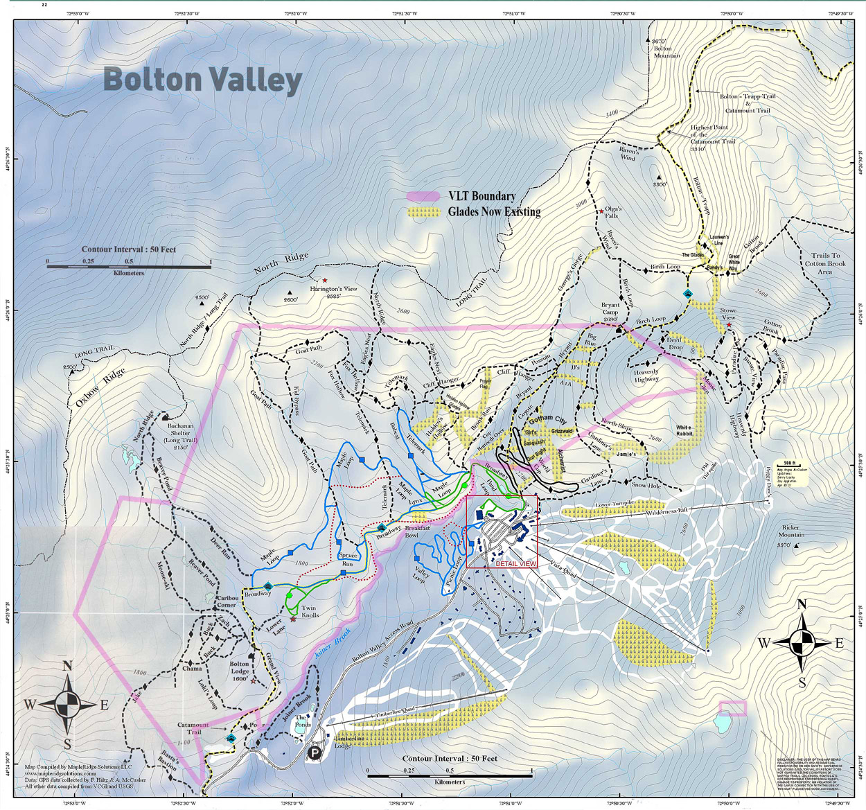
A map of Bolton Valley’s Nordic and Backcountry Network with more than two dozen glades listed.
We stopped our ascent in the middle of Gotham City to switch over for descending, and we were treated to sunshine peeking in and out from behind clouds as we enjoyed the mild air and snowy scene. We had some soup and hot chocolate, but they almost seemed out of place with the relatively mild weather. Despite the rising temperatures, the powder had appeared to hold up pretty well in areas we’d checked during our ascent, but we soon noticed that it was starting to stick to our skis in sunny areas. We knew we’d better get a move on lest the powder turn to mush on us.
We headed down by skiing a combination of Girls and Sasquash, and fortunately the powder was still decent in the more shaded areas. It was starting to turn in sunnier areas though, and when we got into some of the lower elevation glades below World Cup, it was definitely past its prime. Fortunately we’ve got a winter storm on the way this evening, with Winter Storm Warnings up for the Northern Greens. A good storm will make quick work of any adulterations to the powder in those lower elevations.
In any event, we got some good turns, hit four different glades in that short tour, and finished off on the Telemark Practice Slope. I bet one could easily do that tour in under an hour if they got right to it and didn’t pause to do other things. An efficient route for access might be just to go up Coyote, although I’m not sure if the skinning there would be quite as easy as on Bryant since it’s not used as much. We’ll definitely get back there with E, and hopefully the boys with even better snow, but it’s a great little tour that hits some beautiful ski terrain.
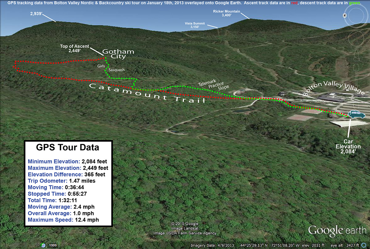
The GPS tracking data from today’s backcountry ski tour on the Bolton Valley Nordic and Backcountry Network plotted on Google Earth
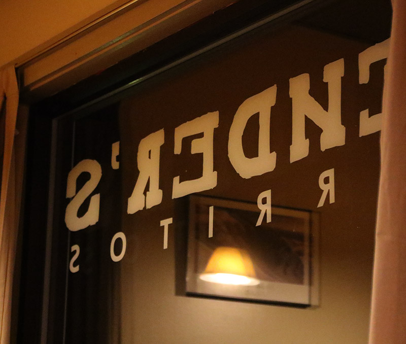
This evening we met up with the Handler’s and the boys at Bender’s Burritos on the Mountain Road in Stowe. Our family has been a few times now since Ty really likes burritos, but apparently it was a first visit for everyone but Jeff in his family. It’s a small place that seats maybe a dozen people, and we were worried that it might be packed with holiday visitors, but we essentially had it to ourselves. A memorable part of the experience was watching the end of the Packers/Seahawks NFC Championship Game, in which the Packers seemed to have it all locked up with just a little time to go, but the Seahawks made a ridiculous comeback to win the game. At one point the Bender’s staff was all out front at the counter, eyes riveted to the screen as they watched the dramatic conclusion of the game. Of most importance of course was the fact that the winner of the game could potential be playing the Patriots in the Super Bowl. I think everyone had a great meal – I got a fish burrito as I often do, going with the cod this time.
“An added bonus while watching the movie was the fact that it was dumping heavy snow outside as an incoming winter storm ramped up…”
The next phase of the evening was to head up to the Spruce Peak Performing Arts Center at the resort to watch the latest Warren Miller ski movie, No Turning Back. We usually catch it in the fall at the Flynn Theater in Burlington, but we didn’t get a chance this year. It was just sort of luck when I found that it was playing at Spruce Peak because I was getting some links for another ski trip report. When Jeff found out about the movie, that set things in motion and he got us all tickets. I believe this showing of the movie is one of those put on by the Vermont Ski and Snowboard Museum, and it’s very unlike the Flynn Theater experience. Whereas that’s a real raucous affair filled with hundreds and hundreds of people, this was a much mellower time, with about a couple dozen of us in the entire theatre. They do have the intermission, but the only prize drawing is for the grand prize opportunity to win a ski trip. Another cool aspect of this showing was that they have free snacks and drinks for everyone – at intermission you just pop out into the lobby and grab your complimentary food. The movie was great, with a lot of depth in each feature as opposed to just the skiing. An added bonus while watching the movie was the fact that it was dumping heavy snow outside as an incoming winter storm ramped up; it’s worth a little more description as I wrap up this report.
Indeed the thing of greatest importance in the world of Vermont skiing this evening was the weather. This current storm has been potentially dicey in the Northeast, with areas off to the east of the Greens likely to see a lot of rain. But, here in Northern Vermont we’ve been in the game for a good shot of snow, and as of this evening it looks like that might be coming to fruition. When we left the house around 5:00 P.M. there wasn’t much going on, but we got into some light rain in the valley during the trip northward. While we were at Bender’s Burritos on the mountain road (elevation 750′), there was a little light rain, and when we left there around 6:30 P.M. the rain had picked up – it was actually freezing on some ground surfaces, but it was spotty so it must have only been those that were very cold. Upon heading up to the mountain to watch the movie, snow mixed in at roughly 1,200′ elevation. At the Spruce Peak Village (1,500′) the precipitation was all snow, and it was starting to come down at a really healthy clip. At intermission during the movie we could see that the snow was really picking up, and when we were leaving around 9:00 P.M. we were getting a real shellacking of dense snow; there was a good inch or so already down. It was snow all the way back to the house at that point, and a very isothermal 33 F on the car thermometer the entire trip. Here in Waterbury at 500′ I measured 1.2″ of snow as of 11:00 P.M. this evening and I’m planning to do a liquid analysis at midnight. Things are looking good for a day on the slopes tomorrow though.
Despite this winter’s low snowfall so far, the snowpack is quite deep along the high elevations of the Catamount Ski Trail and Bolton Valley’s backcountry network.
I parked down at the edge of the tennis court lots as usual, made my way up to the Wilderness Lift, and connected over to Heavenly Highway from the Wilderness Summit. Snow conditions were very much like yesterday – I checked the depth of the powder atop the base snow along Heavenly Highway and found it to be around 9 to 10 inches. The big change from yesterday was that there was nobody out on the backcountry network trails – Monday afternoon on a holiday weekend must have meant that most people had already headed home.
“It was so quiet that even the nearly silent shuffling of my skins through the snow had me feeling like a marching band crashing through a sleepy town in the middle of the night.”
Once past that first glade along the Catamount Trail, I was into what was for me, uncharted territory. I continued along the trail, which gradually rose as it headed generally north-northwest toward Bolton Mountain. One of the most impressive aspects of this part of the trail was seeing the impressive depths of snow that have built up, in what has really been a very low season for snowfall. The general area below the Catamount Trail junction with Raven’s Wind, which is sheltered like parts of Heavenly Highway, revealed evergreens that were just choked, buried, and ensconced with snow. Around every corner I was finding fantastic, gravity-defying deposits of powder. Once past the junction with Raven’s Wind, which marks the last outpost of Bolton’s backcountry network, the Catamount Trail began to level off and skirt along the eastern edge of Bolton Mountain. At over 3,300’ in elevation, this area marks the highest point on the entire Catamount Trail.
Ski tracks leading to the Cotton Brook area provide a rough sense of the snow conditions out along the Catamount Trail today.
I contoured along the southeast face of Bolton Mountain as the trail switched to a northeasterly direction; I couldn’t see the summit of Bolton Mountain (3,680’) through all the evergreens, but the steep rise in the terrain off to my left let me know that it was looming up there about 400’ vertical feet above me. As I continued to scan the elevated terrain to my left, I quickly noticed that the density of the evergreens had become sparser, and I began to see potential ski lines through the trees. I eventually decided that I’d gone far enough out on the trail for the day, and chose a spot to ascend a bit and see if I could start my descent up in the trees above me. The terrain was fairly steep, but there was that consolidated base below that top layer of powder, so I wasn’t wallowing in bottomless fluff as I broke trail. With the evergreens all around me, the air was deathly still. It was so quiet that even the nearly silent shuffling of my skins through the snow had me feeling like a marching band crashing through a sleepy town in the middle of the night. I continued generally westward and upward, following what looked to be the most open lines through the trees. The terrain began to flatten out ahead of me, and I could see on my GPS that I was approaching the Long Trail along the ridgeline; I decided that that was a good goal to mark as my turnaround point. I know that I was very close to meeting up with the trail when I finally stopped my ascent, as I was definitely on the ridgeline and the land clearly began to drop off to the west. I was tempted to go a little farther and make the trail connection, but it just didn’t seem worth it to lose elevation. It was after 3:00 P.M., I was well away from the Catamount Trail, and I was alone. It was at least generally downhill back to the Catamount Trail from my location, and there was no need to push my luck.
“Some trees even displayed that hanging moss that I’ve often seen in the mountains of the Pacific Northwest and British Columbia…”
I stripped off my skins and reversed my course, traveling along generally flat, ridgeline terrain at first, and negotiation a steep south-facing gully as well. When I’d finished crossing the flattest terrain and could see that I was about to begin the descent to the Catamount Trail, I stopped in a comfortable spot and pulled out some of my food supplies. I ate a Clif Bar and had a couple rounds of the hot tomato soup that I’d packed in my thermos like yesterday. That absolutely hit the spot. I definitely needed the recharge after throwing in all that extra trail breaking on top of the ascent of the Catamount Trail. The energy expenditure had been enough that I was getting a bit drained, and I definitely wanted something in the tank for the descent. Once I stopped moving, the silence around me was redoubled, and it was indeed eerily quiet. Such is the scene at times when one is alone in the deep woods of winter.
Catching a line through the trees high on Bolton Mountain
I packed up my food and gear and began the real descent through the evergreens. There were indeed some reasonably open spaces and nice turns, but it was steep enough that it really would have been better with deeper powder for the available tree spacing. The 9 to 10 inches that were there were OK, but I’d say something around 18 inches would be more appropriate. And, although the natural lines through the trees were good, they could be dramatically enhanced just by clearing off the all the dead branches that were still on the lower parts of the evergreens. That would be a great off-season project for someone to tackle, and the process could continue right on down below the Catamount Trailas well, because the terrain just keeps going. In any event, even in its natural state I’m keeping that terrain in mind for a place to visit after a reasonably big dump with depths of powder that will fit the pitch and spacing of the trees.
I popped out on the Catamount Trail and had begun to head back toward the resort, when I ran into the first pair of people I’d seen all day. It was a couple of younger guys, and they asked me if I knew the area. I said that I knew it fairly well, but when they asked me what lay to the north of where we were, I told them that that was out of my range of knowledge – I was currently the farthest north I’d ever been on this section of trail. In terms of descents, I said that I’d recommend descending back in the Cotton Brook area if they were unsure of where they were, because I knew that one could ascend back out of there quite easily. It was likely that one could traverse and get out from areas to the north as well, but one never knows just what the terrain would be like until they’re actually in there. I’m not sure what they ended up doing, but since it was well after 3:00 P.M. by that point, I hope they made an appropriate choice.
Views of countless snow-covered evergreens and even hanging moss as I travel through the high elevations of the Catamount Trail
I was tempted to do a little extra exploration on my return trip, especially as I looked at the vast expanse of evergreens below me. Some trees even displayed that hanging moss that I’ve often seen in the mountains of the Pacific Northwest and British Columbia; as if the deep snowpack wasn’t enough, the sight of the moss seemed to me like a real testament to just how much precipitation falls in the higher elevations of the Northern Greens. As much as it would have been nice to poke around, ultimately I wasn’t willing to explore a descent down into the Cotton Brook area with the time of day, so I descended back toward the resort on the Catamount Trail itself. The trail isn’t very wide, so the descent below Raven’s Wind was quite a hoot. Let’s just say that I’m glad that I didn’t “run” into anyone ascending at that time of day. It’s definitely an exhilarating descent back toward the main glade though if you can catch it without any uphill traffic. I enjoyed a descent of the main glade back toward the Cotton Brook Trail junction, but despite the decent amount of powder, the combination of tracked snow, irregular surface underneath, and some previously work by the sun, made it rather challenging and nothing special in terms of flow. It’s definitely time for another storm.
I cruised quickly back along the Catamount Trail to the Bryant Cabin area, and headed right onto Gardiner’s Lane and North Slope. I was determined to find that glade that I’d missed with E and the boys yesterday, and after a bit of searching, I did. I made another mental note on the entrance to set myself up for next time, and had a fun ride down through there. When I finally got back down to the lower Nordic trails, I saw a couple of other people, but amazingly that was it for the entire tour of almost six miles. I can’t wait for my next chance to get out in the farther reaches of the Catamount Trail and explore it further.


