First Vermont snows for the 2023-2024 winter season

An image from the famed snow stake on Mt. Mansfield in Vermont showing some of the first accumulating snow of the 2023-2024 winter season.

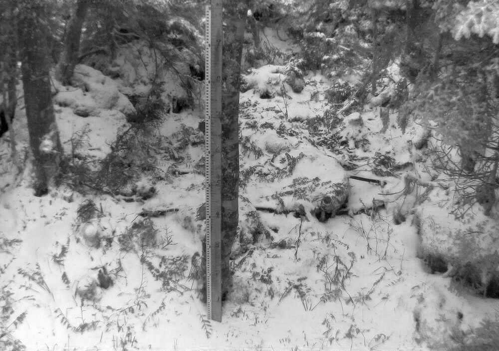
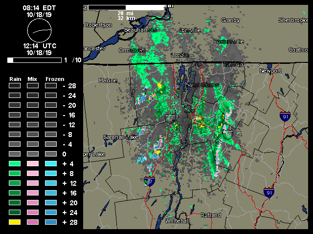
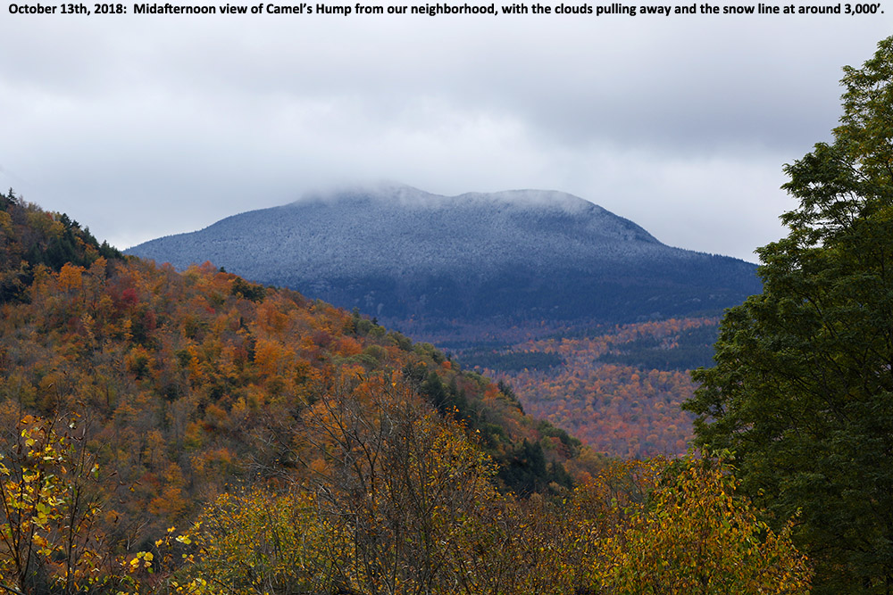
Today we got our first taste of the coming winter in the Northern Green Mountains. While Mt. Washington in New Hampshire has had a number of rounds of snow thus far in the autumn, and there were some reports of possible frozen precipitation in far northern Vermont a week or two ago, today saw the first notable accumulating snow on Mt. Mansfield. As of midafternoon today, Powderfreak reported that the snow level was down to ~2,500’, and he sent in an image of a half inch of accumulation at 3,000’ as of 3:30 P.M. By early evening he provided a few more pictures and indicated that the snow level had dropped below 2,000’. Up at the Mt. Mansfield Stake at roughly 3,700’, the report was that there was about an inch of accumulation over a third of an inch of ice. A check of mountain webcams around the area revealed that just about all the mountains were seeing flakes with accumulation, but those views will have to do for now.  Unfortunately, it’s been far too cloudy to get any nice shots of the snowy peaks from afar, but hopefully we’ll get to see them appear in a day or two.

An image from the famed snow stake on Mt. Mansfield in Vermont showing some of the first accumulating snow of the 2023-2024 winter season.
A shot of the famed Mt. Mansfield stake from today featuring the season’s first accumulating snow.

So, Oct 22 will go down as the date for our first accumulating Mt. Mansfield snow for the winter of 2023-2024, and we can now add it to the books and see how it compares to the averages. The stats for first accumulating snowfall of the season on Mt. Mansfield are below for comparison – today’s date of Oct 22 is later than the mean date of Oct 11, but well within 1 S.D., so quite normal in that regard. Assuming a normal distribution, about 25% of seasons will have later first snowfall dates than this one.

The dates of first accumulating Mt. Mansfield snow for some recent seasons are shown below as well, so this season sits later than the past few, but ahead of most of that stretch in the mid-2010s, which was a surprising run of later October dates.

Date of first accumulating Mt. Mansfield snow:

Mean:  10/11
Median:  10/10
Mode:  10/17
S.D.: 15 days
N:  67
Most Recent:  10/22
Most Recent Days Deviation:  +11
Most Recent # of S.D. Deviation:  +0.732
Most Recent S.D. % Lower:  76.8%
Earliest 8/28/1986
Latest   11/17/1985

Date of first accumulating Mt. Mansfield snow by season:

2008: Oct 3
2009: Sep 30
2010: Oct 7
2011: Oct 30
2012: Oct 8
2013: Oct 24
2014: Oct 26
2015: Oct 17
2016: Oct 26
2017: Oct 27
2018: Oct 13
2019: Oct 18
2020: Oct 17
2021: Oct 18
2022: Oct 8
2023: Oct 22

First Round of October 2022 Snow for Vermont’s Green Mountains

Since our first snows of the season back in September, we’ve moved on into a new month and another window for early season snowfall.  This time the snow chances are associated with a series of small disturbances that started moving into the area last night and are expected to continue through the weekend.

The first notifications I saw of accumulation appeared this morning in the Northern New England Cold Season thread on the American Weather Forums – Powderfreak indicated that it was snowing all the way down to 1,500’ at the base of Stowe Mountain Resort, and flakes were even spotted as low as 1,000’ around The Matterhorn.  Powderfreak posted some images from both the top and bottom of the Stowe Gondola that showed the fresh snow.  As the snow and clouds pulled away a bit more by midday, he posted a beautiful snowliage image of some of Mount Mansfield’s slopes.

The temperatures stayed cold enough throughout the day that new snow continued to hang around on the ground, with the snow line rising to around 2,400’ in the midafternoon period.  Powderfreak sent along some additional nice views from his afternoon hike on the slopes of Mansfield, and he commented on how it was nice to be back out with the crunch of snow underfoot.

First snows of the 2022-2023 season in the Green Mountains

I think it’s been a little while since we’ve had September snows here in the Green Mountains, but the mountains picked up some snow today for their first frozen accumulations of the 2022-2023 winter season.

The weather models have been indicating an early season shot of cool air visiting our area for several days now, with sub-freezing 850 mb temperatures dipping south of the Canadian border.  Residual moisture was expected to be around in the mountains as the colder air moved in to provide some flakes, and indeed that’s what we saw.

Reports of snow seemed most notable in the Central Greens around the Sugarbush area, and Powderfreak linked to a video of the flakes falling at Sugarbush Resort.  He also passed along a nice image of accumulations at the Battell Shelter on the Long Trail, which is in the Lincoln, VT area

A bit farther north on Mount Mansfield, the reports and pictures indicated that there was some glazing from accumulated ice.

After a fairly dry summer, the weather pattern has changed over the past few weeks to produce frequent synoptic precipitation, so let’s hope that sticks around we continue into the snow season!

Snow for the valleys in northern Vermont

An image of October snow on a picnic table in Waterbury, Vermont
I woke up this morning to find snow accumulating on grassy and elevated surfaces like this picnic table on our deck. It’s the first accumulation we’ve seen in the valley this season!

I woke up this morning to find snow on the grass and elevated surfaces at our house, most notably our picnic table out back on the deck.  This was the first snow I’ve seen at our house this season, and although our weather forecast did suggest there was some potential for accumulation, you never quite know how it’s going to play out in marginal situations like this one.

In any event, the snow stuck even down here at 500’, so it should have easily accumulated in the higher elevations.  I measured 0.6” on the boards at observations time, and it did look like it could have melted some since the point at which most of it fell.

This is about a week on the late side for average occurrence of first frozen precipitation here at our house, but just a day off for the average date of first accumulating snow, so it’s very typical in that regard.

Details from the 6:00 A.M. Waterbury observations:

New Snow: 0.6 inches

New Liquid: 0.09 inches

Snow/Water Ratio: 6.7

Snow Density: 15.0% H2O

Temperature: 34.0 F

Sky: Light Rain/Snow (1-2 mm flakes)

Snow at the stake: 0.5 inches

First snows of the season for the Green Mountains

A radar image showing moisture streaming into the Green Mountains of Vermont and producing snow along the peaks in mid October
A look at the local Burlington weather radar from today showing the classic upslope signature of moisture streaming into the Green Mountains from the northwest and snow/mixed precipitation along the peaks.

Although we did have some reports of frozen precipitation around the area back in the beginning of the month, the bombing cyclone that’s moved through New England over the past couple of days has brought the first real snows of the season to the Green Mountains.  As the system moved by yesterday, the summit areas of Killington picked up an inch or two of snow.  There wasn’t much going on with respect to snowfall in the northern part of Vermont at that point, but snow levels finally dropped overnight and we started to see accumulations in the higher elevations around here.  Although I wasn’t out in the mountains today, the view from my office in Burlington showed that classic look of upslope precipitation along the spine of the Northern Greens.  A quick check on the local radar showed that classic signature of moisture streaming into the spine of the Greens, with snow and mixed precipitation along the peaks.  Powderfreak sent in pictures to the Northern New England thread at the American Weather Forums, revealing snow accumulations down to roughly 2,400’ at the Gondola, and a couple of inches of accumulation at the top of the Fourrunner Quad.  At the end of the day, Powderfreak passed along one more photo that showed accumulating snow levels at around 2,300’ at the Gondola, and commented on how snow levels were somewhat lower on that part of the mountain below The ChinWinter’s first salvo of snow is now in the books, and we may see a bit more near the end of the month based on what the weather models are showing for that period.

First snows of the 2018-2019 winter season in the Green Mountains of Vermont

An image showing Camel's Hump in Vermont with the first snows of the 2018-2019 winter season in the Green Mountains
Camel’s Hump showing signs of the first snow of the season for the Green Mountain of Vermont

While the first half of October was fairly warm, the weather models have been suggesting a shift to more seasonal temperatures as we hit mid-month.  The potential for some mountain snow was in the forecast last night, and indeed as of yesterday afternoon snow was already being reported at Whiteface Mountain across the lake with video of the flakes.  Here on our side of the lake, we heard from Powderfreak early this morning that snow had been sighted in the mountains around Stowe, and he was heading up for some investigation.  An hour or two later, he had send along pictures, and indicated that accumulations on Mt. Mansfield were about a half inch and started at an elevation of roughly 2,300 feet.

“…it looks like we’ll have more opportunities for snow this week with accumulations potentially even down to the mountain valleys.”

Here at our house, I did a morning check to find that the cloud ceiling was still only about 2,000 feet and there were no obvious signs of snow below that level.  I gave the clouds some time to think about clearing a bit, and then headed out in the neighborhood during the mid-afternoon period to see what snow might be visible.  Indeed the cloud ceiling had risen by about another 2,000’ and I was able to catch Camel’s Hump as the clouds had just about broken away.  The snow line at that point looked to be around 3,000’.

The first snows of the 2018-2019 winter season are in the books here in the Greens, and the National Weather Service Office in Burlington says it looks like we’ll have more opportunities for snow this week with accumulations potentially even down to the mountain valleys.  We’ll see what transpires as even colder air moves in, so stayed tuned for more October snow updates!

Snow for Vermont and other peaks in the Northeast

An image of early October snowfall being revealed on the slopes of Mt. Mansfield in Vermont as the clouds begin to lift
As clouds begin to lift, an image from the web cam at Stowe Mountain Resort reveals a fresh October snowfall from last night.

It looks like the temperature on the Mt. Mansfield ridgeline stayed at or below freezing from midnight onward last night, and with 0.29” of new liquid found in our rain gauge at the house this morning, there was clearly some precipitation to go with those sub-freezing temperatures.  The web cam images from Mt. Mansfield this morning show snow on the trails at Stowe above the 3,000’ level, and reports from the mountain indicate that there were a few inches of accumulation, so this is likely the first accumulating snow of the season for Vermont.  Over in New Hampshire, new snow is visible on the Wildcat summit at ~4,000’, and the vertical temperature profile on Mt. Washington shows that temperatures really fell of quickly above that elevation and they picked up 3.6” of snow as of this morning.  As the clouds pull away in Northern New England today, I’d expect to see some white-capped peaks to go with our foliage.

Afternoon Update:  Numerous pictures of the fresh snow on the peaks throughout the Northeast are available in a new thread at AlpineZone, and the guys at FIS have already gone up and done some skiing on the snow on Mt. Mansfield this morning.  In addition, Powderfreak measured 4” of new snow while he was working up at the Cliff House on Mt. Mansfield today, and sent in several nice pictures of the snow and foliage in a post in the Northern New England thread at American Weather.

An image of Mt. Mansfield in Vermont taken from the Burlington area on October 8th, 2012 showing the first snowfall of the season on the peak with some of the fall foliage below
Vermont’s first accumulating snowfall of the 2012-2013 winter season