Bolton Valley, VT 13JAN2024

An image of two snowboarders riding the Wilderness Double Chairlift as heavy snowfall in the 1 to 2-inch per hour range falls at Bolton Valley Resort in Vermont during Winter Storm Gerri
An image of fresh powder snow from Winter Storm Gerri below the Snowflake Double Chairlift at Bolton Valley Ski Resort in Vermont
Thanks to some heavy snowfall from Winter Storm Gerri this afternoon, fresh lines of powder were plentiful throughout the resort, especially off the Snowflake Lift where skier traffic had been especially low.

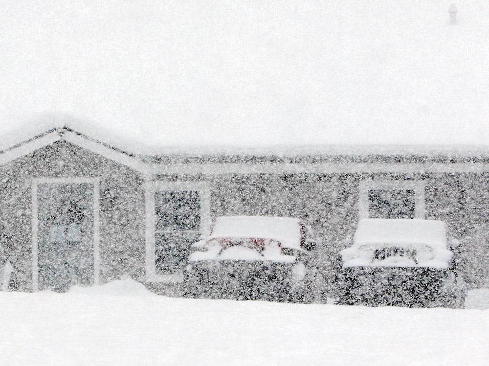
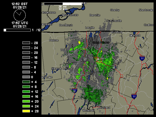
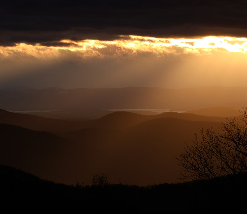
Over the past week, the weather pattern has featured these larger systems with ample snow and moisture, and the most recent one in the series is Winter Storm Gerri. It moved into the area overnight in the wee hours with an initial burst of heavy snow. The front end snow in this case wasn’t as potent as it was with Winter Storm Finn that came through midweek, so when we saw that Bolton Valley was indicating only 2 inches of new snow in their early morning report, we knew there was no need to rush right up to the mountain.

We watched the Bolton Valley Base Area Webcam through the morning and could see that up at 2,100’, the precipitation was snow, and it was quite heavy at times. Dylan and Colin headed up to the mountain in the early afternoon, and we asked them to give us an update on what they found. Their impressions were that the snow surfaces were rather wet, and they said the precipitation was even mixed with rain in the lower elevations at times, so E figured that instead of skiing, she’d hold off until the snow got better. I took another look at the webcam feed and saw that there was heavy snow falling, and decided that it would definitely be worth it to head up for some lift-served runs.

An image of heavy snowfall from Winter Storm Gerri with condominiums in the background in the Village area at Bolton Valley Ski Resort in Vermont
Heavy snowfall in the Bolton Valley Village this afternoon as Winter Storm Gerri continues to affect the area

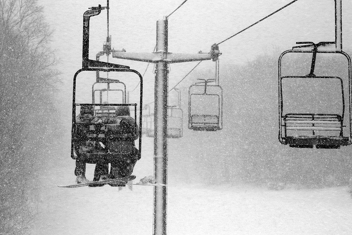
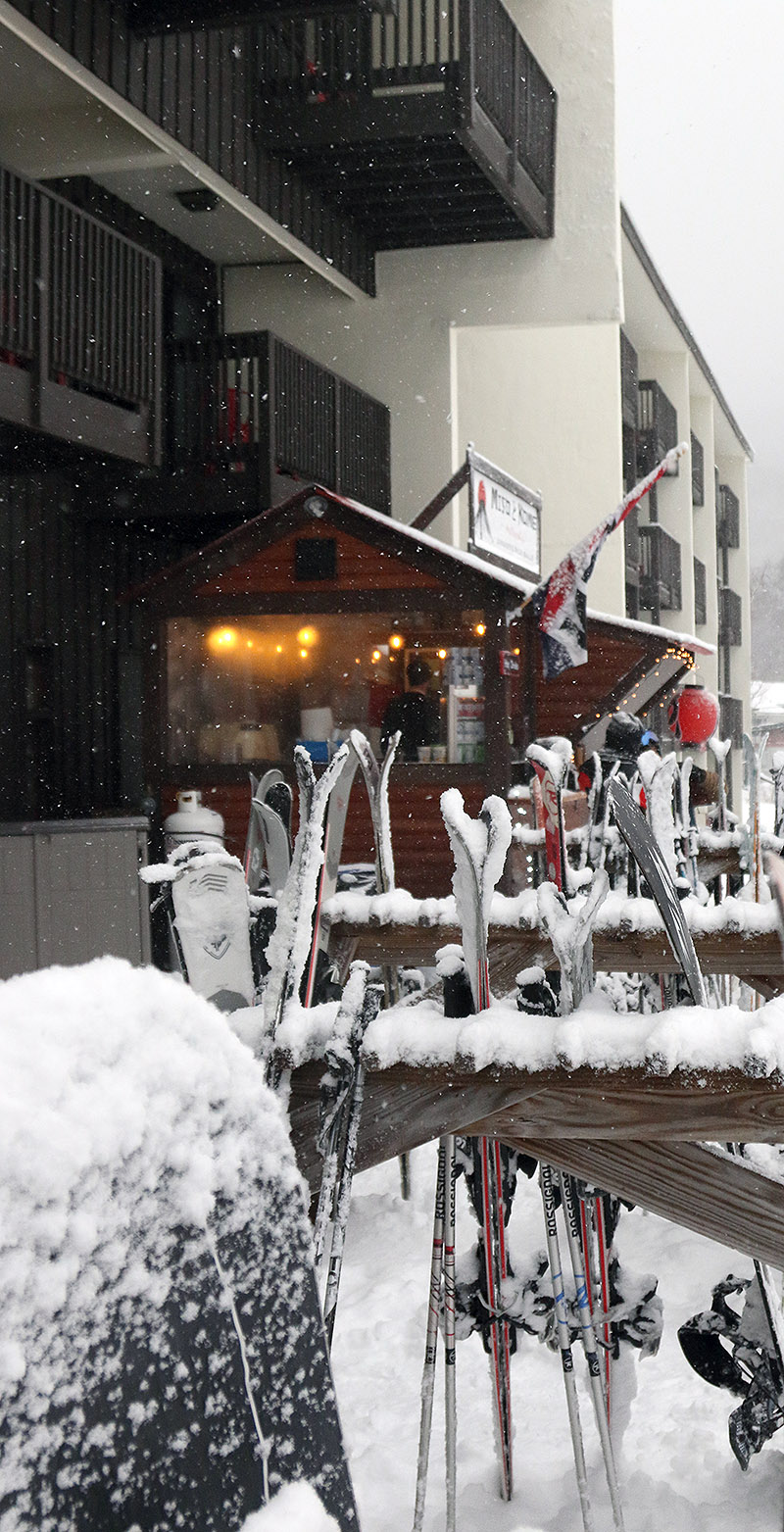
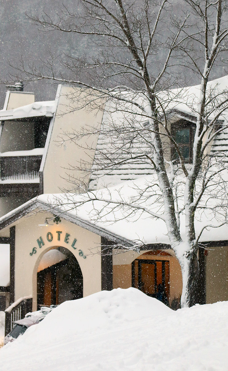
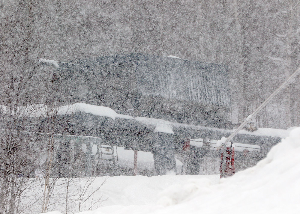
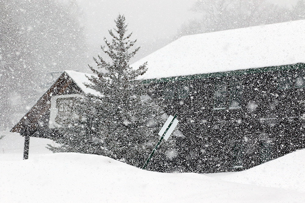
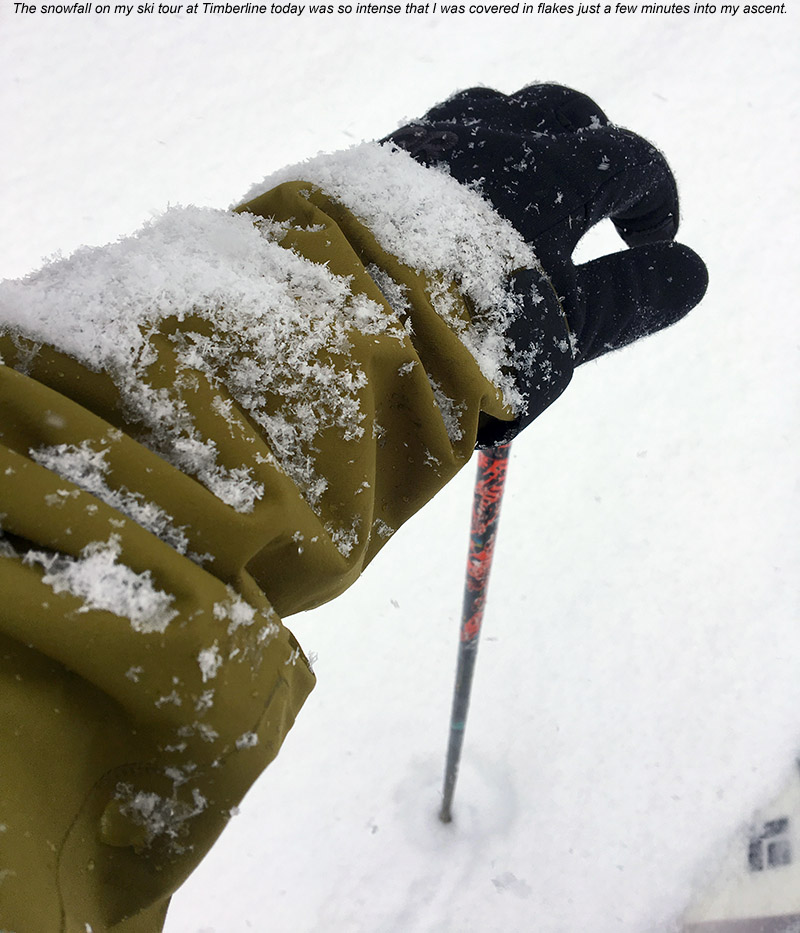
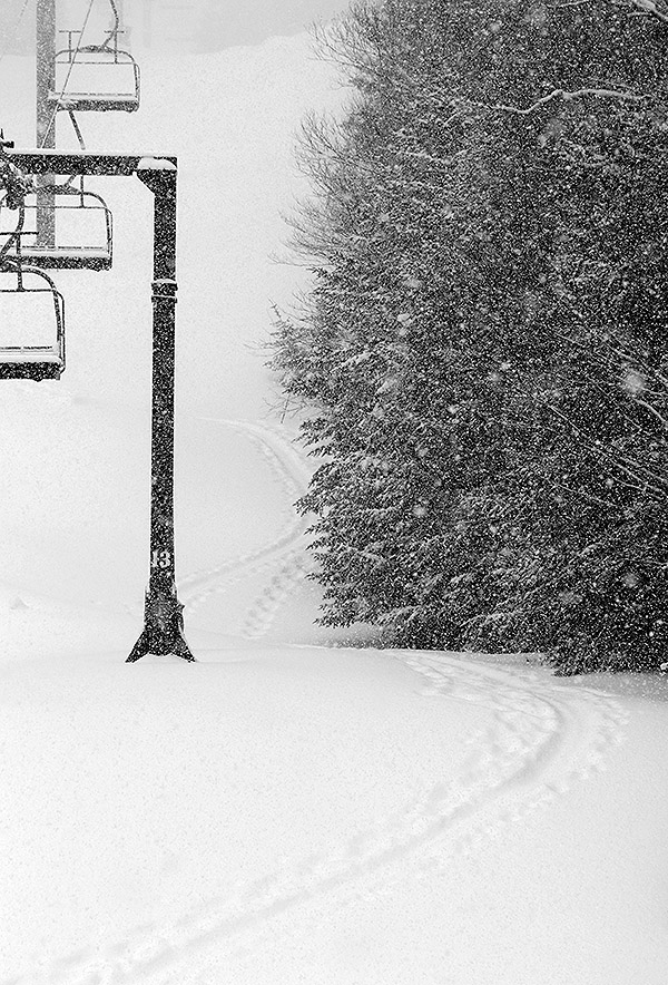
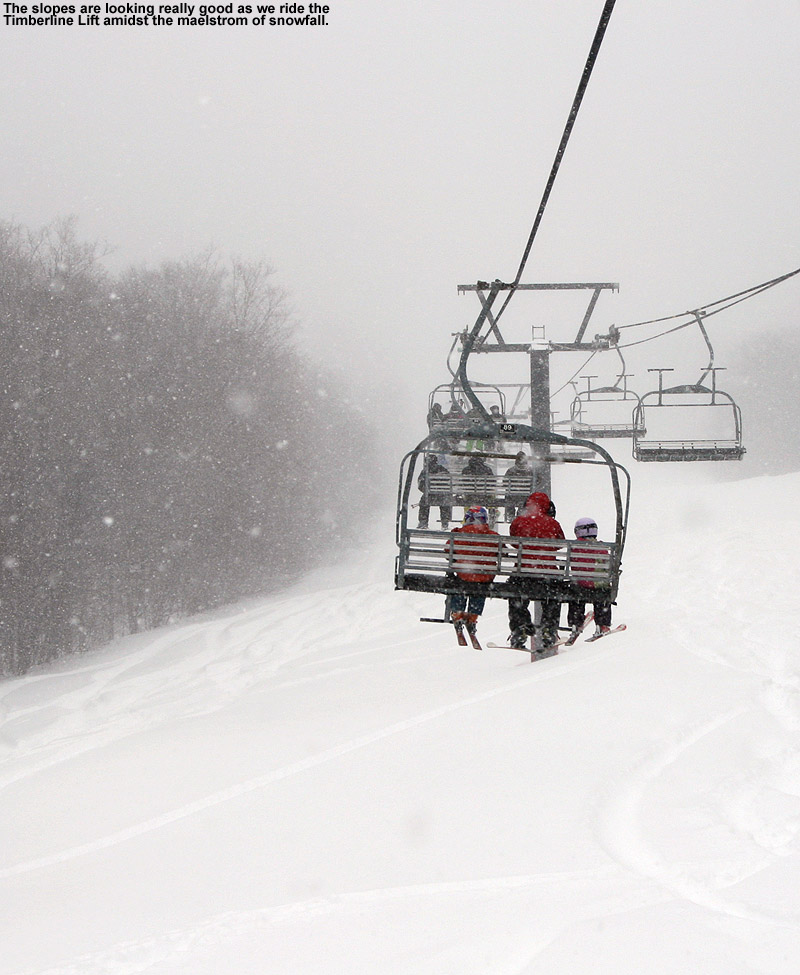
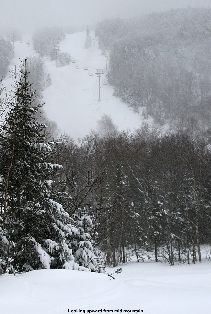
Heading up the Bolton Valley Access Road, the precipitation switched over to all snow at roughly the 1,000’ elevation, and above that the road was quickly covered. The road conditions must have been getting a bit slick with the new snowfall because I had to drive around a van that was stuck trying to make it up the steep s-curve below Timberline. I had actually planned to park at Timberline and start my session there, but the Timberline Quad was apparently on wind hold, so I had to continue on up to the main base area. I arrived up in the Village to very heavy snowfall in the 1 to 2 inch per hour range, and with the intensity of that snowfall, there was just no way that the turns weren’t going to be great.

An image of snow falling during Winter Storm Gerri on cars in a parking lot in the Village area at Bolton Valley Ski Resort in Vermont
Arriving up in the Bolton Valley Village this afternoon I was greeted steady snowfall and cars quickly getting covered in new snow

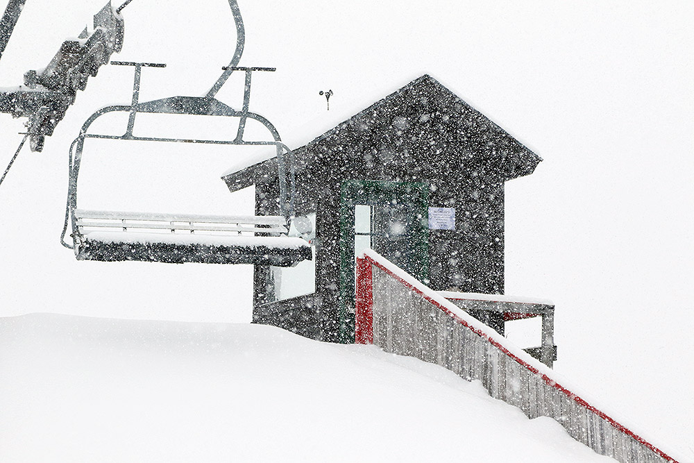
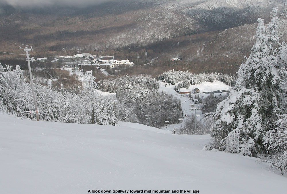
During my afternoon session I managed to get in runs on all the rest of the lifts, and heavy snow continued to pound the resort at all elevations. It was windy, especially at the Vista and Wilderness Summits above 3,000’, but thankfully the wind was from the west and at your back while you rode the lifts. After my first couple of runs, the lights were coming on, and I got to ski Spillway in night mode. I always find it exciting to be able to ski something that steep under the lights, and I knew that the conditions on Spillway were going to be really good because you couldn’t hear anything from the turns of the skiers and snowboarders below you as you passed over them on the Vista Quad. Indeed, my own experience on the trail revealed that the conditions on Spillway were simply fantastic; new snow was falling so heavily that it must have been covering up an slick spots faster than skiers could push the snow away.

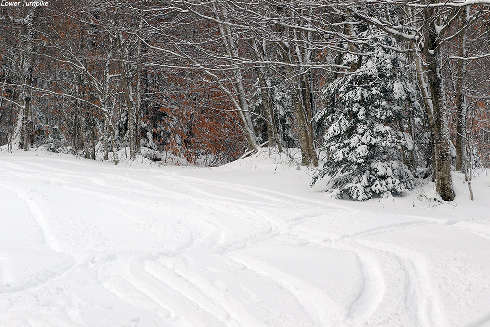
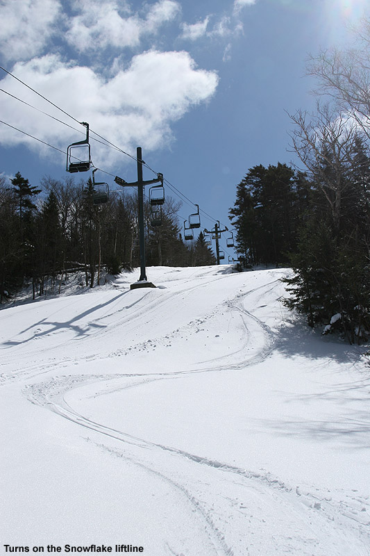
I did notice that below the Mid Mountain elevations (~2,500’), the groomed/packed ski surfaces did have that “wet pack” feel that I’ve encountered in the lower elevations of Whistler Blackcomb. That’s usually a sign that some very wet snow has fallen and was packed by skier traffic. I could see what Dylan was talking about with respect to the wet surface conditions, but at the point that I was up there, those conditions were hard to find because temperatures were falling, and it was snowing so hard that those types of wet surfaces were covered up in all but the highest traffic areas. Some of the best turns I found were near the end of my ski session when I visited the Snowflake Chair. That area hadn’t seen much skier traffic, so I found a lot of fresh powder that skied beautifully. I did numerous depth checks and was consistently getting new snow depths of 6 to 7 inches. There was enough powder there that I questioned whether it was all from just this storm, but when Bolton’s afternoon snow update came in and they were reporting storm totals of 5 to 7 inches, that nicely corroborated my measurements.

An image with snow in the air and snow on skis and snowboards at a ski rack near the base lodge during Winter Storm Gerri at Bolton Valley Ski Resort in Vermont
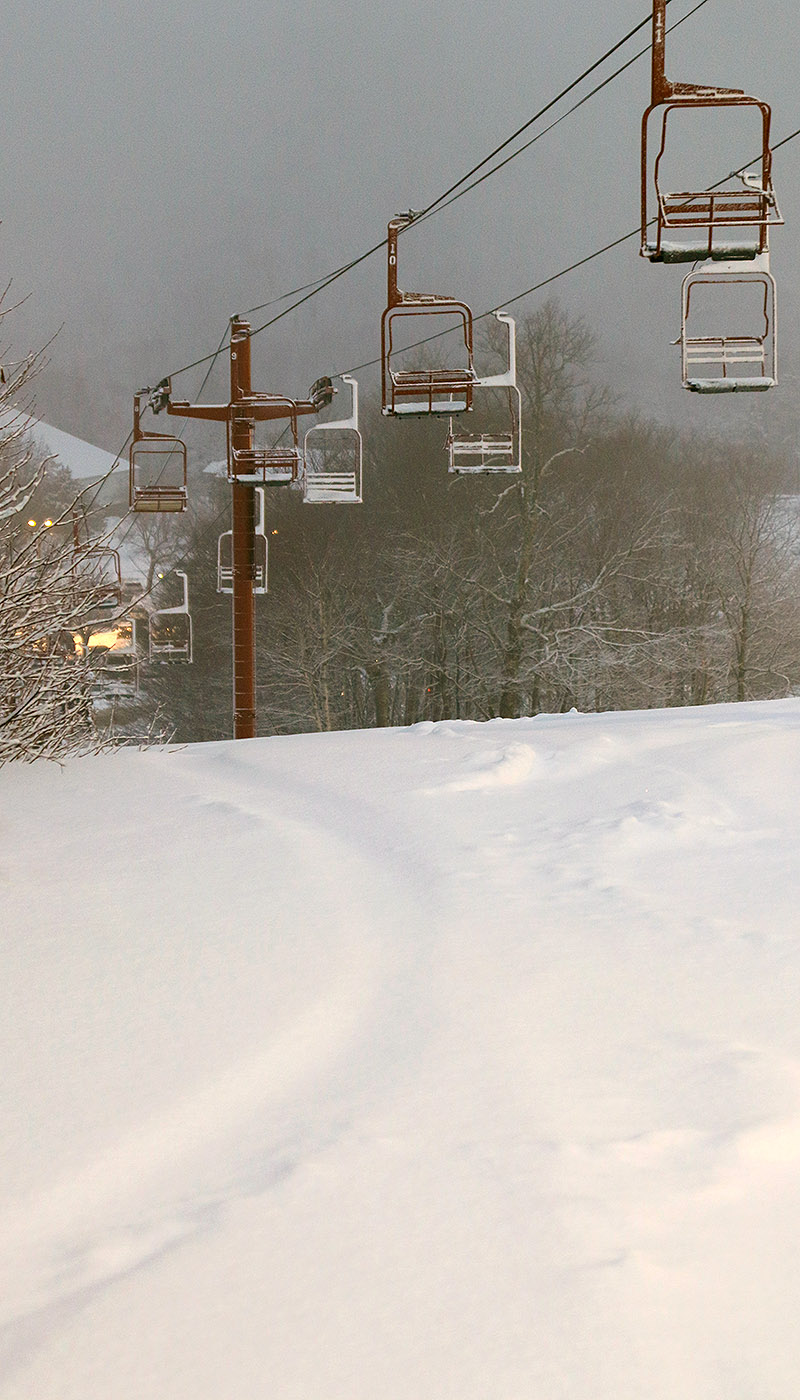
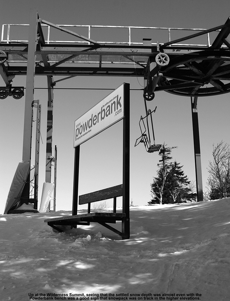
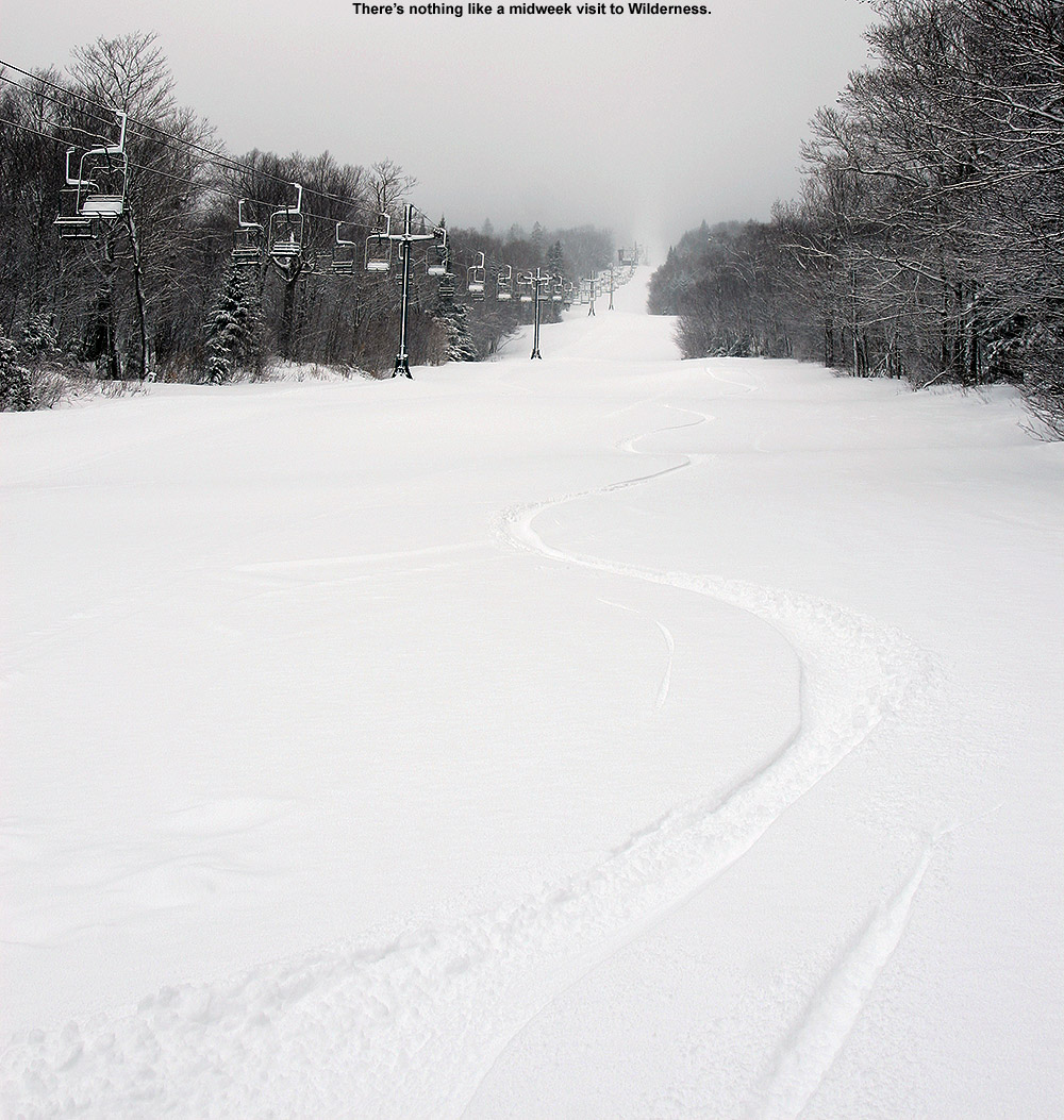
All this new snow is a great addition to the snowpack, but even without it, one thing I noticed while out on the mountain today was the huge jump that the snowpack has taken since last weekend. I hadn’t been up to the mountain since Sunday, and at that time, patrol was just starting to open up more areas of natural snow terrain as coverage improved thanks to Winter Storm Ember. The contributions made by Winter Storm Finn must have been huge though, because the resort has now been able to open up just about everything, and everywhere I looked this evening, coverage felt like midwinter. As I look back now at my storm data, I guess I see the difference – Winter Storm Ember dropped 0.69 inches of liquid equivalent here at our site, while Winter Storm Finn dropped 1.99 inches of liquid equivalent. That’s almost triple the amount of liquid, and when you get up around 2 inches of liquid equivalent, that starts to become a serious resurfacing of the slopes. Winter Storm Gerri has already dropped about an inch of liquid equivalent here at the house, and the back side snow is still coming through, so that’s simply adding yet another great layer to the snowpack. All told, this past week of storms has dropped almost 4 inches of liquid equivalent here at our house in the valley, so it must have put down at least 4 to 5 inches plus of liquid equivalent for the mountains. When I look at the numbers, I realize now why the snowpack seems to have improved so much so quickly. When I was riding the Wilderness Chair today, I actually saw a ski patroller skiing the headwall of the Wilderness Lift Line to check the snow. You know the snowpack is getting decent when that headwall is even close to being skiable, so the fact that he was even testing it speaks volumes about how things have gone over the past week.

An image of snow falling from Winter Storm Gerri near the Hotel and Village Circle area at Bolton Valley Ski Resort in Vermont
A scene from the Bolton Valley Village Circle area this afternoon with snow from Winter Storm Gerri falling in front of the Hotel

Bolton Valley, VT 28JAN2021

An image showing heavy snowfall on the back side of Winter Storm Nathaniel as it interacts with the Green Mountains and drops snow on the Timberline area of Bolton Valley Ski Resort in Vermont
An image of the base station of the Timberline Quad Chairlift through heavy snowfall on the back side of Winter Storm Nathaniel in January at Bolton Valley Ski Resort in Vermont
A view of the base station of the Timberline Quad as heavy snowfall greets me upon my arrival at the mountain today

We had snow here at the house most of the morning, and it was generally light, but at times it would pick up with a burst of intensity with larger flakes.  Toward the afternoon, the snowfall became a bit more persistent, and we were having longer periods with the large flakes, so it started getting to the point where I was wondering how much the mountains were getting.  As it was snowing more heavily here, I checked out the Bolton Valley Base Area Webcam and saw what looked like really heavy snowfall, so I decided to hit the mountain for a couple of runs.  Indeed, the local radar showed that another push of moisture was right on the doorstep as well, so that held the potential for additional snow.

A weather radar image of snow pushing eastward from the Champlain Valley into the spine of the Northern Green Mountains on the back side of Winter Storm Nathaniel
Another pulse of moisture is set to push into the spine of the Green Mountains today as I head up to Bolton Valley for a few runs.

The radar didn’t look that outrageous in terms of snowfall intensity, but I got up to Timberline and the snowfall was very heavy, probably 1-2”/hr with visibility of a few hundred feet.  It was hard to tell how much had fallen recently, but I was finding 4-6” in many areas on the trails since the previous grooming.  In any event, it was definitely a mini powder day up there, with that 4-6” easy to find essentially anywhere that hadn’t been skied recently.

“It was hard to tell how much had fallen recently, but I was finding 4-6” in many areas on the trails since the previous grooming.”

Very steep or windblown areas on piste definitely need another synoptic storm or two before they’re in prime shape, but the snow has continued to build up this week in the off piste areas.  In areas that haven’t been skied in the past week or two, you’re essentially looking at 30” of unconsolidated snow down to elevations as low as 2,500’ now.  I made a trip through Maria’s and I was finding that depth consistently.  There is some dense snow in there form the front end of Winter Storm Malcolm, but since we haven’t had any major thaws in more than a month, there’s no layer in the snowpack that is fully solidified.  My depth checks just went right down through the 30” to what I suspect is the ground, or perhaps a base of a few inches of old base snow depending on the location.  You really need at least moderate pitch to ski these areas because you’re sinking too deep for shallow slopes.  I was on midfats today, so fat skis would help, but pitch is still going to be necessary.

I hadn’t been out on the mountain since my tour on Saturday, and certainly wanted to get some exercise, but the continued snow we had today, and the chance to beat the arctic hounds that are coming in for the next couple of day, definitely made the timing right.

Bolton Valley, VT 13FEB2019

An image showing very heavy snowfall at the Timberline Base at Bolton Valley Ski Resort in Vermont
An image showing snow accumulation on a ski jacket due to intense snowfall at Bolton Valley Ski Resort in Vermont
The snowfall was so intense on my ski tour at Timberline this morning, that my jacket was turning white just a few minutes into my ascent.

The current storm affecting our area has been named Winter Storm Maya, and as of this morning it’s already delivered a solid addition to the local slopes with snow containing more than an inch of liquid equivalent.  Snowfall began yesterday afternoon, and the flake structure has been producing some very dense snow – my analyses from at the house were revealing water content in the snow as high as 13-16% H2O!

After doing some clearing of the driveway this morning, I headed up to the Timberline area at Bolton Valley to get in a quick ski tour before work.  Temperatures have been warming throughout this storm, so I was greeted by some very nice temperatures way up into the 20s F at the Timberline Base.  I was also greeted by pounding snow in the range of 1 to 2 inches per hour, with huge flakes and zero wind.  The big flakes were coming down so hard that my jacket was turning white just a few minutes into my tour.  The intense snowfall, big flakes, and no wind are fantastic conditions for building up fluff, and that was a welcomed addition to the accumulations from this storm cycle; based on what I saw from my snow analyses at the house, there is probably some upside-down character to the initial accumulations we’ve had on the front end of this event.

An image of heavy snowfall at the Timberline Mid Station area at Bolton Valley Ski Resort in Vermont
The snowfall continued to pound down as I reached the Timberline Mid Station this morning.

“The accumulations I found from this storm so far were 9-10” at 1,500’ at the Timberline Base and about 12-13” at 2,500’ at the Timberline Summit.”

The Timberline Base was really deserted when I was up there this morning; there was just one other car in the lot, and the skin track had already picked up three inches of new snow since the last person had used it.  I guess filling in the skin track doesn’t take too long when it’s snowing at an inch or two per hour, but it was still surprising.  The accumulations I found from this storm so far were 9-10” at 1,500’ at the Timberline Base and about 12-13” at 2,500’ at the Timberline Summit.  That pounding snowfall probably did bump up that upper number a bit, even over the course of just a half hour ascent.

An image showing a skin track for ascending on skis at Bolton Valley Ski Resort in Vermont
A view of the upper part of the skin track on Timberline this morning as it slowly disappears in the heavy snowfall.

The trip down Intro was fun, since the initial snow’s hefty density meant great coverage even in spots that might typically get scoured a bit by the wind.  Below the Timberline Mid Station, I opted for Twice as Nice, because the only skier traffic I could see there was the vestiges of one old track.  Boy did the mountain get a resurfacing though – you had to really try hard to find the old subsurface, and for the most part, it’s now just a distant memory.  Winter Storm Maya has definitely been a shot in the arm for the snow conditions so far though, and there’s plenty of snow still to come.  The 3 to 4 inches of fluff on top of the denser snow definitely set the skiing right-side-up this morning, so turns are looking really nice for the foreseeable future.

Bolton Valley, VT 10NOV2018

An image showing some of the four-wheel drive vehicles parked at the Timberline base area of Bolton Valley Resort in Vermont as heavy snowfall fills the arir from a November snowstorm
An image of ski tracks in powder snow on the Lower turnpike trail at Bolton Valley Ski Resort in Vermont
Our most recent storm brought plenty of snow for powder skiing in the Northern Greens.

You can put away the rock skis for this storm.  Indeed the Northeastern U.S. has been under the influence of a double-barrel low pressure system that the weather models have been showing for more than a week, and it’s finally delivered a healthy shot of snow to the Green Mountains.  With one low pressure system traveling through the eastern Great Lakes, and another up the New England coast, there was some warm air involved in this event, but the precipitation in the mountains has generally been frozen, and it’s been plentiful. 

“There’s definitely a nice density gradient to give you those easy powder turns with ample protection below.”

Most of the mountain valleys even picked up some snow, but when the snow began yesterday afternoon, the eastern slopes seemed to be the areas getting the most precipitation and notable accumulations even in the valley bottoms.  I was hoping to head up to Bolton Valley for some turns today, but the lower accumulations in the valleys of the western slopes had me wondering how the resort had done with respect to snowfall.  They don’t have their webcam in operation yet, and they’re not making immediate snow reports, so I quickly popped up to the mountain this morning to assess the potential for turns.

Signs of leftover snow like we had at our house disappeared as I dropped down into Bolton Flats, and at the base of the Bolton Valley Access Road (340’) there was no accumulation.  There weren’t even any signs of white until I hit 1,000’.  So I’d say that indeed, accumulating snow levels were definitely lower in elevation on the eastern slopes – snow at 1,000’ in the Bolton Valley area was about equivalent to 500’ at our house slightly east of the spine.  The snow depths did eventually did go up dramatically with elevation however.  I found 3 to 4 inches at the Timberline Base (1,500’) and up in the Bolton Valley Village (2,000’) there were 6 to 8 inches on the ground with heavy snowfall adding to that by the minute.  The resort was clearly all set in terms of snow, so I hoped to head back up in the afternoon for a tour when I had sufficient time.

An image of November snow in the Bolton Valley Village at Bolton Valley Ski Resort in Vermont
Snowfall and plentiful snow on the ground in the Bolton Valley Village today

After visiting the ski swap in Waitsfield in the early afternoon, I was able to head back up to Bolton Valley in the midafternoon period to get in that ski tour.  The accumulations I’d see in the Village in the morning just continue to increase as I skinned up toward the summits, and all told I found the following accumulation profile with respect to elevation:

340’: 0”
1,000’: Trace
1,200’: 1”
1,500’: 3-4”
2,000’: 6-8”
2,100’: 8-9”
2,500’: 10-12”
3,000’: 12-14”

I did get readings as high as 16” on the upper mountain, and one drifted spot with 20”, but I’d say 12-14” is a decent measure of the top end I found for depth.  It seemed like there was some old snowpack up high, but I don’t think it interfered with measurements of the new snow because it should have been pretty solid by now.

An image of afternoon light from the top of Bolton Valley Ski Resort in Vermont
Afternoon light and mountains off to the west as I begin my descent from the top of Bolton Valley

Even base temperatures had dropped into the 20s F when I was up there in the midafternoon, and my thermometer was showing 19 F when I was up at the Vista Summit, so the snow wasn’t wet at all.  Below ~2,500’ there was a thick layer in the snowpack that was only an issue in wind scoured areas.  I’m not sure when that developed (maybe during the warmest part of the storm), but today’s additional snow sort of mitigated that, at least with the 115 mm skis I was on.  Above 2,500’ it didn’t seem like that layer was even present, and turns were fantastic in midwinter snow.  There’s definitely a nice density gradient to give you those easy powder turns with ample protection below.  With tonight’s temperatures, the only enemy of the powder would be wind, so the good snow should be there a while for those who want get after it.