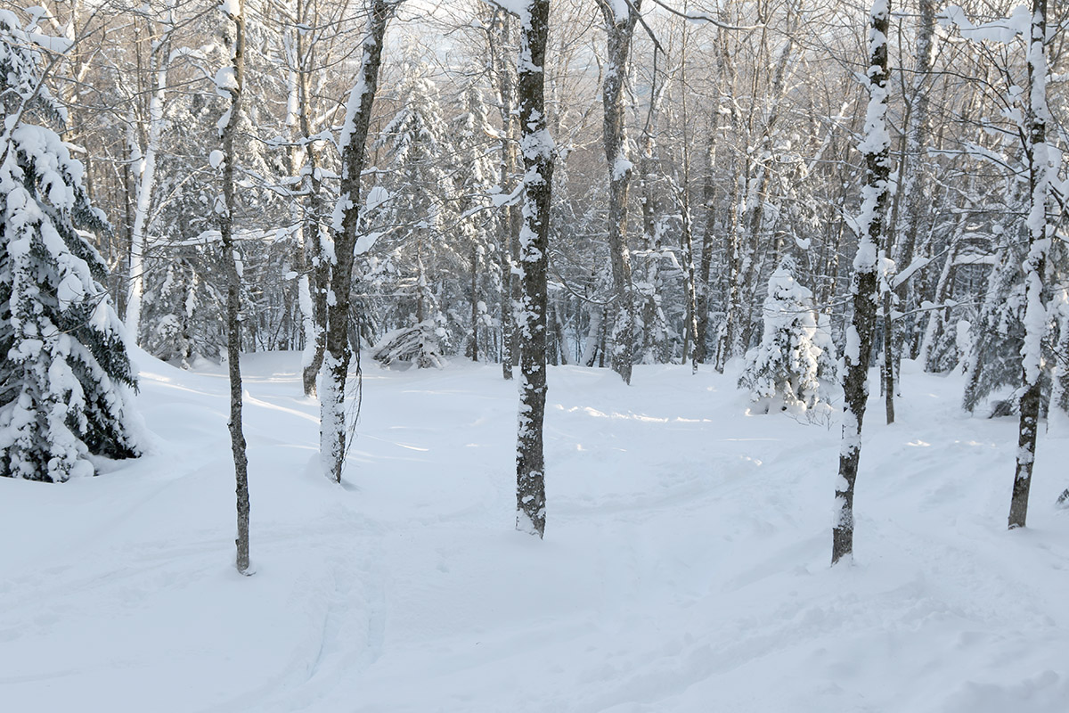
A view down through some of the many glades available on today’s backcountry ski tour up through the Sterling Forest into the Sterling Range
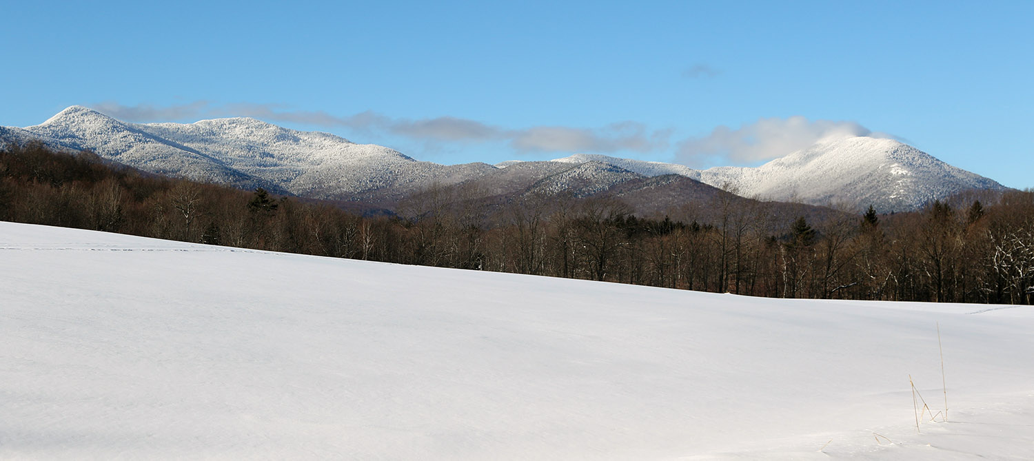
Today the temperatures were still quite cold, so I again opted to stick to ski touring instead of riding the lifts, but it was a bit warmer than yesterday, and I decided to go a bit farther afield and higher in elevation. I set my sights on skiing in the Sterling Range, an area that has been on my list of ski touring spots for quite a while, but I just hadn’t gotten around to making the trip. A very convenient access point to the range is through the Sterling Forest area, and they have a really nice parking lot that’s maintained at the top of Sterling Valley Road.
I’d been up to the area in the warm season for mountain biking, but I haven’t been up there much in the winter. The snowpack around the houses up there is impressive, and you can tell that the area gets, and holds, a lot of snow. I guess it shouldn’t be too surprising with a number of houses that are well above elevations of 1,000’. Indeed there’s some good elevation there as you approach the Sterling Forest – the parking area is around 1,700’, which is 500’ higher than where I began my tour yesterday.
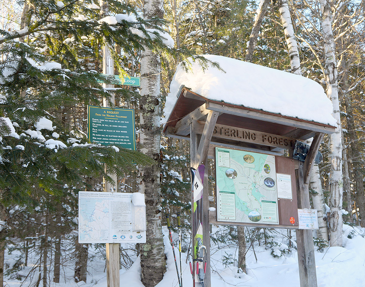
A view of the trailhead area near the Sterling Forest parking lot as I start off on today’s ski tour
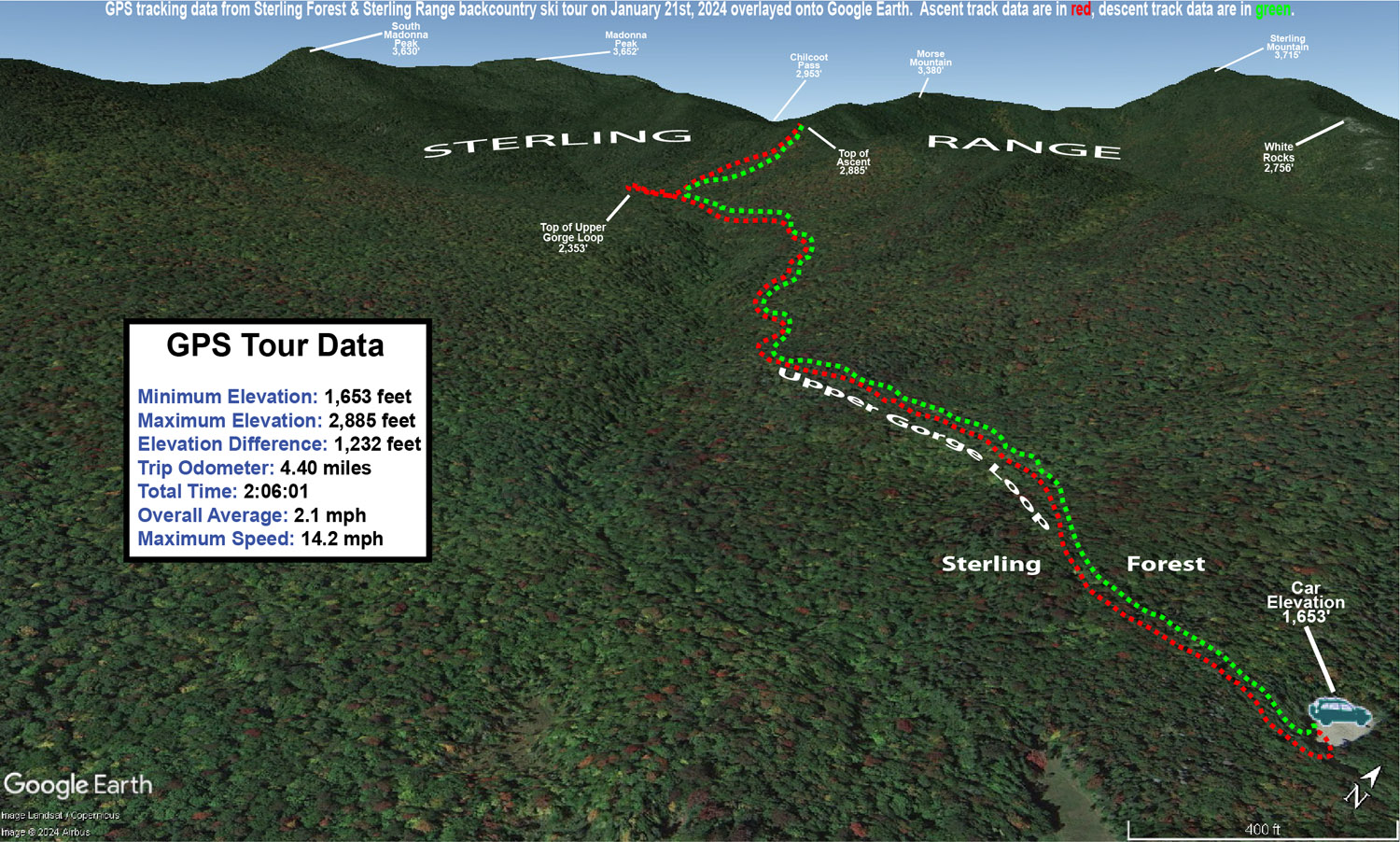
Most people I’ve talked to, as well as reports and videos I’ve seen, use the Upper Gorge Loop trail area as their main thoroughfare for touring. It serves as the approach and as a collector trail if you’re skiing the north side of the basin. For my approach I followed the northerly section of the Upper Gorge Loop Trail, which seemed to be the most popular based on the levels of traffic packing the snow. Following the trail, I began to see skin tracks branch off to head up the north side of the basin, but I continued on the loop trail until I hit its apex, just so I could get the lay of the land. I then skinned back a couple of minutes and took the highest skin track that was available. That brought me to the top of the ridge on the north side of the basin, and along the way I passed numerous open glades that had very few tracks and offered a lot of impressive skiing. I topped out around 2,900’ along the ridge, and descended through the glades back to the Upper Gorge Loop Trail.
Powder depths were very similar to what I found yesterday with respect to similar elevations. I was curious if there might be a difference in surface snow depths since I was about 12 miles farther north in the Northern Greens, but my measurements didn’t reveal any substantial differences. I did ascend substantially higher on this tour though, so it let me add on to what I’d found yesterday. The powder depth profile I found today was as follows:
There are other options for nice touring out there, such as dropping down the back side of the ridge into the next drainage, but the approach to the slopes in the main basin is already a couple of miles even before you begin the main ascent through the glades, so I couldn’t really tack on more with the time I had. It was a gorgeous midwinter day though, with lots of sunshine, and that definitely helped to bring the temperature up that extra notch relative to yesterday.
A Google Earth map with GPS tracking data from today’s backcountry ski tour in the Sterling Forest and Sterling Range in the Northern Green Mountain of Vermont
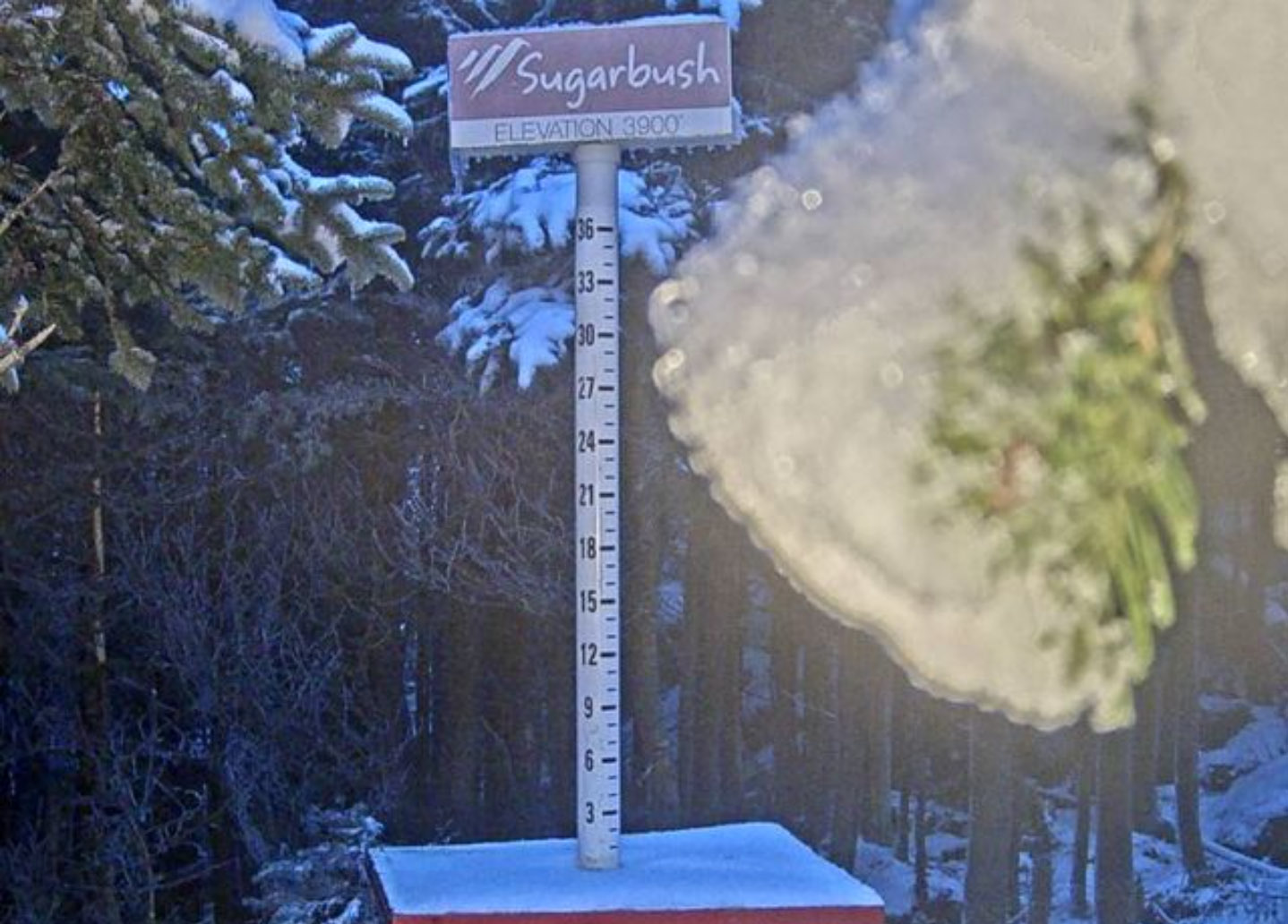
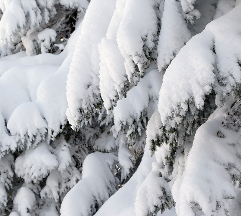
A view of the Sugarbush upper-mountain webcam from this afternoon showing a touch of new snow with what looks like some additional frozen precipitation weighing down the evergreen boughs
Since Winter Storm Carter last weekend, we’ve had numerous rounds of snow here in the Northern Greens. Although it accumulated fairly slowly over the course of the week, snow totals at the resorts were in the 1 to 2-foot range by Friday morning. In yet another pre-season bonus day, Bolton Valley opened for lift-served skiing yesterday, but I suspected skier traffic would have been fairly light and we’d still have plenty of untracked areas to get in some powder skiing on this week’s additions.
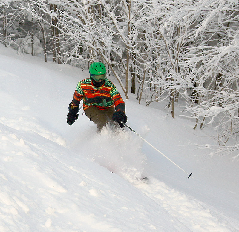
Johannes out in some of that dry Wilderness Powder at Bolton Valley today
The biggest concern on the slopes today certainly wasn’t the snow quality, but the temperatures. We had below zero readings overnight, and single digits F were the rule this morning at opening time. Even with plenty of powder available, I didn’t tempt anyone from the family to head up to the mountain, but I knew Stephen and Johannes would be out there right from opening bell. I planned to catch up with them as soon as I could, so I sent out a text when I arrived to hopefully synch up.
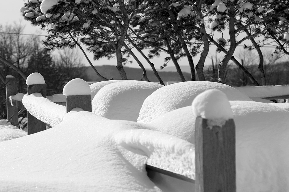
The Bolton Valley Village is simply loaded with snow after the past few weeks of snow and several rounds of fluffy powder in the past few days.
Fora first run I rode the Vista Quad and headed over to Wilderness to check out some powder. I stuck mostly to Wilderness Woods,which had seen some traffic in the main lines, but it was pretty much untracked beyond that. I measured settled snow depths of roughly a foot just about everywhere I went, so even though the resort was only reporting 14 inches, they must have had a bit more than that to still have a foot after the settling of what was very much dry Champlain Powder™. For any terrain with a black pitch or greater, you would still be touching down on the subsurface at times, but moderate angle terrain and below was typically bottomless and smooth.
I measured settled snow depths of roughly a foot just about everywhere I went…
I got the word from Stephen that they were taking a warm-up break in the lodge,so I caught up with them there and we spent the rest of the morning together. We toured around over in the Wilderness area, hooking up from the Vista Quad at first, and then riding the Wilderness Chair once it opened. Powder turns were very easy to come by, and we hit some great spots like Wilderness Woods, Wilderness Lift Line,and Snow Hole. We had to break trail through the powder to get to Snow Hole,and the exit needs a bit of negotiating because one stream bed crossing isn’t fully filled in, but the effort was definitely worth it for some fantastically fluffy turns.
Temperatures were up into the teens F by the time we left at midday, and they’re expected to be much warmer tomorrow for those that are thinking of heading out to enjoy all the new snow.
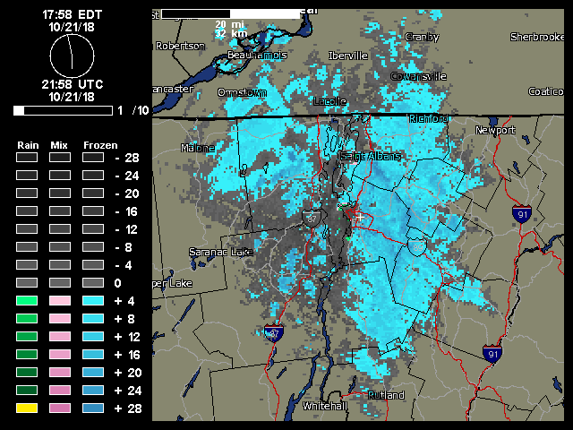
A weather radar image from midday on Sunday showing the continuous push of moisture from the northwest hitting the Northern Green Mountains and giving us continuous light snowfall.
“…once the snow showers got started in the morning, they literally kept going all day with that classic upslope flow from the northwest..”
This event was the second accumulating one at our house this month, and the fourth one for the mountains. Looking ahead, there seems to be some potential for snow in the midweek timeframe, and then again out toward the weekend.
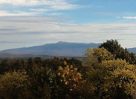
Today you can still see a bit of snow atop Mt. Mansfield above 3,500′ or so.
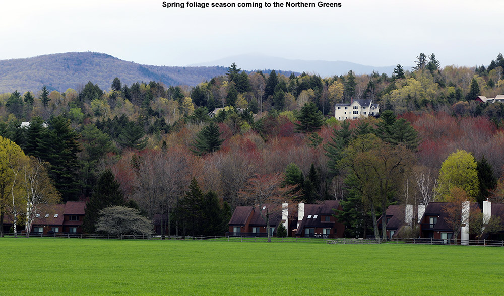
It hasn’t been an especially cool fall thus far in Vermont, and in fact we had some rather warm days with temperatures up to 90 degrees F for the Champlain Valley last month. It’s hard to think of potential snow with temperatures like that! Due to the heat, we actually delayed our September apple picking trip to Boyer’s Orchard with the Bennetts and the Burseys for one week to wait for a more autumnal feel. The temperatures and generally fair weather have certainly made for some fantastic outdoor activities, but the warmth may have altered the timeline for the development of the fall foliage color. In any event, by the beginning of last week I could already see that we were past peak color in the Winooski Valley. Bare trees were numerous throughout the hillsides, leaving at least small gaps in the colorful views.
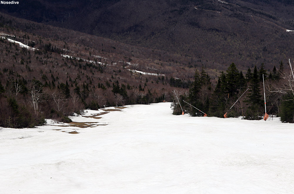
There’s still plenty of snow on Nosedive as of today.
I was hoping to head out for a ski tour when the weather cleared up yesterday afternoon, but it happened just a bit too late to fit any skiing in among the rest of the things I had to do in the evening. Today however, we got a more substantial break in the weather around late morning, so I decided to take advantage of that window and head off to Stowe.
Spring is slowly making its way into the mountain valleys throughout Northern Vermont
The forecast called for scattered rain showers today, but we know how Mother Nature works when it comes to Mt. Mansfield, and it wouldn’t be too surprising to find her scattering a lot more of the showers in that direction. Indeed as I drove the final 10 minutes to the mountain, the rain steadily picked up from sprinkles to a steady light to moderate rain by the time I was at the Mansfield Base preparing my gear.
I ascended via the North Slope route, figuring there’s less time left to explore that area vs. the long-lasting Nosedive option. I found the snow sun cupped in a lot of spots, but coverage was almost completely continuous until I got up into the areas where Toll Road crossed my route. Unfortunately, they’re plowed the road for vehicles, so that put some substantial gaps in the coverage. I had hoped to descend via something similar to my descent route, but eventually resolved to head to Nosedive because the plowing had just cut things up too much.
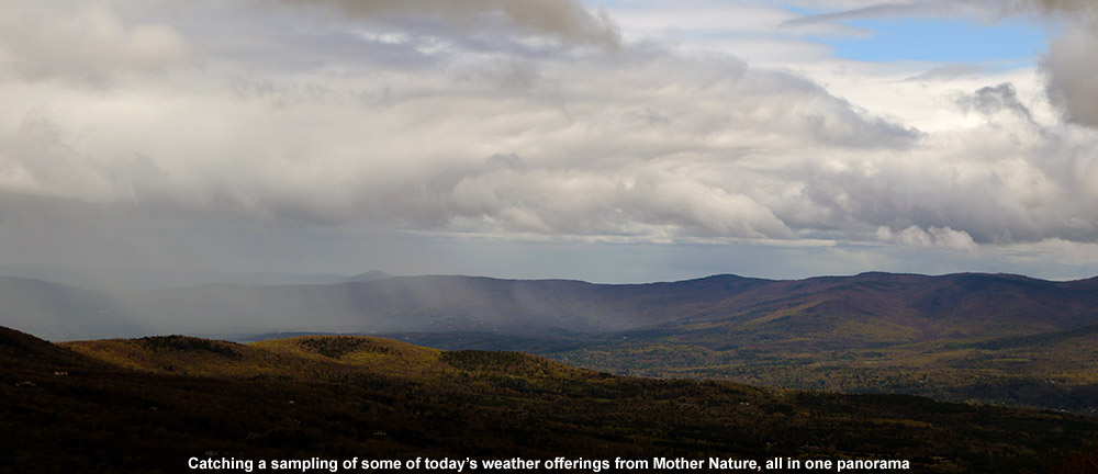
“The overall ascent was quite enjoyable with the variety of weather dancing around Mansfield and the surrounding peaks; there was blue sky, an occasional sprinkle or rain shower, breezes, low clouds skimming the summits, and everything in between.”
The overall ascent was quite enjoyable with the variety of weather dancing around Mansfield and the surrounding peaks; there was blue sky, an occasional sprinkle or rain shower, breezes, low clouds skimming the summits, and everything in between. It was one of those days where you really wanted to have your gear for the various conditions, and I made use of just about everything I’d brought. One minute the hood of my shell was up, the next I needed a light hat, then suddenly it was time for my sunglasses.
Some of today’s weather views
The snow was decent, although I actually would have like it a bit softer. It only gets so soft without consistent the warmth of the sun though. I did notice it softened up a bit more on the lower half of the mountain, simply due to the slightly warmer temperatures. Nosedive does provide some of the best snow on the mountain in terms of skiing though – there have been enough people skiing it that it has a level of “human grooming” to keep the sun cups at bay.
Gliding through some backcountry powder in the Nebraska Valley area today
The weather yesterday was very comfortable, with highs in the local mountains around 30 F at ski resort base elevations. Today was a different story though; mountain temperatures were expected to start in the single digits and drop in the afternoon to produce wind chills well below zero. With that forecast looming, E and Claire decided to cancel today’s BJAMS ski program at Stowe to avoid any frostbite issues with the students. The program can make up the session later in the spring anyway, hopefully on a nice warm day.
“The ski lines were obvious and everywhere, there’s no hunting around necessary if you’re looking for some moderate angle powder to ski.”
With the chilly forecast and some extra time in the afternoon, I decided to head out for a backcountry ski tour in the Nebraska Notch area. Some of the higher elevations of the Northern Greens did pick up as much as 4 to 6 inches of snow overnight, so that added a little extra incentive to get out and see how conditions were faring. I’ve wanted to do an exploratory tour near Nebraska Notch for a while, and I’m familiar with the tour highlighted in David Goodman’s book that starts on the west side of the notch. I’d been through some of that area this past summer when our family was on a backpacking trip with the Handler’s, so I thought that something on the east side would be a fun alternative. From Jacquie, I’d heard about the backcountry skiing potential above the overnight parking area near the Lake Mansfield Trout Club, so I decided I’d give that a shot. It’s a quick trip from our house in Waterbury, and I’d be able to take care of some necessary grocery shopping on the way home as well.
“I’m not sure how deep the base was, but surface powder was 13-14″ in the trees just above the parking area (~1,100′), and pushing two feet up high depending on prior wind and sun exposure in underlying layers.”
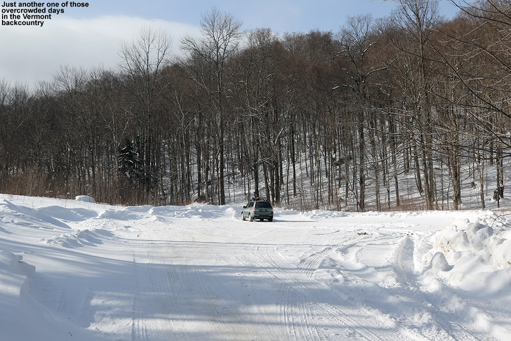
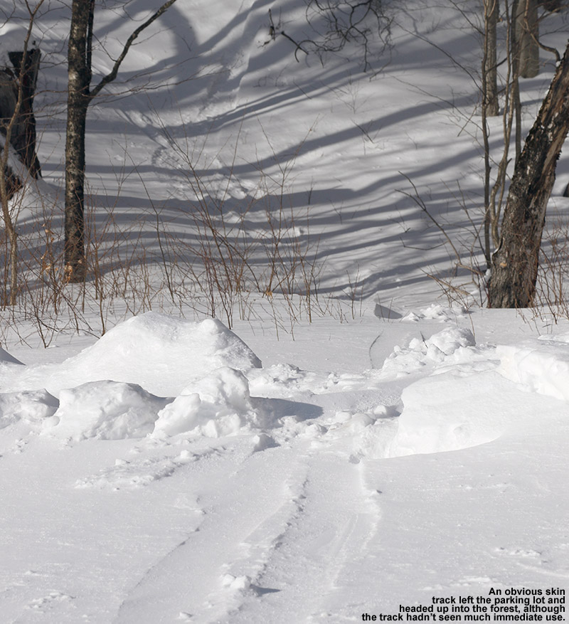
Heading up Nebraska Valley Road, I noticed that as I approached the 1,000′ elevation mark, the snowpack really took a jump. It went from the 8-12″ that we’ve currently got in many of the lower mountain valleys of the Northern Greens to something more, and you could really see how the higher elevations of the Nebraska Valley were holding the snow. I pulled into the lot for overnight recreational parking, and it was empty. There was probably space for 20 cars, but mine was it. I guess it’s just another one of those harbingers of the overuse and overcrowding associated with skiing in the Vermont backcountry. In any event, I could see an obvious, although apparently lightly used skin track off to the right heading up into the forest. More importantly, I could see the associated ski terrain looming right above me; well-spaced hardwoods appeared to fill the entire slope, and you could immediately see that there was some great skiing right down to the parking area.
An old skin track from the parking area marked an obvious route of ascent.
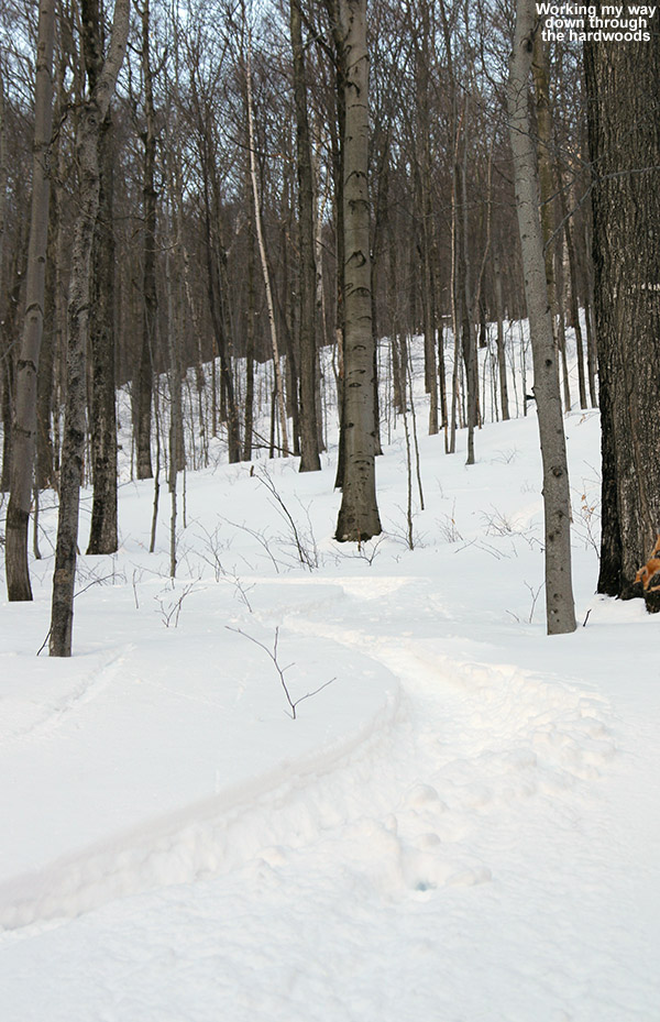
The skin track ascended through the hardwoods on what appeared to be an old logging road, and it sliced right through an impressive chunk of ski terrain. The ski lines were obvious and everywhere, there’s no hunting around necessary if you’re looking for some moderate-angle powder to ski. After looking at the area on Google Earth this morning, I’d decided to explore a drainage off to the northwest of the parking area, and conveniently that’s just where the logging road and skin track headed. After a few hundred feet of ascent I could see that there were a number of ski options, but three main ones were very evident: You could ski the logging road itself, which was relatively narrow and contained the skin track, but would serve up some decent turns. Much more expansive options were to either contour off to the east and make turns in the vast face of terrain containing the hardwoods, or head westward and ski steep gullies down into the drainage. I had plenty of time to survey the topography and decide on descent routes as I continued up the skin track; it’s set at a very nice, consistent pitch with none of these steep spots that might promote slipping.
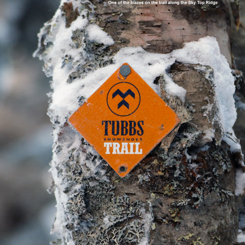
At around 2,100′, evergreens began to mix in with the hardwoods, and the logging road gradually gave way to a skin track that worked its way more tightly through the forest and ascended small streambeds. By 2,500′ I was into exclusively evergreens, and the available snow was getting deeper. I’m not sure how deep the base was, but surface powder was 13-14″ in the trees just above the parking area (~1,100′), and pushing two feet up high depending on prior wind and sun exposure in underlying layers. I hit the ridge line (Sky Top Ridge east of Dewey Mountain) at an elevation of roughly 2,800′, and headed off to the east on the ridge line trail. Appropriately, the trail on the ridge is known as the Skytop Trail, and David Goodman’s Backcountry Skiing Adventures: Vermont & New York book has a specific chapter on touring there. I found it marked with red blazes, but I also noticed a “Tubbs Snowshoe Trail” sign as well. I continued on the Skytop Trail for another few minutes until I hit a local high point where I decided to halt my ascent.
“Some exploring would have been fun, but with the time of day, cold temperatures, and being solo, there really wasn’t much margin for messing around.”
Up there on the ridge it was cold, noticeably colder than the 10 F at the parking area. I was out of the wind, but it wasn’t a temperature to hang around in. I poured some soup and let it cool a bit while I changed over for the descent. My plan was to head back down in the area of the skin track for that first chunk of the descent, since I hadn’t come across any obvious lines in other areas. Some exploring would have been fun, but with the time of day, cold temperatures, and being solo, there really wasn’t much margin for messing around. During the ascent I’d seen that there were plenty of steep, ledgy areas above the open hardwoods. Those ledges and some dense evergreens lay right below me, and from what I’d seen it would be very easy to get cliffed out up there. Any exploration of that terrain will have to wait for another time.
“Being south-facing, it’s not the kind of terrain that one would want to ski on sunny days when temperatures are getting marginal, but on a midwinter day like today, the snow was great.”
The descent up high along the general area of the skin track was very nice – the powder was deep and there were occasional options of ski lines that cut corners or veered away temporarily from the track. When I was back into the open areas of hardwoods, I cut left of the track following a previous skier’s lead, and traversed out into the face of terrain that sat well above the parking area. It was classic Vermont hardwood ski terrain; there weren’t any obvious maintained lines, but you didn’t need them. It was pretty much see it and ski it. The powder was a little shallower on some pitches, no doubt a function of that fact that the terrain faces south and can get plenty of sun due to the leafless deciduous trees. Being south-facing, it’s not the kind of terrain that one would want to ski on sunny days when temperatures are getting marginal, but on a midwinter day like today, the snow was great. I eventually ran into the skin track again, and cut to the other side as I saw some attractive ski lines heading in that direction. I finally had to do a short traverse to get back to the last pitch above the parking area, but with the open nature of the forest, navigation was pretty easy.
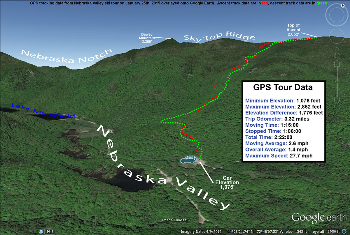
The GPS tracking data of today’s backcountry ski tour in the Nebraska Valley of Vermont plotted on Google Earth
I’d say today was a great first visit to the area; those hardwoods are exceedingly skiable, with the main downside being that it’s south-facing, so the quality of the snow needs to be watched with respect to recent weather trends. The snowpack isn’t even especially deep right now, and I only encountered the occasional underlying obstacle to contend with. As usual, if you throw another couple feet of base down, more and more lines will simply open up and get even cleaner as additional saplings and other trees get buried. On that note, there’s another winter storm (Juno) coming into the area over the next couple of days – it sounds like the bull’s-eye areas are down to the south, but it’s expected to give us a moderate shot of synoptic snow up here as well, which should further improve base depths.


