Bolton Valley, VT 11DEC2023

An image looking down the Villager ski trail choked with fresh snow from near the Timberline Summit during a December snowstorm at Bolton Valley Ski Resort in Vermont
An image of the Timberline Quad Chairlift during an early December snowstorm at Bolton Valley Ski Resort in Vermont
Bolton Valley has already picked up more than a foot of snow from our current winter storm, and the Timberline Quad Chair is showing the results of some of the mid-elevation accumulations.

As of their 4:00 P.M. update, Bolton was reporting a foot of new snow so far from this current winter storm, and I’m sure they’ve cruised right past that mark with the way it was snowing up there when I left the mountain this afternoon.

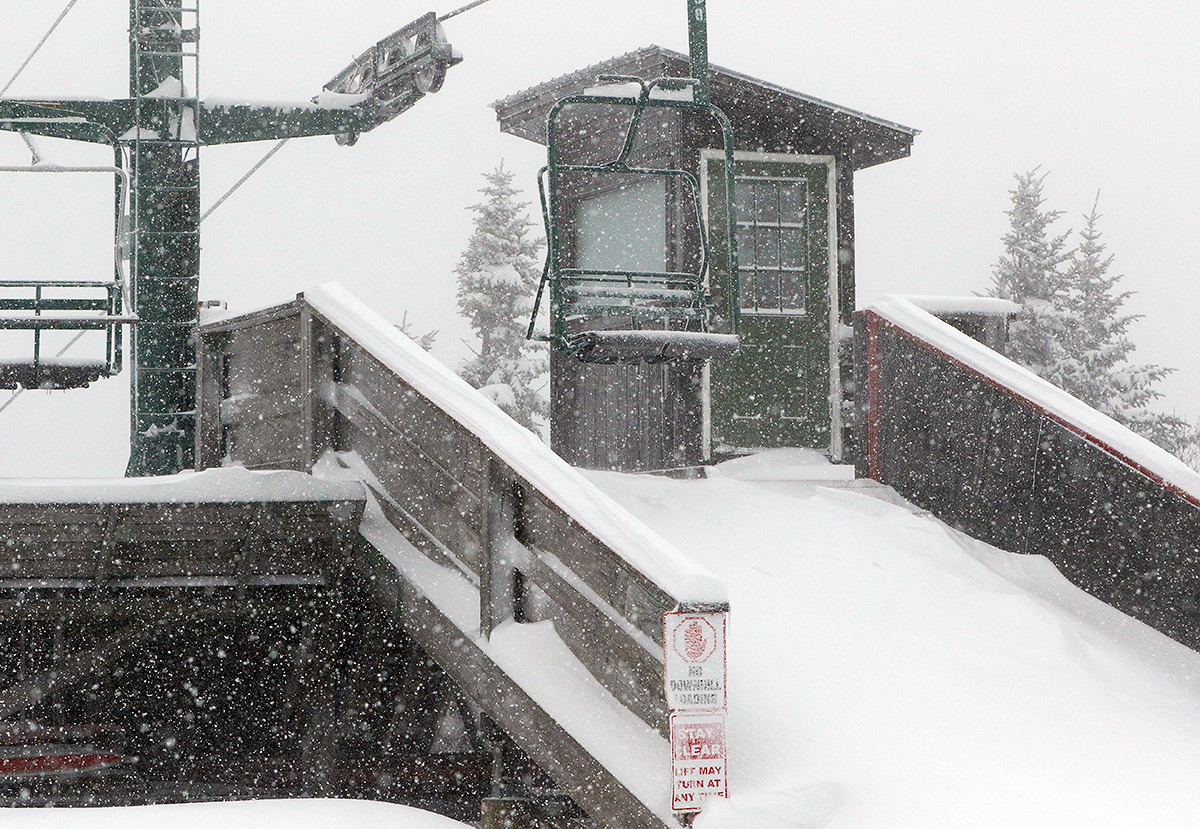
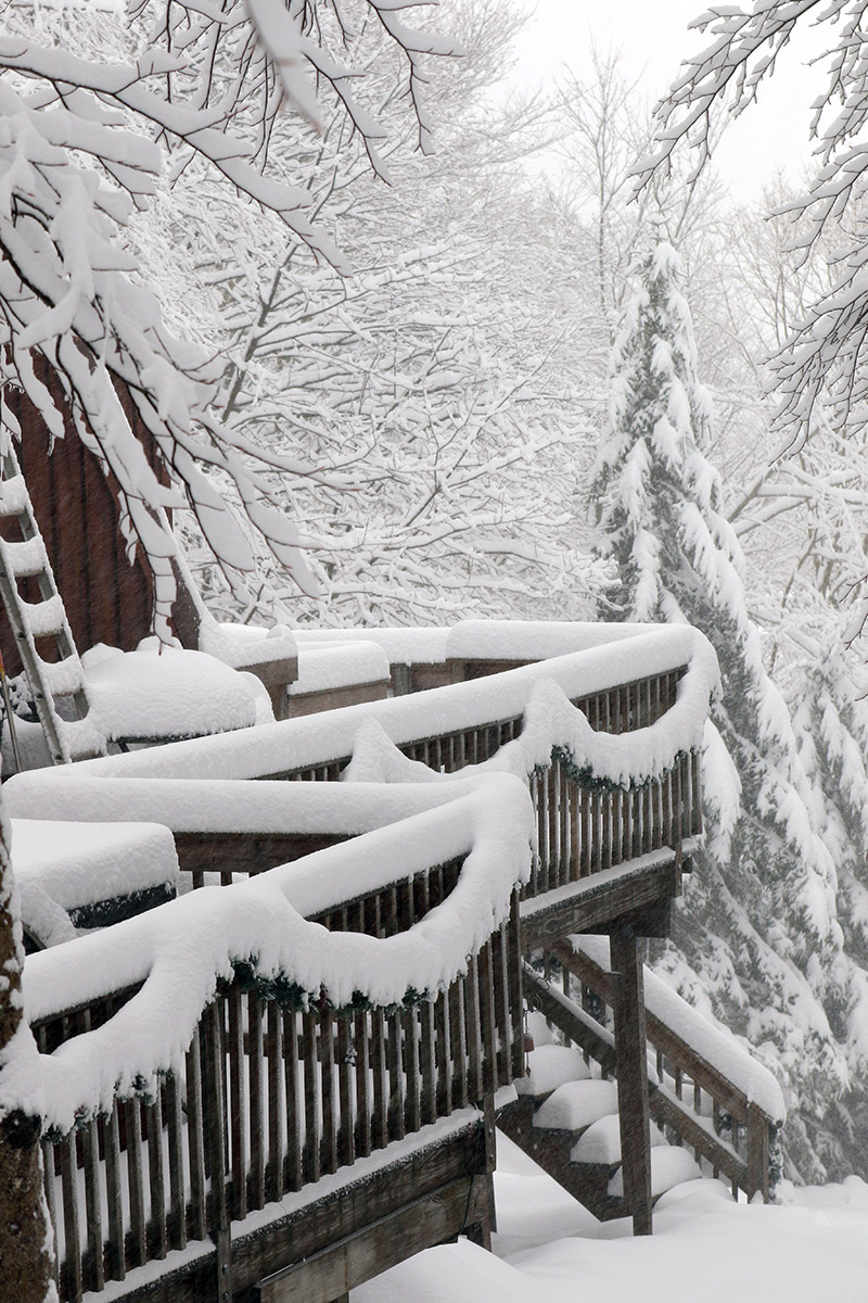
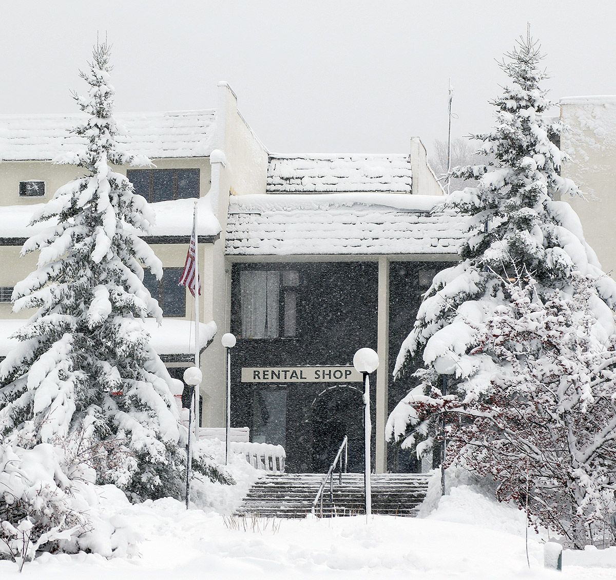
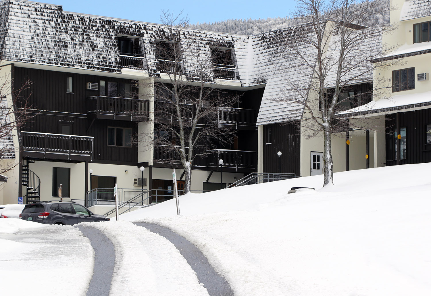
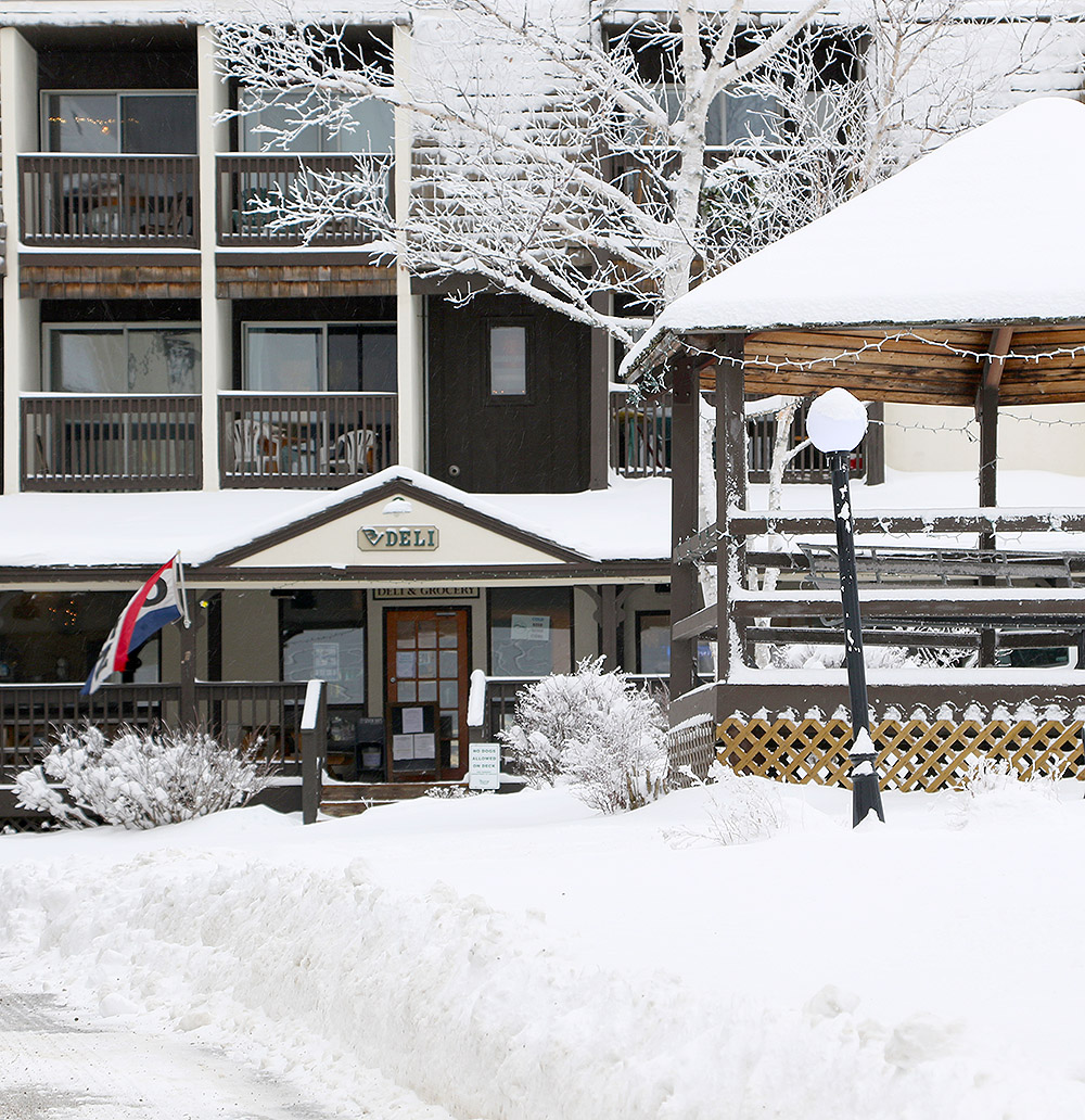
The early morning report from Bolton was 6 inches new up top, so my wife and I planned to let a few more inches accumulate and then head up in the afternoon for some lift-served runs. That plan quickly changed around 11:30 A.M. when we noticed that their main base area live webcam was frozen. We checked their website and they’d updated the snow report to indicate that they’d lost power. They were working directly with Green Mountain Power and hoped to get it back up in an hour, but that was very much up in the air.

An image of snow-covered vehicles in the main Village parking lots during an early December snowstorm at Bolton Valley Ski Resort in Vermont
Even at the Village elevations in the parking lots you can see the results from our ongoing winter storm.

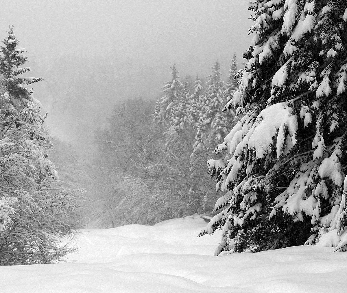
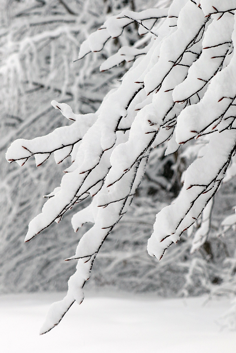
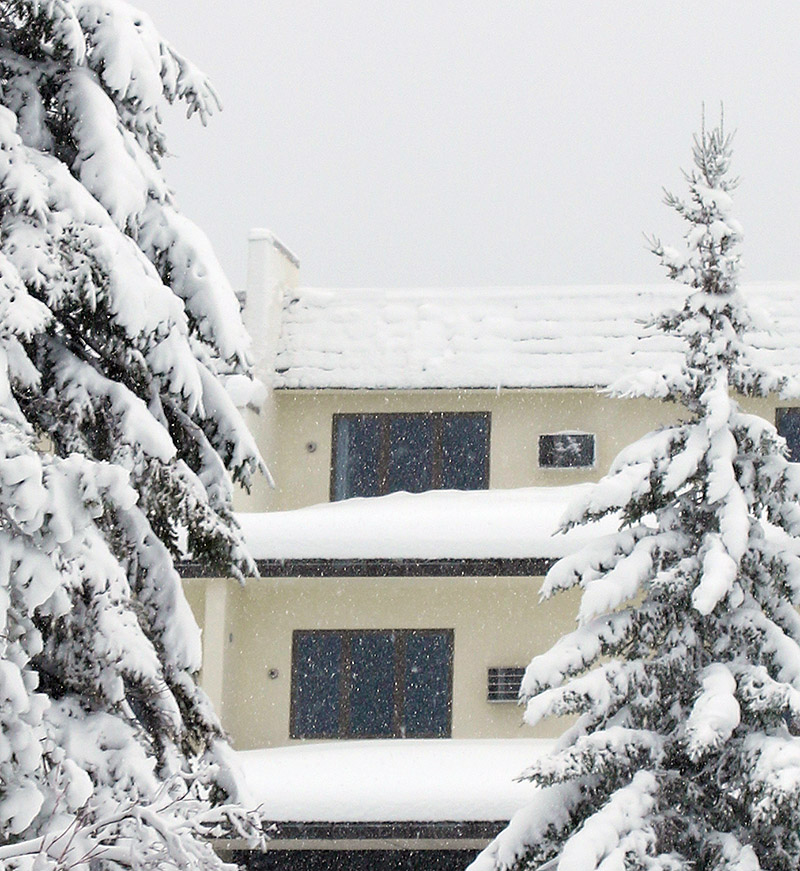
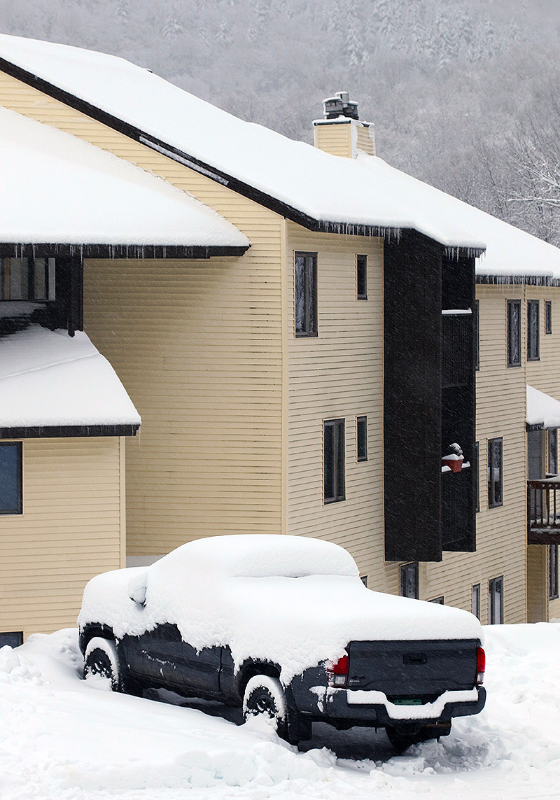
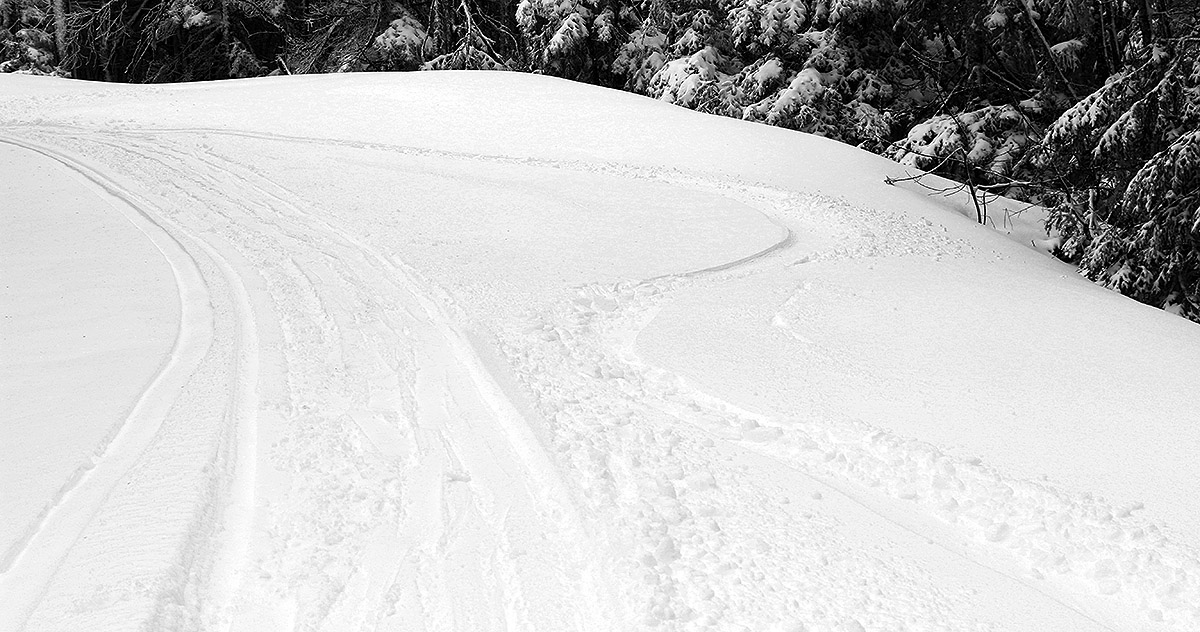
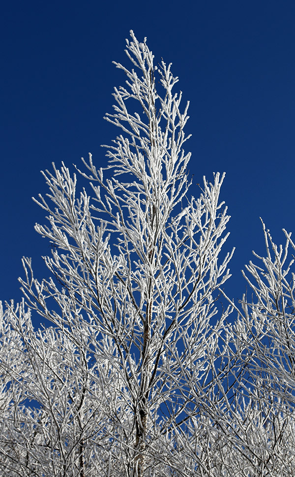
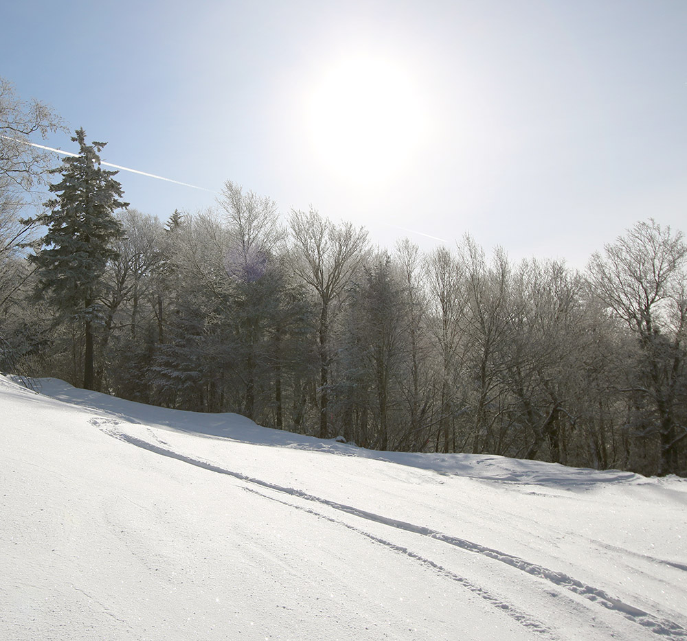
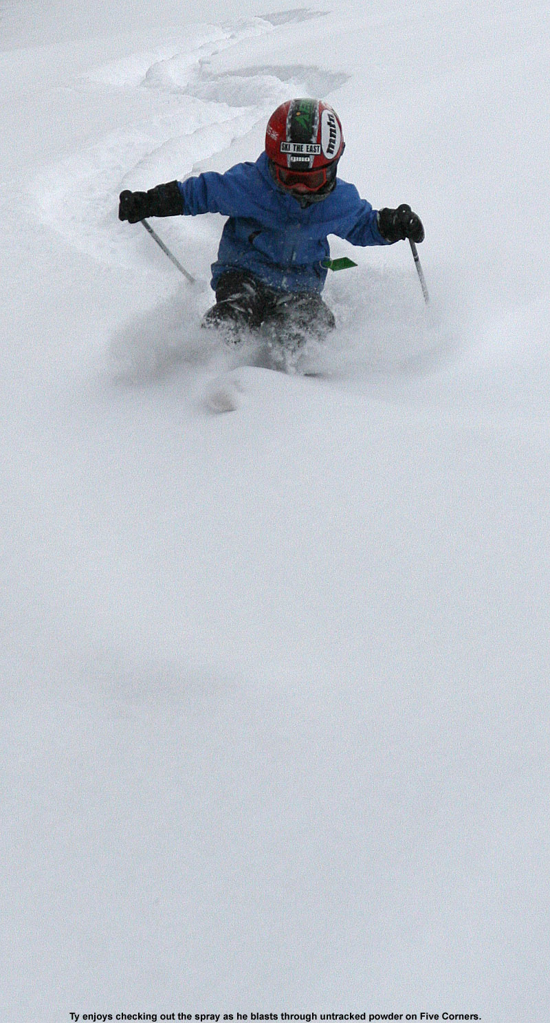
About an hour later with no change in operating status at the resort, I figured it was time to head up for some ski touring to get out in the new snow, since the potential for lift-served skiing was just too uncertain. When I first arrived up at the mountain, the snowfall was steady but I’d say only moderate in intensity. I did some quick depth checks around the Village to get a sense for how much new snow was there, but it was tough to gauge. In many areas, the new snow was so well blended with the old snow that it was hard to determine where the interface was. Overall, that’s a great sign because it indicates that the snowpack wasn’t hit too hard by the warmer temperatures on the front end of this system. In some spots I could find a thicker layer below the new snow, but even at that point I was often getting surface snow depths of 12 to 14 inches. Whatever the accumulations, there’s plenty of new snow and it’s coming together nicely with the underlying snowpack.

An image of heavy snowfall during a December snowstorm at the Wilderness Summit area of Bolton Valley Ski Resort in Vermont
When I reached the Wilderness summit during today’s ski tour, the snowfall was quite intense, often in the 1 to 2 incher per hour range.

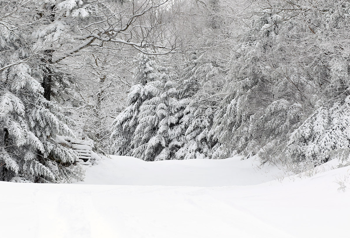
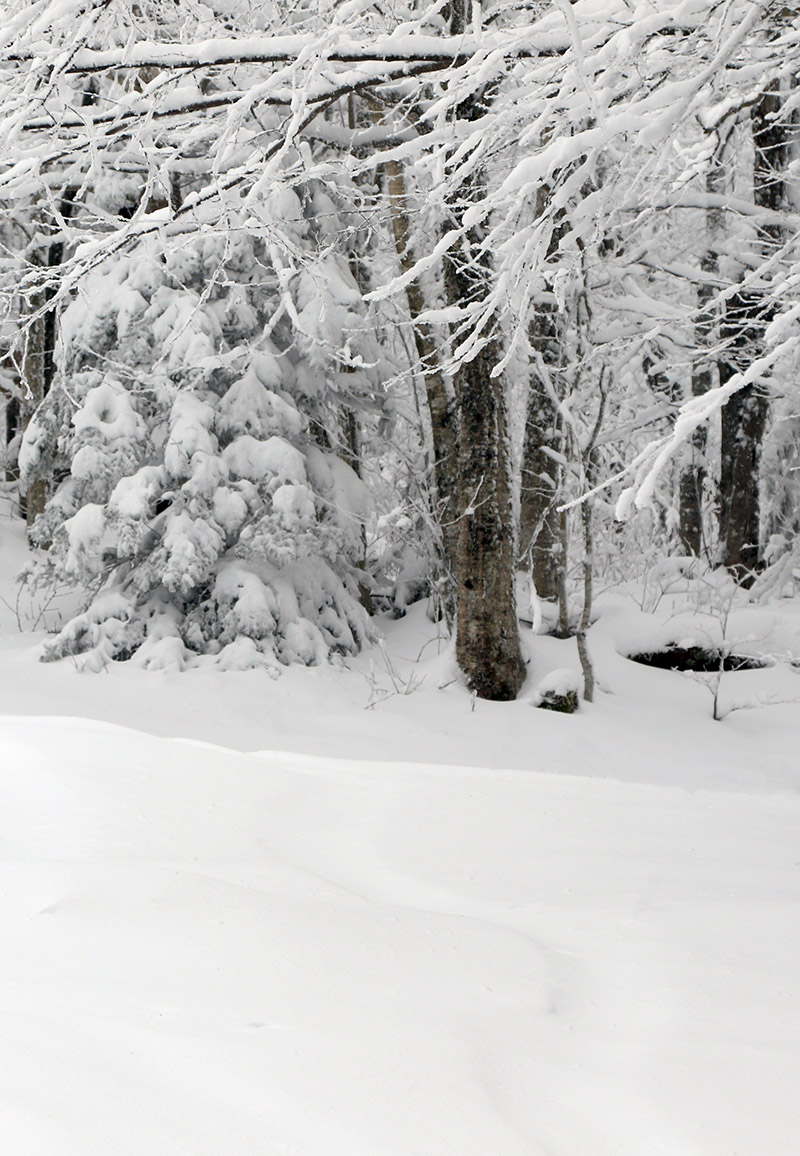
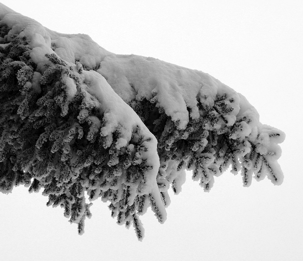
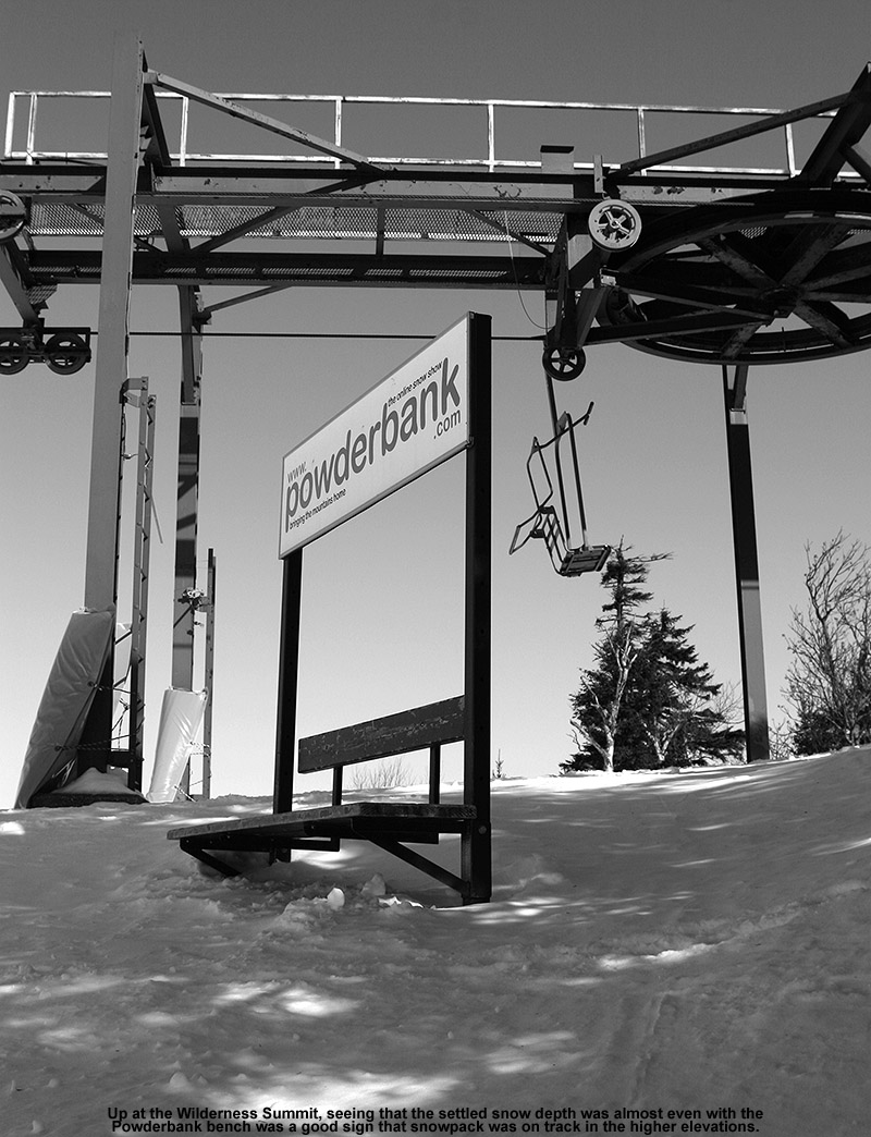
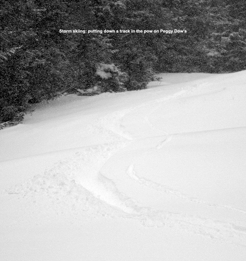
I skinned up to the Wilderness Summit, and touring traffic at that point seemed very light – there were just a couple of tracks down Peggy Dow’s. As I ascended, the intensity of the snowfall increased, and when I was up above 3,000’ on Wilderness it was definitely in the 1-2”/hr. range at times. I know it’s really dumping by how quickly my gear takes on snow accumulations during touring transitions, and this was one of those times where I was constantly having to brush off the snow.

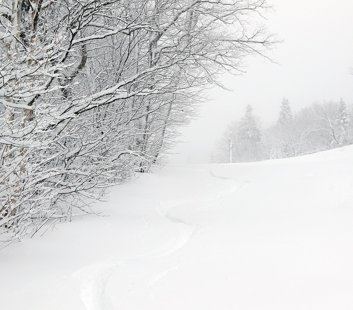
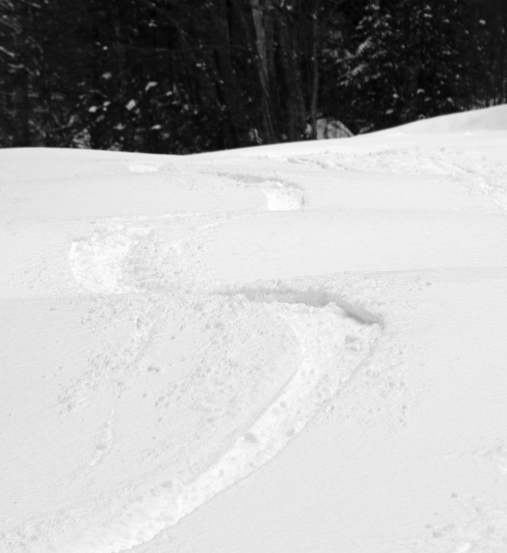
Fat skis were the call again today, and this snow is on the denser side, so you want some pitch for the best turns. In terms of density, at 2,000’ the snow seemed to be a bit above the 10% H2O range, and up at 3,000’ it’s definitely drier; it’s got the feel of something in the 7 to 8% H2O range. The turns are great anywhere at elevation of course; it’s simply bottomless powder everywhere with this storm putting down plenty of liquid equivalent. I was worried about some of the water bars getting blown out with the warmer front end of this storm, but in general they seemed similar to how they were before. The snowfall didn’t actually slow down when I descended back to the Village, so it wasn’t just 3,000’+ that was getting hammered at that point – the intensity of the snowfall had definitely increased in association with the back side of the storm.

An image of delicate fresh snow covering the branches of a tree during a December snowstorm at Bolton Valley Ski Resort in Vermont
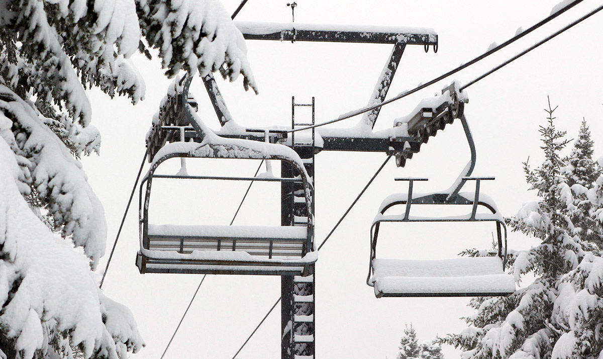
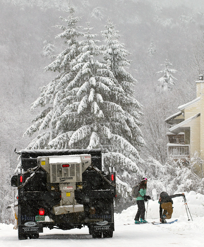
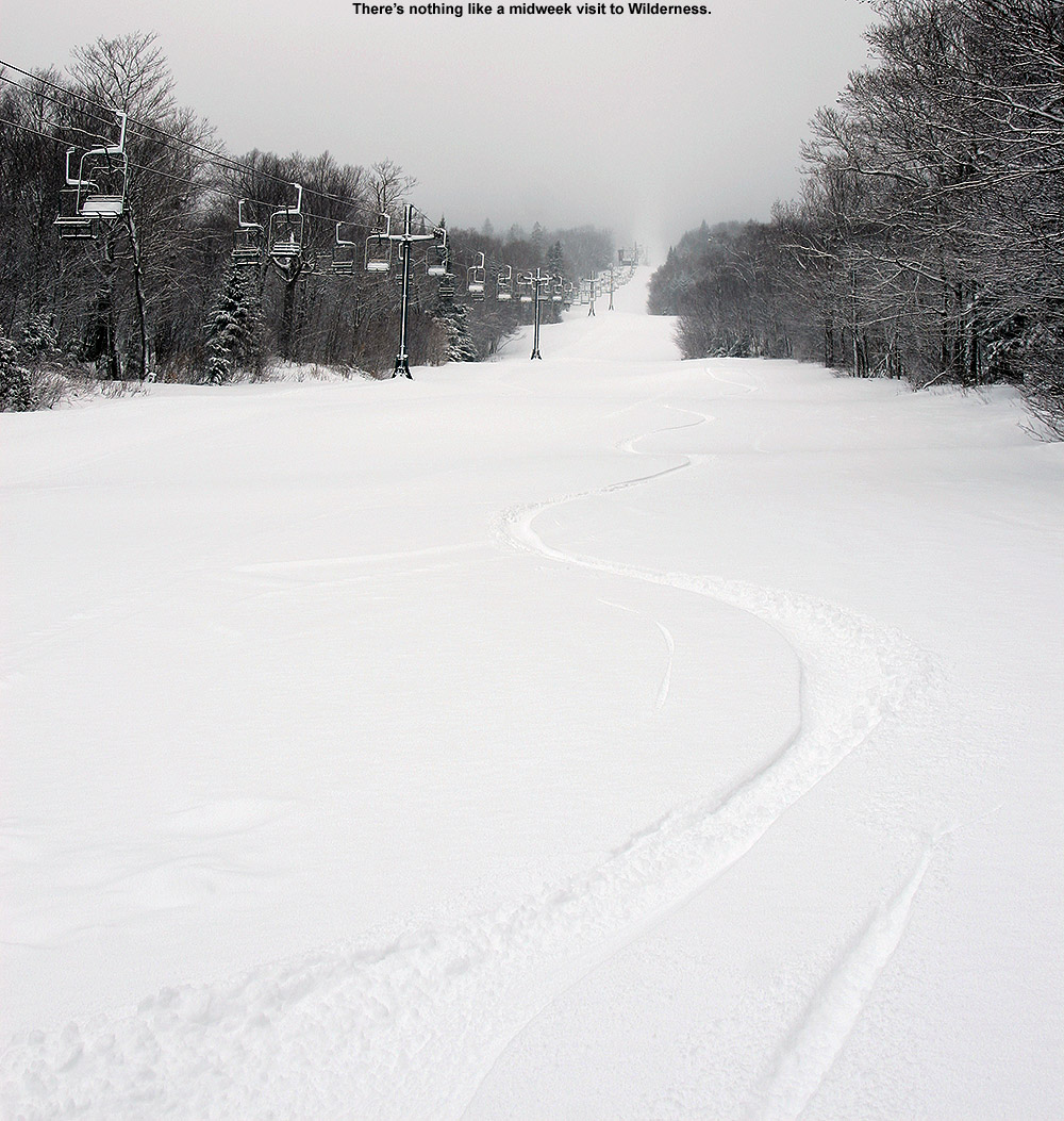
The mountain had been running at least the Snowflake Chair when I started out on my tour, so my plan was to swap over to mid-fats and get in a few lift-served laps to finish off the session. Well, when I arrived back at the main base, power was out again everywhere, so that plan was out the window. There was an easy solution to that though; I just slapped the skins back on and kept touring. I was initially thinking a nice little tour up to the Snowflake Summit would be a great way to finish off the session, but when I got to Five Corners I suddenly thought about hitting the Timberline Summit. I haven’t been up to Timberline at all yet this season because the snow depths at the Timberline Base are still a bit lean compared to the stronger snowpack above 2,000’, but that part of the tour gave me a chance to check out Timberline’s higher elevations. There’s been hardly any skier traffic over there, so it’s nearly untracked everywhere.

An image of the deck of a house covered in snow during a December snowstorm at Bolton Valley Ski Resort in Vermont
It was a winter wonderland out there at the resort today as my ski tour brought me around through the Bolton Valley Village, up to the Wilderness Summit, and even up to the Timberline Summit.

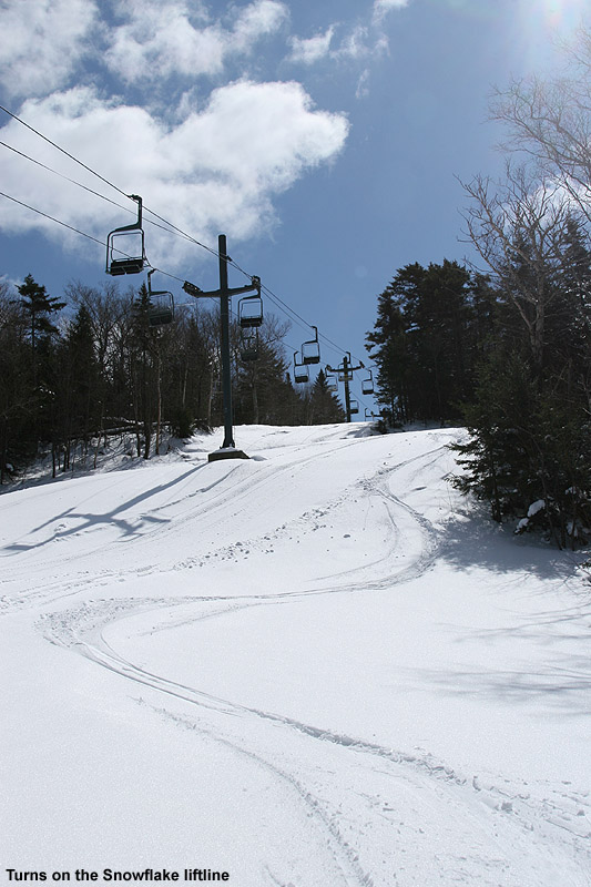
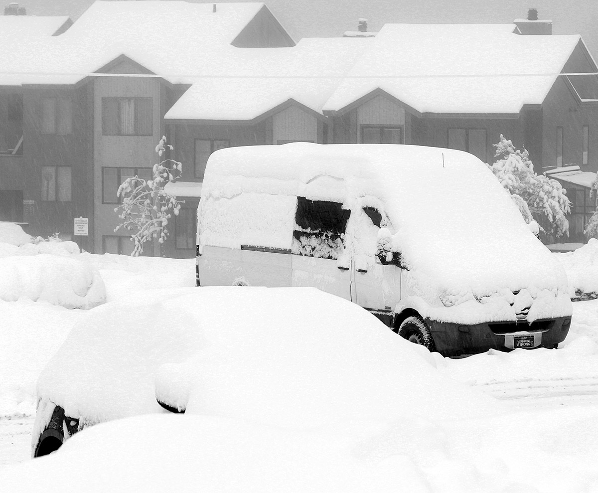
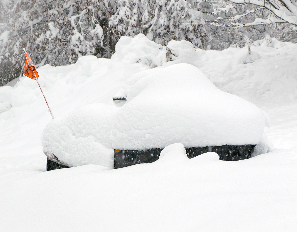
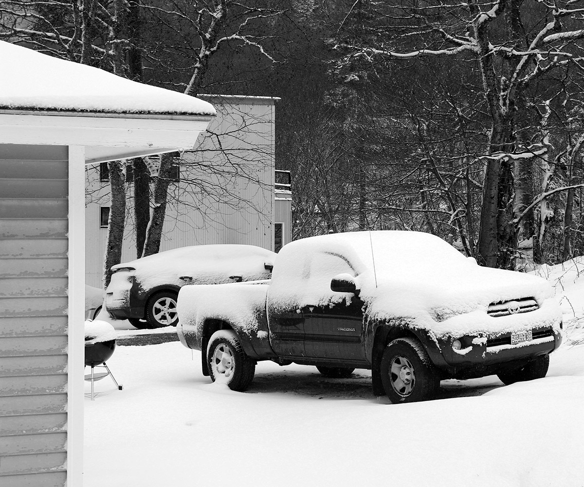
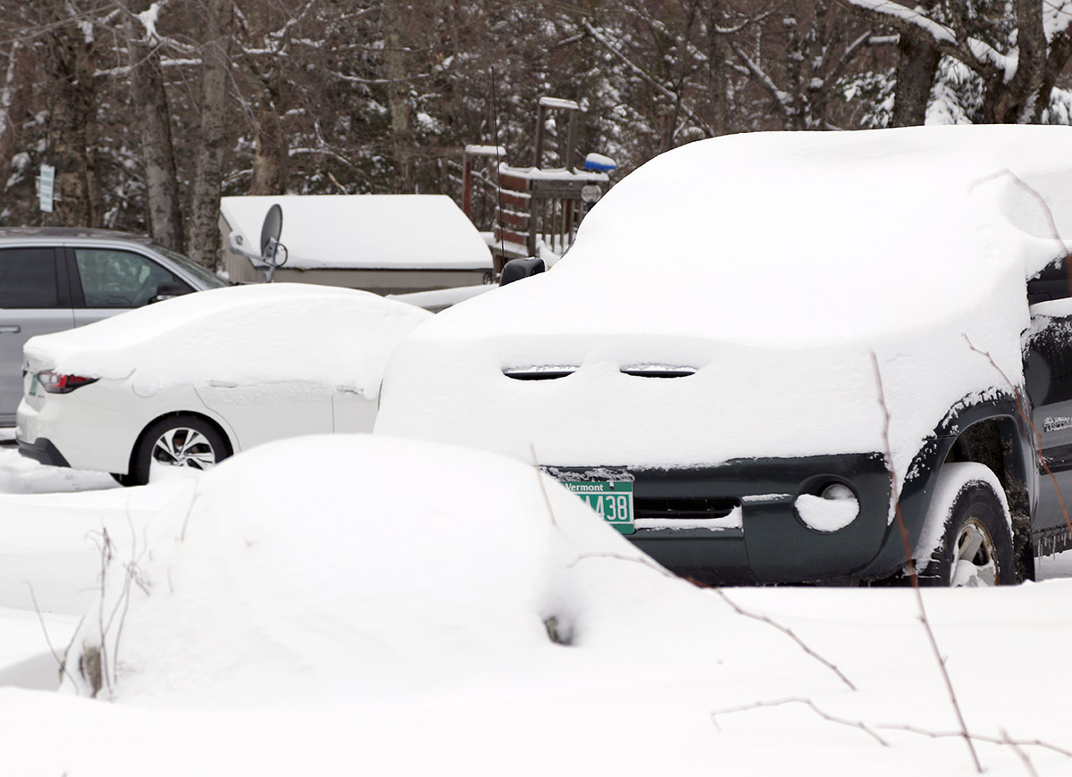
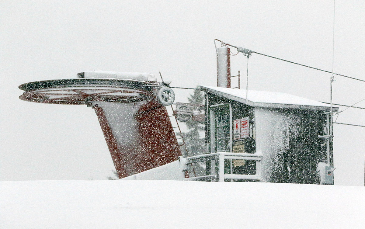
Heavy snowfall continued to pummel the area right through to the end of my ski tour, and my car had been loaded with snow in just the couple hours that I was out there. It took me probably 10 minutes to clean off the snow.  The temperatures had definitely dropped as I was heading down the access road, and the heavy snowfall didn’t start to abate at all until I was below 1,500’. We’ve been accumulating better even down in the valley now that the temperatures have dropped below freezing.

Bolton Valley, VT 04DEC2023

An image of heavy snowfall and snow accumulations at the main base lodge in the Village during an early December snowstorm at Bolton Valley Ski Resort in Vermont
An image of ski tracks in powder snow on the Fanny Hill trail during an early December snowstorm at Bolton Valley Ski Resort in Vermont
Today on Fanny Hill at Bolton Valley – the snow just keeps falling, so we’ll keep making turns!

Of the 11 winter storms we’re recorded so far this season at our site in the Winooski Valley, 3 have delivered more than a half inch of liquid equivalent, and they’ve had a notable upward trend in L.E. The November 21st storm brought 0.72” of L.E., the November 26th storm brought 1.14” of L.E., and this most recent storm that began on December 3rd brought more than 1.40” of L.E., with snowfall continuing tonight. These storms have really helped to build the mountain snowpack, and the snow depth at the Mt. Mansfield Stake is now more than a foot above average.

An image of heavy snowfall and snow piling up in early December on buildings in the Village area of Bolton Valley Ski Resort in Vermont
The snow just continues to pile up in the Bolton Valley Village with these weekly larger systems and the smaller ones in between.

An image of a snowmobile buried in snow from recent early December storms at Bolton Valley Ski Resort in VermontBolton Valley was reporting another 14” of snow in 24 hours, and I popped up to the mountain this afternoon to check it out. Elevation has had quite an impact on the snow from this most recent storm, and the snow depth profile coming up out of the Winooski Valley is quite extreme. There’s really no snow at the base of the Bolton Valley Access Road aside from leftover piles, and it’s like that all the way up above 1,000’, and then the depth begins to ramp up. Here’s the snow depth profile I found on today’s ski tour:

340’: 0”
500’: 0”
1,000’: 0”
1,200’: T-2”
1,500’: 6-8”
2,000’: 16-20”
2,500’: 20-24”
3,000’: 24-28”

An image of fresh snow accumulations on a pickup truck and condominiums after early December storms affect the Village area at Bolton Valley Ski Resort in Vermont
Folks up in the Bolton Valley Village are constantly having to clear the snow with storm cycles frequently affecting the area in the past few weeks.

It was more challenging to get depth readings in those upper elevations since the pack is getting pretty deep and there are a lot of different layers with varying consistencies, but that general trend I’ve seen on the mountain recently of almost an inch of depth increase per 100’ of elevation gain seems to generally be holding. The depths I was getting at 3,000’ also seem generally in line with the current reading at the Mt. Mansfield Stake of 33” at 3,700’.

I arrived up in the Village in the early afternoon to a maelstrom of huge flakes coming down in association with the back side of the storm system, so the mountain continued to tack on more to the snow totals. Fat skis were unquestionably the play for today. The accumulations from this storm definitely came in denser than the previous one, and while fats were of course great for stability, they were also really nice for planing on lower angle slopes and getting additional turns out of that snow. Even though you were only sinking maybe 6 to 10 inches into the powder because of the density, it was still slow going if the slope angle got too low. Steep slopes indeed offered the best turns, and the base is so dense and deep that even on those pitches there’s not much to worry about in terms of coverage on the upper mountain.

An image of skiers getting ready for a ski tour and a snow plow working to maintain roads during an early December snowstorm in the Village area of Bolton Valley Ski Resort in Vermont
A pair of skiers gets ready for a ski tour as a snow plow works its way through the Bolton Valley Village trying to keep up with the continuing snowfall

Bolton Valley, VT 01MAY2021

An image of the Village Circle on May 1st, 2021 filled with snow from a recent spring snowstorm at Bolton Valley Ski Resort in Vermont
An image showing snow accumulations from an early May snowstorm around the peaks of the Winooski Valley in Vermont
This morning’s views created by our latest spring snowstorm were quite intriguing, with snow accumulations frequently varying in terms of both elevation and aspect.

Another spring storm moved into the area on Wednesday, and it resulted in a protracted period of precipitation that started to change over to snow yesterday afternoon into the evening.  It was snowing at our house this morning with a bit of accumulation, and the visible snow line here in the Winooski Valley  reached down to around 1,000’.  The views from the Bolton Valley Main Base Webcam showed the slopes covered in a fresh coat of white, so I decided to get a bit of exercise and headed out for a morning ski tour.

An image showing snow accumulations from an early May snowstorm at Bolton Valley Ski Resort in Vermont
Snow accumulations increased quickly up above 2,000′ with this recent spring storm.

As soon as I left the house and rounded the first corner on Route 2, I was shown a bright visage of white-covered peaks across the valley.  These elevation-based snowstorms typically produce some great views, and the accumulations from this one varied a bit with aspect, so that made for some exciting scenery as I headed through the Winooski Valley.

An image showing accumulations in the Village after an early May snowstorm at Bolton Valley Ski Resort in VermontOnce I was on the Bolton Valley Access Road, the first traces of white appeared at roughly 900’, and the accumulations slowly increased to 2-3’ at the Timberline Base, and 3-4” in the Village.  Temperatures were below freezing from probably 1,000’-1,500’ on up, so the new snow above that point was dense, but dry.  There was a notable jump in accumulations just above 2,000’ or so as the profile below shows.  Above that though, there wasn’t a lot of increase, so presumably the snow line crashed down to that ~2,000’+ level pretty quickly without spending a lot of time at 3,000’+.

Here’s the accumulations profile observed on this morning’s outing:

340’: 0”
500’: 0”
900’: T
1,000’: T
1,200’: 1-2”
1,500’: 2-3”
2,000’: 3-4’
2,250’: 5-6”
2,500’: ~6″
2,800’: ~6-7”
3,100’: ~7”

“I’d planned on a quick tour over in the lower elevations of the Wilderness area, but once I was over there out of the wind, I saw that the accumulations were solid enough to warrant a more extended tour into the higher elevations.”

I’d planned on a quick tour over in the lower elevations of the Wilderness area, but once I was over there out of the wind, I saw that the accumulations were solid enough to warrant a more extended tour into the higher elevations.

As mentioned, the snow was dense but dry, so it skied fairly well.  On 115 mm fat skis I was typically sinking in a couple of inches, and there was a surfy consistency to the setup that really let you have some fun and smear your powder turns easily if you wanted.  The snow provided plenty of cushion for low to low/moderate-angle terrain, and up above 2,800’ or so, old snow and snow bridges were still in place, so that made any water bars less of an issue.

An image showing some ski tracks in powder snow from an early May snowstorm at Bolton Valley Ski Resort in Vermont
Several inches of new dense snow up on the mountain today made for some nice turns on my tour.

“As mentioned, the snow was dense but dry, so it skied fairly well. On 115 mm fat skis I was typically sinking in a couple of inches, and there was a surfy consistency to the setup that really let you have some fun and smear your powder turns easily if you wanted.”

There were a few folks out and about in the Village, but out on the mountain itself it was pretty quiet.  All I saw was a red fox that ran in front of me on Lower Turnpike, and a guy on a fat bike up near the summit.  I was surprised to see him up at that point because there was a half foot of snow, and due to their weight those fat bikes are total dogs with respect to climbing, so I’m sure he’d put in plenty of work.  There were some packed areas of snow due to resort operations traffic and wind scouring, so I’m guessing he made good use of that.

We’ve had a few nice snowstorms over the past few weeks, and this latest one was a nice way to kick off the month of May with a ski tour.

Bolton Valley, VT 22APR2021

An image showing ski tracks in powder snow after a late April storm at Bolton Valley Ski Resort in Vermont
An image of snow accumulations from a late April snowstorm in the Village area at Bolton Valley Ski Resort in Vermont
Our latest April storm brought 8 to 10 inches of snow to the Bolton Valley Village, with as much as a foot of snow higher on the mountain.

Since daylight lingers so long into the evening now, I stopped off at Bolton on the way home from work today for a ski tour.  I hadn’t had the time to get out yesterday, but it kept snowing much of the day today as well, so this gave me the chance to see how all the snow had accumulated from this most recent April storm.  Valley temperatures had edged a bit above freezing in the afternoon, but on the mountain the temperatures were down in the 20s F.

Accumulations from this storm went right down to the lowest valleys, and even the broad, low valleys down near sea level like the Champlain Valley had accumulations that stuck around.  At the base of the Bolton Valley Access Road at ~340’ there were a couple inches of accumulation, and naturally, the depths just went up from there.  The wind had kicked up by this afternoon on the back side of the system, and that really pushed the snow around a lot, but using the typical calmer, unaffected spots, here’s the accumulations profile I observed during today’s outing:

340’: 2”
500’: 2-3”
1,000’: 3-4”
1,500’: 5-6”
2,000’: 8-10”
2,500’: 10-12”
3,000’: ~12”

“So, while not the 2”+ of liquid that some areas saw in the last storm, this snow offered plenty of substance for solid turns on most terrain, and it was easily bottomless on moderate-angle pitches.”

The snow from this storm was certainly not as dense as what last week’s storm delivered, but the initial accumulations were substantial enough to set up a good base, and then in typical Northern Greens style, the upslope came in after to boost the depth and polish things off.  Overall, the snow put down by this storm cycle was right side up, just as PF noted in his post at the American Weather Forum.  We picked up roughly ¾” of liquid equivalent at our site, and I’d say they’d had at least 1” of liquid in the snow on the mountain.  So, while not the 2”+ of liquid that some areas saw in the last storm, this snow offered plenty of substance for solid turns on most terrain, and it was easily bottomless on moderate-angle pitches.  There was also still some snow left from the previous storm in spots, so that bolstered up the base a bit more.

An image of low clouds and whisps of falling snow looking west toward the Champlain Valley during a late-April snowstorm at Bolton Valley Ski Resort in Vermont
The low cloud deck and wisps of falling snow from an incoming burst of precipitation were visible as I looked back westward toward the Champlain Valley.

Anyway, turns were great with the right-side-up deposition, with midwinter consistency all the way down to the Village areas at ~2,000’ this afternoon.  I didn’t tour down to 1,500’, but even there at the base of Timberline the snow was still powder as of early evening.

Bolton Valley, VT 23DEC2020

An image of a snow-covered tree against a brilliantly blue sky in the background at Bolton Valley Ski Resort in Vermont
An image of a ski track in powder snow after some small storms dropped 8 to 10 inches at Bolton Valley Ski Resort in Vermont
This morning’s ski tour revealed some excellent ski conditions with up to 8-10″ of powder on the upper mountain in undisturbed areas.

Today turned out to be sort of a bit of a midwinter gem, which is pretty nice considering winter just started.  I hadn’t expected it to be quite so stunning, but with the recent snows, it was clearly a good day to head up to Bolton for a tour and check out how the powder had settled in.

In the morning, before any clouds rolled it, the sun and sky were simply brilliant.  And that’s the first thing I noticed when I got out of the car at the mountain.  And I couldn’t believe how hot the sun felt.  We’re up near 45 N latitude, and this time of year is just about as low a sun angle as we get, so all I can think is that I’m just not used to actually having the sun shining on my face.  I had a 23% VLT lens in my goggles, figuring that sure, it was sunny, but it’s late December way up here in the north.  Well, I could have easily gone with something sub-10% VLT; it was that bright.

“The powder definitely exceeded expectations today – I found settled depths of roughly 5-7” above the subsurface at 2,000’, and many spots with 8-10” up near 3,000’.”

The powder definitely exceeded expectations today – I found settled depths of roughly 5-7” above the subsurface at 2,000’, and many spots with 8-10” up near 3,000’.  I initially couldn’t figure out where all of it had come from, but then I realized that since the 4-5” from Winter Storm Gail, it’s just continued to snow with these past couple of smaller systems.

An image of someone pushing a stroller on snow with a ski on the front wheel at Bolton Valley Ski Resort in Vermont
Out for a snow stroll around the base area

The Wilderness skin track was in excellent shape, and it almost looked like the resort had groomed the adjoining Turnpike trail because it was so smoothly packed.  It’s possible that it was just very nicely packed by skier traffic, but for folks looking for groomed turns in the Wilderness area, it’s good to go.

Off the main route though, there was tons of untracked powder available, and it was definitely right-side-up, midwinter quality stuff.  That synoptic snow from Winter Storm Gail, topped off with the drier snow from these last couple of systems has really put together a quality surface.  Low-angle stuff is good to go, and even moderate-angle slopes are nice if the snow is protected from the wind and there hasn’t been any skier traffic.  Above those angles though, the snowpack is definitely not ready yet; the base is just not deep enough.

An image of the exterior of the Mad Taco restaurant location at Bolton Valley Ski Resort in Vermont
We can’t wait to try out the Mad Taco outpost that they’ve added to Bolton Valley this season!

It’s going to be interesting to see how things play out for this next week.  This next storm looks to consolidate the base, and there are a couple of potential systems behind it that could make some nice conditions atop that if they came to fruition on the snowy side of things.

Bolton Valley, VT 10DEC2020

An image of the village circle area at Bolton Valley Ski Resort in Vermont after a small December snowstorm
An image of fresh snow with some buried ski tracks from a small December snowstorm at Bolton Valley Ski Resort in Vermont
One of the beautiful scenes from Bolton Valley this morning, showing a few old ski tracks on Lower Turnpike

Yesterday, an upper-level disturbance/Alberta Clipper-style system began to affect our area, and as of this morning, Bolton Valley was reporting 4-8” of new snow in the past 24 hours, and 10” in the last 48 hours.  Although we haven’t had too much base snow yet this season, those accumulations, as well as the view on the Bolton Valley Main Base Webcam, suggested that there was enough snow out there for a tour.

Temperatures up in the Bolton Valley Village were in the upper 20s F, and I generally found 7-10” inches of snow from the Village elevations upward.  There’s decent substance to the snow (i.e. it’s not just fluff), but as expected, there’s really not too much base below that snow from what I saw.  I just don’t think there was any dense snow, or rain-affected snow that had a chance to consolidate below these most recent accumulations.  The snow quality is good though; the snowpack I encountered was right-side up with some medium weight density snow below fluffier powder on top.

Here are the snow depths I observed from the bottom of the Bolton Valley Access Road and up above the Bolton Valley Village:

340’:  2”
1,000’:  3-4”
1,500’:  4-5”
2,000’:  7”
2,500’:  8-9”
2,700’:  9-10”

Roughly 2,700’ was as high as my tour took me today, so I can’t provide observations above that level, but snow depths probably would have increased a bit more with elevation.

An image of fresh snow on an evergreen bough after a December snowstorm at Bolton Valley Ski Resort in Vermont
Some of the recent snow on a spruce bough

I’m surprised to see a depth of only 8” at the Mt. Mansfield Stake at 3,700’ as of the most recent report, but I’m not sure when that depth was last updated.  Based on the amount of liquid equivalent that seemed to be in the snow, and the sub-freezing temperatures up there, this would likely be the start of the winter snowpack unless we get a really warm/wet, long-duration event.  Consolidating the snow that’s there right now and/or adding some water to it would certainly help form a base.  We certainly want to get in a decent synoptic winter storm to substantiate the base, but the mountains have got at least a minimal start with this system.  I’m not sure if the snow we have in the valleys around here is quite enough to mark the start the season’s snowpack, but it’s possible.  We’ll see what the next couple of weeks bring as we head into the busy holiday season.