Bolton Valley, VT 10FEB2018

an image looking down Bolton Valley toward the Winooski Valley at the Timberline area of Bolton Valley Ski Resort in Vermont
An image of Ty skiing powder in the Villager Trees at Bolton Valley Resort in Vermont
The Northern Greens are definitely back at it now, with Bolton Valley picking up 16 inches in the past few days from Winter Storm Liam and Winter Storm Mateo.

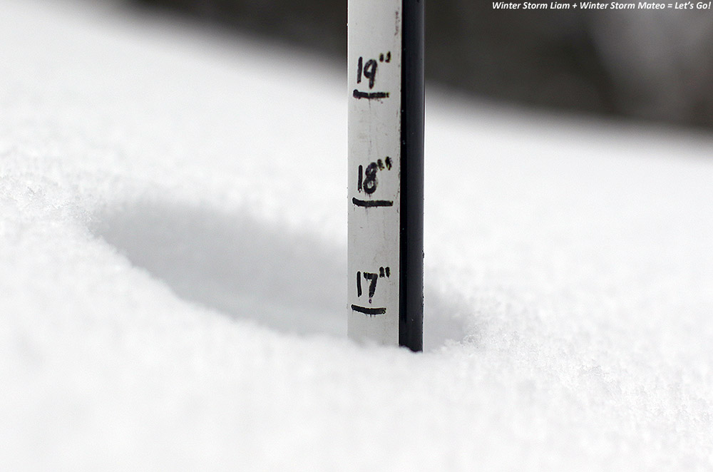
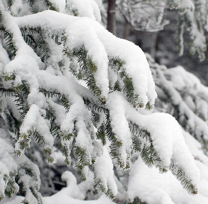
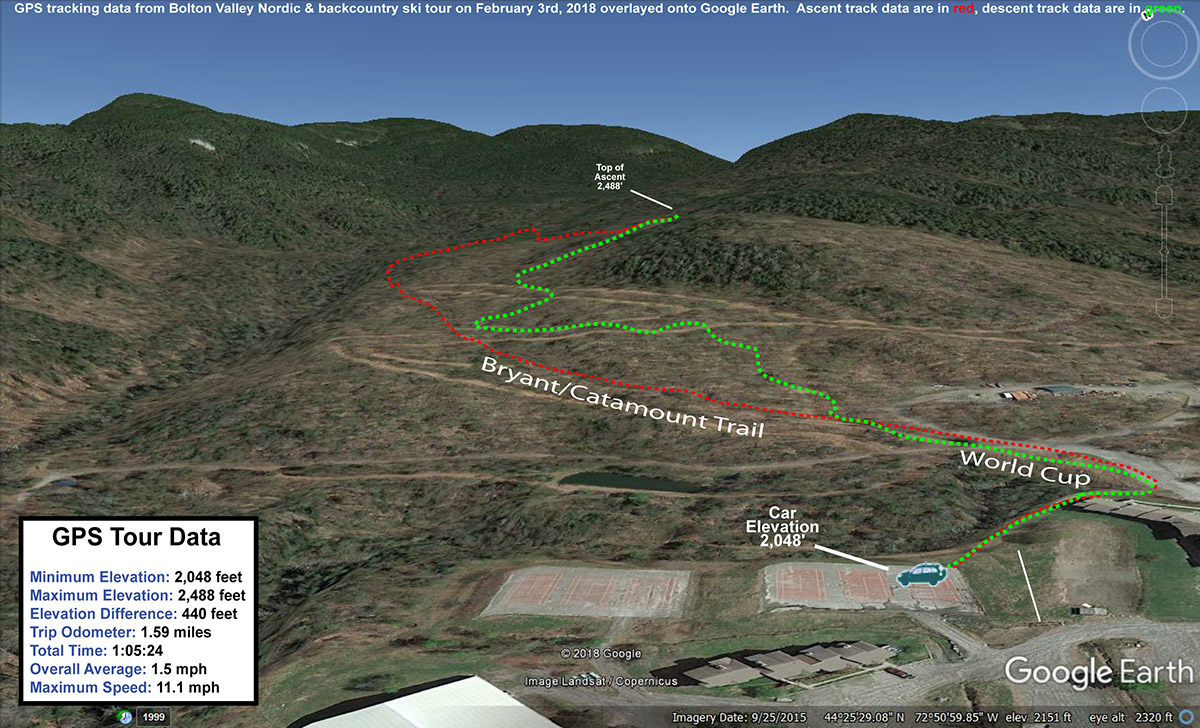
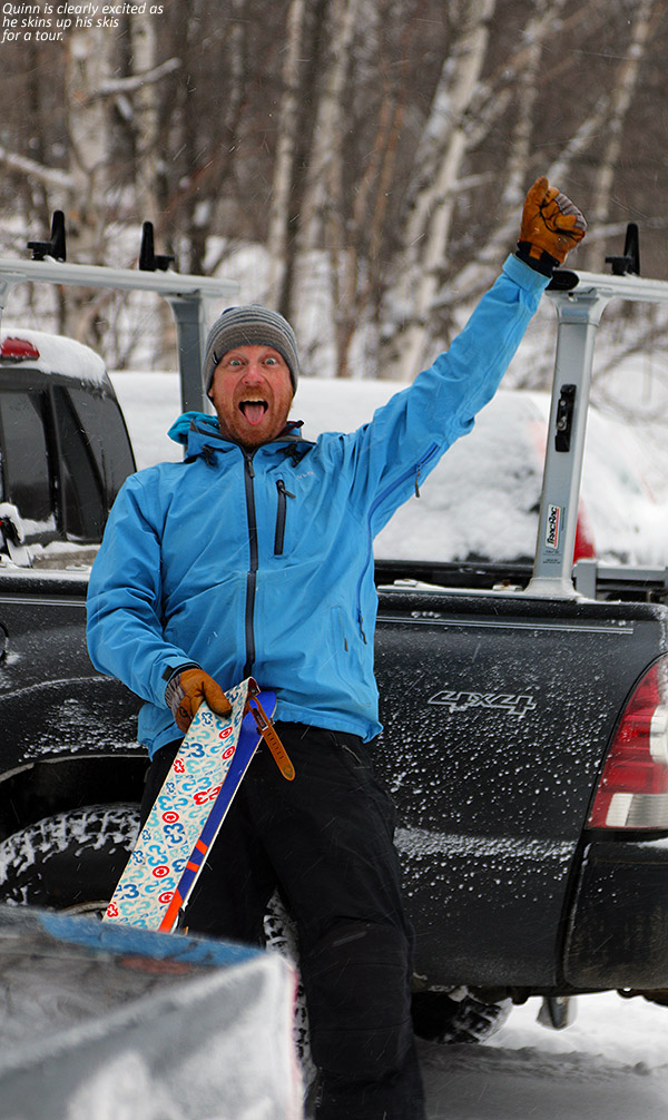
With the combination of Winter Storm Liam and Winter Storm Mateo over the past few days, Bolton Valley is reporting 16 inches of new snow and the ski conditions are taking off.  E and Dylan were off to Lake Elmore to do a polar plunge today, but Ty and I headed up to the mountain to make use of all the new powder.

“Off piste there has been a nice shot of snow (probably 16 to 18 settled inches above 2,000’) from that combination of Winter Storm Liam and Winter Storm Mateo, so there’s plenty of powder out there.”

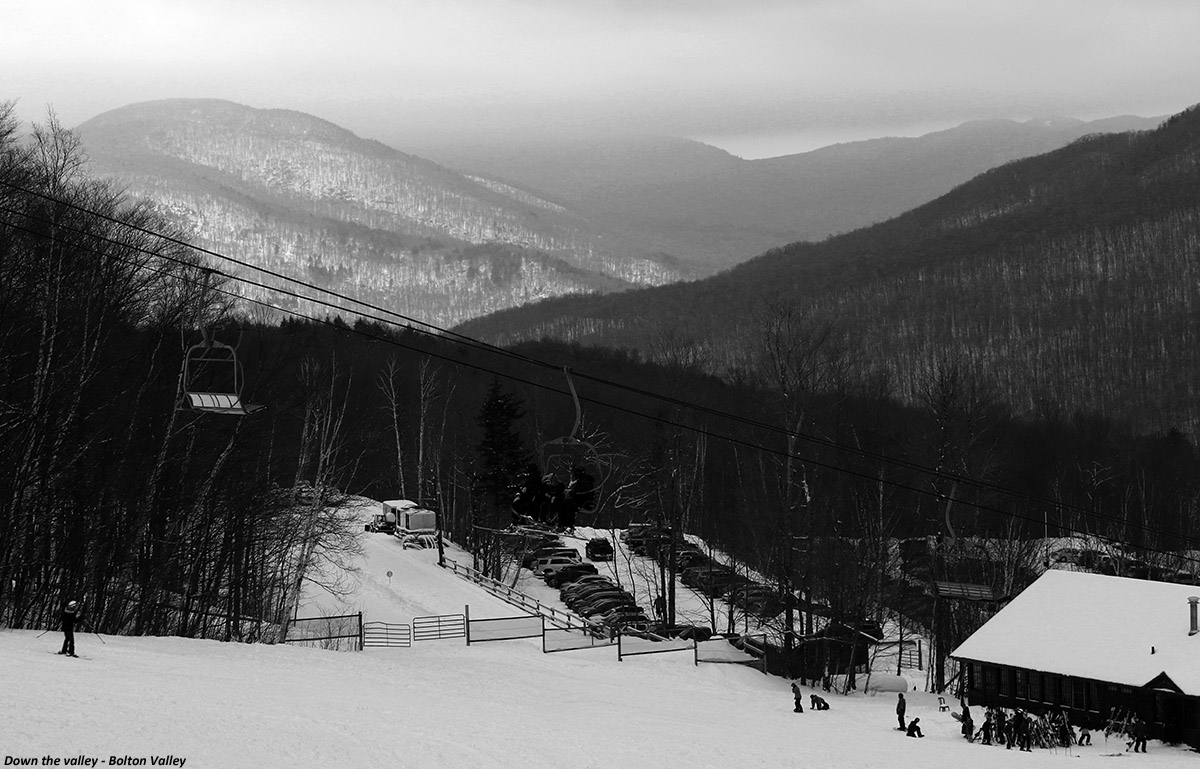
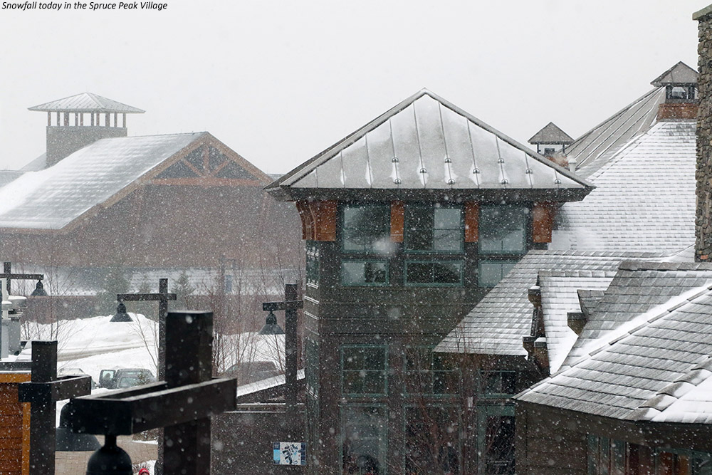
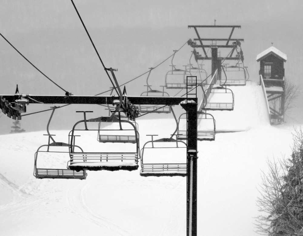
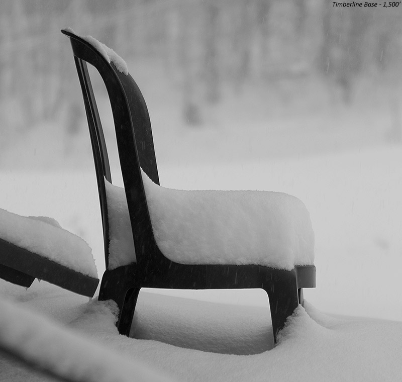
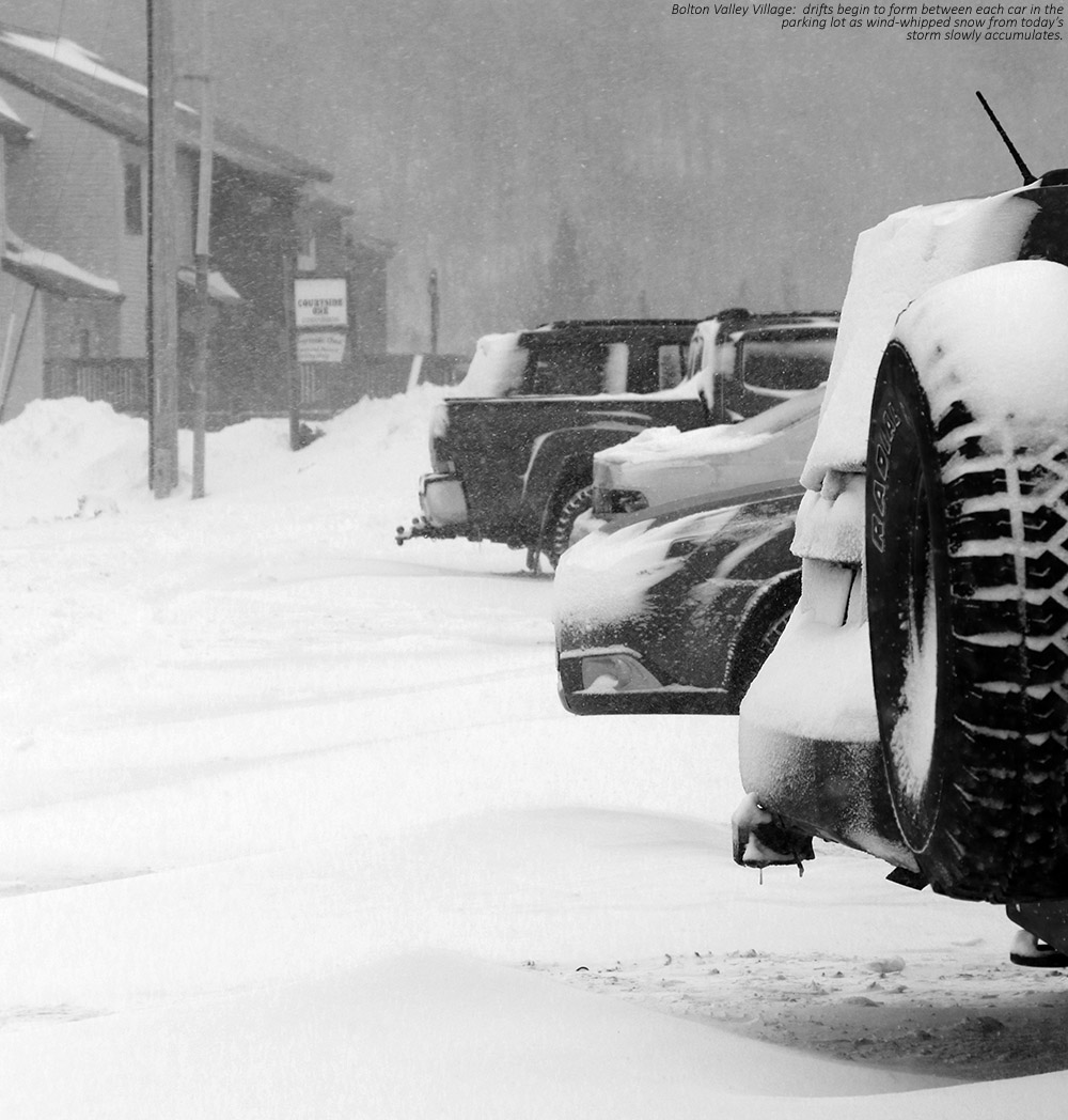
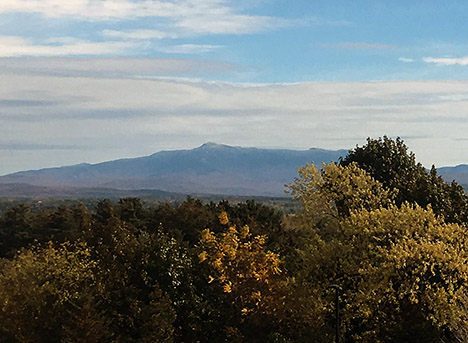
We had snow falling at the house in the morning, and were surprised to see what looked like some brief sleet or rain as we passed through ~1,000’ elevation band on the Bolton Valley Access Road, but as we got to the switchbacks below 1,500’ near the Timberline Base we were hit with a wall of steady light snow.  We arrived at Timberline in the 9:30 A.M. to 10:00 A.M. range when the Timberline Quad was just opening, and had light snow falling with a cloud ceiling around 2,200’.

An image of the depth of the powder after Winter Storm Liam and Winter Storm Mateo at Bolton Valley Ski Resort in Vermont
Winter Storm Liam + Winter Storm Mateo = Let’s Go!

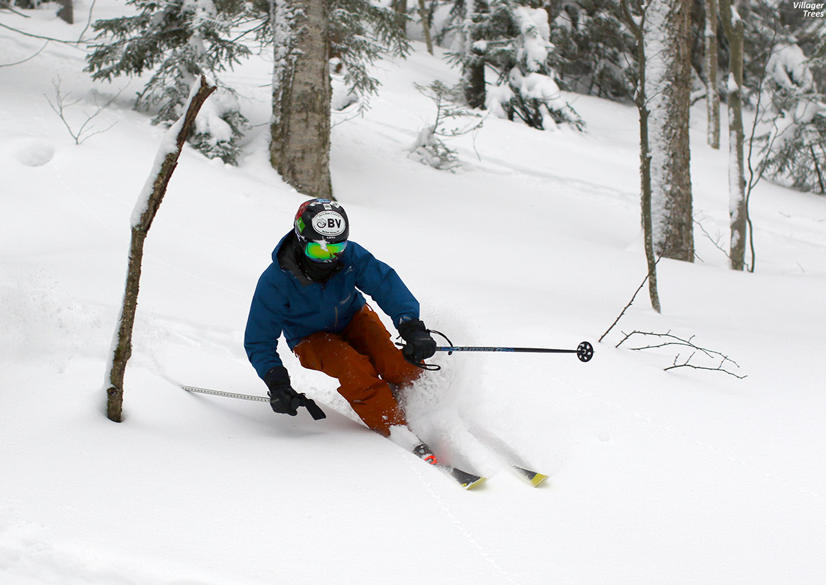
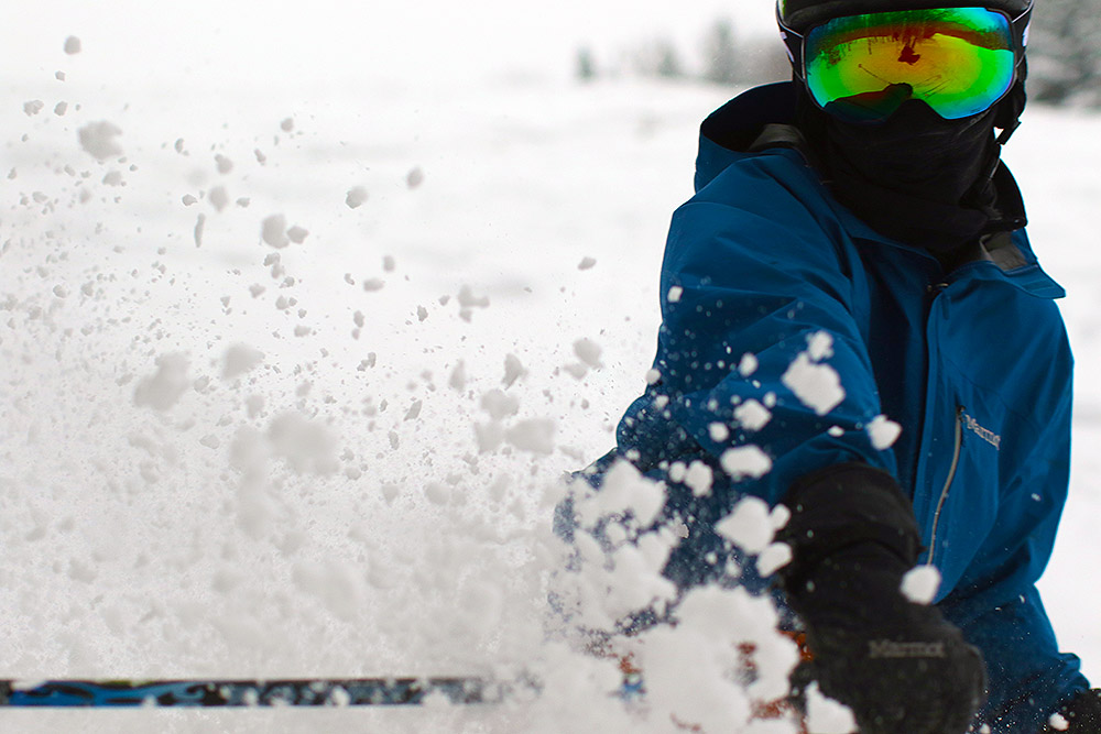
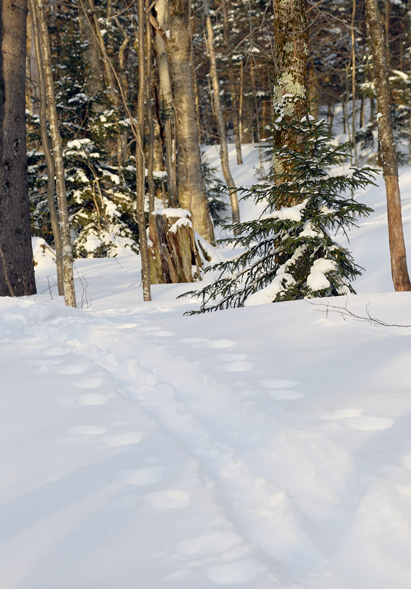
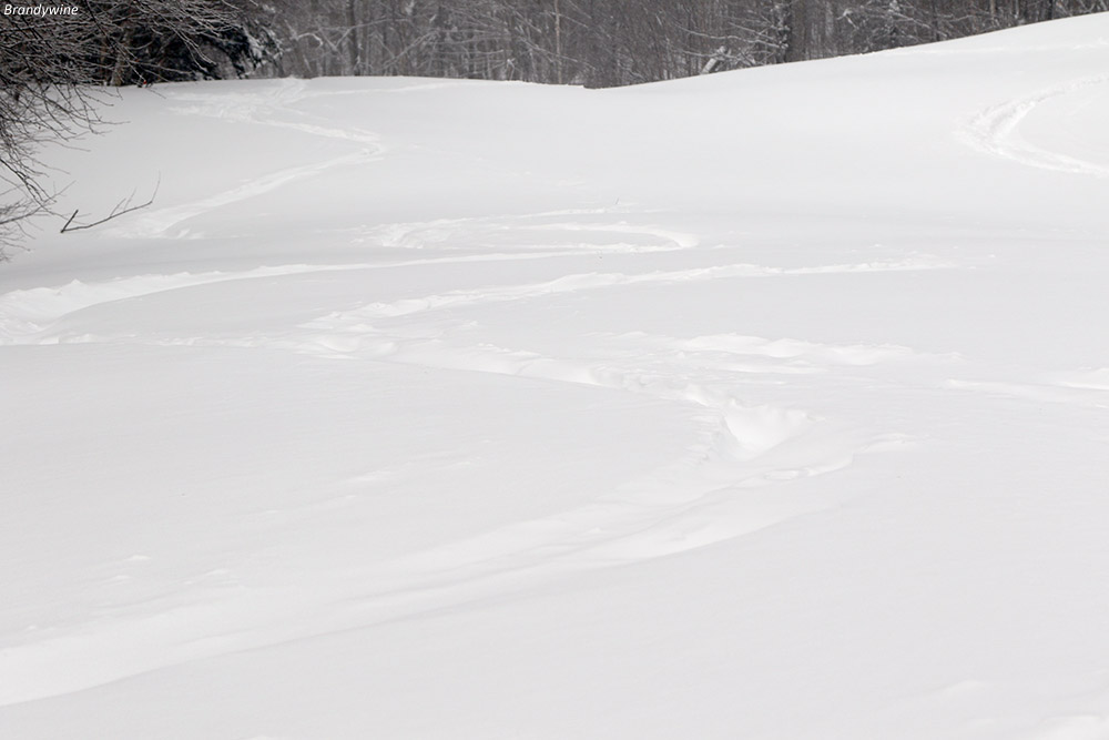
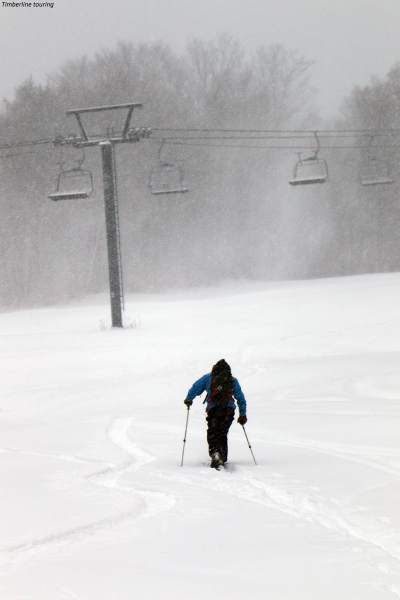
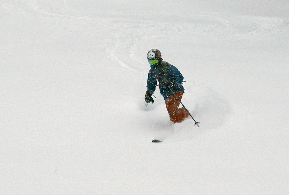
We kicked things off with a quick run through Wood’s Hole and the Corner Pocket Glades.  The powder was good, although you could feel that the freezing level had rise to just about the Timberline base elevations.  We found that total snowpack and coverage is OK below 2,000’, but those elevations could use one more solid storm to cover up some obstacles that still remain.

An image of Ty skiing the Glades trail at Bolton Valley Ski Resort in Vermont
Ty dropping into some great snow on Bolton Valley’s Glades trail

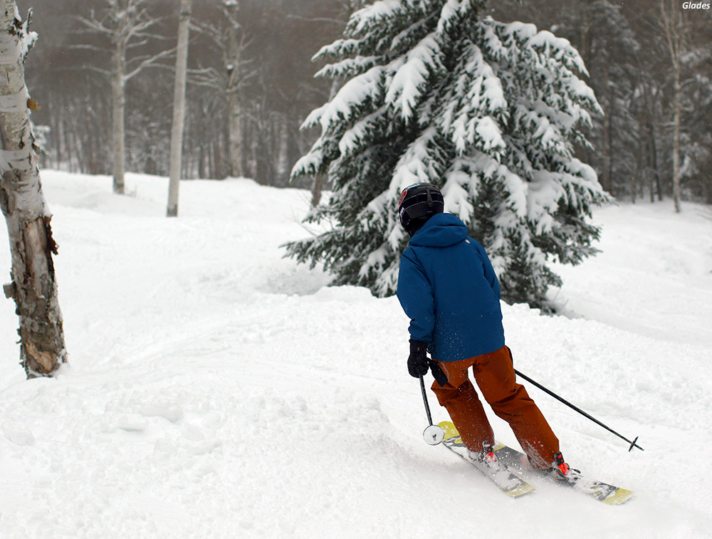
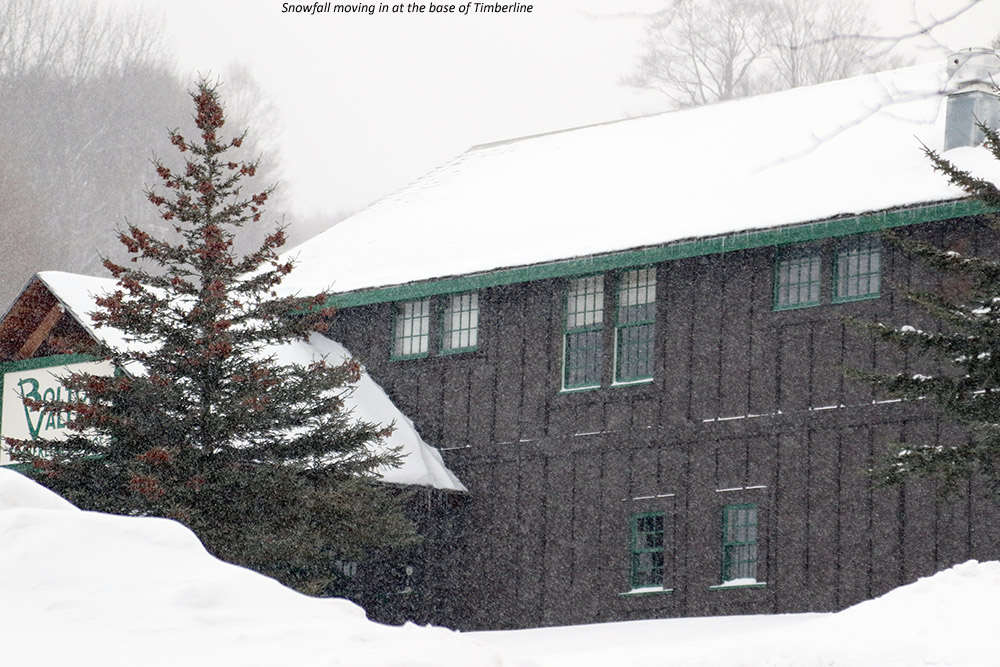
We spent time over at the main mountain after that, with a couple of great runs connecting from Hard Luck to Show Off, which hadn’t seen much traffic and had excellent snow.  The main mountain was well above the freezing level and base depths are plentiful up there.  We had a quick break with some slices at Fireside Flatbread, and then we finished off at the main mountain with a trip through the Villager Trees before heading back to Timberline.  Eventually we took a lunch break at the Timberline Lodge before we finished off the day skiing over there, and it was definitely disappointing to see that South of Solitude isn’t running in the lodge – we were really amped to have some burritos!

An image of fresh snow on evergreen branches at Bolton Valley Ski Resort in Vermont
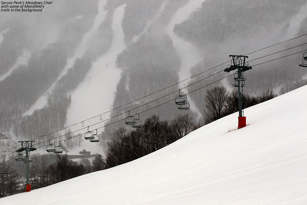
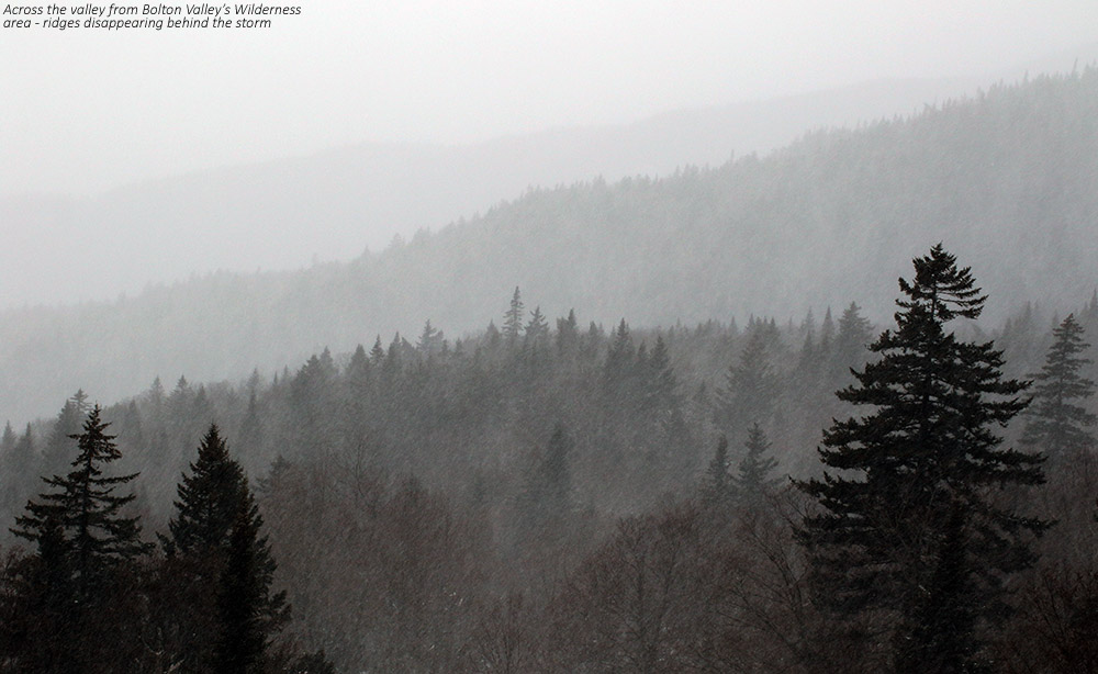
There was light snowfall when we first arrived, and it ramped up to moderate intensity at times, but the flakes were fairly small early on.  We had a period of heavier snow with big flakes near midday, but snowfall was typically on and off through the day.  The freezing line was climbing during the day, and at least based on the temperature’s effect on snow surface consistency, I’d say it was around 1,700’ around midday, and 2,000’ by the time we were leaving near 3:00 P.M.

Overall the skiing is excellent right now as one would expect, but I’d say the biggest improvements have been on piste.  The groomed terrain is skiing very nicely.  Off piste there has been a nice shot of snow (probably 16 to 18 settled inches above 2,000’) from that combination of Winter Storm Liam and Winter Storm Mateo, so there’s plenty of powder out there.  There really wasn’t a lot of champagne to top it off with this last storm, so I can’t put it up there with those primo dumps where you get that amazing density gradient of powder, but the powder skiing was still great.

An image of Ty spraying powder while skiing at Bolton Valley Resort in Vermont
Pow!

It’s nice to have some more typical Northern Greens conditions back in the house.  We’ve got some big flakes falling here at our place this evening, so hopefully we’ll get a nice addition for more fun on the slopes tomorrow!

Stowe, VT 04FEB2018

An image of Molly waiting on the trail on her snowboard at Stowe Mountain Resort in Vermont
An image of Dylan making a Telemark turn at Stowe Mountain Ski Resort in Vermont
Dylan out for some Telemark turns and bit of new snow today at our BJAMS ski program

Snow from our incoming winter storm began in the area this morning, and maintained a steady light intensity through our arrival at Stowe a bit before noontime.  After the family had some lunch at the Great Room Grill, everyone gathered up for the afternoon’s sessions.  With the past couple of week’s program sessions having rather stale snow, there was a bit of a buzz in the air with the incoming storm, even if new snow accumulations were still on the minimal side at that point.

An image of snow falling in the Spruce Peak Village at Stowe Mountain Resort in Vermont
A view of the snowfall today in the Spruce Peak Village

Molly was continuing with her snowboarding, so Ty snowboarded as well, while Dylan and I went with Telemark skis.  E feels that Molly is progressing really well with her turns, and just needs time on snow, so that’s exactly what we gave her.  We did several runs off the Meadows Chair, which provided Molly with great terrain for her boarding, and it was an excellent area for Dylan’s Telemark practice as well.  I drilled him using a technique that he actually invented, which involves skiing all turns in both directions in the same Telemark stance.  In this case I made him work on his weaker stance, which is left foot in the back.

An image of the Meadows Chairlift and some of the trails on Mt. Mansfield in the background at Stowe Mountain Resort in Vermont
Enjoying the view of the Meadows Chair and some Mansfield trails in the background

We had a good hot chocolate break back in the Great Room Grill before finishing off with a couple of bigger runs off of Sunny Spruce.  The snow continued to fall lightly, but ended up adding a couple inches to freshen up surfaces before we left.  We only took the occasional quick jaunt into the off piste, but it skied quite nicely with about 6 inches of powder, even down near the base elevations.  The snow’s been chugging right along this evening at a slightly invigorated pace, so tomorrow should be another excellent day for turns.

Bolton Valley Nordic & Backcountry, VT 03FEB2018

An image of a Coyote trail sigh no the Bolton Valley Backcountry Network at Bolton Valley Ski Resort in Vermont
An image of a Coyote trail sign on the backcountry skiing network at Bolton Valley Ski Resort in Vermont
Following a skin track out in the Bolton Valley backcountry today – the recent snow really started getting the backcountry conditions back on track.

As the forecasts suggested, we’ve moved back in a bit of a snowier weather regime after the past couple weeks of midwinter doldrums.  A system on Thursday ushered in some welcomed snow, with 4.4 inches down here at the house, and 6 to 8 inches at most of the resorts in the northern 2/3 of Vermont.

Today started out quite cold, with temperatures down near 0 F, but it was expected to get warmer throughout the day.  I waited until midafternoon, then headed up to Bolton Valley for a tour to check out how the new snow had settled in.  Temperatures were in the mid to upper teens F when I arrived, and checking the settled depth of the powder at the 2,100’ elevation level, I found it was 4 to 5 inches deep.

An image of an Old Goats trail marker on the backcountry network at Bolton Valley Ski Resort in Vermont
Old Goats: The Bolton Valley Backcountry Network is probably the only place you’re ever going to see a trail marker like this.

Instead of going all way up to Bryant Cabin today, I decided to do a bit of an abbreviated tour.  I headed about halfway of the way up the Bryant Trail, then connected onto Coyote and made my way up to Gotham City.  I saw a nice skin track taking a novel route into the upper reaches of Gotham City, so I followed that for a few minutes and added on some additional vertical.  I topped out close to 2,500’, where the depth of the powder was roughly 6 inches.  The upper reaches of Gotham City that I skied were totally untracked and yielded some excellent turns, and I followed my run out through the usual assortment of glades available throughout the World Cup area.  The turns were excellent on low to moderate angle terrain, with only the occasional contact with the subsurface unless you got into steeper terrain or areas that had seen previous traffic.

A Google Earth map showing GPS tracking data for a ski tour on the backcountry ski network at Bolton Valley Resort in Vermont
GPS Tracking Data for today’s ski tour on the Bolton Valley Nordic & Backcountry Network overlayed onto Google Earth

Even that modest storm that we just picked up was all that was really needed to make a huge bump up in the ski conditions, but we’ve got another system on its way tomorrow that should help even more.  We’ll see how this next system plays out, but another several inches on top of what we just picked up will really get things back in midwinter form.

Bolton Valley Nordic & Backcountry, VT 30DEC2017

An image of snow-covered berries on a tree up by the Bryant Cabin near Bolton Valley Ski Resort in Vermont
An image of a glade in the Bolton Valley backcountry network at Bolton Valley Ski Resort in Vermont
Taking advantage of today’s slightly warmer temperatures to visit some of the glades in the Bolton Valley backcountry network

I last got out for a ski tour at Bolton Valley on Tuesday, with the plan of getting in some turns ahead of the very cold weather that was forecast for the rest of the holiday week.  Indeed the cold came into the area as expected, and while the low temperatures were far from anything that would set records, high temperatures that were staying below zero F and wind chills on top of that meant that it was going to be brutal out there.  Today marked a bit of a respite from those temperatures though, with highs expected to be well up into the single digits F, no winds, and sunshine.  I figured that today was my window to get back out for a ski tour before temperatures dip back down in the coming days.

An image of some plants poking through the snow along the Broadway trail at Bolton Valley Ski Resort in VermontThe warmest part of the day was expected to be in the afternoon, with a southerly flow of air thanks to the remnants of Winter Storm Frankie passing through the area.  I went with two base layers (lights under heavies) just to ensure that I’d be comfortable, and headed up to the mountain around 2:30 P.M.  There was still some dim, arctic-looking sun pushing through the clouds off to the south as I arrived at the Village and parked right along the edge of Broadway.  Temperatures were in the in the 5 to 10 F range, and with no wind it was actually quite comfortable – within a few minutes of starting my ascent of Bryant I was skinning without a hat in order to cool off.

“Learning from my Tuesday tour, I brought fatter skis and dropped the pitch of my selected slopes just a bit, and that yielded some excellent powder turns.”

It was my first day out on the backcountry network this season, so I stuck with a simple trip up to Bryant Cabin with one of my favorite touring routes:  Car –> Broadway –> Bryant –> Bryant Cabin –> Gardiner’s Lane –> North Slope –> Connector Glade –> Gardiner’s Lane –> Grizzwald –> Gotham City –> Girl’s –> World Cup –> World Cup Glade –> Telemark Glade –> Broadway –> Bolton Valley Village –> Fireside Flatbread –> Car.  It seems like quite the tour, although it’s only about 2.5 miles.  That last stop before the car is pretty important though, especially on a cold December afternoon when the sun’s gone down.

A map with a GPS tracking data plotted onto Google Earth for a ski tour on the Nordic and Backcountry network at Bolton Valley Resort on December 30th, 2017
The GPS track of today’s Bolton Valley Nordic & Backcountry tour mapped onto Google Earth

We’ve had perhaps an inch or two of snow since my last outing on Tuesday, and at Village elevations I was finding about 5 inches of powder atop a thick layer.  That surface snow depth definitely increased a bit with elevation, and if you punched through the thick layer in the snowpack you’d be looking at 18 to 24 inches of snow before getting to whatever base snow was below that.  Learning from my Tuesday tour, I brought fatter skis and dropped the pitch of my selected slopes just a bit, and that yielded some excellent powder turns.  Some of the best sections were Girl’s and Telemark Glade, where the terrain and snow really flowed well.

Bolton Valley, VT 26DEC2017

an image of the Timberline Lift at Bolton Valley Ski Resort in Vermont
An image of ski tracks in powder snow on the Brandywine trail at Bolton Valley Ski Resort in Vermont
Preparing for some turns on Brandywine during my ski tour at Bolton Valley’s Timberline area today

The middle of Winter Storm Dylan at the end of last week had some mixed precipitation that put a thick layer into the snowpack, but since then we’ve had the backside snow from that storm, the snow from Winter Storm Ethan, and some additional snow from a localized streamer that was affecting the area yesterday.  It was certainly enough new powder to entice me out to the mountain for a quick tour today, especially with some very cold air coming into the area later this week.

I arrived at Timberline in the mid-afternoon period, just as a some snow was moving into the valley.  The snow was steady during my whole tour, although visibility was generally in the 1 to 2-mile range, so it wasn’t especially heavy.  In terms of the powder, I found roughly 4 to 6 inches at the 1,500’ level, and probably 5 to 7 inches at the 2,500’ level.

An image of the Timberline Lodge with some snowfall at Bolton Valley Ski Resort in Vermont
Snowfall at the Timberline Lodge today

Although I did ascend all the way to the Timberline Summit, my main goal was a trip down Brandywine, which had some great snow and just a couple of previous ski tracks.  The powder was deep enough for plenty of good turns on Brandywine, although I think it would have been better with some wider skis vs. just my midfats.  I also think some slightly lower angle would be good to really stay away from that crust.

At the end of my tour I spoke with one of the crew that was working on grooming Timberline Run, and it sounds like they’re planning to open the Timberline area tomorrow for lift-served skiing.

Bolton Valley, VT 22DEC2017

An image of snow from Winter Storm Dylan collecting on a chair by the Timberline Base Lodge at Bolton Valley Ski Resort in Vermont
An image of Quinn skinning up in the Timberline area at Bolton Valley Ski Resort in Vermont
Quinn heads up on his ascent of Timberline this afternoon to enjoy the fresh snow from Winter Storm Dylan.

We’re currently under the influence of Winter Storm Dylan, which started dropping snow on the area early this morning.  The snow started out slowly for the first couple of hours, but by 10:00 A.M. or so it had ramped up to very heavy intensity – at one point it was coming down at a rate of roughly 4 inches per hour.  It continued at a steady pace, and by midafternoon we’d already picked up 6 to 8 inches of snow at the house.  By that point it was obvious that there was going to be enough fresh snow for a ski tour, so I headed up to Bolton Valley while I still had light.

I pulled into the Timberline lot amidst heavy snow, and chatted with another gentleman who was just skinning up his skis for an ascent.  Within a couple of minutes, Quinn appeared out of his truck, and we sort of laughed amongst ourselves how everyone sort of had the same idea.  Well, great minds think alike, and know to get to the powder while the getting’s good.

An image of Quinn preparing his skis with climbing skins for a ski tour during Winter Storm Dylan at Bolton Valley Ski Resort in Vermont
There’s definitely some excitement out there for what Winter Storm Dylan was delivering today!

As I began my tour, my checks near the Timberline Base Lodge revealed that roughly 8 inches of new snow had fallen.  That number was growing by the minute though, and the snowfall during my ascent was quite heavy.  At times, visibility was down to a tenth of a mile, which equates to very heavy snowfall.  Up at the Timberline Mid Station I was finding anywhere from 8 to 12 inches of new snow.

“Up at the Timberline Mid Station I was finding anywhere from 8 to 12 inches of new snow.”

There were few if any tracks on Twice as Nice, so I decided to make use of its fairly consistent pitch and make my descent there.  I was on my 115 mm Black Diamond AMPerages, even with accumulations only topping out around a foot, the snow was mostly bottomless.  My legs got cooked pretty quickly from making Tele turns, but it gave me time to stop and soak in the scene with the storm, the snowfall, and the solitude.  It was a great outing, and there’s nothing like getting some of these productive winter storms during the holiday period when one’s schedule is a bit more relaxed.

Winter Storm Dylan is supposed to continue through tomorrow, but we’re going to have to watch out for some mixed precipitation and see how that plays out before everything changes back to snow.

Bolton Valley, VT 12DEC2017

An image of ridgelines in the Bolton Valley Reosrt area in Vermont disappearing behind snow from a December storm
An image of Ty skiing powder during a December storm at Bolton Valley Resort in Vermont
Ty catching a few Telemark turns on today’s ski tour at Bolton Valley

Due to the winter storm coming through the area today, school was cancelled for Ty, and since I had contemplated working from home due to the weather, Ty being home for the day sealed the deal.  The storm had only started up in the morning, so it would take some time before there was much new snow down for skiing.  So, I got a bunch of work done, and finally in the midafternoon, we headed up to Bolton Valley for a quick ski tour in the new snow.

“We toured in the Wilderness area from 2,100’ up to around 2,800’, and we measured depths of the new snow in the 6” to 9” range, with some spots approaching 10” near the top of our ascent.”

On the way up to the Village, we noted the state of the snow at the Timberline Base (1,500’) and one could certainly have made some turns there if they wanted to, but some of the taller brush was still showing so I’d say it wasn’t quite ready for prime time at that point.  We toured in the Wilderness area from 2,100’ up to around 2,800’, and we measured depths of the new snow in the 6” to 9” range, with some spots approaching 10” near the top of our ascent.  I’d say the accumulations up there at that point weren’t all that different than what we had down at the house, although the flakes were pretty small, and the powder a reasonable middle-weight variety, so I’d say they’d picked up more liquid equivalent.

An image of snow drifts forming in the Bolton Valley Village
Drifts beginning to form in the Village

In terms of the powder skiing, although it certainly wasn’t champagne dry snow, the moderate heft to it was decent for keeping you up off the base.  At this stage of the season we can of course use some snow with plenty of liquid in it to build the snowpack, and if what’s up there gets topped with fluff form the back side of the storm, it should produce some excellent powder skiing.

“There’s something special about these deep dark December storm days though, the low light just gives them a unique feel that it’s hard to replicate at other times of the year.”

We’re into some of the shortest days of the year now, so light it as a premium, especially during a snowstorm.  I brought my brightest lens, the Canon EF 50mm f/1.2L USM, and it was definitely sufficient, but there was still a lot of snow in the air making action shots a challenge.  There’s something special about these deep dark December storm days though, the low light just gives them a unique feel that it’s hard to replicate at other times of the year.

One last bout of snow for October

A radar image showing snow falling in the Adirondacks and in the Green Mountains of Vermont on Halloween
Radar image on Halloween night snowing snow in the Adirondacks and along the spine of the Green Mountains that prompted me to check on the type of precipitation we were receiving at the house.

After our big autumn storm that brought substantial wind and power outages to Vermont (including our house), cold air came into the area today and brought one last snowfall for the month on Halloween.  Powderfreak is out of town, but his colleagues at Stowe kept him apprised of what was going on at the mountain with pictures of the fresh snow.

As is typical for this type of weather setup with a flow from the Great Lakes, the areas around the mountains often get the most vigorous precipitation, which can lower snow levels down to the valleys.  I wasn’t home during the day to see if anything frozen fell at our house, but I wouldn’t be surprised if we got something.

There was additional precipitation while we were out in town for Trick-or Treating with the boys, with fairly heavy rain at times, and when we got home I saw that the moisture was still pushing into the mountains.  With the temperatures dropping into the 30s F I went out to check the precipitation during one of the heavier bursts, and sure enough, there were some partially frozen aggregates coming down, which confirms a trace of snow for today’s records. 

It’s interesting to note that if we hadn’t picked up any frozen today that would have been the first time in the 12 years we’ve been at this location that we didn’t get any frozen precipitation in October.  So that streak continues for now, but it’s still 12 days later than the mean, and of course it’s the latest “first frozen precipitation” we’ve seen here.  I guess with as warm as this October was, it’s nice to even get anything frozen, and at least the snowfall season is officially underway here.

Now it’s on to November, with more substantial chances for snow growing by the day.

Next October snow as we approach Halloween

An image of Mt. Mansfield in Vermont with some October snow as viewed from the University of Vermont in Burlington
Mt. Mansfield and its latest coating of snow seen from Burlington

We’ve had plenty of pleasantly benign weather days this month, but yesterday was one of those raw October days that really speak to the seasonal progression.  Temperatures in the valleys even stayed well down in the 40s F, and a storm passing through the area brought bouts of heavy rain that made walking around outside a rather rough experience.  I wasn’t sure if this storm was actually cold enough to bring in some snow to the area, but sure enough, Powderfreak was already posting snowy images from Mansfield this morning and letting us know that the snow level was down to 3,000 feet.  Once the clouds began to break away from the mountains in the afternoon I was able to snap an image from my office of the new white near the peak of Mansfield behind some of the colorful foliage still hanging on in the Champlain Valley.  We’ve got a potent storm coming into the area Sunday that is expected to bring a lot of wind and rain, and next week there’s the chance for a bit more snow in the area as we get some cooler temperature and a flow that could bring moisture over from the Great Lakes.

First October snow for the Green Mountains of Vermont

An image of Mt. Mansfield in Vermont with a bit of October snow atop the Chin
Today you can still see a bit of snow atop Mt. Mansfield above 3,500′ or so.

It hasn’t been an especially cool fall thus far in Vermont, and in fact we had some rather warm days with temperatures up to 90 degrees F for the Champlain Valley last month.  It’s hard to think of potential snow with temperatures like that!  Due to the heat, we actually delayed our September apple picking trip to Boyer’s Orchard with the Bennetts and the Burseys for one week to wait for a more autumnal feel.  The temperatures and generally fair weather have certainly made for some fantastic outdoor activities, but the warmth may have altered the timeline for the development of the fall foliage color.  In any event, by the beginning of last week I could already see that we were past peak color in the Winooski Valley.  Bare trees were numerous throughout the hillsides, leaving at least small gaps in the colorful views.

It’s funny, but despite the warm weather in recent weeks, we actually had some September snowfall on Mt. Mansfield and other peaks in the region.  We don’t get September snow every year, so it’s quite interesting that things came together to put some white on the peaks so early during a warm period.

With the fall foliage around and especially with the colors now beginning to wind down, more snow usually isn’t far behind, and indeed today’s dramatic drop in temperatures from the 70s F we had just yesterday evening made it really feel like we were transitioning further into fall.  We never got out of the 40s F in the valleys, so there was definitely a bit of a bite out there with wind on top of those temperatures.  While heading to a class today here on the UVM campus, it absolutely felt like one of those days where it could easily be snowing along the spine.  And, lo and behold, when I later checked in on the Northern New England fall thread on the American Weather Forums, Powderfreak was already reporting accumulating snow down to 2,700’ on Mt. Mansfield.  He posted some additional pictures later, showing how the snow had a hard time accumulating on the warm ground in most areas and was typically found on the trees.  He did report snowfall down as low as 1,500’ in elevation though, probably via help from the orographics of the Green Mountain Spine.  The Bolton Valley Facebook page also posted an image of flakes getting down to the Village, and I’m sure many of the local mountains saw flakes as well.

I hear Killington also took advantage of the cooler temperatures to test the snow guns, so we’re certainly on our way.  The longer range forecasts suggest a possible stretch of colder weather near the end of the month into November, so we’ll see what potential that brings with regard to manmade or natural snow.