
For years I’ve driven along Route 242 to get to Jay Peak, often remarking about the intriguing ski terrain that dropped to the road from both sides. This was always on the way to ski the resort of course, and thoughts of exploring those backcountry goodies had to wait. Since Jay Peak had received 2 ½ feet of new snow in the past few days (much more than anyone else locally for us), and it was a holiday weekend, I decided it was time to explore the goods off Route 242. This realization came to me on Friday morning when I awoke, and I soon sent out a secret message to a local band of agents informing them of a Mission Impossible. This mission, which James, Erica, and Dave chose to accept, wasn’t really all that impossible, it was more just unknown. Mission Impossible sounded fun though.
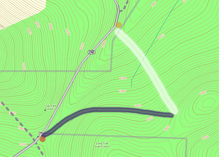
At the crest of Route 242 (elevation ~2,250′), The Long Trail crosses the road, and along with the trailhead there’s a parking area (see the red dot at the lower left corner of the topographic map provided with this report), so this appeared to be a good place to start a hike. My initial plan was to head south along The Long Trail (note on the map where the gray-dashed Long Trail heads south from the red dot) toward Domeys Dome (elevation 2,913’ – not visible on map) and ski down from there to Route 242 where we would have a second car waiting (elevation ~1,500′ – off the map to the south). This would provide a roughly 1,400′ vertical run, with a calculated pitch of around 23 degrees.
When we actually arrived to surveil the area though, we discovered that what looked good on paper didn’t look as enticing in real life. The parking at the bottom was quite far away, and the slope leveled out too quickly to a very low angle. In 10 degree temperatures and brisk winds, we gathered together in one of our cars at the top of Route 242 and consulted the maps for new guidance.
We decided to drive the car along Route 242 to the northeast (in the direction of the Jay Peak base area) as the road descended toward the resort, while we looked for potential ski lines. There were plenty of lines off to our right, as well as a second parking area for cars (yellow dot on the map) at the next low point of Route 242 (elevation ~1,950′). This setup seemed almost too perfect. I say “almost”, because unfortunately The Long Trail doesn’t go in that direction at all, and we assumed we’d have to blaze our own path through deep powder to get to where we wanted to go. We had seen what appeared to be a trail heading off in the direction we wanted, very wide (10 feet or so on average), but we were still unsure if it would work for us. As we got closer, we could see that someone already had a skin track heading that way; we’d found our hiking route.
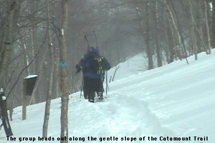
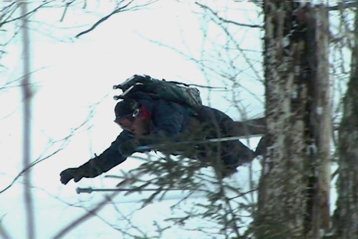
 From the top of Route 242, we got our gear together, threw on our snowshoes, and headed out along the trail (our ascent route is roughly marked by the thick blue line on the map). The image of the group heading out shows the general look of the terrain at the start of the trail. I soon noticed from the blazes that this was The Catamount Trail (the HUGE cross-country ski trail that travels the whole length of the state). The upward slope of the trail was very slight, but as we continued on our ascent, Route 242 quickly fell away to our left and we could watch the vertical drop for our potential ski run grow rapidly. At an elevation of around 2,400′, we broke uphill of The Catamount Trail (following the switchbacks of another skin track) to gain some additional vertical. It turned out that other folks had been in the area today, as shown by the skin tracks, ski tracks, and the people themselves. We continued to hike up to around the 2,600′ mark, and then as the slope started to mellow out, we decided to boot up and test out the terrain. A group of about five Telemark skiers passed by on their way up, one of them deciding to cash in at that point and start his descent as well.
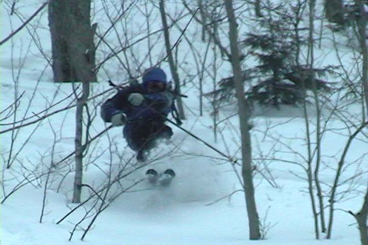
It’s amazing to think that last weekend had been a situation of rain, warm temperatures, and a refreeze that turned the entire snowpack into a solid, crusty mess. From where we were standing, it was basically bottomless powder, a situation in which removal of snowshoes or skis meant trouble standing. The pitch of our descent started off mellow, with various areas of hardwood glades and some underbrush at times. The snow was nice and light; I’d estimate its density at somewhere in the 5-7% H2O range. The slope gradually got steeper as we picked lines along the way that looked good and headed in the general direction of our lower shuttle vehicle. Our general descent route is marked by the thick white line on the map. Even with the deep snow, some areas had enough underbrush that they made picking lines difficult. Some areas we quite clear, but a bit of scouting was needed to find them. James picked direction with his usual finesse, and guided us right down to the parking area and our waiting vehicle (Dave’s pickup truck).
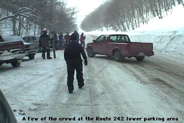
Our total vertical skied was approximately 700 feet, which was a nice run for only about 400 vertical feet of very easy hiking. At the parking area it felt like the local version of Grand Central Station for backcountry skiing. There were numerous cars, lots of people hanging out, and skiers pouring down off of both sides of the road enjoying the powder. James said it felt like a local backcountry Mecca (in reference to the number of people). Although a few of the people were from our side of the road, most came down from the Jay Peak side, riding the lifts and then catching a beautiful long run all the way down to Route 242. Some people had cars waiting for them, some hitched rides, and some looked like they had no idea where they were. It was an awesome scene to see though, with all those folks out there enjoying the snow. I’m thankful we weren’t skiing the other side of the road though (the Jay Peak side), as the number of skiers on those slopes had even that vast amount of terrain tracked up quite well. I had always thought of heading that way when skiing Jay Peak, and had no idea how many people did it. There was a continuous flux of people coming through that area all day long, with cars pulling in, parking, leaving, people looking for rides, giving rides, looking for people that they had lost, etc. etc. etc.
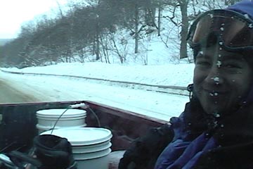
Using our vehicles, we shuttled our crew up to the top of the pass, and started for another run from the upper parking area. Unlike the lower parking area, there were only a few cars there, and no people. The wind was blowing and the temperature had stayed around 10 degrees the whole day, but the sun had come out for a while during our first trek, and it had made that a great hike. We had a snack in the car, and headed off along The Catamount Trail for round two. Our first run had tuned us into the lay of the land its terrain nuances even better, and now James had plans for some even sweeter lines. We hiked the same general route (much easier at this point with the presences of our tracks and those of numerous others who had been up). We cut upward off The Catamount Trail a bit earlier, and topped off near the same elevation as before. This time we found some lines that were even more open, although we did still had to pass through some brushy sections.
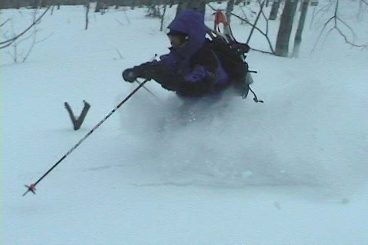
I’m not sure how good the ski touring in this area would be with low snowpack, since even with four feet of base, there was still brush in some areas, but it was certainly good skiing with our usual midwinter base depths. Some of the most fun we had was due to spectacular falls, with all four of us getting in on the act by diving into the powder. We shot about 30 minutes of video, hopefully enough to have a segment in this year’s ski movie. We’ll have to see, but either way, we got some of our best falls for this season’s crash reel! 🙂


