Bolton Valley, VT 23DEC2012

An image of ski tracks in powder on the Spell Binder trail at Bolton Valley Ski Resort in Vermont
Tracks on Spell Binder – sometimes you can tell the quality of the snow just by the ski tracks.

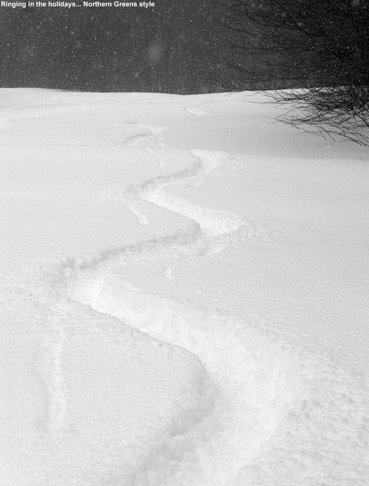
The upslope snow that started yesterday really delivered in the evening, and we got to witness it first hand as we drove off to a Christmas party in the Champlain Valley.  We almost turned around right at the house as the snow was coming down at 2 inches an hour or more, and we could only see a few yards in front of the car.  Fortunately that tapered off a couple miles to our west, but in the end we wound up with 9.5 inches of upslope fluff at the house, and Bolton Valley probably had over a foot, bringing them to 30 inches of snow in the past week.  This snow was some incredibly high quality Champlain Powder™ to boot, with my snow density analyses coming in at 2 to 3% H2O.

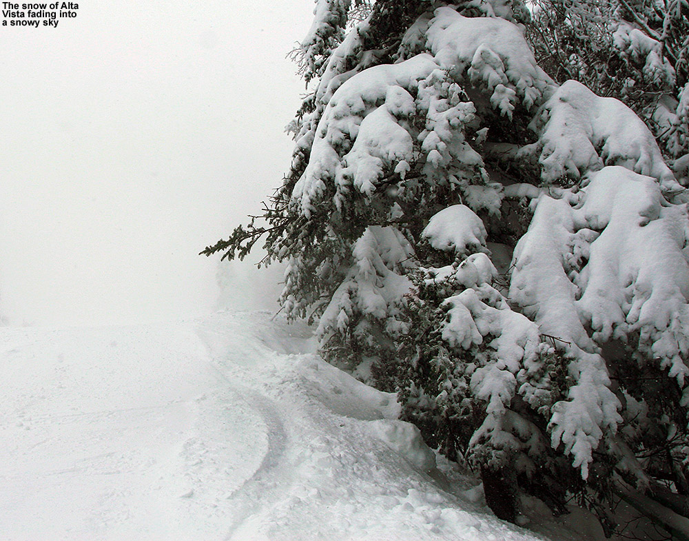
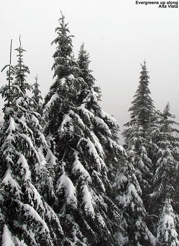
This morning we got up to the resort around 9:00 A.M., and similar to yesterday the scene was fairly mellow – after dropping off E and the boys I was able to park in the third tier of the main lot.  We started off with a run down Alta Vista, and it was E’s first chance to try out her Black Diamond Element skis, which are the women’s version of the AMPerage.  I warned her that unlike my first experience with the AMPerages, which was entirely under powder conditions, she might not be that impressed with how they skied on the groomed areas before we made our way to the powder.  Indeed she was very unimpressed, noting that there was so much ski width (115 mm at the waist) that she couldn’t even get them on edge.  I hadn’t found that to be an issue for me with the AMPerages, so it could certainly be attributed to a difference in our ski styles, but I think it questions again the potential for these skis to serve as a one ski quiver for all surfaces.  We got them as our backcountry/powder Telemark skis anyway, but it will be interesting to see how our usage patterns develop; being more comfortable on them so far, I might take them out on more marginal lift-served powder days, where E might stick with her narrower Telemark skis.  E did point out that her Telemark ski boots are a bit loose, and she could feel the slip in them today due to the thinner socks she was wearing.  Having that slip in there may make it challenging to get the pressure necessary to roll these fat skis on edge on groomed surfaces, so we’ll have to see if a better boot fit helps out, or if there’s going to be an adjustment period due to something else.

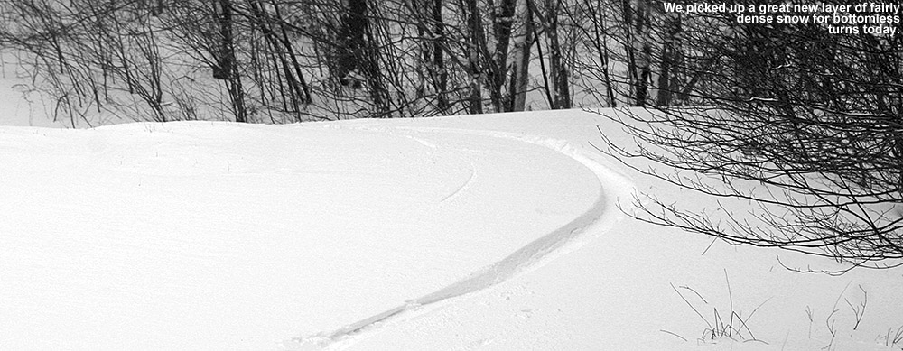
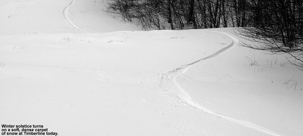
“We found a foot plus of
Champlain Powder™ over a
consolidated base – and it
was more than enough to
be bottomless…”

We made our way over to Wilderness and got into some powder, and not surprisingly, E didn’t have any issues with the skis there.  But, neither did she find them to be as amazing in the powder as I had on my previous outings.  Of course we were skiing in roughly a foot of amazingly dry snow over a well consolidated base, so almost any ski could handle it.  We enjoyed lots of fresh turns on Lower Turnpike, and it was a bit slow with the modest pitch and all the powder, but the boys had a great time.  Ty had an especially fun time straight lining sections of the powder.  We also jumped into Wilderness Woods, which were being skied extensively – they’re certainly skiable, although you still needed to be somewhat cautious to avoid underlying objects.  On that note, the Mt. Mansfield Stake hit 28” inches yesterday, passing the magic 24” mark that I’ve used as a measure of when those initial forays into the trees begin.  Bolton even opened steep tree areas like Devil’s Playground today, so many trees are definitely ready for skiing if patrol deems areas like that acceptable.

We headed for the same route again on the next run at Ty’s request, but wound up taking the Wilderness Lift Line when Dylan led us that way.  Conditions along the edges still offered up plenty of nice turns though.  The boys were calling for an early lunch after those two runs, so we headed into the lodge, and eventually got a call from Stephen that he and the kids had finally made it to the mountain.  We finished up our lunch and met up with Helena and Johannes to take a run while Stephen picked up his skis from the ski shop.  We opted for the standard Sherman’s Pass route to let Helena and Johannes warm up.  Surfaces were decent packed powder aside from wind-exposed areas, which were blasted down to whatever nasty hard surface lay below.

When we all got back together we hit Lower Turnpike again, and it felt much faster that second time.  There were a few more tracks around to let you gain your speed, but somehow it was more than that.  Whatever the case, the turns were smooth and silky in the powder.  Johannes and Helena needed their lunch break by that point, so while they went in the lodge, E and the boys and I went back for another round.  Dylan and I came in at a higher entrance and got some bonus fresh turns.

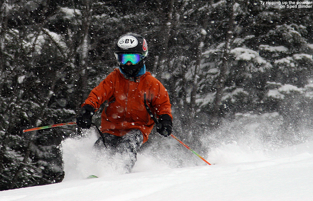
We had spotted a car over at Timberline on our way up to the resort, with the intent of finishing off the day there, but Dylan was pretty beat, so E decided that they would drive down and meet Ty and me there.  Johannes had enough energy, so he joined Ty and me for the trip.  Aside from windblown areas, which were reduced thanks to the lower elevation, the snow was simply amazing at Timberline as is typical for these types of events.  We found a foot plus of Champlain Powder™ over a consolidated base – and it was more than enough to be bottomless, even on the Spell Binder headwall as long as you stuck to the skier’s right.  That’s some pretty primo skiing.  The only part to avoid was the bulk of the headwall section with sastrugi (or “fake powder” as it often looked today) from the winds.  Both boys did well, and we made reasonable time down to the car, with the requisite photo sessions as well.  Dylan missed some great turns, but he was certainly tired – while E was out getting a couple of final things for the holiday in the evening, I found that Dylan had gone and tucked himself into our bed and gone to sleep.

An image of Ty skiing in about a foot of Champlain powder on the Spell Binder trail at Bolton Valley Ski Resort in Vermont
Ty taking on Spell Binder today

I was worried about the cold today due to the potential wind chill, but it turned out to be a fine day with temperatures in the 20s F and only minor breezes.  We’ve got more snow falling tonight with the potential for four more storms to pass through the area this week.  It could be an excellent holiday period for skiing if the potential storms hit our area as snow.  The mountain is already opening up lots of natural snow terrain, so the snowpack is building with the weather pattern we’re in.  The Mt. Mansfield Stake just hit 42” today, and that is a sign that off piste skiing should be well under way.

Bolton Valley, VT 22DEC2012

An image of the edge of the Alta Vista trail at Bolton Valley Ski Resort in Vermont
Enjoying the edge of Alta Vista today

The back side snow of our current storm cycle was starting up right around 6:00 A.M. this morning when I was making my CoCoRaHS observations, and it continued at a steady, albeit light pace through the morning.  Knowing that yesterday’s mixed precipitation left some variable surfaces on the slopes, I waited until around mid morning to let the accumulations get going, and then headed up for some turns.  On my way up the Bolton Valley Access Road, I stopped in at the Timberline Base (1,500’) to check the depth of the new snow; I found 2” there, then roughly 3” up in the Village (2,100’).  It actually wasn’t too busy at the mountain, with about three rows of the main lot filled.

“The skier’s left of Alta Vista
yielded some excellent turns – it
wasn’t untracked powder, but it
was a good combination of new
snow along with what skiers
had pushed over there.”

It was basically walk-on at the Vista Quad so I headed up with the intention of checking out Alta Vista and going in the direction of Wilderness.  The skier’s left of Alta Vista yielded some excellent turns – it wasn’t untracked powder, but it was a good combination of new snow along with what skiers had pushed over there.  I did touch down to a firmer surface below, but you could tell that it was one of those thick, spongy sort of crust layers as opposed to an ice sheet.  Checking in protected areas, it seemed like the upper mountain had picked up about 4” of new snow by that point.  I boogied over to Wilderness to check out the snow conditions there, and as I dropped in elevation I could tell that the snowpack had taken more of a hit due to more warming.  Underlying surfaces were a bit firmer, and of course the new powder a bit less, so the turns on chopped up powder weren’t quite as good.  In addition, the westerly wind was whipping its way right up the trail, so that was taking away a lot of the snow.  The sides of the trail were well protected and yielded at least some decent powder turns, even if I was typically touching down on my RT-86s.  There was certainly a part of me that wanted to see how the AMPerages would float, but I figured it was good to get the RT-86s out and give the AMPerages a go in what’s expected to be a bigger powder day tomorrow.

An image of snow-covered evergreens along the edge of the Alta Vista trail at Bolton Valley Ski Resort in Vermont
Wintry views off Alta Vista today

I next explored Cobrass on the other end of the main mountain, which was open on 100% natural snow with an “Experts Only” sign.  Coverage was easily sufficient, and the only detraction was encounters with that firm layer.  In the higher elevations it was sufficient to support skiing in the powder on top of it, but below mid mountain you could punch through so you had to be on your guard.  In many spots you could tell that the conditions were the sort where turns were great in some of the fresh powder, or in areas that had seen plenty of skier traffic that had pulverized the thick layer back to packed powder, but those in-between areas created a challenge.  That run led me down onto Cobrass Run, where there were more good powder turns as long as you didn’t get on terrain that was so steep that you’d punch through the thick layer.

I decided on one more run to explore the central part of the main mountain, hitting Alta Vista again but finding it not quite as impressive as my first run because other skiers had apparently discovered that left side.  Sherman’s Pass was fine, with some excellent powder turns available along the skiers left down near Hard Luck and Lower Show Off.  I checked out the Enchanted Forest, and coverage was good, but that low on the mountain the new powder was only a few inches, so I was spending a lot of time on the old surface.

“We almost didn’t go to
a Christmas party tonight
because it was snowing
so hard when we were
leaving that we could
only see a couple of
yards in front of us.”

Before leaving I stopped in at ski patrol and picked up my powder pass from Quinn from our summer glade work.  Quinn said that he was very happy that they were able to have Show Off open, because the skier traffic was just what it needed to help keep that snow in place and fend off the effects of the wind.  It looked really good from above when I was riding the lift, but I was thinking I’d hit it tomorrow with a bit more snow.  I stopped in at the retail shop for a bit of last minute shopping with my pass holder discount, and the place was hopping.  I ran into people buying all sorts of gear like goggles, gloves, etc., so hopefully business was good.

I’d say that another inch or so had fallen by the time I left the mountain around lunchtime, but we’ve been getting blitzed with snow tonight here at the house.  We almost didn’t go to a Christmas party tonight because it was snowing so hard when we were leaving that we could only see a couple of yards in front of us.  Fortunately the intense snow tapered off as we headed west out of the mountains, but there was a half a foot of snow on the snowboard by the time I measured after the party, and then after the snowboard was cleared, another couple of inches fell in just that next hour.  That’s another 8 inches of snow here at the house tonight, so it will be interesting to see how much the mountain reports in the morning.

Bolton Valley, VT 21DEC2012

An image of a ski track in powder on the Twice as Nice trail Bolton Valley Resort in Vermont
Carving away through some bottomless powder today

The mountain snowpack has been building up all week due to storms running through the area, and with the snowpack at the Mt. Mansfield Stake approaching the two foot mark today, it was finally time to venture up to Bolton Valley and see how the western slopes of the Greens were skiing.  I awoke this morning to find 2.2” of new snow at our house in the Winooski Valley, and Bolton Valley reporting 4” overnight to bring their seven-day total to 19”.  Although 19” of isn’t an outrageous accumulation over the course of a week, these recent storms have put down plenty of dense snow, so there’s been ample liquid equivalent in that snow to build the base for skiing.

“The turns were naturally really
fun, with all sorts of new ski terms
like smeary, slarvy, and drifty
dancing through my head as the
rocker in the skis did its thing.”

When I left the house (495’) it was a couple degrees above freezing and we were in a precipitation lull, but by the time I hit Bolton Flats a couple miles to the west, the next wave of moisture was coming in, and I was hit with a barrage of wet snow and rain.  There was no snow on the ground right at the bottom of the Bolton Valley Access Road (340’), but snowpack appeared very quickly as I began the climb – just a couple hundred feet up there was a solid inch or two of snow down on the ground.  The lowest part of the road is fairly protected, but as I got higher I could see that the winds were howling.  With the strong winds I was keen to stay somewhat low in elevation, so my goal was to start a ski tour at the Timberline Base (1,500’) if the snow looked sufficient.  The temperature at that elevation was right around the freezing mark, but snow was falling with plenty of intensity – when I had my skis out on the ground while I was getting ready, they were covered with a few tenths of an inch of snow in just a few minutes.  The wind gusts were strong, certainly 20-30 MPH, and I actually had to head off into the trees a few dozen yards away when I realized that one of my glove liners had been stolen and carted off by the wind.

An image showing the driving school vehicles at Bolton Valley with a fresh coating of snowAside from the driving school’s vehicles that were lined up in front of the base lodge, I only saw one other vehicle that seemed like it might belong to a skier (not surprisingly it was a Subaru).  As I began my ascent, I didn’t initially find a skin track, although I followed some fairly fresh snowshoe tracks before breaking off to set my own track up the climber’s left of Twice as Nice.  Snow depths at the base ranged from as little as 5 inches, to as much as 18 inches, with the average snow depth falling somewhere in the middle of that range.  Breaking trail was at times a bit tough through the snow on the deeper end of the spectrum, but I enjoyed very good traction despite sporting the combination of AMPerages with RT-86 skins.  This combination struggled to provide traction in established skin tracks back on November 30th and December 1st outings at Stowe, but it was very solid today.  I’ve discovered that the width of the AMPerages combined with narrow skins proves to be a difficult combination in skin tracks that may have been made by narrower skis – it leaves one resting on just the outer edges of the wide ski base, where there is no skin.  Today’s snow was dense with good grip, and I was able to head straight up the edge of the trail with minimal switchbacks.  Snow depth increased somewhat as I ascended, and that increase seemed to be on the bottom end of the range; the deepest areas weren’t get deeper, but coverage was definitely getting better in areas that needed it.  More notable than even the increase in snow depths was that after the first couple hundred feet of elevation, the snow got drier.  There’s definitely not enough base yet to open terrain to lift-served traffic down at that elevation, but it’s getting close.  One good dump with an inch or two of liquid equivalent would have it there.  The wind actually subsided quite a bit by the time I was descending, so it was very comfortable with the temperature near freezing.

“Today’s snow
was dense…”

I didn’t have time for a really long run, so I headed right back down Twice as Nice, sticking to the skier’s left where the snow looked deepest.  Indeed there were no issues touching down, and areas where depths were blown low by the wind were easily avoided.  This was my first chance to try the AMPerages in a denser, powder (morning analysis of the snow at the house came in at a Sierra-like 11.4% H2O) and they again showed that they were in their element.  After one cautious turn to see if I was going to find myself being tossed around in a Telemark stance… it was all downhill.  The turns were naturally really fun, with all sorts of new ski terms like smeary, slarvy, and drifty dancing through my head as the rocker in the skis did its thing.  I wouldn’t say that I ever tire of skiing powder, but these types of skis can definitely inject a new level of fun if you’re looking for something to invigorate your skiing.  Boy did I want to stick around for some more turns!

An image of ski tracks on dense powder at the Timberline area of Bolton Valley Ski Resort in Vermont
Timberline is sporting a good coating of dense snow

I’m not sure when the mountain started opening natural snow terrain, but as of today they’ve got numerous natural snow trails in the mix, including several black diamond runs on the upper mountain.  That is a very good sign that snow depths are substantial up there above 2,000’.  I see from one of Powderfreak’s recent posts on the American Weather forum, that Stowe has also been opening up a bunch of natural snow terrain, and the skiing looks excellent.  It appears that some upslope snow could be coming in to the area tomorrow with the back end of this system, and that might deliver another foot of powder in some areas.  The skiing should be quite good with that addition, and with potentially more of these storms in the pipe, we could be looking at a very good holiday week for the local resorts.

Stowe, VT 30NOV2012

An image of skiers making their way up the Liftline trail at Stowe Mountain Resort to catch some early morning powder turns
Today’s dawn patrol on Liftline

A cold front came through the area last night, and while it was expected to drop a few inches of snow, the Northern Greens did their usual thing and ultimately managed to pull a foot of beautiful fluff out of the event.  Even though I didn’t quite know what the totals were going to be last night, Winter Weather Advisories had to be posted by the National Weather Service Office in Burlington, we’d picked up over 4 inches of snow down at the house by~9:30 P.M., and it was obvious that the local mountains were getting something worthy of dawn patrol.

I awoke this morning to our coldest temperatures of the season – we bottomed out at 7.2 F and there was no doubt that the snow was going to be light and dry.  Since the snow had shut off by roughly midnight, there had been plenty of time to clean up the roads, and the trip over to Stowe was quick.  There were a good 20+ vehicles present as I parked in the Mansfield lot, and although it was still fairly dark, I could see a few skiers making their way up the slope leading to the trails.  They seemed to be heading off in the direction of Nosedive, so I opted to head that way and hopefully make use of an established skin track.

“I’ve often wondered if it
was worth going the slightly
narrower route on skins to
reduce weight and enhance
glide. After today’s experience,
I can tell you to forget about it
for typical alpine ascents.”

The track headed up Lower National through a few lower elevation snow guns, and the areas of firm, manmade snow quickly made me aware that my ascension setup wasn’t going to be perfect.  I was using my AMPerages (139-115-123) to see how they fared in the powder, but since I don’t have skins for them yet, I was using my RT-86 skins (127-86-113).  That width differential left a good deal of base exposed, and on occasion I had to use a heaping helping of arm strength with my poles to avoid slipping.  Although I’ve always cut my skins to the full width of my skis, I’ve often wondered if it was worth going the slightly narrower route on skins to reduce weight and enhance glide.  After today’s experience, I can tell you to forget about it for typical alpine ascents.  Unless you’re going to be touring on very low angle terrain, it’s just not worth it based on what I experienced today – any benefit from the weight/glide could easily be lost by the constant slipping.  Thank goodness the skin track didn’t have any post holes in it this morning or it would have been a huge pain to hold traction.  Up through Lower National I was getting by reasonably well with the occasional small slip of my skins, but the challenge wasn’t quite over.  After reaching the top of Lower National, the skin track shot up Midway, which has quite a steep pitch, and maintaining skin traction became a lot harder.  The pitch eased a bit as the track made its way onto Nosedive, but by the time I’d reached the Liftline/National junction, time was getting short and I was more than happy avoid any more slipping.  It was time for a descent.

I’d been checking on snow depth during my ascent, but due to all the snow this week, there was a lot of unconsolidated stuff under the current storm’s bounty and it was difficult to assess just what came down overnight.  I’d been getting measurements of roughly a foot or more since I’d started at the base area (~1,500’), but when I stuck my measurement pole into the snow at that ~2,800’ mark, I got an overall depth of 18 inches.  Combined with what I was seeing around me from other skiers (check out the pictures from adk and from Powderfreak at the American Weather Forum), who were having little if any issues touching down on obstacles below the snow, the potential turns were looking really good.  National is quite steep and while it wouldn’t typically be my first choice for early season skiing, Mother Nature has really been dishing out the snow on Stowe this week.  It looked ready and I was about to test it out.

“These new fat, rockered skis
are absolutely the real deal.
I continued to bound my way
down the steep slope, just
amazed at how easy the
turns were.”

I switched to descent mode and decided to see what the AMPerages could do.  I dropped in for the first few turns, tentatively, still wondering in the back of my mind if I was going to hit something below, but it was immediately obvious that there was plenty of snow.  The powder was light and dry, and I quickly found myself just giddy with how well the AMPerages performed.  This was my first time on such fat, rockered skis, and although I figured that there might be some modest, incremental increase in ease of powder skiing over my regular Telemark setup, it was far more than that.  These new fat, rockered skis are absolutely the real deal.  I continued to bound my way down the steep slope, just amazed at how easy the turns were.  At the bottom of National I decided to avoid heading back down toward the snow guns where I’d ascended, and instead took Houghton’s over toward the Lookout Double.  It was very quiet over there, since it was well away from any snow guns, and I finished off my run turning my way through fluffy silence.  It’s not even December 1st and there’s not just passable, but really good natural snow skiing from top to bottom on Mt. Mansfield, so indeed that’s a great end to November on the slopes.

An image of the Lookout Double Chairlift with fresh powder below it at Stowe Mountain Resort in Vermont
A peaceful Lookout this morning

Sure today featured the best snow I’ve encountered this season, but I can already tell that the powder skiing is going to be just that much more fun this season with the new boards in the quiver.  I’ve now tested the AMPerages in some legitimate Champlain Powder™ – they handled the fluff with aplomb and they are clearly NVT worthy in that regard.  Presumably the whole season won’t be just a fluff fest, so I’m also eager to see how they handle thicker snow and crud, but we’ll have time for that.

Checking out today’s snow at Bolton Valley, Vermont

An image of the village area at Bolton Valley Ski Resort in Vermont - November snows have just coated the slopes along with the village.
Today’s snow up at Bolton Valley

On our way toward Burlington to run some errands today, we headed up to Bolton Valley in the mid afternoon to get our season’s passes.  Temperatures were in the low 40s F at the house, but started to drop pretty quickly as we ascended the Bolton Valley Access Road.  The first signs of snow on the ground along the road were just above the Timberline Base in the 1,700’ elevation range, but I also noticed that slushy snow was still present on vehicles in the parking lot of the Timberline Base Lodge (1,500’) even though there was nothing left on the ground there.  I suspect that the snow line was a bit lower last night, but I’m not sure quite had far down it reached. Up in the village at 2,100’ it was snowing with temperatures in the low to mid 30s F, and we found about an inch and a half of accumulated snow on the ground/elevated surfaces.  It was quite a contrast descending the road and spending the afternoon in the Burlington area, where the temperatures were in the mid 40s F and it was hard to imagine that it was snowing even below 2,000’, the lapse rate actually seemed steeper than usual today.  In the Champlain Valley it was often just cloudy with the feeling that precipitation had wound down, but as the afternoon wore on, spits of precipitation and bouts of light rain became more common.  At times we’d have bursts of more moderate precipitation and it was nice to know that moisture was still heading to the mountains and falling as snow.  Leaving Burlington later in the evening we went from 42 F in Williston to ~37-38 F at the house.  There no accumulating snow to report down here as the temperature is sitting around the 37 F mark, but we’ve got light to moderate rain right now and 0.18” of liquid in the rain gauge since it was emptied this morning, so it’s probably still accumulating at elevation.  A few pictures are available from our visit to the higher elevations of Vermont today.

Third October snowfall finally reaches to the valleys in Vermont

An image of early-season October snow falling in front of Bolton Mountain in Northern Vermont, obscuring the Green Mountains from view
Today’s snow along the western slopes of the Green Mountains, blocking them from view

White tendrils of snow began to appear along the western slopes of the Green Mountains late this morning as the cold air moved into the area, and people started seeing snow all the way down into the valleys.  Although the snow from Monday and Thursday only affected the mountains, we picked up our first accumulating snow at the house today as a heavy graupel storm came through in the afternoon.  Tonight is supposed to be the coldest of the season so far, and there’s still the chance for a bit more snow before the weather warms up going into next week.  For more information about today’s snowfall, be sure to check out my post in the American Weather Forum.  For the full details on this storm, head to the detailed report at the winter weather section of our website.

Next round of October snow hits the peaks in Northern Vermont

An image showing Vermont's second October snowfall coating the summit of Mt. Mansfield, with green trees in the Champlain Valley marking the foreground
Round two of October snow revealed itself near the summit of Vermont’s Mt. Mansfield this morning.

As the sun rose Monday morning, it revealed the first accumulating snow in Vermont this season, but the next event was close on its heels, with another round of snow laid down on the peaks of the Greens today.  It was raining and 41 degrees F at the house this morning, but that translated into snow 3,000’ to 4,000’ up.  The snow line appeared to be a bit higher with this event, up around 3,000’, and less than an inch of new snow was reported at ~3,700’ on Mt. Mansfield.  Although this snowfall wasn’t as substantial as the last one, it was definitely enough to paint the peaks white.  The cold season is definitely edging closer though, as the higher elevations of Mt. Mansfield stayed below freezing all day for the first time this season, and even more snow could be on the way tonight.

September and October Snowfall Averages for Mt. Mansfield

As we head into the last few weeks of summer, some people’s thoughts turn to early snowfall in the mountains, and this topic recently popped up with respect to Mt. Mansfield in the New England Regional Forum at American Weather.  Since I have all the raw snowpack data from the Mt. Mansfield co-op station downloaded from when I created the Mt. Mansfield 24” snowpack plot, I scanned through the September numbers back to 1954 to see what they revealed.  Because the collection of actual snowfall at that station can be a bit dicey, I first checked the snowpack data that I had, and found three occurrences of September snowpack at the stake:

Date                 Snow at the stake (in.)
9/15/1959          1
9/16/1986          4
9/17/1986          2

However, assuming they have historically been using the same practice of reporting the depth of the snowpack at the end of the day (~5:00 P.M. or so) as they do now, it was likely that there was overnight September snowfall that simply didn’t make it through the entirety of many warm, September days to be reported from the stake.  Therefore, I also checked the snowfall data, and found that indeed there are a fair amount of reports of September snowfall:

Date                 Snowfall (in.)
9/15/1959          1.00
9/24/1966          0.50
9/2/1967            0.30
9/25/1967          1.50
9/22/1976          1.00
9/28/1980          0.50
9/16/1986          4.00
9/24/1989          1.00
9/21/1991          1.00
9/28/1991          0.30
9/29/1991          1.00
9/30/1992          0.30
9/23/1998          0.30
9/30/2009          0.02

There are a few years with no data, but accumulating September snow does happen on Mt. Mansfield, at a rate of roughly a couple times each decade.  I’m not quite sure what was going on with the 2009 number, since one doesn’t generally report snowfall to the hundredths of an inch; perhaps they are reporting a trace on that one.  Not surprisingly, September snowfall is more frequent on Mt. Washington with a couple thousand feet of extra vertical – the September monthly average there is 2.2” inches, and the monthly maximum is almost 8 inches, so accumulating September snow is probably fairly common.

I also scanned the Mt. Mansfield data for August, and there was even one report of accumulation there:

Date                 Snowfall (in.)
8/28/1986          0.20

Since there was also mention of October, I took a look at those data as well.  Because accumulating October snowfall is already fairly common even down here in the mountain valleys of the Northern Greens (out of the six season’s worth of snowfall data I have collected here, four Octobers have seen accumulating snowfall, and the average is right around an inch) I figured that getting October accumulation on Mt. Mansfield must be almost a lock.  Indeed that’s the case; after checking the snowpack data from 1954 – 2012, there are only a handful of seasons without reported snowpack, and one of those seasons did at least show some snowfall:

Seasons without reported October snowpack on Mt. Mansfield
1956-1957
1963-1964 – 0.1” snowfall
1971-1972
1973-1974
1985-1986
1996-1997
2007-2008

So essentially it’s about twice a decade that there is accumulating snow on Mt. Mansfield in September, and about once a decade that there isn’t accumulating snow on Mt. Mansfield in October.

2011-2012 Winter Weather Summary

Summer is moving along here in Northern Vermont, but at J&E Productions we’ve still been thinking about the winter of 2011-2012, and we’ve finally analyzed our reams of weather data and put together our 2011-2012 Winter Weather Summary. In this post I’ve hit on some of the highlights that came out of the data, and attached our various plots and graphs, but to get to the full data set, you can use the following link:

2011-2012 WINTER WEATHER SUMMARY

The first item that I’ll highlight from the winter of 2011-2012 is the monthly snowfall plot for our location. As meager as the snowfall was this season at our location (just 115.3″ of snow, or 67.0% of our 2006-2011 average), the monthly distribution of snow did retain an aesthetically symmetrical look, peaking in January with February close behind:

A bar graph of the monthly snowfall at our location in Waterbury, Vermont for the 2011-2012 winter season
Snowfall at our house in Waterbury was relatively low during the 2011-2012 winter season, but the monthly distribution was quite symmetrical, peaking in January.

So although 2011-2012 will go down as our least snowy in the six years that we’ve been collecting snowfall here in Waterbury, the 67.0% of our 2006-2011 calculated average is relatively decent compared to the snowfall experienced at some of the first-order New England stations like Burlington (51.4%) or Boston (21.2%). These types of seasons happen, but next season is already closing in fast, and hopefully snowfall totals will be much improved.

The next piece of information is our updated yearly snow/snowfall data table, with the 2011-2012 season now included.

A table showing some key winter weather parameters for the 2006-2007 through 2011-2012 winter seasons at our house in Waterbury, Vermont
When compared to the previous five seasons, the 2011-2012 winter season at our house in Waterbury was the lowest in snowfall, maximum snow depth attained, and snowpack on the ground as assessed by snow depth days. As you can imagine, it gets pretty cold at the house and so it’s always important to make sure that the heating system works. Maintaining it can be easy if you get hold of professionals in your area such as these – thecomfortdoctors.com/heating-and-cooling-services-wilkes-barre-pa/.

The table touches on some of the highlights (or in this case lowlights) from this past winter season (top data row of the table). The 2011-2012 winter season had the somewhat dubious honor of being the “worst” in our data set in three categories: total snowfall, maximum snow depth, and snow depth days (see the red entries in the top row). The snowfall and max snow depth values weren’t all that far from the runner up values, but the big standout was snow depth days, which was well below the next closest season. It’s amazing to see a number so far below the 1,000 day·inches mark, which speaks to the state of the snowpack this season. We still had continuous snowpack at the house for about three months (vs. the typical four months) but the big factor in the low snow depth days was that the snowpack just never got that deep. It sat around at a bit below the one foot mark for most of the season and just didn’t build beyond that except for a couple of periods in February/March:

A plot showing the snowpack depth during the winter of 2011-2012 at our house in Waterbury, Vermont
At our house in Waterbury, the 2011-2012 winter season featured a fairly meager snowpack that sat around the one-foot mark for much of the season, and topped out at just one and a half feet.

With only six seasons worth of data, the low snowfall this season did deal quite a blow to the overall calculated snowfall average, dropping it by almost 10 inches from up above 172 inches per season down to 162.7 inches per season. That’s probably Mother Nature at work getting to her real averages after some banner years. Even though two of the past six seasons have been up around 200 inches of snowfall, presumably that is going to happen only so often. Nonetheless, snow of any size will cause extremely cold temperatures. As a result, make sure your heating is working properly. If not a repair kc team will be able to ensure everything is in working order. However, if you are unable to use these services you must look around for ones that are in your vicinity and can get to you in the proper amount of time. You may want to check here to see who may be available to you. Now back to the science that can help us determine the measurement of snowfall.

As for the rest of the parameters that I track in the table, they were either right around or slightly better than average this season. An interesting note is that the number of snowstorms this season (45) was right around average, so naturally with low snowfall, the amount of snowfall per storm had to take a hit. Indeed, while the average amount of snowfall per storm is typically up around 4 inches, this season it came out at just 2.6 inches, so there were clearly a lot of systems that were weak on snow. This average snowfall per storm was a huge deviation from the mean (almost 2 S.D.), so that must say something about the weather pattern during the past winter, even if I’m not exactly sure what it is at this point.

While the detailed reports of the 45 accumulating snowstorms from the past season are available with more information at the 2011-2012 winter weather summary page, they’ve also been posted here for quick access. If you know of a storm that interests you, you can head right to it. The reports are comprised of text, links, graphs, photos, etc., and much of the text is derived from my posts and dialog from the Americanwx.com New England regional forum. Thanks to the great features available on the forum, you can click on the icon associated with any quoted text in the report, and you’ll be linked right to that post its respective thread. Hopefully this will be useful for folks that are researching/reviewing winter storms. The list of linked winter storms observed at our house is listed below:

01. 10/29/11
02. 11/11/11
03. 11/17/11
04. 11/23/11
05. 12/02/11
06. 12/07/11
07. 12/09/11
08. 12/13/11
09. 12/17/11
10. 12/19/11
11. 12/21/11
12. 12/23/11
13. 12/25/11
14. 12/27/11
15. 12/30/11
16. 01/02/12
17. 01/05/12
18. 01/06/12
19. 01/10/12
20. 01/12/12
21. 01/17/12
22. 01/19/12
23. 01/21/12
24. 01/23/12
25. 01/26/12
26. 01/28/12
27. 01/29/12
28. 01/31/12
29. 02/03/12
30. 02/11/12
31. 02/13/12
32. 02/16/12
33. 02/21/12
34. 02/22/12
35. 02/24/12
36. 02/28/12
37. 02/29/12
38. 03/02/12
39. 03/04/12
40. 03/08/12
41. 03/09/12
42. 03/26/12
43. 03/28/12
44. 04/04/12
45. 04/26/12

Something new that we’ve also added this season is a gallery of our snow measurement devices in action, so other folks that measure snowfall may enjoy those images:

SNOWFALL MEASUREMENT PAGE

The various data charts and graphs from this season’s analysis can also be viewed in the gallery below:

Stowe, VT 27APR2012

An image of ski tracks in late April powder on the Sunrise trail at Stowe Mountain Resort in Vermont
Catching some turns today in the virgin powder on the Sunrise trail at Stowe Mountain Resort

For this latest spring storm, the temperature dropped below freezing on the Mt. Mansfield ridgeline in the wee hours this morning, and presumably any precipitation changed to snow around that point as well.  I found close to a half inch of liquid in my rain gauge at my 6:00 A.M. CoCoRaHS report, and even if part of that was snow up in the higher elevations, it was going to mean some decent accumulation.  There were definitely some winter-like temperatures moving into the higher elevations though, and that even translated down into the valleys to keep the lower elevations in the 30s F all day.  It was pouring rain at the house when I left around 7:00 A.M., and snow was even reaching down into the lowest valleys at times.

I checked on the Bolton Valley Web Cam a couple of times during the day today, and knowing that it was snowing the whole time in the mountains, I headed off to Stowe in the afternoon to do a tour and ski some of the new powder.  Temperatures remained in that upper 30s F through the Winooski Valley and into Waterbury Center; and although it wasn’t accumulating, it snowed continuously in the mountain valleys.  It was right around 1,000’ near the Matterhorn that I first started seeing accumulations of snow on the ground, and by the time I’d reached the base of Mt. Mansfield at around 1,500’, the temperature was near freezing and the snow was accumulating easily.  I found an inch or two of new snow outside the Mansfield Base Lodge, and even down at that elevation it was quite dry.

I put on my gear and skinned up in the North Slope area, knowing that it had a decent base of snow thanks to Powderfreak’s snow reports from the past few days.  Light snowfall continued during my ascent, but the wind wasn’t bad, and temperatures just a few degrees below freezing were pleasant.  I followed the vestiges of a skin track that while presumably fairly recent, wasn’t very deep, and indeed the new snow and at least some wind erased it in many spots.  There was visible grass poking through the snow in the lowest elevations below Crossover, and even a bit above that level, but at around 2,000’ atop the bottom steep pitch of North Slope, the coverage got more consistent and things really started to look appealing.  The snow depth didn’t really increase all that rapidly with elevation; there were probably 3 to 4 inches in the middle elevations, and some areas were scoured a bit, but some areas were also a bit deeper.

I continued my skin on up on Lord and Lower Ridgeview, and the snow had reached a depth of about 5 inches at 3,500’ where I stopped my ascent just a bit below the top of the Fourrunner Quad on Lord Loop.  It was a little tough to get an accurate measurement of the snow depth due to drifting, but I’ll go with 5 inches as my best guess for up near the top of the quad.  I did find areas where accumulations were as deep as 7 inches, but those seemed to be spots where snow had collected efficiently with help from the wind.  As of 5:20 P.M., the depth of snow at the Mt. Mansfield Stake had gone up by 4 inches, so that certainly seems to be in the range of what I found up in the higher elevations.  I saw a couple of small groups of skiers and riders during my ascent, but there really weren’t too many people out on that North Slope route.

I descended generally in the region of my ascent, since I’d seen the state of the base coverage there, although I did make a side excursion onto Sunrise because I was presented with a huge expanse of unbroken snow that looked like it had decent base.  I touched down on firm stuff a couple of times, but it was definitely worth it.  I was unsure of the coverage lower down on that route, but I was able to make my way back toward the main North Slope route by using what I think was part of Toll Road.  Anyway, the snow was nice medium-weight powder, and although this storm hasn’t delivered as much as that last one a couple weeks ago, the powder is of much higher quality.  It’s not totally bottomless powder skiing everywhere, but in many areas it is, and with the nice base snow below, it makes for some smooth and effortless turns.  In the last few hundred vertical feet of the descent below Crossover, there are certainly areas where there’s no base, but the snow is deep enough and of enough substance that the turns are smooth all the way to the top of the stairs above the Mansfield Base Lodge.  You certainly want to be careful to watch out for rocks, but one doesn’t really need rock skis unless they really want to venture well off the beaten path into areas that don’t have any sort of base.

An image of spring powder turns on the Sunrise trail at Stowe Mountain Resort in Vermont
There were a few obstacles to navigate around today, but the rewards were some really sweet powder turns on the slopes of Mt. Mansfield.

Back at the car, I spoke with another guy who had skied in the Nosedive area, and he said it was fabulous in the upper elevations, and OK toward the bottom, but I’m not sure if there is quite as much base in the lower elevations there based on what I’ve seen from afar.  Temperatures were dropping when I left the resort around 6:30 P.M. or so, and I saw accumulating snow all the way down to The Gables Inn on the Mountain Road, which is around 750’.  I met E and the boys for dinner at Frida’s, and when we were done, snow was accumulating right in the center of Stowe at around 700’ as the temperatures continued to drop.  It snowed on and off all the way back to our house in Waterbury (495’), and I found a couple of tenths of an inch of accumulation on the snowboard as of 8:00 P.M.  It’s continued to snow all evening, it’s still been light, but there’s another tenth of an inch or two on the board now.  It’s going to be quite cold the next few nights, and not really that warm during the day, so the new snow should be around for some good skiing during that time.