Snow line around 1,500′ this morning

It was ~41 F at the house this morning, so I suspected that the snow level was still a bit high for new powder in the easily accessible elevations, but I checked in at Bolton on the way in to Burlington this morning to get a handle on where things were at in terms of base and new snow.  I could tell that it wasn’t yet a huge hit below 2,500’ yet because the cars coming down the road didn’t have snow on them, but the precipitation certainly looked like snow up high.  Here’s the vertical temperature profile I observed on the Bolton Valley access road around 7:00 A.M. with comments on the precipitation/accumulation; hopefully it will be useful for other mountain recreationalists:

340’:  41F (light rain)
950’:  40F (light/moderate rain)
1,100’:  39F (moderate rain)
1,500’:  38F (moderate rain/snow)
1,800’:  37F (moderate snow)
2,000’:  36F (moderate snow)
2,100’:  35F (moderate snow, accumulating)

As you can see from the above list, snow wasn’t accumulating until I reached the village at 2,100’, but it seemed to be accumulating on most surfaces other than the pavement, and there was probably ¼ inch down when I was there.  Skier’s left of Beech Seal showed a couple of breaks in coverage, as I suspected it would based on my Sunday observations, but it was still pretty close to continuous.

Even back down in the valley, there were some bouts of moderate precipitation, so hopefully that continues to hit the mountains.  Roger Hill was thinking that the snow level would rise a bit during the day today, so that may have to be factored in as well.
Heavy rainfall and more high water today

I haven’t seen any snow with this system, but last night’s precipitation seems worthy of note because we had 2.30 inches of liquid and the Winooski is back up even with our local VAST bridge as it was on the 11th, despite the fact that most of the snow has already melted in the lower elevations.  Some area schools are closed due to road access issues with this event.  I just summed my CoCoRaHS numbers for April and with this latest event the total liquid is right at 8.00 inches for the month thus far.  While I had that open I grabbed a few additional liquid numbers.  For the 2011 calendar year up to this point at my reporting location the liquid precipitation is at 20.46 inches, for the 2010 calendar year the total was 54.17 inches, and for the ’10-’11 snowfall season as it currently stands (October 15th, 2010 – April 16th, 2011), the total was 28.09 inches.

The snow in the yard has melted

The last of the snow in the yard melted today, so I can finish off that portion of my seasonal snowfall numbers.  The data for the last of the snow melting out in the yard (as of this season the mean date is April 15th ± 10 days) is actually something I’ve recorded all the way back since our first winter here (2006-2007) and April 24th is one day later than the previous record I had down (April 23rd, 2007).  This puts the continuous snowpack season in the yard at 141 days, which is exactly the same number recorded for ’06-’07.  Both of those seasons had slow starts with poor November snowfall, and snowpack that did not become established until early December, so they are well behind the highest value of 152 days recorded for the 2007-2008 season.  The next benchmark I’ll monitor will be when the last of the snow melts out in our neighborhood, which tends to be about a week beyond when the snow melts out at the house.

As I was skiing at Bolton yesterday I was reminded of some outings in April ’07, and realized that while the snowpack is in excellent shape this spring, the skiing this month has really paled in comparison to the equivalent period back in ’07.  Even down at this elevation we had almost two feet of snowfall in April ’07, and this season we’ve had just 4.4 inches.  I’m not sure what the mountains have had this April, but in ’07 it was measured in feet; I skied one day mid month on the mountain where I found up to 19 inches of new snow, and that was for just one of the storms.  The reading from the Mansfield stake on Friday was certainly respectable at 82 inches, but for the same date in ’07 it was actually at 84 inches.  It’s really been just an issue of the storm track this April; the moisture has been there, but the track has been too far to the north/west to get into the appropriate combination of precipitation and temperature.  With a good track over the past few weeks we probably would have had another April 2007 on our hands.  I think that the past couple of springs have been so poor in the snowfall department that some perspective has been lost on April’s potential, this one is good in terms of base/snowpack, but I’d say subpar for snowfall (we’re still below average by a few inches at the house).

Snowpack has reached zero at the back yard stake

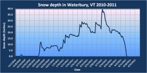
Waterbury, Vermont 2010-2011 snowpack plot
The snow depth went to zero today at our back yard stake in Waterbury. (Click on the image for the full size plot)

As of this morning, the depth of snow at our back yard stake has reached zero, so I’ve updated my Waterbury snowpack plot and included it in this post.  This means that the last day with snow at the stake was 4/12, and the average I have for that value is 3/27 ± 14 days, so this season is a couple of weeks later than that average.  The next benchmark I’ll monitor will be when the final snow in the yard is gone, and based on data I have from ’07-’10, that average date is 4/12 ± 10 days, so roughly a couple of weeks later than when the snow has melted out at the stake.  As of today, the yard snowpack has been around for 130 days, but that is actually still below average (138 ± 14 days) because of the late start to the season; the start of continuous snowpack this season was on the later side at 12/5 vs. an average of 11/27 ± 9 days.  Unless the rest of the snow in the yard melts unusually fast however, the end result of the snowpack season will probably be somewhere around that average value.

I’d say that winter temperatures were more consistent than usual this season, so it’s a little easier to see the steady climb in snowpack from a value of 0″ on 12/4 through the value of 39.5″ on 3/8.  The average rate of increase during the period was 0.42″/day.  This was a decent snowpack season, with snow depth days from my stake coming in at 2,227 depth-days vs. the average of 1,812 ± 741 depth-days.  However, the combination of the rather late start and long stagnation through mid January (visible on the plot) while the storms were going south, meant that it certainly wasn’t up where the ’07-’08 season was at over 2,500 depth-days.

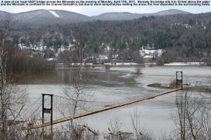
High water on the Winooski at the VAST snowmobile bridge

Image of high water on the Winooski
Melting snow from warm temperatures caused the Winooski to rise today - our local VAST snowmobile bridge was basically floating on the river.

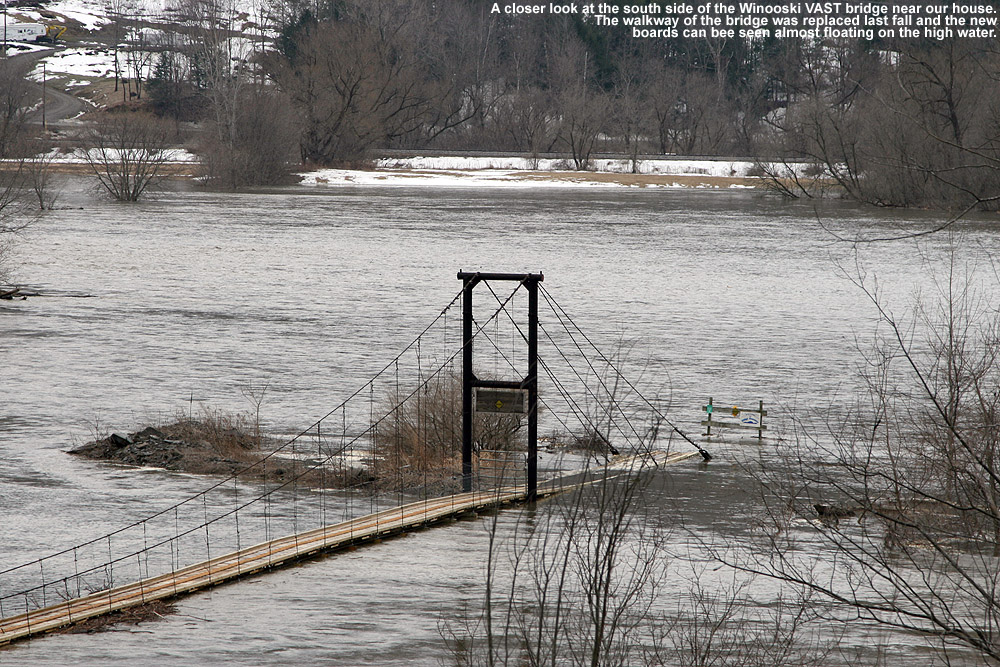
With the recent warm temperatures melting some of the snowpack, the Winooski was quite high today, so I’ve added a couple of pictures of our local VAST snowmobile bridge.  The bridge was refurbished in the fall, and from the pictures one can see that the boards are still pretty light in color.  Normally the bridge is 5 to 10 feet above the river, so that provides a sense of the rise of the water level due to the melting snow, and with the fields off to the south taken over by water (visible in the background) the Winooski was several times its normal width. 

Close up image of the VAST snowmobile bridge at high water
A close up view of the south side of the VAST bridge and the flooded fields beyond

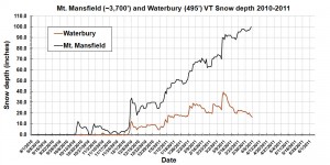
100 Inches

Mt. Mansfield and Waterbury Vermont snowpack plot for April 5th, 2011
The snowpack at the Mt. Mansfield stake hit 100 inches after yesterday’s snowfall – click for the full size plot
The snowpack at the Mt. Mansfield stake has been flirting with the 100-inch mark for several weeks, but thanks to yesterday’s snow, the afternoon reading indicated that we’d finally hit the century mark.  A depth of 100 inches at the stake is a nice benchmark indicating an excellent snowpack in the Northern Green Mountains, so the base depths for skiing should be decent for quite some time.  Down in the valley, the snowpack at our house in Waterbury was at 16 inches as of this morning’s reading.  I’ve added my latest plot for the Mt. Mansfield and Waterbury snow depths in this post.

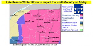
Storm incoming, 1 to 2 feet possible for the Greens

Winter Weather Advisories Map from the BTV NWS
The winter storm watches from yesterday have been upgraded to winter weather advisories and winter storm warnings today

I’ve added the updated advisories and warnings map from the National Weather Service Office in Burlington, but their projected accumulations map looks similar to yesterday, so I’ll just refer to the one that was already posted earlier in the blog.  In his forecast from this morning, Roger Hill suggested the potential for 1 to 2 feet in the Green Mountains, with 6 to 10 or 8 to 14 for some valley locations and the potential for school closures.  Looking at the winter storm warnings from BTV, it seems that the biggest totals are more south of here, although as is often the case, if upslope gets into the picture later in the storm cycle, the Northern Greens seem to do pretty well.  The current point forecast for our location in the Winooski Valley at ~500’ suggests 5 to 10 inches through tomorrow, and then additional snow Friday night, Saturday, and Saturday night.  We’ll have to see how this system goes around here, but similar to what we saw in 2007-2008, we would be closing in on the 200-inch mark for seasonal snowfall at our location if we get a decent dump.

Afternoon update on potential snowstorm

BTV NWS Accumulations Map
Snowfall predictions from the Burlington NWS updated this afternoon - click for the full size image

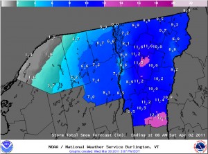
I’ve added the latest Storm Total Snow Forecast map from the Burlington office of the National Weather Service in this post.  The models are still moving around with the exact track of the system, but the NWS meteorologists feel that we’ve got a shot at some decent snow in the area.  More details and a comparison of the morning and afternoon maps for potential accumulations are in my afternoon post in the NNE thread at Americanwx.com.

Potential April Fool’s Day Storm

BTV Winter Weather Warnings Map
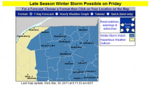
Winter Storm Watches are up for Vermont and New York as of this morning

There appears to be a storm on the way for the Northeastern U.S. in the Thursday through Saturday timeframe. The exact effects on our region aren’t known yet, but there is the possibility of some decent snowfall. I’ve added the latest Burlington NWS advisories and potential accumulations maps to this thread, and more details are in the NNE thread at Americanwx.com.

Potential Snowfall Accumulations Map
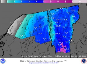
Initial snowfall projections from the Burlington office of the National Weather Service - click to view the larger image

A little more snow today, possible storm this weekend

I measured 0.3 inches of snow today at the house due to the upslope snowfall activity that has been hanging around, bringing our location to 39.6 inches for March and 192.6 inches for the season.  Details are in my post in the Northern New England thread at Americanwx.com.  There is the potential for a larger storm this weekend, and there’s plenty of good discussion going on in the Americanwx.com New England Forum.