Pico, VT 30OCT2011

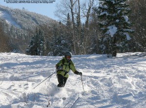
An image of Erica skiing powder on the Birch Glades Trail at Pico Vermont - October 30, 2011
E enjoys some of the October powder at Pico after back to back storms set up some great ski conditions.

On Thursday, Vermont got hit with its first major storm of the 2011-2012 winter season.  The greatest effects were felt in the central and southern parts of the state, where areas like Killington picked up about a foot of snow.  Then yesterday, an early season Nor’easter came through the Northeast, and it turned out be historic for the Mid Atlantic and Southern New England, where some areas picked up more than 30 inches of snow.  That’s a good dump of snow for any time during the winter, but it’s incredible for October, and numerous October snowfall records were shattered.  Through the combination of the two storms, some areas in the Berkshires of Massachusetts had already picked up over three feet of snow for October. Up in Vermont, the Nor’easter was focused on the central and southern parts of the state, just like the previous storm.  We did actually pick up 1.2 inches of snow at our house in Waterbury last night, but with areas south of us getting another good dump of snow on top of the base they already had from the previous storm, our eyes were definitely drawn southward for some potentially great October skiing.

Since Killington had already opened for lift-served skiing, we decided that Pico would be a much mellower option for earned turns, with similarly great snow.  Despite many days of skiing at Killington in the past, nobody in the family had actually ever skied Pico, but it’s hard not to admire the way 3,967’ Pico Peak towers well above Sherburne Pass on Route 4.  Since the base area of Pico sits at an elevation of ~2,000’, it’s got plenty of elevation to help keep the snow dry if lower elevation temperatures are above freezing.

E hosted a Halloween pumpkin-carving party last night, but I still had plenty of time after clean up to prep some of the gear and put the skins on the skis so that we’d be able to save time this morning.  After a hearty breakfast to ensure that the boys were charged up for the mountain ascent, they got dressed very quickly and headed out to play in the snow while we got everything together for the trip.  I recorded the final couple of tenths of an inch of snow that had accumulated on our snowboard from the morning’s light snow, and we were on our way southward.  To read the details about the skiing and see all the pictures, head to the full report from Pico on October 30th, 2011.
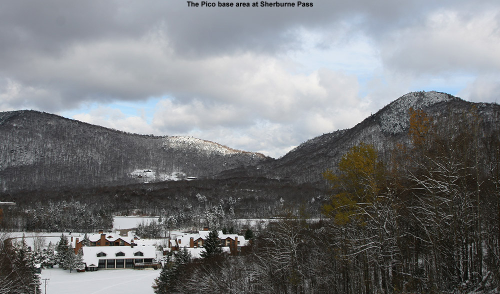
An image of Sherburne Pass from Pico ski area in Vermont with October snow
Looking down from the trials of Pico at the base area and Sherburne Pass, October almost seemed like mid winter.


Second major October snowstorm of the season for Vermont

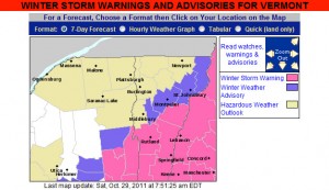
The map from the National Weather Service for Vermont Winter Storm Warnings and Advisories for October 29, 2011
Winter Storm Warnings and Winter Weather Advisories are up in Vermont for our second October snowstorm in three days.

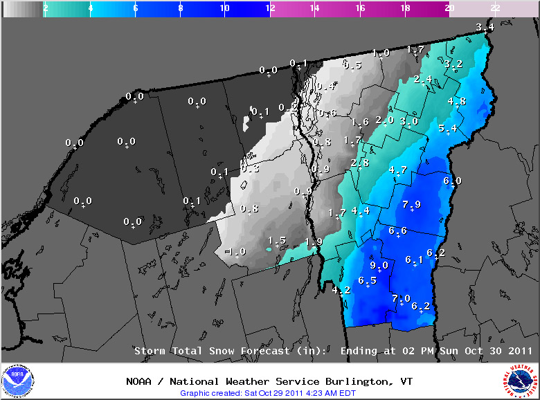
Our second significant snowstorm for October, and in fact our second significant snowstorm of the past three days, is on our doorstep.  As with the storm from Thursday, Vermont snowfall will again focused on the southern part of the state, and this is likely to be a record snowfall event for areas of Southern New England, and the Mid Atlantic Region.  Although this storm is still focused to our south, it is large enough that even our area is under its first Winter Weather Advisory of the season.  The winter weather advisory maps from the National Weather Service Office in Burlington have been added here, and more updates about this historic early-season winter storm can be found at their website.

A map of the expected snowfall totals from the National Weather Service in Vermont

For the full details on this storm, head to the detailed report at the winter weather section of our website.

First major snows of the season for Vermont

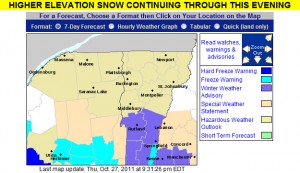
An map of the winter weather advisories in Vermont for October 27, 2011
October 27, 2011: Vermont's first winter weather advisories of the season

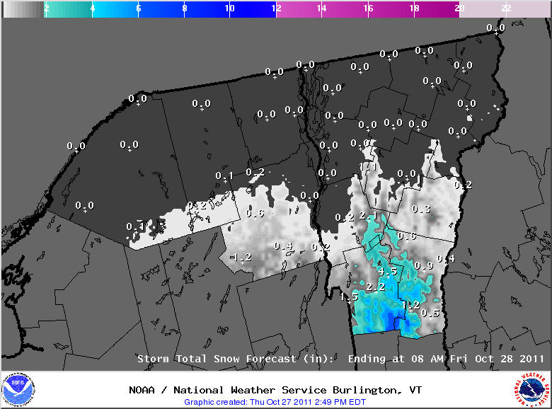
The National Weather Service Office in Burlington put up the first Winter Weather Advisory for the state of Vermont today, thanks to a storm that is passing to our south.  The southern and central parts of the state have been receiving the snow, with generally just clouds north of I-89.  The Killington area picked up a nice shot of snow; adk from Americanwx.com reported up to 14 inches of snow there in his post in the Northern New England thread.  You can find more about his trip at Famous Internet Skiers – they’ve got snowy skiing pictures from both October 27th, and October 28th.  The great news is that there may be another storm coming in on Saturday night to cover up all the tracks that people have been making and set us up for some great October skiing.

Snow accumulations map for October 27, 2011 from the National Weather Service Office in Burlington, Vermont
Snow accumulations with this storm have been in the southern and central parts of the state.

Accumulating snow today on Mt. Mansfied

An image of snow that has been accumulating at the snow measurement stake up near the top of Mt. Mansfield in Vermont
October 22, 2011: The fabled stake atop Mt. Mansfield, picking up the first accumulating snow for Vermont's Green Mountains this season

I was reading the Northern New England Thread on the New England Regional Forum at American Weather, and just got the word that Mt. Mansfield received its first accumulating snow of the season.  Thanks to Powderfreak for passing along the message, and including a picture of the snow at the Mt. Mansfield Stake, which I’ve included here.  As far as I’m aware, this is the first accumulating snow in the Green Mountains of Vermont this season due to the fairly warm October.  It does look like the weather is going to cool down this coming week, so there will likely be more chances for snow in the high country.  We’ll keep our eyes on the mountains, weather forecasts, and weather boards to see if any of the white stuff shows up in the near future, but as we approach November, the season of snow and skiing is certainly close at hand.

A touch of October snow for the Greens

With the warm weather regime we’ve been in over the past few weeks, it’s actually been a month since I’ve heard of any snow in the Green Mountains – September 16th was when we had that cold shot that produced some flakes.  We saw some frosty nights at the beginning of the month, but there was no precipitation with that cold air.  However, new reports of snow have been coming in today.  Over at the Americanwx.com New England regional forum, Powderfreak got a report of snow squalls atop Camel’s Hump, there was a report of various forms of mixed precipitation on Mt. Mansfield, and there was also a report of frozen precipitation from near the Pinkham Notch area over in New Hampshire.  Not surprisingly, Mt. Washington picked up some accumulating snow, with 1.2 inches reported for the day.

Another round of frost and freeze warnings for Vermont

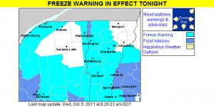
The map of freeze warnings and frost advisories for October 5, 2011 from the National Weather Service Office in Burlington, Vermont
After our initial round of frosty weather back in mid September, more substantial freeze warnings and frost advisories are back for the start of October.

We’ve got another batch of cold air moving in over the next couple of days, so the National Weather Service Office in Burlington has put up freeze warnings throughout the area. Temperatures should be colder than last round with most areas in the 20s F, but since we’re into October now, that’s not all that surprising. For those areas like the Northeast Kingdom and the Adirondacks that don’t have warnings up, it’s because they aren’t needed; for those colder areas with early dates for the typical first frost, the growing season is considered to be over already. This is bad news for farmers in that area. Unfortunately, the weather cannot be changed. This will probably impact the crops of many farmers. To prevent this from happening next year, some farmers may want to take some extra precautions. Some may want to visit https://shrinkwrapcontainments.com/t-reinforcedblackout.aspx, for example, to purchase some light deprivation tarp. This is currently being used by full-time farmers in other areas who are trying to extend the growing season by creating artificial growing conditions. This tricks the crops, allowing them to continue growing for longer. Hopefully, this should help more farmers to have a successful growing season next year.

Some of the details from the National Weather Service have been added below:

434 AM EDT WED OCT 5 2011

…FREEZE WARNING IN EFFECT FROM MIDNIGHT TONIGHT TO 8 AM EDT THURSDAY…

THE NATIONAL WEATHER SERVICE IN BURLINGTON HAS ISSUED A FREEZE WARNING…WHICH IS IN EFFECT FROM MIDNIGHT TONIGHT TO 8 AM EDT THURSDAY.

* LOCATIONS…ALL OF VERMONT…EXCEPT CALEDONIA…ESSEX…GRAND ISLE AND ORLEANS COUNTIES. THE SAINT LAWRENCE VALLEY IN NORTHERN NEW YORK.

* HAZARDS…WIDESPREAD FROST AND BELOW FREEZING TEMPERATURES.

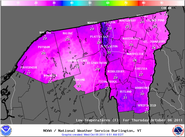
* TEMPERATURES…MAINLY IN THE MID TO UPPER 20S.

* TIMING…FROM AROUND MIDNIGHT TONIGHT THROUGH 8 AM EDT THURSDAY.

* IMPACTS…WIDESPREAD FREEZING TEMPERATURES WILL BRING AN END TO THE GROWING SEASON FOR ANY UNPROTECTED PLANTS OR VEGETATION.

A map of predicted low temperatures for October 5, 2011 for Vermont and Northern New York
Temperatures are expected to drop into the 20s F in much of the area this evening, resulting in frost and hard freezes for most locales.