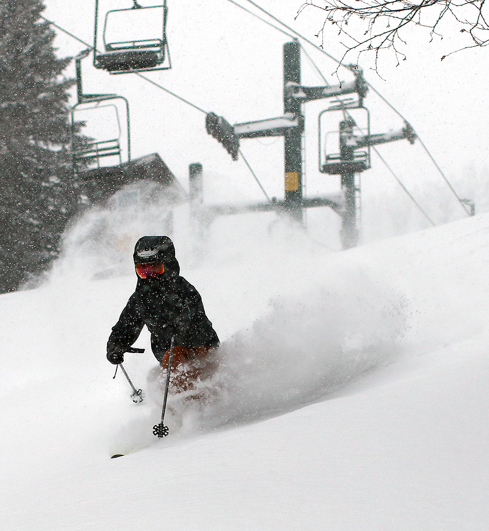
Today was forecast the be the warmest day of this current stretch, and while there was a chance for showers, it was sunny most of the morning. We had an appointment in the afternoon, but with sunshine and valley temperatures expected to get into the 50s F, it seems like too nice a day to pass up the chance to get in some turns.
We headed up to Bolton’s Timberline area, since the relatively low elevation and exposure there make it the best bet for the snow to start softening up. I think even snow on the main mountain would have been fine though – the snow was already nice and soft all the way up to the Timberline Summit at 2,500’ when we arrived in the midmorning period. With the soft snow and sunshine, today on the slopes had more of a March feel than a typical February feel.
I don’t think the snow has seen too much freeze-thaw cycling over the past couple of days, but in general it was skiing quite well. I felt that my skis were sticking just a touch at the start of my first run, but that seemed to disappear quickly, so it was likely just an issue of working off some old wax or maybe some residual skin glue that had been left over from last weekend’s ski tours. We found the best turns to be where others were churning up the snow and getting down a bit into the cooler layers, but in general you could go anywhere. In terms of coverage, even the natural snow trails down at Timberline elevations are doing well, with a few bare spots here and there that were inconsequential in general. They’ll need some additional winter storms though for those lower elevation trails to maintain robust coverage into March and April.
Today was gorgeous, but we’re definitely in a dry spell with respect to winter weather events. Relative to the usual frequency of winter storm in the Northern Greens at this time of year, the period we’re in right now feels like being in the middle of a desert. The little clipper system that came through at the end of the week would typically be just a blip in the storm parade, but in this case it was a much appreciated mini oasis for this stretch of winter. I wasn’t sure if I was going to ski at all this weekend, let alone get out for two sessions, but the way the new snow set up the low angle terrain for powder turns wound up creating some respectable conditions. And then of course there was today’s perfect midwinter weather with clear blue skies and temperatures pushing into the upper 20s F – that really sealed the deal to get out for another ski tour.
On yesterday’s tour I hit a good collection of low angle terrain and explored some new spots that don’t typically lend themselves to great turns in deeper powder. Whereas yesterday I’d topped out around 2,800’ on Heavenly Highway, today I pushed out a bit father out toward Stowe View and topped out around 3,200’. Even up at that altitude, I wasn’t detecting any notable increases in new snow depths, so the general 2 to 3 inches that I’d encountered yesterday was still the rule.
My target terrain for today was some of the lower angle slopes in the Moose Glen/White Rabbit area. I hadn’t been up there in a while, and it turns out there was a lot of terrain that was steeper than I’d remembered, especially in the initial parts of the descent dropping down from Stowe View and Moose Glen. Although that terrain was a bit steep for today’s conditions, the visit did serve as a reminder to get out there when the powder is a bit deeper, because the terrain is quite expansive. I eventually got into more of the lower angle terrain that I’d remembered, and that offered some nice powder turns with similar consistency to what I’d experienced yesterday. Overall I’d say yesterday’s tour had a slightly higher yield in terms of catching smooth, bottomless turns on the right terrain, but today being Sunday, it did mean another full day of visitors getting out there in the snow. Even on the backcountry network, traffic eventually tracks up the snow, and with these conditions, you really needed untracked snow for the best turns. Just one pass through the snow by another skier makes a big difference with these lighter accumulations.
One neat thing I did see today while heading up Birch Loop was a skier returning from out on the Catamount Trail heading toward Bryant Cabin. There’s a bit of rolling terrain there that isn’t optimal for having skins either on or off, and what he did was to have a skin on one ski but not the other. When he was skiing, he was one-footing it on the ski with no skin for maximum glide, and then he could use the other ski with the skin on it for better grip going uphill. I thought that was a pretty slick compromise for that sort of rolling terrain. Being on Telemark gear, I typically just go without skins on rolling terrain since herring boning on the uphill sections is simpler with the light gear, but that guy’s technique could be a nice way to go on a heavier setup like alpine touring gear.
The snowpack out there is midwinter deep and ready for prime time as soon as we get another decent storm – let’s hope something pops up before mid-month so we don’t have to spend another ten days in this veritable snowfall desert.
After a consistent run of storm cycles throughout January, we’re in a relatively slow period of snowfall right now. We haven’t had a substantial storm in several days, and it looks like it will be at least a few more until our next one, so this is likely our best immediate window of fresh snow. With that in mind, it seemed like a good day to get our for some turns, so I headed up to Bolton Valley for some touring on the backcountry network.
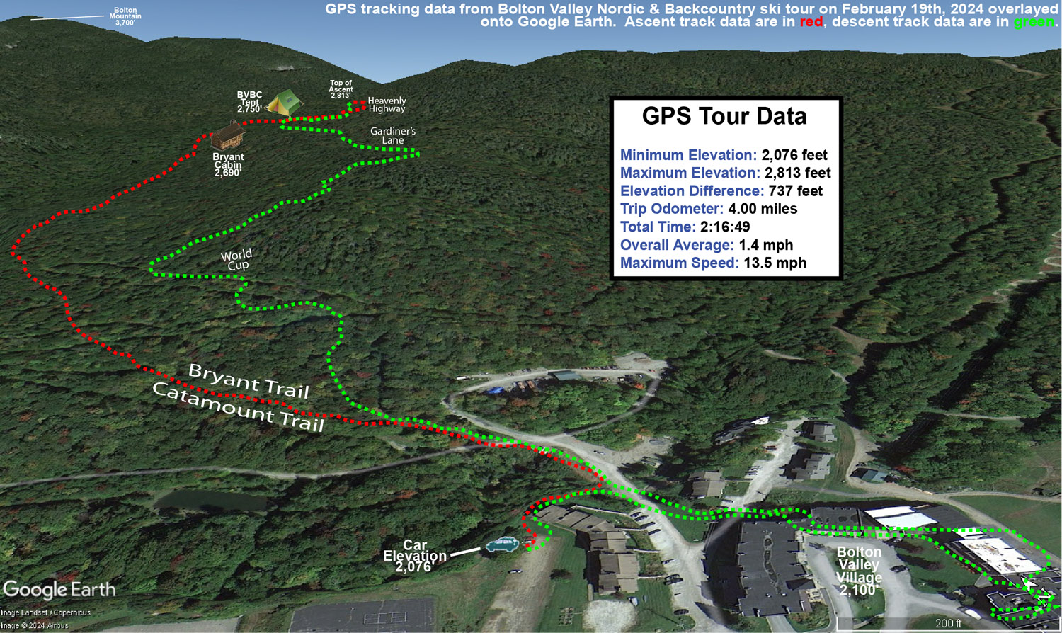
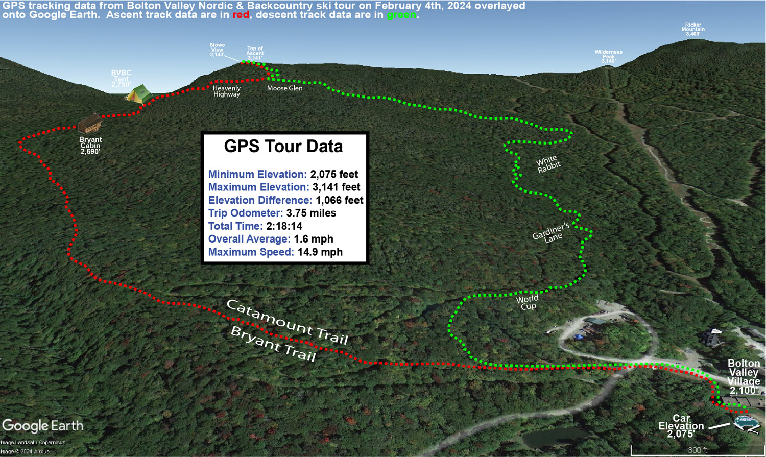
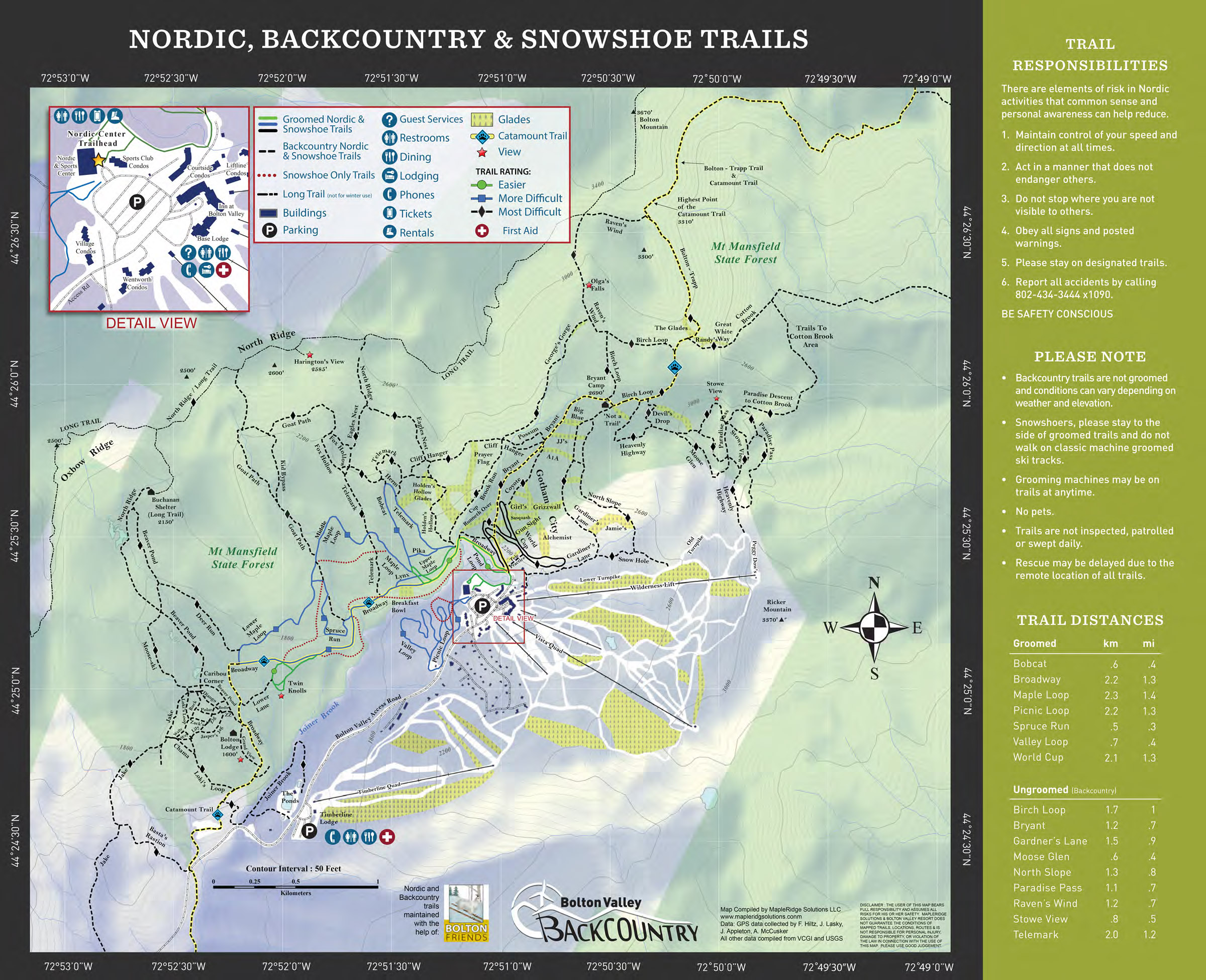
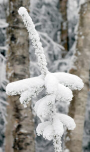
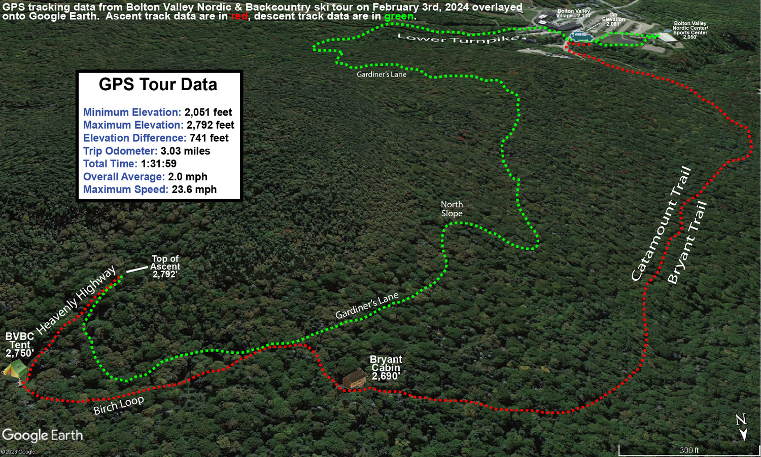
Starting from the Village at around 2,000’, I skinned up past Bryant Cabin to roughly 2,800’ on Heavenly Highway. The new snow depths were very much as advertised, with 2 to 3 inches of powder throughout that entire elevation range. There really wasn’t much increase in the snowfall totals at those elevations where I was touring, but the totals definitely started to tail off below 2,000’. I can’t say exactly how much fell at 1,500’, but it was noticeably less, and once you got below 1,000’ there was no new snow. At some point in the past several days there’s also been some riming in the mountains; you can see the rime on the trees at various elevations throughout the resort.
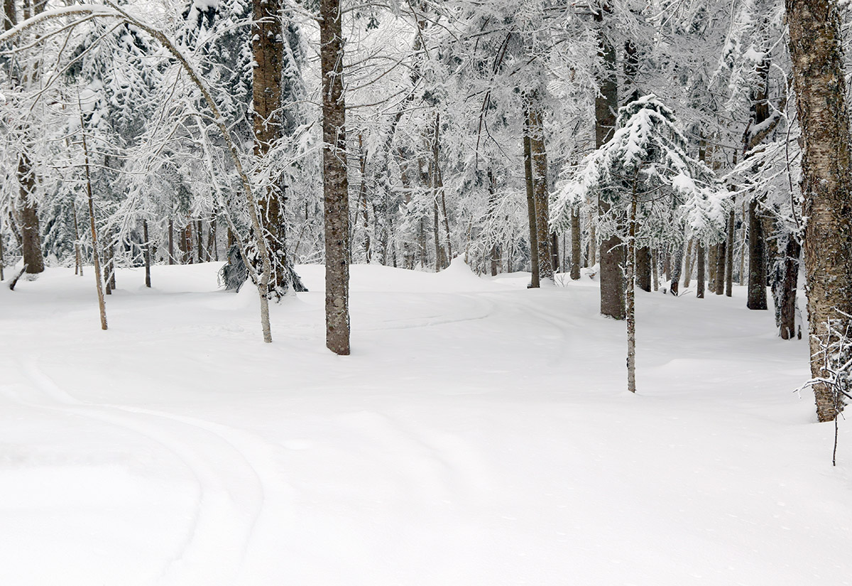
With the available snow I stuck to low-angle glades for as much of my descent as possible, and as noted, the new powder had some substance to it so the turns would up being quite decent. On mid-fats I was probably getting 25-50% bottomless turns on terrain with the appropriate pitch. And even when touching down, the turns were still feeling very good because the subsurface has some pliability – it’s certainly dense, but nothing like the sheet of ice that would result from a big rainstorm followed by a refreeze. The base snow is soft enough that you can punch down into the snowpack if you’re not on a floatation device like skis or snowshoes, and I saw numerous signs of this happening where snowboarders or hikers were traversing areas in boots.
For the last part of my tour on the backcountry network I worked my way along Gardiner’s Lane and made good use of the low-angle terrain there. In many areas I was able to explore lines that you often can’t hit because the powder is too deep to sustain good momentum, but they were great today, so I experienced a lot of new sections of the network that I often breeze past.
I connected onto the alpine trails at Lower Turnpike for the last part of my tour, and let’s just say, if you didn’t get out for lift-served turns around here today, you’re really not missing anything. Lower Turnpike typically maintains some of the highest quality snow on the alpine trails because of relatively low skier traffic, modest pitch, and good protection from the wind. Even there, the surface was firm unless I was able to get into the untracked powder off to the sides, and if the snow is firm on Lower Turnpike you know it’s going to be very rough elsewhere. I don’t actually have to imagine what the conditions were like on the main trails though, because some friends sent us video of their son snowboarding today, and the sound of his board on the snow was excruciating. That’s probably going to be a common situation until the next substantial storm comes into the area or it gets very warm, so we’ll be looking for Mother Nature to get another good winter storm system through here as soon as possible.
Since today’s forecast was in the single digits F, and there was the possibility of wind as well, ski touring seemed like the natural choice vs. riding the lifts. In addition, our current weather system, while certainly enough to freshen up surfaces, isn’t expected to be large enough to really reset the powder in areas that had been recently skied.
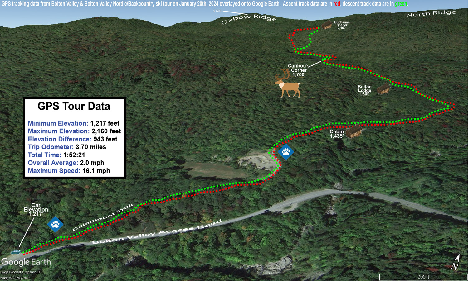
With the cold temperatures, and the way the depth and quality of the snowpack has been improving over the past week or two, I decided that I’d tour in some relatively low elevations nearby to see what potential they held. I started my tour at the Catamount Trail access area at roughly 1,200’ on the Bolton Valley Access Road, and did a ski tour up to the Buchanan Shelter near the 2,200’ elevation. That’s not a heavily used part of the Bolton Valley Backcountry Network, so I suspected that untracked powder would be relatively plentiful.
While I was out touring in the afternoon, light snow fell continuously, and throughout the tour I checked powder depths above the highest detectable subsurface layer in the snowpack. The powder depth profile I found with respect to elevation was as follows:
Even with cold temperatures, powder of the 3-4% H2O variety that we recently received from Winter Storm Heather can’t sustain that level of loft forever. Indeed, the powder I encountered today had settled down to something more in the 6-8% H2O range, so the numbers above are the depths to which the surface snow has currently settled. Obviously all these recent storms continue to push the useful snowpack to lower and lower elevations, so overall snowpack depth wasn’t an issue even down to the 1,200’ mark. It’s hard to get estimates of the total snowpack depth because the lower layers are so settled and thick, but the snowpack is maybe a couple feet deep down at 1,200’? While I don’t have an exact number, even if there was only a foot of base below the powder, it’s so consolidated and flush with liquid equivalent that it would easily do the job.
In terms of the skiing, the best turns were certainly up in the slopes just below the Buchanan Shelter where there is some solid pitch up into the black diamond realm. The approach portions of the tour have enough pitch to make a nice glide out and grab a few low-angle turns in certain spots, but with the current depths and density of the powder, descent speed is on the slower side right now. Also, cold temperatures like these reduce ski glide somewhat due to less melting, so that factors in as well. In the slopes up by the Buchanan Shelter I had the run of the area though in terms of fresh tracks. One person had recently skied back down the Beaver Pond Access Trail, but that was even a bit old, so it must have been from a couple of storms ago. Off in the trees, there were no prior tracks of any kind, so I had my pick of the most open lines, streambeds, chutes, etc. Fat skis were the call, and turns were definitely bottomless, but the best turns came from hitting those correct areas that appropriately accommodated the pitch, powder depth, cold snow, tree spacing, and all that. There were some excellent powder turns on the tour though, so even down to the lower elevations in the ~1,000’ range, the current snowpack is really delivering.
By observations time early this morning, the backside snows of Winter Storm Heather had departed and skies here at the house were partly cloudy. The clear skies didn’t really seem to jive with the imminent snow I saw in the forecast, but sure enough, clouds soon began to roll in, and within an hour, flakes were flying.
I decided to get in a quick morning session up at the mountain, and the snowfall continued to intensify as I ascended the Bolton Valley Access Road. Up in the Village there was steady snowfall, and while it wasn’t the pounding 1-2”/hour snowfall of yesterday, visibility dropped substantially and it felt like we were right back in the meat of the storm. It looks like today’s snow was rolling in from the lake effect snow event off to the west, so we thank our big friend Lake Ontario for that.
Wilderness was the hot ticket for skiing today, since the Wilderness Double Chair doesn’t run on Mondays and Tuesdays, and this was the first chance for lift-served access to all the recent snowfall from Winter Storm Heather. I decided to start off with a short workout ski tour using the Wilderness Uphill Route, then stuck around for a bit of lift-served skiing after that.
It’s getting a bit tougher to discern how much powder came specifically from Winter Storm Heather, since it’s just blending in with the layers below it as the subsurface is buried deeper and deeper, but the approximate powder depths I found today were as follows:
2,000’: 6-8”
2,500’: 8-10”
3,000’: 10-12”
There was definitely a bump in powder depths even compared to what we skied yesterday thanks to the additional overnight snow and the new snow that was falling. One obvious clue that depths had increased was the fact that the snow was now getting a bit too deep for low-angle terrain. Moderate angle and steeper terrain are now providing the best powder turns. I had a feeling we’d be getting to that point today, and indeed while I’d been on mid-fats for the past few days, today I bumped up to the fat skis and that was the correct call as long as you were skiing untracked snow.
Bolton Valley is indicating that they’ve picked up roughly 60 inches of snow since the start of the year, which is very solid snowfall total for the first half of the month. Heck, 60 inches of snow is respectable even for a full month’s total at many resorts.
It wasn’t even snowing this morning when Ty and I headed off to Burlington for an early appointment, so we knew we’d be giving Mother Nature some time to get rolling and freshen up the slopes. The snow from Winter Storm Heather started up a couple hours later, and by midafternoon we decided to head up to Bolton Valley for some turns.
We were happy to see that the Timberline Quad was running, so were able to park and start our session right there. Snow was simply pouring down at that point, and my initial measurements revealed storm totals of 4-5” at 2,500’ and 6-8” at 3,000’.
The snow was light and dry (my past couple of liquid analyses from down here in the valley averaged right around 4% H2O), so it was very high quality powder. With such cold smoke snow, you weren’t getting bottomless turns on steep terrain, but you could on low and moderate angle terrain, and the turns were great even if you were contacting the subsurface.
It was pounding 1-2”/hour snow the entire time we were on the mountain, so one could easily tack on another couple inches or so to the storm totals by closing time, and it even kept snowing into the evening.
In this morning’s update, Bolton Valley was reporting an additional 3-5” of snow from yesterday’s lake-effect snow and snow squalls. The other recent snowfall numbers they had in their report looked solid, with 12” in the last two days, 27″ since Tuesday night and more than 48” for the first half of the month. The season snowfall for the resort currently stands at 157”, and that’s very respectable since it’s already about half their annual snowfall average when we’re not even halfway through the snowfall season. What makes that pace more impressive is that they’ve had all that snowfall despite the second half of December being quite lean on snow. That really speaks to how much has been falling up there during the snowier periods.
There was no new snow falling today, which was somewhat notable because this morning’s snow report also indicated that if the current forecast for tomorrow’s snow comes through, they’ll be looking at 14 out of the first 16 days of 2024 with snowfall. With today’s break in the falling snow, I figured it was time to head out for a tour on the backcountry network as a reliable route to untracked powder.
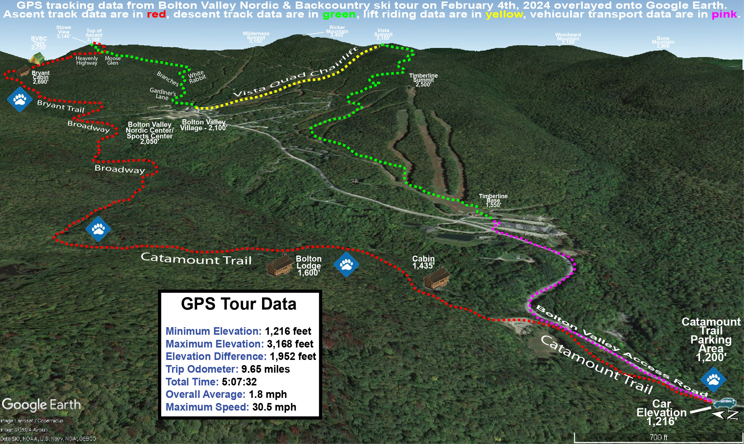
I decided to head up the Bryant Trail to Bryant Cabin in the afternoon, and play it by ear with respect to lengthening my tour, depending on how my supply of daylight was looking. I was well ahead of sunset when I was up at Bryant Cabin, therefore I just continued on up to the Catamount Trail Glades so I could get in some turns in the higher elevations. Based on my recent outings at the resort, I knew that conditions improved a lot with elevation, so I wanted to get a good sampling of the powder up high. I topped out at an elevation of about 3,100’ on the back side of Bolton Mountain, descended through the Catamount Trail Glades, and then traversed back above Bryant Cabin and navigated a route through another half dozen different glades back to the base. Today definitely had a nice midwinter vibe, with bright afternoon sun, temperatures somewhere around 20 F, and great powder.
The surface powder and upper snowpack analysis was really interesting today. Starting my tour around 2,000’ in the Village, I found 4-5” of surface powder, and then there was a fairly solidified layer below it. That layer marks the wet snow that recently came from Winter Storm Gerri, which hardened up somewhat as temperatures dropped back below freezing. The surface snow above it is from the snow on the back side of the storm, plus the additional drier snows that have fallen over the past couple of days. As you ascend to higher elevations though, that firmer layer gradually begins to soften, and then above 2,500’ it starts to disappear altogether. At that point there is another substantial subsurface layer, which I suspect comes from Winter Storm Finn. So, monitoring the elevation profile for the depths of the powder was bit unusual. Compared to the 2,000’ elevation, I didn’t detect any notable increase in the powder depths at 2,250’, but at 2,500’ it finally started to deeper, and as I continued higher, I could still sort of detect an interface from Winter Storm Gerri, but it eventually became hard to discern. So, what I’ve done for the surface snow depth elevation profile below is to indicate those different layers, with the first depth being snow down to the dense layer from Winter Storm Gerri, and the second being the depth of the snow down to the dense layer from Winter Storm Finn.
At some point between 2,500’ and 3,000’ that first depth number sort of becomes moot, and you’re essentially skiing in the 8-16” of powder depending on elevation, so go I’d say go in with that mentality. In terms of getting out there in the backcountry around this part of the Northern Greens, I’d recommend touring above 2,500’ if you can for the best turns. I went with mid-fats on today’s tour, but you could easily go with fat skis if you’re going to spend most of your time above 2,500’. When I was up in the Catamount Trail Glades in the 3,000’ range, fat skis would have been nice, except in some of the denser areas of evergreens where they have trapped so much of the snowfall on their boughs, that you actually notice the deficiency of powder below.
The system that is expected to come into the area tomorrow is name Winter Storm Heather, and any snow from that should really be icing on the cake in terms of the ski conditions. Temperatures are forecast to stay cold, so you can pretty much take the powder depths I have above and then tack on whatever new snow comes next.
With the additional overnight snowfall, Bolton was reporting a total of 9 inches from Winter Storm Gerri as of their early morning report. And, since the Timberline Quad didn’t open yesterday due to winds, today would also be its inaugural run of the season. E and I figured the chance to visit the Timberline terrain that nobody has really skied at all up to this point was a nice bonus.
Based on the conditions I encountered yesterday, I really expected the main mountain to offer the best conditions today, especially above 2,500’ where the snow was never too wet. However, there was always the chance that the lower elevation Timberline terrain would still surprise us due to all the fresh snow. After our first lift ride on the Timberline Quad, the lift actually had to go off line for a time due to a mechanical issue, so heading to the main mountain turned out to be the appropriate option anyway.
Not surprisingly, there were a lot of fresh tracks to be had out there today, but I’d actually say the snow quality below 2,500’ was a notch beneath what it was when I was out yesterday afternoon/evening. Yesterday I was skiing in 6 to 7 inches of powder off Snowflake, but the bottom few inches of that snow must have still be fairly wet at that point because we found it had thickened up with today’s cooler temperatures. So, it meant that today we were only skiing in the top few inches of powder and contacting that denser snow below if we pressured our turns hard enough. As long as you had untracked snow, it was nice skiing, but it certainly wasn’t as bottomless as yesterday in those lower elevations. Areas with previous skier traffic ended up with uneven subsurfaces that definitely detracted from the quality of the turns. Thankfully, the dense snow didn’t form anything like a breakable crust, which would have made the skiing much more challenging. On our return trip to the Timberline Base, we did get first tracks down the lower half of Tattle Tale, and that was really sweet, even if the powder wasn’t as bottomless as it would have been yesterday.
Over the past week, the weather pattern has featured these larger systems with ample snow and moisture, and the most recent one in the series is Winter Storm Gerri. It moved into the area overnight in the wee hours with an initial burst of heavy snow. The front end snow in this case wasn’t as potent as it was with Winter Storm Finn that came through midweek, so when we saw that Bolton Valley was indicating only 2 inches of new snow in their early morning report, we knew there was no need to rush right up to the mountain.
We watched the Bolton Valley Base Area Webcam through the morning and could see that up at 2,100’, the precipitation was snow, and it was quite heavy at times. Dylan and Colin headed up to the mountain in the early afternoon, and we asked them to give us an update on what they found. Their impressions were that the snow surfaces were rather wet, and they said the precipitation was even mixed with rain in the lower elevations at times, so E figured that instead of skiing, she’d hold off until the snow got better. I took another look at the webcam feed and saw that there was heavy snow falling, and decided that it would definitely be worth it to head up for some lift-served runs.
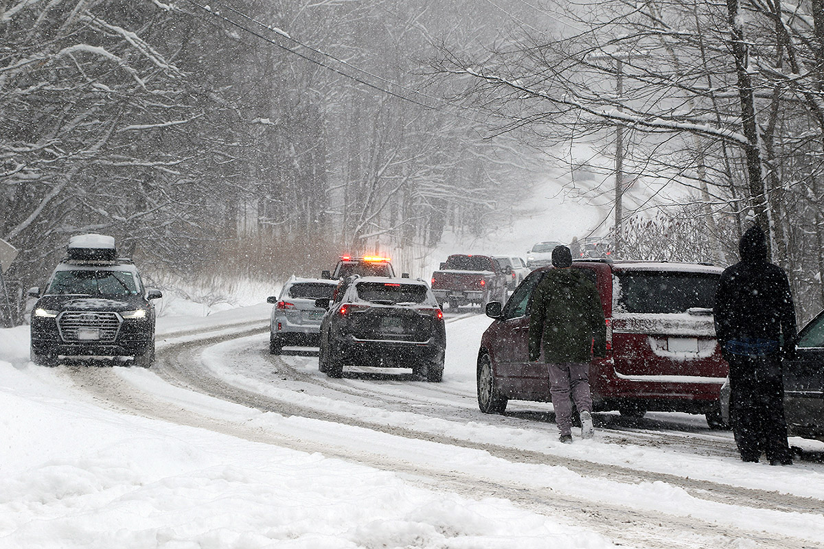
Heading up the Bolton Valley Access Road, the precipitation switched over to all snow at roughly the 1,000’ elevation, and above that the road was quickly covered. The road conditions must have been getting a bit slick with the new snowfall because I had to drive around a van that was stuck trying to make it up the steep s-curve below Timberline. I had actually planned to park at Timberline and start my session there, but the Timberline Quad was apparently on wind hold, so I had to continue on up to the main base area. I arrived up in the Village to very heavy snowfall in the 1 to 2 inch per hour range, and with the intensity of that snowfall, there was just no way that the turns weren’t going to be great.
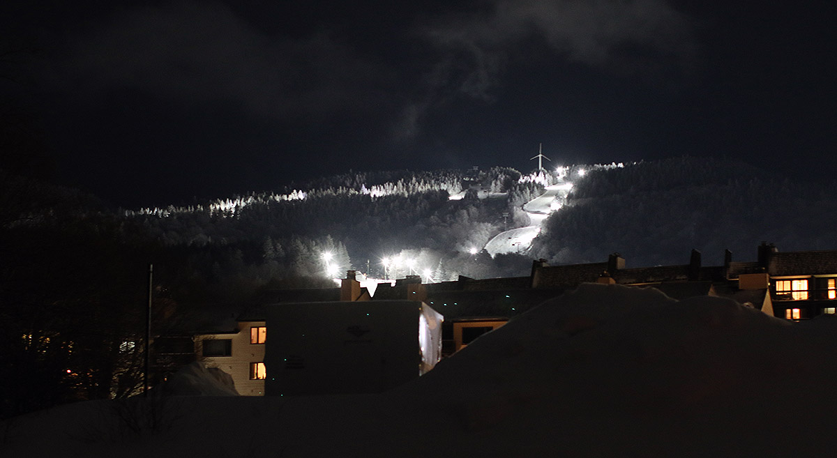
During my afternoon session I managed to get in runs on all the rest of the lifts, and heavy snow continued to pound the resort at all elevations. It was windy, especially at the Vista and Wilderness Summits above 3,000’, but thankfully the wind was from the west and at your back while you rode the lifts. After my first couple of runs, the lights were coming on, and I got to ski Spillway in night mode. I always find it exciting to be able to ski something that steep under the lights, and I knew that the conditions on Spillway were going to be really good because you couldn’t hear anything from the turns of the skiers and snowboarders below you as you passed over them on the Vista Quad. Indeed, my own experience on the trail revealed that the conditions on Spillway were simply fantastic; new snow was falling so heavily that it must have been covering up an slick spots faster than skiers could push the snow away.
I did notice that below the Mid Mountain elevations (~2,500’), the groomed/packed ski surfaces did have that “wet pack” feel that I’ve encountered in the lower elevations of Whistler Blackcomb. That’s usually a sign that some very wet snow has fallen and was packed by skier traffic. I could see what Dylan was talking about with respect to the wet surface conditions, but at the point that I was up there, those conditions were hard to find because temperatures were falling, and it was snowing so hard that those types of wet surfaces were covered up in all but the highest traffic areas. Some of the best turns I found were near the end of my ski session when I visited the Snowflake Chair. That area hadn’t seen much skier traffic, so I found a lot of fresh powder that skied beautifully. I did numerous depth checks and was consistently getting new snow depths of 6 to 7 inches. There was enough powder there that I questioned whether it was all from just this storm, but when Bolton’s afternoon snow update came in and they were reporting storm totals of 5 to 7 inches, that nicely corroborated my measurements.
All this new snow is a great addition to the snowpack, but even without it, one thing I noticed while out on the mountain today was the huge jump that the snowpack has taken since last weekend. I hadn’t been up to the mountain since Sunday, and at that time, patrol was just starting to open up more areas of natural snow terrain as coverage improved thanks to Winter Storm Ember. The contributions made by Winter Storm Finn must have been huge though, because the resort has now been able to open up just about everything, and everywhere I looked this evening, coverage felt like midwinter. As I look back now at my storm data, I guess I see the difference – Winter Storm Ember dropped 0.69 inches of liquid equivalent here at our site, while Winter Storm Finn dropped 1.99 inches of liquid equivalent. That’s almost triple the amount of liquid, and when you get up around 2 inches of liquid equivalent, that starts to become a serious resurfacing of the slopes. Winter Storm Gerri has already dropped about an inch of liquid equivalent here at the house, and the back side snow is still coming through, so that’s simply adding yet another great layer to the snowpack. All told, this past week of storms has dropped almost 4 inches of liquid equivalent here at our house in the valley, so it must have put down at least 4 to 5 inches plus of liquid equivalent for the mountains. When I look at the numbers, I realize now why the snowpack seems to have improved so much so quickly. When I was riding the Wilderness Chair today, I actually saw a ski patroller skiing the headwall of the Wilderness Lift Line to check the snow. You know the snowpack is getting decent when that headwall is even close to being skiable, so the fact that he was even testing it speaks volumes about how things have gone over the past week.
January snowfall is rolling along now with the appearance of our first major weather system of the month, and thus our first big event of the new year. Winter Storm Ember began to affect the area last night, and Bolton Valley was indicating that an additional 3 to 4 inches of new had fallen as of their early morning report. E and I headed up with Ty a couple hours later to catch the opening of the lifts, and there was probably another inch or two down by that point because it was snowing at a decent clip. Even more notable though was the wind – it was easterly and quite strong, and it was hitting you right in the face while riding the Vista Quad. Combined with temperatures in the teens F, our storm gear was definitely earning its keep and was highly appreciated.
Based on my analyses from the house, the mountain had seen probably about a half inch of liquid equivalent by that point. Combined with the several small storms we’ve had over the past week as we’ve kicked off January, it was a decent contribution to resurfacing, but certainly not at the point where patrol could simply drop the ropes on all the natural snow terrain. The snow was enough to open up certain natural snow areas like the Enchanted Forest, but at that point of the storm there just wasn’t enough liquid equivalent down to get the steepest terrain going. There was plenty of terrain open to enjoy the fresh powder though, and we knew additional trails would open as the storm continued to deliver more snow.
In the late morning Ty had to head off to work, but Dylan son and his college friends who are staying over for a mini ski vacation were headed up for some runs, so we got to ski with them. The fierce winds from the morning had abated to essentially nothing, so that made the lift rides much more comfortable. A depth check I made around noontime in undisturbed snow at about mid-mountain elevation revealed 9 inches of surface snow, which was probably the combination of what had fallen from this storm on top of the lighter amounts from our other recent storms.
After we left in the early afternoon, I heard that they began to open some steep terrain like Schuss, so the storm was definitely having an impact on replenishing coverage in areas that needed it. The resort was reporting 9 inches of new snow as of closing bell, but with the way it’s been snowing around here this evening, I’m sure they’ll have picked up more by tomorrow morning.