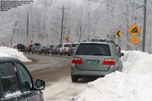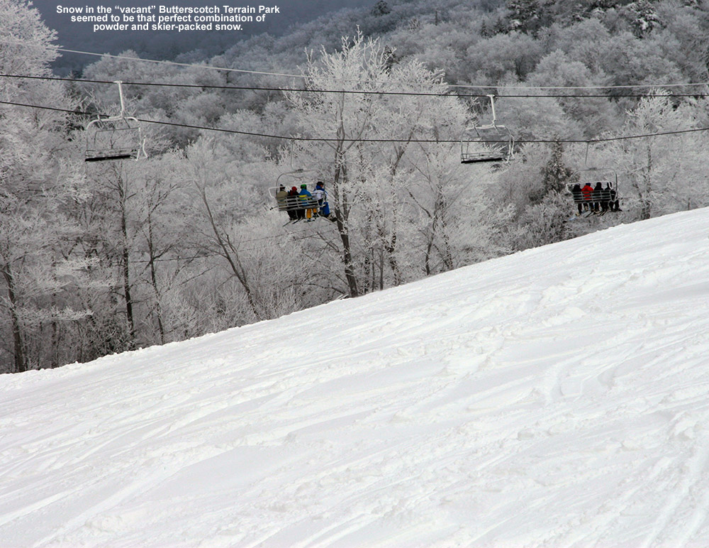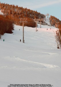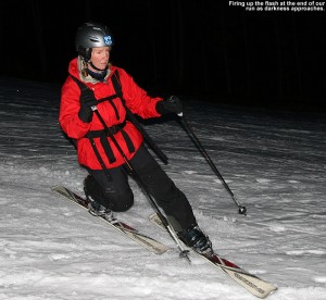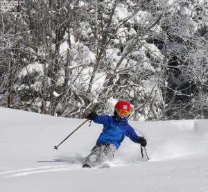
I awoke this morning to our coldest temperatures of the season – we bottomed out at 7.2 F and there was no doubt that the snow was going to be light and dry. Since the snow had shut off by roughly midnight, there had been plenty of time to clean up the roads, and the trip over to Stowe was quick. There were a good 20+ vehicles present as I parked in the Mansfield lot, and although it was still fairly dark, I could see a few skiers making their way up the slope leading to the trails. They seemed to be heading off in the direction of Nosedive, so I opted to head that way and hopefully make use of an established skin track.
“I’ve often wondered if it was worth going the slightly narrower route on skins to reduce weight and enhance glide. After today’s experience, I can tell you to forget about it for typical alpine ascents.”
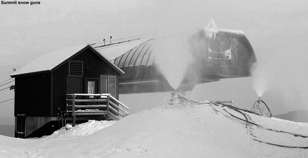
The track headed up Lower National through a few lower elevation snow guns, and the areas of firm, manmade snow quickly made me aware that my ascension setup wasn’t going to be perfect. I was using my AMPerages (139-115-123) to see how they fared in the powder, but since I don’t have skins for them yet, I was using my RT-86 skins (127-86-113). That width differential left a good deal of base exposed, and on occasion I had to use a heaping helping of arm strength with my poles to avoid slipping. Although I’ve always cut my skins to the full width of my skis, I’ve often wondered if it was worth going the slightly narrower route on skins to reduce weight and enhance glide. After today’s experience, I can tell you to forget about it for typical alpine ascents. Unless you’re going to be touring on very low angle terrain, it’s just not worth it based on what I experienced today – any benefit from the weight/glide could easily be lost by the constant slipping. Thank goodness the skin track didn’t have any post holes in it this morning or it would have been a huge pain to hold traction. Up through Lower National I was getting by reasonably well with the occasional small slip of my skins, but the challenge wasn’t quite over. After reaching the top of Lower National, the skin track shot up Midway, which has quite a steep pitch, and maintaining skin traction became a lot harder. The pitch eased a bit as the track made its way onto Nosedive, but by the time I’d reached the Liftline/National junction, time was getting short and I was more than happy avoid any more slipping. It was time for a descent.
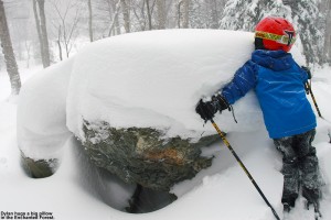
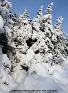
I’d been checking on snow depth during my ascent, but due to all the snow this week, there was a lot of unconsolidated stuff under the current storm’s bounty and it was difficult to assess just what came down overnight. I’d been getting measurements of roughly a foot or more since I’d started at the base area (~1,500’), but when I stuck my measurement pole into the snow at that ~2,800’ mark, I got an overall depth of 18 inches. Combined with what I was seeing around me from other skiers (check out the pictures from adk and from Powderfreak at the American Weather Forum), who were having little if any issues touching down on obstacles below the snow, the potential turns were looking really good. National is quite steep and while it wouldn’t typically be my first choice for early season skiing, Mother Nature has really been dishing out the snow on Stowe this week. It looked ready and I was about to test it out.
“These new fat, rockered skis are absolutely the real deal. I continued to bound my way down the steep slope, just amazed at how easy the turns were.”
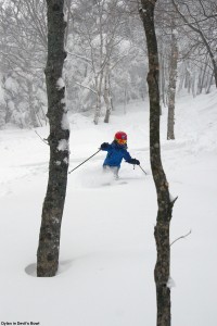
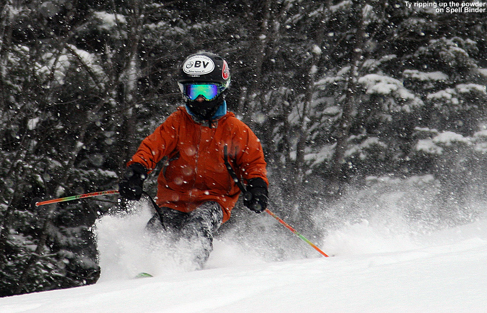
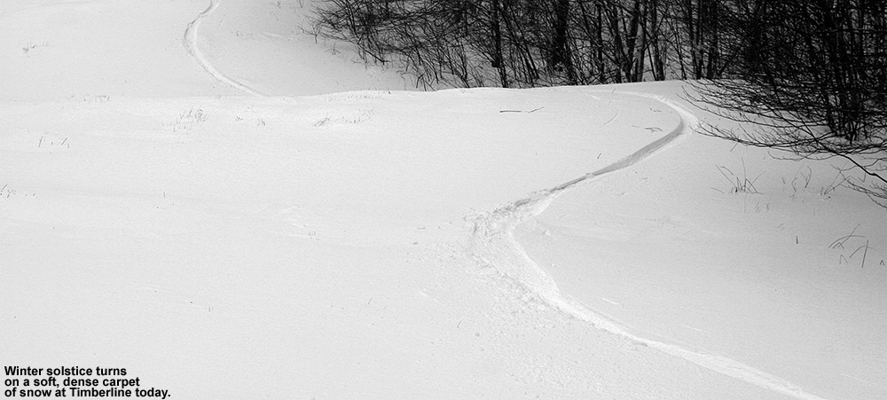
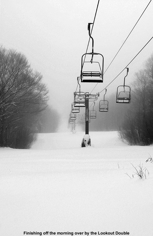
I switched to descent mode and decided to see what the AMPerages could do. I dropped in for the first few turns, tentatively, still wondering in the back of my mind if I was going to hit something below, but it was immediately obvious that there was plenty of snow. The powder was light and dry, and I quickly found myself just giddy with how well the AMPerages performed. This was my first time on such fat, rockered skis, and although I figured that there might be some modest, incremental increase in ease of powder skiing over my regular Telemark setup, it was far more than that. These new fat, rockered skis are absolutely the real deal. I continued to bound my way down the steep slope, just amazed at how easy the turns were. At the bottom of National I decided to avoid heading back down toward the snow guns where I’d ascended, and instead took Houghton’s over toward the Lookout Double. It was very quiet over there, since it was well away from any snow guns, and I finished off my run turning my way through fluffy silence. It’s not even December 1st and there’s not just passable, but really good natural snow skiing from top to bottom on Mt. Mansfield, so indeed that’s a great end to November on the slopes.
Sure today featured the best snow I’ve encountered this season, but I can already tell that the powder skiing is going to be just that much more fun this season with the new boards in the quiver. I’ve now tested the AMPerages in some legitimate Champlain Powder™ – they handled the fluff with aplomb and they are clearly NVT worthy in that regard. Presumably the whole season won’t be just a fluff fest, so I’m also eager to see how they handle thicker snow and crud, but we’ll have time for that.
I was in Morrisville today, so on the way home to Waterbury I stopped in at Stowe to make some turns. From the Stowe Village area, the view is quite nice with all the trails covered in white from the snow at the beginning of the week. Even at midday, the temperature was just a bit above freezing at the base (~1,500’) and the resort was cranking out snow from top to bottom. The bulk of the snowmaking was taking place on the main routes in the Lord/North Slope area, although snow was also being blow over on the lower slopes of Spruce Peak in the same places that we’d seen it on Sunday. To avoid the roar of the guns, I decided to make my ascent up Nosedive. Hiking was in order at the start of the ascent, since natural snow doesn’t appear until roughly the 1,800’ elevation. The air was generally calm and the temperatures pleasantly cool as I hiked, and finally when I reached the 3,000’ elevation it seemed that the snowpack was sufficiently deep and consistent enough to strap on the skis and start skinning. There were a couple of descent tracks from people who had skied the upper parts of Nosedive, and while the snow was actually quite nice with some powder and sugary surface hoar, you’d certainly want to use your rock skis based on the coverage. I topped out at the Fourrunner Quad summit area, and switched over for the descent on the plateau above Nosedive away from the snow guns. Estimates of the natural snow depth at various elevations on the ascent are as follows:
“The descent featured all sorts
of conditions, such as bottomless
manmade snow, sticky manmade sludge,
refrozen moonscape, and thankfully,
some areas of packed powder and
partially groomed manmade snow.”
The descent featured all sorts of conditions, such as bottomless manmade snow, sticky manmade sludge, refrozen moonscape, and thankfully, some areas of packed powder and partially groomed manmade snow. I started the descent on Upper Lord, and that was where I found the bottomless manmade that had recently been blown. After my experience with the snow on my November 4th tour, I have to say that I find that unconsolidated manmade stuff even more horrific to ski than Sierra Cement or Cascade Concrete, at least on Telemark gear. The turns often feel like an accident waiting to happen as you glide across the top and then suddenly cut into the paste with random frequency as you pressure the turn. Fortunately that ended by the time I reached the top of the Lookout Double. Snow was still being made, but the guns weren’t as densely packed and you could get around so that you were riding on older snow. Those middle elevations offered some of the best turns, with some nice packed powder to be found. The manmade snow that had had some time to dry out and/or had been packed by other traffic skied quite nicely. I did get into trouble in one spot where a gun was blowing fresh snow that turned out to be on the wet side – as soon as I stopped, several inches of it glommed onto the bottom of my skis and I had to slowly work it off while I got moving. I did my best to avoid any of the snow being blown by the lower mountain guns after that point, but it seemed like that one was just especially bad because of the mixture it was putting out. On the bottom half of the mountain there were still some areas of nice snow, but also refrozen and slick areas where one had to be careful to avoid a sliding out. At the bottom of my run, the guns were blowing in the North Slope Terrain Park, and I was dreading the thought of what the snow would be like down at that elevation. I watched a snow cat head right up through the gut of the trail, so I waited for him to make it above me in order to stay out of his way. That turned out to be very beneficial, because the best snow was actually in the track that had been churned up by the treads. It hadn’t been fully smoothed out, but by breaking up the top skin of the manmade snowpack, it produced some really nice packed powder. Those turns were actually great as I made my way back and forth in the swatch of the snowcat, and it gives me confidence that once Stowe’s snow is appropriately groomed, it’s going to ski quite nicely.
So, I definitely found some nice turns out there today. Today’s skiing scores well above what was available when I went out for a tour back on November 4th, but it wasn’t quite up to the consistency we found in the corn snow on Sunday’s outing, so today will fall in the middle of the pack for this November’s turns. It looks like we’re going to continue with this stretch of generally clear weather into next week, so while we can’t expect much natural snow during that time, at least the temperatures are such that plenty of snowmaking can take place.
The past week has seen some excellent cold temperatures for November snowmaking in the Northeastern U.S., and Stowe took full advantage, running close to 200 snow guns at times. I witnessed some of the high elevation guns being fired up when I was out on the mountain last Sunday, but since that point it’s been an all out assault reaching all the way down to the base. The resort did such a thorough job covering the slopes that they were able to go ahead with an early opening for seasons pass holders yesterday. The conditions looked fantastic based on Powderfreak’s pictures from the day, but just as exciting was the fact that the lifts wouldn’t be running today, opening up the chance for earned turns. The forecast called for sun and temperatures in the 50s F, so it looked like we’d have some nice soft snow for carving.
We had house guests over in the morning, and then stopped by the Nordic Barn to pick up some new poles and Telemark boots for Ty, so it was mid afternoon before we got to the mountain. This meant that we were already in the shadow of mighty Mansfield as we began our ascent, but the sun was still shining brightly on the east wall of the valley. There’s still a good deal of natural snow around on Mt. Mansfield, with a half foot of snow at the stake as of this evening, but the snowmaking terrain in the North Slope area was the obvious choice in terms of coverage. The ascent was very easy, since the surface was predominantly dense, manmade snow, which had consolidated with today’s warm temperatures and become spring-like. We saw a couple of people heading up just ahead of us, but we appeared to be the last group ascending for the day.
The boys had a good ascent in terms of their energy levels, and we got to enjoy numerous views of the Spruce Peak area as we made our way up out of the base elevations. It turns out that Stowe even turned on some of their snowmaking firepower on the sunny slopes of Spruce, and we could see large expanses of white that had been laid down in the Easy Street and Slalom Hill areas. We topped out on North Slope in the area of the Lord junction, with dusk dictating that we just had to descend. Beneath the darkening sky, we descended with the trails to ourselves toward the glowing lights of the Stowe Mountain Lodge. We had just enough light to see the terrain, so it made for one of those surreal on-slope experiences. Even at the late hour, the snow remained soft, and it supported great carving thanks to the warm air that’s moving into the region. Dylan was the hero of the descent, actually finding a tail clip from Ty’s skin that had been lost on the way up. It was amazing that he was able to find the small piece of metal it in such low light, but he’s going to be inheriting those skis soon once we get Ty’s new ones mounted, so perhaps it was destiny.
After getting in some skiing last weekend, and now this one, November 2012 is turning out much more typical than the previous couple we’ve seen. Both of those featured above average temperatures, so I only got out for one day in November 2011, and not even a single day on November 2010. I’m definitely enjoying the return to normalcy this year, and although we’ve got a couple of warm days on tap, snow is already back in the forecast for the mountains and valleys on Tuesday.
I left the house near midday under cloudy skies and a temperature of 39 F, but a few minutes into the drive, the temperature dropped to 37 F in the Waterbury Center area, and snow began to fall. It snowed lightly all the way to the mountain, and accumulations began to appear just as I hit the resort base at ~1,500’ in elevation. The temperature had really dropped as I ascended the last stretch to the resort, and as I parked in the Midway lot, the temperature was right around the freezing mark.
Accumulations in the Midway area were generally a trace to an inch, so I stowed my skis on my pack and headed over toward Nosedive to use that standard route of ascent. As I approached the 2,000’ mark, the snow depth became a bit more consistent, generally in the 1”-2” range, and I switched to skins. I was probably a touch early on putting on my skins since I encountered a few more spots of mud, but that’s what rock skins are for, and it made for a lot less slipping than hiking in my boots. The precipitation that had been snow at the start of my ascent turned into more of a freezing mist as I headed into the clouds around 3,000’. Up around 3,600’ at the Stone Hut it was windy, well below freezing, and quite chaotic with Stowe’s snow gun firing off what seemed like a 21 gun salute. I sheltered behind the hut to keep out of the wind and the roar of the snow guns as I switched to descent mode and had a much needed snack. The wind made for plenty of drifting during my ascent, but I’d sum up the snow depths with respect to elevation as follows:
I’d only encountered a couple of groups descending on Nosedive while on my ascent, but there were plenty of tracks from previous visitors and the snow was quite packed out, so I decided to descend some other terrain off to the south. The combination of wind, freezing mist, low visibility, and manmade snow made for a really challenging descent, especially on my skinny Telemark skis, so I generally just took it easy and stuck to mellow terrain. In general I didn’t find much in the way of decent turns until I got down onto Sunrise below the snowmaking, and pretty quickly after that the snow depth was getting a bit meager. I did manage some nice turns here and there, but eventually it was more gorilla-style survival turns until I finally decided to call it at the elevation of Crossover. I strapped the skis back on my pack and had a nice stroll back to the car. I’d say at this point the skiing isn’t worth putting in a ton of effort, but it’s definitely fun to get out for a few turns if you’re close by. We’ll have to see if anything comes from the Nor’easter that’s expected this week though, because the current snow could serve as a decent base for another round of accumulations.
On our way toward Burlington to run some errands today, we headed up to Bolton Valley in the mid afternoon to get our season’s passes. Temperatures were in the low 40s F at the house, but started to drop pretty quickly as we ascended the Bolton Valley Access Road. The first signs of snow on the ground along the road were just above the Timberline Base in the 1,700’ elevation range, but I also noticed that slushy snow was still present on vehicles in the parking lot of the Timberline Base Lodge (1,500’) even though there was nothing left on the ground there. I suspect that the snow line was a bit lower last night, but I’m not sure quite had far down it reached. Up in the village at 2,100’ it was snowing with temperatures in the low to mid 30s F, and we found about an inch and a half of accumulated snow on the ground/elevated surfaces. It was quite a contrast descending the road and spending the afternoon in the Burlington area, where the temperatures were in the mid 40s F and it was hard to imagine that it was snowing even below 2,000’, the lapse rate actually seemed steeper than usual today. In the Champlain Valley it was often just cloudy with the feeling that precipitation had wound down, but as the afternoon wore on, spits of precipitation and bouts of light rain became more common. At times we’d have bursts of more moderate precipitation and it was nice to know that moisture was still heading to the mountains and falling as snow. Leaving Burlington later in the evening we went from 42 F in Williston to ~37-38 F at the house. There no accumulating snow to report down here as the temperature is sitting around the 37 F mark, but we’ve got light to moderate rain right now and 0.18” of liquid in the rain gauge since it was emptied this morning, so it’s probably still accumulating at elevation. A few pictures are available from our visit to the higher elevations of Vermont today.
Parts of the Northeast have had bouts of sub-freezing temperatures since the end of August, but tonight looks like the first widespread occurrence of the season throughout Vermont. We’ve got a frost advisory here in Washington County, but it sounds like some of the colder areas of the state up in the Northeast Kingdom could get down into the middle 20s F, and freeze warnings are in place. It’s certainly time to cover up those gardens in the usual cold spots.
With everyone having their own unique perspective on skiing, some of which you can discover at supreme ski morzine skiing school. They tend to love skiing since they teach people how to do it! But combined with the multitude of weather-related factors involved in winter recreation in general, there’s usually ample room for debate about where a ski season sits relative to average. However, when it comes to the 2011-2012 ski season in Northern Vermont (and perhaps to an even greater extent in other parts of the Northeastern U.S.) most any metric would set it firmly in the lower half of seasons. Some key contributing factors to the outcome of the season were temperatures, which were above average for every month from October through May (specific monthly temperature departures are available in the monthly detail section), overall precipitation, which was well below average during that period, and as expected with that combination, snowfall that was well below average. However, the numbers don’t always tell the whole story, and indeed that was the case in Northern Vermont this past season. If numbers aren’t everything, perhaps timing is everything, and the snow machine of the Northern Greens exhibited some impeccable timing for some of the busiest ski periods when it came down to it. There was also a consistency and intensity in backside snows that seemed to heal just about every mixed precipitation event. So while I don’t think that the winter of 2011-2012 can be considered anything but below average around here, the bigger story might just be how “surprisingly good” it was. That story unfolds in the details below, and may inspire people to look at other skiing options. Some may consider the vail village ski rentals in such a situation, especially after reading about this different location.
Snowfall: A very reliable and trustworthy indicator of just how poor the winter’s snowfall was for the general Northern Vermont area, is the data from the area’s first-order weather station at the National Weather Service Office in Burlington. Out of 127 years worth of data going back to the winter of 1884-1885, the 37.7″ of total snowfall in Burlington during 2011-2012 was the third lowest in their records (only 1912-1913 with 31.3″ and 1904-1905 with 32.0″ were lower). Interestingly this third lowest recorded snowfall obtained in 2011-2012 came right on the heels of Burlington’s third highest recorded snowfall of 128.4″ in 2010-2011. Relative to average snowfall, which for the 1884-2011 period of record in Burlington is 73.3″, 2011-2012 came in at just 51.4%. Burlington is the local first-order weather station for the area, but despite its proximity to the spine of the Northern Greens, the Champlain Valley’s snowfall doesn’t necessarily correlate with what goes on in the mountains. Looking next at Winooski Valley snowfall data obtained from our house, which sits right along the spine and is a decent representation of what happens in the mountain valleys of the Greens, we find that snowfall was well below average during all the key winter months, and our season total was 115.3″. Not surprisingly, this is the lowest snowfall total obtained in the six years that we have collected rigorous data at our location, and it’s almost two standard deviations below the mean (172.1 ± 31.5″) obtained from 2006-2011. However, at 67.0% of the average snowfall, it’s not quite as low as what Burlington experienced. Like the local mountains themselves, some spots in the mountain valleys have what Powderfreak refers to as a snowfall “insurance policy”, which comes in the form of upslope snow. Burlington and the Champlain Valley can get in on a bit of mesoscale weather action in the form of lake-effect snow from Lake Champlain, but it’s not a major contributor to snowfall due to the size and orientation of the lake. To the east of the Champlain Valley however, the upslope snow, sometimes referred to as Champlain Powder™, is what sets the snowfall in the Greens apart from areas that rely solely on synoptic precipitation. Interestingly, as we head up in elevation above our house in the valley, we find Bolton Valley reporting a very similar deviation from average snowfall compared to Burlington this season. Bolton recorded 159″ of snow this past season, which based on Bolton’s reported seasonal snowfall mean of 312″, comes in at just 51.0% of average. That amount of snow is extremely low for this area, and is more akin to what one might find in a typical season at Lake Louise Ski Area in Alberta vs. the spine of Vermont’sNorthern Greens. The updated table with Bolton Valley’s snowfall from the past several seasons is added below, which illustrates the strong snowfall deviation from average seen in 2011-2012:
Although still well below average all around, there certainly was a trend toward slightly better snowfall as one continued to head north in the state, with the northward trend of 63.4% at Stowe, 66.6% at Smuggler’s Notch, and 71.5% at Jay Peak relative to average. A contributor to the low snowfall at the resorts was the fact that there was really only one big, multi-foot storm cycle during the heart of the season. That storm came at the end of February and dropped 40″ at Jay Peak, just on the heels of a couple smaller systems for a total in excess of 50″ of snow in just a few days. The resulting skiing was fantastic due the density gradient that was set up by the way it fell – 1 to 2 feet of dense snow came first, and it was topped off with another couple feet of champagne that finished at around 2% H2O. The snowpack at the Mt. Mansfield Stake jumped from 49″ to 81″ during that period, and the icing on the cake was that the storm cleared right out to produce bluebird skies on Feb 26th. Unfortunately, one great storm doesn’t make a season. Based on estimations from my weather data, on average we should only expect one or two of those 40″+ storms per season, but they would typically be backed up by several 20″+ storms, and the deficiency of those is part of what left the overall snowfall lacking.
Tree Skiing:In the past I’ve used empirical data from trip reports to establish a mean date for the start of tree skiing in Northern/North-Central Vermont, and as I outlined in last year’s ski season summary, that analysis revealed a date of December 10th ± 13 days, with an average depth at the stake of 28.1 ± 6.5 inches. However, after a comment from Powderfreak back on December 12th, in which he indicated that he’d observed tree skiing on appropriate terrain at Stowe to start roughly when the snow depth at the Mt. Mansfield Stake hit 24 inches, I decided to run an analysis using snowpack data from the stake. Instead of just the 15 to 20 seasons worth of ski trip reports that are available since the arrival of the internet era, there are almost 60 seasons worth of data available from the Mt. Mansfield Stake. Analysis of the stake data using the first date of attaining 24″ of snow depth or higher as the start of tree skiing, actually produced a very similar result (December 12th ± 19 days, with an average depth at the stake of 25.8 ± 2.7 inches) to what was obtained from the empirical data. With the date being so close to what I determined from the empirical data, I’m pretty confident that the date of attaining 24″ in the stake data will serve just as well in determining the average start of tree skiing, and the relative start date for individual seasons. With the median and mode for that analysis coming in quite close to the mean, the distribution seems normal, so the standard deviation in the data should have some predictive value. This “24-inch rule” isn’t meant to replace the traditional “40-inch rule“, but it’s there to compliment it as a more practical measure of when people actually start venturing into the trees in this area (the fact that it is corroborated by many years of empirical data can testify to that). The point at which the stake hits 24 inches is a decent mark for when appropriately maintained trees are going to start offering up good turns for those with the right skills and knowledge, whereas once the stake hits 40 inches, skiers can pretty much venture into most off-piste areas with a good degree of confidence. Between those two points is going to be a continuum of increasing access to off piste terrain. Moving from the 24″ depth to the 40” depth will typically take place during the month of December, with the snowpack at the Mt. Mansfield Stake reaching the 40″ mark at the beginning of January on average.
So where did the 2011-2012 season stack up in terms of the start of tree skiing in Northern Vermont? Not surprisingly, when assessed by the new method of reaching 24″ at the Mt. Mansfield Stake, it’s down near the bottom of the pack. Below, I’ve added a scatter plot that I generated using the Mt. Mansfield snowpack data; the X-axis is a timeline spanning from October to January, and the blue stars represent the dates when 24 inches of snow depth was attained at the stake for the various years from 1954-2012. The red data point is for the 2011-2012 season (date of attaining 24″ = January 3rd, 2012), so the season is indeed more than one standard deviation on the late side (the large vertical line in the plot is the mean, and the small vertical lines are ± 1 standard deviation), although it actually isn’t as late a start as some seasons:
How did the 24-inch snowpack depth analysis compare to what we actually found on the ground this season? Since skiing natural snow terrain on piste began first, I’ll mention that momentarily before discussing the trees. I saw the first signs of people skiing natural snow trails this season on December 27th at Bolton, and coverage certainly looked sufficient on at least moderate terrain. The tracks I saw at that point already looked old, and I suspect that on piste natural snow coverage was actually sufficient the day before (December 26th), thanks to the Christmas Day storm. Bolton picked up close to a foot of snow from that storm, and at the end of the day on the 26th, the snow depth at the Mt. Mansfield Stake came in at 14″. The first day that we actually ventured into the trees at Bolton Valley was December 29th, and as I stated in my report from that day, we only ventured in for one run because the base was just a little too thin to really ski with confidence in there and enjoy it. And, when the snowpack was measured at the Mt. Mansfield Stake later that afternoon, the depth was 21 inches, just a bit shy of that 24-inch mark. By the next day, we were skiing natural snow trails with more than enough coverage, but it wasn’t until January 7th at Bolton that I commented about some of the trees finally being ready after the boys and I skied Wilderness Woods. The measurement from the stake came in at 24 inches that afternoon, and we were clearly reaching another threshold of sorts, so attaining that 24-inch depth at the stake was indeed a decent measure for the start of tree skiing this season in our experience. Powderfreak and I have discussed how that 24-inch number is going to be quite rough, since a 24-inch depth attained mostly with fluff will represent something substantially different that a 24-inch depth attained with cement, but it looks like it’s going to be a reasonable approximation of when people start to take their initial forays into the trees and find the conditions good enough to stay there.
Looking at tree/off piste skiing for the season as a whole, there’s no question that it was curtailed relative to normal. The very late date of reaching 24 inches at the stake in the beginning of January (January 3rd) is 1.13 standard deviations beyond the mean according to the Mt. Mansfield snowpack analysis, putting it close to the bottom 10% of seasons. When this is coupled with the large amount of melting in Mid March due to record heat, which closed a lot of terrain, it equates to a tree skiing season that is roughly 2 ½ months long, compared to the more typical length of 4 to 5 months. The off piste season was certainly condensed, and while coverage was there to enable plenty of access in January (Stowe reached 100% open status by January 14th), tree skiing really seemed to take forever to hit its stride; to wit, the snowpack at the stake didn’t hit the 40-inch mark until the end of January.
Snow Quality: In last season’s summary, I checked my trip reports and found those days in which we were skiing powder, typically suggesting a fairly high level of snow quality, and those days in which powder skiing wasn’t available, often indicating some sort of thaw (or in one case this season, insufficient base depths). For the list of outings below, I’ve again placed a P whenever we were skiing powder, and put a red X if we weren’t, to reveal the temporal pattern associated with that categorization. Outings with an X may still be providing decent skiing such as wet snow, corn, etc. (or else we’d probably be doing something other than skiing) but aside from the spring period, there’s going to be a price to pay in terms of snow quality after these episodes when temperatures eventually cool back down. Chronologically, the first X appears for the outing on December 10th at Bolton Valley. The lack of powder skiing on that date wasn’t actually due to temperature fluctuations, but instead due to the fact that there just wasn’t enough natural snow; substantial snowfall was very slow in coming in early December. The natural snow depth up above 2,000′ in the Bolton Valley Village was still only 2-3″ at that point, so short of junkboarding, skiing was really restricted to just the limited terrain that had manmade snow. The next X appears on our Bolton Valley outing on December 31st, and it represented a notable bump in the winter weather. The holiday week wasn’t too cold, but it was certainly snowy like one would expect at Christmas time in Vermont, with three decent snowstorms totaling more than two feet of snow at the northern resorts (refer to the December entry in the detailed monthly section for more information). So there was indeed some great powder skiing during that stretch. The main factor that kept the overall quality of the skiing from being really outstanding was the lack of base. The natural snow terrain that was open was excellent, but there still hadn’t been enough snow to open the steepest terrain without snowmaking. The X in this case comes in at the tail end of the holiday period where there was a thaw. I described the skiing on New Year’s Eve as reminding me of the Pacific Northwest, with low hanging clouds on the mountains, and dense snow underfoot. I’m not sure how long the resulted firm snow conditions lasted, because three small to moderate storms came through the area that week, with the first one dropping a half foot of snow in the mountains. By the following Saturday there was powder skiing again for the weekend. From that point on there were no interruptions in powder skiing though to mid March – at least from our perspective; we don’t ski every day of course, but we did ski every weekend through that period. However, Powderfreak does ski just about every day of the season at Stowe, and he noted that there were only a few select days without powder. I’ll speak more about that at the end of this section. By far the section of the outings list that stands out the most is the second half of March – the dramatic change in conditions is quite obvious, with seven outings in a row marked with an X. Record warm weather came in with a vengeance in mid March, and it was all spring skiing until the weather cooled back down to normal levels and produced snowstorms for the final two thirds of April. We finally finished off our season with a couple of corn snow days in May, a point in the season where that type of snow is the norm.
The 2010-2011 ski season was the first one to which I applied this type of powder skiing analysis, and relative to what I thought it would look like, I was certainly surprised by the consistent availability of powder conditions once I saw the data lined up. But as surprised as I was with that result, the 2011-2012 analysis is even more astounding. Somehow there was good to great skiing every weekend/holiday period throughout most of the core ski season, despite the overwhelmingly warm temperatures and low snowfall. As I mentioned above in the snowfall section, Bolton Valley reported just 159″ of snow for their entire season. That’s ridiculously low – it’s half their usual snowfall, and we typically average more snow than that at our house, almost 3,000′ below the upper elevations of the resort where the snowfall measurements are taken. That amount of snow might suffice for some decent skiing in an environment like the high elevations of the Rockies with very consistent winter temperatures, but this season in Vermont was anything but that. There were temperature issues throughout the season, and January was a perfect example – at the end of the month, local meteorologist Roger Hill pointed out that we’d had seven January thaws. I had many ski weather-related conversations with Powderfreak in the 2011-2012 ski thread at American Weather’s New England Subforum about the surprisingly high quality of the skiing, and there was certainly consistency in conditions, but we also determined that it was an issue of timing. Snowfall was low, and spells of warm temperatures abundant, but storms were just timed well to ensure that most snow quality issues were remedied by the weekend. Although the season was warm on average, we didn’t have many big rain events, and any that we did have seemed to be quickly covered by backside snow. There was indeed something special about the timing though, because somehow we had weekend after weekend of nice skiing with powder on Bolton’s 159″ of snow. The detailed reports below and the monthly ski summaries that follow, provide the specifics of how it all went down, and the frequency and distribution of P in the outings list really speaks to that theme of “surprisingly good”:
October: Snowfall in the month of October is generally scant down at the elevation of our house (495′), and because we’re on the fringe of the cold season at that point, it’s not a great indicator of snowfall in the local mountains. The six year average I have in the valley is 0.9″ of snow for October, so by that measure, the 1.2″ of snow that we received in October 2011 was very typical. However, for the New England region as a whole, October 2011 would wind up being anything but typical. Back to back snowstorms hit New England at the end of the month, with the first one on October 27th dropping over a foot of snow at Killington to kick things off with gusto. That type of storm is pretty standard for the mountains of Vermont in October, but just a couple days later on the 29th, it was followed up by a second, larger storm – a record-breaking monster of an October snowstorm for Southern New England. Over 30 inches of snow fell in some locations, and those weren’t necessarily high elevation locales. Massive power outages ensued because leaves were still on the trees in those areas, and people were without power for up to two weeks. Ironically, despite the back-to-back snowstorms in New England, including an historic, 100-year event, Northern Vermont ended up with little if any snow from either of them. The lack of snowfall is seen easily in my 2011-2012 Waterbury/Mt. Mansfield snowpack plot – the only snow depth recorded on Mt. Mansfield for the entire month was 0.5″ on October 30th, and that is essentially invisible with the scale used. I don’t know what Mt. Mansfield averages for snow in October, but I’m sure what they got was well below average. As for the skiing though, what we couldn’t get in the Northern Greens was easily obtained about an hour south in the Central Greens. With the mountains of Central Vermont getting hit by both storms, we headed down to Pico with the boys for an outstanding day of turns in the powder. The back-to-back storms had essentially set up snow on snow, or powder atop a base. That’s a bit of a treat compared to the way October skiing on natural snow often plays out, so it was enjoyed by many. It almost seemed like half the ski population of Stowe had temporarily migrated south to access the great turns at Pico. So while in general, October was pleasant, mild, and nearly snowless in Northern Vermont (Burlington came in 2.0 degrees F above normal at the National Weather Service Office) some great skiing snuck in there a bit to the south.
November: I’ll put November 2011 into perspective by looking at November 2010, in which the ski conditions were apparently poor enough that we didn’t ski once. Fortunately, that didn’t happen this season – even if just by a day. The near lack of snow in November 2010 could be considered demonstrative of typical November snowfall in the valley though, because up to that point it had truly been feast or famine since we moved to our current Waterbury location in 2006. However, this past November finally bucked that trend by coming in with 11.4″ of snow (128% of average) which is as close to “normal” snowfall as I’ve ever seen for the month based on my data. We had a couple of minor accumulating snowstorms early in the month, and then another mid month, but it was a storm near the end of the month that really produced 95% of our November valley snowfall. That storm dropped almost a foot of snow at the house, and got me to head up to Bolton Valley for some turns. In terms of skiing, options for catching the new snow atop a manmade base were rather limited because most of the local resorts were of course using their manmade snow to serve customers, but I headed up to Bolton Valley to see if the natural snow alone was enough for some turns. Since they don’t open until December, Bolton hadn’t yet made any snow by that point, but it turned out that the storm had dropped over a foot of snow up there, and it was dense enough that one didn’t need much of it to keep them off of whatever lay beneath. I enjoyed some decent turns, even if that outing wound up being the only one for the month. This past November was a decent step up from the previous couple of seasons with little to no snow, but we’ve still yet to have a very snowy November since the 2007-2008 and 2008-2009 seasons; both those seasons delivered roughly 20″ of snow in the valley, and plenty more in the mountains. The general seasonal trend of warm weather continued right through the month as well; although much colder than October on an absolute basis, November was even warmer relative to its long range average, coming in 5.1 degrees above normal at the National Weather Service Office in Burlington.
December: The first two thirds of December simply felt like a continuation of November; the pre-holiday period was hampered by above average temperatures, but the more notable issue was the absence of significant storms. The Northern Greens were holding their own thanks to numerous small snowfalls, and these events were definitely enough to get us into some powder skiing, but they weren’t enough to really build a deep base of natural snow. The last third of the month was really the highlight in terms of snowfall. As the all-important holiday week approached, Central Vermont northward finally got into some moderate storms. The localized nature of these storms was good for highway travelers from down south, and one could hardly ask for better timing of fresh snow for the holiday week. Storm 1 hit on Friday the 23rd, dropping roughly half a foot from Killington northward, storm 2 was on the 25th, centered on Stowe where they received over a foot, and storm 3 began on the 27th, with totals again topping out around a foot. The skiing was quite good, indeed excellent by the end of the week as the snow from the storms continued to pile up, but the lack of snowfall earlier in the month meant that the natural base depths weren’t there like they would normally be. Fortunately, some natural snow terrain was open, but certainly not the steepest stuff, and the natural snowpack was still just a bit too lean to spend much time in the trees. In any event, we skied eight times during that holiday stretch, a sign that there was definitely some good skiing. With all the new snow, our local area certainly had it a lot better than many places in the country did during the holiday week, so in that regard we were lucky. I’m sure business was still down at the Vermont ski areas in general, but people may have been hearing about the holiday snow that Northern Vermont was getting, because Powderfreak posted on Christmas Eve how lodging space was still very tight in Stowe. Despite the snow in the northern half of Vermont though, the general talk around the region was how poor and snowless it was in general, so I’m sure many places lost some potential visitors due to that. Even with those moderate storms at the end of the month, when all was said and done, we still ended up quite low on snowfall down at the house; the 24.7″ we received was just 59% of our average for the past six seasons. Temperature consistency/snow surface quality: With the slow start to snowfall, we didn’t even ski during the first weekend of the month, but we did get out for the other four. The second weekend was the one where there was no powder simply because there wasn’t enough snow. Temperatures were certainly above average as a whole (NWS in Burlington was +4.8 F on the month), but December mean temperatures start getting cold enough that even above average departures can still be sub-freezing and produce snow in the mountains . The third weekend of the month had some decent conditions at Stowe, and then the final two weekends sort of lose their definition with the big holiday week, and that period gets lumped together. Conditions for the holiday week were mostly wintry; strictly speaking though, the last weekend of the month did see a thaw, but in the context of the whole holiday week it was rather insignificant.
January: We had 13 accumulating snowstorms at the house in January, which is quite decent and actually a bit above average in number, but as mentioned in the Snow Quality section of this season summary, we also had seven January thaws. These thaws didn’t mean torrential rains, but what we saw were many storms with mixed precipitation in the middle, cutting down on snow totals. The Northern Greens continuously made fantastic recoveries in snow conditions due to grabbing that upslope snow on the backside, so snow surfaces were quite nice in general, but in those first couple of weeks after the holiday storms, we got back into what Powderfreak calls “nickel and dime” snows. They kept surfaces fresh, but base depths built very slowly. Finally on the 12th, we got a more significant storm, which dropped two feet at Jay Peak, and roughly a foot and a half down through Sugarbush. That storm was an undeniably propitious event, and Stowe’s terrain was 100% open by January 14th. Again we saw Mother Nature pulling off some of her nice timing with that storm cycle, since it was just in time for the MLK weekend. I remember skiing great packed powder snow on Waterfall at Stowe on the 16th, and commenting to Powderfreak how astonished I was – it seems like that trail is hardly ever open even in a good season, and there we were skiing it with such premium snow in a very low snow season. We were fortunate to get that storm though, because after that it was back to nickel and dime storms with some of those similar mixed precipitation sandwich events with backside snows for the remainder of the month. Overall snowfall at the house was 32.6″, not quite as low as December, but still just 83% of average, so we weren’t making any gains on the low season snowfall. At +5.8 F, the deviation from normal temperatures at the Burlington NWS for January was even a degree higher than it had been for December. Like December though, normal January temperatures are cold enough that substantial snow can fall with positive departures like that. Temperature consistency/snow surface quality: With eight days under our belts from the holiday week, and nothing returning the conditions to midwinter after our Pacific Northwest-style outing on December 31st, we didn’t ski on January 1st, but we did ski on all four of the full weekends during the month. As seen in the outings list above, powder was present throughout our trips to the mountain, which was pretty amazing considering all those thaws/mixed precipitation storms.
February: There’s no question that February will go down as having the best skiing of the season in Northern Vermont, but the month certainly didn’t start out in a spectacular way. An initial half foot storm at the beginning of the month did a fantastic job of resurfacing the slopes after one of those January “sandwich” storms with mixed precipitation in the middle, and Mt. Mansfield continued to impress. Although still well below average in terms of both snowfall and snowpack, Northern Vermont was clearly doing extremely well in comparison to even Central Vermont by that point. After that initial modest snowfall event, our wishes for a weather pattern change that would get us away from all those mixed events were indeed answered, but perhaps not exactly in the manner we would have liked. Instead of switching over to more typical snowstorms, the precipitation basically shut off. Down at the house, we’d had just over half a foot of snow through the first three weeks of the month. For a month in which we average over 40″ of snow in the valley with a very low standard deviation of about 8 inches, we were staring at the potential for an amazingly low monthly snowfall total. Happily, the last week of the month ensured that February 2012 didn’t live on in infamy. We quickly picked up a couple of appetizer storms on the 21st and the 22nd, which didn’t produce much snow at the house, but delivered close to a foot in the mountains. It was on the 24th though that the big kahuna came through; that storm dropped up to 40″ in the northern mountains, with a total of over 50″ at Jay Peak for the three storms combined. It wasn’t just a fluff storm either; snow from that storm definitely fell “right side up”, and ski conditions were off the charts. So much snow fell so quickly though that the avalanche conditions got a bit tenuous in the backcountry. I saw mention that Jay Peak broke their 24-hour snowfall record during the storm, but since I see that listed as 42″, I don’t think that was actually topped with this storm. In any event, the natural snow depths made huge gains, and as mentioned above; that storm even brought the snowpack at the Mt. Mansfield stake to an above average level. With a final storm total of 22.7″ at the house, it was our largest valley snowfall of the season. That one storm pretty much made the month in terms of our valley snowfall, but we still ended up with just 30.7″, which is 73% of average. The general presence of heat didn’t let up either, and the departure from normal at the NWS in Burlington again went up an entire degree from the previous month to reach +6.8 F. Temperature consistency/snow surface quality: The great timing of storms continued, and even the reduced snowfall in the first ¾ of the month was enough to keep powder around; conditions certainly remained good as we moved through that first part of February.The big storm was wall to wall snow and timing hardly mattered, but it was a weekend event anyway, with storm day skiing on Saturday, and fresh powder and blue skies on Sunday. That weekend took the cake of course, but all four weekends of the month offered some great skiing.
March: The first half of March felt like a continuation of that decent stretch at the end of February, even if we didn’t get any additional three to four foot storm cycles. Just a few days after the big February storm ended, another decent cycle came through heading into the 1st of the month, with close to a foot of additional snow at the northern resorts, and a foot and a half at the southern resorts. Amidst other freshening events, a storm on the 4th dropped about a half foot of snow, and then over a foot fell from a storm on the 9th that targeted the north-central resorts. The boost from the big February storm was felt in base depths and surface conditions, and you could feel that the season had really turned into what one would expect for March. Even as unseasonable warmth started to intrude and occasionally turn the powder wet through the first half of the month, there was usually enough time to get in turns for a good part of each day while the powder was still dry, and then more snow would come along to freshen things back up. The weather through that period was certainly on the warm side, but it was during the second half of the month when all hell broke loose with regard to temperatures. That expression is somewhat apt, because for March, it felt like that when five consecutive days of record temperatures with departures of +40 F hit the state from the 18th-22nd. Combined with the more moderate warmth during the rest of the month, the result was an incredible +12.2 F departure from the average March temperature at the NWS in Burlington. With almost no new snow in the valley during that warm second half of the month, March snowfall was a paltry 14.2″ at the house, just 60% of average. Temperature consistency/snow surface quality: The list of ski outings from above shows the trend here quite well, the first two weekends offered powder conditions, and from then on it was spring skiing. However, powder had been available for every weekend or holiday period since the middle of December by the point at which the snow conditions flipped, and that’s a commendable three-month stretch for such a season. Beyond the middle of the month, X was the only way to describe the powder conditions until we finally got to April. There was decent corn snow and great weather during that second half of March, but it was so warm that trail counts dropped rapidly at many resorts; even the huge snowpack gains made by the northern resorts at the end of February were lost as the snow depth at the Mt. Mansfield stake fell well below where it had been before the big climb. Despite the good spring skiing, it seemed like many resorts closed down simply because people had given up on winter by that point. The slow start and rapid end to winter seemed to take the wind out of everyone’s sails and, it had them looking to quickly put the season in the rearview mirror.
April: Temperatures for the month of April still came in above average (+1.2 F) at the National Weather Service in Burlington, but after the unprecedented warmth of March, that felt downright cool by comparison. Indeed April was more typical though, and some good skiing returned, even if the slightly warm temperatures kept the snow especially elevation dependent. With that trend, snowfall down at the house was almost insignificant, just 0.5 inches or 8% of average. That’s the least snowy April we’ve encountered in the six years that I’ve been monitoring snowfall at our location. Storms nailed the mountains with snow though, in the form of a minor event on the 4th of the month, then a big cutoff low dropping 2 to 2 ½ feet on the 9th. That snow was fairly dense and represented an unmitigated resurfacing of the slopes as one headed up in elevation. The skiing was great, at least in a Sierra Cement/Cascade Concrete sort of way where it doesn’t take much to cover whatever is below, but it would have been even better if the March warmth hadn’t deteriorated the snowpack as much as it did. With most ski areas closed after March sapped people’s interest in the season, plenty of great earned turns were made, but at the resorts that had stayed open, there was also some excellent lift-served skiing. April finished off with one final storm at the end of the month, which was nothing like the big one earlier, but it dropped about a half foot in the upper elevations and that was enough for some final powder skiing before we moved on to May. Temperature consistency/snow surface quality: While certainly not up to the level of April 2007, we did get to ski powder on all of our April days except April 1st. Most of what fell during the month for snow was rather dense, but it was still a nice reprieve to have fresh snow after the way March had gone. We only skied three of the five weekends that month, as half of our outings ended up being midweek.
May: After some tempering of the heat for April, Mother Nature was back at the stove for May, with a +5.3 F departure for the month at the NWS in Burlington. We didn’t have any accumulating snow in the valley, although that’s typically the case down at our elevation. There were actually no significant winter storms to speak of, but we did have one Vermont ski day on the 12th, enjoying the last of the corn snow up at Jay Peak. We took advantage of a Mother’s Day package that offered a chance to sample a lot of the new facilities up at the resort (water park, arcade, restaurants, etc.), and indeed taking in that smorgasbord of activities is an especially nice way to go when skiing is only going to be a minor part of a trip. Our other day in the month was actually out of state in New Hampshire on Memorial Day weekend, taking our traditional camping trip Auto Road ascent with the boys to ski the snowfields. The snowfields were somewhat on the lean side this year, but not bad considering what the region went through meteorologically during the winter season.
At the monthly level, the 2011-2012 ski season was a simply amazing stretch of positive temperature departures followed by even more positive temperature departures, and that trend has continued right into the summer, with June and July coming in at +1.9 F and +2.4 F respectively. August is currently coming in with a positive departure as well, and if it ends up staying that way, it will be the 17th month in a row in the positive departure streak for Burlington. Those departures are going to flip at some point, and it’s going to feel quite chilly by comparison. Despite that trend though, even when combined with below normal precipitation, the quality of the ski surfaces encountered this past season in Northern Vermont was quite good. I’m not sure if I’m willing to say better than average, since I don’t think surfaces were better than average at Bolton Valley, but I am willing to say that in our visits to Stowe this season, the typical on piste surfaces we encountered were actually better than the previous season. One thought is that the lack big storms in general also played out as a lack of notable rainstorms, which while generally infrequent in the heart of winter anyway, are likely more detrimental to the snow surfaces than more modest events with simply some mixed precipitation in the middle. The Northern Greens certainly showed throughout this past season that they have the ability to cover the back side of mixed precipitation events with additional snow quite effectively when there’s at least some moisture in the atmosphere to be wrung out. The fact that business was down somewhat at the resorts, may also have contributed to less skier traffic and slightly elevated on piste snow quality. Whatever the case, for a ski season that felt like an abysmal “perfect storm” of sorts with regard to temperatures and precipitation, 2011-2012 in Northern Vermont can certainly be described as “surprisingly good”.