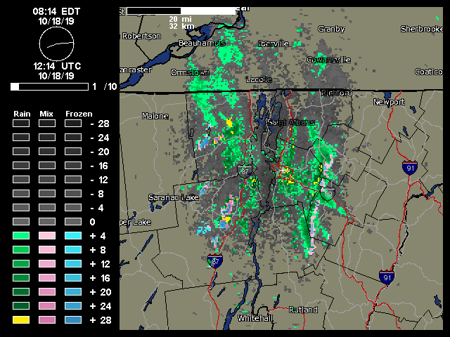
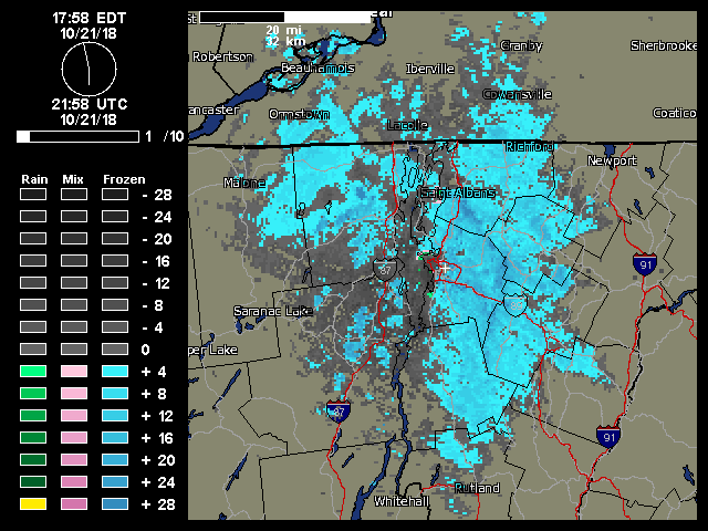
A look at the local Burlington weather radar from today showing the classic upslope signature of moisture streaming into the Green Mountains from the northwest and snow/mixed precipitation along the peaks.
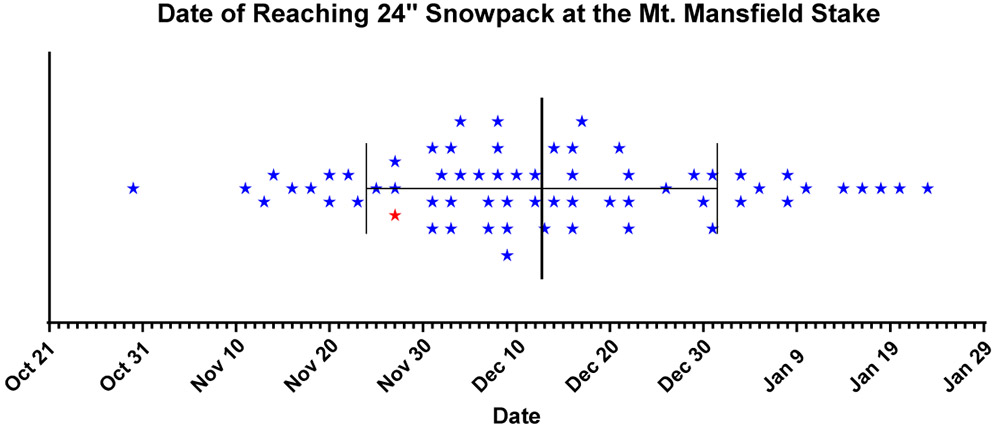
One approximate measure of when the potential natural snow/off piste skiing begins each season here in Northern Vermont is the date when the snowpack at the Mt. Mansfield Stake reaches 24 inches. This is by no means an exact date, especially since it’s possible to get great turns on just a few inches of snow if the snow is dense and the underlying surface is grass instead of rocks. You can indeed get by with much less than 24 inches of snowpack if the snow is very dense, but not if it’s all Champlain Powder™ fluff. Based on empirical observations and reports from skiers in the area each season though, hitting the 24” mark is reasonable for most situations.
With that preface, let’s take a look at where last season sits with regard the start of the natural snow/off piste skiing around here. By most accounts, last season started off with bang. Even in the local mountain valleys, the winter snowpack started as early as November 10th. That’s very early for the valleys, and when the valleys are doing well, the mountains certainly are too.
The updated plot for the 60+ seasons in the Mt. Mansfield Stake database is below, with last season represented by the red star:
The updated plot showing the date of reaching 24-inches of snowpack at the Mt. Mansfield Stake. The point for the 2018-2019 winter season (November 27th, 2018) is indicated by the red star.
Before I add a bit of context to last season’s start, here are the stats for the data set:
n: 64
Mean: Dec 12th
Median: Dec 9th
Mode: Dec 16th
S.D.: 18.8 days
Entry of this year’s data point had no effect on the mean, mode, or S.D. (within a tenth of a day), but it did drop the median by one day from Dec 10th to Dec 9th.
The plot would suggest a reasonably good start, but nothing outrageous: last year’s 24” date was Nov 27th, which is only 0.78 S.D. ahead of the mean, so well within 1 S.D. That puts it in roughly the top 22% of seasons, so about 1 in 5 seasons will have a similar or earlier 24” date.
While the 24” date is a nice snapshot for the start of the natural/off piste season, there are of course a number of other factors to take into account that made last November more impressive than that number alone:
1) Near miss: If you look at the raw November stake depth data (posted below), you can see that the snow depth at the stake reached 23” on Nov 21st. That’s as close of a miss as you can get to hitting 24”, so even as of the 21st of the month, the snowpack had essentially hit that two-foot level. Getting to that level by the 21st brings a season past 1 S.D. and into that top ~15% of seasons. That’s not a huge bump in this regard, but having nearly an extra week of borderline two-foot snowpack at that part of the season could easily mean an entire additional weekend of natural snow skiing potential.
2) No going back: This is a much bigger feather in last season’s cap. Even from about mid-month, the snowpack never really took a major hit, and once it did hit that 24” mark on Nov 27th, there was really no going back. It sailed past 24” and just kept climbing as you can see in the numbers at the end of the month. I haven’t added the December numbers below, but even with the lackluster December we had, the snowpack never dropped below ~40”. That can’t be said for all of the seasons on the left side of the plot (certainly not Mr. October out there in front, which was the 2006-2007 season – he was back to 0” at the stake by mid-November).
3) Snow-depth days: I haven’t calculated this for any November with the stake data, but it will obviously be a good integrative measure of how much snow was on the ground for the start of the season. I’m sure last November would have a solid ranking if I put those data together.
So, if we look into that left side of the plot, do we have any other recent seasons in there that we can use for comparison to last season?
Actually, that lone star (Nov 25th) just to the left of the red star for last season is for 2007-2008. We know that was a solid season around here. The snowpack began building in the first week of November, and there was really no going back there either. Unlike this past season, that solid November was followed up by a stellar December (almost 70” of snow here at the house) and the Mansfield snowpack was hitting five feet by the holidays. With a solid December, last season certainly would have given 2007-2008 a run, but instead it was languishing at around 40” at the stake during the holiday period.
With regard to some of the other stars up at that end of the plot:
The two compatriots of last season on the plot, those other two stars on Nov 27th, are 1997-1998 and 1977-1978. 1997-1998 looks pretty solid with a snowpack start in the first week of November, and snowpack at about that five-foot mark by the holiday period. There’s also a nice-looking bonus stretch of snow at the end of October, with snow at the stake for almost the last third of the month, and the depth peaking at 16”. Checking my archives, I actually went for some lift-served skiing at Sugarbush on Oct 28th, so that speaks to that period snow being a bit of something special. 1977-1978 was before my time around here, but it looks a bit tamer. There was nothing in October, then snowpack began to build around mid-November and was getting around the four-foot mark by the holidays.
The two stars right at Nov 20th are interestingly, back-to-back seasons of 1967-1968 and 1968-1969. Both had a little October snow, and then a snowpack start in the first week of November. Both had pretty steady climbs right through November and December, with 1967-1968 getting to around 40” for the holiday period, and 1968-1969 hitting a very robust 6+ feet of snowpack for the holidays. I guess that shouldn’t be too surprising, as that was just the start of a season that would become legend.
The star at Nov 18th is 1965-1966, and the progression looks sort of like 1967-1968. That’s quite a 4-year stretch of good early seasons from ’65-’66 to ’68-’69 with those three solid starts.
The star at Nov 16th is 1980-1981. That season is interesting in that the snowpack started building on Oct 20th and sailed right into November without ever going back to zero. Snowpack was 4+ feet for the holidays, but the rest of the season looks modest (relatively speaking) with the snowpack depth never getting above 6 feet.
The star on Nov 14th is for something more recent: 2003-2004. I was out in Montana for that one, but snowpack started building in the second week of November, it was 4+ feet at the holidays, and hit the 100” mark in March.
The star on Nov 13th is for 1976-1977. That looks like an impressive start, with snowpack taking hold in the second half of October, climbing right through November, and hitting roughly the 4-foot mark for the holidays. The stake didn’t quite top out at 100” that season, but it did pretty well topping out at 94”.
The final early star I haven’t mentioned yet is the one on Nov 11th, that’s for the 1990-1991 season. It seems like the only other boom and bust start to go with Mr. October (2006-2007). There was a little inkling of snow at the end of October and start of November, but snowpack started building at the end of the first week of the month and topped out at a very impressive 45” on Nov 14th! It was a downhill slide after that though. The snowpack never went lower than 9” but there were only 12-18” on the ground for the holiday period, and on Dec 30th it dropped from 18” to 13”, so that must have been quite a dagger in the holiday week (I guess that depends on whether it was a nice spring skiing day or a nasty rainstorm). The rest of that season seemed pretty blasé because the snowpack never even hit 5 feet. I don’t recall much about that season, but I’m assuming there was nothing too remarkable.
The November 2018Mt. Mansfield snow depth data are below – note that there are a few days with no depth data available:
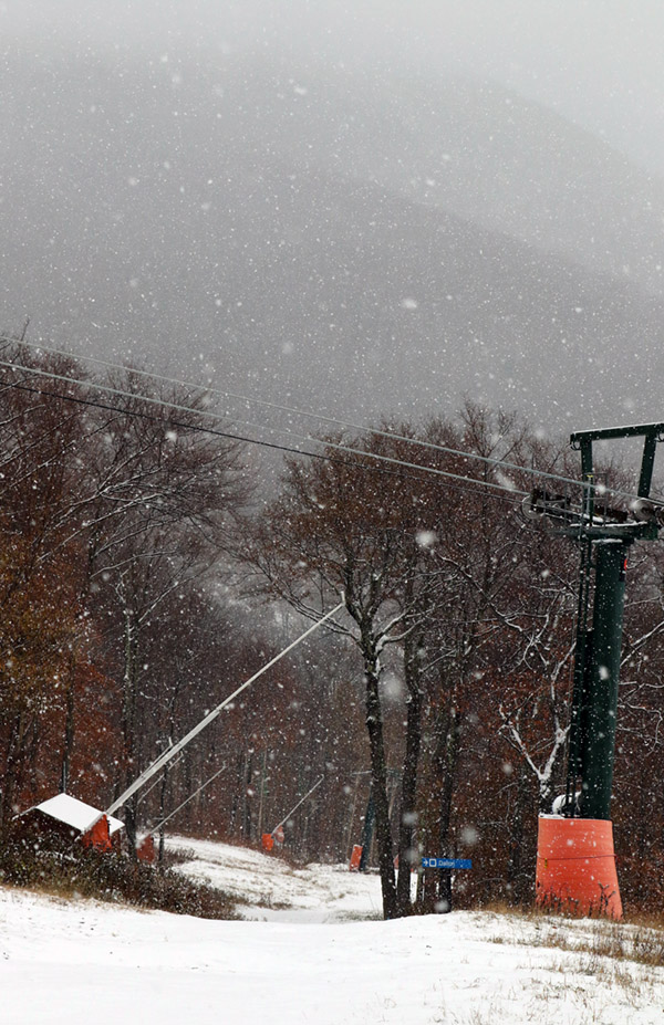
Views on my ascent of the Crossover trail with the mountains in the background obscured by snowfall
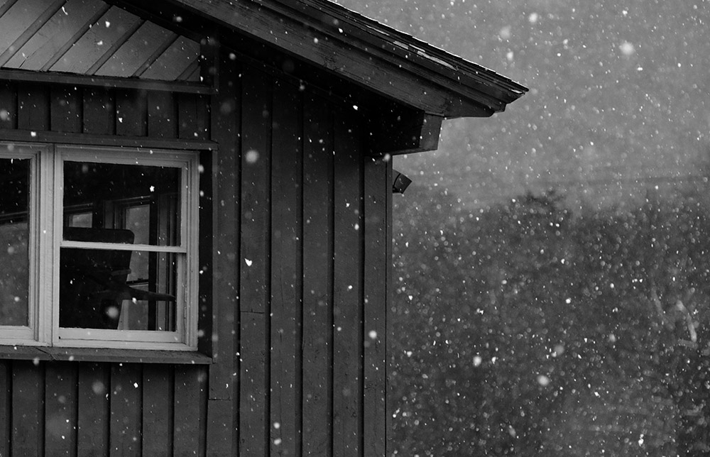
It’s been quite a while since I last used my “rock skis”. Although I’ve certainly gotten out for many early- and late-season turns over the past several seasons, I just haven’t had to worry much about conditions that were going to damage my skis. Late-season snow is dense, for the most part covering rocks where it’s present, and our early-season storms of late have generally been substantial enough that I wasn’t concerned about rocks on the terrain I was skiing. This year has been a bit different here in the Northern Greens though, and rock skis turned out to be just the right choice for today’s outing. We’ve had numerous rounds of snow in the mountains over the past couple of weeks, but none of the storms have been the type that really put down a big dump of 6 to 12 inches or more at once. New Hampshire did get a big shot of snow from the last storm that hit, but over here in the Greens we’ve just been adding an inch or two here and there. Those smaller bouts of snow have added up over the past couple of weeks though, and with the nor’easter affecting the area today, it finally seemed like it would reach that threshold of base depths to lure me out to the slopes.
“Up by the Mountain Chapel, the 3 to 4 inches of dense snow on the smooth surface of the Toll Road really produced some excellent floaty turns.”
As the nor’easter approached, snowfall at our house in Waterbury began mid-morning, and then in the midafternoon Mother Nature really turned on the spigot and we got into a period of heavy snowfall composed of big wet flakes up to 2 inches in diameter. With the heavy snow falling it seemed like as good a time as any with respect to catching any new accumulations on the slopes before any potential mixed precipitation. I was planning to take an initial look at Bolton Valley to see how the snow was up there, but the Bolton Valley Access Road still hadn’t been plowed as I started up, so I didn’t go very high before I decided it was best to turn around. There was no way I wanted to try heading all the way up to the Village above 2,000’ on an unplowed road.
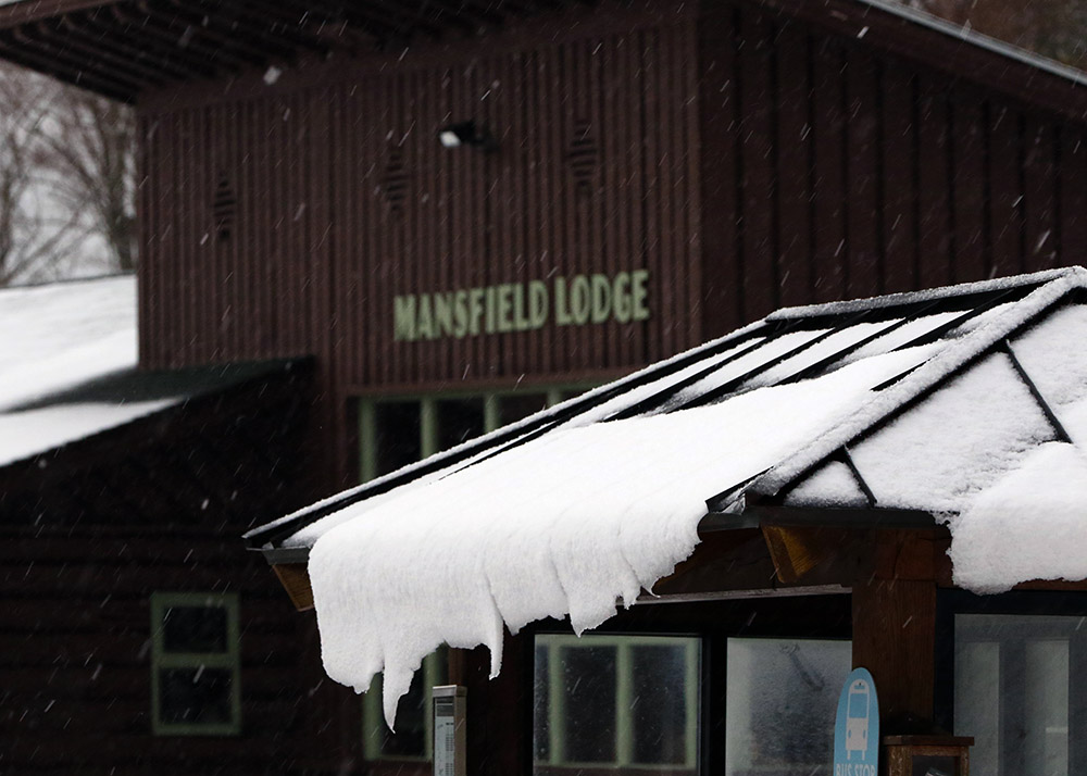
Mansfield Base Lodge
In line with my plans, I next headed off to Stowe for some skiing, and I was fairly confident that the driving would be fine with the route at mostly low elevation. Indeed the driving was fine, and unlike Waterbury, the town of Stowe really hadn’t picked up any snow, so that made the drive very easy. Rain through the valley switched to mixed precipitation as I approached the base elevations of the resort at 1,500’, and I found a solid covering of 1 to 2 inches of snow on the ground at the Mansfield Base Lodge where I parked. I’d brought two pairs of skis and skins, and after surveilling the area I decided that the rock skis were the way to go for a more enjoyable descent because I wouldn’t have to work too hard trying to avoid any rocks.
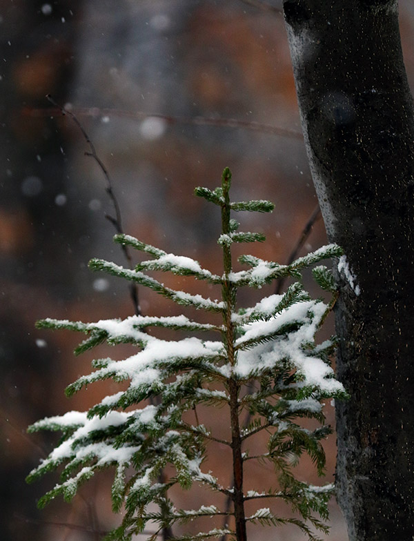
I wanted some mellow, grassy slopes for my tour, so I headed up in the area of the Mountain Triple Chair toward the Stowe Mountain Chapel. The mixed precipitation that I’d found when I first arrived changed over to all snow as I began my ascent, and I really needed the hood of my coat at times due to the intensity of the precipitation. I quickly found 3 to 4 inches of snow on the grassy slopes, which is about where the depth stayed up to the Mountain Chapel at ~2,300’. Although I could have used my skins, I never really needed them because once I got up to the Crossover road I was able to simply walk in my Tele boots easily.
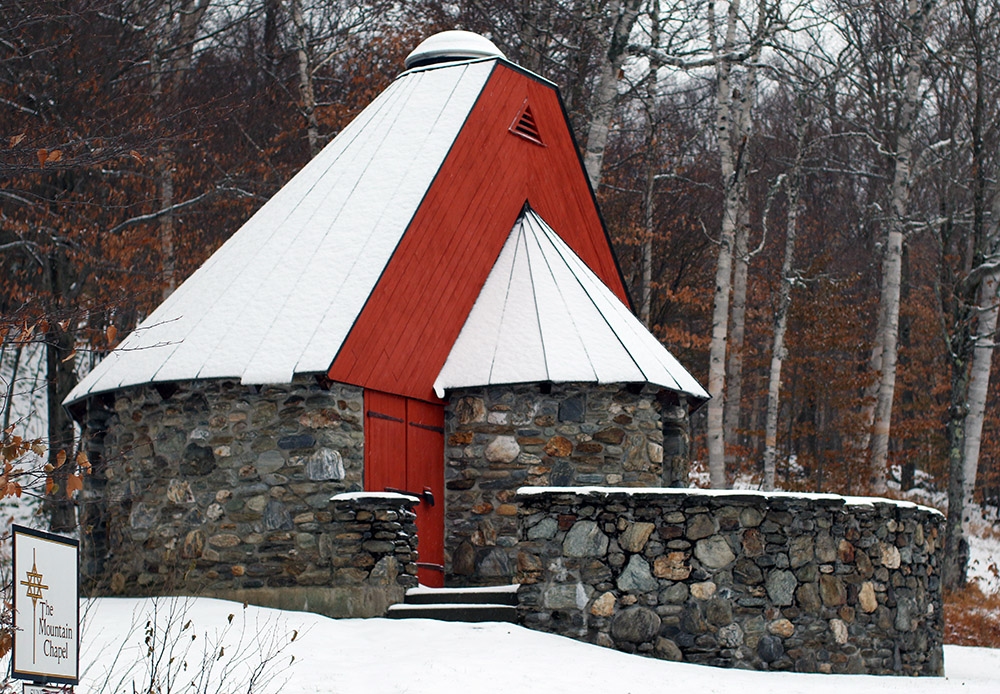
Stowe Mountain Chapel along the Toll Road
I really thought that the grassy slopes would offer the best skiing, but it turned out that the service roads were the best. Up by the Mountain Chapel, the 3 to 4 inches of dense snow on the smooth surface of the Toll Road really produced some excellent floaty turns. The Crossover Road isn’t nearly as smooth, and the snow depths did drop a bit on the descent, so nothing compared to the turns up on the Toll Road. On the grassy slopes, the depth of the cut grass relative to the few inches of snow, combined with my fairly skinny rock Tele skis, made turns much more challenging. I was low enough down in the grass that there was substantial resistance to making any short-radius turns.
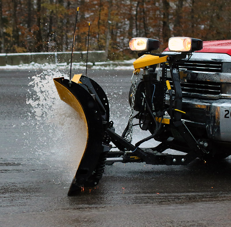
Plowing some snow so slushy it looked like water in the Stowe parking lot
The snowfall had let up for the most part by the time I’d descended back to the base, but the weather show wasn’t quite over. I got to see some plowing of the parking lot, and the slushy snow was so wet that it was almost as if the plow was simply plowing water! This was the 4th storm with accumulating snow at our house this October, and based on my count, it was the 6th storm with snow for the mountains, so we’ve really had quite a run. It might not be the last of our October snow though; we may get a couple of chances through midweek before we get into a slightly warmer pattern heading into November.
There’s apparently a Nor’easter brewing for this weekend, although there’s not a ton of cold air around for the system to use, so the current forecast suggest snow will only be up near the summit elevations and fairly limited in amount.
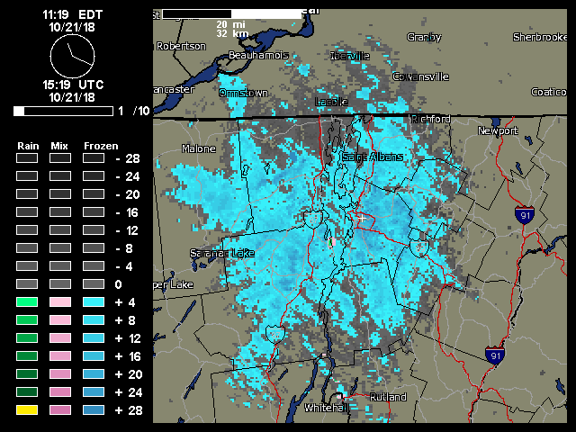
A weather radar image from midday on Sunday showing the continuous push of moisture from the northwest hitting the Northern Green Mountains and giving us continuous light snowfall.
“…once the snow showers got started in the morning, they literally kept going all day with that classic upslope flow from the northwest..”
This event was the second accumulating one at our house this month, and the fourth one for the mountains. Looking ahead, there seems to be some potential for snow in the midweek timeframe, and then again out toward the weekend.
“The data suggest that our first snow of the 2018-2019 winter season from this past Saturday (October 13th) is a few days on the late side of the mean for first accumulating snow (October 10th), but overall quite typical.”
There are a couple of seasons that I couldn’t include in the statistical analysis because of gaps in the data collection early in the co-op site’s history, but there were still 62 seasons in the data set that provided useful information. The data suggest that our first snow of the 2018-2019 winter season from this past Saturday (October 13th) is a few days on the late side of the mean for first accumulating snow (October 10th), but overall quite typical. The full results from the statistical analysis are below, so have a look and think snow!
“…it looks like we’ll have more opportunities for snow this week with accumulations potentially even down to the mountain valleys.”
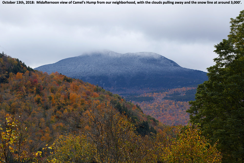
Here at our house, I did a morning check to find that the cloud ceiling was still only about 2,000 feet and there were no obvious signs of snow below that level. I gave the clouds some time to think about clearing a bit, and then headed out in the neighborhood during the mid-afternoon period to see what snow might be visible. Indeed the cloud ceiling had risen by about another 2,000’ and I was able to catch Camel’s Hump as the clouds had just about broken away. The snow line at that point looked to be around 3,000’.
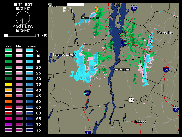
Radar image on Halloween night snowing snow in the Adirondacks and along the spine of the Green Mountains that prompted me to check on the type of precipitation we were receiving at the house.
After our big autumn storm that brought substantial wind and power outages to Vermont (including our house), cold air came into the area today and brought one last snowfall for the month on Halloween. Powderfreak is out of town, but his colleagues at Stowe kept him apprised of what was going on at the mountain with pictures of the fresh snow.
As is typical for this type of weather setup with a flow from the Great Lakes, the areas around the mountains often get the most vigorous precipitation, which can lower snow levels down to the valleys. I wasn’t home during the day to see if anything frozen fell at our house, but I wouldn’t be surprised if we got something.
It’s interesting to note that if we hadn’t picked up any frozen today that would have been the first time in the 12 years we’ve been at this location that we didn’t get any frozen precipitation in October. So that streak continues for now, but it’s still 12 days later than the mean, and of course it’s the latest “first frozen precipitation” we’ve seen here. I guess with as warm as this October was, it’s nice to even get anything frozen, and at least the snowfall season is officially underway here.
Now it’s on to November, with more substantial chances for snow growing by the day.
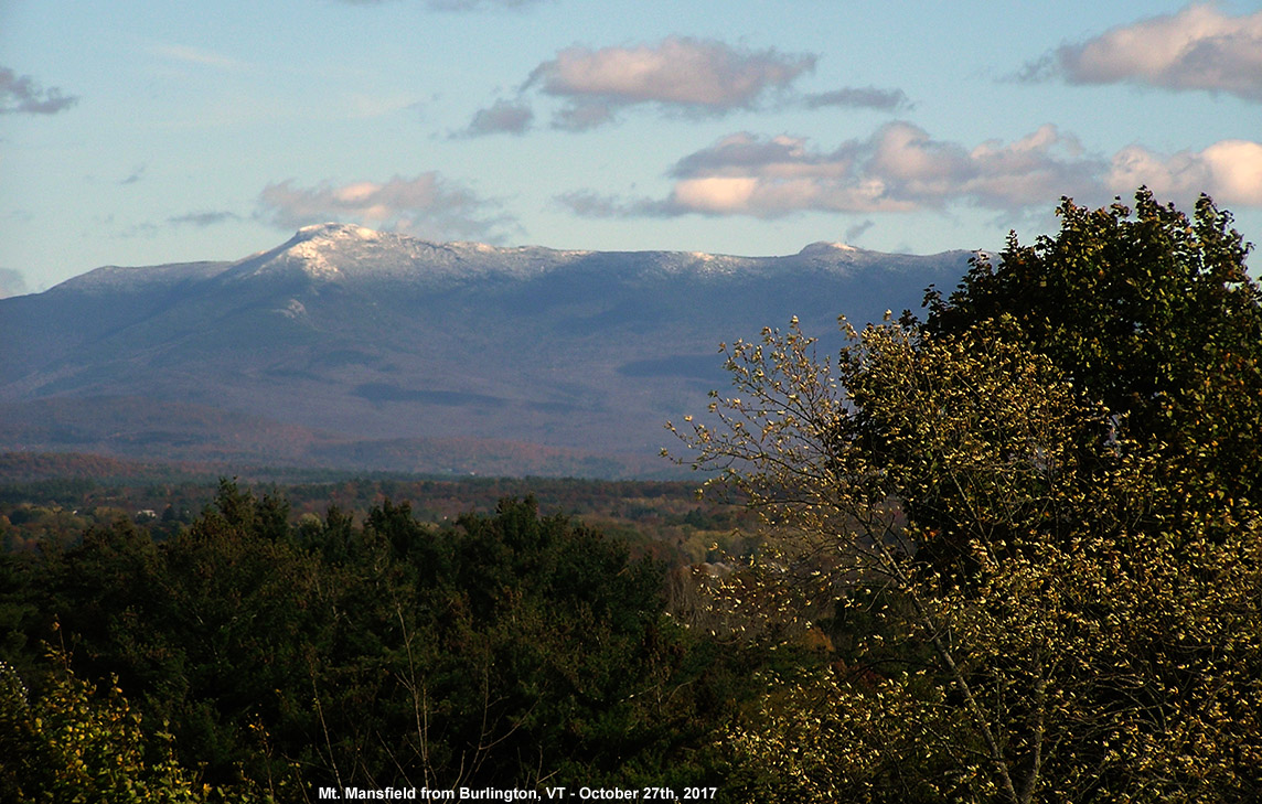
Mt. Mansfield and its latest coating of snow seen from Burlington
We’ve had plenty of pleasantly benign weather days this month, but yesterday was one of those raw October days that really speak to the seasonal progression. Temperatures in the valleys even stayed well down in the 40s F, and a storm passing through the area brought bouts of heavy rain that made walking around outside a rather rough experience. I wasn’t sure if this storm was actually cold enough to bring in some snow to the area, but sure enough, Powderfreak was already posting snowy images from Mansfield this morning and letting us know that the snow level was down to 3,000 feet. Once the clouds began to break away from the mountains in the afternoon I was able to snap an image from my office of the new white near the peak of Mansfield behind some of the colorful foliage still hanging on in the Champlain Valley. We’ve got a potent storm coming into the area Sunday that is expected to bring a lot of wind and rain, and next week there’s the chance for a bit more snow in the area as we get some cooler temperature and a flow that could bring moisture over from the Great Lakes.


