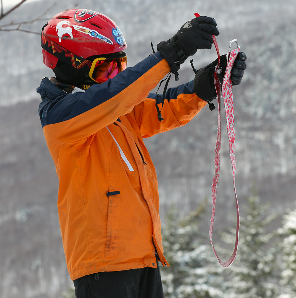
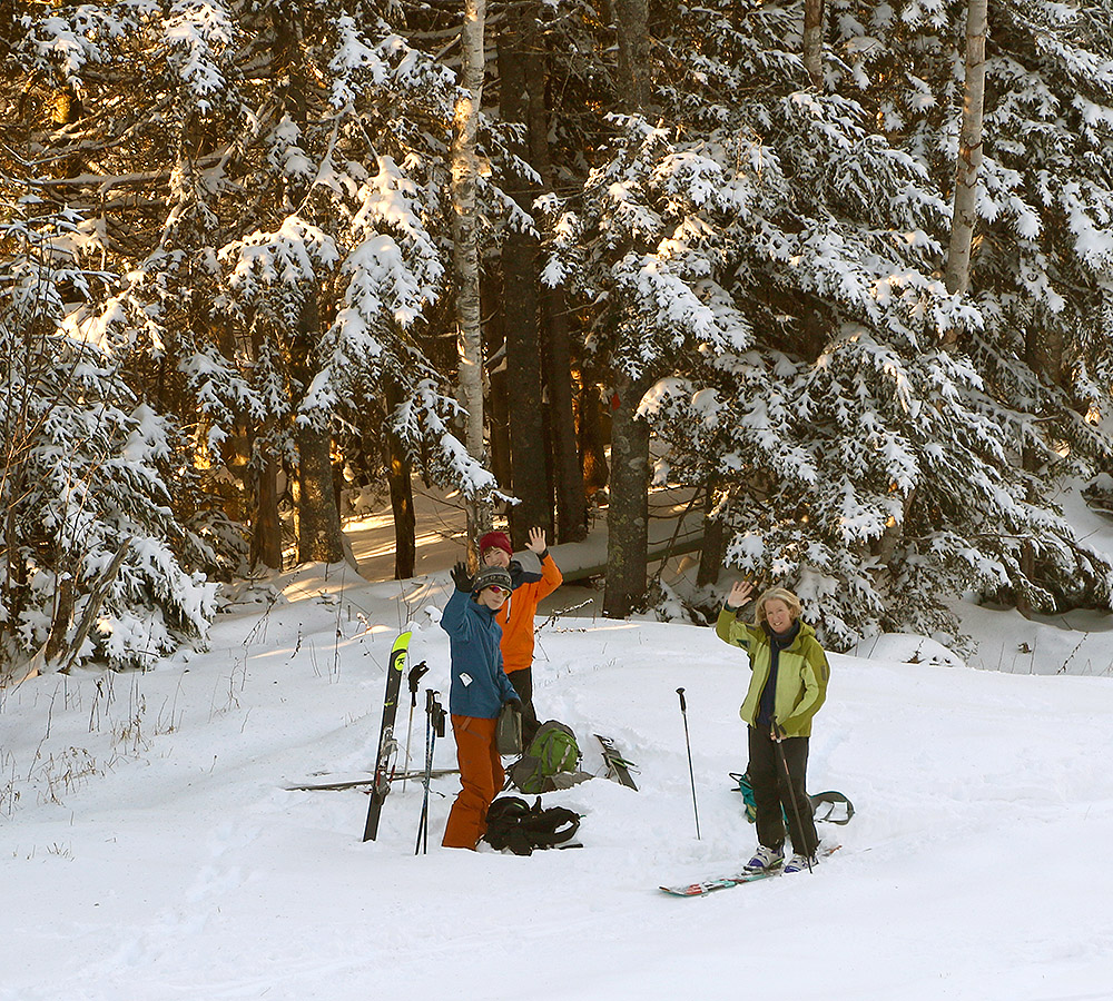
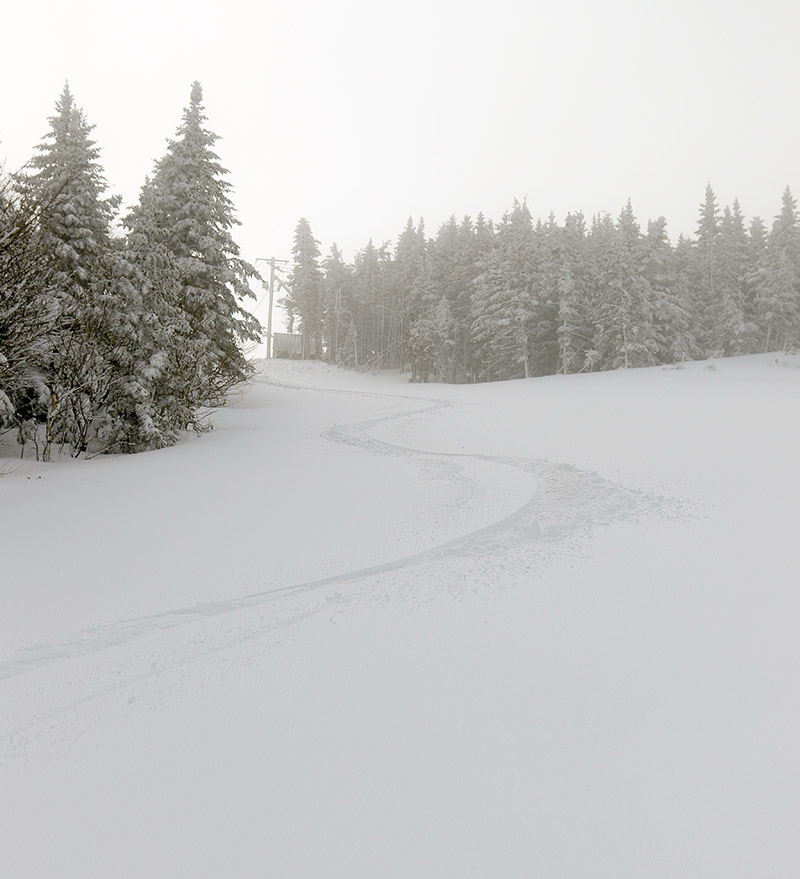
Dylan gets ready to pack up his climbing skins as we get ready to start out descent during the family’s ski tour at Bolton Valley today.
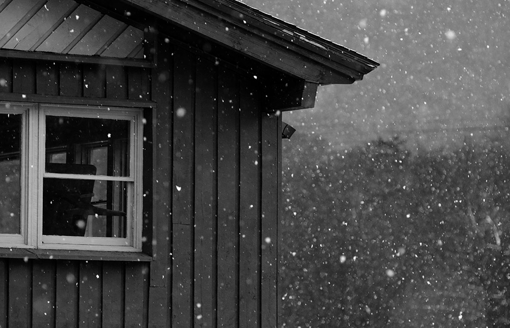
We’ve had some great snow in the Northern Green Mountains over the past week. Three coastal storms have affected the area: a double barrel low pressure system last weekend, a low pressure system hugging the coast in the midweek period, and now Winter Storm Avery this weekend. All told, the local mountains have picked up two to three feet of snow in the past seven days, with Bolton Valley reporting 32 inches during the period as of today. That’s a good pace of snowfall for any week during the winter, but it’s an excellent pace for November. This is when the mountains should be building that natural snowpack, so this is an especially good time to be getting these substantial storms.
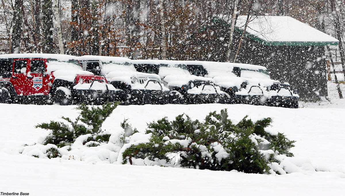
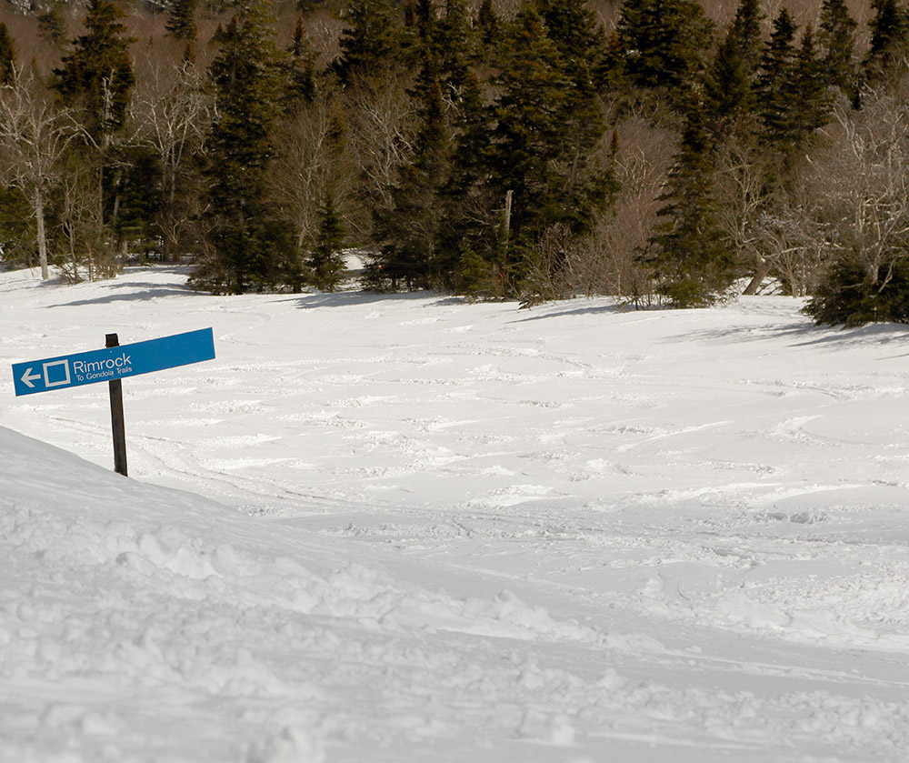
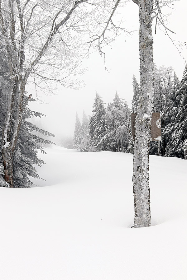
Some of the recent snow accumulations at the Timberline base area of Bolton Valley
“Snow depths were generally 1 to 2 feet throughout the tour…”
The family got out for a tour in the snow from last weekend’s storm, but I had a busy week and wasn’t able to check out the snow from the midweek system. We had time to get out today though, and there’s been enough snow now that even Timberline was an option.
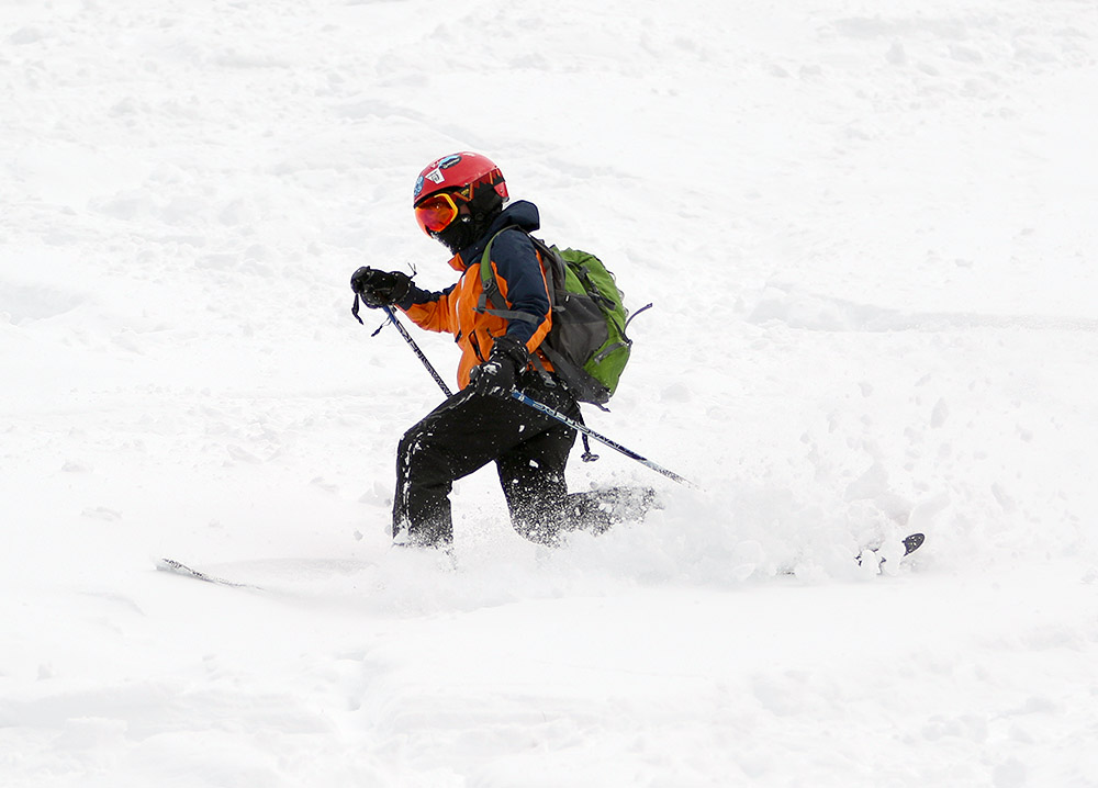
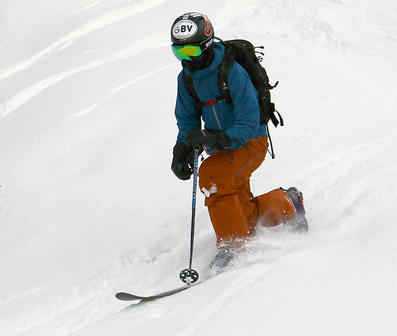
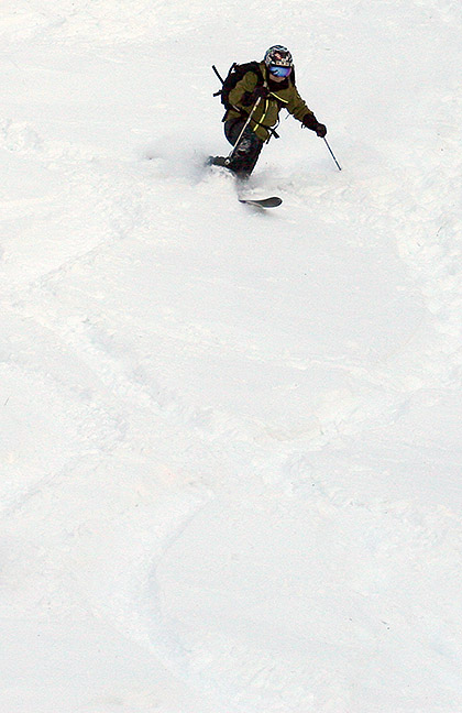
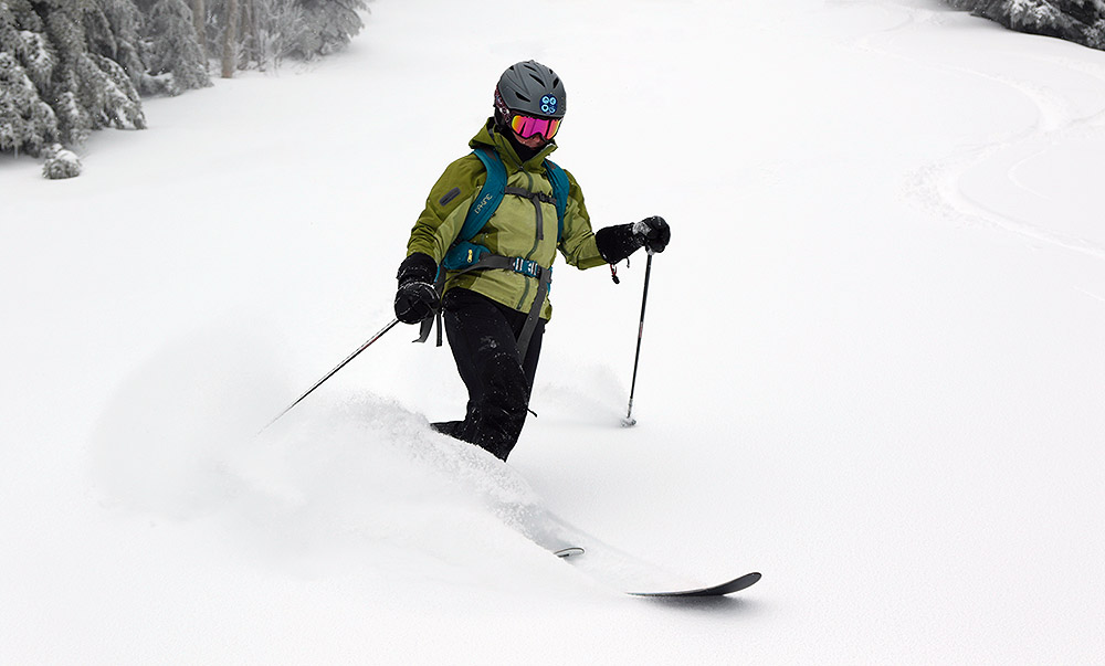
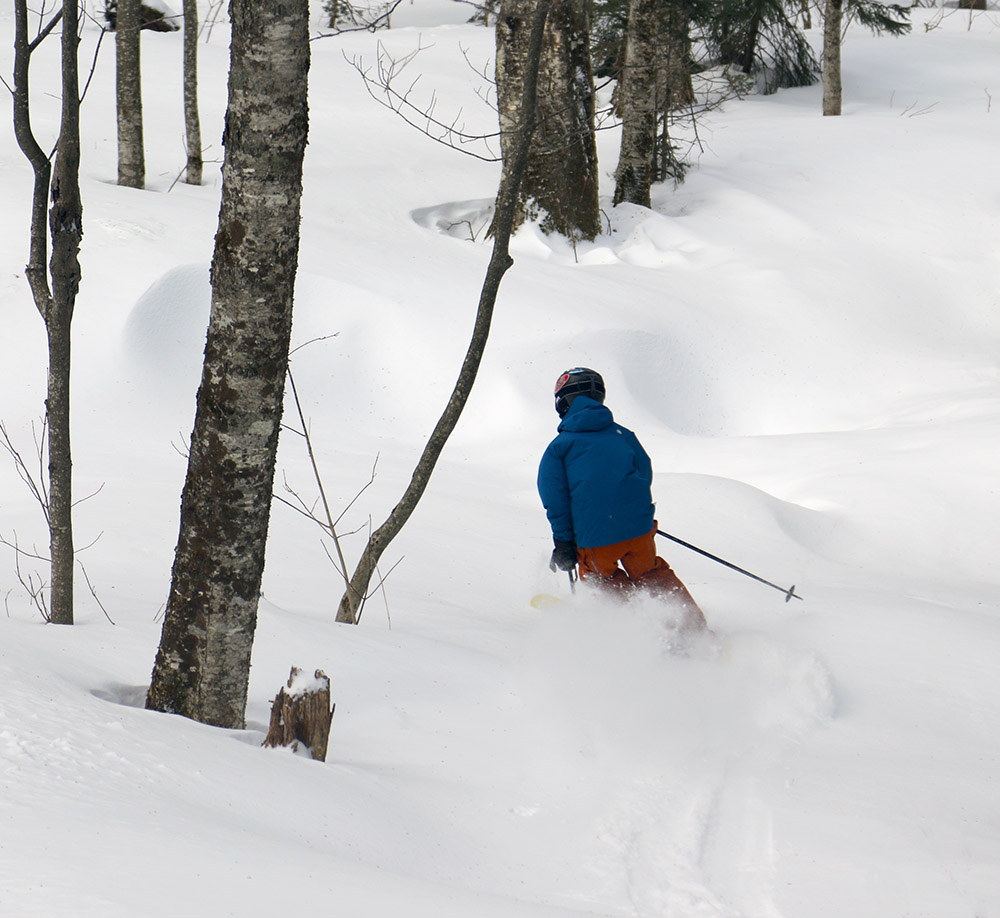
Dylan in some of today’s power at Timberline
Timberline had already seen lots of visitors as of late this morning, so there was a well-established skin track on the usual Twice as Nice route. Snow depths were generally 1 to 2 feet throughout the tour, and temperatures were just creeping above freezing down at the base, so the powder down in the lower elevations was starting to get just a bit wet. In the higher elevations the snow was fairly dry, middle-weight powder, so the skiing was quite good. I’d say starting at the main base up above 2,000’ would be a good move to optimize the best snow, so I might think about that for my next tour, but even touring down to the 1,500’ elevation is still quite reasonable.
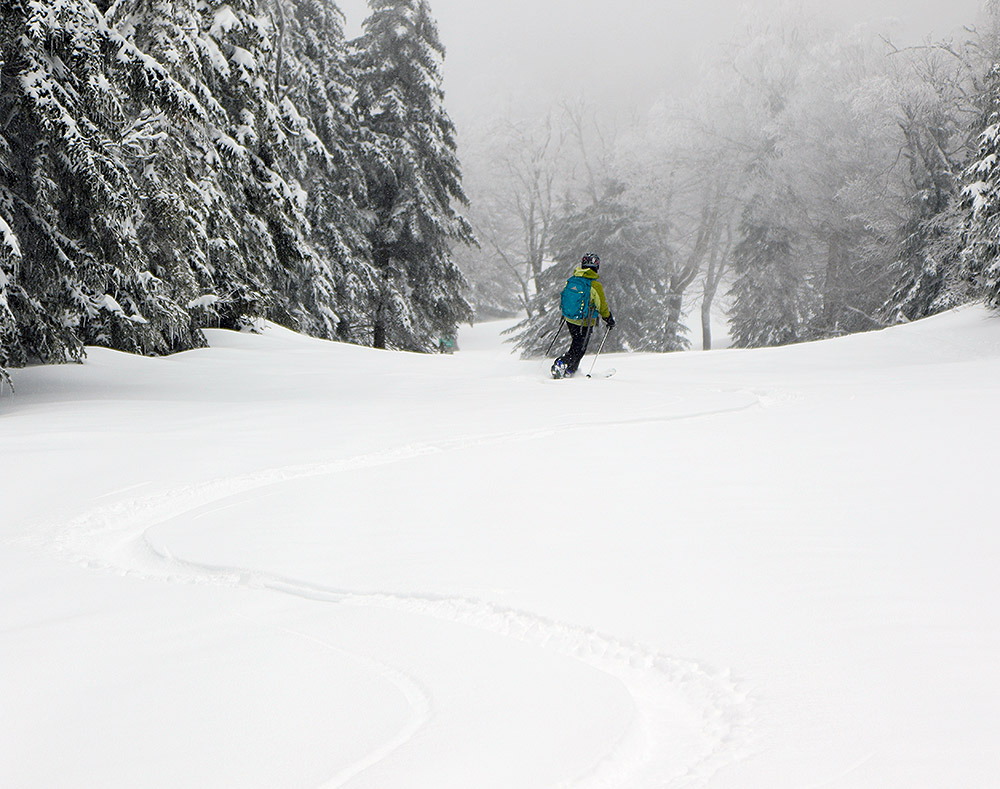
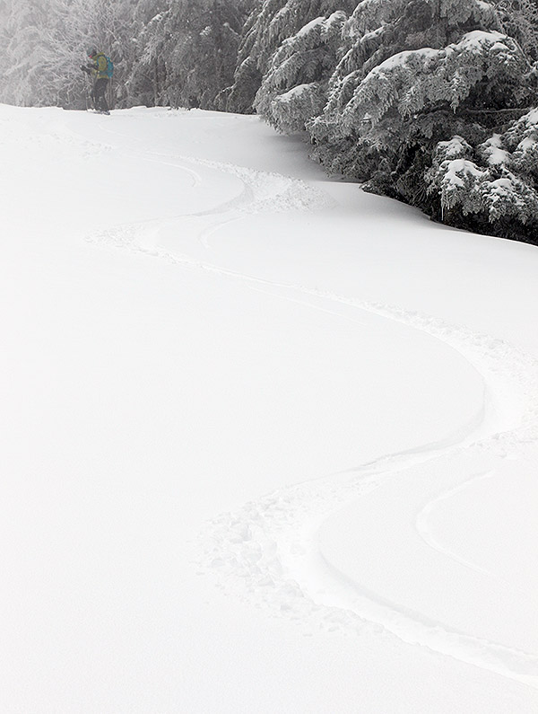
Ty going down in the powder on today’s ski tour
After our tour we headed up to the main base to pick up our season passes, and learned that there’s talk of starting the lift served season a week or two early. I’d say we’re happy either way, since there’s still plenty of touring to do even if the lift-served skiing hasn’t started.
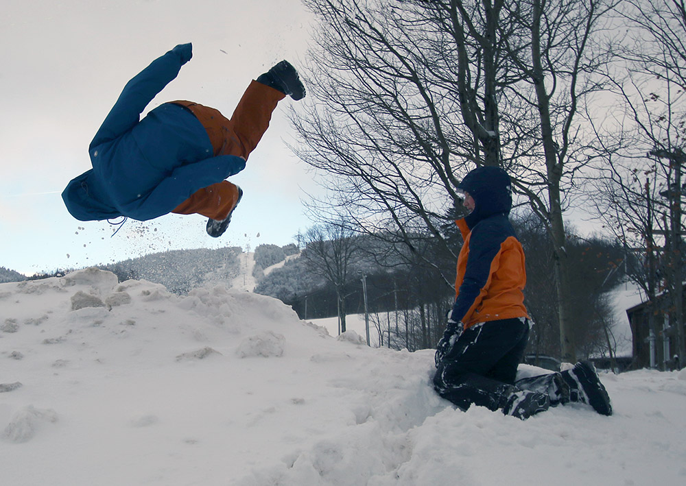
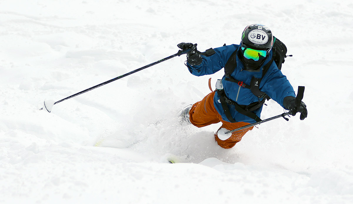
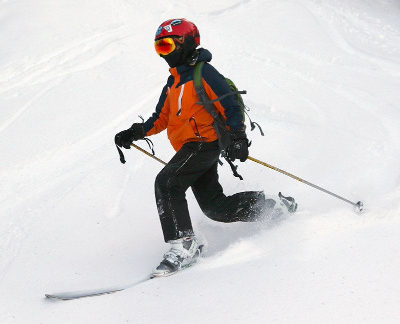
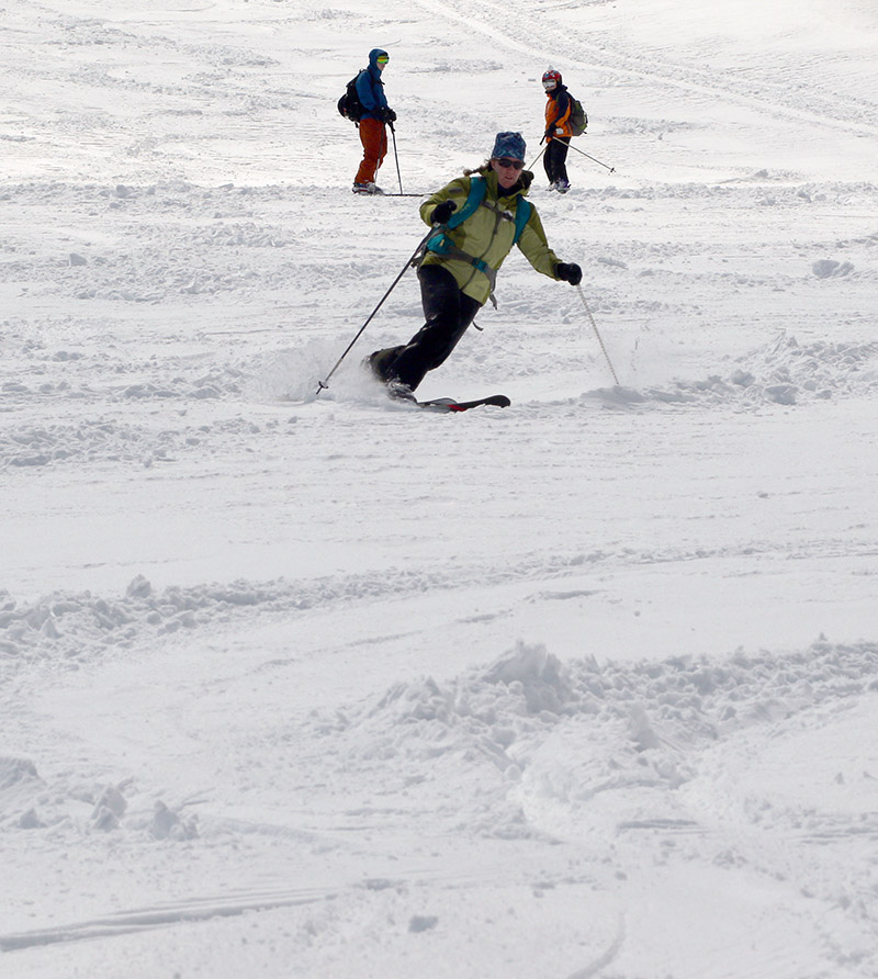
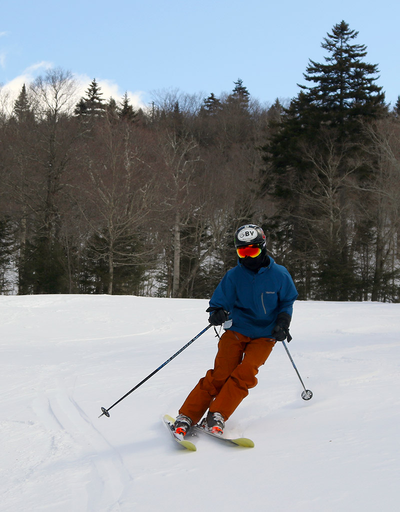
Ty getting down into a nice Telemark turn in the powder as the whole family got out for a ski tour at Bolton Valley today
Temperatures in the higher elevations stayed well below freezing overnight, and indeed they weren’t even going to rise above freezing during the day today. So as expected, whatever state the snow was in by the end of the day yesterday was essentially how it was going to stay. I found very nice powder conditions on the upper half of the main mountain when I was at Bolton Valley yesterday, and with that in mind, we got the family out for a ski tour today.
“So that meant some nice powder turns on the upper half of the mountain, and a melt crust under a little fluff on the lower mountain.”
The temperatures we found today were very much like what I’d encountered yesterday, with uppers 20s in the Bolton Valley Village, and 19 F up around 3,000 feet. This afternoon featured nearly cloudless skies however, so we had much more sunshine today, and that made it at least feel a bit warmer to me, even if the thermometer didn’t have much to say about it.
E cruising along through the powder as we ascend during today’s ski tour
I took E and the boys on essentially the same tour I did yesterday, and the snow depths and conditions we found really were unchanged today. So that meant some nice powder turns on the upper half of the mountain, and a melt crust under a little fluff on the lower mountain. E and the boys were definitely leery of the conditions on the lower half of the mountain when we began our ascent, but I told them to stick with it and we’d get up into the good snow. We did just that, and I’d say everyone had a lot of fun working on their first turns of the season in the powder. We got back to the car just as the sun was beginning to set, and all in all it was a great first family ski outing of the season.
Dylan gets behind the camera and captures Dad enjoying some of today’s powder turns.
We’ve actually got a couple more storms on the way over the next several days that hold the potential for additional snow. There’s one on the way for Tuesday which could be similar to this past one, and then another one near the end of the week that bears watching as well.
Our most recent storm brought plenty of snow for powder skiing in the Northern Greens.
You can put away the rock skis for this storm. Indeed the Northeastern U.S. has been under the influence of a double-barrel low pressure system that the weather models have been showing for more than a week, and it’s finally delivered a healthy shot of snow to the Green Mountains. With one low pressure system traveling through the eastern Great Lakes, and another up the New England coast, there was some warm air involved in this event, but the precipitation in the mountains has generally been frozen, and it’s been plentiful.
“There’s definitely a nice density gradient to give you those easy powder turns with ample protection below.”
Most of the mountain valleys even picked up some snow, but when the snow began yesterday afternoon, the eastern slopes seemed to be the areas getting the most precipitation and notable accumulations even in the valley bottoms. I was hoping to head up to Bolton Valley for some turns today, but the lower accumulations in the valleys of the western slopes had me wondering how the resort had done with respect to snowfall. They don’t have their webcam in operation yet, and they’re not making immediate snow reports, so I quickly popped up to the mountain this morning to assess the potential for turns.
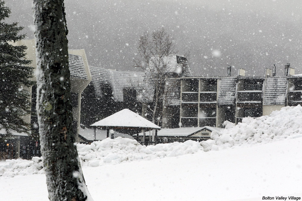
Signs of leftover snow like we had at our house disappeared as I dropped down into Bolton Flats, and at the base of the Bolton Valley Access Road (340’) there was no accumulation. There weren’t even any signs of white until I hit 1,000’. So I’d say that indeed, accumulating snow levels were definitely lower in elevation on the eastern slopes – snow at 1,000’ in the Bolton Valley area was about equivalent to 500’ at our house slightly east of the spine. The snow depths did eventually did go up dramatically with elevation however. I found 3 to 4 inches at the Timberline Base (1,500’) and up in the Bolton Valley Village (2,000’) there were 6 to 8 inches on the ground with heavy snowfall adding to that by the minute. The resort was clearly all set in terms of snow, so I hoped to head back up in the afternoon for a tour when I had sufficient time.
Snowfall and plentiful snow on the ground in the Bolton Valley Village today
After visiting the ski swap in Waitsfield in the early afternoon, I was able to head back up to Bolton Valley in the midafternoon period to get in that ski tour. The accumulations I’d see in the Village in the morning just continue to increase as I skinned up toward the summits, and all told I found the following accumulation profile with respect to elevation:
I did get readings as high as 16” on the upper mountain, and one drifted spot with 20”, but I’d say 12-14” is a decent measure of the top end I found for depth. It seemed like there was some old snowpack up high, but I don’t think it interfered with measurements of the new snow because it should have been pretty solid by now.
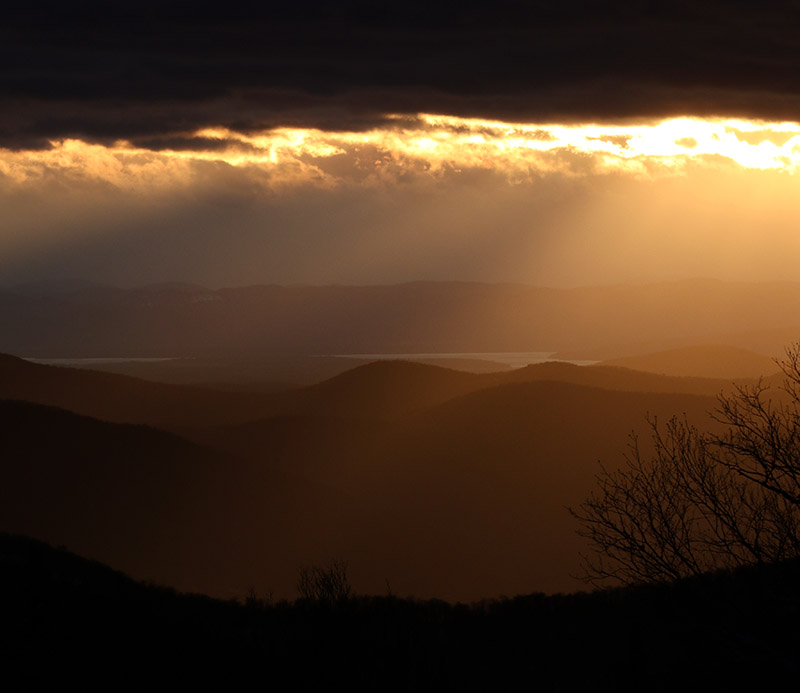
Afternoon light and mountains off to the west as I begin my descent from the top of Bolton Valley
Even base temperatures had dropped into the 20s F when I was up there in the midafternoon, and my thermometer was showing 19 F when I was up at the Vista Summit, so the snow wasn’t wet at all. Below ~2,500’ there was a thick layer in the snowpack that was only an issue in wind scoured areas. I’m not sure when that developed (maybe during the warmest part of the storm), but today’s additional snow sort of mitigated that, at least with the 115 mm skis I was on. Above 2,500’ it didn’t seem like that layer was even present, and turns were fantastic in midwinter snow. There’s definitely a nice density gradient to give you those easy powder turns with ample protection below. With tonight’s temperatures, the only enemy of the powder would be wind, so the good snow should be there a while for those who want get after it.
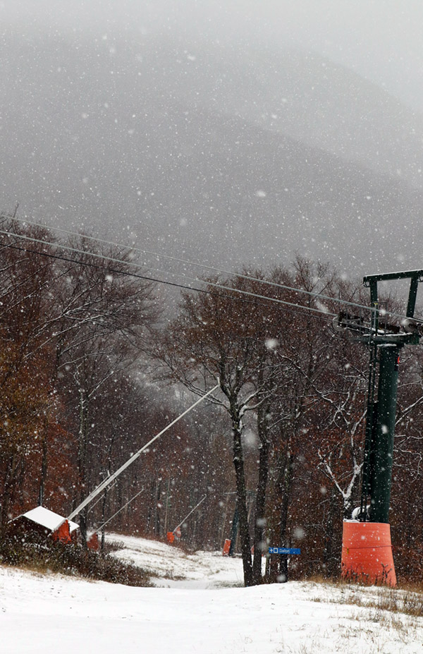
Views on my ascent of the Crossover trail with the mountains in the background obscured by snowfall
It’s been quite a while since I last used my “rock skis”. Although I’ve certainly gotten out for many early- and late-season turns over the past several seasons, I just haven’t had to worry much about conditions that were going to damage my skis. Late-season snow is dense, for the most part covering rocks where it’s present, and our early-season storms of late have generally been substantial enough that I wasn’t concerned about rocks on the terrain I was skiing. This year has been a bit different here in the Northern Greens though, and rock skis turned out to be just the right choice for today’s outing. We’ve had numerous rounds of snow in the mountains over the past couple of weeks, but none of the storms have been the type that really put down a big dump of 6 to 12 inches or more at once. New Hampshire did get a big shot of snow from the last storm that hit, but over here in the Greens we’ve just been adding an inch or two here and there. Those smaller bouts of snow have added up over the past couple of weeks though, and with the nor’easter affecting the area today, it finally seemed like it would reach that threshold of base depths to lure me out to the slopes.
“Up by the Mountain Chapel, the 3 to 4 inches of dense snow on the smooth surface of the Toll Road really produced some excellent floaty turns.”
As the nor’easter approached, snowfall at our house in Waterbury began mid-morning, and then in the midafternoon Mother Nature really turned on the spigot and we got into a period of heavy snowfall composed of big wet flakes up to 2 inches in diameter. With the heavy snow falling it seemed like as good a time as any with respect to catching any new accumulations on the slopes before any potential mixed precipitation. I was planning to take an initial look at Bolton Valley to see how the snow was up there, but the Bolton Valley Access Road still hadn’t been plowed as I started up, so I didn’t go very high before I decided it was best to turn around. There was no way I wanted to try heading all the way up to the Village above 2,000’ on an unplowed road.
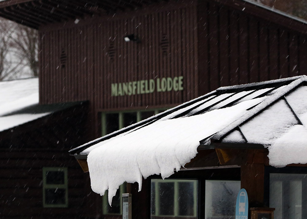
Mansfield Base Lodge
In line with my plans, I next headed off to Stowe for some skiing, and I was fairly confident that the driving would be fine with the route at mostly low elevation. Indeed the driving was fine, and unlike Waterbury, the town of Stowe really hadn’t picked up any snow, so that made the drive very easy. Rain through the valley switched to mixed precipitation as I approached the base elevations of the resort at 1,500’, and I found a solid covering of 1 to 2 inches of snow on the ground at the Mansfield Base Lodge where I parked. I’d brought two pairs of skis and skins, and after surveilling the area I decided that the rock skis were the way to go for a more enjoyable descent because I wouldn’t have to work too hard trying to avoid any rocks.
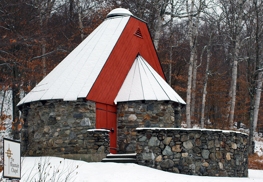
I wanted some mellow, grassy slopes for my tour, so I headed up in the area of the Mountain Triple Chair toward the Stowe Mountain Chapel. The mixed precipitation that I’d found when I first arrived changed over to all snow as I began my ascent, and I really needed the hood of my coat at times due to the intensity of the precipitation. I quickly found 3 to 4 inches of snow on the grassy slopes, which is about where the depth stayed up to the Mountain Chapel at ~2,300’. Although I could have used my skins, I never really needed them because once I got up to the Crossover road I was able to simply walk in my Tele boots easily.
Stowe Mountain Chapel along the Toll Road
I really thought that the grassy slopes would offer the best skiing, but it turned out that the service roads were the best. Up by the Mountain Chapel, the 3 to 4 inches of dense snow on the smooth surface of the Toll Road really produced some excellent floaty turns. The Crossover Road isn’t nearly as smooth, and the snow depths did drop a bit on the descent, so nothing compared to the turns up on the Toll Road. On the grassy slopes, the depth of the cut grass relative to the few inches of snow, combined with my fairly skinny rock Tele skis, made turns much more challenging. I was low enough down in the grass that there was substantial resistance to making any short-radius turns.
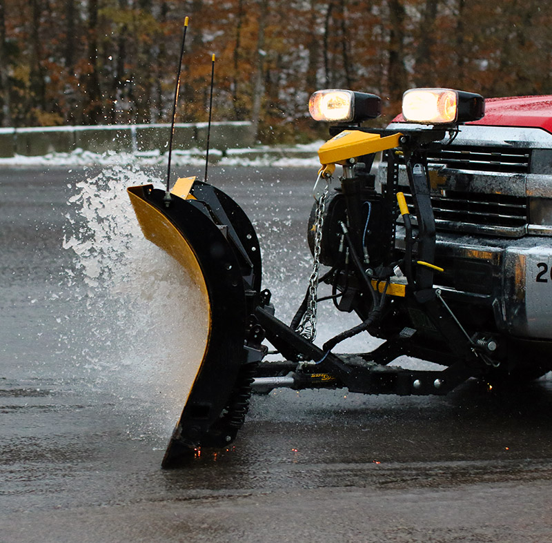
Plowing some snow so slushy it looked like water in the Stowe parking lot
The snowfall had let up for the most part by the time I’d descended back to the base, but the weather show wasn’t quite over. I got to see some plowing of the parking lot, and the slushy snow was so wet that it was almost as if the plow was simply plowing water! This was the 4th storm with accumulating snow at our house this October, and based on my count, it was the 6th storm with snow for the mountains, so we’ve really had quite a run. It might not be the last of our October snow though; we may get a couple of chances through midweek before we get into a slightly warmer pattern heading into November.
I had initially contemplated heading to Stowe for some turns in the morning, thinking the terrain above 3,000’ would really be needed to get into some good snow, but those low snow levels on the western slopes definitely had me thinking about Bolton Valley as good option. The overnight didn’t seem to bring about any substantial changes, so I stuck with that plan and headed to Bolton for a ski tour this morning.
“I could tell right away as I began my descent that the density and consistency of the snow called for steep terrain, so I dove right down Spillway and that really hit the spot.”
Low clouds were obscuring the mountains by our house, but it seemed like the snow line this morning was down around 1,000’. On my drive, the first signs of fresh snow accumulations were indeed right around the 1,000’ elevation on the Bolton Valley Access Road, and then the world just got whiter and whiter as I headed up.
I started my ski tour at the Bolton Valley Village, which is a bit above 2,000’, so with the way this storm accumulated that meant decent coverage from there on up to the summits. At the base elevations this morning the temperature was just edging above freezing in the 7:30 -8:00 A.M. timeframe, and the snow was definitely dense. The fresh snow was wet, but not slushy or sopping at that point. It was gradually falling of the trees on my ascent as the temperatures rose. I headed up into cooler temperatures, but it was still warming all the way to the summit and I bet temperatures in the mid-30s F tracked with me as I ascended.
Bolton Valley Village today
Here’s a summary of the accumulations I found this morning for various elevations:
The larger range I’m reporting at the 2,000’ level was simply because I had time to get a sense for accumulations atop the different surfaces, with the low end being on paved or gravel surfaces, and the high end being on the existing snowpack, elevated surfaces, etc.
In terms of what was out there on the trails for new snow, the numbers above show that there really wasn’t a huge bump in accumulations above 2,000’, so I’d say those elevations did fairly well in terms of maximizing whatever snow they were going to get out of the available moisture. We had ~¾” of liquid in the rain gauge at the house this morning, so presumably the mountains are somewhere north of that.
“Even with 115 mm fat skis I was still touching the subsurface at times, but this snow was definitely dense enough to hold up pretty well on steep, aggressive turns.”
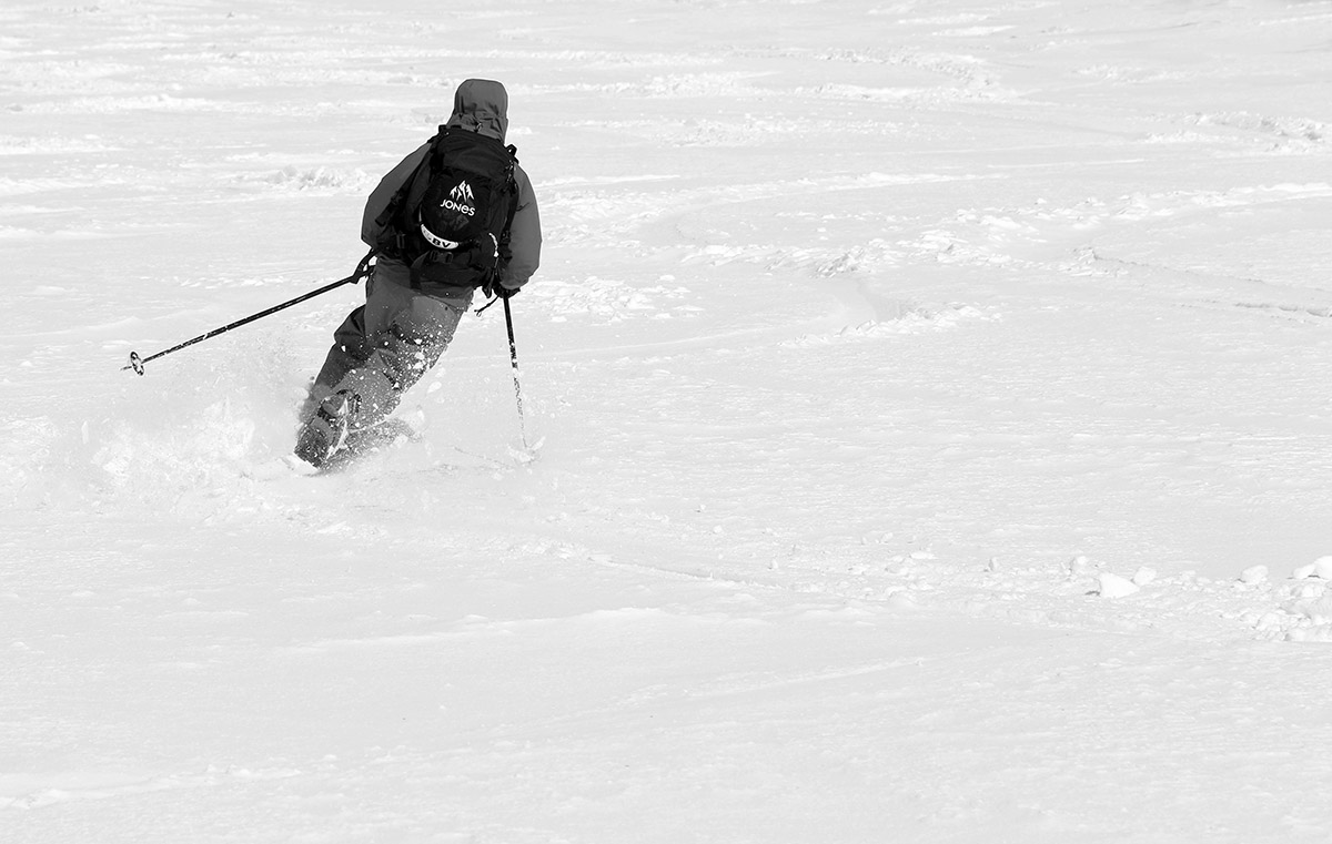
Although it can’t compare to the drier snow we had with last weekend’s storm, the turns were actually pretty sweet today. I could tell right away as I began my descent that the density and consistency of the snow called for steep terrain, so I dove right down Spillway and that really hit the spot. Even with 115 mm fat skis I was still touching the subsurface at times, but this snow was definitely dense enough to hold up pretty well on steep, aggressive turns. I stuck with Beech Seal on the lower half of the mountain, and the pitch there was also quite sufficient for a lot of good turns.
Starting off the descent with some powder turns on Spillway Lane
Today was the last day of April, but it’s certainly been a decent one for snow. It’s time to move on to May and see what it delivers for turns!
Today we were able to get out into some of the powder from our recent upslope snowstorm on the slopes of Mt. Mansfield, topped off with a convenient stay right at the Stowe Mountain Lodge.
Since school was out of session due to vacation week, E’s been thinking about some sort of getaway for the family. Quebec City and Maine came up as possible destinations, but with the Green Mountains having just reeled in some great powder due to our recent upslope event, doing something more local seemed like an obvious choice. That decision was heavily reinforced after E and I skied some great powder at Bolton Valley yesterday, and after weighing a number of options we ultimately decided to head to Stowe for some earned turns and a stay at the Stowe Mountain Lodge. They’ve got some fantastic amenities, and the rates this time of year are great because they’re in between the winter and summer seasons.
The fresh snow on Mt. Mansfield was astonishingly white today in the late April sunshine.
We kicked things off this morning with a start at the Midway Lot, which had dozens of vehicles in it from folks with similar ideas. It was approaching mid-morning when we arrived, so I was surprised at how many people were heading right up Gondolier in the sun. With that morning sun and warming temperatures, I was leery of how well the winter snow would hold on the Gondola side. E and the boys and I opted to head toward Nosedive, which generally has much more protected snow when sun and warmth are a concern. The Nosedive area had certainly seen some skier and rider traffic already, and there was a nice double skin track in place that made for easy conversation and passing options during the ascent. Ty was feeling really good on the climb and cruised ahead of the rest of us, eventually waiting for us up around the 3,000’ mark. We joined up and topped out at the 3,300’ plateau just below the Nosedive switchbacks.
Nosedive today
We stopped below the switchbacks because the snow quality was good, and the narrow width of the trail above that elevation meant that the snow was pretty much tracked out. The consistency of the snow had definitely changed substantially over the course of the ascent. At base elevations it was already getting rather wet with the rising temperatures, and by the time we finished our ascent it was fairly dry, dense powder. There wasn’t any sharp transition zone for the snow consistency, it had just changed ever so gradually with each step we’d ascended.
“The broad upper slopes of Nosedive definitely held the best snow we found today. The powder was dense, but dry, and there were plenty of areas of untracked snow to crank out some nice turns.”
The broad upper slopes of Nosedive definitely held the best snow we found today. The powder was dense, but dry, and there were plenty of areas of untracked snow to crank out some nice turns. The whole descent was definitely fun, although the last few hundred vertical feet, where we’d actually switched over to Lower National to get to some snow that had seen less traffic, held snow that had gotten pretty wet in the warming temperatures. The best snow could be found on the shady side of the trails, and I even jumped into the trees in several spots on the lower half of the run and found some excellent turns.
E and the boys out in some of the fresh snow on Nosedive today
When the skiing was done, we checked in at the Stowe Mountain Lodge and had some appetizers at the Hourglass Lounge. E and the boys did some swimming, and we had dinner at Solstice, which was a real treat. They were taking part in Vermont Restaurant Week, and my first course was an amazing smoky tomato soup. The boys and I headed out later in the evening for some night swimming, which was definitely a bit thrilling in the chill of a cold clear evening. Naturally we spent a good amount of time in one of the hot tubs, although the pool was also a nice temperature for cooling back down a bit after that heat.
I think everyone would be up for doing a similar trip again in the future, especially if we can order up some of these late season April snowstorms atop such a deep snowpack!
Our latest April storm brought another heaping helping of midwinter powder to the slopes of Bolton Valley.
April temperatures have been running several degrees below average here in Northern Vermont, and for those awaiting warmth, the winter weather must feel simply interminable. Some of us don’t have a whisper of complaint though, since we know when we’ve got a good thing going. While average April temperatures around here can bring snow, below average temperatures typically bring more snow, drier snow, and preserve the snowpack. With the approach of the current storm, the National Weather Service in Burlington was already talking about the potential for the snowpack at the Mt. Mansfield Stake to get back up to 100 inches, and as of this evening’s co-op report, indeed it’s there. The snowpack is essentially wall-to-wall everywhere in the local mountains here, so topping that off with fresh powder is a recipe for some awesome skiing and riding.
“Well let’s just say, the turns were fantastic – we had medium to moderately dense midwinter powder covering everything, temperatures near 30 F, and an almost fully untracked resort to ski.”
It’s spring vacation week for E and the boys, so E was able to join me this morning for a tour in the new snow up at Bolton Valley. We’ve had substantial accumulations of snow all the way to the valley floors with this latest storm, so I knew the potential was there for some dry, winter-style snow up at elevation. We headed out this morning amidst light snow at the house, and arrived in the Bolton Valley Village to steady snow and temperatures in the upper 20s F. A quick check on the new snow in the parking lot around 2,000’ revealed accumulations of 5 to 6 inches.
We started skinning right from the car up the Lower Turnpike ascent route, and found a decent skin track in place with just a couple inches of additional snow in it. We eventually worked our way over toward Vista and the depth of the new snow continued to steadily increase with elevation. By the time we topped out above 3,000’ on Alta Vista, my depth checks on the powder were revealing 10 to 11 inches. We de-skinned by the trees out of the wind, and E was pretty slick with her ski-on skin removal.
Looking up Alta Vista with a fresh blanket of whiteE throwing around some of today’s powder at Bolton Valley.
On the entire ascent the snow quality was looking really good, but you never quite know how things are going to ski until you drop. Well let’s just say, the turns were fantastic – we had medium to moderately dense midwinter powder covering everything, temperatures near 30 F, and an almost fully untracked resort to ski. Wind effects were pretty minimal on much of the mountain so it really was a dense, velvety resurfacing that skied like a dream. It’s definitely a good time to get out there and enjoy those uncrowded slopes with all this new snow.
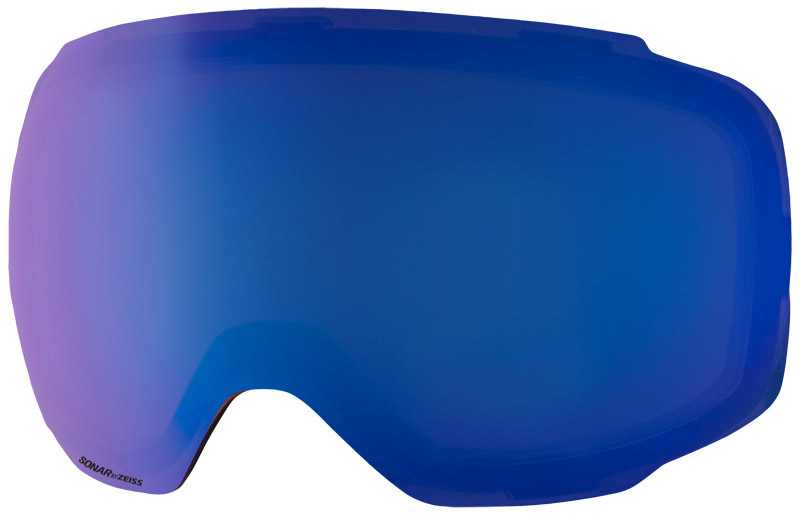
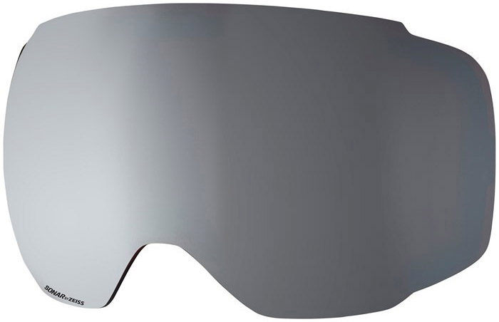
With the continuing snowfall during today’s tour, I went with our Sonar Blue lenses for my Anon M2 Goggles. They’ve got 46% visible light transmission and are recommended for graybird days and tree skiing, but they were definitely a good fit for today even with snowfall since we’re talking late-April light.
In an update from this afternoon, eyewall noted that he encountered about 7 inches of new snow at the Bolton Valley Village elevation, so it sounds like they’d picked up another inch or two with the additional snow since E and I had left. That would put accumulations near the summits around a foot, so it’s definitely been a nice April event for the mountains around here.
Enjoying the snowy April views from the valley – cool temperatures have brought snow accumulations all the way to the valley bottoms with this latest storm.
A bit of snow fell yesterday and overnight to freshen up the slopes at Bolton Valley.
A modest winter storm came into the area on Friday and left up to 8 inches of new snow at the Vermont ski areas. Bolton Valley was reporting 3 inches up top, which seemed like a fairly minimal covering over the base snow that’s seen plenty of spring cycling, but we figured it was worth heading up for a couple of runs to see how the accumulations had settled in. Sometimes 3 inches can ski like 3 inches, or sometimes it can ski like more, depending on how it was distributed and how densely it settled.
Ty and I headed up fairly early to find bright April sun among some on and off clouds, and temperatures in the upper 20s F. We took an initial run on the Snowflake Chair to make our way over to the Vista Quad, and while we found the groomed terrain was skiing nicely, we didn’t really find that the snow was enough to get the skiing shaped up off piste, at least down there below the 2,500’ mark.
Base of the Snowflake Chair
We still wanted to check out how accumulations had played out at the Vista Summit up above 3,000’, and Alta Vista revealed a few good turns off the usual protected left side, but they were in the minority. We headed over toward Wilderness and did find some nice turns in the Wilderness Woods, but as Ty nicely put it, “You just couldn’t trust it on every turn”. Indeed you could get a few nice turns on low angle terrain, but then you’d run into a spot that had been hit by the wind and you’d be back to contacting the hard spring surface below.
“I actually had some of my best turns of the day on the left side of Cougar, where several inches of new snow had settled in.”
The opening of the Wilderness Lift had been delayed a bit due to winds, but it had recently opened as we approached the bottom, so we figured it was worth at least one trip. It was running slow due to winds though, so we dropped off at the mid station and headed down Cougar. I actually had some of my best turns of the day on the left side of Cougar, where several inches of new snow had settled in. We had first tracks on the lower part of Cougar as well, and where the snow was undisturbed by the wind the turns were quite nice. We finished off dropping in and out of the Wilderness Woods, and for some reason, (perhaps the bright sunlight, or perhaps the deep spring snowpack?) they just seemed very open and smooth everywhere. There were very few tracks in there, so we had our pick of fresh lines. You still couldn’t “trust” every turn, just as Ty had said earlier, but we definitely had some good smooth lines through the trees in many spots.
In line with the bright April sun, Ty and I both had a chance to try out the Sonar Silver lens for the Anon M2 Goggles. It only lets through 6% of the visible light, so it’s even darker than the Sonar Red lens that we’d used last weekend at Magic Mountain, which lets through 14% of the visible light. We swapped between the two actually, but you could definitely notice the difference – you could easily look toward the sun with the Sonar Silver lens and not be too strained, and I can see it’s going to be another great one for these types of bright, late season days.
“…Bolton Valley is going to open back up for a couple more bonus days of skiing.”
We finished off with a trip to the Bolton Valley Deli & Grocery to grab some subs, and it was around lunchtime, so a crowd was building. Although temperatures were wintry today, and there was some wind, that April sunshine easily warmed you up and you could see that folks were generally quite comfortable out there on the slopes. It looks like temperatures will be warming up next week for some spring skiing, and Bolton Valley is going to open back up for a couple more bonus days of skiing. From what I can see in some of the weather models, we may not be quite done with snowfall in the mountains yet either.
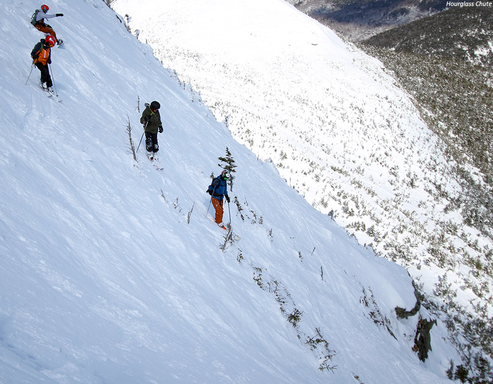
Robbie, Dylan, Wiley, and Ty are poised in the steep upper section of Mt. Mansfield’s Hourglass Chute as they get set to drop in on their first descents of this famed run in the alpine terrain above Stowe Mountain Resort.
Thanks to Winter Storm Skylar, the snow depth at the Mt. Mansfield Stake hit the 100-inch mark around the middle of the month. When the snowpack starts getting that deep up there, it’s time to really think about heading above tree line into the alpine, because everything is filled in and the skiing really gets good. While last Sunday’s weather in the higher elevations was frigid, with wind chills well below zero F at the summits, today’s forecast with minimal winds and temperatures in the 20s F was looking perfect for some above tree line adventures on Mt. Mansfield. With the weather looking good, my only remaining concern was how much spring cycling the alpine snow had seen in the recent stretch of sunny days we’ve had around here. Either way though, that wasn’t going to be a deal breaker, so I had E inform any interested students and coaches from our BJAMS ski program that we’d plan to hike up above Stowe’s terrain into Mt. Mansfield’s alpine for our Sunday afternoon session.
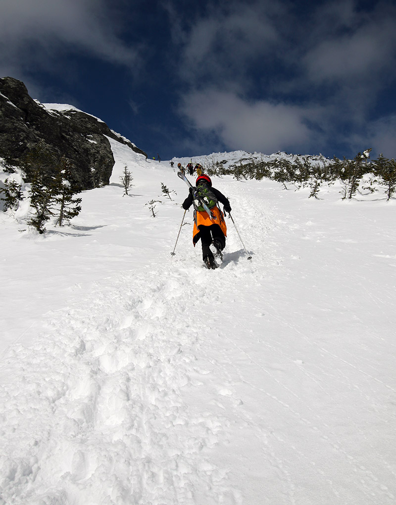
Dylan heads up toward the Mt. Mansfield ridgeline and The Chin under sunny skies as he ascends the boot ladder in the Climbing Gully.
We ultimately had a crew of eight for today’s alpine adventures, with our usual suspects from my group along with Jonah and his brother and dad, who was willing to make the trip with the boys even though he’s got one injured arm in a sling! As soon as program started in the afternoon, we headed right up to the Climbing Gully and found an excellent boot pack in place. With some pretty decent southern exposure, the snow in the Climbing Gully had softened in the sun and sat somewhere between winter and spring consistency. Once we hit the Mt. Mansfield ridgeline though, the consistency of snow was all winter, and that allayed at least some of my fears about the consistency of the snow above tree line. You could feel the nice cool breeze along the ridgeline doing its job to keep the snow from baking in the late March sun, and I knew that any terrain without strong southern exposure up in the alpine was going to be in fine midwinter form. The views were stupendous, so we took a few minutes to enjoy the scene and fuel up. Ty had been silly and not eaten much in the morning, so he’d been bonking on the climb up the Climbing Gully. I made him quickly have a couple packets of GU around the middle of the ascent, and then I told him to get at least one granola bar into him on the ridge to make sure he’d have enough in the tank for the rest of the tour.
Josh snaps a photo of Agi and Jonah as today’s ski groups takes a break on our ascent to the Chin to enjoy the views from the Mt. Mansfield ridgeline.
“Profanity was loaded with snow, and up at those elevations, even south-facing terrain had a surface that was a chalky midwinter consistency.”
After our ridgeline break, we headed up to The Chin, and I first checked out the condition of Profanity Chute, which was my initial plan for today’s descent. Profanity was loaded with snow, and up at those elevations, even south-facing terrain had a surface that was a chalky midwinter consistency. I knew from Powderfreak’s pictures and comments that Winter Storm Skylar had really dropped a ton of liquid equivalent on the mountain and filled everything in, but it’s still most impressive to see it firsthand. Even more impressive to me than how filled in Profanity was, was just how plastered all the usual windswept areas of the summit were. The Chin is so exposed to the wind that it’s more typical to see a mix of rocks and snow vs., the area being covered wall-to-wall in white, but that’s how it’s been since Winter Storm Skylar. People were even skinning all the way to the summit, which you’ll only see when you get a storm of plentiful, dense snow that really covers all the rocks.
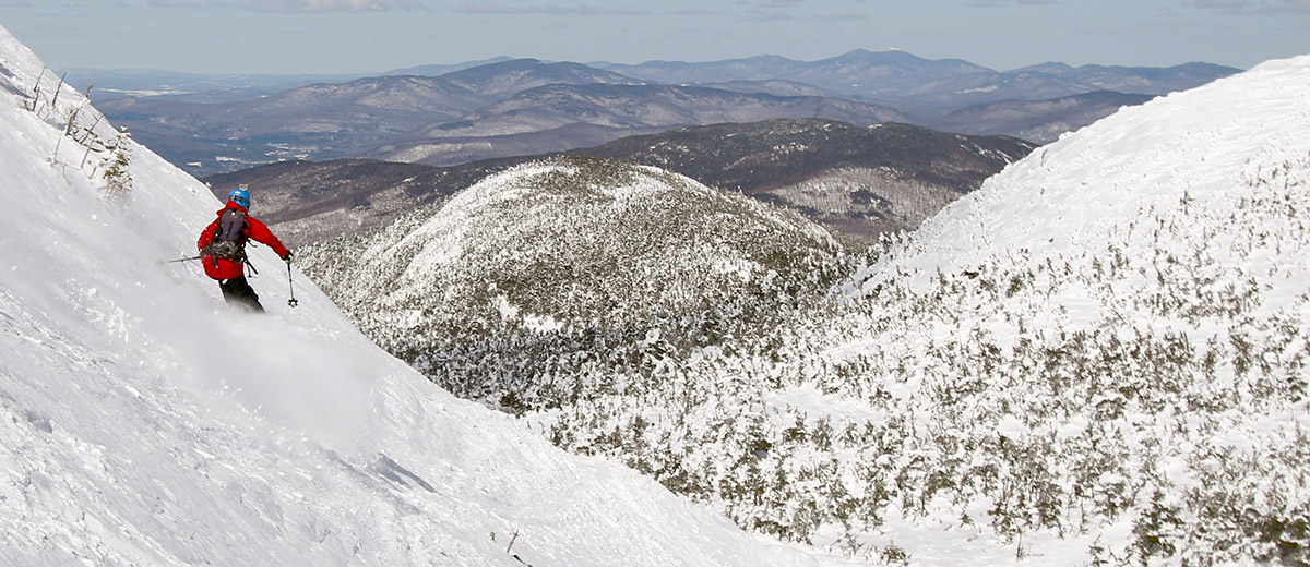
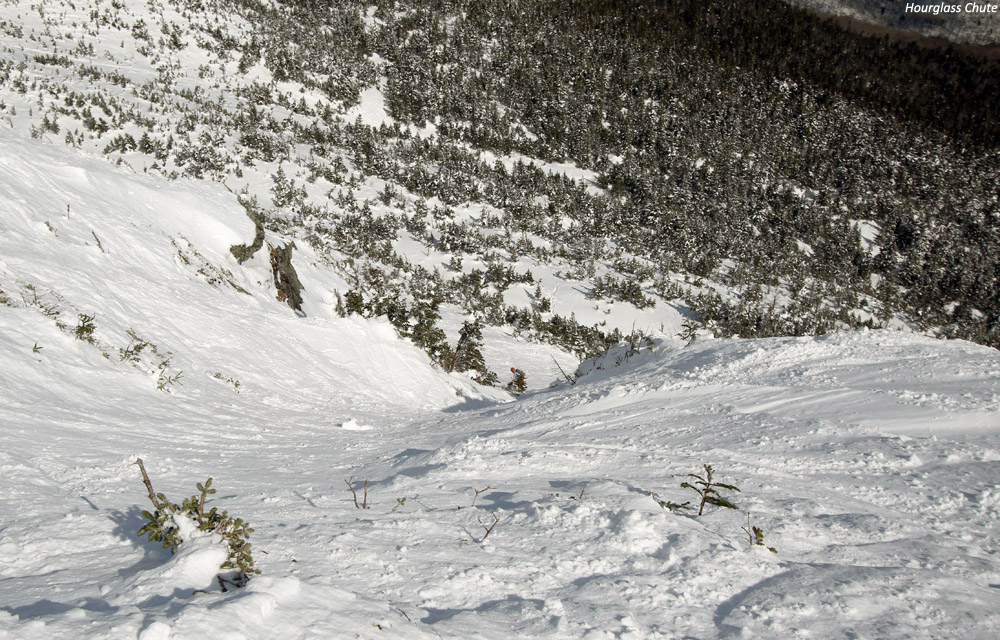
“From what I can find in the SkiVT-L archives, where Stephanie McConaughy reported measuring the slope of Hourglass, the pitch tops out around 50 degrees at the throat.”
While the group congregated at the summit, I also took a look down at Hourglass Chute, and I was very impressed with what I saw. The snow quality and coverage looked excellent. Hourglass is narrower and steeper than Profanity, and I’ve never brought to boys down it, but it was starting to look like today might be the day. It was hard to pass up the great aesthetic look of Profanity with the current snowpack, but the boys have now skied it a number of times, and after surveying everyone to see who was interested, the boys were definitely game to give Hourglass a shot. Looking down on Hourglass from above, it’s a pretty intimidating view with plenty of exposure. From what I can find in the SkiVT-L archives, where Stephanie McConaughy reported measuring the slope of Hourglass, the pitch tops out around 50 degrees at the throat. That’s a pretty impressive pitch wherever you are, and with the apparent exposure of the chute from above, I was sort of dumbfounded that none of the boys even gave it a second thought. Jonah, Wiley, Robbie, Ty, and Dylan were all simply ready to jump right in, and they seemed confused as to why I was even making a big point to thoroughly confirm that everyone was on board. I was worried that it might just be ignorance on their part, but they stood there right atop the chute with a clear view of everything and didn’t even blink, so it is what it is I guess.
A look down Hourglass Chute from above as Robbie just finishes passing through the throat onto the apron below
I dropped down above the throat of the chute (Hourglass is so named because of the relatively open upper headwall and apron areas, with a tight, rock-lined middle section) and set up for some photography of the boys. I had the wide-angle Canon EF-S 10-22mm f/3.5-4.5 USM on my camera body at that point, and the spot I was in was a bit too steep to comfortably change it out, so I ended up sticking with it. Even at 22 mm it was too wide to really get nice shots of the boys going through the throat of the chute, but I did give a nice side-angle shot of everyone above the chute as they waited, and you can get a good idea of the pitch of the slope. Everyone ultimately did fine skiing the chute, although Dylan did take a tumble at the end of the throat as he was doing a jump turn, and I heard that Jonah also had a tumble down there. Fortunately, even with that steep pitch, it’s still not “No Fall Zone” terrain with the decent snow conditions we had. I saw Dylan slide headfirst for a time after his fall, and Ty was below ready to help him arrest, but he’d stopped before that point. Anyway, everyone seemed to have a great time skiing Hourglass, and all the snow was a fantastic midwinter consistency. Even after skiing it, none of them seemed to feel that it was a very big deal, so I guess I was much more impressed with how they did than any of them.
“…they stood there right atop the chute with a clear view of everything and didn’t even blink…”
We caught some steeps along the apron, managing our descent as much as possible to make for an easy cruise over toward and around the Adam’s Apple to catch the Hell Brook Trail. The Hell Brook Trail was in its usual state for this time of year, with terrain exposed to the south/sun getting crunchier and crunchier as one descended in altitude, but the sheltered snow on the skier’s right of the gully was continually fantastic. The whole area is really loaded with snow now, and in conversations with Ty and Dylan during the descent, we all really loved those steep, open faces on the south side of the gully that held the protected winter snow. Although he’d skied Hourglass beautifully, Ty was feeling off his game and heavy on his feet in the tighter sections of the Hell Brook gully (probably because of not initially fueling up properly), so he was really enjoying those more open areas that didn’t have any moguls.
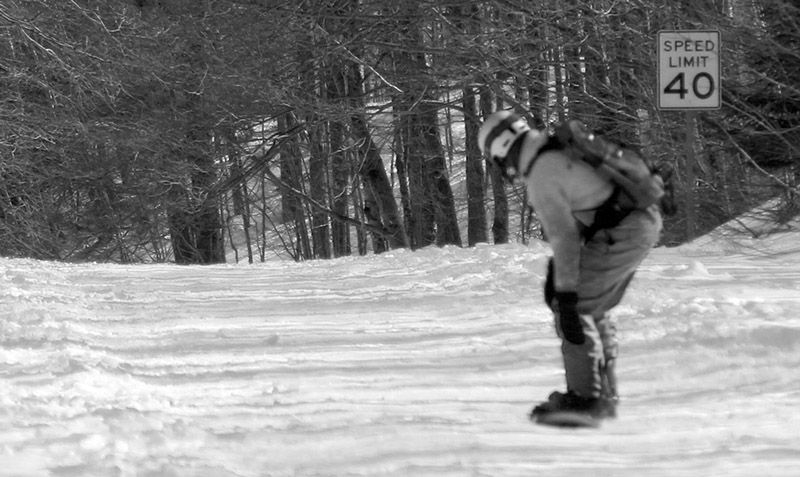
You’re not going to break any speed limits returning to the resort from the bottom of the Hell Brook Trail on a snowboard, but we saw plenty of people like Robbie making it work.
The ski out was relatively quick because the snow wasn’t sticky at all, although I hadn’t noticed that Wiley and Robbie had chosen a route without a good bridge across the final stream, so they had to take some time working their way through the lower woods to find a good crossing. Robbie was of course a trooper doing the whole thing on his snowboard, both above and below the Hell Brook Trail there are plenty of spots that are no big deal on skis, but can be a headache on a board. Down there on Route 108 it totally felt like spring, with lots of sunshine, and winter recreationalists out enjoying any manner of snow and ice travel. I’d had a lot of fun on today’s outing because I guess it’s been about 20 years since I last skied Hourglass Chute. Hopefully it won’t be so long before I get to do that again!
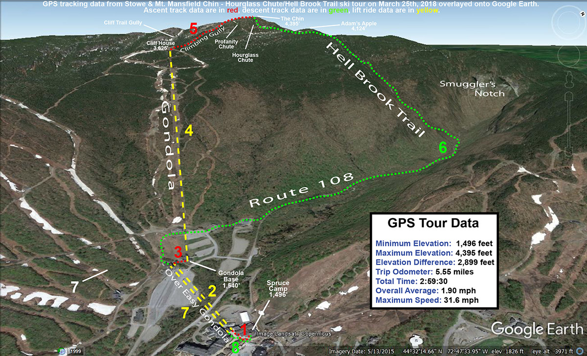
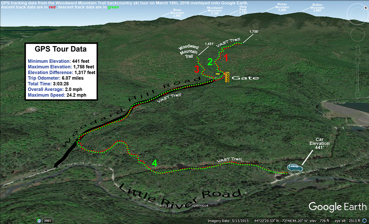
A Google Earth map with GPS tracking data for today’s ski tour at Stowe Mountain Resort and the Mt. Mansfield Chin featuring Hourglass Chute and the Hell Brook Trail
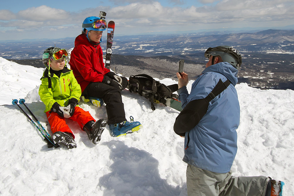
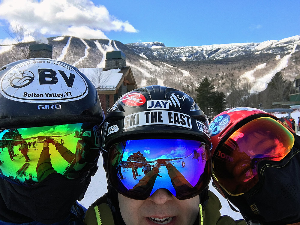
Both Dylan and I got to try out our new Anon M2 Goggles, the same model of goggles that Ty got at Christmas with the magnetic interchangeable lenses. Dylan and I were both in need of new goggle for various reasons, and it seemed like a no brainer to get the same model that Ty has to be able to quickly share all the lenses between us. We even got a few extra lenses for various conditions – we’ll just have to be good about not fighting over them!
Dad and Dylan joining Ty as they try out their new Anon M2 goggles today!
By the time we got back to Spruce Camp, the program session was just about over. I do like that a typical hike to The Chin with a Hell Brook run is just about perfect for one of our afternoon program sessions, since everyone is pretty cooked by the end anyway between the hike in and the traverse out. Ty was famished, so we headed up to the Great Room Grill for some food with Mom, and Ty got one of their huge burgers. He devoured it, not surprisingly, and E and had time to remind him not to try pulling ski outings like that on a nearly empty stomach. There’s nothing quite like a hearty meal after being famished from a good winter tour, but you have to know your metabolism and where the empty line is on your tank or you can easily get into trouble before you get to that next feast.
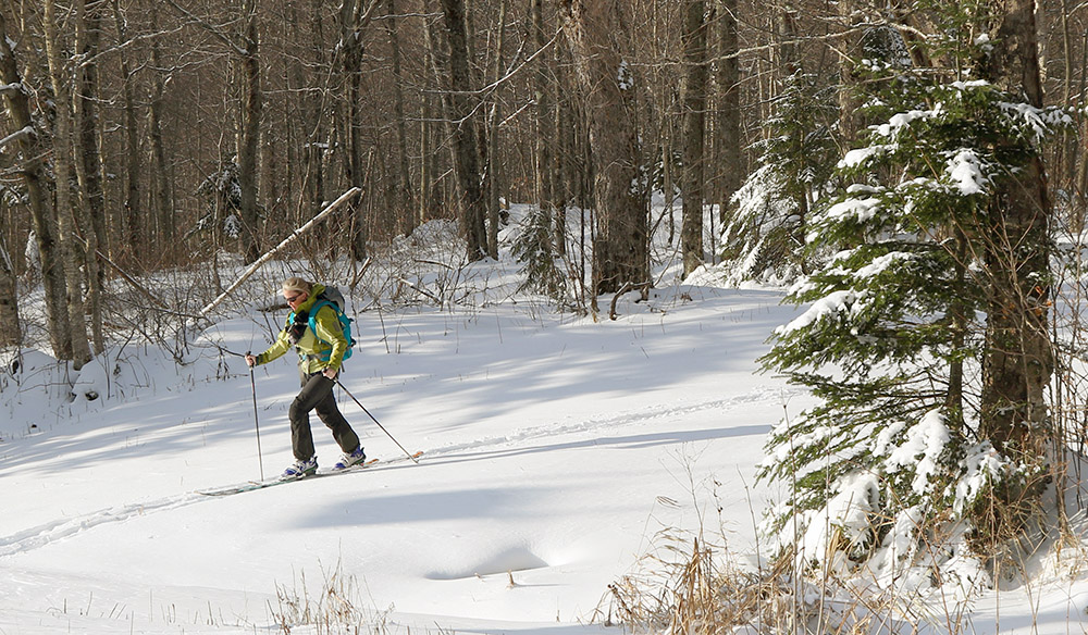
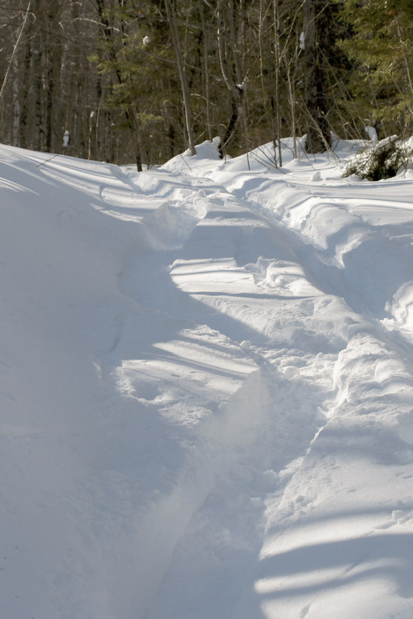
Powder turns today during explorations in the lower elevations of the Woodward Mountain Trail
Wind chills were forecast to approach -30 F today on the upper elevations of Mt. Mansfield at Stowe Mountain Resort, so E did a “soft cancel” of our BJAMS ski program. The program was still on, and families could go if they wanted to, but no coaches were required to go, and students wouldn’t have to deal with those potentially frigid temperatures.
Although I was glad to not have to battle the nasty wind chills up in the higher elevations, it was still a gorgeous late-winter day out there, so I thought about heading out for a ski tour on something local, relatively low elevation, and sheltered from the wind. Eventually, an exploration of the lower elevations of the Woodward Mountain Trail came to mind. The base of the trail is just a couple miles from our house in Waterbury, and with the healthy snowpack that extends all the way to the bottom of the local mountain valleys, the ski conditions there should be outstanding.
The Woodward Mountain Trail is quite a route, running six miles and dropping over 2,500 vertical feet in elevation. The traditional way to ski the trail is to spot a car at the VAST parking area (450’) at the bottom on Little River Road near the Waterbury Reservoir, then drive up to Bolton Valley Resort and use the Vista Quad to get to the top of Vista Peak (3,150’). From there, you ski southward along the ridge between Vista Peak and Woodward Mountain, before descending eastward off the flanks of Woodward Mountain itself down to Little River Road in the Waterbury Reservoir and Little River State Park area. I’ve skied the upper elevations of the trail before, but I’ve heard route finding for the ending (and middle for that matter) portions of the trail can get a bit tricky. At some point it would be great to get family and friends together for a full run of the trail, so my goal with today’s outing was to orient myself to the twists and turns at the bottom of the trail to hopefully make that experience a bit more efficient. And with the great snowpack and plenty of powder out there, I hoped to get in some good turns in the process.
“…my goal with today’s outing was to orient myself to the twists and turns at the bottom of the trail to hopefully make that experience a bit more efficient.”
I used my copy of David Goodman’s classing backcountry guidebook “Backcountry Skiing Adventures: Vermont and New York” to get myself oriented with respect to the lower regions of the route. His book has a nice description of where to park, as well as a topographic map with the route outlined. The guide is excellent, with just one problem in my case – the guide is built for following the trail down, so it’s not perfect for guiding you up from the base of the trail if you want to try that approach. In any event, with the map from the guidebook and my GPS in hand, I knew I’d be able to orient myself reasonably well to what the bottom of the trail held in store, and I’d always be able to come back again if necessary on a future trip with my own first experience in hand.
Temperatures were probably around 20 F when I parked at the VAST lot on the west side of Little River Road. There were a few cars there, most with snowmobile trailers of course, although one car looked like it might be backcountry skiers waiting to pick someone up. Starting from the parking lot, you’re immediately on the VAST trail, and it climbs a steep pitch before leveling out and going through some fields along the power line leading up to the dam. It was easy to see from the map in the guidebook that this part of the trail is a bit circuitous – you’re doing a big loop that doesn’t immediately bring you toward the rest of the Woodward Mountain Trail. This is due to the layout of the VAST trails, but with the topography of the ridges, valleys and streams down there, you’d probably just waste a ton of time trying to break trail through the snow if you wanted to follow more direct route from the parking area anyway. It’s hard to put a price on having a packed, well-marked trail to get you through the backcountry, even if the route is a bit indirect. The energy-saving and route-finding efficiency of having an established packed trail are simply huge. I was a bit dismayed to find that there was one fairly substantial downhill section (which of course means uphill on the way out) on the route in. I’m talking about a substantial enough slope that you’re likely going to have to take off your skis and walk, or put your skins on to deal with it.
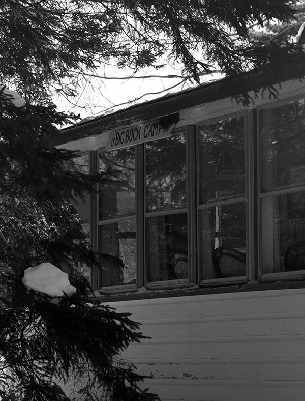
After 0.9 miles on the well-packed VAST trail, I came to a T junction. The trail I was intersecting was part of the VAST system, but it was also a road, Woodard Hill Road. It had actually been groomed (and apparently even plowed) down in that area, so the snow cover was a bit thin in spots. I headed upward and to the right on Woodard Hill Road, which was the obvious route to take based on the guidebook map. I passed a couple of hunting camps on the left, and eventually at 1.75 miles into the route I came to a gate that seems to be the one indicated on David Goodman’s route. This is where the utility of the map in his guidebook broke down a bit for the ascent. His route appears to be shown passing through the gate, but it’s also shown staying to the south of the main drainage in that area. If you go through that gate, you’re crossing a bridge to the northerly side of that drainage, so those two pieces of information don’t line up. On the south side of the drainage there is a clearing that had seen some snowmobile activity, but I didn’t see any obvious ski tracks coming down from there to suggest it was near the Woodward Mountain Trail.
One of the hunting camps seen during my ski tour along Woodard Hill Road
I decided to play it safe on my first look and simply follow the VAST trail through the gate to see if any obvious trails branched off from it. The “safe” aspect of this choice was that I could continue to follow a well-packed, well-marked trail for a while, wherever it was going to take me. At 2.65 miles and an elevation of ~1,750’, I hit the local peak of that VAST trail and hadn’t seen any obvious trails converging on it, so it was time to see what potential the clearing on the other side of the drainage held. I de-skinned and switched to descent mode, and actually had some fun turns in the terrain off the sides of the VAST trail.
“At the very start of my tour down around 450’, the powder was generally 8 to 12 inches deep, but up in the 1,500’ to 2,000’ range where I topped out it was in excess of 20 inches deep. So there were a lot of good turns today at all elevations.”
Coming back down to the gate and bridge area, I headed up into the clearing and could see what had to be the outlet of the Woodward Mountain Trail. The clearing was full of powder, and the reason I hadn’t seen any ski tracks coming out among the snowmobile tracks was simply due to the fact that the last person to use the trail had done so before our recent bout of snowfall had stopped. Once I looked up the trail, I could see that there was an obvious ski/skin track. I put my skins back on and started up the trail. Fortunately, only about 6 to 7 inches of light fluffy snow had accumulated since the last person’s track, so breaking trail wasn’t really too much of a chore. I ascended for a bit within what my schedule allowed, and then had a nice ski back down that section of the trail with some smooth powder turns.
Back at the VAST trails, I descended until I hit the VAST stop sign at the junction of the final leg back to the parking lot. I was reading Ski Maven’s report of her trip on the Woodward Mountain Trail, and it sounds like her group went right through this junction, which left them at the base of Woodard Hill Road about a mile from the parking lot where they had spotted their car. This meant that they had to walk that distance back on Little River Road to get to where they’d parked. Froom that VAST trail junction though, it’s really a short downhill jaunt (just a couple tenths of a mile) to get to the base of Woodard Hill Road. This would actually be a much better place to park a car for finishing the Woodward Mountain Trail. Unfortunately, there’s not the expansive VAST parking area that you get following the other route, but I’ve seen cars parked down at the base of Woodard Hill Road, and I’m sure that’s why. I can tell you, having returned the 0.9 miles to the main parking lot on my tour today via the standard route in the guidebook, with its one substantial uphill and extensive flat sections, that continuing down on Woodard Hill Road would be tremendously more fun and efficient. It shortens the travel at the end of the route by almost a mile, and it’s all downhill. Even if parking isn’t available at the bottom of Woodard Hill Road, and you had to park at the VAST lot, you could still have everyone in your party continue that way and have one strong member follow the regular route and pick the rest of the party up at the road. It would honestly give people a much more enjoyable finish to their tour.
A Google Earth map with GPS tracking data showing today’s tour on the Woodward Mountain Trail
At the very start of my tour down around 450’, the powder was generally 8 to 12 inches deep, but up in the 1,500’ to 2,000’ range where I topped out it was in excess of 20 inches deep. So there were a lot of good turns today at all elevations. At some point I’d like to get to the middle portions of the Woodward Mountain Trail, but I’ve now learned a lot about the layout of the upper and lower sections, and would definitely feel comfortable guiding people in those areas. The middle portion of the route is supposed to have a lot of fun glades though, so I can’t wait to check those out.


