First Vermont snows for the 2023-2024 winter season

An image from the famed snow stake on Mt. Mansfield in Vermont showing some of the first accumulating snow of the 2023-2024 winter season.

Today we got our first taste of the coming winter in the Northern Green Mountains. While Mt. Washington in New Hampshire has had a number of rounds of snow thus far in the autumn, and there were some reports of possible frozen precipitation in far northern Vermont a week or two ago, today saw the first notable accumulating snow on Mt. Mansfield. As of midafternoon today, Powderfreak reported that the snow level was down to ~2,500’, and he sent in an image of a half inch of accumulation at 3,000’ as of 3:30 P.M. By early evening he provided a few more pictures and indicated that the snow level had dropped below 2,000’. Up at the Mt. Mansfield Stake at roughly 3,700’, the report was that there was about an inch of accumulation over a third of an inch of ice. A check of mountain webcams around the area revealed that just about all the mountains were seeing flakes with accumulation, but those views will have to do for now.  Unfortunately, it’s been far too cloudy to get any nice shots of the snowy peaks from afar, but hopefully we’ll get to see them appear in a day or two.
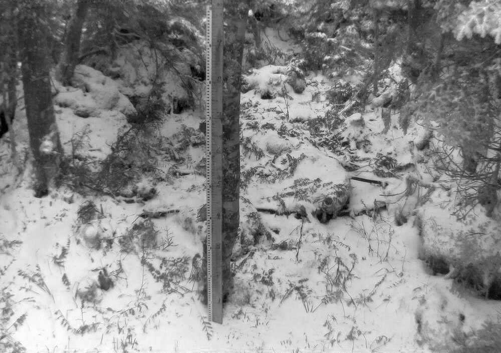
An image from the famed snow stake on Mt. Mansfield in Vermont showing some of the first accumulating snow of the 2023-2024 winter season.
A shot of the famed Mt. Mansfield stake from today featuring the season’s first accumulating snow.

So, Oct 22 will go down as the date for our first accumulating Mt. Mansfield snow for the winter of 2023-2024, and we can now add it to the books and see how it compares to the averages. The stats for first accumulating snowfall of the season on Mt. Mansfield are below for comparison – today’s date of Oct 22 is later than the mean date of Oct 11, but well within 1 S.D., so quite normal in that regard. Assuming a normal distribution, about 25% of seasons will have later first snowfall dates than this one.

The dates of first accumulating Mt. Mansfield snow for some recent seasons are shown below as well, so this season sits later than the past few, but ahead of most of that stretch in the mid-2010s, which was a surprising run of later October dates.

Date of first accumulating Mt. Mansfield snow:

Mean:  10/11
Median:  10/10
Mode:  10/17
S.D.: 15 days
N:  67
Most Recent:  10/22
Most Recent Days Deviation:  +11
Most Recent # of S.D. Deviation:  +0.732
Most Recent S.D. % Lower:  76.8%
Earliest 8/28/1986
Latest   11/17/1985

Date of first accumulating Mt. Mansfield snow by season:

2008: Oct 3
2009: Sep 30
2010: Oct 7
2011: Oct 30
2012: Oct 8
2013: Oct 24
2014: Oct 26
2015: Oct 17
2016: Oct 26
2017: Oct 27
2018: Oct 13
2019: Oct 18
2020: Oct 17
2021: Oct 18
2022: Oct 8
2023: Oct 22
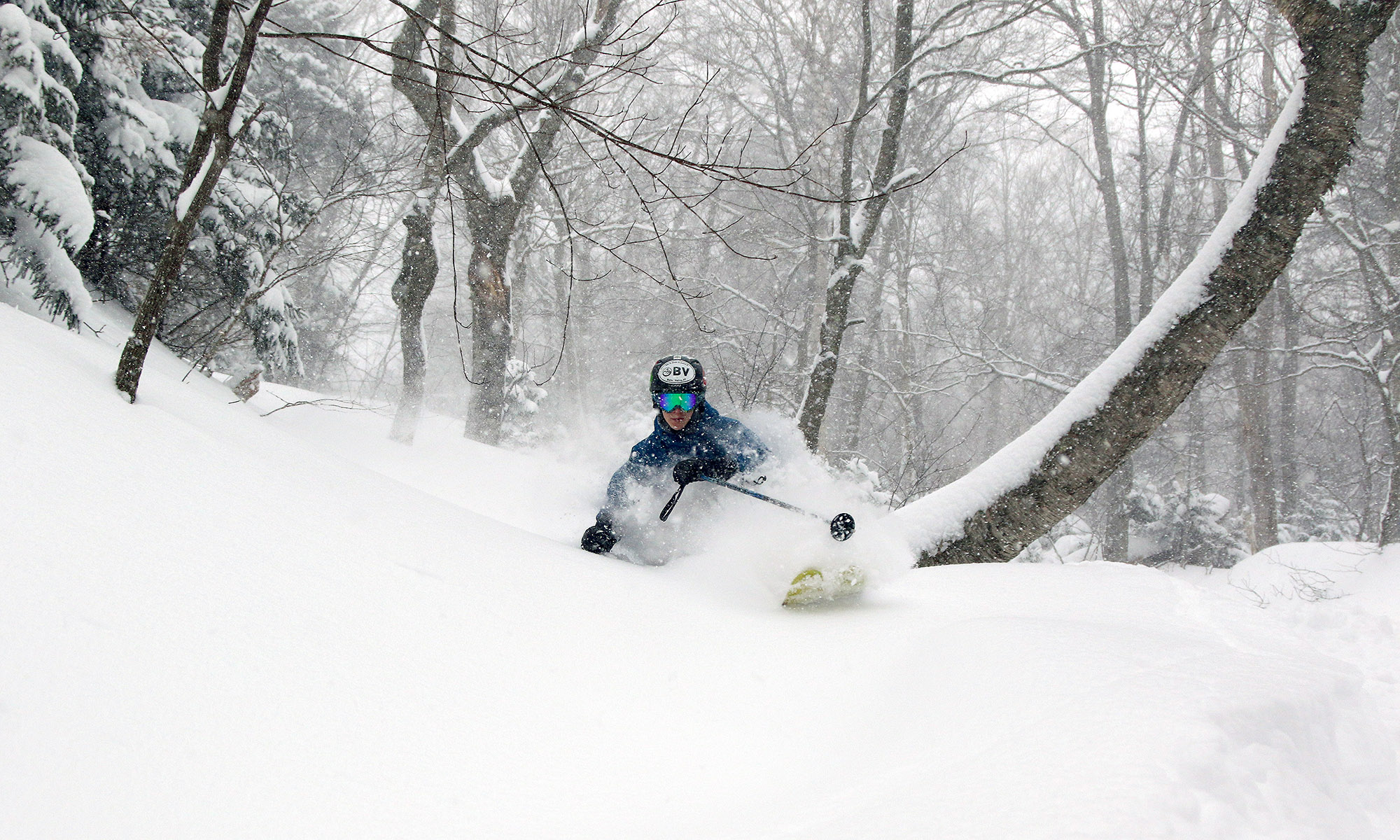
Average date of first snowfall for Mt. Mansfield in Vermont

Having recently picked up our first snowfall of the season here in Vermont, reports and discussion in the New England Regional Forum at American Weather had people wondering where this event sat with respect to the average date of occurrence for the first snowfall on Mt. Mansfield.  I’d been curious about that date as well, so I used the data from the Mt. Mansfield co-op weather observations site, which comes from the ridgeline of the mountain up near the 4,000-foot elevation.  It’s a fairly substantial data set that goes all the way back to 1954, and Wesley Wright set it up to be available through the SkiVT-L site at UVM.

“The data suggest that our first snow of the 2018-2019 winter season from this past Saturday (October 13th) is a few days on the late side of the mean for first accumulating snow (October 10th), but overall quite typical.”

There are a couple of seasons that I couldn’t include in the statistical analysis because of gaps in the data collection early in the co-op site’s history, but there were still 62 seasons in the data set that provided useful information.  The data suggest that our first snow of the 2018-2019 winter season from this past Saturday (October 13th) is a few days on the late side of the mean for first accumulating snow (October 10th), but overall quite typical.  The full results from the statistical analysis are below, so have a look and think snow!

Date of 1st Accumulating Snow at Mt. Mansfield, VT Co-Op Station:

Mean:  10/10
Median:  10/8
Mode:  10/17
S.D.:  15 days
n:  62
Earliest:  8/28/1986
Latest:  11/17/1985

September and October Snowfall Averages for Mt. Mansfield

As we head into the last few weeks of summer, some people’s thoughts turn to early snowfall in the mountains, and this topic recently popped up with respect to Mt. Mansfield in the New England Regional Forum at American Weather.  Since I have all the raw snowpack data from the Mt. Mansfield co-op station downloaded from when I created the Mt. Mansfield 24” snowpack plot, I scanned through the September numbers back to 1954 to see what they revealed.  Because the collection of actual snowfall at that station can be a bit dicey, I first checked the snowpack data that I had, and found three occurrences of September snowpack at the stake:

Date                 Snow at the stake (in.)
9/15/1959          1
9/16/1986          4
9/17/1986          2

However, assuming they have historically been using the same practice of reporting the depth of the snowpack at the end of the day (~5:00 P.M. or so) as they do now, it was likely that there was overnight September snowfall that simply didn’t make it through the entirety of many warm, September days to be reported from the stake.  Therefore, I also checked the snowfall data, and found that indeed there are a fair amount of reports of September snowfall:

Date                 Snowfall (in.)
9/15/1959          1.00
9/24/1966          0.50
9/2/1967            0.30
9/25/1967          1.50
9/22/1976          1.00
9/28/1980          0.50
9/16/1986          4.00
9/24/1989          1.00
9/21/1991          1.00
9/28/1991          0.30
9/29/1991          1.00
9/30/1992          0.30
9/23/1998          0.30
9/30/2009          0.02

There are a few years with no data, but accumulating September snow does happen on Mt. Mansfield, at a rate of roughly a couple times each decade.  I’m not quite sure what was going on with the 2009 number, since one doesn’t generally report snowfall to the hundredths of an inch; perhaps they are reporting a trace on that one.  Not surprisingly, September snowfall is more frequent on Mt. Washington with a couple thousand feet of extra vertical – the September monthly average there is 2.2” inches, and the monthly maximum is almost 8 inches, so accumulating September snow is probably fairly common.

I also scanned the Mt. Mansfield data for August, and there was even one report of accumulation there:

Date                 Snowfall (in.)
8/28/1986          0.20

Since there was also mention of October, I took a look at those data as well.  Because accumulating October snowfall is already fairly common even down here in the mountain valleys of the Northern Greens (out of the six season’s worth of snowfall data I have collected here, four Octobers have seen accumulating snowfall, and the average is right around an inch) I figured that getting October accumulation on Mt. Mansfield must be almost a lock.  Indeed that’s the case; after checking the snowpack data from 1954 – 2012, there are only a handful of seasons without reported snowpack, and one of those seasons did at least show some snowfall:

Seasons without reported October snowpack on Mt. Mansfield
1956-1957
1963-1964 – 0.1” snowfall
1971-1972
1973-1974
1985-1986
1996-1997
2007-2008

So essentially it’s about twice a decade that there is accumulating snow on Mt. Mansfield in September, and about once a decade that there isn’t accumulating snow on Mt. Mansfield in October.