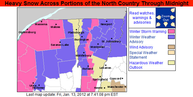
Over the past couple of days we’ve been affected by a fairly significant, two-part winter storm that has really resurfaced the slopes. The storm began on Thursday with some synoptic snow, where we accumulated 3.7 inches of snow comprised of 0.34 inches of liquid equivalent at the house, and the mountains picked up about a half a foot. We headed up to Bolton for some skiing in the evening, and we found pleasant temperatures and nice powder. Yesterday we were generally in the dry slot of the storm, but toward the afternoon and evening, the back part of the system came through and it really started to unload fluffy Champlain Powder™ in both the mountains and valleys. Here at the house we picked up almost 3 inches of snow in one hour while the snowfall pounded the area around dinner time, causing temporary road closures and prompting the issuance of Winter Storm Warnings for the western slopes of the Green Mountains:

Down here in the valley, the storm finished up today with a total of 11.7 inches of snow comprised of 0.91 inches of liquid equivalent. Up in the mountains, snow totals were generally around 1.5 feet, with Jay Peak topping out around 2 feet. The north to south storm totals list for the Vermont ski areas is listed below:
Jay Peak: 23”
Burke: 12”
Smuggler’s Notch: 15”
Stowe: 18”
Bolton Valley: 15”
Mad River Glen: 16”
Sugarbush: 18”
Middlebury: 13”
Suicide Six: 8”
Pico: 14”
Killington: 14”
Okemo: 8”
Bromley: 10”
Magic Mountain: 12”
Stratton: 12”
Mount Snow: 11”
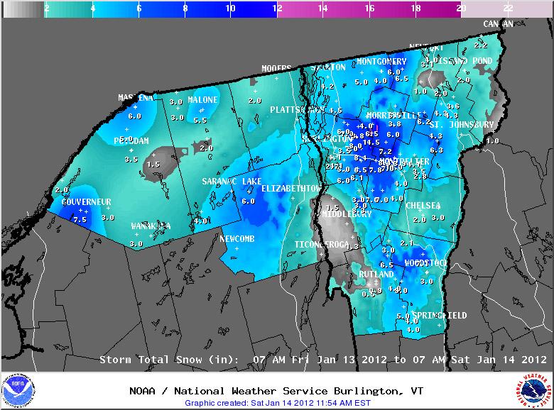
The National Weather Service Office in Burlington generated a snowfall map for the second part of the storm, where totals in the Stowe area pushed past the 1-foot mark:

For more full details on this storm, head to the detailed report at the winter weather section of our website.

4 Replies to “Significant mid-January winter storm for Vermont”
Comments are closed.