First Round of October 2022 Snow for Vermont’s Green Mountains

Since our first snows of the season back in September, we’ve moved on into a new month and another window for early season snowfall.  This time the snow chances are associated with a series of small disturbances that started moving into the area last night and are expected to continue through the weekend.

The first notifications I saw of accumulation appeared this morning in the Northern New England Cold Season thread on the American Weather Forums – Powderfreak indicated that it was snowing all the way down to 1,500’ at the base of Stowe Mountain Resort, and flakes were even spotted as low as 1,000’ around The Matterhorn.  Powderfreak posted some images from both the top and bottom of the Stowe Gondola that showed the fresh snow.  As the snow and clouds pulled away a bit more by midday, he posted a beautiful snowliage image of some of Mount Mansfield’s slopes.

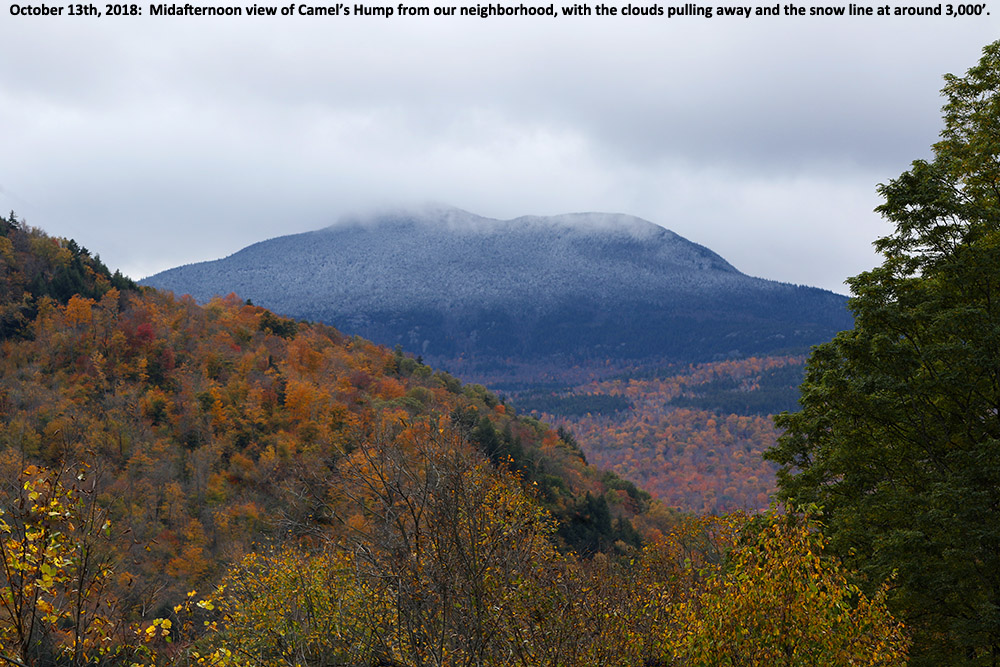
The temperatures stayed cold enough throughout the day that new snow continued to hang around on the ground, with the snow line rising to around 2,400’ in the midafternoon period.  Powderfreak sent along some additional nice views from his afternoon hike on the slopes of Mansfield, and he commented on how it was nice to be back out with the crunch of snow underfoot.

First snows of the 2018-2019 winter season in the Green Mountains of Vermont

An image showing Camel's Hump in Vermont with the first snows of the 2018-2019 winter season in the Green Mountains
Camel’s Hump showing signs of the first snow of the season for the Green Mountain of Vermont

While the first half of October was fairly warm, the weather models have been suggesting a shift to more seasonal temperatures as we hit mid-month.  The potential for some mountain snow was in the forecast last night, and indeed as of yesterday afternoon snow was already being reported at Whiteface Mountain across the lake with video of the flakes.  Here on our side of the lake, we heard from Powderfreak early this morning that snow had been sighted in the mountains around Stowe, and he was heading up for some investigation.  An hour or two later, he had send along pictures, and indicated that accumulations on Mt. Mansfield were about a half inch and started at an elevation of roughly 2,300 feet.

“…it looks like we’ll have more opportunities for snow this week with accumulations potentially even down to the mountain valleys.”

Here at our house, I did a morning check to find that the cloud ceiling was still only about 2,000 feet and there were no obvious signs of snow below that level.  I gave the clouds some time to think about clearing a bit, and then headed out in the neighborhood during the mid-afternoon period to see what snow might be visible.  Indeed the cloud ceiling had risen by about another 2,000’ and I was able to catch Camel’s Hump as the clouds had just about broken away.  The snow line at that point looked to be around 3,000’.

The first snows of the 2018-2019 winter season are in the books here in the Greens, and the National Weather Service Office in Burlington says it looks like we’ll have more opportunities for snow this week with accumulations potentially even down to the mountain valleys.  We’ll see what transpires as even colder air moves in, so stayed tuned for more October snow updates!