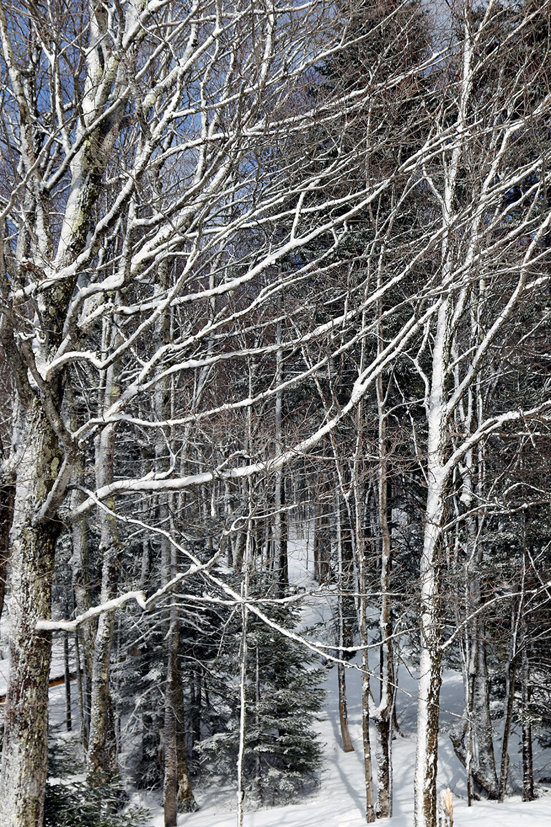
Sun lights up some trees with fresh snow as a perfect representation of today’s variable spring and winter weather.
I’d seen that the potential for more snowfall was in forecast today based on the weather modeling, and it looked like the afternoon period might be the best bet for catching some turns in fresh snow. The BTV NWS forecast discussions have been noting that there’s no large, defined system in our area today though, we’re just moving into a general period of unsettled weather. With nothing really going on at the house other than cloudy conditions around midday today, I was surprised when I checked the Bolton Valley Base Area Webcam and saw that the visibility up there was extremely low due to heavy snowfall. It was notable to see such a disparity between the weather on the mountain and the weather at our house, but then I checked the radar and saw what was going on. The precipitation was very convective/cellular in nature, so the mountain happened to be under one of those rather localized, intense areas of snowfall. In another 10 minutes or so, the snowfall began to wind down, but the radar of to the west was riddled with similar pockets of precipitation all across the North Country that were heading toward the spine of the Northern Greens. I suspected the mountain would see additional episodes of snowfall throughout the afternoon, so I decided I’d head up for turns once I finished up some work I had to get done.
Later in the afternoon when I was getting ready to pop up to the mountain, I checked the webcam again and they were getting hit by another round of snowfall. The early morning snow report from the resort indicated that they’d picked up a fresh inch of snow before opening, and with the way the afternoon had gone, I wouldn’t have been surprised if they’d picked up another inch or two. We were even getting some rain in the valley with that round of snow, and as I headed up the Bolton Valley Access Road, the precipitation switched over to snow a bit below 1,500’. When I’d headed up to the mountain on Friday, the snow level was around 2,000’, so it was notably lower today.
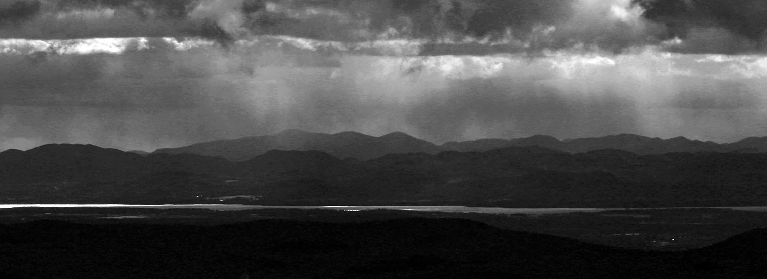
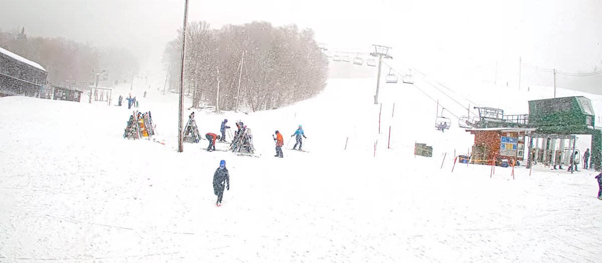
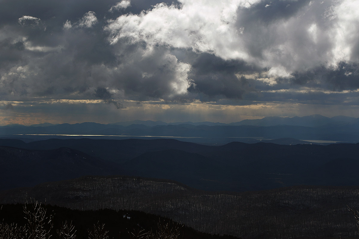
A shot taken from the Bolton Valley webcam today as one of the heavy snow squalls moved across the mountain. The resort’s webcam was invaluable today in keeping tabs on the changing March weather.Another shot across to the Adirondacks showing some afternoon like and the various areas of snowfall upstream of Bolton Valley
I can’t say what the snow was like earlier in the day today, but what I found in the later afternoon was a very fun mix of different conditions that all skied quite well. The mountains have been in that temperate March/April mode over the last few days where we’ve got some fresh snow accumulations, temperatures in the upper 20s to 30s F, some sun, some clouds, semi-cycled snow depending on elevation, and probably whatever else you can think of that this time of year has to offer in the higher elevations. Descending from above 3,000’ on Wilderness, I found wintry conditions with some dense powder that was blended into the old snowpack in untouched areas, with wintry wet pack on the groomed/traveled areas that had firmed up somewhat with temperatures below freezing. By the time I descended to 2,000’ I encountered areas of semi-corn, soft packed snow on piste, and denser wet snow off piste. I didn’t ski down below 2,000’ to Timberline, but that area unquestionably had the softest snow. In any event, it all skied remarkably well, with nothing overly sticky or firm. I had waxed my skis in preparation for any potentially sticky conditions, so that probably helped keep things extra smooth for me, but I didn’t see anyone else struggling with apparent stickiness either. Temperatures did seem to be dropping as the afternoon came to a close, so the sub-freezing conditions were falling to 2,000’ and below.
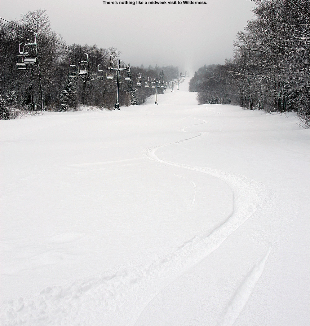
Being later in the day on a Sunday afternoon in March, skier traffic was quite low when I was on the mountain, and I was coming upon trail areas where there were literally just two or three tracks in the fresh snow, and I’d basically have the run of it with respect to laying down my own tracks. I see that the mountain is indicating 3 inches of new snow in the past 48 hours, so that seems about right based on the untouched areas I skied, and it’s generally dense so it does a great job of providing floatation above the base. The weather models are still suggesting that we’ve got more snow chances continuing right through to the end of the month, so we’ll look forward to what are hopefully additional days of these fun winter/spring conditions atop a snowpack that is probably slightly below average, but not bad. Average snowpack this time of year is nearing peak anyway, so even if we’re off from that a bit, it’s still quite plentiful.
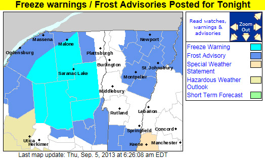
AS OF 454 AM EDT THURSDAY…HIGH PRESSURE WILL CREST OVER THE REGION TONIGHT. GIVEN CLEAR SKIES AND NEALY CALM WINDS WILL ALLOW FOR IDEAL CONDITIONS FOR RADIATIONAL COOLING…WITH TEMPERATURES FALLING INTO THE 30S IN MOST LOCATIONS…WITH SOME TEMPERATURES APPROACHING NEAR RECORD LOWS FOR SEPTEMBER 6TH. EXPECTING TEMPERATURES TO FALL INTO THE UPPER 20S IN THE SHELTERED VALLEYS OF MOST OF THE ADIRONDACKS LATE TONIGHT. THUS…HAVE PUT OUT A FREEZE WARNING FOR THOSE AREAS. ELSEWHERE…HAVE PUT UP A FROST ADVISORY FOR MOST OF THE REMAINDER OF NORTHERN NEW YORK…AS WELL AS NORTH CENTRAL AND NORTHEAST VERMONT FOR PATCHY FROST. NOT EXPECTING ANY FROST OVER THE CHAMPLAIN VALLEY AS LAKE CHAMPLAIN WATER TEMPERATURES STILL IN THE LOW 70S…WHICH WILL KEEP THE VALLEY RELATIVELY WARM WITH MOST TEMPERATURES IN THE UPPER 30S IN THE CHAMPLAIN VALLEY.
“…you didn’t have to worry about hitting anything underneath and you could just let it rip.”
Saturday arrived with a nor’easter developing just like the weather models had suggested. For folks that had outdoor, warm-weather plans for the big holiday weekend, you almost couldn’t find a nastier combination of weather. Temperatures were in the 40s F, and there was plenty of wind and rain. We wondered if we were going to have to turn the heat back on in the house. Reports began to come in about the snow in the mountains, and by mid afternoon, Whiteface was already reporting that they had received 18” of new snow. As the afternoon wore on, even valley temperatures fell down well into the 30s F in many places in New England, and fairly low elevation spots began to report snow mixing in with the rain. Although we weren’t getting any snow down to the low elevations in our area, we lost power from about 8:30 P.M. to 9:30 P.M. for some reason, so we headed off to bed early and decided to see how things were going in the morning.
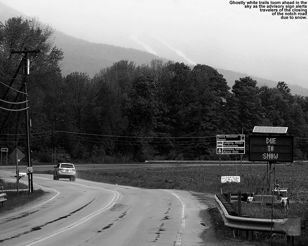
Snow closed down the road through Smuggler’s Notch today.
I made my morning CoCoRaHS observations at 6:00 A.M., and after checking back in on the weather board and looking at some of the mountain web cams, I decided to head to Mt. Mansfield for a ski tour. I couldn’t tell quite how low the snow line had gotten, but it was still below freezing in the higher elevations, and the precipitation had continued through the night. There was a good chance that a nice shot of snow had accumulated on Mt. Mansfield. I didn’t try convincing E or the boys to try to join me, since they were all still in bed, so I got into my ski clothes, let E know that I was on my way, and loaded up the car with my gear. I don’t typically find the ski gear vying for space with the baseball stuff in the back of the car, but it definitely was today. I headed off to the mountain around 7:30 A.M. or so, and temperatures throughout the mountain valleys in the Waterbury–Stowe area were in the lower 40s F on my drive. The precipitation was generally light rain until roughly the point where the electronic sign indicates the status of Route 108 through Smuggler’s Notch, and not long after that, the rain became much heavier. The sign, by the way, read “NOTCH ROAD CLOSED… DUE TO SNOW”. The road through the notch tops out near 2,200’, so clearly the snow was accumulating at that elevation on paved surfaces. The temperature remained in the lower 40s F until that final rise above The Matterhorn to Stowe Mountain Resort, where they dropped into the upper 30s F.
“You could do laps up there from 2,500’ to 3,600’ and think it was midwinter.”
I parked at the Midway Lodge (~1,600’), where the temperature was in the mid to upper 30s F, and the precipitation was generally snow, but certainly some rain as well, and the snow that was falling was of course incredibly wet. It was pretty nasty at that point, with 25 MPH winds and driven wet snow/rain. The snow wasn’t quite accumulating there, but it was close, and you could see the accumulations just a few hundred feet up the trails. The weather was nasty enough that I left my lens hood on my camera in its protective orientation, even when it went back in my pack. I rarely feel the need to do that, and typically flip it back around for storage, but that speaks to just how wet and windy that snow was to make me take that extra step to minimize the amount of precipitation getting on the lens filter.
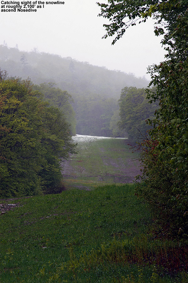
Snow line in sight on Nosedive at 2,100′
In the Midway parking lot there were a few dozen vehicles belonging to skiers, and most of the people were heading up Gondolier, but my initial ascent was via Nosedive; it’s often a good bet for decent snow coverage and preservation in these early and late-season storms. Also, based on what I saw in the report from AdventureSkier.com last Sunday, it looked like there would be some decent base snow left in case the new snow depths were marginal. The first traces of snow accumulation on the ascent were at 1,800’, by 2,100’ there was generally complete coverage of the trail, and by ~2,200’ the depth was a couple of inches and it was consistent enough that I switched from hiking to skinning. Even with those couple inches of snow, I was beginning to experience some occasional slipping as I hiked, so it was nice to get the skis off the pack and on the snow where the skins had beautiful traction. There was a faint skin track from an earlier ascender, but it was intermixed with some of the descent tracks of skiers and a bit hard to follow. I met up with another guy that was making the Nosedive ascent, and we chatted a bit about skiing as we made our way up the mountain. He was just hiking in his boots with his skis on his back, which seemed like a bit more work as the snow got deeper and deeper, but it didn’t appear to slow him down too much. Listed below are the snow depths I found on the ascent of Nosedive with respect to elevation:
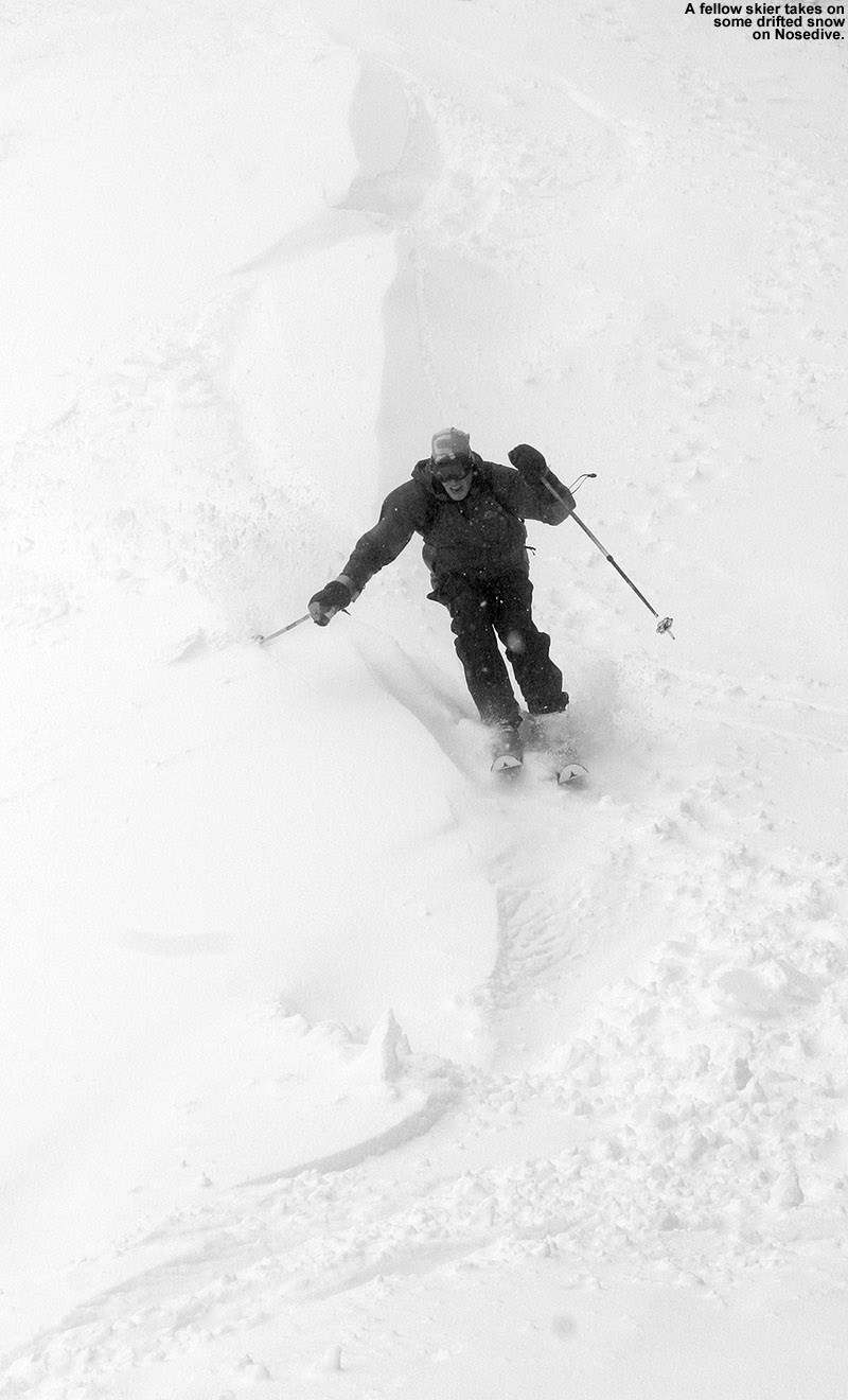
We stopped our ascent at 3,300’ because as we approached the switchbacks at the top of the trail we got some beta from a couple of skiers coming down Nosedive – they indicated that everything above that elevation in the switchbacks was scoured and really not worth it, and indeed that was obvious once we got to the landing below that final switchback at 3,300’. I’m going to call the average snow depth there 10” to be on the conservative side, but there were plenty of areas with 12”-15” of snow; there was just variability due to the effects of wind deposition. I stuck my measurement pole right in the snow in the center of that landing, and found 15” of snow depth. The guy that had ascended with me headed up just a bit higher to catch some turns along a drift of snow, so I pulled out the camera and got some action shots as he made his way down.
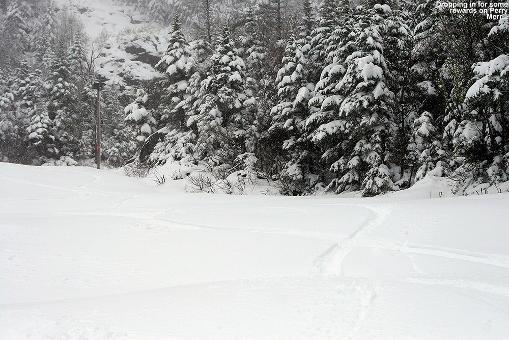
I didn’t get his name, but he had quite a blast ripping up the powder on Nosedive today.
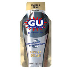
Before beginning my descent, I downed a packet of GU Energy Gel to see if it would provide that extra boost of energy to my legs to permit proficient and aggressive Telemark turns. I’ve noticed that after fairly long and/or quick ascents, my legs are often still recovering, and not to the stage where they can handle a lot of rigorous Telemark skiing right away. Alpine turns are typically no problem, since they’re easier and more stable to begin with, and after decades of alpine skiing, my muscles have the memory to really let them do it efficiently. But those Telemark turns take a lot more work, and it seemed like a little extra boost of quick energy would get me where I needed to be. So, I took a cue from the boys, who like to have a GU when they’re starting to fade while we’re biking or skiing – the Vanilla Bean flavor is a favorite among all of us. I usually don’t find that I need to worry about having enough energy on outings with the boys along; the pace is so slow that E and I usually don’t get drained. The boys certainly push themselves though, often needing some sort of recharge due to their smaller energy reserves, and when that’s the case, it’s GU to the rescue. On bigger, faster paced outings by myself though, I also feel the drain, and today I wanted to give a recuperative GU shot a try. I had the GU just a few minutes before my descent, and it absolutely worked. It helped give my legs that quick energy that they craved, and they had no trouble making Telemark turns. It was great having maximum powder to drive the legs, and while there’s no way to know exactly how my legs would have performed without the shot of GU, it was certainly my hero for today. I can still remember when I first learned about those energy gels back in the early 2,000s when Scott and Troy and their Dirtworld.com mountain biking team would use them. They’d strap them to their handlebars and down one on each lap to keep their energy up. With the way it performed today, I think a shot of GU before each earned descent is going to become part of the routine.
“There were plenty of
untracked lines to ski,
and it was dense, wall-
to-wall snow…”
As for the snow conditions, indeed there was some leftover base snow on Nosedive, and that offered up great turns, but the new snow itself was extremely dense (probably 12-14% H2O or so) and as long as there was enough of it, there was no need for previous base because it kept you off of anything below. I caught some beautiful bottomless powder on the skier’s left below the switchbacks, and then a lot more on the skier’s right along the edge of the trail. The Telemark turns were definitely flowing, and despite the fact that it was dense snow that could easily have been challenging to ski, it wasn’t. I immediately thought back to that storm last year on April 10th. Mt. Mansfield picked up more than two feet of dense snow that covered everything, but it was quite a challenge to ski on the Teles. Sometimes you would punch through the snow too far, perhaps with one ski, making lateral balance tough, and fore-aft balance was also extremely challenging. It’s possible that there was snow of varying densities in that storm, with some less dense snow underneath the topmost layer. That’s “upside down” snow, which is typically more challenging to ski. It was after that storm that I really decided that I wanted some fat, rockered Telemark skis for powder, and eventually got the Black Diamond AMPerages. I can only wonder how they would have performed in that storm – they would have been nice today, but being unsure of the snow depths I went with my older Atomic RT-86 midfats, and there were no issues. Really, the most challenging aspect of today’s skiing was negotiating areas of thinner snow as you dropped in elevation. I was actually quite impressed with the quality of some of the powder skiing on Nosedive today, but little did I know it wasn’t even going to hold a candle to what was in store over at the Gondola.
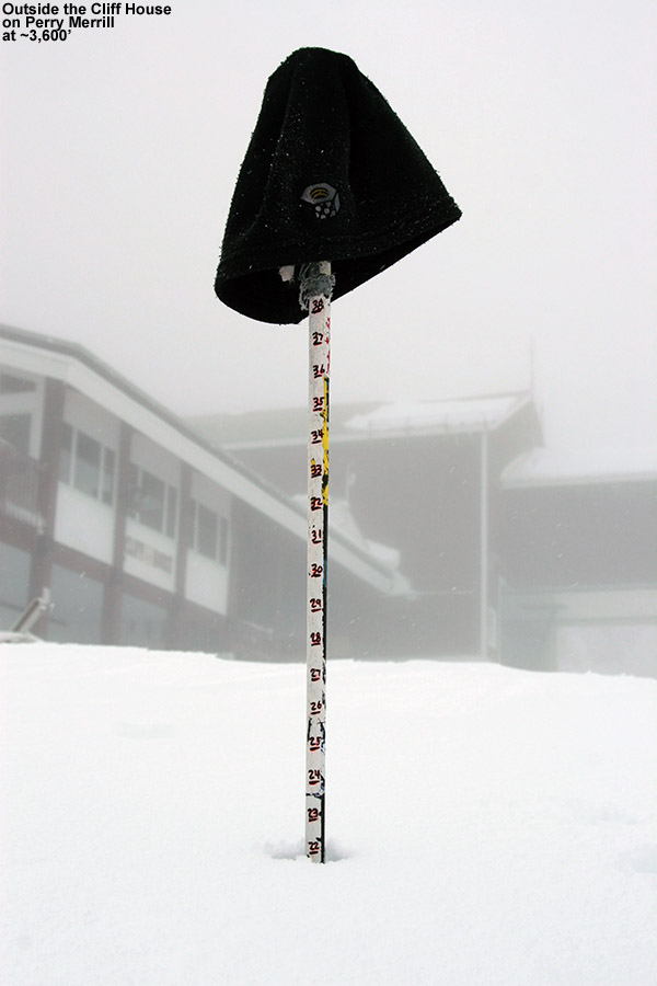
22″ of new snow up at the Cliff House today
I had no time limits, and plenty of energy left in the tank with the shortened ascent, so I skied down to the junction of Nosedive and Cliff Trail, and continued my tour by skinning up Cliff Trail. Within a few moments of starting my ascent, it was obvious that snow depths were substantially greater on Cliff Trail than they were on Nosedive at equivalent elevations. I wasn’t sure if it was because I was heading toward the Gondola, or because Cliff Trail offers better protection from the wind, but coverage was deep, wall-to-wall. Unlike what I’d seen on most of Nosedive, there were no signs of whatever lay beneath the snow. It wasn’t an illusion either; the depth at 3,000’ on Cliff Trail was 11”, vs. the 8” on Nosedive. The snow just continued to increase as I ascended toward the Gondola, there was 12”+ by the junction with Perry Merrill at 3,400’, and 12” – 15” easily up at the Cliff House. That’s on the conservative side for what you could find up there, and in general the snow depth was somewhat deceptive because you didn’t sink much into the dense snow. But right in the middle of Perry Merrill just beyond the Cliff House I measured 22” of new snow in flat terrain with no drifting. The usual measurement off the top of the picnic tables was deceptive as well – there was about a half foot of snow on the tables, but you could tell that the snow was much deeper because the table’s seats were just about buried. I measured in the open space between the tables and got a depth of 18”, so presumably the tops of the tables didn’t accumulate the snow well due to wind, melting, or some other effect. Here’s the summary of the depths I found on the Gondola side ascending via Cliff Trail:
“…at times it was dense enough that you’d be smearing turns right on the surface.”
I had another GU and got ready for my descent. Even that first steep pitch of Perry Merrill had great coverage comprised of that dense snow. Typically you’d sink in a few to several inches, but at times it was dense enough that you’d be smearing turns right on the surface. It took a moment to adapt when that was happening, but somehow the variability in the turns didn’t seem to disrupt the flow of the skiing – it was just really fun. I almost headed back down Cliff Trail since the coverage was so complete, but there were already a couple of tracks on it, and it’s fairly narrow, so I opted to check out Perry Merrill instead. I was hoping it would live up to the coverage I’d seen on Cliff Trail, and indeed it was just as good, if not even a bit better. There were plenty of untracked lines to ski, and it was dense, wall-to-wall snow, all the way down to 2,500’. You could do laps up there from 2,500’ to 3,600’ and think it was midwinter. The snow certainly wasn’t fluffy VermontChamplain Powder™, it was dense Sierra Cement, but it wasn’t wet or sticky. It made for plenty of base and just skied really well – it was right near the top on quality that I’ve experienced relative to many similar early and late-season dense-snow events. Sinking into the snow only a few inches or so was inconsequential compared to the fact that you didn’t have to worry about hitting anything underneath and you could just let it rip.
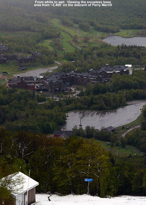
The view from white to wet
I stopped my descent at around 2,300’, as the snow was down to about 4” and it was getting notably wetter. You could probably go down to around 2,100’ easily if you had your rock skis. I hiked down the last 700’ back to the Midway Lodge, and the last vestiges of snow disappeared right around 1,800’ just like I’d seen over on Nosedive. The precipitation was snow down to just a couple hundred feet above the base, and back down at the lodge it was mostly rain with some snow mixed in at times. There were some really good bursts of snow on my descent, even in the lower elevations. The temperature had increased a few degrees to ~40 F at the base, but it was midday at that point, so that was still quite impressive.
Overall, I was really excited about how my equipment and supplies performed on this tour. My Gore-Tex did its job in keeping me dry, despite the driving rain and snow. My skins held like glue even in the wet snow, and hiking both up and down in my Telemark boots was a joy. I remembered to put them in walk mode for the walking sections (and put them back in ski mode for the descents) and it was almost like being in my hiking boots. And then there was the GU. It really quickened my recovery for the descents, and I’m going to be keeping that on the tour menu going forward. The boys won’t be able to borrow GU from me as easily though when they need it. While the GU certainly did its thing, I’m sure my stop off at Dunkin Donuts to fuel up before the tour also helped. I was feeling so great when I got home at midday, that I was ready to go for another round of skiing if E and the boys wanted to. It was still nasty and rainy outside, and not really conducive to doing too much else, but we had some fantastic winter powder skiing sitting up there in the high country. I couldn’t convince them to go though, so they unfortunately missed out this time. We did get some quality time indoors though, which I’m guessing a lot of families were doing this weekend. Ty, Dylan and I had a great round of “The Settlers of Catan” while E did a bit of shopping. It was quite a storm though, with Whiteface and other areas of the high peaks really cleaning up and putting out some amazing pictures.
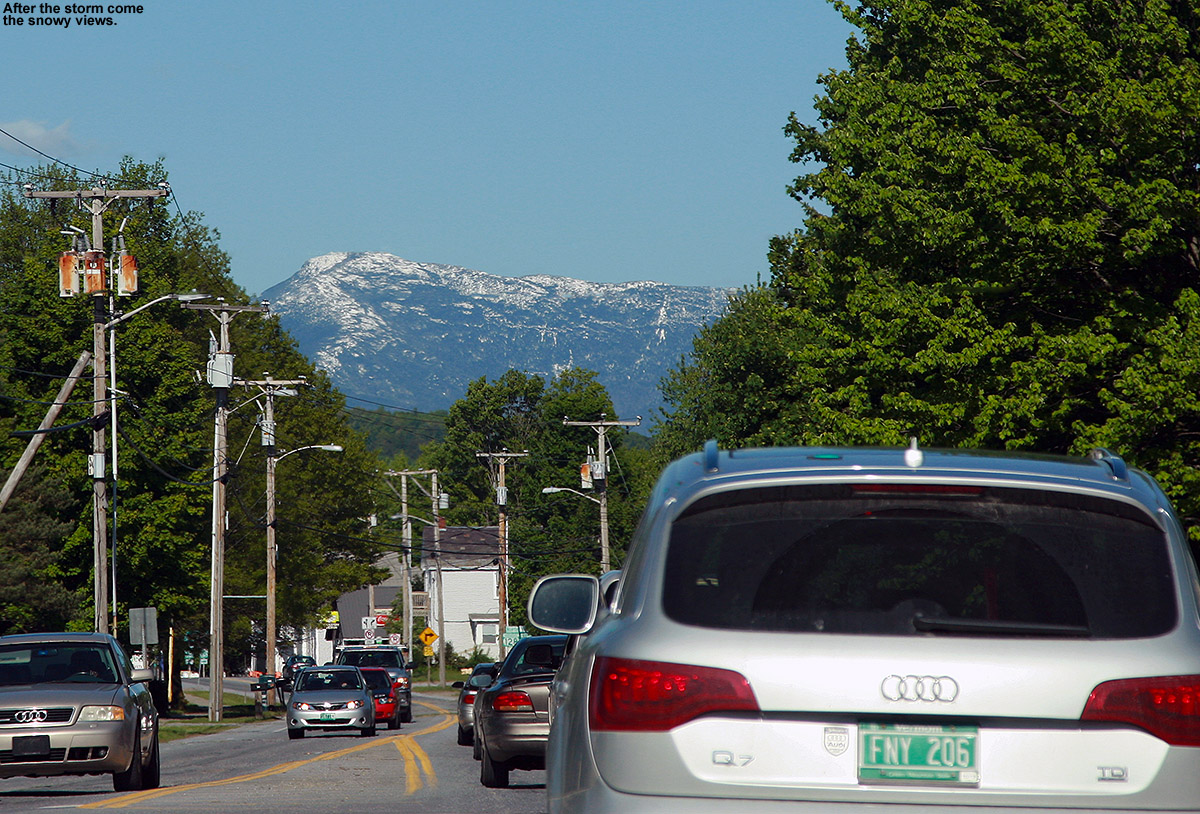
…and this is what you get for Memorial Day
Monday update: The clouds cleared out today to produce crystal blue skies, and naturally that revealed some amazing vistas of the spring foliage and snow-capped peaks everywhere. Mt. Mansfield and Camel’s Hump were topped with white, shimmering in the strong sun of late May, and the high peaks of the Adirondacks were brilliant. We traveled around from Waterbury to Vergennes to Cambridge doing various activities, so we took in numerous vantages of the Greens and Adirondacks. It turned out to be a spectacular Northern New England Day for the holiday, almost as if Mother Nature was trying to strike as sharp a contrast as possible against the recently departed storm.
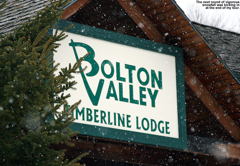
We had a family gathering through early afternoon today, but in the mid to late afternoon, I headed up to Bolton Valley for a tour. Up to that point we’d had on and off bouts of precipitation in the valley, often showers mixed with sleet, but no notable accumulation other than transient stuff. Temperatures were in the mid 40s F in the 300’-500’ elevation range along the bottom of the Winooski Valley as I headed westward toward Bolton; we’d had breaks of sun among the clouds and precipitation, and I was preparing for some fairly soft and slushy spring turns up on the hill. Since I never pulled them out yesterday at Stowe, I’d even brought my fat skis to evaluate how they’d perform in the soft stuff. A lot of people seem to like the way they smooth out the mushy stuff, but I’m still curious about how well that works.
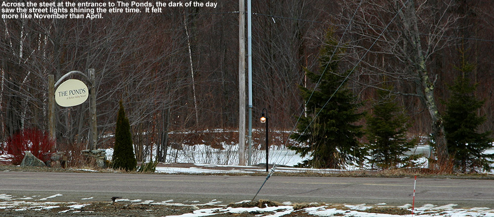
A dark, November feel today
Precipitation was pretty sparse as I headed up the Bolton Valley Access Road, and while there’s patchy snow all the way up out of the valley, consistent natural snowpack really didn’t appear until roughly the 1,500’ elevation at the Timberline Base. Temperatures had dropped into the upper 30s F by that elevation, and light snow was falling. It was mid to late afternoon, but it was actually pretty dark with the clouds around, and more of them appeared to be building in from the west. Based on the available light, it actually felt like a typical November outing in the mountains.
“The snow was good on the whole descent…”
On the slopes, the snow wasn’t really the mushy spring snow that the valley temperatures had given me the impression I’d find; I think the temperatures and/or available sunlight really weren’t high enough to support that. Instead what I found was the couple inches of wet snow/sleet that we’ve picked up from these latest storms, sitting atop the base. The subsurface was still fairly soft and spring-like, presumably due to the recent rounds of wet precipitation percolating some moisture down in there. The intensity of the snowfall was fairly light on the ascent, although I could see squalls around off to the west. There was one off to the south, and another more ominous-looking one off to the north, they were both starting to devour the views of the Adirondacks and it looked like the spine of the Greens was in their path.
Up around the Timberline Mid Station at 2,250’, the surface snow began to have a bit more coalesced consistency relative to what was below. The temperature was approaching the freezing mark, and it appeared to be due to a combination of elevation and some cooler air coming in with the approaching weather. I topped out at the Timberline Summit at 2,500’, and the temperature by that point was either below freezing or very close – the trees still held snow from the recent storms.
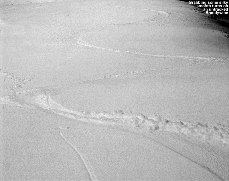
Brandywine Tracks
After starting down Upper Brandywine, I was about to head back toward the Timberline Mid Station, when I saw that there was a lot of good untracked snow farther down on Brandywine, so I followed that less traditional route. The coverage was actually quite good, and although I don’t follow that route as often, I’m realizing that it’s got more of a northerly aspect than the slopes below the mid station. I think it’s going to be a good route to use in more marginal situations of coverage or sun exposure. The snow was good on the whole descent, transitioning from that stronger, peel-away stuff in the higher elevations, to a wetter consistency down low. I was amazed at how much be It was very much like what we experienced yesterday at Stowe up to the midday hour before the freezing level rose up above the summit of the Fourrunner Quad. There are certainly areas starting to develop bare patches at Timberline, but if you wanted you could ski natural snow terrain all the way down to the Timberline Base; that’s pretty decent for west-facing terrain down at those low elevations this time of year.
The precipitation that had been looming off to the west finally pushed its way over the ridge and into the valley as I was switching out of my ski gear at the car. In typical Bolton Valley style, it came strong, and it was snowfall that meant business. It wasn’t quite the whiteout that I saw in Powderfreak’s Stowe pictures, I think in part because the flakes weren’t as large (probably about ½” max in diameter), but a decent wall of snow came in and made its presence known.
If that snow had been rain, it would have been pouring, and indeed I was able to watch that transition as I descended back down the access road. The snow stayed with me down to around the 500’ elevation, and finally mixed out to just a pouring rain. That rain followed me through the lower elevations of the Winooski Valley, and then by the time I got up a bit higher back at that house along the Waterbury/Bolton line, snow was mixing back in. Checking the radar a little while later, it showed a nice shot of moisture making its way through the Winooski Valley.


