First storm of the winter season in the Greens

An image from the Burlington National Weather Service showing projected snow accumulations for our first October snowstorm of the season
The projected accumulations of roughly a foot of snow in the higher elevations of the Green Mountains came to fruition today.

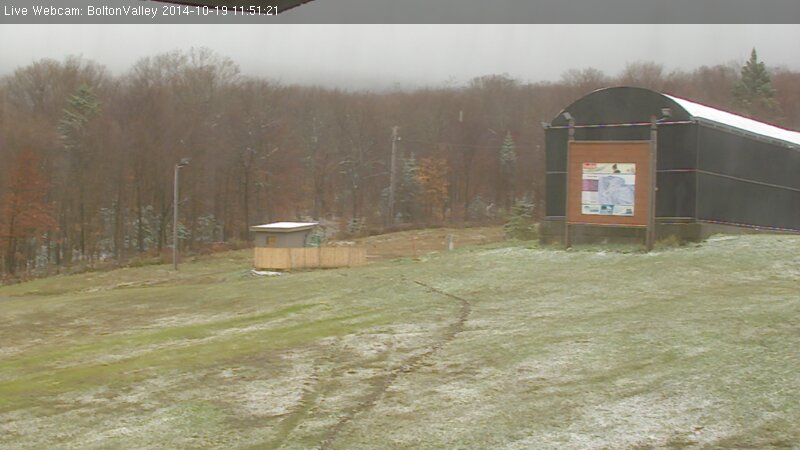
We’ve had several days to watch the forecasts building up to a potential first snowfall of the 2016-2017 winter season for the Green Mountains of Vermont.  The storm was projected to move along the coast and up into the Canadian Maritimes, which, as usual, would put it at the point where cold, moist air could wrap around and hit the spine of the Greens from the northwest.  Yesterday afternoon the snow levels began to drop toward the summits, and as daylight began to fade we were able to see that snow was starting to accumulate up near 4,000’ via the new Lincoln Peak Snow Cam.  At around 10:30 P.M. I looked outside and saw that snow had made it all the way down to our house at just 500’ in the Winooski Valley, which meant that the mountains were well into the snow.  We’d accumulated a couple of tenths of an inch of snow at the house before I headed off to bed.

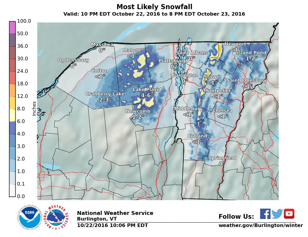
As of this morning we’d picked up about a half inch of snow down at the house, and accumulations reports began to come in from around the area.  One of the more surprising results the storm was just how much snow had accumulated at relatively low elevations on the western slopes of the GreensThere were reports of up to 6 inches of dense snow in areas that still had substantial leaves on their trees, and combined with some aggressive winds that meant downed trees, travel difficulties, and some power outages.

In the higher elevations, Powderfreak reported finding 5.5 inches at 1,500’ the base of Stowe Mountain Resort, a foot at 2,000’ – 2,500’, and accumulations seemed to generally top out in that range up and down the Central and Northern Green MountainsBolton Valley reporting 9 inches, 11 inches were found at the Mount Mansfield Stake, and there were images of waist-deep drifts at Jay Peak.  I didn’t get a chance to get out on the slopes because we were down at a New England Revolution match at Gillette Stadium, but it looked like the dense snow did a decent job of covering up surfaces to enable some fun October turns.  The weather looks relatively cool this week, so the snow shouldn’t be going anywhere immediately, and I heard Killington even plans to open on Tuesday to start the lift-served ski season.

Vermont snow levels lowering

An image of October snow on the Bolton Valley Web Cam
The Bolton Valley web cam showing that snow made it down to the elevation of the Bolton Valley Village today

As the forecasts suggested, colder temperatures came into New England overnight, dropping freezing levels for another round of Vermont Snow. In the Northern New England thread at the American Weather Forum, Powderfreak contributed several pictures of the snow at Stowe, Eyewall provided some from Bolton Valley, and Borderwx added one from Jay Peak. Notable accumulations made it down all the way to 2,000’, which is the lowest so far this season. Some grainy snow even accumulated briefly on our picnic table down at our house at the 500’ in the Winooski Valley, and that’s just about average for picking up our first traces of snow at our location. I’ve added the text from my report to American Weather below:

“We just documented our first frozen precipitation and accumulation of the season down here at 500’ in the valley. It started pouring out a few minutes ago as one of those bursts of precipitation came through in the northwest flow – you can see those yellow 28 db returns that disappear as the pulse of moisture barrels into the mountains:

A radar image showing a pulse of moisture that brought October snow to our house in Waterbury
As a pulse of heavier moisture ran into the mountains today, it dropped snow all the way down to our house in the Winooski Valley

Hearing the racket of the heavy precipitation outside, I decided to check out on the back deck because I know how these things sometimes go – indeed there was frozen precipitation among the rain, in the form of sleet and other dense granules that can typically make it down through the warmer layers of the atmosphere. I don’t even have my snowboard set up yet, but our picnic table out back sufficed to catch the accumulation. Seasonally, the timing of this event was right on track, with the mean for the first trace of snow here at Oct 20th from nine seasons of data. The event has actually brought the median value for that first trace of frozen down from Oct 21st to be right in line with that mean date of the 20th, and the S.D. dropped from seven days to six, so it’s helped to tighten up the data spread. The accumulation might have actually reached the 0.1” threshold for an official accumulation, but I was definitely caught off guard and by the time I grabbed my ruler and made measurements, all the accumulation was below that 0.1” mark so it will have to go down as a trace.”