
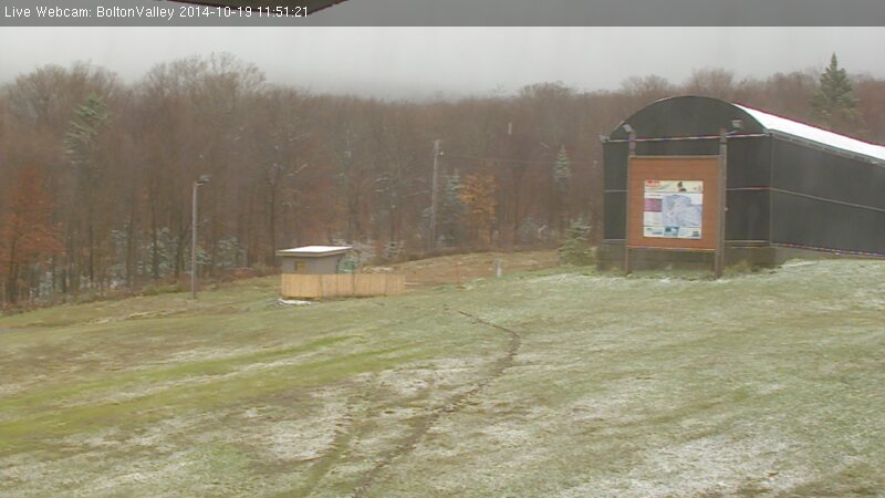
As the forecasts suggested, colder temperatures came into New England overnight, dropping freezing levels for another round of Vermont Snow. In the Northern New England thread at the American Weather Forum, Powderfreak contributed several pictures of the snow at Stowe, Eyewall provided some from Bolton Valley, and Borderwx added one from Jay Peak. Notable accumulations made it down all the way to 2,000’, which is the lowest so far this season. Some grainy snow even accumulated briefly on our picnic table down at our house at the 500’ in the Winooski Valley, and that’s just about average for picking up our first traces of snow at our location. I’ve added the text from my report to American Weather below:
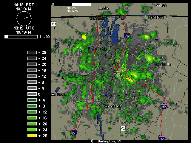
“We just documented our first frozen precipitation and accumulation of the season down here at 500’ in the valley. It started pouring out a few minutes ago as one of those bursts of precipitation came through in the northwest flow – you can see those yellow 28 db returns that disappear as the pulse of moisture barrels into the mountains:
Hearing the racket of the heavy precipitation outside, I decided to check out on the back deck because I know how these things sometimes go – indeed there was frozen precipitation among the rain, in the form of sleet and other dense granules that can typically make it down through the warmer layers of the atmosphere. I don’t even have my snowboard set up yet, but our picnic table out back sufficed to catch the accumulation. Seasonally, the timing of this event was right on track, with the mean for the first trace of snow here at Oct 20th from nine seasons of data. The event has actually brought the median value for that first trace of frozen down from Oct 21st to be right in line with that mean date of the 20th, and the S.D. dropped from seven days to six, so it’s helped to tighten up the data spread. The accumulation might have actually reached the 0.1” threshold for an official accumulation, but I was definitely caught off guard and by the time I grabbed my ruler and made measurements, all the accumulation was below that 0.1” mark so it will have to go down as a trace.”