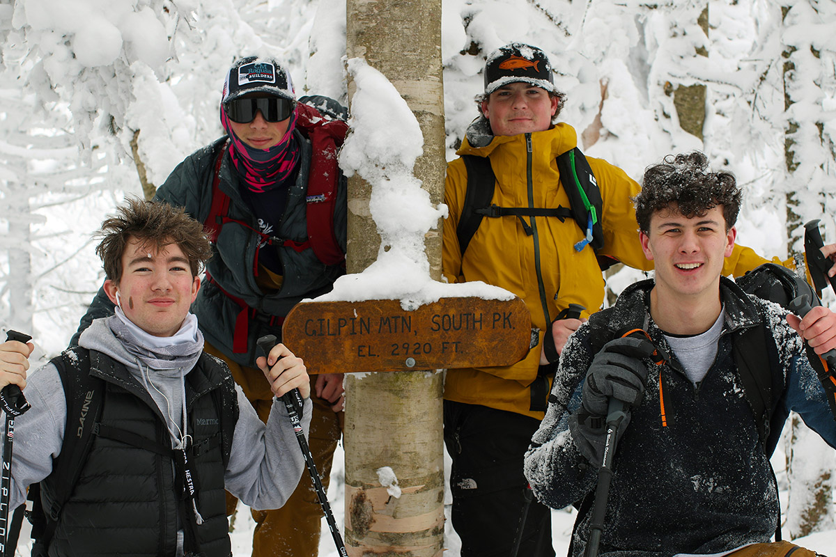
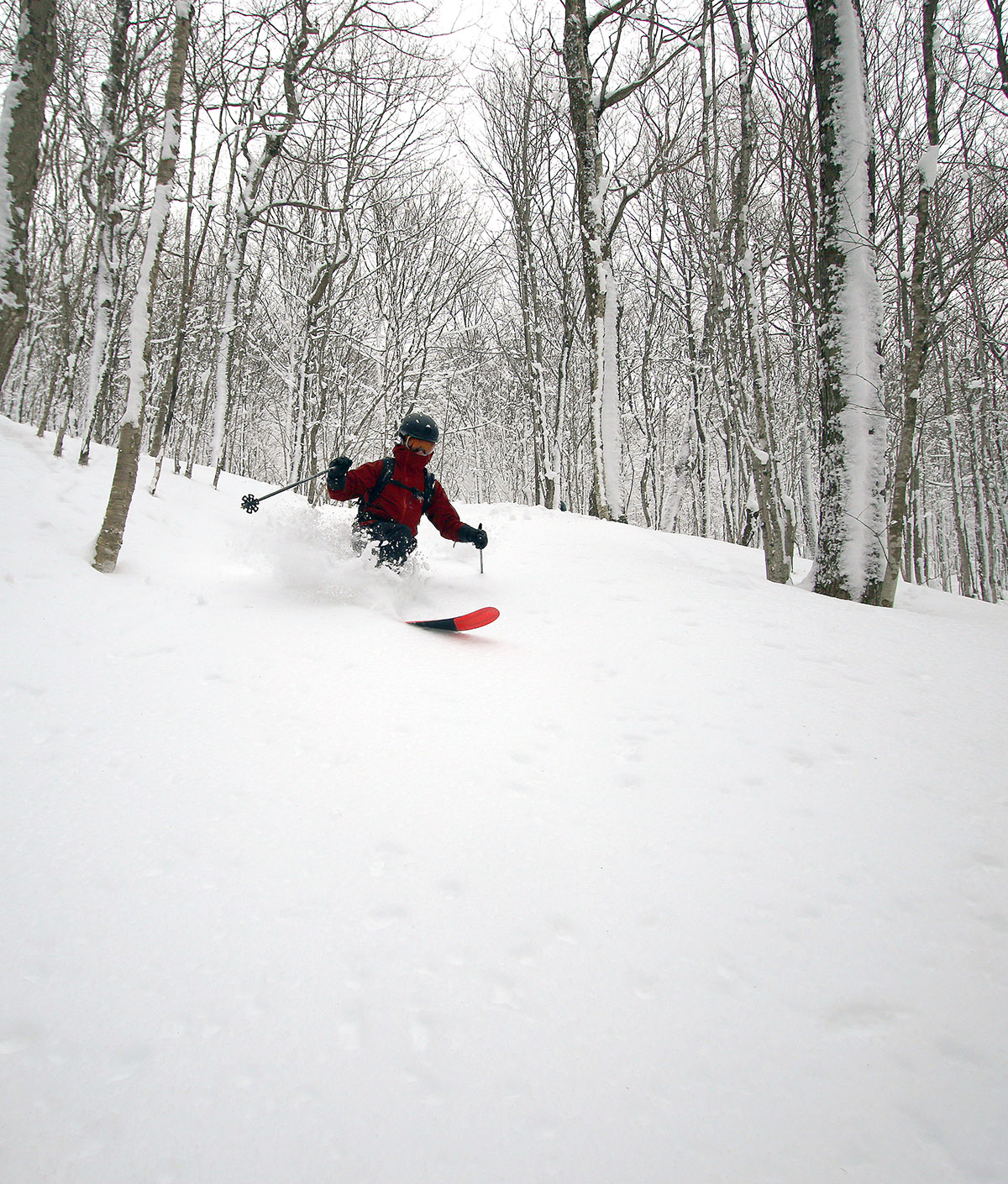
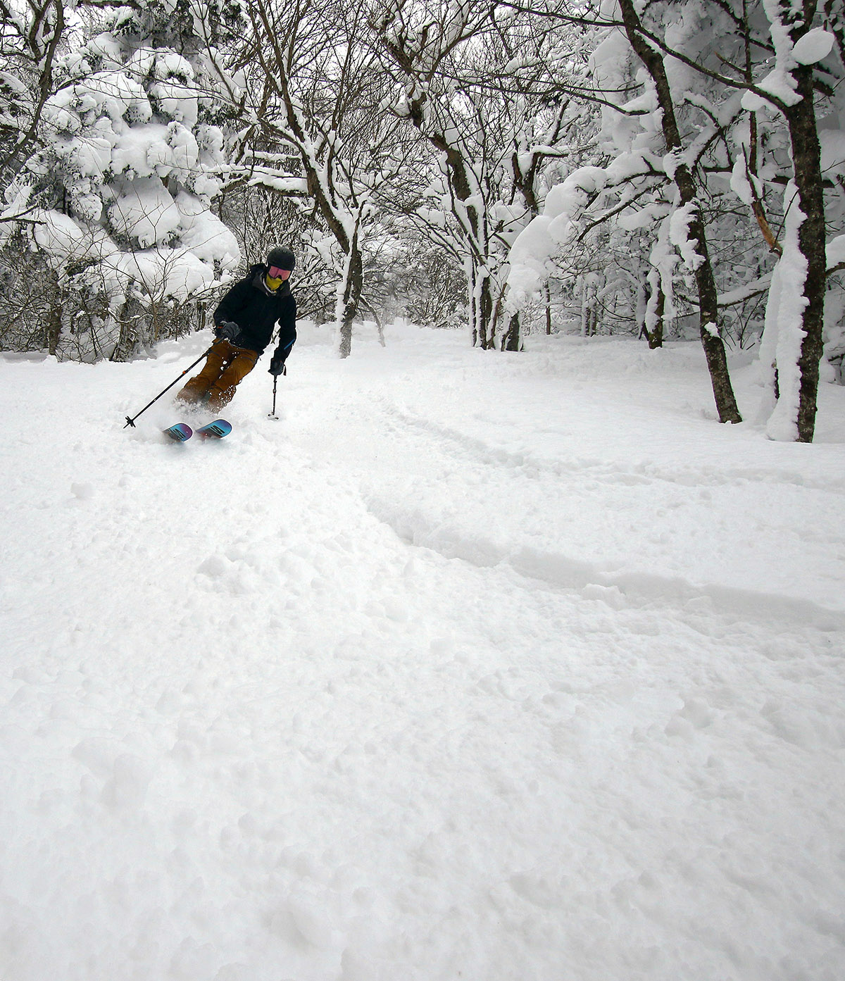
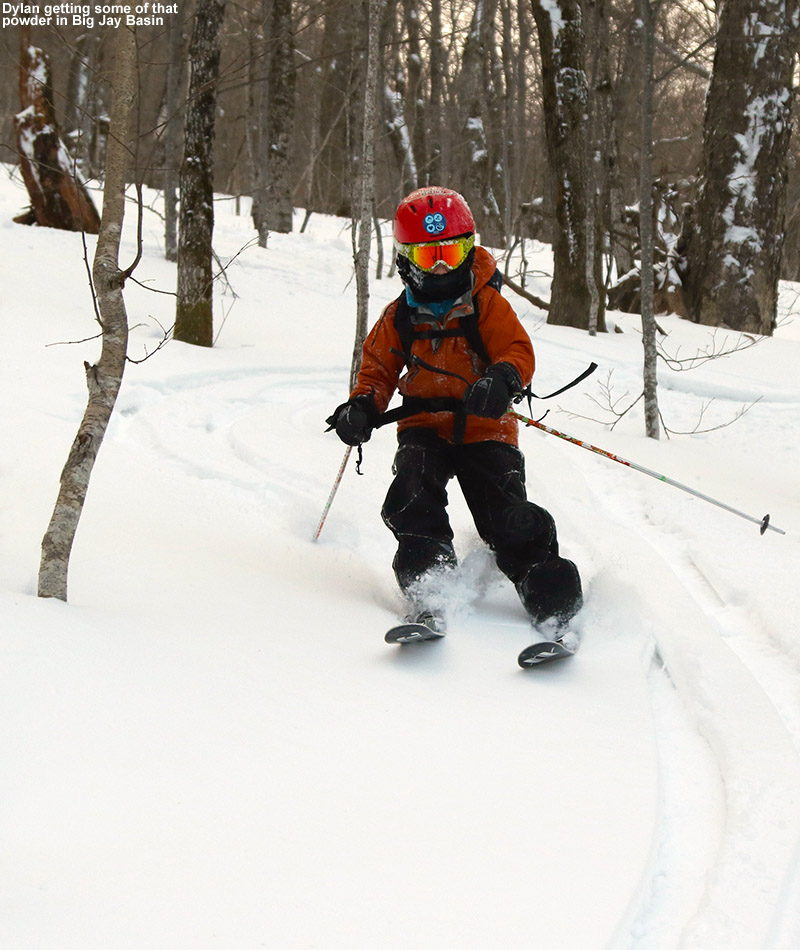
Dylan was back on his Telemark skis gliding through the powder today. We had a great ski tour today in the Gilpin Mountain/Domey’s Dome area of the Jay Peak backcountry with great snow and many acres of nicely spaced tree skiing.
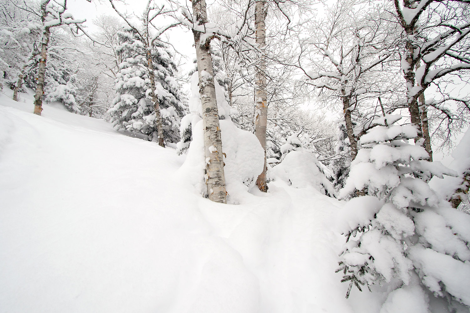
The powder was deep and bottomless throughout the descent today.
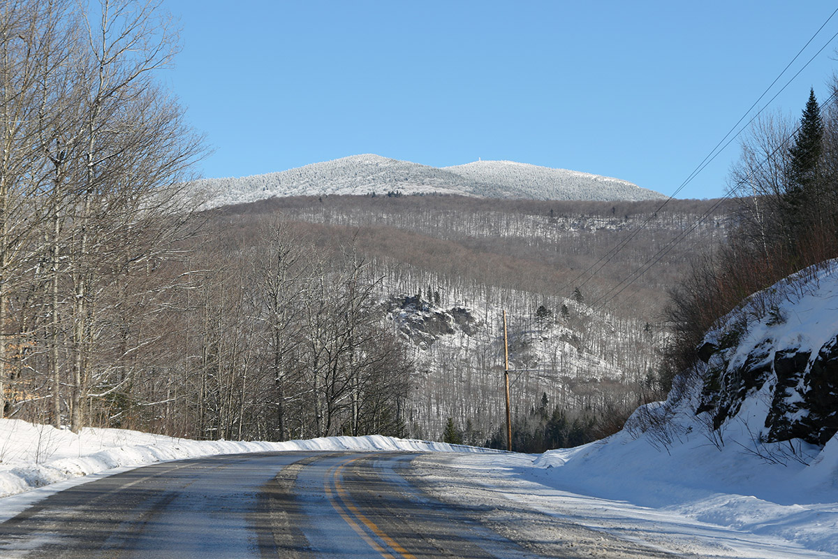
The forecast for the day was looking great – temperatures in the upper 20s F are perfect because it’s warm enough to be quite comfortable out in the backcountry, but below the freezing mark to avoid any temperature effects on the powder. I was concerned about parking since it’s a holiday weekend, but there were plenty of parking spots up at Jay Pass on Route 242. I arrived about 20 minutes before Dylan and his friends, so I poked around at the pass, and checked out the snow conditions and trail access points until they arrived.
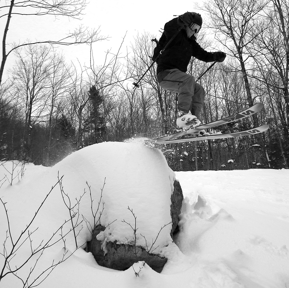
Along with the powder, Mother Nature also supplied plenty of terrain features for a bit of extra fun during the descent.
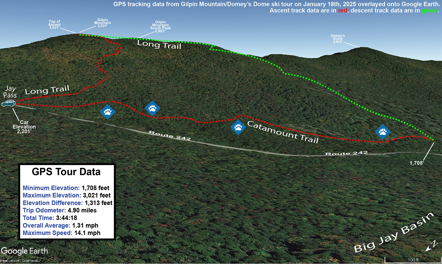
I’ve skied the terrain north of the pass on Gilpin Mountain before, but this time I wanted to check out the terrain to the south. My plan for our tour was to use the Long Trail to head up Gilpin Mountain and out along the ridgeline toward Domey’s Dome, then descend the west face of the range and catch the Catamount Trail for the return trip. With regard to ski touring, that side of the range is, in theory, set up beautifully – the Long Trail follows the ridgeline, and the Catamount Trail roughly parallels it down in the valley near Route 242. So, you can head out on the Long Trail to whatever point you want, then drop in for a descent and use the Catamount Trail as a collector for returning to Jay Pass. I say it’s a great setup “in theory”, with the caveat that the Long Trail can be tough to follow at this time of year. The Long Trail uses white blazes on the trees to mark its route for hikers, and the trees up along the ridgeline there can be absolutely loaded with snow. So, following the trail can be quite challenging if someone hasn’t already put a track in place. Also, as the snowpack continues to rise, the blazes can be more and more difficult to find. As of now, the blazes are at about waist level, so they’re still visible if you can find them behind the inches of snow caked to the trees, but even at the current height they are getting hard to see. One could certainly head out to an ascent of Domey’s Dome using the Catamount Trail from below, but after traversing the Catamount Trail in that area for the return on our tour (there are plenty of undulations and meanderings), that approach feels like more work than it needs to be unless you park farther down on Route 242.
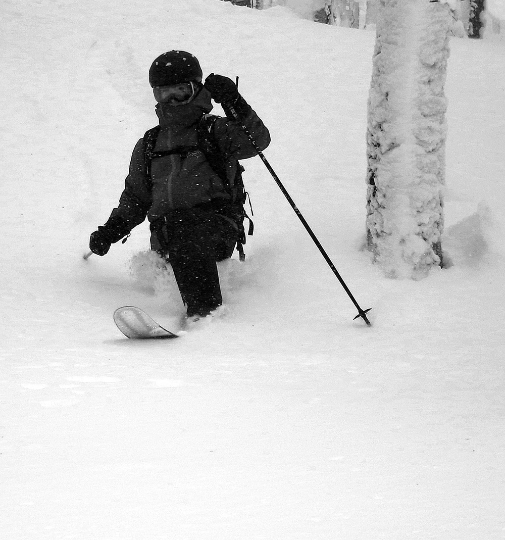
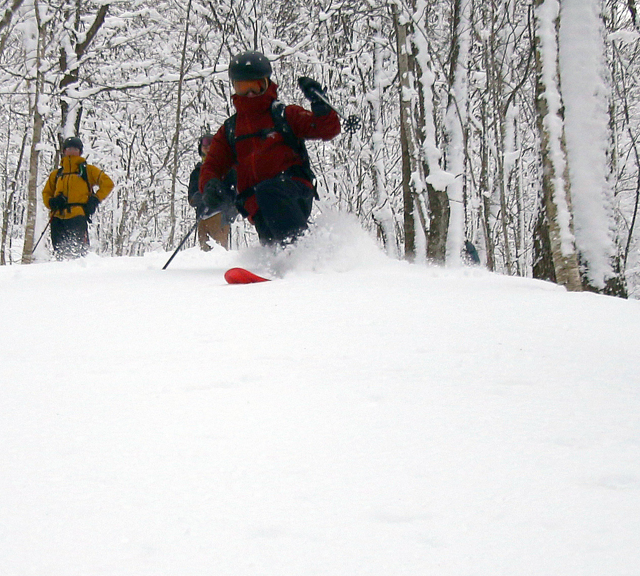
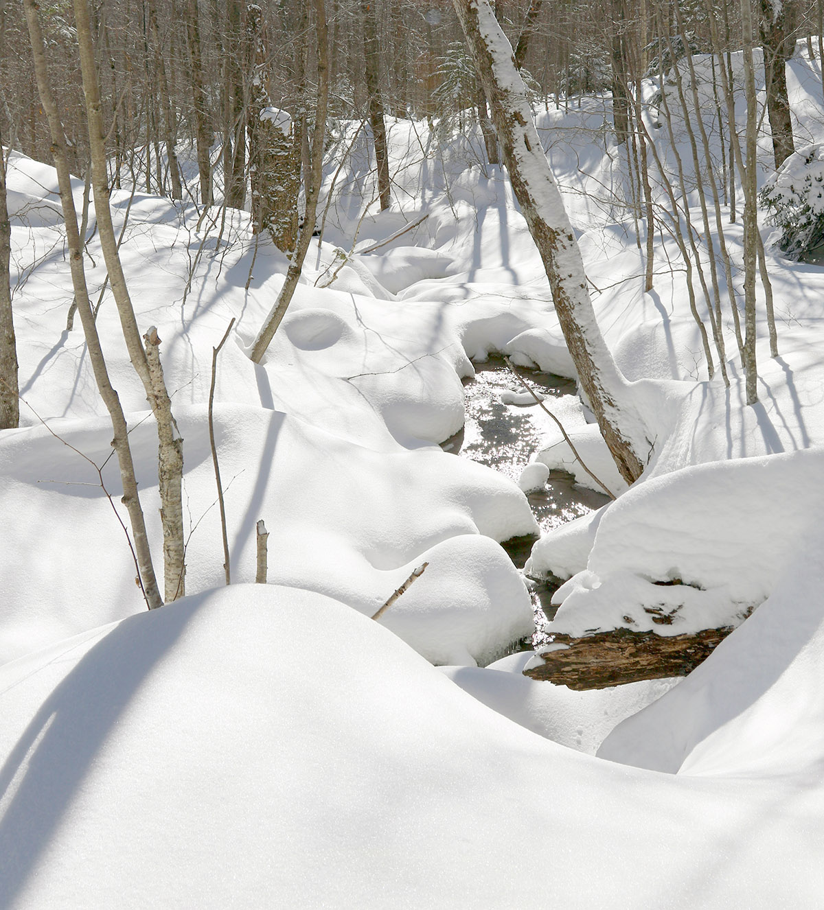
In many areas of the tour, the terrain and trees were just choked with fluffy snow.
While it was breezy in the open area of Jay Pass, with the anemometers at the weather station area buzzing right along, the wind disappeared as soon as we entered the forest on our ascent. Following the Long Trail upward from the pass to Gilpin Mountain was fairly easy – it was well set as a skin track from plenty of skier traffic, so even without being able to see the blazes, it’s simple to follow. Once we were up at the Gilpin Mountain ridgeline, we took a quick jaunt to the north to check out the official summit of Gilpin Mountain at 3,021’ then moved southward and reached the South Peak of Gilpin Mountain, which is slightly lower at 2,993’. From there, we headed south on the Long Trail toward Domey’s Dome. We ran into a couple of guys from Quebec (based on their accents) who were setting up to descend a steep, sweet looking gully on the back side of the range. They joked with us about not stealing it from them, but we would never have done that, and we had other plans anyway. After that, we didn’t run into anyone, because skier traffic seems very light once you get past the general Gilpin Mountain area. We were able to follow the Long Trail southward for a little while, with the help of one track from a previous skier, but as we descended into the col between Gilpin and Domey’s, it became more and more difficult to hold the ridgeline and not get pulled into descending on one side of the ridge of the other. Nobody had broken trail on the Long Trail across the ridgeline, so the route finding took time. We had access to multiple GPS units, and when the Long Trail is obscured with deep snow like it is now, you certainly want to have your GPS and compass. Not wanting to waste too much of the session trying to navigate the traverse, we eventually decided to hug the western side of the ridge as we headed southward, with the intention of beginning a descent if we saw some appealing ski terrain. It wasn’t too long before we found a relatively steep line that dropped through some open trees, and we decided it was as good a time as any to begin skiing.
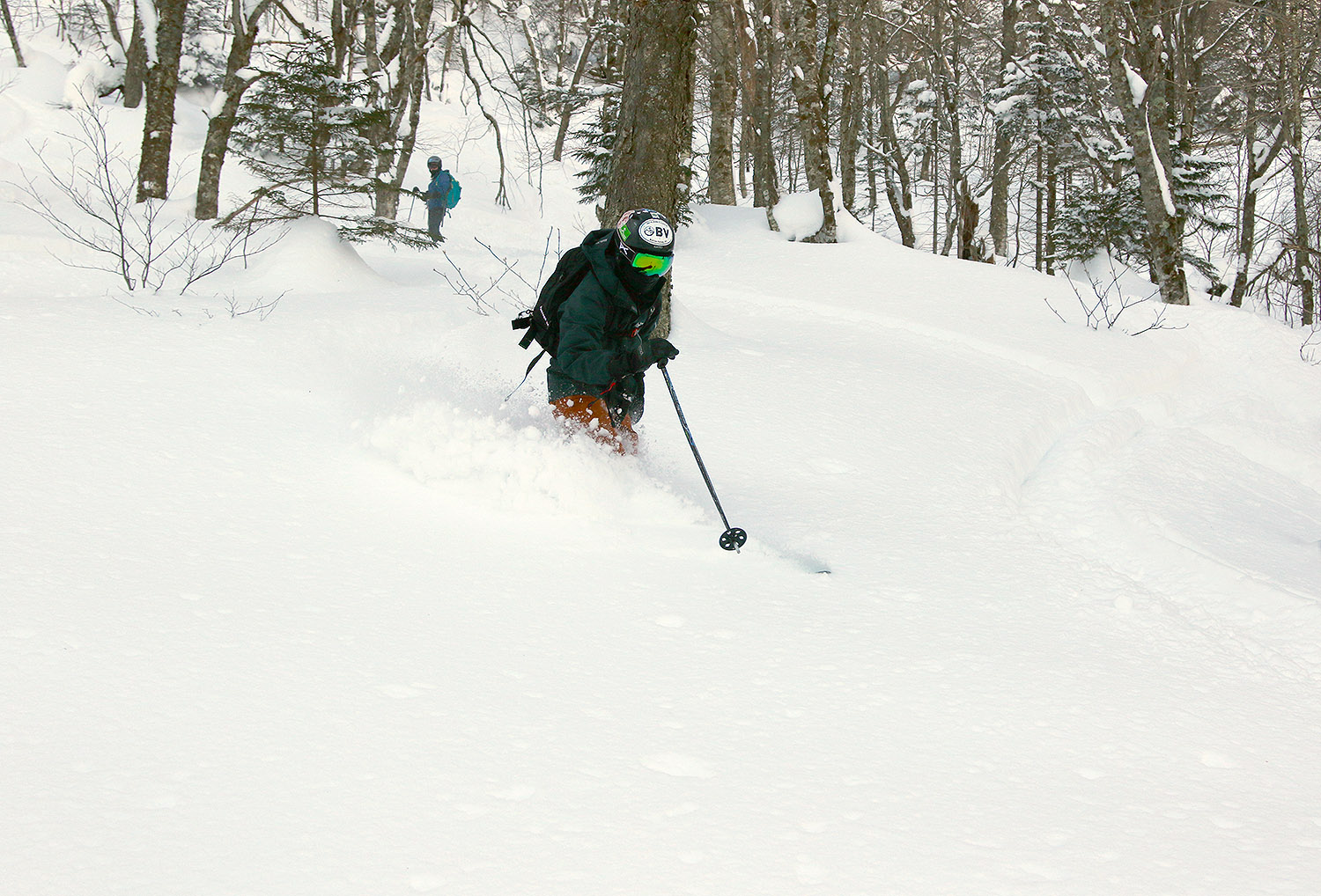
The boys would line up, drop into their lines, and let ’em rip.
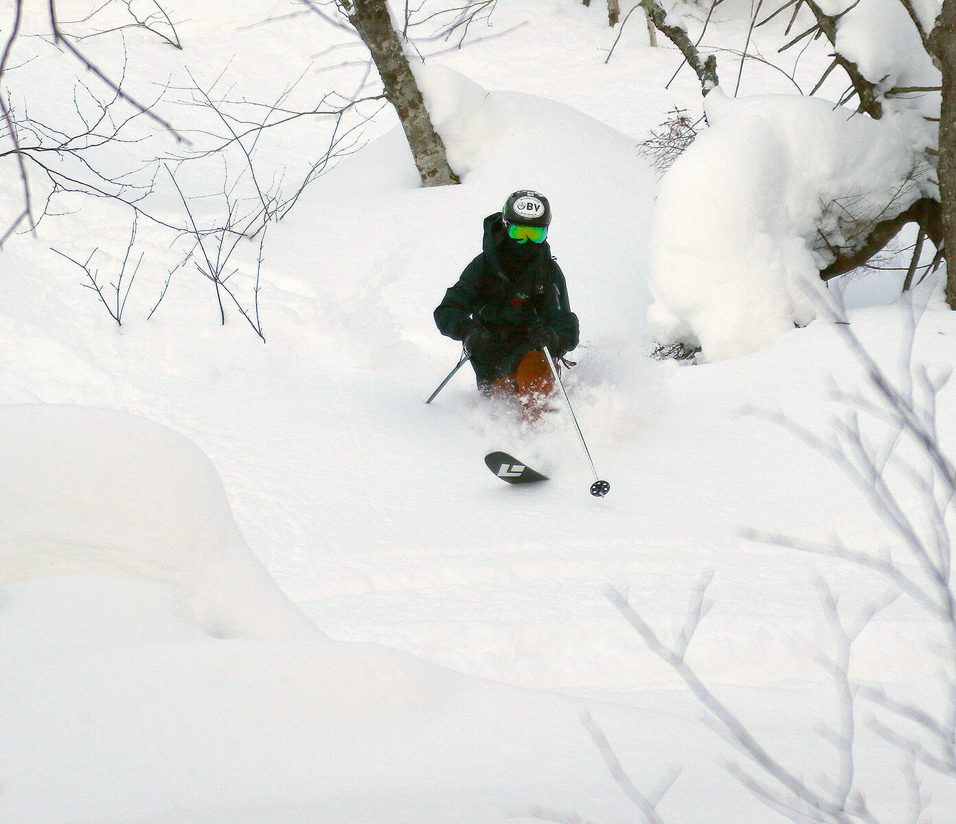
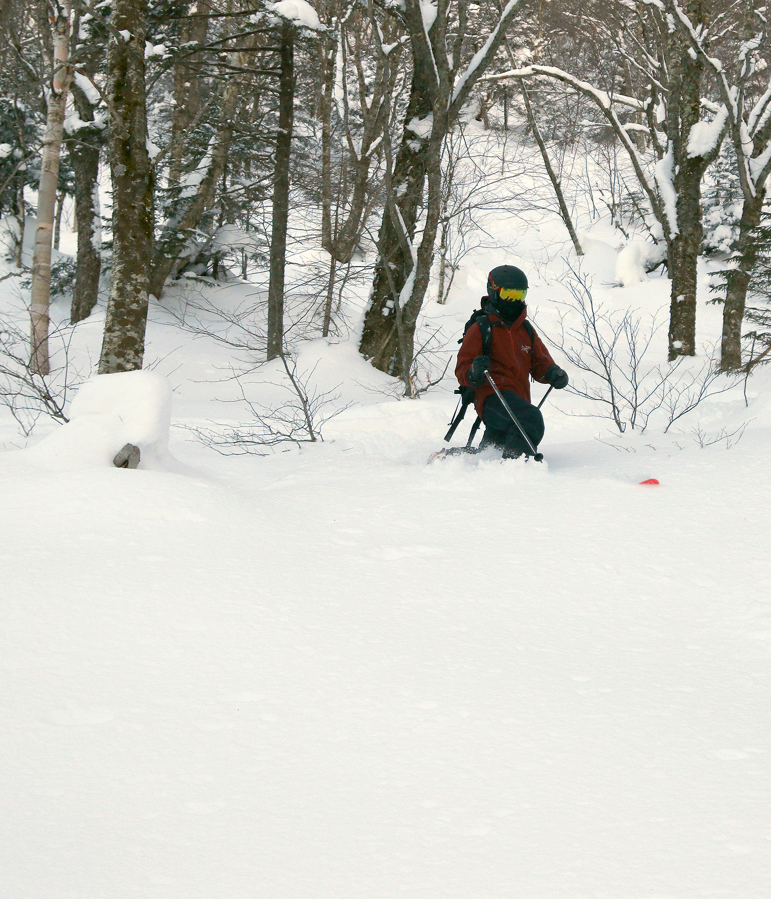
Our descent from the col between Gilpin and Domey’s featured some nice areas with reasonably open trees, spots with excellent natural glades, and some terrain that had been logged and maintained for logging access. The powder was fantastic – there was typically 1 to 2 feet of bottomless powder over a deep base. I would frequently check the depth of the snowpack, and my ski pole would go below the surface of the snow, which means the snowpack depth was in excess of 45 inches. The powder was in a very nice right-side-up density gradient starting with snow in roughly the 6 to 8% H2O range on top. The only thing that could have really made the powder better would have been to throw on several more inches of fresh 3-6% H2O champagne, but that’s really getting picky, because it skied incredibly well. Everyone was on fat skis with widths over 100 mm, and the skis were definitely in their element out there today. Dylan was on his Telemark skis for the first time in 2 or 3 seasons because he’s been looking for a good pair of boots to replace the current ones that are too tight, but it didn’t look like his Telemark skiing had missed a beat. I was happy to see that, and so were his friends.
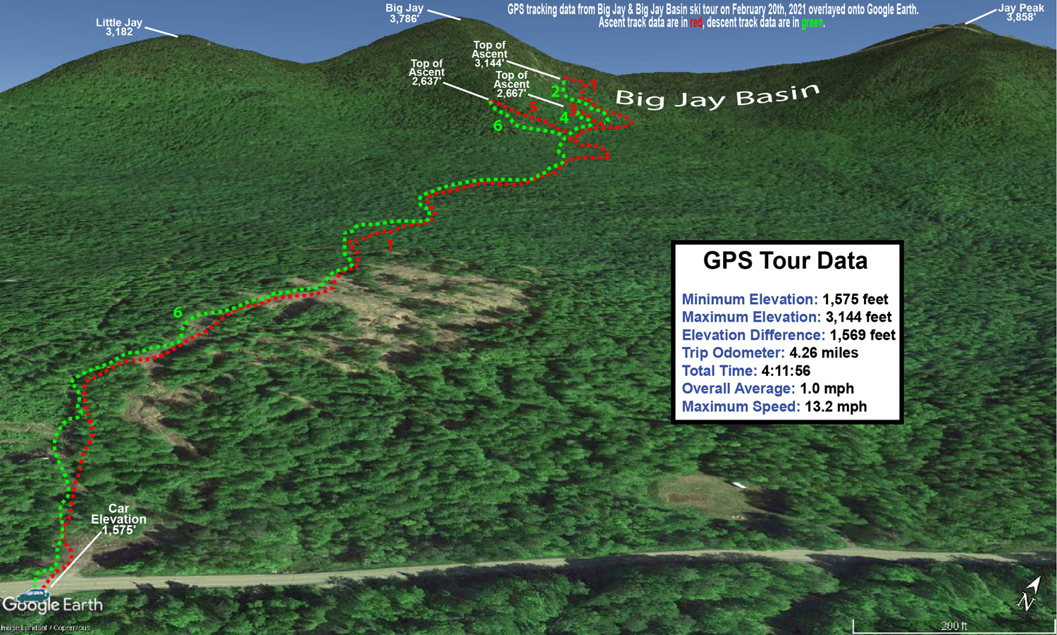
A Google Earth map with GPS tracking data for today’s ski tour in the Gilpin Mountain and Domey’s Dome area of the Jay Peak backcountry.The Omakase Asian fusion restaurant on Route 242 really fit the look of the Jay Peak area with its snow on the roof and huge icicles hanging down to the ground.
As of this morning, Jay Peak is reporting 203 inches of snowfall on the season, and you can really feel it when you’re out there in the nearby backcountry. The snowpack depth at the Mt. Mansfield Stake at 3,700’ is around 55 inches, but based on what I found out there on our tour in the Gilpin/Domey’s area, that snowpack depth is probably obtained at a lower elevation in the Jay Peak area. We weren’t even out in the Big Jay Basin area, which seems to collect some of the most snow in the area due to its leeward position, so I bet the snowpack is quite deep out there. Dylan and his friends are planning to head out to Alyeska in March for some skiing during spring break, and he mentioned that as of now they apparently have the most snowfall for the season of any ski area in the U.S. at 346 inches. That got me wondering about how things are going for some of the well-known, snowier resorts in western North America with respect to snowfall, and I saw that Steamboat is at 143 inches, Whistler Blackcomb is at 197 inches, Grand Targhee is at 211 inches, and Alta is at 233 inches. So, Jay Peak’s 203 inches is certainly in that ballpark, and the area’s snowpack is definitely doing well. I’d say what’s really helped with making Jay Peak’s snowfall perform in terms of building the snowpack is that they haven’t had to deal with many thaws, especially in the past few weeks when they’ve has so much continuous snowfall.
The fresh snow and plentiful sunshine out there today provided some beautiful midwinter views throughout today’s ski tour.
The back side of this most recent storm cycle seemed to show some promising potential for upslope snow in the Northern Greens, so this morning I made a quick survey of the snow reports from the resorts along the northern spine to see how things had worked out. With the Jay Peak snow report indicating 4 to 7 inches of new snow, and bwt’s measurement of 5.5 inches at 1,900’ from his place at Jay Peak, things were looking good there. Bolton, Smugg’s, and Stowe were reporting totals in the 2 to 4-inch range, so the Jay Peak area really seemed to be a cut above the other resorts. Temperatures rose above freezing in some areas during the middle of the storm though, so maximizing that resurfacing snow/liquid equivalent could make a substantial difference in the quality of the ski surfaces.
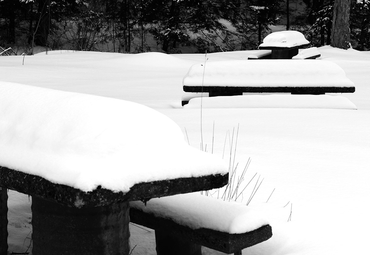
Picnic tables at a roadside park along Route 118 in the Montgomery area today showing some of the recent snow accumulations
E was heading up to Morrisville to deliver some food to a colleague and do some snowshoeing, so I decided to pop up to the Jay Peak area for a bit of touring, and we coordinated our trip. New accumulations of snow were present everywhere from Waterbury on northward, but they really started to pick up once I got to Eden and points father north. You could tell that the storm had hit harder up there. With road maintenance and some sun, I was generally dealing with slushy accumulations on road surfaces, but those usual spots on Route 118 along Belvidere Pond and through the notch areas into Montgomery were wall-to-wall winter snow and required some extra caution.
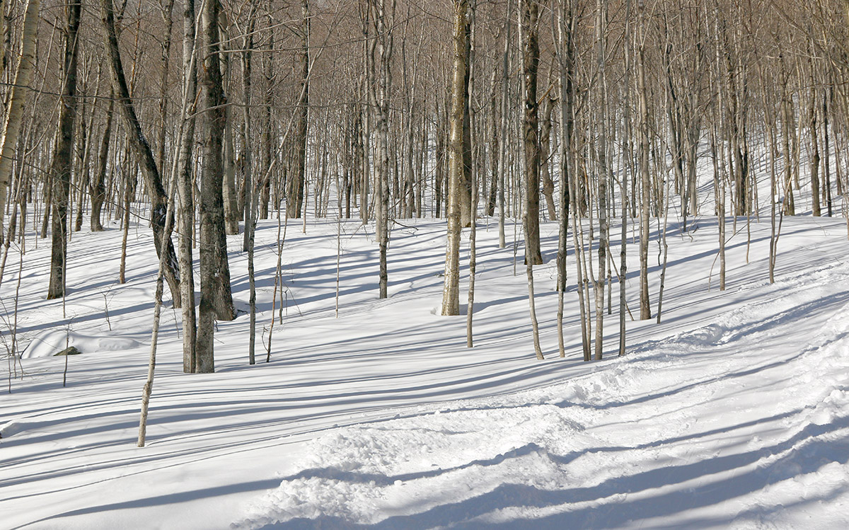
Checking out some of the ski terrain below Little Jay on my ascent today.
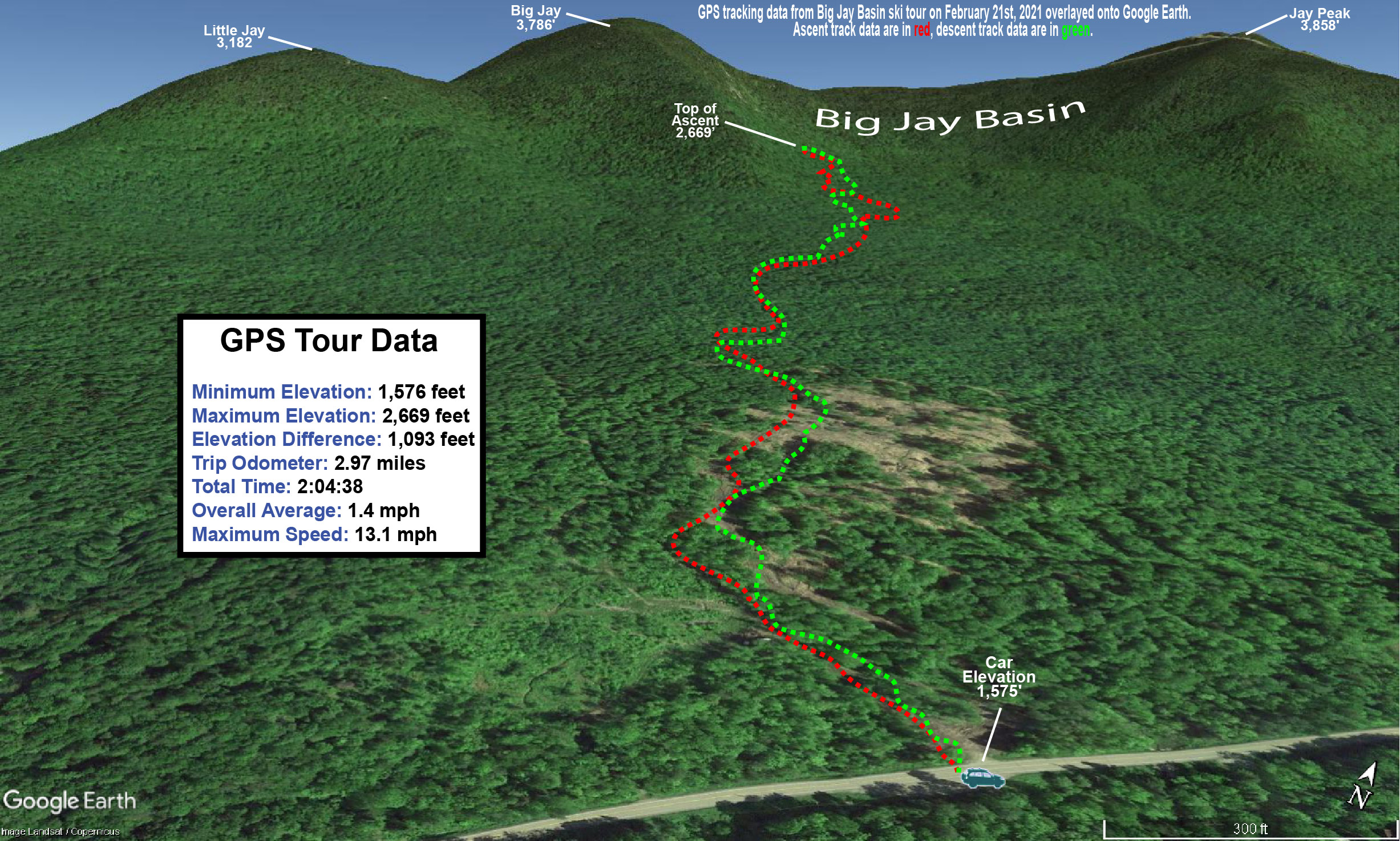
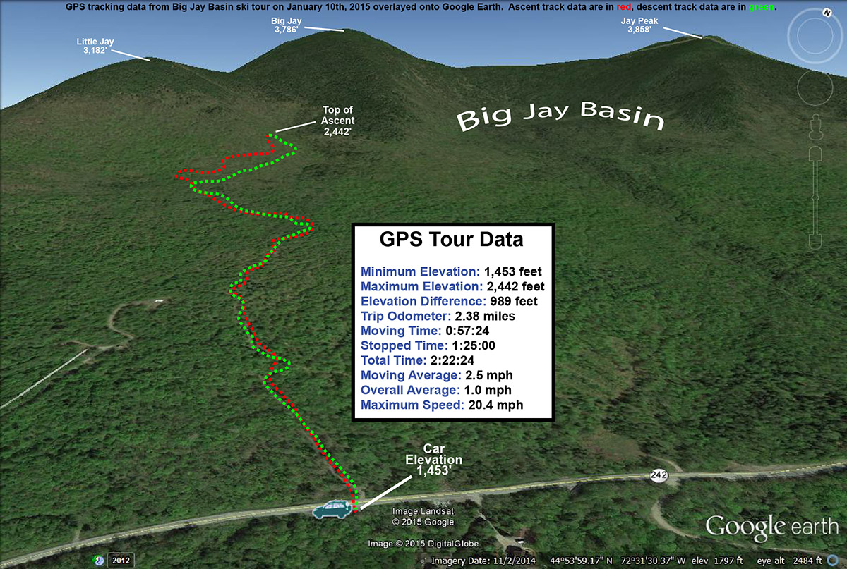
My tour was in the Big Jay Basin area that I’ve visited various times before, since it has convenient parking and some decent lower to moderate angle slopes along with its steeper lines. It also has that leeward exposure from Jay Peak, Big Jay, and Little Jay, so it absolutely reels in the snow. The past couple of times we’ve visited the basin, we’ve toured the terrain more toward the north side below Big Jay, but for this tour I decided to favor a bit more toward Little Jay to the south. I’d heard good things from some of my students about the terrain there, so as skin tracks diverged on my ascent, I generally opted for those heading more southward toward Little Jay. As I approached Little Jay, I could see that the terrain was getting steeper than I was looking for with the most recent accumulations, and slightly less pitched terrain was more prevalent off to the north, so I followed a skin track that was heading right through the terrain that looked the best for my plans. That skin track brought me into that drainage below the col between Big Jay, and Little Jay, and the lower sections there do have some nice pitches that avoid the really steep stuff. My goal was to get in a moderate tour’s worth of skiing and exercise with about 1,000’ of vertical, so with the trailhead elevation a bit shy of 1,600’, I was shooting to stop my ascent around 2,500-2,600’. Once I’d hit that level, I contoured back toward the south a bit along the side of Little Jay to get into more untouched snow, and dropped in from there.
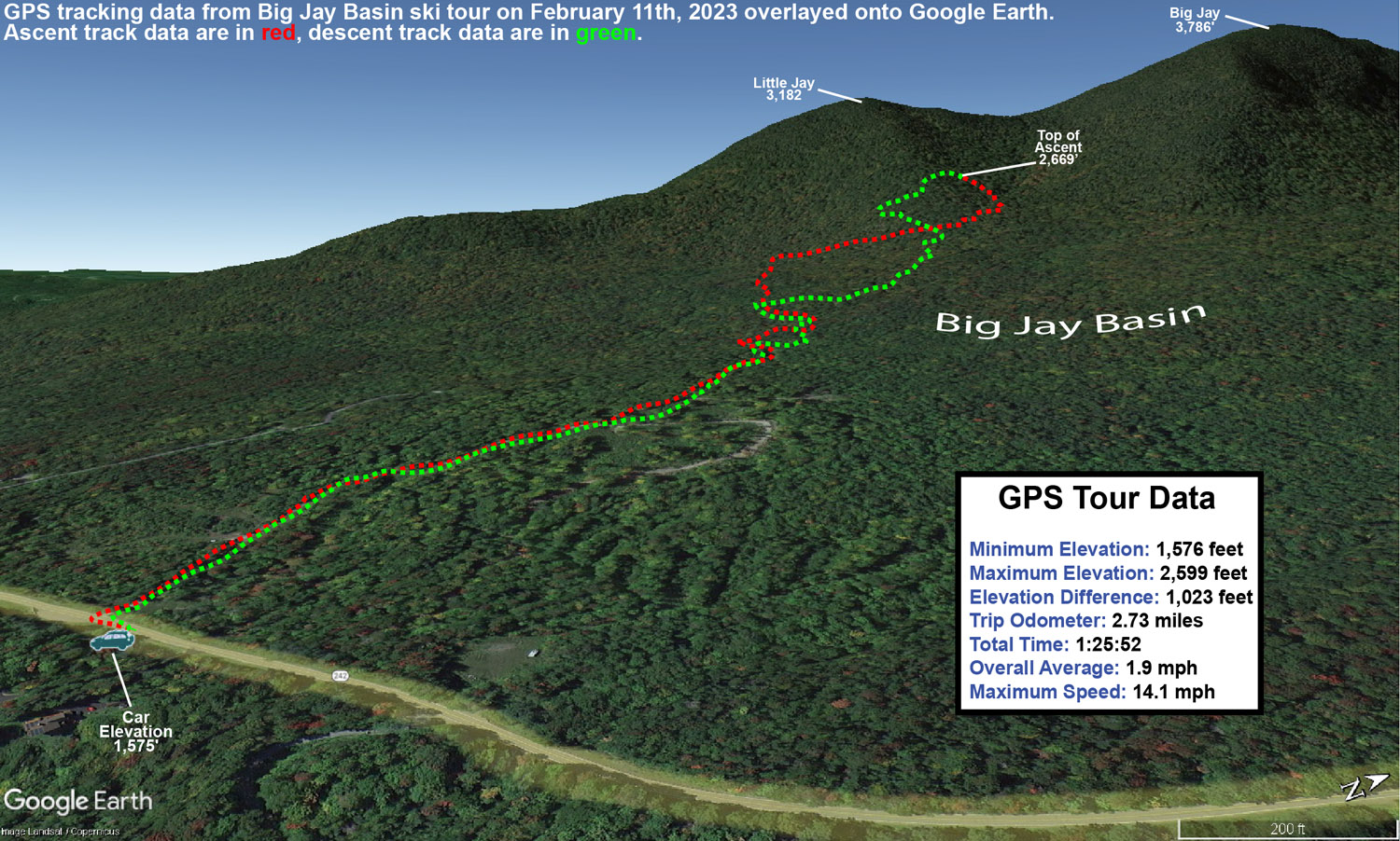
A Google Earth Map with GPS tracking data from today’s backcountry ski tour in the Big Jay Basin area
In terms of the snow quality, it far exceeded my expectations. Accumulations of new snow were very much as expected – I measured about 5 inches of new snow around 1,600’ at the trailhead, and that matched up perfectly with what the resort and bwt had reported in the morning. Accumulations probably increased by another inch about 1,000’ higher, but this didn’t appear to be one of those storms with heavy snow accumulation gains as elevation increased. What impressed me most was when I encountered at least a couple feet of bottomless powder in the drainage below the col. In that area, there were no signs that there had been any sort of significant warmth or rain. It was great to watch all the skiers and riders out there taking advantage of the great snow, and their whoops and hollers could be all over the place throughout the basin, just as you’d expect with great conditions. Aspect mattered in terms of snow quality though. The farther I wrapped around Little Jay toward southern exposure, the more I was skiing on just the new snow, and there was actually a detectable layer atop the old snowpack. Seeing this, I moved back toward the north as I descended in order to get into the best snow. I just found it surprising that it was really only southern aspects where the snowpack had consolidated, because that would represent more effects from sun vs. general warmth. Whatever the case, non-southerly aspects held some excellent bottomless powder out there.
Temperatures on the day were perfect, with mid to upper 20s F keeping the snowpack wintry. Skies were clear and sunny though, and you could tell that the mid-February sun was trying to work on that powder on southern exposures. Temperatures seemed just cold enough, and/or the air was just dry enough, to keep that from happening.
It looks like we might have a system coming through the area tomorrow night that could do something similar to what the back side of this system did, so we’ll see if that adds another few inches to freshen things up again.
The weather was quite a contrast between yesterday and today – yesterday was relatively low visibility with constant snowfall, but today there was hardly a cloud in the sky. The basin area had definitely picked up more snow since I’d left yesterday, but it was most notable above the road elevation (~1,500’). Yesterday I found powder in the 8-12” range down in that elevation range, and we found something closer to a consistent 12” today. Up higher, I’d found 12-16” in the 2,500’ range, but my measurements show that the powder depth had increased to roughly 20” when we were there today. If one considers how dry that snow was, and whatever settling occurred, that was obviously another impressive shot of snow overnight.
Ty drops into another turn in the powder on today’s Big Jay Basin tour, while E looks on from above.
Based on my adventures yesterday, I had no plans to bring E and the boys way up toward the east face of Big Jay; the terrain is really too steep for efficient skinning, and there’s so much great ski terrain in Big Jay Basin itself, that there was little point anyway. As I mentioned in yesterday’s report, during the approach, it was somewhere above 2,000’ when I found the first obvious split in the main skin track – I literally came to a “T” junction with a skin track to the left, and the other option to the right. It was interesting guiding the family around today though, as the situation with visible routes was quite different. There had been a lot more skier traffic, so there were skin tracks and descent tracks all over the place, and the obvious distinction of those skin track routes had been obliterated. There were so many ski tracks and descent tracks around that the most efficient one’s I’d taken yesterday got missed in a couple of places, but they were all generally leading to where we wanted to go.
“Yesterday I found powder in the 8-12” range down in that elevation range, and we found something closer to a consistent 12” today. Up higher, I’d found 12-16” in the 2,500’ range, but my measurements show that the powder depth had increased to roughly 20” when we were there today”
The skiing, as expected, was excellent. We topped out at an elevation of roughly 2,700’ in the basin, and worked our way generally back toward the parking area following the typical routes. There was plenty of powder, although since the area had seen additional skier traffic, we didn’t quite have the run of the place like I did yesterday, and we had to move around a bit more for fresh lines. I brought up the idea of just skiing straight down the basin to Route 242 and making the short walk back to the car on the road, because I saw some people that seemed to have taken that approach on my outing yesterday. E and the boys wanted to hit some of that open terrain that’s available near the bottom of the approach though, so we headed that way. Heading straight down out of the basin will be something I’ll have to try on a future trip, but it could be a nice way to avoid having to traverse to the right as much during the ascent and get a more direct fall line run.
A map of our backcountry ski tour in the Big Jay Basin area today with GPS data mapped onto Google Earth
Since the trip is an hour or so from home, we used it as an opportunity to get Dylan some of his required driving hours, and that was a win-win. There was still some snow to navigate on the roads so that he could work on dealing with slushy areas, but it was probably good that he wasn’t dealing with the heavy snowfall and low visibility that I had frequently encountered yesterday.
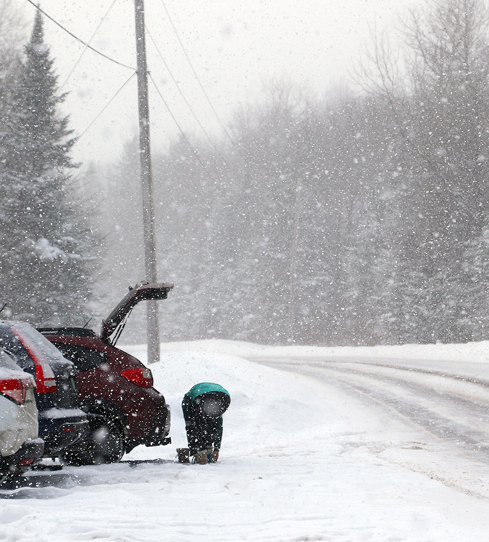
The snowfall was quite heavy at times today, including a the Route 242 parking area when I was starting my tour.
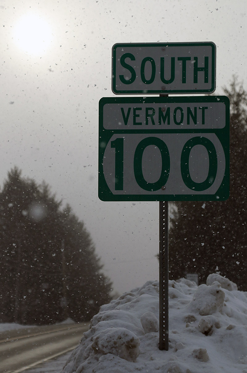
My drive up toward the Jay Peak area gave me a chance to see what had happened with respect to accumulations from Winter Storm Viola thus far. The Froude Numbers have been forecast to be relatively low, meaning that the western slopes were more likely to pick up accumulations than areas east of the spine, and indeed my travels showed that there have definitely been some notable differences in snowfall around the area. The rounds of fluff we’ve been getting here along the spine at our house have covered up the old snow pretty well, and monitoring that aesthetic during my travels today turned out to be a decent way to see who’d recently gotten snow. Heading east from our place, accumulations definitely dropped off toward the Waterbury Village area, and indeed, all along through the east slope towns of Waterbury Center, Stowe, and Morrisville, there really hadn’t been much new snow that I could see. Either that, or what’s fallen had sublimated and disappeared quickly off the snow banks. I’m sure accumulations increase as one heads westward up the mountain road and Mt. Mansfield, but down in Stowe Village, I could see that they need a refresher. There was still light snow falling in all those east side towns, but once I left Morrisville and rose up into the Hyde Park area, the increase in snowfall intensity was obvious. That continued right on through Eden. The snowfall was squally, and quite heavy at times, and I was continually having to turn on my headlights and fogs when I’d get into those more intense areas of snowfall. That increased snowfall definitely showed itself with accumulations – up in that area, all the roadside snowbanks were covered up with a solid coating of new snow. I’d say the snow was in general a bit less through Belvidere and Montgomery Center, but once I headed toward the pass on Route 242… well, we know what happens up there. Even from just a quick glance at the side of the road, it was obvious that even down at the roadside elevations, a lot more snow had fallen than I’d seen anywhere else on my drive.
Today’s drive yielded lots of midwinter Vermont views, including this one in Waterbury Center.
As we’d done on our last backcountry ski trip in the area, I parked at the lower access lot on the east side of the pass to start my tour. The elevation there is about 1,500’ and right from the start of the tour, I was finding 8-12” of new champagne atop the older snow. Above 2,000’ there was 12-16” of accumulation.
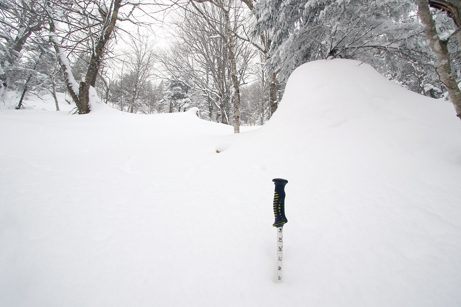
Finding a snowpack depth of nearly 40 inches as I make my way up through one of the glades in Big Jay Basin
I was also checking snowpack depths along my tour, and I was already getting 40” snowpack readings at just 2,000’. On top of that, it snowed the whole time I was there – most of the time it was what I’d call moderate, probably in the 0.5”/hr range, but there were also stints where it bumped up to the 1”/hr range. The snowfall was typically large, upslope-style flakes, which can make it a little tough to gauge the snowfall rate because they just stack up so fast.
It’s firsthand experiences like this though that have me rolling my eyes every time somebody gets going with the smack talk about Jay Peak and their snow reporting. My actual experiences reveal again, and again, and again that they really get a ridiculous amount of snow in that area.
My ski tour had me on Big Jay itself, and in the Big Jay Basin area today, and that southeast side of Jay Peak really seemed to be the epicenter for this shot of continuing snowfall. I can’t say when all of it fell, and I believe I only saw 3” new on the snow report for the resort this morning when I checked. Reports I heard about said that the resort side of the peak didn’t pick up nearly what the east side did, so the Jay Peak cloud was dropping its bounty there. Whatever the setup has been in terms of wind direction and Froude, etc., that Big Jay Basin area today was definitely getting hit. Something similar was going on with Hyde Park and Eden as well, to a lesser degree of course.
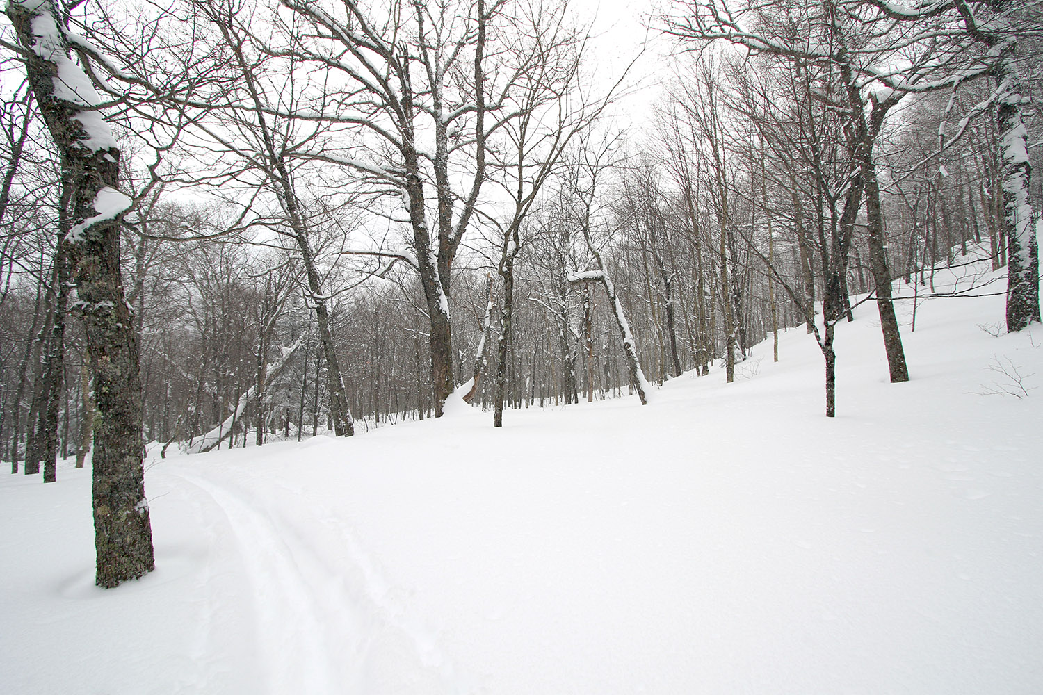
The lower areas of the approach offer lots of open terrain for skiers returning to the parking area
Indeed, my numerous checks on the snowpack today revealed that the area definitely avoided any real crust from Winter Storm Uri, so obviously that’s going to help a lot with respect to the quality of the subsurface. The resort reported 6-8” from that storm, and although there wasn’t a crust, that snow was still dense. The skiing was indeed fantastic with as much as 16” of that champagne powder in that area, but compared to last weekend, one can definitely nitpick a bit on the quality of the powder skiing. This most recent snow is so ridiculously light that it’s easy to get down to the dense Winter Storm Uri snow if you’re on more than moderate/blue pitch. Then you get to that region of dense snow, and if you pressure hard enough, you’ll collapse that layer a bit because the powder below it is less dense. Essentially, the snowpack’s got an upside down issue with respect to those second and third layers down. We’re very much talking first-world powder problems here of course, but I figured it would be good to get the beta out there for anyone else thinking of heading out. Naturally, going as fat as you can will help with respect to staying up in the champagne layer, and heck, if it dumps more tonight, that surface layer of powder will be bolstered to make it even better.
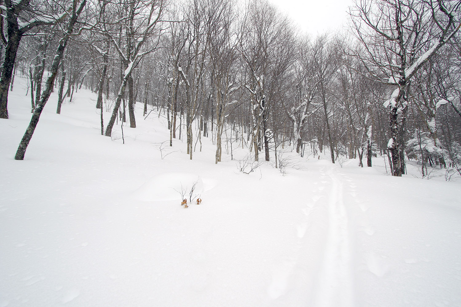
The glades were just everywhere in Big Jay Basin, with a skin track providing access right across the bottom.
Relative to Big Jay, I could definitely see the convenience of hitting Little Jay when coming from that lower parking lot on Route 242. Last time I was up there with the family in the general Big Jay Basin area, we actually did head more toward Little Jay, and we were in that drainage between Big Jay and Little Jay. I specifically went out today with the intention of just making turns in Big Jay Basin, but I left the option open to head up toward the main lines from Big Jay (in that general Jailbird Chute area) depending on what skin tracks were in place. There turned out to be a well-established skin track that headed right to that area, so my plan was to continue on it until it either disappeared, or I felt that ascending on skins was getting pointless.
On today’s tour, it was somewhere above 2,000’ when I found the first obvious split in the skin track – I literally came to a “T” junction with a skin track to the left, and the other option to the right. I was heading to the right toward Big Jay Basin, but the left option would have been a good choice for the Little Jay area.
“…right from the start of the tour, I was finding 8-12” of new champagne atop the older snow. Above 2,000’ there was 12-16” of accumulation.”
As I approached the 3,000’ elevation mark on Big Jay today, the ascent was starting to get pretty silly on skins because progress was just so slow. It was around that point when I found myself sidestepping up a steep, narrow area between some trees where the person setting the skin track had essentially done the same. It was basically just a ski’s width area, so you really couldn’t even make any sort of switchback. That was the point where I knew I wasn’t going to push too much longer on the ascent. The skin track still continued a bit farther, and I stuck with it a little while longer until the track really just became hard to follow in the packed snow of the main chute area. I followed a skin track (perhaps the same one, perhaps not) off to climber’s right briefly before that seemed to disappear, and then I decided I would stop my ascent as soon as I found a reasonable spot for deskinning. I side-stepped up about an extra 30 feet or so through fairly deep powder to a nice sheltered spot where I deskinned and had a snack.
I’d been there for just a few minutes when a group of five skiers, ascending on skins, appeared below me. They said hi, and thanked me for setting the skin track. I let them know that I was just following an old one made by others and was stopping where I was. It seemed like they were just going to stop there as well, but they started breaking their own trail above me and continued pushing on. I actually debated putting my skins back on and following now that someone else was breaking trail, but after watching them get maybe another 50 feet or so over the course of 5 to 10 minutes, I knew I’d made the right choice. As a group, I think they were having fun together with respect to the challenge of trying it on skins, and that’s probably the way to approach it.
The terrain was getting steep, and the powder quite deep as I made my way up the east face of Big Jay today
I wanted to get back down into the lower basin because the powder skiing was far better down there anyway, simply because it’s just so steep up on that face of Big Jay. You’re not getting bottomless turns up there unless there’s 2 to 3 feet of powder. The 12-16” of champagne was really nice up there, but you want even more for that upper terrain. Overall it’s some fantastic steep skiing of course, but I was on fat Tele gear and planning for undisturbed powder on more blueish and blackish pitches, not semi-tracked super steeps.
So where I topped out was in the 3,000’ – 3,100’ elevation range, and I’d argue that it was already boot pack territory. Boot packing up there would also be quite slow though because you’re pushing up very steep terrain with lots of powder. It would be a serious slog through the snow once you were off your skis if someone hadn’t already broken trail, although you could stick to the more packed snow in some of the main chutes and that might offer some efficiency. I don’t know how far that group of five went, but if they were going all the way to the summit at ~3,800’, it must have been a lot of work. I’m sure one can make it up to the Big Jay summit by skinning that route, but it’s probably something to do if you’ve got a lot of time and want the challenge, it’s certainly not the efficient way to go. I do wonder if there’s an approach from the Little Jay side that perhaps gets it done in a practical way.
A Google Earth map with GPS tracking data for today’s tour in the Jay Peak Backcountry
One definite theme out there today was a lot of visages of the sun through moderate to heavy snow with big flakes. It was pounding snow a lot on both my tour and my drive, so it made for some nice, snowy scenes.
Out for some backcountry powder in Big Jay Basin today
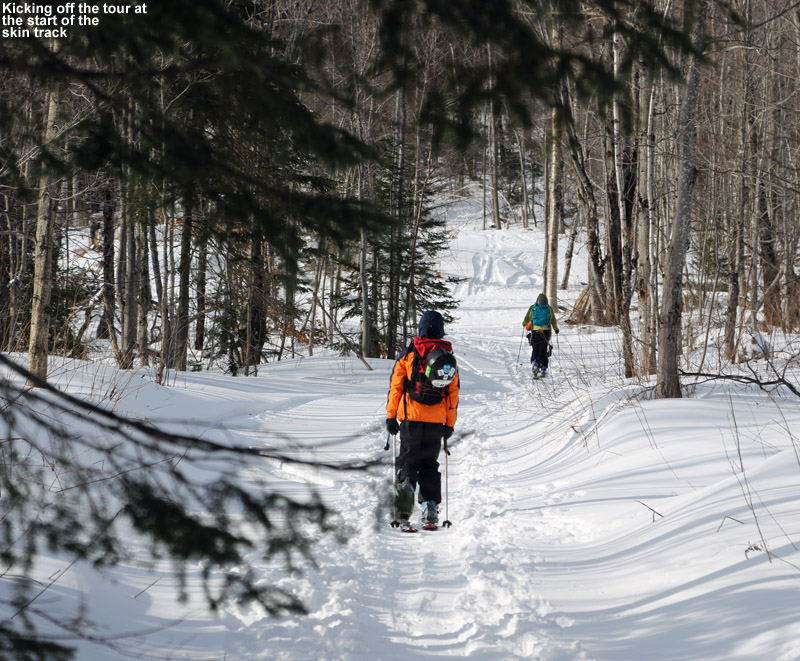
All of Vermont has seen a number of modest snowfalls this past week, and with the squally nature of some of them, snow totals were quite variable at the ski resorts up and down the spine of the Greens. As is often the case though, the Jay Peak area did quite well in the snowfall department, with a seven day snow total of over two feet. After seeing a couple of photos showing the delectable powder at Jay Peak on Thursday, and knowing that even more was on the way for Friday, a visit the Jay Peak area backcountry was sounding very appealing. I mentioned the idea to borderwx on the American Weather Forum, since he lives right in the area and is a regular at the resort and local backcountry, and he got back to me with a number of options. Previously we’ve skied Gilpin Mountain using a car shuttle off Route 242, and I was initially thinking of a variation on that theme, but borderwx also mentioned some options for tours in Big Jay Basin. There were variations starting from Jay Pass, as well as the parking areas down on Route 242 where Big Jay Basin drains out. After weighing the options, and consulting the nice Google Earth map of the Big Jay area put together by Guru Gered in his Big Jay Powder Day trip report at the Nor’easter Backcountry Blog, E and I decided that an out-and-back tour from the lower parking area at the outlet of the basin was the most practical with the boys. We really didn’t want to drive two cars to set up a shuttle, temperatures were expected to only be in the 10 to 15 F range, and this was our first tour in the area. A simple out-and-back meant that we could stop and descend at any time should the need arise.
“The quality of the powder remained very good all around, with just a few windswept areas, and the depth had quickly increased to the 8 to 12-inch range.”
Temperatures were right around 20 F in the Waterbury area as we left at noontime today, but the thermometer gradually dropped with our travel northward until it was 12 F at the Big Jay Basin parking area at ~1,500′. There were about a half dozen cars parked there, and we saw one guy just prepping his gear and starting on a tour. We could see he was using the prominent skin track right across the road, so as soon as we’d geared up, we followed suit. An initial depth check right there at the base of the skin track revealed 7 to 8 inches of powder, so even down at that elevation, the Jay Peak area had clearly picked up a decent amount of new snow this week. The powder was cold, fluffy, midwinter stuff… just like you’d expect out of January.
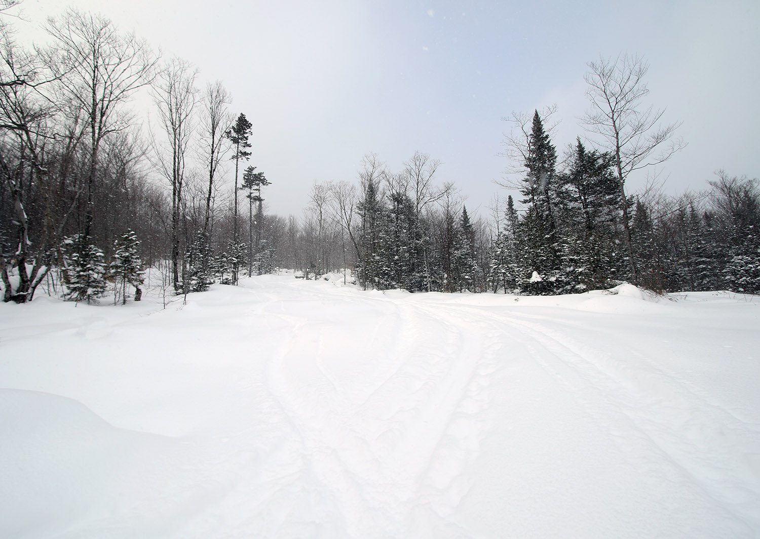
The skin track began in the rather open surrounds of a logging road and surrounding fields.
The skin track was indeed well established, and easy to follow as it worked its way up at a gentle pace on what appeared to be a logging road. We traveled along the road through areas of dense and sparse vegetation, as well as some acreage cleared by logging. The quality of the powder remained very good all around, with just a few windswept areas, and the depth had quickly increased to the 8 to 12-inch range. I’m not actually sure how deep the base snow was, but aside from a few windswept areas it was quite plentiful; we never really had to deal with underlying obstacles due to thin snow. Along with the skin track, we could see that people also used this route for descent out of the bowl, and that was clearly evident when we had to make way for a couple of groups skiing down. They appeared to be having a really good time as judged by their greetings and attitudes.
“It turns out that the bowl we were seeing off to our east wasn’t the main expanse of Big Jay Basin, but a smaller bowl below the col between Big Jay and Little Jay.”
After about a half mile, the skin track left the logging road and headed off generally to the right into the trees. From here the pitch increased a bit, and the skin track wound through the slightly tighter confines of the forest. Around 2,150′ we came to an obvious open spot that seemed to be the base for a broad collection of skiable lines. The skin track continued off to the left, and there were no longer ski tracks around it – it seemed like this was the point where people were converging to the track from the various ski routes above during their descents. It also seemed to be a popular spot to use for people skiing laps above the final runout back to the road. The skin track steepened here, and there were a few spots where it was a little steeper than it probably should have been, but we managed our way through them. Since I knew the boys wouldn’t want to do a huge tour, I’d set an elevation mark of ~2,500′ as a good stopping point from which to descend. That would make for a respectable descent in the range of 1,000′ of vertical. At an elevation of ~2,450′, we came across a very nice flat area along the western edge of a bowl somewhere below Big Jay on the western fringe of Big Jay Basin. The spot had a nice view down into the various areas of open ski terrain within the bowl itself. It was slightly shy of the 2,500′ mark, but a quick look around revealed that it was the obvious choice for a comfortable respite and preparation for descent in the immediate area. It turns out that the bowl we were seeing off to our east wasn’t the main expanse of Big Jay Basin, but a smaller bowl below the col between Big Jay and Little Jay. For perspective, our route can be seen on the Google Earth map available at the end of this report.
“All of us made a lot of alpine turns though, since the confines were just a bit too tight to really open it up all the time with slower, Telemark turns.”
We had some hot soup and cocoa that we’d brought along, removed our skins, and generally geared up for the descent, but we didn’t linger long because it was definitely chilly. While we were there though, we saw a few skiers descend through the more open terrain in the middle of the bowl, and the skiing looked nice. As soon as we were ready, we dropped into the bowl. The snow quality was excellent, there was about a foot of powder over a generally smooth base. There were a few windswept spots with hard snow here and there, which was sort of strange because the area was generally sheltered. I’d say that the tree spacing and amount of smaller saplings was a bit too constraining though. It looked better a bit up from where we were, so I think that we’ll explore up there the next time we head into the bowl. A couple more feet of base would really help in those lower reaches of the bowl that we skied, since it would bury some of the smaller saplings and open up more lines. With that said, there were some nice lines in there and we managed some good turns. All of us made a lot of alpine turns though, since the confines were just a bit too tight to really open it up all the time with slower, Telemark turns. We made our way generally back in the direction of the logging road, and once we got there we skied a combination of on and off-road lines, depending on the pitch and spacing of the trees. The trees were actually pretty tight down along the logging road, and although the pitch was fairly shallow, it’s about as much as you’d want. There were some areas where the pitch was shallow enough that skiing on the partially packed logging road was the only option, but there were still shots of powder along the edges of the road to catch.
“We were the last car in the lower parking lot, so he was really thankful that we were there and able to give him a ride back up to the top of the pass.”
As we were packing up our gear back at the car, a group of four skiers emerged from the forest about 100 yards up the road from where we were. One of them grabbed my attention and asked if he could get a lift up to the top of the pass where his vehicle was parked. He’d started a tour from there, and had intended to finish there as he’d done in the past, but somehow he got into a different drainage or something. He’d actually run into the other skiers along the way, who were presumably in a similar predicament, and they teamed up to make sure they all got out OK. We were the last car in the lower parking lot, so he was really thankful that we were there and able to give him a ride back up to the top of the pass. He let the other guys know that he’d be back soon to pick them up. The delivery to his car went fine, and he was happy to have avoided a 1.5-mile hike up the road. There was a good amount of traffic on the road though, so I’m sure he could have found a ride pretty quickly if we hadn’t been there. I’m just glad we had space in the car for one more!
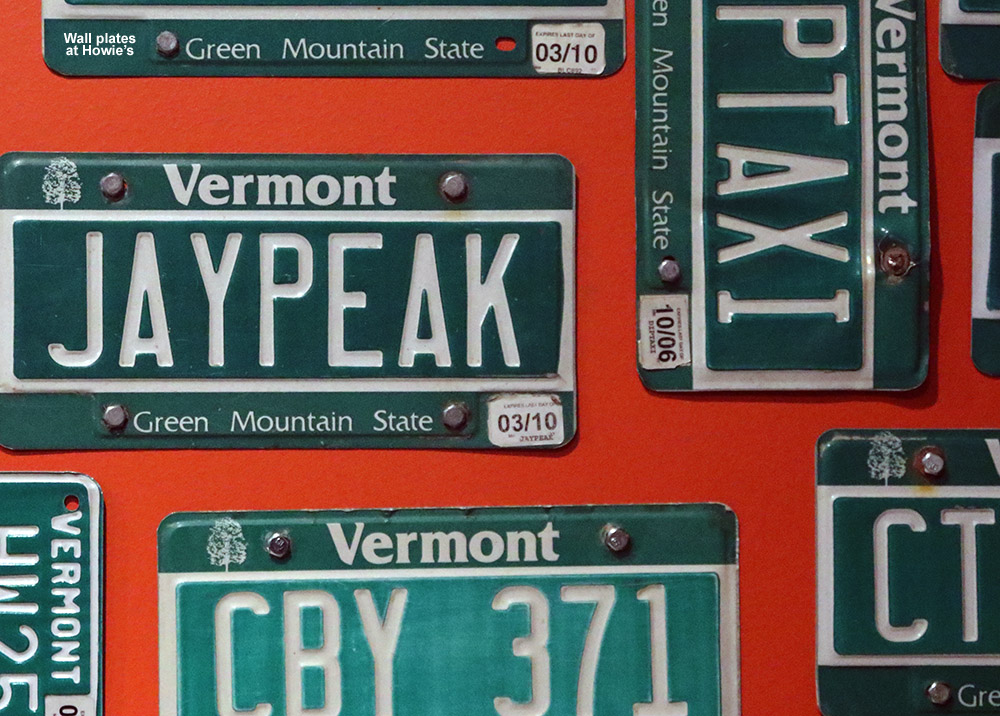
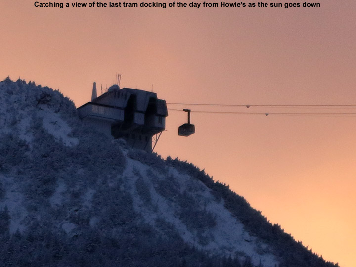
On our drive to the area earlier in the day, we’d taken the Montgomery Center route, since it was closer to where we were touring, but on the way home we continued east down the pass and stopped in at Jay Peak Resort for a bite to eat. We went to Howie’s at the Stateside Base, which we’d last visited about a year ago during our Christmas trip to Jay Peak with my family. We had some appetizers (including poutine of course) and got to watch the start of the Patriots playoff game against the Ravens. There were a number of people at the bar, but we had the table area to ourselves as the resort wound down from the day and darkness descended. This evening when I was at a work function in Burlington, a colleague mentioned that he’d heard the trails at Bolton Valley were really icy, and I said that we’d suspect that might be the case and headed up to the Jay Peak backcountry for a tour. After hearing his comment, I’d say we made the right choice today and got some good powder skiing out of it.
The GPS tracking data from today’s backcountry ski tour plotted on Google Earth: our tour took us up into terrain below the col separating Big Jay and Little Jay, along the west edge of Big Jay Basin.
Looking at the Google Earth map of our GPS track, it’s really easy to see that we were quite far on the western fringe of Big Jay Basin, so we’ll certainly want to explore a bit farther to the east in the big bowl next time we visit the area. A start from Jay Pass would certainly get us in there, I just think spotting a car appropriately for the exit might be difficult. Aside from the large parking area that we used on the south side of Route 242, we didn’t see any other obvious spots between it and the pass. Another option would be to simply tour out and back to the pass, but of course that means finishing with an ascent.
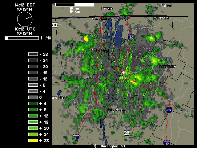
“We just documented our first frozen precipitation and accumulation of the season down here at 500’ in the valley. It started pouring out a few minutes ago as one of those bursts of precipitation came through in the northwest flow – you can see those yellow 28 db returns that disappear as the pulse of moisture barrels into the mountains:
As a pulse of heavier moisture ran into the mountains today, it dropped snow all the way down to our house in the Winooski Valley
Hearing the racket of the heavy precipitation outside, I decided to check out on the back deck because I know how these things sometimes go – indeed there was frozen precipitation among the rain, in the form of sleet and other dense granules that can typically make it down through the warmer layers of the atmosphere. I don’t even have my snowboard set up yet, but our picnic table out back sufficed to catch the accumulation. Seasonally, the timing of this event was right on track, with the mean for the first trace of snow here at Oct 20th from nine seasons of data. The event has actually brought the median value for that first trace of frozen down from Oct 21st to be right in line with that mean date of the 20th, and the S.D. dropped from seven days to six, so it’s helped to tighten up the data spread. The accumulation might have actually reached the 0.1” threshold for an official accumulation, but I was definitely caught off guard and by the time I grabbed my ruler and made measurements, all the accumulation was below that 0.1” mark so it will have to go down as a trace.”
We saw sun, snow, and lots of fun skiing out there at Jay Peak today.
The skiing yesterday was capped off with some dinner, water park time, and then movie watching back in the room to make for a pretty full day. Some of us were up pretty late last night, so fortunately there was no pressing need to get up early this morning. E hadn’t been one of those up late, and she got to sleep in, so that combination was a good way to head into Mother’s Day. Aside from Ty roaming around a bit in the room, there was little activity this morning until a knock at the door signaled the arrival of the pastries and juice. We hung out in the room most of the morning until the Pump House Waterpark opened up, and then E and the boys headed off for one more water session while I took advantage of the quiet room to get some work done.
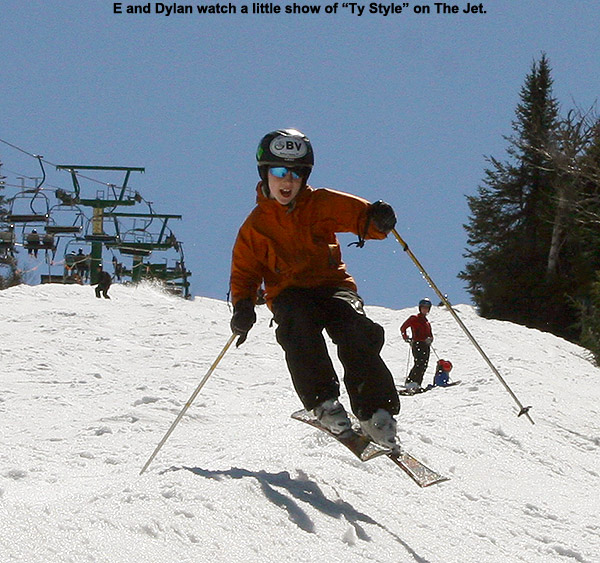
Festivities at the base of The Jet Triple Chair
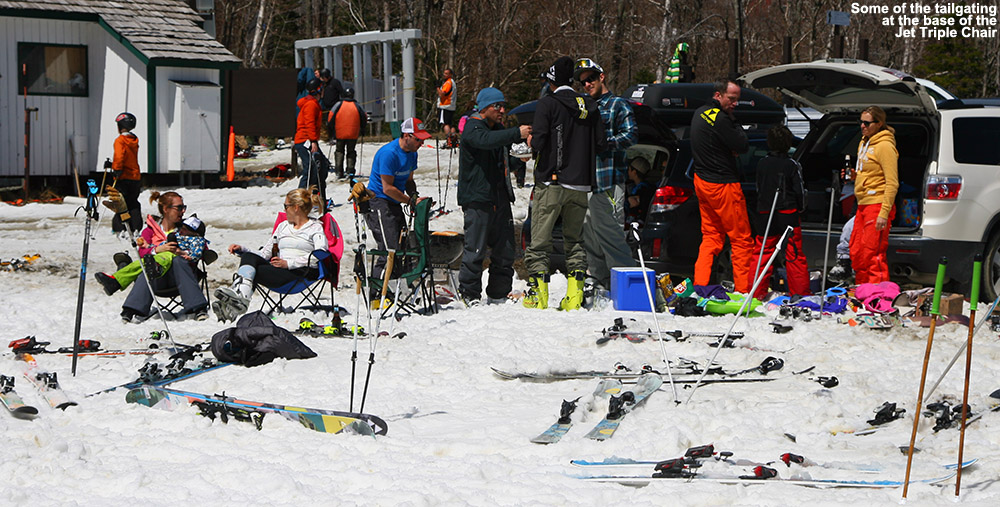
Once everyone was back from the water park, we checked out of the Tram Haus Lodge and headed over to Jay Peak’sStateside area for some skiing. The weather was a bit cooler today, and the air had definitely dried out as well. With a breeze at times it felt almost chilly, even though it was in the 60s F. Once we got over to Stateside, it took a little while to orient ourselves due to the massive changes that have taken place. The removal of the old Stateside Lodge and the addition of the new Stateside Hotel and Base Lodge as well as the Mountain Kids Adventure Center have transformed the area. We actually visited the new hotel during our Jay Peak trip in December to eat at Howie’s, but we came by shuttle and it was a dark, frigid, December night with snow and wind; there was no way we were seeing anything. We had to do a bit of walking up and around the hotel via the big staircase on the side, and found some skiers enjoying the deck area. Below that there’s a lot of landscaping in progress so there isn’t currently much in the way of convenient access to the slopes right above the lodge, but eventually we found our way over to the base of the Jet Triple Chair. It’s a couple-minute walk back and forth between the hotel and the base of the chair, but the pathway has crushed rock to mitigate potential issues with mud. We also found that there were a number of cars parked right at the base of the Jet Triple Chair; there appears to be a small parking lot there, and some folks had set up for tailgating festivities.
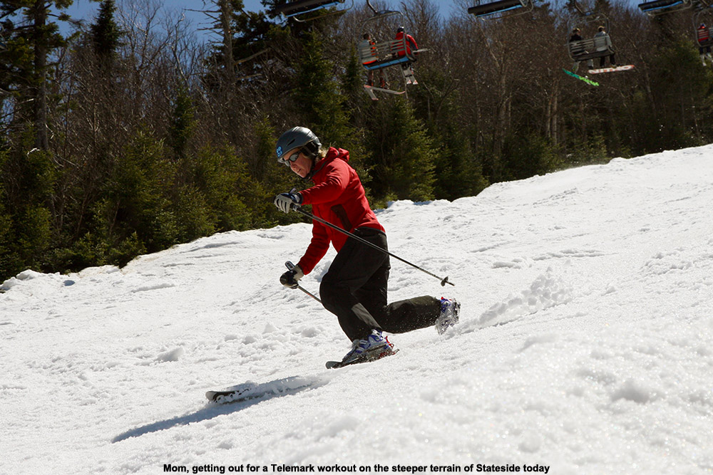
Mom getting in her Mother’s Day Telemark workout on Stateside’s steeper terrain
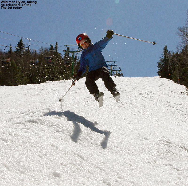
The options for skiing today at Stateside were The Jet and Haynes/Mont L’Entrepide as the steeper routes back down to the base of the Jet Triple Chair, and then another route down Montrealer and Angel’s Wiggle that would bring you right back to near the base of the Stateside Hotel. Snow on the steeper runs was decent, a little thick in spots and a little scratchy in others, but classic, soft spring snow overall. Dylan really fired up some wild skiing for the camera on one of our runs, and was having a blast catching air along the edge of The Jet. It was fun watching from the chair as everyone skied The Jet, and at first we didn’t see any Telemark skiers, but then we started to spot them and some of them were really rippin’ it up. E and I got in a great workout navigating the steep bumps with Telemark turns, and E was happy to get a chance to work on her turns on steeper terrain – she’s often frustrated if we head into steep trees when she’s on her Tele gear, and it’s just too much at once to really get in much practice, but today’s snow and pitch was nice, and she commented on having some great sections where the turns flowed. I found one of the most challenging spots was at the very top of The Jet, where the trail is a bit narrower because it’s constrained by the ropes closing off the top of the lift line so skier’s don’t collide with the chair. There are a couple of huge bump lines, but if you want to ski those while deviating from the obvious troughs, it’s tricky.
Ty out on The Jet
We finished a final run back down Montrealer and Angel’s Wiggle, which were a bit sloppier and softer when it came to the snow, so my legs were definitely cooked by the time we reached the bottom. I burned them as hard as I could holding Tele turns until that last stretch to the lodge. We poked around the Stateside Hotel for a bit until we found a drop box for our room keys/ski passes, and then headed out.
We stopped down in the Village of Jay for some food, and although it was mid afternoon, we were happy to find that the Jay Village Inn & Restaurant was serving all day. It’s great to have places like inns that are serving food all day, because even in Stowe we’ve had trouble finding mid afternoon options for dining. For those days when you finish up skiing in the mid afternoon, or don’t want to try waiting around until 5:00 P.M. to stop in for a bite, inns with restaurants seem to be just the ticket. The Whip at the Green Mountain Inn has come to the rescue for us a number of times in that regard. It was our first time at the Jay Village Inn & Restaurant, and it’s got a nice homey feel being a combination inn/restaurant. There’s a huge couch and table in one of the main dining rooms, and the boys were quickly sucked in and passing out while we were waiting for our order. We knew they weren’t likely to be awake in the car too long on the ride home. The food was great and the portions were huge, which is pretty much the general theme you’ll see if check out the reviews for the restaurant on tripadvisor®. I had the unique “Atlantic Sea Dog”, which turned out to be a piece of cod that was about a foot long, and shaped sort of like a hot dog, on a huge bun. I didn’t quite get the name before it came out, but it was all too obvious once I saw it!
I had the unique experience of the “Atlantic Sea Dog”, and E had the BLT right above it.
After this weekend, it’s just Killington running their lifts for skiers in Vermont, and it will be interesting to see how long they’ll keep going. In an event, there’s still a lot of snow out there for earning turns.
Making use of what Mother Nature delivered to get in some fun turns today at Jay Peak
We’ve been up at Jay Peak with family leading up to Christmas, and today we got out on the slopes for a few turns. The weather hasn’t been great for the ski conditions, since we just had an extended storm with plenty of mixed precipitation. The storm did bring some snow with it, but also plenty of other precipitation that ultimately led to a hardening up of the slopes. There really wasn’t much to inspire one to get out on the hill today, especially with colder temperatures on the way, but it was snowing when we arrived last night, and that piqued my interest at least a little.
When it finally came time to decide if we wanted to ski today, the boys were game. And since our RFID cards that serve as our room keys and provide access to other areas of the resort, also serve as RFID ski tickets, there wasn’t much of a downside to hitting the slopes. Today was also a chance for the boys to ride the tram, which was already closed for the season the last time the boys and I came to Jay Peak for lift-served turns. Temperatures were starting the day in the mid teens, which wasn’t too bad, but they were expected to drop throughout the day, so we decided that we’d best served by going for our turns in the morning before it got colder.
We started out at the moving carpet, where Luke and Lilly were having their first ski experience ever. We helped Marc and Jill get them going with some tips, and then once they started getting the hang of things, Marc joined up with E and the boys and me for a run on the Tram. The boys finally got their tram ride, and were impressed with how high and fast it traveled. From the summit we headed down Northway to Ullr’s Dream, and conditions were simply heinous up top. The snow was hard and icy, and I’m glad I’d sharpened our skis, but I’m not sure how much good it did. That’s sort of par for the course anyway with the way the wind blows up there, but the recent storm certainly didn’t help in that regard. We didn’t find much to inspire us to really take another run until we got down onto Kokomo along the lower elevations of Ullr’s Dream. Down there, an inch or two of powder has settled in, and combined with the modest pitches, we were starting to encounter some soft turns
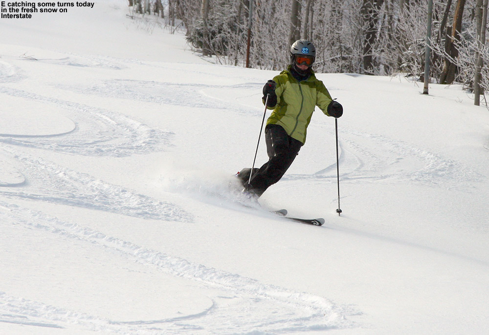
The end of that run inspired us to make a second, and this time we used the Metro Quad, which is low, out of the wind, and down in the warmer elevations. We were hoping to head over toward Deer Run, but when we found the terrain on that side of the lift roped off because of snowmaking, we moved toward the Interstate side of the lift. That turned out to be just what we were looking for. Since the vast majority of the people on the trial were there for the terrain features, they were totally ignoring the large area of untracked snow off to the skier’s left. We found an inch or two of fresh powder over a smooth base, and turns were quite inspirational. It was the sort of discovery that definitely injects some excitement into the day. It was so much fun, I felt that we had to do it again. Of course with the rest of the family hungry and eager to get to the water park, I was by myself on that next run, but it was just as sweet.
It’s snowing again tonight as I write this, so as is par for the course for the Northern Greens, they seem to be starting to nickel and dime their way back to nicer conditions. I don’t think we’ll really have time to ski tomorrow with the Christmas Holiday, but I bet our tracks will be covered up again for tomorrow, and there should be fresh turns out there waiting for someone. I’ll update this report with more info on the whole trip as time goes on, but indeed there’s just way more to do here than time often permits. I will say one thing that really impressed and surprised me though, is that with the addition of the new Stateside Hotel, there are now 17 eateries of various sorts up here at the resort. We tried out three new food options on this trip that we hadn’t before, so I’ll talk about those when I add a bit more to this trip report.


 We stopped down in the
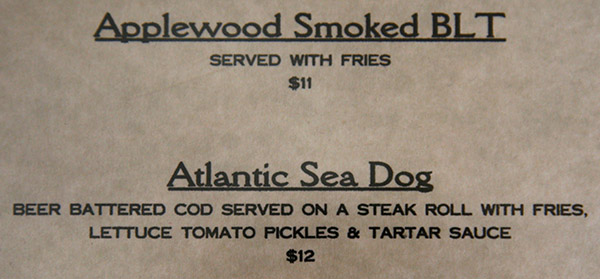


