Bolton Valley, VT 20NOV2025

An image showing a westward view from the Timberline area of Bolton Valley Ski Resort in Vermont out toward Whiteface Mountain and the Adirondacks with low clouds hanging in the Champlain Valley
An image of icicles hanging off the Timberline Base Lodge in November at Bolton Valley Ski Resort in Vermont
Icicles hang off the Timberline Base lodge with some ski terrain visible in the background. While the lower elevations snowpack has consolidated some since our recent storm, the snow is still dry and the powder skiing is still quite good.

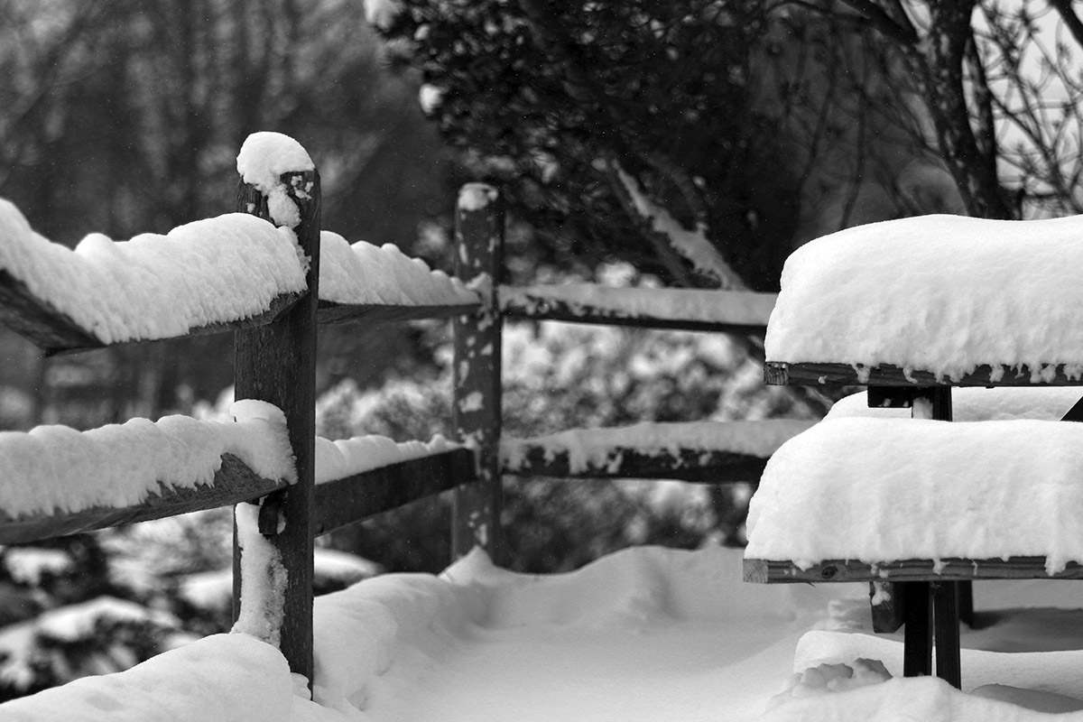
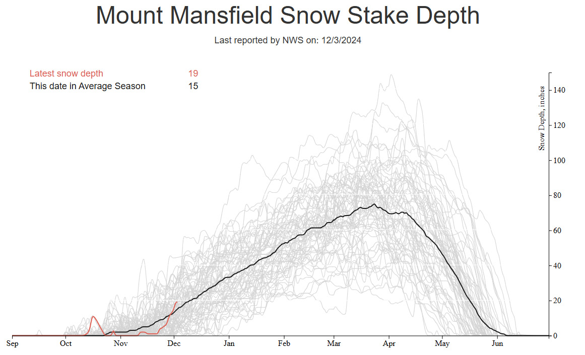
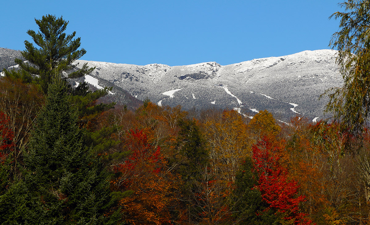
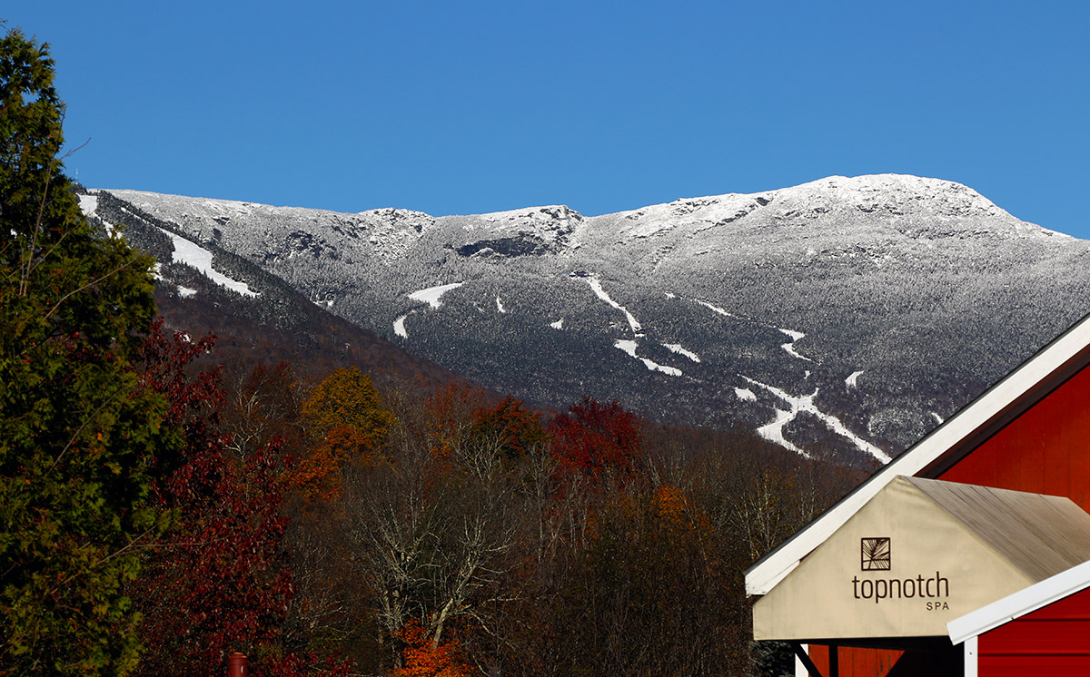
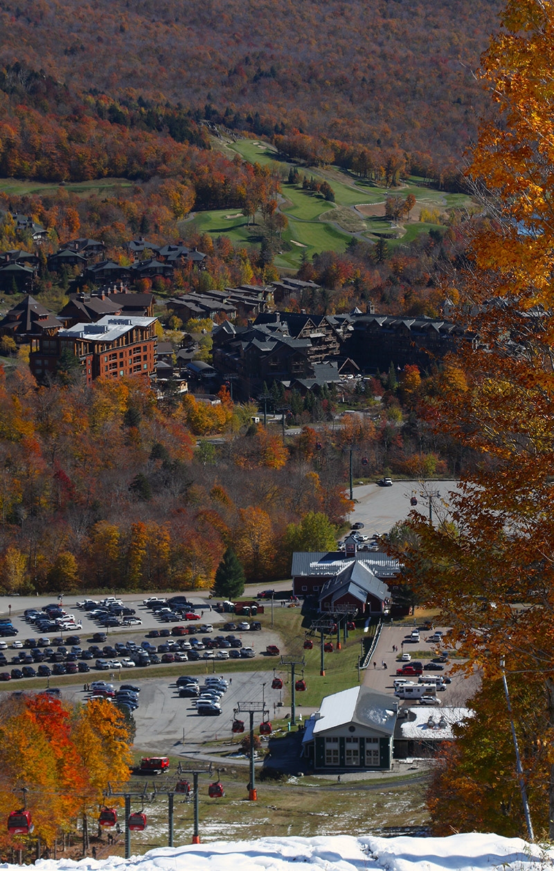
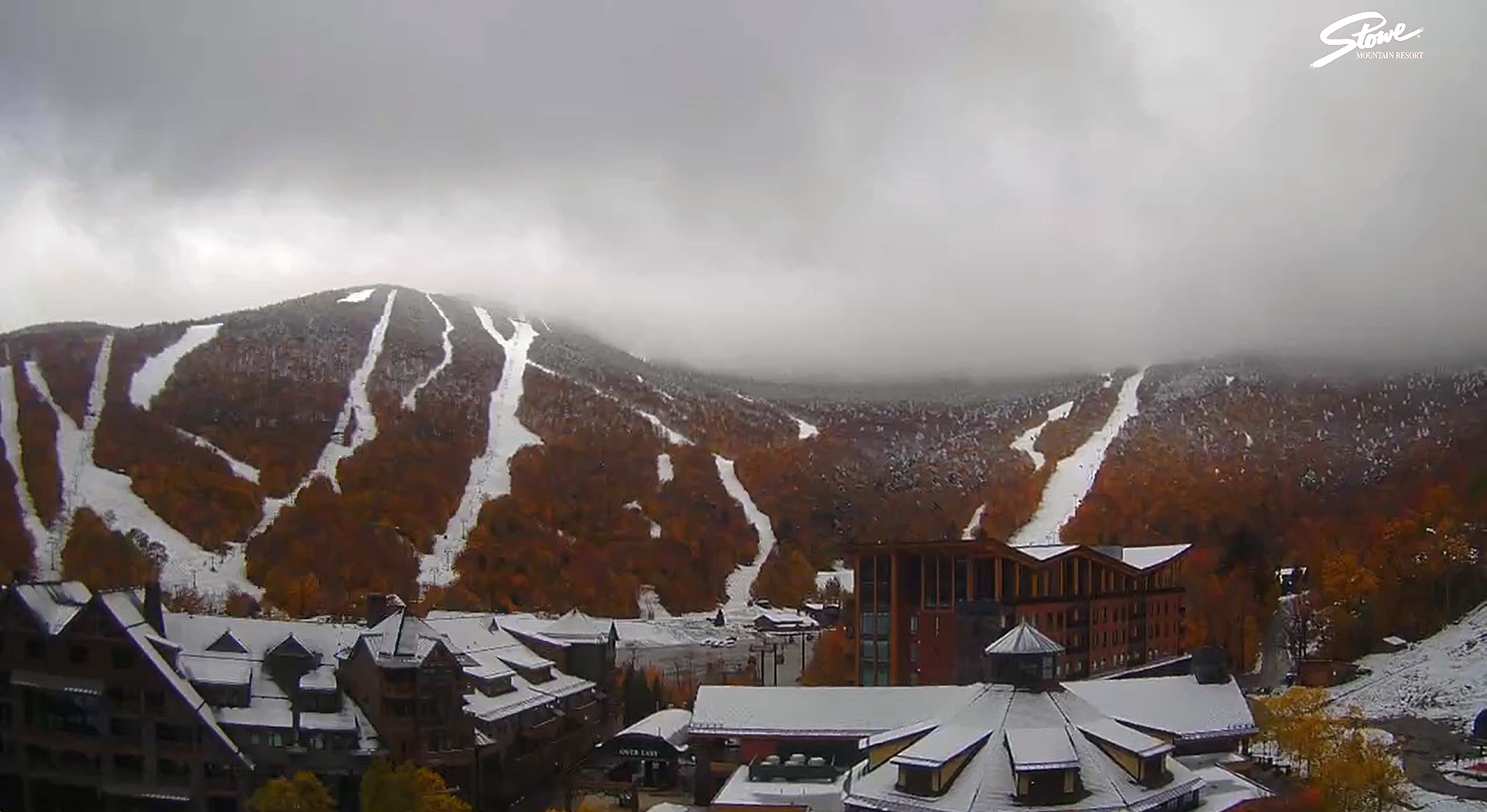
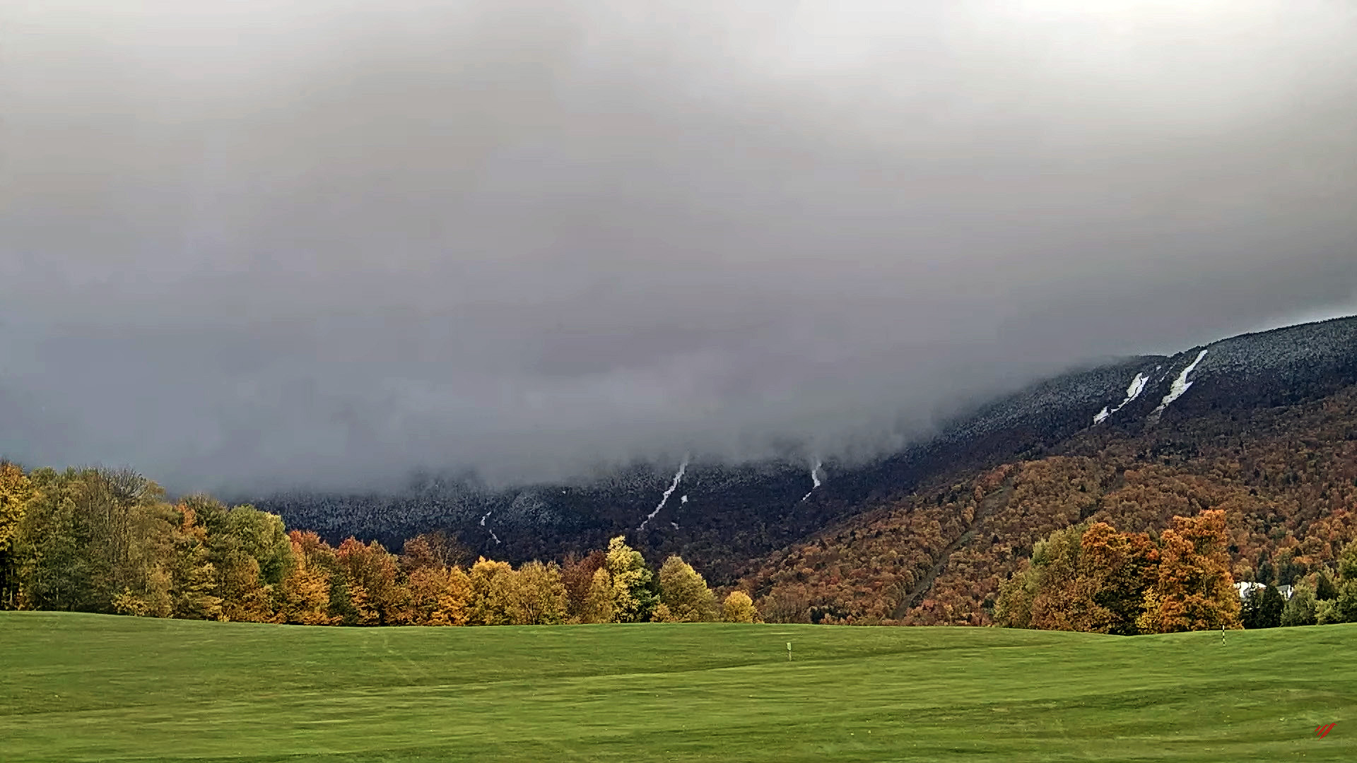
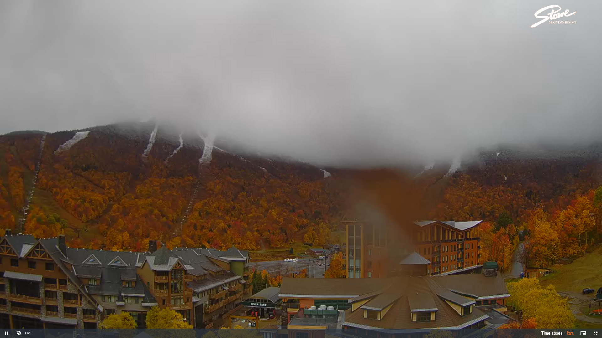
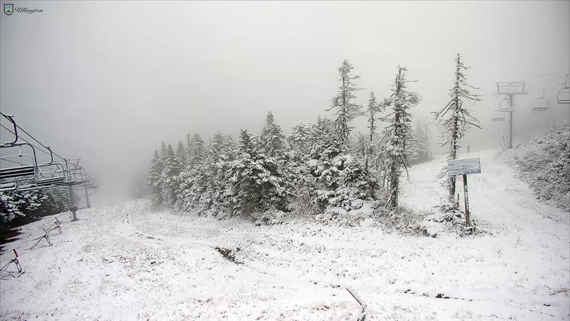
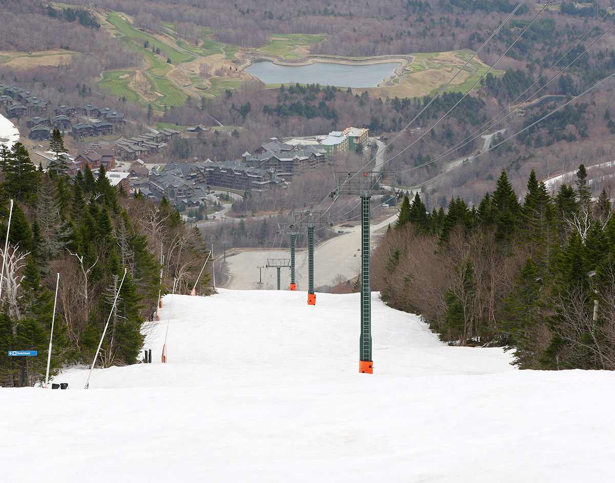
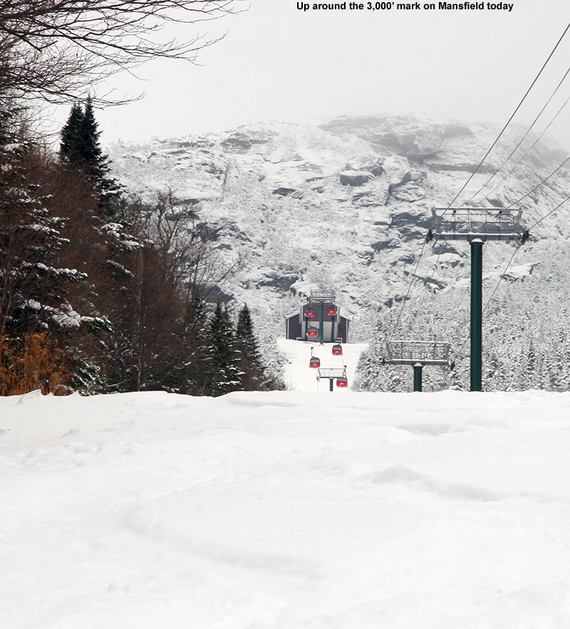
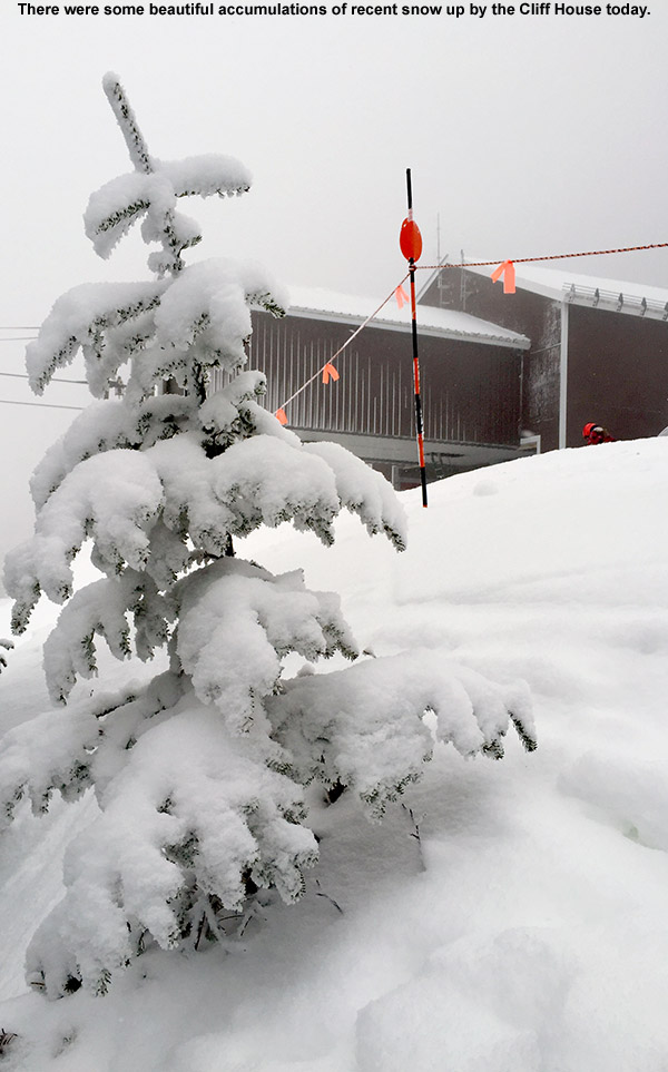
By midweek, our protracted period of snowfall was winding down here in the Northern Greens, and we finally began to get some views of the peaks. When the clouds broke away you could see that the mountains were absolutely plastered with snow – the snowpack depth at the Mt. Mansfield Stake topping out near 40 inches will attest to that. Also notable in the views was the very low snow line – it reached way down below 1,000’ into the valleys.

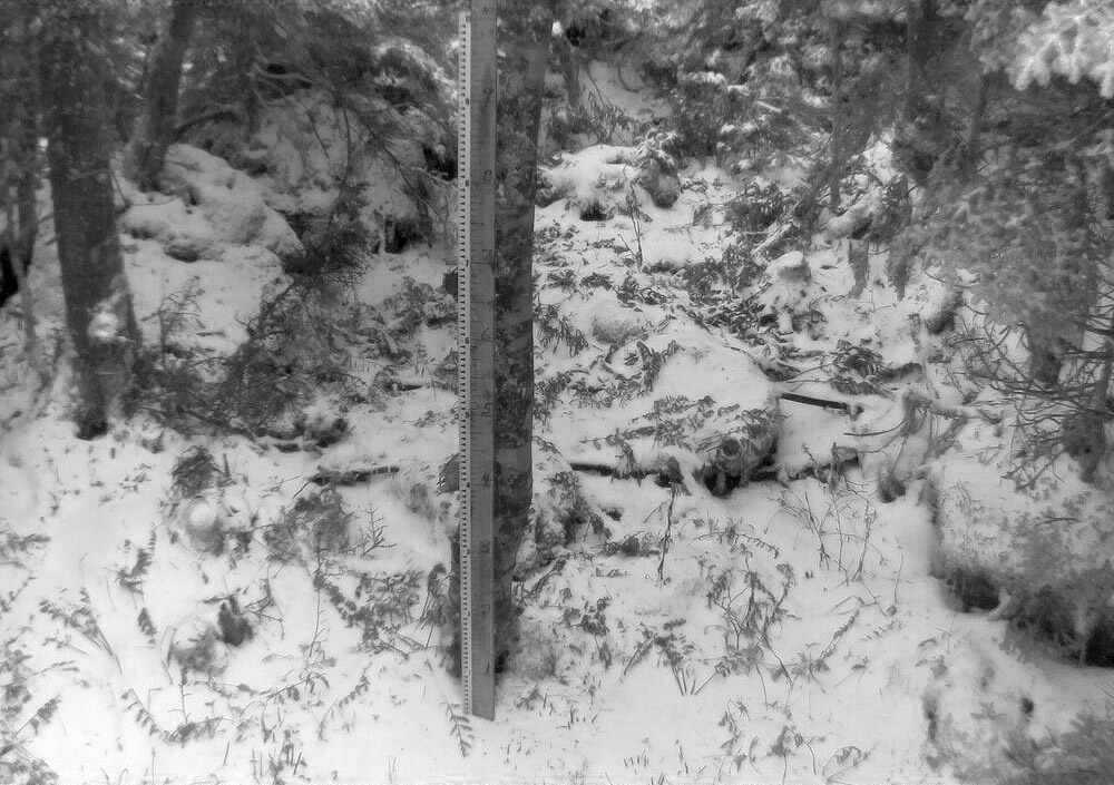
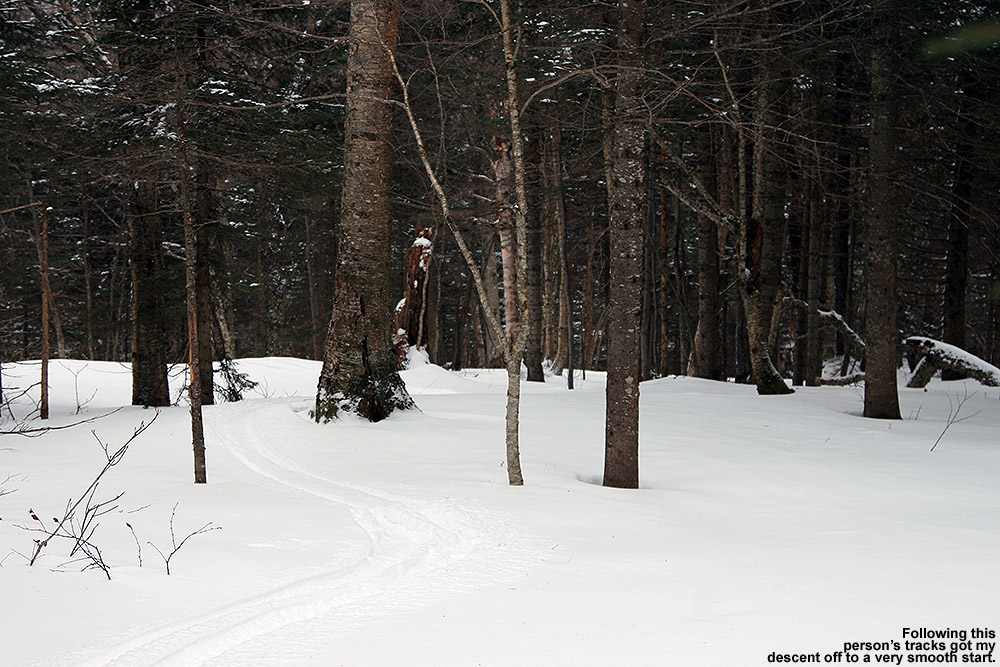
I hadn’t been out to the hill since Monday when the storm was still going strong, but I had enough time today to go on a ski tour for my workout. I was unsure if the lower elevations of Timberline were still going to be offering good powder turns, but when I parked and checked out the snow consistency, it seemed quite decent, so I decided to tour from there. The snow had definitely settled since Monday; depths at 1,500’ that were previously 15-20” on that outing were roughly 12” today. There hasn’t been any real melting of the snow, so that decrease in depth generally just represents settling of the snowpack, and all the liquid equivalent was still there to support skiing. Areas in direct sun showed greater effects of consolidation, but humidity levels have been low, so even the most affected areas still weren’t getting mushy.

An image from the Timberline Base Lodge in November showing the snow conditions in the Doug’s Woods tree skiing area at Bolton Valley Ski Resort in Vermont
Looking up from the Timberline Base Lodge at the snow in Doug’s Woods

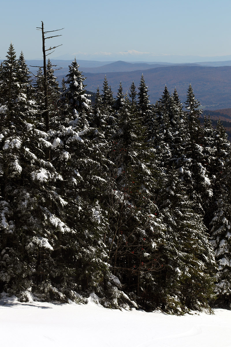
The depth of the snowpack definitely increased with elevation, and up around 2,000 – 2,500’ the snow depths were in the 1 to 2 foot range. I didn’t get any higher than that, but above 3,000’ the depths should be fairly similar to the depths at the Mt. Mansfield Stake.

By this morning there had naturally been a lot of additional skier traffic compared to Monday, but there were still plenty of untracked lines available. The very best powder was in areas protected from the sun, but that’s a lot of terrain at this time of year when the sun angle is so low. The snow may consolidate a bit more by tomorrow with the next system coming into the area, but as of today, fat skis were still definitely the way to go. There were some areas of deep, unconsolidated snow that could really throw you for a loop. To that point, I hit one especially deep pocket that was 2 to 3 feet of bottomless fluff, and even on my 115 mm boards, everything just dropped away from below me and I wound up going head over heels into deep snow. It was a chore to extricate myself from that. In general though, the skiing just offered more sublime powder turns that would rank right up there with the best midwinter days.

Stowe, VT 15NOV2025

An image of Jay Telemark skiing in powder along the Perry Merrill trail in mid-November at Stowe Mountain Resort in Vermont after multiple winter storms have brought the snowpack depth at the Mt. Mansfield Stake to nearly 30 inches and provided rounds of great snow for skiing
An image of Erica Telemark skiing in powder on the Perry Merrill trail in mid-November at Stowe Mountain Resort in Vermont after multiple winter storms have brought the snowpack depth at the Mt. Mansfield Stake to nearly 30 inches and provided rounds of great snow for skiing
E and I got our for a ski tour at Stowe today. The weather was great, and with the Mt. Mansfield snowpack at nearly 30 inches and the base topped off with powder from multiple November storms, the skiing was superb as well!

In the New England Subforum at American Weather, Powderfreak has done a fantastic job of keeping everyone apprised of the snow conditions at Stowe, so for today’s ski tour, E and I decided to mix it up a bit and head to mighty Mt. Mansfield. On the approach to the resort, we found spotty snow cover in the valleys building to roughly 12-15” of snow at 1,640’ at the Midway Lodge. Today was a simply beautiful November day, with temperatures a bit below freezing, little to no wind, and some peeks of sun to keep it bright and create excellent views but not throw out so much sun that it substantially affected the quality of the snow.

Plenty of skiers and other winter enthusiasts were around at the resort as they took the opportunity to get out and enjoy the snow, but crowds certainly weren’t crazy – I didn’t see many cars in the Mansfield lot, and the Gondola parking lots certainly weren’t full. There was a good assortment of established skin tracks on the Gondola terrain, and there were typically double and triple tracks available. So it was very easy to ascend side-by-side and enjoy conversations, and you could conveniently pass people or let them pass you if need be.

An image take from Route 108 in Vermont showing the closure sign for Smuggler’s Notch and the snowy trails of Stowe on Mt. Mansfield in the background where the snowpack depth at the Mt. Mansfield Stake to nearly 30 inches
As you approach Mt. Mansfield, you can see that the slopes are well covered thanks to all the recent November storms that have hit the Green Mountains.

Snow depth increased to over 20” as we ascended, and the snow was substantial enough that it provided both excellent base snow and surface powder for skiing. I’d say it was denser snow overall than what we had back from that storm on the 5th, but the powder skiing was still quite good. We found that the snow did get a touch denser below 2,000’, so you had to be on top of your turns a little more in those elevations as you finished the descent. Dylan was going to head to Bolton for a tour yesterday, but I suggested that he pop over to Mansfield instead, since Stowe isn’t open for the season yet and it’s an excellent time to get in some turns there. We were able to meet up with him and Ronan at the start of their tour, just as we were finishing ours. I passed along the info what we’d encountered with respect to snow conditions, and he said they had an excellent tour with some great turns that even brought them into the trees.

First Vermont Snows for the 2025-2026 Winter Season!

A Photo of October snow on Mt. Mansfield taken by Scott Braaten
An image of the first official snow at the Mt. Mansfield Stake in Vermont for the 2025-2026 winter season
The first touches of snow recorded at the Mt. Mansfield stake for the 2025-2026 season

It’s been a reasonably warm fall season with many beautifully dry days featuring blue skies to enjoy the foliage, but the change in seasons is becoming evident now as we approach the end of October and move into a much wetter pattern. It’s interesting to note that over in New Hampshire, Mt. Washington had multiple episodes of snow in August, but they didn’t record any snow in September. This new influx of systems into the area has seen a return of their snow however, with multiple accumulations over the past few days.

I haven’t seen any reports of snow here in Vermont prior to yesterday, but now they’re coming in, so this stretch likely marks the kickoff to the 2025-2026 Vermont snow season. Yesterday morning at 9:40 A.M. Powderfreak reported that the precipitation was snow above 3,500’ on Mt. Mansfield, and later in the evening there was some video posted of the snow falling up at Jay Peak. There was also a post showing what was probably the first snowman of the season on Whiteface. As of this morning, Powderfreak posted images of snow falling on Mt. Mansfield and then the initial accumulations up at the Cliff House. The first accumulation of the season was recorded at the Mt. Mansfield stake, and by the afternoon, accumulations had made it down to the middle elevations of Mt. Mansfield, so there we go – the Vermont snow season is on!

Bolton Valley, VT 03DEC2024

An image of evergreen branches, an old snowcat, and the Little Rock Rental Shop covered in powder from rounds and rounds of early December snow up at Bolton Valley Ski Resort in Vermont
An image of snow on tables and railings during early December in the Village area at Bolton Valley Ski Resort in Vermont
The views of the snow were gorgeous in the Bolton Valley Village today; we’ve been getting hit with rounds and rounds of continued light snow as impulses come into the area and help push along moisture streaming over from the Great Lakes.

I hadn’t been up to the mountain since Saturday, so I was eager to get out for a ski tour when I had time today. There’s been no specific synoptic storms in the area, but the snow has been piling up the thanks to the continuous feed of moisture off the Great Lakes and the upper-level low pressure to our north. Seeing the snowpack depth at the Mt. Mansfield stake quickly jump up to near 20 inches is a strong sign that it’s been snowing around here. Having that closed upper low over Hudson Bay with broad upper level troughing is a great setup when you have a 4,000’ wall of mountains sitting downwind of a moisture source like the Great Lakes.

A plot showing the snowpack depth at the Mt. Mansfield Snow Stake in Vermont on December 3rd, 2024
The snowpack depth at the Mt. Mansfield Stake has been shooting right up above average over the past few days thanks to the continuous parade of smaller weather impulses affecting the area as well as the moisture pushing into the area from the Great Lakes.
An image from the Wilderness Summit during a ski tour in early December at Bolton Valley Ski Resort in Vermont
Up at the snowy Wilderness Summit above 3,000′ on today’s ski tour

Even without data from the Mt. Mansfield stake to go on, I know it’s been snowing because we’ve recently had several inches of new snow down at our place in the valley, so the snow is hitting all elevations with the current temperature regime. Indeed, I found that snow depths were up substantially at all elevations during today’s ski tour. I toured again using the Wilderness Uphill Route, so I was able to check snowpack depths from the valley on up and compare them to what I’d last seen on Saturday. The updated snow depths are below, with Saturday’s depths listed first, then today’s depths following in bold. The depths I found up at 3,000’ and above are certainly consistent with what is being reported for the snowpack depths at the Mt. Mansfield stake.

340’: T-1: –> 1-2”
500’: 1” –> 2”
1,000’: 2” –> 3-4”
1,200’: 2-3” –> 4-5”
1,500’: 3” –> 6-8”
2,000’: 6-8” –> 8-12”
2,250’: 8-10” –> 10-14”
2,500’: 10-12” –> 12-16”
2,750’: 11-13” –> 14-17”
3,000’: 12-14” –> 16-18”

Concomitant with the increasing depths, the quality of the powder skiing even jumped another notch relative to the already great conditions we experienced on Saturday. In fact, even though the surface snowpack is excellent right-side-up powder that is beautifully dry, it’s getting deep enough that it’s starting to be a bit too much for the lowest angle slopes if you’re in fully untracked snow. I’d brought my 115 mm fat skis for today’s tour because they had already been a good choice on Saturday, but I was glad to have them for planing more efficiently on the lowest angle slopes today.

An image of a fence with fresh snow and a snow gun generating manmade snow in early December at the base of Bolton Valley Ski Resort in Vermont
Along with all the natural snow they are picking up, the resort in blowing lots of snow as well in anticipation of opening in a few days.

Indeed, it was snowing today during my tour akin to what’s been happening for the past several days, but today’s snowfall was lighter and less consistent than what I experience on Friday or Saturday. Our next Clipper system is now coming into the area though, so snowfall should pick up with that. We’re under a Winter Weather Advisory here along the spine of the Northern Greens, and the latest BTV NWS Event Total Snowfall map currently has some areas of 8-12” and 12-18” shading.

Stowe, VT 17OCT2024

A view of some of the snowy trails of Stowe Mountain Resort in Vermont from the Mountain Road under brilliant sunshine with foliage after a mid-October snowstorm
Ski tracks in powder snow on the Perry Merrill trail at Stowe Mountain Resort in Vermont after a mid-October snowstorm brought more than a foot of snow to the higher elevations
A view of some of the powder turns on Perry Merrill. While yesterday was definitely the best day to get out in terms of fresh snow quality, today still delivered some very nice turns as long as you were high enough and early enough to avoid the warming temperatures.

With this latest round of autumn snow culminating in over a foot of accumulation on Mt. Mansfield, the setup was calling for some early season turns. With the way the temperatures were expected to rise today, I think yesterday was the way to go for potentially the best overall snow quality for powder turns, but I was too busy to get out to the slopes. I did get out this morning though, and while snow preservation was undoubtedly better yesterday, the clouds totally disappeared today to reveal incredible snowliage in the sunshine.

An image of Mount Mansfield in Vermont with the snowy ski trails of Stowe Mountain resort visible in bright sunshine after a mid-October snowstorm brought over a foot of snow to the higher elevations
A view of the beautiful snow and foliage from the Top Notch area on my approach to the mountain today.

I started my ascent from the Gondola base at 1,600’ and walked with my skis on my pack for a few minutes to get above the areas with the most melting, then I transitioned for touring and skinned up from there. The snow was already becoming spring-like down low in the sun, and areas in the shade featured refrozen snow. So even yesterday, the freezing level made it above the base elevations. I encountered my first real winter snow that had not seen a thaw-freeze cycle at about 2,800’ in the shade, and then at around 3,200’ I began finding some winter snow even in the sun. I made snow depth checks along the way, and here’s the depth profile I found in the late-morning to midday period:

1,600’: T-2”
2,000’: 4-5”
2,500’: 9-10”
3,000’: 12-13”
3,600’: 13-14”

Depths had consolidated a bit even up at 3,600’ based on Powderfreak’s pictures from yesterday, and the sun was really doing a number on the snow down low. The Gondola terrain gets hit by the sun, and the accumulations down near the Gondola base were just about gone by the time I finished my descent.

An image looking eastward from Mt. Mansfield in Vermont out toward the snow-capped White Mountains of New Hampshire while ski touring at Stowe Mountain resort after a mid-October snowstorm brought over a foot of snow to the local peaks
An eastward view out toward the snow-capped White Mountains of New Hampshire on today’s descent

In terms of the skiing, I encountered just about every sort of condition that Mother Nature can throw at you, from dense, silky powder, to refrozen areas with unbreakable melt crust, to spring snow, to sticky, freshly melted snow. Once you were down below the driest snow up top, the best approach was to fucus on the snow that was in that happy medium between seeing the most sun on the skier’s left, and that which had seen no sun on the far skiers right in the shade of the trees. The snow on the skier’s left that had seen some hours of sun was getting sticky, and snow that was shaded by the trees was still frozen with either an unbreakable or breakable melt crust, but in between there was an area of quality snow that had seen just enough sun to soften up but not get sticky. Once you were down below roughly 2,000’, everything was melting, so you just sort of kept going until you felt the snow was too thin. You could still make it all the way to the base with the help of shaded areas depending on what level of rock skis you might be on, but I took off my skis for the last few hundred vertical because I didn’t want to beat them up too much.

An image of the Gondola base are of Stowe Mountain Resort in Vermont with melting snow after a mid-October snowstorm brought over a foot of accumulation to the higher elevations of Mount Mansfield
Snow cover was disappearing in sunny areas down at the base elevations of the resort as I approached the end of my descent

That was a solid dump for the middle of October though, and with the bonus snowliage it was a great way to kick off the season.

Third round of early season snows for Vermont’s Green Mountains have been the most impactful yet

An image showing a mid-October 2024 snowstorm with over a foot of snow in the upper elevations of Stowe Mountain Resort in Vermont
An image showing mid-October snow accumulations in the mountains as viewed from the golf course webcam at Sugarbush Ski Resort in Vermont
The Sugarbush Golf Course Webcam was starting to reveal the mountain snows on Tuesday as our latest round of winter weather hit the Greens.

We’re wrapping up our third round of early season snows here in the Green Mountains of Vermont, and this cycle has certainly raised the bar with respect to accumulations. For several days, the weather modeling has shown the potential for a solid shot of snow at elevation, and as of Sunday’s runs, it was becoming more obvious that the event was coming together.

Personal observations related to this latest cycle of snow began for me on Sunday – I was up at Bolton Valley around 2,500’ and was getting into some frozen precipitation even down at that elevation. Right around that time, Powderfreak reported in from the upper elevations of Stowe Mountain Resort at the Gondola with a picture of big flakes coming down. As of later that afternoon, the snow level was around 3,200’, but it was expected to potentially mix all the way down to the valley floors by Monday. Late that evening, the 3,000’ Lookout plot on Mt. Mansfield was showing about a half inch of snow, so accumulations were clearly beginning.

By midday Monday, the Mt. Mansfield Lookout plot was at 2 inches of accumulation, and later that evening, snow was mixing in down to the valley floors as expected.

As of Tuesday, snow accumulations were pushing farther down the mountainsides, and the evening update from Powderfreak was that the 3,000’ Lookout plot had seen 7 inches of snow up to that point in the event. Snow was even mixing in with the rain down at our house at the 500’ elevation in the Winooski Valley, and our site recorded its first trace of snow on the season.

An image of mountain snows with fall foliage during a mid-October snowstorm at Stowe Mountain Resort in Vermont
By Tuesday, accumulations were starting to appear in the upper elevations of Mt. Mansfield, with snow levels continuing to drop and accumulations jumping as the event continued on into Wednesday.

Wednesday was the culmination of the event, with accumulations on Mt. Mansfield topping out around 15 inches. At Stowe Mountain Resort, the snowmobiles and snowcats were out trying to open the Gondola for summer/fall operations for the tourists. The snow depth at the famed Mt. Mansfield Stake came in at 12 inches, which is certainly solid for mid-October depths.  Powderfreak put together a great collection of photos from the upper elevations of Mt. Mansfield that nicely showed the accumulated results from this early season snowstorm.

This was a great early season event for the local mountains, and even at elevation, there were still enough leaves left on some of the trees to create excellent snowliage images.

Another round of Vermont snows: accumulations have begun

An image of early October snow from the North Ridge Webcam at Killington Resort in Vermont

We had our first reported snow of the season here in Vermont over a month ago when flakes were spotted atop Jay Peak, but this latest round of winter weather has now brought us the first actual accumulations of the season. Our initial images of the accumulations came out yesterday morning when Powderfreak sent out some shots from the higher elevations of Mt. Mansfield during his usual Stowe Mountain Resort duties. Later in the day he sent along a nice image of the cloud ceiling and flakes falling on Spruce Peak while he was out on an afternoon hike. The snow was down to at least the 3,100’ elevation as of the afternoon, and with more moisture pushing into the spine of the Greens according to the radar, the potential for some additional overnight accumulations was looking good. The moisture seemed to be drifting a bit south though, and I saw a comment from Powderfreak that he felt the Central and Southern Greens would have the better chances for accumulations during the overnight period.

His thoughts were right on track, and by morning we were alerted with pictures from the Killington North Ridge Webcam of some more substantial accumulations. Up here in the Northern Greens, where the mid-level lifting mechanisms for precipitation weren’t as strong, the higher elevations of Mt. Mansfield picked up some ice accumulations and another coating of snow.

An image of early October snow from the North Ridge Webcam at Killington Resort in Vermont
A shot from Killington’s North Ridge Webcam of today’s new snow during our period of first snow accumulations for the 2024-2025 winter season. Accumulations began in the area yesterday and the Central Green Mountain s picked up some of the best snows overnight.

Looking at the data for the average date of first accumulations on Mt. Mansfield, October 9th is right on track for first accumulating snow on Mt. Mansfield – the mean date is October 11th ± 14 days, and the median date is October 10th. Last year was a bit on the later side on October 22nd, but the year before was very similar to this one with snow coming on October 8th.

So, the 2024-2025 snowfall season has begun here in Vermont, and we may see more snow in the coming days. The snowfall maps from the weather models are starting to suggest accumulations next week, and the National Weather Service office in Burlington mentions that there is possibility for accumulations above 2,000’ in their most recent area forecast discussion.

First Vermont snows for the 2023-2024 winter season

An image from the famed snow stake on Mt. Mansfield in Vermont showing some of the first accumulating snow of the 2023-2024 winter season.

Today we got our first taste of the coming winter in the Northern Green Mountains. While Mt. Washington in New Hampshire has had a number of rounds of snow thus far in the autumn, and there were some reports of possible frozen precipitation in far northern Vermont a week or two ago, today saw the first notable accumulating snow on Mt. Mansfield. As of midafternoon today, Powderfreak reported that the snow level was down to ~2,500’, and he sent in an image of a half inch of accumulation at 3,000’ as of 3:30 P.M. By early evening he provided a few more pictures and indicated that the snow level had dropped below 2,000’. Up at the Mt. Mansfield Stake at roughly 3,700’, the report was that there was about an inch of accumulation over a third of an inch of ice. A check of mountain webcams around the area revealed that just about all the mountains were seeing flakes with accumulation, but those views will have to do for now.  Unfortunately, it’s been far too cloudy to get any nice shots of the snowy peaks from afar, but hopefully we’ll get to see them appear in a day or two.

An image from the famed snow stake on Mt. Mansfield in Vermont showing some of the first accumulating snow of the 2023-2024 winter season.
A shot of the famed Mt. Mansfield stake from today featuring the season’s first accumulating snow.

So, Oct 22 will go down as the date for our first accumulating Mt. Mansfield snow for the winter of 2023-2024, and we can now add it to the books and see how it compares to the averages. The stats for first accumulating snowfall of the season on Mt. Mansfield are below for comparison – today’s date of Oct 22 is later than the mean date of Oct 11, but well within 1 S.D., so quite normal in that regard. Assuming a normal distribution, about 25% of seasons will have later first snowfall dates than this one.

The dates of first accumulating Mt. Mansfield snow for some recent seasons are shown below as well, so this season sits later than the past few, but ahead of most of that stretch in the mid-2010s, which was a surprising run of later October dates.

Date of first accumulating Mt. Mansfield snow:

Mean:  10/11
Median:  10/10
Mode:  10/17
S.D.: 15 days
N:  67
Most Recent:  10/22
Most Recent Days Deviation:  +11
Most Recent # of S.D. Deviation:  +0.732
Most Recent S.D. % Lower:  76.8%
Earliest 8/28/1986
Latest   11/17/1985

Date of first accumulating Mt. Mansfield snow by season:

2008: Oct 3
2009: Sep 30
2010: Oct 7
2011: Oct 30
2012: Oct 8
2013: Oct 24
2014: Oct 26
2015: Oct 17
2016: Oct 26
2017: Oct 27
2018: Oct 13
2019: Oct 18
2020: Oct 17
2021: Oct 18
2022: Oct 8
2023: Oct 22

Stowe, VT 06MAY2023

A black and white image of the Presidential Range with snow taken in May from Mt. Mansfield in Vermont
An image of the North Slope trail with some skiers hiking up for May turns at Stowe Mountain Resort on Mt. Mansfield in Vermont
Snow in the North Slope area was still nearly continuous today, but there are a couple of breaks down by the base

Unlike the previous couple of weekends, there were no real concerns about the weather for skiing this weekend – both days have been looking quite reasonable without any major bouts of precipitation expected.  Today looked great with clear skies all morning, so I eventually headed back out to Mt. Mansfield for some turns.

I was torn between skinning and hiking for the ascent.  There appeared to be nearly continuous snow through various routes on The Nose side of the resort, but there were also plenty of areas in which the snow had melted out and dry ground was present.  Because there were some breaks in the snowpack near the base area on Lower North Slope anyway, and since I’d been skinning for the past couple of weeks, I decided to set myself up for hiking on the ascent.

To generally stay on dry ground, I kept my ascent on trails to the south of the main North Slope/Lord route, and it made the route a bit less steep.  There was still a lot of snow around, so I’d often find myself skirting the snow line on various trails, and I ended up mixing it up with some hiking on the snow as well.

I set my goal on ascending until I found a major break in the continuous snowpack, but I couldn’t really spot any obvious ones from the route I took, and I eventually topped out by the Octagon/Fourrunner Quad Summit.  The views of the Presidential Range were impressive, and it’s obvious that there have been recent snows in the elevations above tree line.

On my descent of the main North Slope/Lord route, I did discover that there’s a fairly large break of about 50 feet or so in the continuous cover on North Slope, but I just couldn’t see it from where I ascended.  Coverage is pretty much continuous aside from that break, and the couple of breaks in snowpack down by the base.

I saw a mix of people who were both skinning and hiking while I was out, and if I was to do it again, I think I’d bring along my skins so that I had them with me.  The snowpack is strong enough in a number of areas such that there are long stretches where skinning is the more practical and efficient approach, and having the flexibility to swap back and forth between skinning and hiking would be a nice option to have for a smooth ascent.  The skiing is still quite good with some great corn snow, and it will probably be around for a few more weeks unless we get some really warm spells.

Stowe, VT 22APR2023

An image of the Gondolier trail from near the base of the Gondola during an April ski tour at Stowe Mountain Resort in Vermont
Looking up at the snow on Gondolier at the start of today’s ski tour at Stowe

Based on the forecast, today seemed like the better half of the weekend for turns, so I decided to head to Mt. Mansfield and make use of all the snow that’s still out there.  A look at the Stowe Mountain Cam this morning showed that coverage still looked continuous on the Gondola side of the resort, and since that area generally melts out faster than the terrain under The Nose, I decided to ski that while it was still in good shape.

An image looking out toward the Worcester Range with clouds at summit level viewed from the base of the Gondola at Stowe Mountain Resort in Vermont
Looking across the valley toward the Worcester Range at the clouds just rising up above the peaks.

Based on what I’d seen from the webcam and views from the valley, the cloud ceiling seemed to be sitting at around 3,200’ on Mansfield, so my plan was to continue my ascent until I hit the lowest cloud deck, or the snow became too firm at elevation, whichever came first.  Indeed, as the webcam view had indicated, coverage on Gondolier was pretty much continuous from top to bottom.  It turns out that there are a couple of small breaks of a few feet, but they’re nothing substantial that would ruin a top-to-bottom run.

It remained mostly cloudy today, and not especially warm with temperatures around 50 F, so I was initially worried about the snow being generally too stiff for quality turns.  It was a little tough to tell exactly how it was going to ski during the ascent, but the sky began to brighten a bit in the midafternoon period, and the cloud ceiling started to rise.  The ceiling rose all the way up to 3,600’, and then slowly continued to rise beyond that, so I opted to make a full ascent to the Gondola Summit Station.  The brightening skies probably provided that extra punch of solar radiation to ensure that the snow quality was decent at all elevations, so in the end, the whole descent provided some fantastic spring turns.

An image of the Nosedive trail on Mt. Mansfield as viewed from the Gondola Summit station during an April ski tour at Stowe Mountain Resort in Vermont
A view over toward Nosedive and the terrain under the Nose of Mt. Mansfield

I’d expect some decent gaps to open up on the Gondola terrain over the next week if the weather was going to be mild, but the snow there might actually hold out for a while.  The forecast suggests numerous snow chances over the next couple of weeks, so that could result in some accumulation and decent preservation as we head farther into the spring ski season.