Bolton Valley and Backcountry, VT 16FEB2013

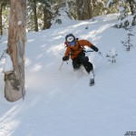
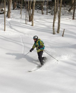
An image of Erica skiing powder in one of the glades in the Nordic and Backcountry network at Bolton Valley Resort in Vermont
E enjoying the powder in one of the glades today

Although the recent midweek storm gave a decent shot of snow to the Northern Greens, with Stowe picking up a foot of snow, and Jay Peak picking up a foot and a half, it’s still been fairly dry in general. Because of the rather high Froude Numbers for that storm, the more west-side locations of Smuggler’s Notch and Bolton Valley saw them picking up just a half foot of snow during that event, and that’s what Bolton was reporting for their seven-day total as of today. The dearth of snow and a holiday weekend had me thinking a tour on the Nordic/backcountry network was in order, because there’s some excellent snow out there, but there’s been enough time since if fell for lift-served traffic to pack it down pretty well by this point.

“Depths of powder above whatever
firmer subsurface lay below were in
the 8-12″ range, with a bit of that melt
layer in there in the lower elevations
or on south facing terrain.”

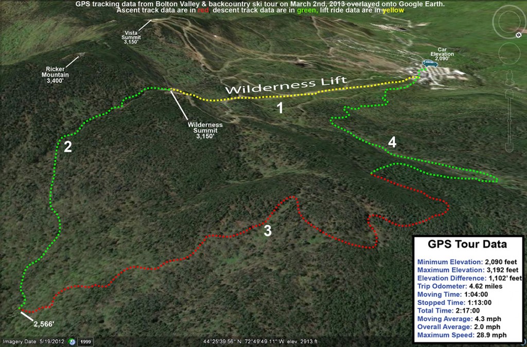
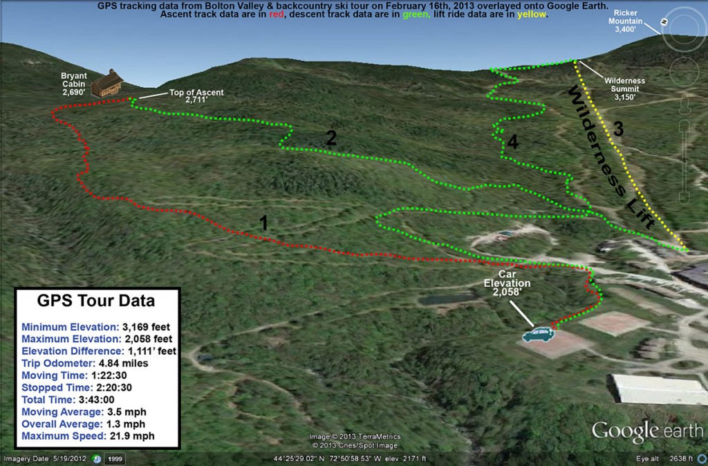
I devised a somewhat ambitious tour for today, at least with respect to what the boys might be willing to accommodate. It would be an opportunity to show E and the boys the two glades that I discovered last month on the 19th and the 27th. The plan was to skin up Bryant to the Bryant Cabin, descend through the first glade, then connect over to the alpine trail network, catch an assist from the Wilderness Lift to the Wilderness Summit, traverse out on Heavenly Highway, ski the second glade, and return to the car via the Nordic/backcountry network. If we couldn’t complete the whole tour we’d have some opportunities to truncate it as needed. The forecast called for some sun and temperatures in the 20s F today, so it looked like we wouldn’t have to worry about anyone getting cold too quickly.

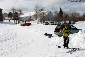
An image of our car parked along the edge of the Broadway trail in Bolton Valley's Nordic skiing area with Erica unloading backcountry ski gear in preparation for a ski tour
Unloading and preparing the gear along Broadway

We arrived up in the Bolton Valley Village in the late morning period, and the main parking lots were getting pretty full, but we were able to get a trailside spot right on World Cup in the lower tennis court lot. There were plenty of people about as we began our ascent, including a number participating in the “Bolton to the Barns” event. We ran into Alex, one of my former students on his descent with the event group, and learned that he is now at Tufts Medical School, although he seemed very happy to be back in Vermont visiting Bolton Valley. Dylan asked for just one break on the ascent, and we pulled over into the sunshine along the top section of World Cup and had a snack.

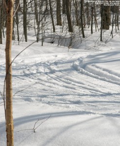
An image of the World Cup Nordic Trail at the Bolton Valley Cross Country Ski Center in Vermont
Admiring the beautiful conditions in the World Cup Nordic trail as we pause for a snack on our way up to Bryant Cabin

Near the start of our tour when we’d passed by the Courtside 1 Condos on Broadway, we ran into a Nordic skier who was pausing there. She inquired about the substantial width of E’s fat skis, and E indicated that they were for powder skiing. The woman seemed puzzled because as far as she could tell there was no powder around. She wished us luck on finding powder, but you could tell she figured it was a lost cause. It was very interesting to hear her speak that way when just a few feet away from her off the side of the trail, you could see the powder sitting there. People certainly have some unique perspectives on snow conditions. As a Nordic skier, perhaps she’s got a totally different idea of what powder snow actually is, or she may have just been oblivious to what conditions were like off the groomed runs of the Nordic trails. Anyway, in terms of the actual snow conditions, out near the car a bit above the 2,000′ mark there were 2 to 3 inches of fluffy snow above a bit of a melt/sun crust, but I suspected that crust would disappear as we got out of exposed areas and headed up in elevation. Indeed, pretty quickly in shaded areas I found that the powder was deeper and the melt crust underneath was disappearing, and after a few hundred feet of ascent it was essentially gone. Depths of powder above whatever firmer subsurface lay below were in the 8-12″ range, with a bit of that melt layer in there in the lower elevations or on south facing terrain.

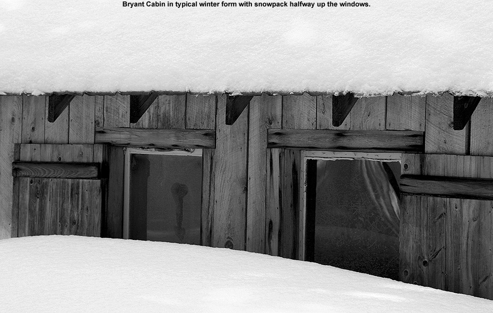
An image of Bryant Cabin in the Bolton Valley backcountry showing the snow depth outside reaching halfway up the windows
Snowy Bryant Cabin

An image of a thermos and cup sitting in powder snow outside the Bryant Lodge on the backcountry trail network at Bolton Valley Ski Resort in VermontWe found the Bryant Cabin in use with the woodstove pushing a fragrant plume of smoke out the chimney. When we talked to one of the guys using the cabin, he said that the resort is no longer renting it or regulating the usage; you can just use it on a first come, first serve basis. I’m guessing that also means that they aren’t supplying wood, which is why we frequently saw him browsing around for dead stuff to throw on the fire. Some people may have loved the idea of this, and have wondered if they should get a prefab log cabin of their own. For us, it was a place to rest for a bit. We sat down and had lunch off to the side of the cabin clearing, and enjoyed hot soup, cocoa, and other items we’d brought. Various groups of skiers made their way past while we were there; it was probably one of the busier days I’ve seen out there on the backcountry network, and it was nice that all the people were out supporting the use of the trail system. Hopefully the initiative to buy the land with the help of Vermont Land Trust will go through and people will be able to continue enjoying it as public land.

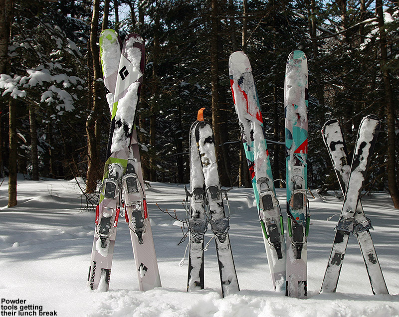
An image of Black Diamond AMPerage, Black Diamond Element, and two pairs of Volkl Gotama Junior skis mounted with Telemark bindings and sitting in the snow near the Bryant Cabin on the Bolton Valley Backcountry Network in Vermont
The Tele powder boards hanging out at lunch

“We found the Bryant Cabin
in use with the woodstove
pushing a fragrant plume
of smoke out the chimney.”

Our first descent was in the North Slope and Gardiner’s Lane areas, and the powder was very good in the upper elevations. On our first pitch dropping from North Slope, conditions were just right so that both Ty and Dylan made some nice Telemark turns. Later, Ty dropped a nice Telemark-style jump turn launching off one of the steeper pitches, and he was very proud of that. The boys threw in a good amount of alpine turns, especially when they wanted to go faster, but it was all around great practice for them. Like I’d noticed on our ascent, the last couple hundred vertical of the descent featured some of that melt crust below the powder. We were on a south-facing slope, so that certainly wasn’t surprising. I found my fat AMPerages to be really helpful in that terrain, and E had some nice turns on her Elements, but she’s still finding them hard to get up on edge in packed snow due to their width. We’re wondering if the play in her boots is just too much and it’s ruining the ability to convey the necessary pressure into the ski.

We connected over to the Wilderness Double Chair and took it to the Wilderness Summit as planned, but Ty was pretty insistent on a quick descent without additional skinning. So instead of heading across on Heavenly Highway to drop through the second glade I’d chosen for the day, we opted to descend on Peggy Dow’s to quickly get to Snow Hole. There was decent powder in Snow Hole, although it was certainly more tracked and packed than what we’d seen in the backcountry glades. I got off to the sides of the main route a good deal though and got a number of fresh lines, and at times the boys would follow me. We did make a good connection back onto the Nordic network and caught a few final turns on the Telemark Practice Slope and other lower mountain glade areas before heading back to the car. We’ll be planning another tour at some point to catch that second glade; I still want to show it to E and the boys.

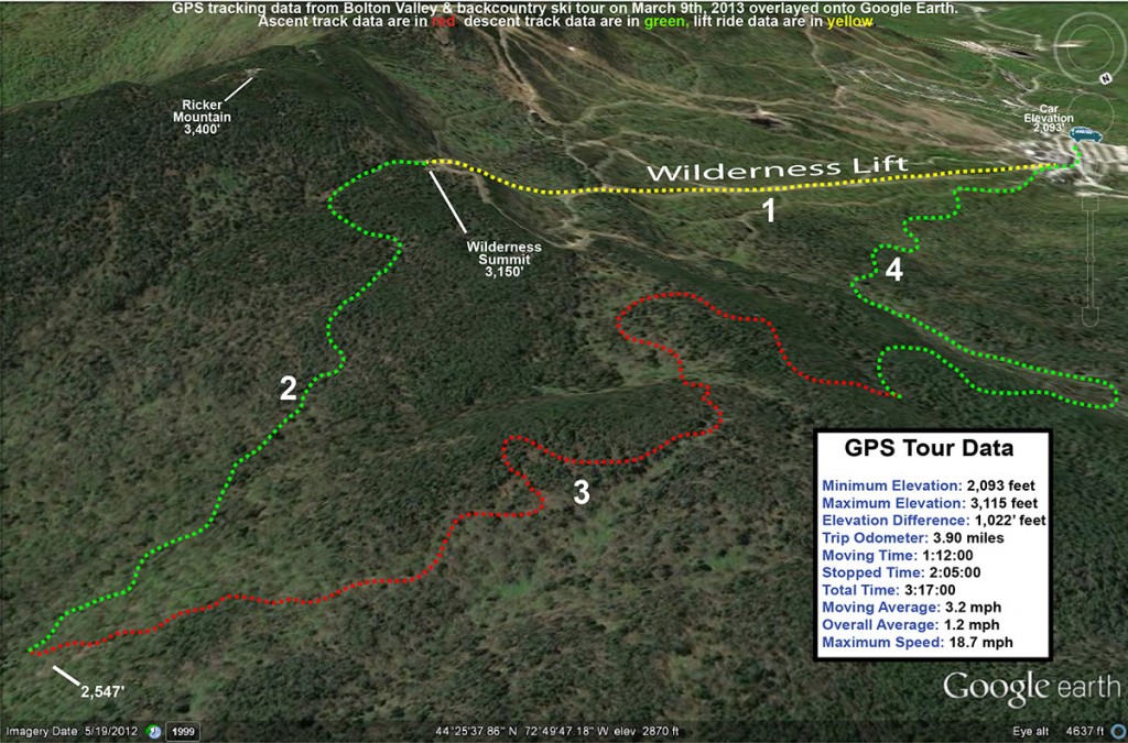
An image of a Google Earth map showing the GPS track of a ski tour on the alpine, Nordic, and backcountry areas at Bolton Valley Resort in Vermont on February 16th, 2013
A map of today’s combined alpine, Nordic, and backcountry tour at Bolton Valley – click for full-size image

Our next shot at snow appears to be coming into the area in the Tuesday timeframe. It looks like it’s going to be a pretty standard frontal passage at face value without much fanfare in terms of snowfall, but there is definitely the potential for some upslope snow. The crew at the National Weather Service Office in Burlington has had their eyes on the potential, and Powderfreak has been watching as well. We’re hoping for that snowfall boost from the upslope snow, because there isn’t much forecast in terms of synoptic snowstorms in the immediate future.

Bolton Valley Nordic/Backcountry, VT 27JAN2013

An image of ski tracks in powder on the backcountry network at Bolton Valley Resort in Vermont
Making tracks in the Bolton Valley backcountry today

We’ve had arctic air in the Northeast all week, which has made it one of the coldest and driest periods of the season.  With the lack of moisture there’s been only an inch of snow at the house in the past seven days, and although Bolton Valley was reporting a similar accumulation, they had picked up a few inches since I was last there for my backcountry outing on the 19th.  I also suspect they’ve picked up various small accumulations of dry arctic snow similar to what we’ve seen down here at the house, but they haven’t hit that one inch threshold for the snow report.  Although still rather cold this weekend, temperatures have definitely moderated somewhat from the beginning of the week… when high temperatures actually remained below zero in many locations.  Yesterday we topped out around 15 F down here at the house (495’), and the afternoon temperature was sitting around 4 F up in the Bolton Valley Village (2,100’).  Today we actually got up around 20 F at the house, and when I arrived at the Village in the mid afternoon, the temperature was a reasonable 12 F.  The arctic air is definitely waning.  Although I wasn’t planning on doing too much skiing this weekend with the combination of air temperature and minimal new snow, I at least wanted to get out one day for a tour.  I almost got one in yesterday, but ran out of time since we were having James and the kids over for the evening.  However, E and Claire cancelled our BJAMS ski program at Stowe today due to the forecast temperatures, so it gave me the opportunity to get in an afternoon tour.  I think today actually worked out to be the better ski day of the weekend, since it was almost 10 F warmer up on the mountain, and we had sunny skies in contrast to a bit of gray yesterday afternoon.

“It was surprising to think
that the snow was holding
pat after such a dry week,
let alone improving.”

Last weekend’s outing on the backcountry network was fun, since the powder was decent, but also fruitful in that I discovered a nice new glade in an area I hadn’t previously visited.  That discovery really wasn’t planned, but since it worked out well I figured I’d go with a similar theme today; my goal was to check out a descent off Heavenly Highway in the Moose Glen area.  It’s an area that E and the boys and I have wanted to explore for a while.  Since the boys were a bit under the weather and they weren’t going to head out in the cold temperatures, it was another solo outing for me.  I find these solo outings work well for reconnaissance though, because I can move quickly and efficiently and explore a lot of terrain relative to when we’ve got the boys along.

“As I slid through that last run in
the powder, my feet felt really quick.
I guess that’s the best way to describe
it; the pitch of the slope, the depth of
the powder, and the length and width of
my skis all just came together to make
everything work for Telemark turns.”

Once again, despite the chilly temperatures and dearth of fresh snow, the main parking lots up in the Village were pretty full, so the resort was getting a lot of visitors.  On piste conditions are actually pretty good based on what I’ve seen though, as the arctic air appears to be preserving packed powder surfaces very nicely.  I’ve been sort of down on the arctic air that’s been hanging around because it doesn’t bring fresh powder for skiing, but boy does it do a heck of a job on snow preservation.  Even though new snow has been minimal in the past week, I could tell that the quality of the snow on the ground had improved as soon as I began my ascent today.  I saw a bunch of Telemark skiers working on turns on the Telemark Practice Slope, and even though that was a tracked area and they were often on the subsurface below the powder, the turns were very quiet.  As I probed around and checked depths during my trip up the Bryant Trail, I could tell first hand that the subsurface had improved since last weekend.  Presumably that ultra dry arctic air has been working on it, because it was even more crumbly and Styrofoam-like than last weekend.  The conditions also seemed to be bolstered by additional powder.  Whereas last weekend I found 3 to 4 inches at the 2,100’ level and 6” up at 2,700 at the Bryant Cabin, today I found roughly 5 inches at the base elevations and 7 to 8 inches at the cabin.  It was surprising to think that the snow was holding pat after such a dry week, let alone improving.

An image of drifted snow along the edge of the Bryant Trail on the Nordic/Backcountry network at Bolton Valley Ski Resort in Vermont
Along the Bryant Trail

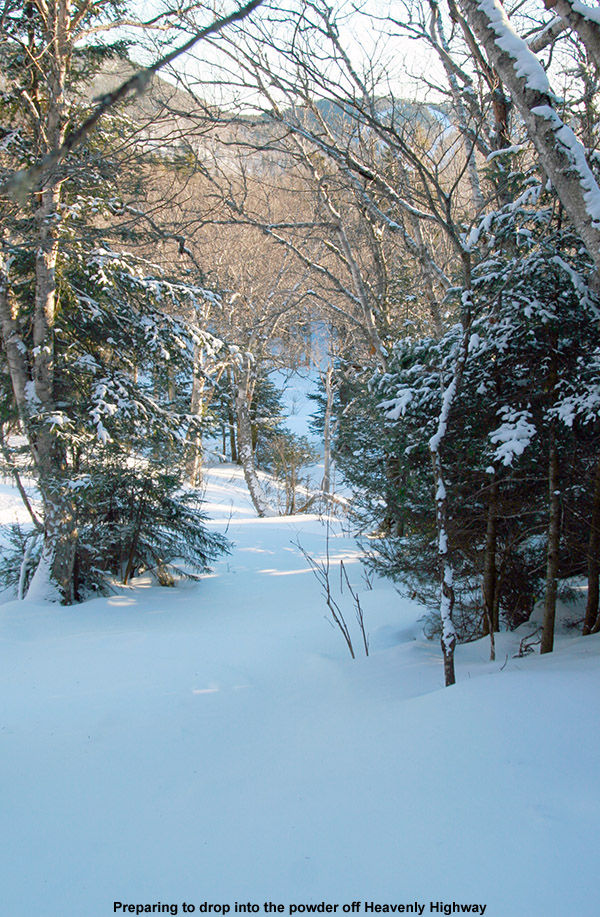
My ascent went smoothly, and I saw a few other groups of skiers here and there having fun in the good snow.  After reaching the Bryant Cabin, I continued on up to Heavenly Highway, and once I got up to around the 3,000’ elevation I could really see just how well preserved things were at those elevations.  In protected areas, the evergreens were still coated in white like snow had just fallen.  I finally switched to descent mode in the Moose Glen area, where below me sat a nice open, untracked line powder line.  The pitch looked perfect for the 6 to 8 inches of medium-weight arctic fluff that it held, and I could see the exact line I wanted to take.  As I sat there contemplating those first turns, there was an almost tangible excitement in seeing if the snow was going to deliver.  As good as the snow can seem on the ascent, making those turns is really where the rubber meets the road.

I dropped in and the turns were smooth and effortless; there was still the occasional touch on the subsurface, but indeed the conditions had taken quite a leap since last weekend.  There were a couple old tracks from previous skiers to give me an idea of where to go on the descent, but I also let the lay of the land dictate the route.  A number of clear areas offering nice turns, but I could tell that many more shots would be available if the snowpack was bumped up a foot or two.  After some consolidation and this dry January spell, snowpack depth at the Mt. Mansfield Stake is about a foot below average, so typically some of those areas with brush would be covered by now.  Hopefully we can do some catching up on snow depth in the next couple of months.

An image looking down at an untracked powder line from Heavenly Highway in the Moose Glen area on the Nordic & Backcountry Ski Network at Bolton Valley Ski Resort in Vermont
Getting ready to drop in

I continued downward in a general southerly direction and entered an area of flat terrain among evergreens.  I could tell that it was a bit of a shelf with land sloping off to the south.  There was a clearly cut route that entered the area, but the ski tracks that had led me there disappeared.  After a few minutes of poking around, I was happy to find that my instincts had led me in the right direction.  There was a nicely made glade dropping down the initial steep slope, and then in mellowed out into a large, sparsely treed area with lines everywhere.  I enjoyed a lot of good turns in there, and I eventually found that it had led me right down in Snow Hole, which without the Wilderness Lift running, didn’t have many ski tracks.  I was really appreciating the consistency of the snow in Snow Hole – the powder was just perfect for the pitch; it was dry, but somewhere just on the dry side of medium in density, and the floatation was great.

When I came to the fork indicating the route over to the Wilderness Lift, I opted to check out the right option instead, and quickly found myself on Gardiner’s Lane.  I was really liking the overall setup of this descent, gaining that extra elevation above the Bryant Cabin had already given it that extra boost of vertical, and I knew I still had some good turns to go.  On World Cup I headed past the glades adjacent to the Telemark Practice Slope, since I could see that they had seen a number of skiers, and continued on until I got to some additional untracked lines.  The woods are pretty open there, so there was no need for a specific glade to get some really nice turns.

As I slid through that last run in the powder, my feet felt really quick. I guess that’s the best way to describe it; the pitch of the slope, the depth of the powder, and the length and width of my skis all just came together to make everything work for Telemark turns.  I’d say that was really just the pinnacle in terms of that feeling, but all day today I felt good on the AMPerages.  After the way they’d felt slow at times last weekend when I hit the Bruce Trail, I was tempted to switch to my narrower-waisted RT-86s today for a faster feel with a potentially firmer base.  In the end I decided that I wanted the float of the AMPerages, and I’m glad I went that route.  Whether it was that improvement in the powder, the subsurface, the snow density, or just the lines I hit today, they were the tool of choice.

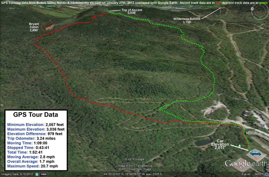
This is a Google Earth map with GPS tracking data for a ski tour on the Nordic/Backcountry network at Bolton Valley Ski Resort in Vermont
GPS tracking data for today’s Bolton Valley Nordic/backcountry tour – click for full size map

It was getting close to 5:00 P.M. before I was done with my tour, and now that we’re over a month past the solstice, I’m definitely noticing (and thankful for) that longer light.  We’ve also got some warmer temperatures coming in the next few days, with a dramatic change in the weather pattern this week.  A storm is coming in tomorrow that is forecast to deliver a modest 2-4” type of snowfall, but that is going to feel like a lot after only arctic dustings over the past week or so.  We’re also expected to go above freezing with the next round of the storm as it cuts to the west, but hopefully we’ll get some additional snow on the back side.  We could be into a more active pattern going into next weekend, which would be nice to build the snowpack after these January doldrums.  With that said, I’ve certainly got a new found respect for what these arctic weather conditions can do for the snowpack, so if we do get another round of that weather, the skiing could be good as long as we can get at least some snow to go with it.

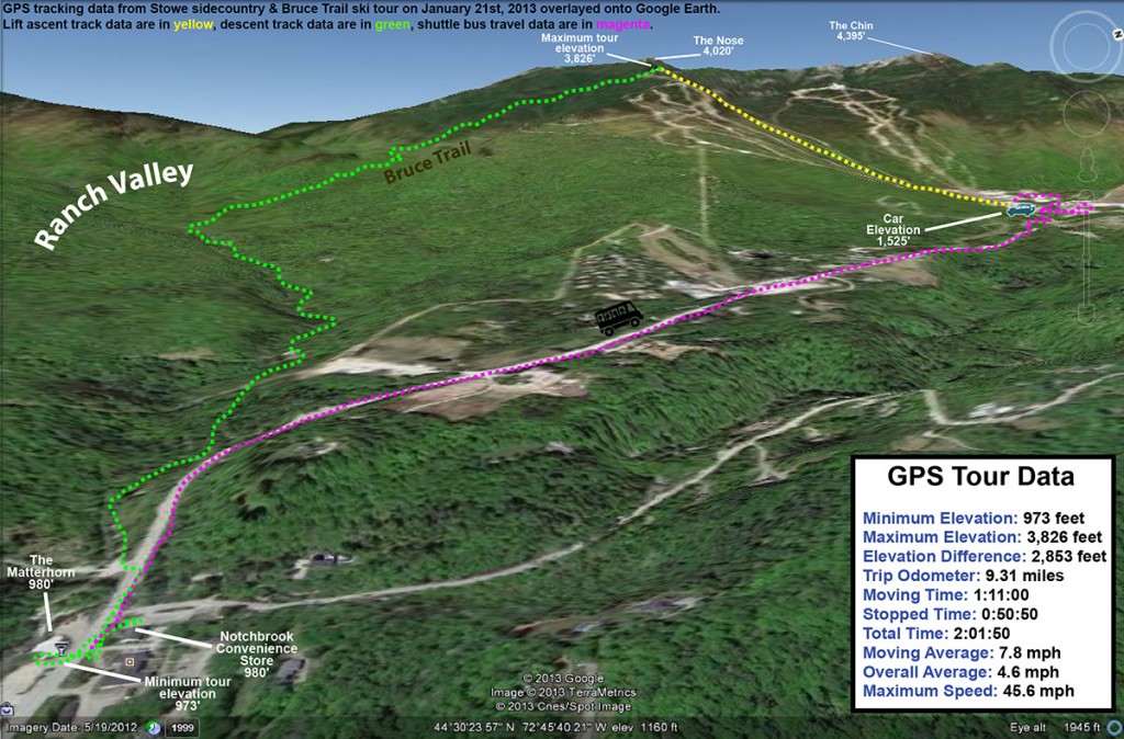
Stowe sidecountry & Bruce Trail, VT 21JAN2013

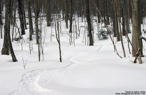
An image of a ski track in powder along the edge of the Bruce Trail near Stowe Mountain Resort in Vermont
Powder along the Bruce

Some of the Northern Vermont ski areas have picked up close to (or in the case of Jay Peak, substantially more than) a foot of snow in the past seven days, and while that’s actually a fairly modest pace for snow accrual in the mountains this time of year, it’s helped to get surfaces back to packed powder since they hardened up last week.  The snow has generally been dry and fluffy, so even with all that accumulation it hasn’t been a thorough resurfacing for all slopes.  However, my explorations Saturday on the Bolton Valley Backcountry Network revealed that the powder is building and there are some nice turns to be had.  Temperatures were expected to be in the single digits in the highest elevations today, so it seemed like a good opportunity for some sidecountry exploration instead of riding lifts.  And, since Claire and I have been talking about bringing our Stowe ski group for a trip on the Bruce Trail one of these days, this seemed like an excellent opportunity for some reconnaissance.  There’s no doubt that everyone in the group is ready for the skiing on the Bruce, but I still wanted to familiarize myself with the route to ensure that the trip would go smoothly with all the boys in tow.

“In general, I found 6 to 7
inches of powder down to
the 2,000’ elevation, and
at some point below there
it dropped down more
toward the 5-inch range.”

Temperatures hovered right around 10 F all the way to the base of the resort, and there was sun and no wind, so it wasn’t feeling too frigid at the point.  The resort had snow guns going on various trails, no doubt taking advantage of the temperatures to bolster base depths that were probably brought down a bit by the warmth earlier in the month.  I rode the Fourrunner Quad with a guy who had already been out for some runs, and he said the conditions were quite good.  Listening to the turns of the skiers below us, it did sound pretty quiet.  I could see the occasional icy spot, but the surface seemed to be mostly packed powder just as the snow report had indicated.  The snow over the past week has definitely been having an effect in terms of softening up surfaces.

“While I’m sure the steeper
top sections of the Bruce are
great with a good dump of
snow, the skiing today was far
superior once I got down out
of the evergreens and into the
hardwood forest.”

From the quad summit I headed over to the top of the Bruce Trail – a few tracks indicated that some skiers had already skied it today, but I dropped in via an alternate entrance to get an untracked line.  The line was pretty steep and I was definitely touching down on the subsurface, but I could tell that I’d be able to get in some good powder turns on some lower angle terrain.  The top part of the Bruce wasn’t really all that inspiring today – it’s pretty steep, a lot of pitches face southward, and it’s narrower than I’d thought it would be.  I’d say it’s only 10 to 12 feet wide on average in the upper sections, which means that in reality it’s going to be tracked out and packed down after just a few skiers hit it.  With its somewhat southern aspect making for spots of poor coverage here and there, it skied even narrower today.  The snow was generally skier packed, so my fat Telemark skis were indeed feeling slow edge to edge, and I had to throw in a good number of alpine turns to fit in some of those small spaces dictated by the trail width and coverage.

An image of ski tracks in powder among trees along the Bruce Trail in the sidecountry of Stowe Mountain Resort in Vermont
Catching turns down in the lower elevations among the hardwoods

While I’m sure the steeper top sections of the Bruce are great with a good dump of snow, the skiing today was far superior once I got down out of the evergreens and into the hardwood forest.  The trail is notably wider in that area, and there are a lot more glade options for venturing off the sides of the main route.  In general, I found 6 to 7 inches of powder down to the 2,000’ elevation, and at some point below there it dropped down more toward the 5-inch range.  All those depths were definitely enough for some nice powder turns on moderate angle terrain though.  With the narrow nature of the Bruce Trail in the top sections, it’s really not a trail that’s going to offer up much in terms of fresh powder, so those looking for a sidecountry experience with real untracked snow would probably be best served by using the Bruce as a jumping off point for explorations of the Ranch Valley.  The snowpack isn’t even especially deep right now (right around the 40” mark), but I could see a multitude of ski options all around during my descent.  I noted a couple of potential areas for exploration up in the evergreen areas, but choices really exploded once down in the hardwoods.  It would be easy to make a day of it out there, or, ski the resort in the morning and then tour out in the Ranch Valley in the afternoon and finish off the day by skiing out to Route 108.

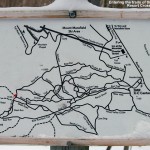
An image of the trail map for  the Stowe Mountain Resort Cross Country Ski Center
Stowe XC Map – Click for full size image

At around the 1,500’ elevation, I entered the trails of the Stowe Mountain Resort Cross Country Ski Center.  This is the part I’d been concerned about in terms of making the correct choices to get out to Route 108 and the Matterhorn.  It turns out that it’s much easier than I’d thought; you simply stay on the Bruce, and Burt Trails, following the signs that say “Ski Lift”.  Even though you may not be planning to head back to the Toll House Lift, those “Ski Lift” signs are the way to go.  Eventually you’ll get to a junction where following the “Ski Lift” route is a very obvious (and somewhat arduous looking) uphill, so you won’t want to go that way.  By that point there are signs that indicate “Route 108”, and those will get you right out to the Matterhorn area.  At every intersection you essentially go straight through, so in a worst case scenario, go with that.  The trek through Stowe’s Nordic trails, and a small portion of the trails that belong to the Trapp Family Lodge Cross Country Ski Center, is slightly downhill, but there’s plenty of poling and skating to be done.  I was happy to have my Telemark gear, even if I looked funny with my skis being three times the width of the other Nordic skiers ambling around on the trails.  I generally took it slow and enjoyed the scenery, which included some marvelous views of the Ranch Brook.  The brook had that winter look with some flowing water, but also lots of ice, and snow pillows covering the rocks.

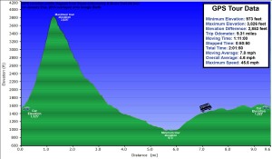
A Google Earth GPS elevation profile showing a ski tour on the Bruce trail near Stowe Mountain Resort in Vermont
Elevation profile of today’s tour – click for full size image

The final leg of the descent on Ranch Brook Road brings your right out on the “Ski Inn” driveway, next door to the Matterhorn, and across the street from The Notchbrook Convenience Store.  I had time before the next uphill Mountain Road Shuttle arrived, so I stopped into the Matterhorn to get some sushi… only to discover that they don’t have sushi on Mondays.  Clearly I’m going to have to hit the Bruce again with the boys on a different day so that we can finish that part of the adventure.  So instead, I popped across the street to the store and got a snack before catching the shuttle back up to my car in the Mt. Mansfield lot.  One thing I should note about the shuttle – the ski slots on the outside are still fairly old school, so if you’ve got fat and/or twin tip skis, you might have to bring them on the bus with you.  Apparently that happens a lot, because the driver immediately knew what my issue was when I inquired.  Missing out on the sushi, I did stop off at Harvest Market for a couple of samosas on the way home, and that definitely filled the void.  So, today’s outing offered up some good turns in the powder, and was certainly a successful reconnaissance.  The route down to the Matterhorn is easy, and I can tell that the biggest hurdle is going to be getting the boys through the flatter terrain at the end of the run.  If that’s the toughest part we have to deal with though, it should be a lot of fun.

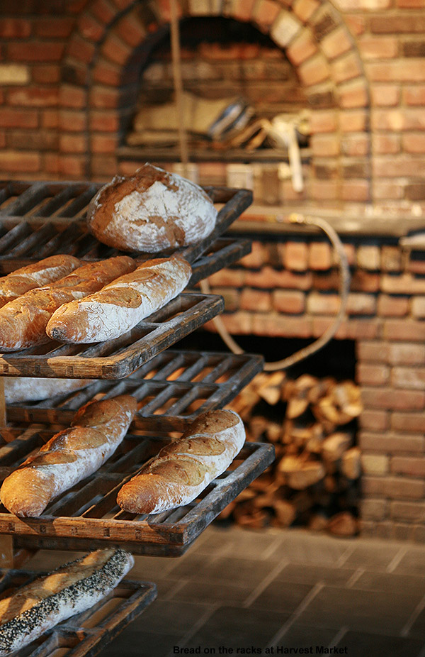
An image of bread on racks with firewood and bricks in the background at Harvest Market in Stowe, Vermont
Harvest Market

Weather-wise, the day turned out much warmer than the forecast seemed to suggest – it was 20 F once I was back down in the valley, and before I’d realized that, I couldn’t figure out why it felt so comfortable.  The sunny skies from earlier in the day had clouded over ahead of another small snowfall event that’s supposed to hit us tonight into tomorrow – these are the sorts of storms we’ve got for now until something bigger comes along, but at least we’re getting something.

A Google Earth GPS track showing a ski tour on the Bruce trail near Stowe Mountain Resort in Vermont
Today’s Tour viewed in Google Earth – Click for full size image

Bolton Valley Nordic/Backcountry 19JAN2013

An image of ski tracks in powder descending from the North Slope trail on the Nordic & Backcountry network at Bolton Valley Resort in Vermont
Heading off into the powder below North Slope today

It was a lot of fun skiing in the soft snow and warm temperatures last weekend, but winter is definitely back now.  Temperatures dropped down closer to seasonable levels at the beginning of the week, and then the bottom fell out toward the end of the week as we dropped below zero F Thursday night with an arctic frontal passage.  Fortunately, we’ve also had some modest shots of snow to start freshening the snowpack, and temperatures were back up to around 30 F in the mountains today, so it did seem like a good opportunity to get out for some turns and exercise.  Stowe is reporting 8” of snow since Wednesday, and the skiing looks great based on the pictures that Powderfreak posted in the ski thread and the Northern New England thread at the American Weather Forum today. Bolton Valley is also reporting 5” of new snow during the period.  Although I’m thinking of waiting until we hit roughly the one foot mark before checking out the lift served terrain, it did seem like we’d seen enough new snow in the past few days to provide some decent backcountry turns.

“…I found 3 to 4 inches of fluff
down at the Village level, and
that gradually increased to the
4 to 6 inch range by the time I
got up to the Bryant Cabin at
around 2,700’.”

With all that in mind, I decided to hit the mountain for a quick tour up to the Bryant Cabin and back through whatever terrain seemed fitting for the conditions.  We’d reached the mid 30s F down at the house (495’) when I headed out around 2:00 P.M., but up in the Village at 2,100’ it was just 31 F.  There certainly hasn’t been enough snowfall yet to really resurface the slopes and get the on piste conditions back to normal, so I couldn’t believe how the Village parking lots were virtually full.  I wasn’t even able to get a parking spot in the upper tennis court lot like I usually do because it was full, but the lower tennis court lot had a decent number of spaces, and I was still able to park trailside along Broadway.  The resort was hopping though, so I guess the holiday weekend and the comfortable weather are enough to make people really want to get out there.  Overall that’s great for the resort of course.

“Indeed the turns in the powder
were silky, especially when
aided by the width of my
AMPerages, and it was nice
to feel that float again.”

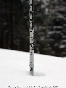
In terms of unconsolidated snow above the old base, I found 3 to 4 inches of fluff down at the Village level, and that gradually increased to the 4 to 6 inch range by the time I got up to the Bryant Cabin at around 2,700’.  Coverage on the Bryant Trail was generally fine, although a couple of the stream crossings had only recently filled back in after presumably being blown out a bit with running water during the warm spell.  Traffic out in the Bryant area was pretty light once I was up above the Nordic trails – I saw a couple of skiers descending and a couple groups coming down on snowshoes.  The air was generally calm, although you could occasionally hear some gentle gusts of wind up in the peaks.  We’ve got another system and arctic frontal boundary coming through tomorrow, so there was that feeling of being between systems.

An image of Bryant Cabin on the Bolton Vally Nordic & Backcountry network at Bolton Vally ski resort in Vermont
Bryant Cabin

There was nobody in the Bryant Cabin area when I arrived there, and it was very quiet as I made my way past and stopped at the top of Gardiner’s Lane.  I could see some of the glades above me, and the look of the powder up there was very appealing, but I could tell by the tracks of a couple of other skiers up there that the new snow wasn’t quite deep enough to really make the turns bottomless.  As I was stripping off my skins, I heard a little noise coming from above me in the Birch Loop direction, and soon another backcountry skier passed by and headed down Gardiner’s Lane.  I’m not sure what he’d been skiing up above, but he probably had a similar plan to mine for the terrain below – there are a lot of nice mellow options off Gardiner’s Lane that would work really well with the conditions.

An image showing a measurement of the powder snow depth atop the base outside the Bryant Cabin on the backcountry ski trail network at Bolton Valley Resort in Vermont
The powder is building.

Conditions on Gardiner’s Lane were packed, and a little bumpy in spots.  At the junction with North Slope, I headed up a bit to catch a nice mellow line that I knew, and I’m glad that I did.  I could see that another skier had taken in before me, and the tracks left behind suggested some nice turns.  Indeed the turns in the powder were silky, especially when aided by the width of my AMPerages, and it was nice to feel that float again.  Back on Gardiner’s Lane, I had a feeling that I was in the zone of another glade I knew, and figuring that Gardiner’s Lane itself would have seen a fair share of traffic, I decided to head on that lesser used route.  Only one other skier had passed through there, and the snow was good, but the pitch was too steep to avoid contacting the base snow.  Below there I followed a set of tracks to an area I’d never been, and found a nice long glade that brought me all the way back down to World Cup.  It’s got to be one of the longest glades I’ve seen out there.  I’m not sure how new it is in the grand scheme of the backcountry network, but it’s new to me; I can’t wait to show it to E and the boys – especially with deeper powder.  Someone did some nice work in there.  The glade starts off with some mellow terrain that was great for today’s conditions, and then it steepens out to more of an intermediate pitch.  I was even able to finish off with a run on the Telemark Practice Slope, which did have some irregularities in the subsurface snow due to previous skier traffic, but still delivered some nice turns – even a few in which I was able to stay floating in the powder.

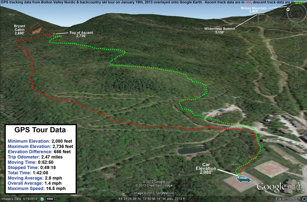
A GPS map on Google Earth showing a ski tour taken on January 19th, 2013 using the Nordic and backcountry ski network at Bolton Valley Resort in Vermont
GPS Track of today’s tour on Google Earth

Overall I’d say that that part of the run in the new glade was a good description of the general conditions out there – you can get some bottomless turns (especially with the help of fat powder boards) on the mellower green-style terrain, but on intermediate pitches and above you’re going to be touching bottom a lot.  It was definitely worth a tour out there today though, and if we get a few more inches as the next system passes through tomorrow, it’s going to be even better.

Bolton Valley Nordic/Backcountry & Bolton Mountain 20FEB2012

An image of evergreens caked and buried with powder snow along the Catamount Ski Trail north of Bolton Valley Ski Resort in Vermont
Despite this winter’s low snowfall so far, the snowpack is quite deep along the high elevations of the Catamount Ski Trail and Bolton Valley’s backcountry network.

A little fresh snow fell when we were out on our tour in the Bolton Valley backcountry yesterday, but in general we’ve been in between systems over the past couple days.  That’s presented a great opportunity to explore the backcountry with the boys though, and yesterday they completed their longest tour to date as we took them out to one of the glades along the Catamount Trail.  E and the boys had to head back to school today, but I had the holiday off and decided to do a tour similar to yesterday’s, with some additional exploration along the Catamount Trail past the glade we’d visited.

I parked down at the edge of the tennis court lots as usual, made my way up to the Wilderness Lift, and connected over to Heavenly Highway from the Wilderness Summit.  Snow conditions were very much like yesterday – I checked the depth of the powder atop the base snow along Heavenly Highway and found it to be around 9 to 10 inches.  The big change from yesterday was that there was nobody out on the backcountry network trails – Monday afternoon on a holiday weekend must have meant that most people had already headed home.

“It was so quiet that even
the nearly silent shuffling
of my skins through the snow
had me feeling like a marching
band crashing through a
sleepy town in the
middle of the night.”

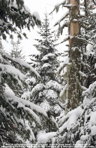
Once past that first glade along the Catamount Trail, I was into what was for me, uncharted territory.  I continued along the trail, which gradually rose as it headed generally north-northwest toward Bolton Mountain.  One of the most impressive aspects of this part of the trail was seeing the impressive depths of snow that have built up, in what has really been a very low season for snowfall.  The general area below the Catamount Trail junction with Raven’s Wind, which is sheltered like parts of Heavenly Highway, revealed evergreens that were just choked, buried, and ensconced with snow.  Around every corner I was finding fantastic, gravity-defying deposits of powder.  Once past the junction with Raven’s Wind, which marks the last outpost of Bolton’s backcountry network, the Catamount Trail began to level off and skirt along the eastern edge of Bolton Mountain.  At over 3,300’ in elevation, this area marks the highest point on the entire Catamount Trail.

An image of ski tracks in powder snow above the Cotton Brook area connected to the Catamount Ski Trail and Bolton Valley's backcountry ski network in Vermont
Ski tracks leading to the Cotton Brook area provide a rough sense of the snow conditions out along the Catamount Trail today.

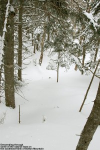
I contoured along the southeast face of Bolton Mountain as the trail switched to a northeasterly direction; I couldn’t see the summit of Bolton Mountain (3,680’) through all the evergreens, but the steep rise in the terrain off to my left let me know that it was looming up there about 400’ vertical feet above me.  As I continued to scan the elevated terrain to my left, I quickly noticed that the density of the evergreens had become sparser, and I began to see potential ski lines through the trees.  I eventually decided that I’d gone far enough out on the trail for the day, and chose a spot to ascend a bit and see if I could start my descent up in the trees above me.  The terrain was fairly steep, but there was that consolidated base below that top layer of powder, so I wasn’t wallowing in bottomless fluff as I broke trail.  With the evergreens all around me, the air was deathly still.  It was so quiet that even the nearly silent shuffling of my skins through the snow had me feeling like a marching band crashing through a sleepy town in the middle of the night.  I continued generally westward and upward, following what looked to be the most open lines through the trees.  The terrain began to flatten out ahead of me, and I could see on my GPS that I was approaching the Long Trail along the ridgeline; I decided that that was a good goal to mark as my turnaround point.  I know that I was very close to meeting up with the trail when I finally stopped my ascent, as I was definitely on the ridgeline and the land clearly began to drop off to the west.  I was tempted to go a little farther and make the trail connection, but it just didn’t seem worth it to lose elevation.  It was after 3:00 P.M., I was well away from the Catamount Trail, and I was alone.  It was at least generally downhill back to the Catamount Trail from my location, and there was no need to push my luck.

“Some trees even displayed that
hanging moss that I’ve often seen
in the mountains of the Pacific
Northwest and British Columbia…”

I stripped off my skins and reversed my course, traveling along generally flat, ridgeline terrain at first, and negotiation a steep south-facing gully as well.  When I’d finished crossing the flattest terrain and could see that I was about to begin the descent to the Catamount Trail, I stopped in a comfortable spot and pulled out some of my food supplies.  I ate a Clif Bar and had a couple rounds of the hot tomato soup that I’d packed in my thermos like yesterday.  That absolutely hit the spot.  I definitely needed the recharge after throwing in all that extra trail breaking on top of the ascent of the Catamount Trail.  The energy expenditure had been enough that I was getting a bit drained, and I definitely wanted something in the tank for the descent.  Once I stopped moving, the silence around me was redoubled, and it was indeed eerily quiet.  Such is the scene at times when one is alone in the deep woods of winter.

An image of a ski line through the trees above the Catamount Trail on Bolton Mountain, north of Bolton Valley Ski Resort in Vermont
Catching a line through the trees high on Bolton Mountain

I packed up my food and gear and began the real descent through the evergreens.  There were indeed some reasonably open spaces and nice turns, but it was steep enough that it really would have been better with deeper powder for the available tree spacing.  The 9 to 10 inches that were there were OK, but I’d say something around 18 inches would be more appropriate.  And, although the natural lines through the trees were good, they could be dramatically enhanced just by clearing off the all the dead branches that were still on the lower parts of the evergreens.  That would be a great off-season project for someone to tackle, and the process could continue right on down below the Catamount Trailas well, because the terrain just keeps going.  In any event, even in its natural state I’m keeping that terrain in mind for a place to visit after a reasonably big dump with depths of powder that will fit the pitch and spacing of the trees.

I popped out on the Catamount Trail and had begun to head back toward the resort, when I ran into the first pair of people I’d seen all day.  It was a couple of younger guys, and they asked me if I knew the area.  I said that I knew it fairly well, but when they asked me what lay to the north of where we were, I told them that that was out of my range of knowledge – I was currently the farthest north I’d ever been on this section of trail.  In terms of descents, I said that I’d recommend descending back in the Cotton Brook area if they were unsure of where they were, because I knew that one could ascend back out of there quite easily.  It was likely that one could traverse and get out from areas to the north as well, but one never knows just what the terrain would be like until they’re actually in there.  I’m not sure what they ended up doing, but since it was well after 3:00 P.M. by that point, I hope they made an appropriate choice.

An image of evergreens with snow and some hanging moss along the Catamount Trail north of Bolton Valley Ski Resort in Vermont
Views of countless snow-covered evergreens and even hanging moss as I travel through the high elevations of the Catamount Trail

I was tempted to do a little extra exploration on my return trip, especially as I looked at the vast expanse of evergreens below me.  Some trees even displayed that hanging moss that I’ve often seen in the mountains of the Pacific Northwest and British Columbia; as if the deep snowpack wasn’t enough, the sight of the moss seemed to me like a real testament to just how much precipitation falls in the higher elevations of the Northern Greens.  As much as it would have been nice to poke around, ultimately I wasn’t willing to explore a descent down into the Cotton Brook area with the time of day, so I descended back toward the resort on the Catamount Trail itself.  The trail isn’t very wide, so the descent below Raven’s Wind was quite a hoot.  Let’s just say that I’m glad that I didn’t “run” into anyone ascending at that time of day.  It’s definitely an exhilarating descent back toward the main glade though if you can catch it without any uphill traffic.  I enjoyed a descent of the main glade back toward the Cotton Brook Trail junction, but despite the decent amount of powder, the combination of tracked snow, irregular surface underneath, and some previously work by the sun, made it rather challenging and nothing special in terms of flow.  It’s definitely time for another storm.
I cruised quickly back along the Catamount Trail to the Bryant Cabin area, and headed right onto Gardiner’s Lane and North Slope.  I was determined to find that glade that I’d missed with E and the boys yesterday, and after a bit of searching, I did.  I made another mental note on the entrance to set myself up for next time, and had a fun ride down through there.  When I finally got back down to the lower Nordic trails, I saw a couple of other people, but amazingly that was it for the entire tour of almost six miles.  I can’t wait for my next chance to get out in the farther reaches of the Catamount Trail and explore it further.
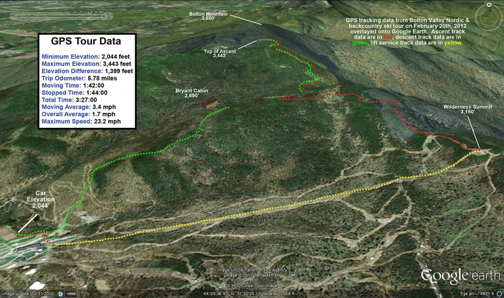
A Google Earth GPS map tracing of my tour on the Bolton Valley Nordic/backcountry network of ski trails and the Catamount Ski Trail in Vermont on February 20, 2012
The Google Earth GPS track for today’s tour

Bolton Valley Nordic & Backcountry, VT 19FEB2012

An image of Jay skiing powder in one of the glades off the Catamount Trail past Bolton Valley Ski Resort's Nordic & Backcountry terrain
Enjoying some turns in one of the glades off the Catamount Trail

During yesterday’s outing at Bolton, we found decent powder above roughly the 2,000’ level, and ended up skiing several laps off Wilderness to take advantage of the good snow.  With that in mind, we decided to head out onto the backcountry network today to get in some additional powder skiing.  The plan was to begin by riding the Wilderness Lift for a quick elevation assist, then transit on Heavenly Highway to a glade along the Catamount Trail that I’d last skied on January 22nd, 2011I’ve brought Ty out on Heavenly Highway before, but this would be the first opportunity to get out there with the whole family at once, so that aspect was very exciting.  Dylan’s touring range has grown by leaps and bounds over the past couple of seasons, and it seemed like he was ready for a tour this size.  With a planned route that would encompass 4 to 5 miles, it would likely be the longest ski tour that either of the boys had done, but with a mile of distance and 1,000’ of vertical coming from the Wilderness Lift, it seemed manageable.  The boys each got two packs of GU energy gel, which were stashed in the side pockets of their ski pants to quickly mitigate any concerns about bonking out on the tour.  The boys both like the GU (at least the vanilla bean) a lot; we’ve found it helpful for mountain biking in the off season, and it worked quite well for Dylan on our ski tour at Pico in October.

Although not quite as warm as yesterday’s highs in the 30s F, the forecast was for temperatures in the upper 20s F and generally clear skies, so weather wasn’t expected to be an issue on the tour.  The Wilderness Lift wasn’t opening until 10:00 A.M., so we had plenty of preparation time in the morning.  I cooked up a typical ski day big breakfast to ensure the boys would be maxed out on energy, and we loaded up all the gear.  Arriving up in the Village in the mid morning period, we found that the resort was hopping with holiday visitors.  I dropped E and the boys off at the ski patrol building at the base of Wilderness, and parked in the tennis court lot down along the Broadway trail.  The village lots were filling up fast, but they hadn’t overflowed into the tennis court lot yet; it was just me and a couple other cars parking for Nordic/backcountry activities.

I got my gear on and headed up to find E getting the skis ready and helping out the boys with theirs.  The boys’ Telemark skis are still in the three pin format, so getting them on can be a little tricky.  That process combined with having to negotiate a lift ride with a backcountry pack plus a child, makes it E’s least favorite part of one of these types of outings, but everyone got loaded, had a good ride, and disembarked at the Wilderness Summit without incident.  Once off the lift, E was able to relax and enjoy the rest of the tour.

We skied over to the Heavenly Highway entrance, and strapped on everyone’s skins for the undulating trip across to the Catamount Trail.  As we started along, E commented that it seemed like we could do this part without skins if we wanted, but having done parts of that myself before, I assured her that it was much more fun having the skins on.  There are enough dips and rolls that you appreciate not having to herring bone up every rise.  Dylan took point on our travels across Heavenly Highway, and actually kept a decent pace.  It wasn’t long before he decided that he wanted to remove his helmet to cool down a bit.

An image of Ty reaching up and putting his pole through a thick stack of powder atop a log on Heavenly Highway at Bolton Valley Ski Resort in Vermont
Checking out some of the thick snow formations created by the powder along Heavenly Highway

We found tremendous snow formations in the usual sheltered spots along the Heavenly Highway – some stacks of snow on the trees were two to three feet high, revealing just how much snow had built up from recent storms.  Ty probed one stack by punching his pole way up through it, and then Ty and Dylan had fun with another thick stack by knocking it off the tree to which it was attached.  Even though it’s been a low snow year, elevations up around 3,000’ have still taken on a lot of snow this season, and E was very impressed with how the snowy corridors through the trees made one feel like they were entering some sort of magical world.  It was the first time E had been up there, but I’m sure similar experiences by those in the past played a part in how the Heavenly Highway got its name.  We’d negotiated a few moderate drops in all the ups and downs of Heavenly Highway, and Ty was very proud that he’d been able to make some Telemark turns on those pitches – it’s certainly tough with the narrow confines and skins on the skis.

At the junction with Devil’s Drop we had to make a decision, whether to finish off our trip to the Catamount Trail on Heavenly Highway, or take on the quicker, but more challenging descent of Devil’s Drop trail.  I gave everyone an idea of what the two routes were like, and we all joked about the nearly polar opposite names of our two choices.  I pointed out that Heavenly Highway would finish off with terrain much like we’d seen up to that point, while Devil’s Drop was, true to its Machiavellian name, a fairly precipitous and tricky drop to negotiate on skis.  I figured that everyone would be able to handle it though, and the momentum quickly seemed to shift that way.  Before we knew it, Dylan was on his way down toward Devil’s Drop with the rest of the family in tow.  We didn’t take off our skins, which actually made the descent kind of fun as the extra friction combined to make it both difficult, sort of like day with sticky snow on the slopes, and easier, almost like having your car holding you back in low gear on a descent.  There were a couple of icy patches, and indeed the necessity of fitting skins so that one’s edges are left exposed was never demonstrated so well.  I’d say that some pitches on Devil’s Drop are easily in the range of 30 degrees or so, but fortunately the trail has switchbacks to avoid having to ski it at that pitch.  Ty did some impressive switchback short-cutting though, working his way through a steep slot that was much more challenging than I would want to take.  There are actually some nice options for skiing Devil’s Drop and getting some great powder turns, but with the time for transitioning the boys out of their skins and them back into them for the return to the ascent didn’t quite seem worth it.  Perhaps on a future trip we’ll add that feature into the tour.  At the bottom of Devil’s Drop, after what had seemed like a surprisingly challenging descent to me, I realized that I’d left my Telemark bindings in free pivot touring mode.  There’s much less stability in that mode than with the toes locked down – it explained why the drop felt extra challenging today, but I wished I’d realized it before the bottom!

Below Devil’s Drop we took a short snack break at the junction with the Catamount Trail, and I told the boys not to eat too much because we weren’t too far from our final destination where we planned to have lunch.  With our snack complete, Dylan continued on point, and led us on the Catamount Trail through the wide, flat col between the height of land containing the Devils’ Drop area to the east and the 3,300’ spur of Bolton Mountain to the west.  We cruised along through the flats thanks to Dylan’s abiding pace, entering back into the thicker trees in about 5 to 10 minutes and quickly coming to the north intersection with the Cotton Brook Trail.  There were lots of people out in that junction area today, and everyone seemed excited to see Ty and Dylan out there.  They got lots of encouragement from folks for undertaking such a substantial backcountry tour.

An image of Erica and Ty skinning up the Catamount Trail along the edge of a glade
E and Ty approach the top of our ascent along the Catamount Trail.

We came to the final leg of our ascent, and I was able to show E and the boys the glade that I was thinking of skiing with them.  Dylan continued in the lead, pushing up through the switchbacks along the glade.  I could tell that he was getting a little impatient and/or tired, but we let him know we were just minutes away from our stopping point, and he pushed on.  Ty was actually more impatient than Dylan at that point, and he clearly needed to be done with the ascent.  At the top of the glade we found a beautiful powdery spot overlooking the ski terrain and the Catamount Trail, and set everything down to have lunch.

An image of Jay having soup during lunch along the Catamount Trail
Dad finally gets that chance to sit down and enjoy lunch along the trail.

We’d packed a thermos full of tomato soup, and another full of hot chocolate, and I was really anxious to get some food and an energy recharge.  Before I could relax though, I wanted to finish putting away all the skins and preparing all the gear for the descent.  Ty and Dylan had clearly been more anxious for the end of the ascent than they were tired, because they were running around like animals having a big snowball fight, and E actually had to work on calming them down so that they weren’t too disruptive to other folks traveling on the trail.  The boys played on, but finally I’d taken care of the gear; I fashioned myself a nice soft seat in the powder, and kicked back with some hot soup.  I’d been waiting for that for quite a while.  To sweeten the scene, just as we’d arrived, it had begun to snow.  We had expected mostly clear skies earlier, but clouds moved in quickly, and before we knew it, big fat flakes were swirling all around us.  One never knows what Mother Nature will throw at them up at 3,000’ in the Northern Greens, but the beauty of the falling snow was certainly appreciated.  Sitting up there overlooking the glade with the fresh snow falling was quite a treat, and one of the folks passing by on the trail commented on what a great lunch spot it seemed to be.

An image of snow falling among the mountains and trees as viewed from the Catamount Trail beyond Bolton Valley Ski Resort in Vermont
Enjoying the snowy scene during lunch along the trail as big flakes of snow fall all around us

After a few rounds of soup, we were finally able to pull ourselves away from the superlative location for a descent of the glade.  We found several inches of powder atop the base, but I was surprised that the snow wasn’t quite up to the standards that I thought it was going to be.  There appeared to have been just enough traffic and or sun exposure that there was a bit of a crusty layer below the powder.  That made the skiing challenging in those spots, but I was able to sneak in some nice turns in areas of untracked snow.  Clearly I’m going to have to bring E and the boys back for another trip to experience the primo conditions that are often found there.

An image of Jay skiing powder in one of the glades off the Catamount Trail past Bolton Valley Ski Resort's Nordic & Backcountry terrain
Enjoying some turns in one of the glades off the Catamount Trail

Once back on the Catamount Trail, Dylan took the lead again, and I told him that he could cruise as fast as he wanted down the trail.  We came rocketing through the flats in the col, and Dylan continued to move along at a marvelous pace.  While it’s generally a gentle downhill glide, there are a few short rises and I couldn’t believe how fast we covered the ground.  The snow must have been a lot slower the last time I’d been out in that area, but before we knew it we were back at the intersection with Devil’s Drop where we’d had our first snack.  We cruised further down the trail, and as soon as Ty and Dylan saw the Bryant Cabin, they headed right toward it like a shot.  E and I hadn’t really planned to stop in there unless we needed to, but it was quickly obvious there was no way we were getting past it without a stop.  Getting a chance to play around in the cabin is clearly one of the favorite parts of these trips for Ty and Dylan.

An image of icicles outside one of the windows of the Bryant Cabin on the Nordic & backcountry network at Bolton Valley Ski Resort in Vermont
A window scene from up at the Bryant Cabin today

We pulled into the cabin, which was unoccupied and had no fire going in the woodstove, but with the fairly moderate outside temperature it was comfortable enough that the boys shed some layers.  We got into the hot chocolate and snacks for a while, and the boys played around in the upstairs area that they like so much.  We saw a couple of groups ascend the Bryant Trail and reach the cabin, but they congregated outside.  Eventually the hot chocolate was spent, and we geared up for the final descent leg of the trip to the car.

We headed out on Gardiner’s Lane and onto North Slope, and my intent was to take E and the boys down through the North Slope and Gardiner’s Lane glade combination that I’d visited a lot last season.  There hasn’t been a lot of traffic at the glade entrance though, so we sailed right past it and continued on North Slope.  We ran into Kurt Ries, who was part of a large group collecting at the top of one of the drops on North Slope.  Clearly they had a similar idea to us on this fine winter day.  Having missed the glade I’d initially planned to visit, we cut off North Slope and simply explored the woods below.  The snow was quite good, with 6+ inches of powder in many spots, and while we found a few good shots, there was nothing too outrageous in terms of providing an extensive amount of turns in open terrain.  We connected onto Gardiner’s Lane, and recounted the last time we’d skied it where Dylan had had some binding issues and I’d needed to carry him.  He talked about how much fun that had been, but I liked it better with him skiing.  We finished off with a run through the Telemark Practice Slope and the associated glades, and cruised down Broadway to the car.

A Google Earth image containing the GPS track from our ski tour on Bolton Valley's Nordic & Backcountry terrain - 19FEB2012
Today's 4.35-mile backcountry tour plotted on Google Earth, with the ascent tracks marked in red, descent tracks marked in green, and the Wilderness Lift assist marked in yellow

Checking the GPS at the car, it reported a tour length of 4.35 miles, with an overall elevation difference of 1,112’.  It was certainly the boys’ biggest tour to date, and they continued to have energy at the end because they were quickly playing on top of the snowbanks in the parking lot while E and I packed up the gear.  E said that she had a great time with her first trip on Heavenly Highway and the Catamount Trail beyond Bryant Cabin, and we saw plenty of opportunities for more exploration.  Hopefully next time we can get even softer conditions and nail the route through those lower glades.

Bolton Valley Nordic & Backcountry, VT 21JAN2012

An image of Ty skiing a glade below the Heavenly Highway trail on the Nordic/backcountry network at Bolton Valley Ski Resort in Vermont
Ty glides through some Champlain Powder today in a glade below Heavenly Highway.

There was some warmth in the area in the early part of the week that put a crust on snow surfaces, but then the mountains picked up in excess of a half foot of snow in the Thursday/Friday storm, and that remedied the issue pretty quickly.  And, although the current storm has been focused down along the south coast of New England, the local Northern Vermont resorts reported another 2 to 3 inches of fluff to top the powder off further.  This latest addition was extremely dry snow, classic Champlain Powder™.  With only about 8 inches or so of new snow atop the old base, and the top of that being some of our ultra fluff, it wasn’t going to be extremely durable when stacked up against resort levels of skier traffic, so it seemed like a great day to head out for some backcountry turns.  It also turned out that Dylan had to go to a birthday party today, so it meant that Ty and I could ski together; we’d be able to cover ground a little faster and extend our tour a bit compared to an outing in which Dylan was with us.

“…we were surrounded by
accumulations of that 2%
water-content Champlain
Powder™ that I affectionately
call ‘see-through’ snow.”

Ty and I spent the morning around the house, and light snow was in the air because we were on the northern periphery of that storm off to the south.  The snowfall transitioned from small 1-2 mm diameter flakes in the early hours, to huge, 1-inch monsters by mid morning.  The small flakes deposited just a couple tenths of an inch, but by noon we’d picked up another couple of inches thanks to the loft from those huge flakes.  My noontime snow density analysis revealed that the water content of the snow was just 2%; indeed it was as light as feathers.  While I prepared the ski gear, Ty grabbed his sled and hit the front yard slope to enjoy some of the fresh fluff.  Even though the top coating on the snowpack wasn’t all that deep, it was so dry that it easily exploded up around him as he cruised through it on his sled.  We talked about why this snow behaved that way, and I pointed out the fact that since this snow was 2% water, that meant it was also 98% air.  Looking at it that way really puts a perspective on just how delicate and airy such accumulations are.   One great thing about living so close to Bolton Valley, is that when we get snow like that at the house, we know that they’ve received at least that much (and almost always significantly more) up on the resort’s slopes.

An image of Ty sledding in extremely dry, 2% water content powder at our house in Waterbury, Vermont
Champlain Powder comprised of just 2% water explodes around Ty this morning as he takes a run on one of the sledding hills at the house.

It continued to snow lightly at the house, and we’d picked up another half inch of fluff by the time we headed up to the mountain around 1:00 P.M.  We skinned up Bryant, and I figured that with Ty’s energy level, we’d be able to head up past the Bryant Cabin and add in some of the higher elevation glades to our descent.  The trip up Bryant was very serene, as we were surrounded by accumulations of that 2% water-content Champlain Powder™ that I affectionately call “see-through” snow.  Indeed, the snow piles up with such loft on tree branches and other objects that you can actually see right through it in certain spots.  As we ascended along the trail, touching the snow-loaded branches would produce the most amazing effect, as hundreds of huge crystals would scatter and float ever so slowly toward the ground in a brilliant, shimmering storm.

An image of an evergreen branch coated with super-dry, 2% water-content "Champlain Powder" along the Bryant Trail on the Nordic/backcountry network at Bolton Valley Ski Resort in Vermont
Branches along the Bryant trail coated with some of that 2% H2O “see-through” Champlain Powder

Once we approached the Bryant Cabin, we found out that it was occupied by a group that had rented it out for an overnight to enjoy some backcountry skiing, and they invited us to join them inside.  They had the woodstove running, and it was delightfully warm in there.  Ty and I pulled out our snacks and hot chocolate, and had a great time chatting as Ty intermittently explored the cabin.  I can’t recall exactly where the group was from, but I think at least some of them were from parts of Southern New England, so it was great to see that they had been able to come up and enjoy the snow – as deficient as our snowfall has been so far this season in Northern Vermont, farther south, the dearth of snowfall seems even worse.  While we were there, various members of the group were in and out getting in some touring, and it was just what you’d expect to see at the Bryant Cabin in the heart of winter.

An image of the Bryant Cabin with smoke coming from the chimney on the Nordic/backcountry trail network at Bolton Valley Ski Resort in Vermont
Smoke from the chimney foretold a warm welcome at the Bryant Cabin today

After our brief stay, Ty and I bid everyone at the cabin adieu, thanked them for the “warm” hospitality, and headed out to gain a bit more vertical before our descent.  We used Birch Loop to connect to Heavenly Highway, and then continued up for a few more minutes to get to the higher glade that drops us down to Gardiner’s Lane.  While switching gear, I initially couldn’t figure out why my pack smelled so much like hot chocolate, but then I saw that my thermos had leaked a little liquid into the pack’s interior.  The thermos has one of those recessed valves in it that enables you to pour out the liquid without removing the inner cap, but it’s easy to forget to close that valve (and you often can’t tell at a quick glance whether it’s open or closed).  Indeed, simply screwing the outer cup/cap back on the top of the bottle was not liquid-tight.  The spill wasn’t too large, but I did smell like hot chocolate for the rest of the tour and learned a good lesson about those valves – since it’s difficult to tell whether they are open or closed, close them as soon as you are done pouring so you don’t need to worry about it.


An image of Ty skiing a glade near the World Cup trail on the Nordic/backcountry network at Bolton Valley Ski Resort in Vermont
Finishing off the day in the backcountry glades with the golden light of the afternoon sun.

That first glade dropping from Heavenly Highway has some pretty steep pitches, and even with all the new snow that had fallen, we would still encounter the underlying crust at times.  Ty had an advantage, as he floated on top of the snow better than I did, and he even worked a few Telemark-style turns into the pitch.  We both managed some nice turns though, since there are plenty of open spots in that area.  We next headed down to JJ’s, and since the trail itself had seen a good deal of traffic, we opted to check out some trees off to the side.  The tree spacing was just too dense for the pitch of the slope combined with the consistency of the snow, so we didn’t get a lot of great turns in there.  We got back into some really awesome turns though once we hit the lower elevation glades down near World Cup.  The pitches there are more moderate, and there were just a couple of old, partially buried tracks from other skiers, so that set us up for some beautiful floating through the trees in the golden light of the setting sun.  It was definitely a stupendous way to end the day.

Pico, VT 30OCT2011

An image of Erica skiing powder on the Birch Glades Trail at Pico Vermont - October 30, 2011
E enjoys some of the October powder at Pico after back to back storms set up some great ski conditions.

On Thursday, Vermont got hit with its first major storm of the 2011-2012 winter season.  The greatest effects were felt in the central and southern parts of the state, where areas like Killington picked up about a foot of snow.  Then yesterday, an early season Nor’easter came through the Northeast, and it turned out be historic for the Mid Atlantic and Southern New England, where some areas picked up more than 30 inches of snow.  That’s a good dump of snow for any time during the winter, but it’s incredible for October, and numerous October snowfall records were shattered.  Through the combination of the two storms, some areas in the Berkshires of Massachusetts had already picked up over three feet of snow for October. Up in Vermont, the Nor’easter was focused on the central and southern parts of the state, just like the previous storm.  We did actually pick up 1.2 inches of snow at our house in Waterbury last night, but with areas south of us getting another good dump of snow on top of the base they already had from the previous storm, our eyes were definitely drawn southward for some potentially great October skiing.

Since Killington had already opened for lift-served skiing, we decided that Pico would be a much mellower option for earned turns, with similarly great snow.  Despite many days of skiing at Killington in the past, nobody in the family had actually ever skied Pico, but it’s hard not to admire the way 3,967’ Pico Peak towers well above Sherburne Pass on Route 4.  Since the base area of Pico sits at an elevation of ~2,000’, it’s got plenty of elevation to help keep the snow dry if lower elevation temperatures are above freezing.

E hosted a Halloween pumpkin-carving party last night, but I still had plenty of time after clean up to prep some of the gear and put the skins on the skis so that we’d be able to save time this morning.  After a hearty breakfast to ensure that the boys were charged up for the mountain ascent, they got dressed very quickly and headed out to play in the snow while we got everything together for the trip.  I recorded the final couple of tenths of an inch of snow that had accumulated on our snowboard from the morning’s light snow, and we were on our way southward.  To read the details about the skiing and see all the pictures, head to the full report from Pico on October 30th, 2011.

An image of Sherburne Pass from Pico ski area in Vermont with October snow
Looking down from the trials of Pico at the base area and Sherburne Pass, October almost seemed like mid winter.


2010-2011 Ski Season Summary

Having now compiled all our ski trip and winter storm summary reports for the ’10-’11 ski season, I’ve put together this season summary as a view of how things transpired from a Northern Vermont local perspective.  It’s interesting to note that for Burlington, winter ’10-‘11 was well above average for snowfall (128.4”, 175%), while out in the mountains at our house the deviation was much less (197”, 114%), and indeed in the higher elevations of the Northern Greens like Bolton it was even closer to average (330”, 106%), so ski resort snowfall around here was essentially average.  I actually made a chart for a post at Americanwx.com concerning the ’07-’08 season, which used Bolton’s snowfall from the past several seasons as a general indicator of how the snowfall has been in Northern Vermont:

A table showing the snowfall at Bolton Valley Ski Resort in Vermont from the 2006-2007 through to the 2010-2011 season

One can see from the chart that ’10-‘11 was basically average for snowfall, and that the amount of snow (330”) was identical to ’07-’08.  I would add that the general impression was that consistency of winter temperatures was a bit better than average in ’10-‘11 due to fewer warm events, so the quality of snow surfaces was higher.  I’m not sure how much better than average it was though, since it seems that during midwinter, the norm in the higher elevations of the Northern Greens is to have about one warm episode per month.  Also, since we were essentially out of the main track of synoptic storms until February, there wasn’t much in the way of moderate-density snowfall to resurface the slopes.  I try to address the consistency of temperatures/quality of the snow surfaces in the text below though, at least in the context of weekends; I should note that it’s possible there could have been some midweek weather issues that simply flew under the radar for me.  For the quality assessment I simply focused on whether or not we were skiing powder, because unless there is some sort of notable rise in temperatures, there is always powder available.

A monthly breakdown of snowfall and my perspective on the season follows below – you can click on each month (except November) and it should bring up that month’s posts in the J&E Productions Web Log.  I only have the monthly snowfall for my house and not the ski areas, but the percentages relative to average often parallel the mountains reasonably well, especially for Bolton which is right up above us:

October:  Pretty typical in that we got at least some snow for skiing; we had 1.0” of snow at the house.  October snowfall in the lower valleys is often minimal enough that the percentages aren’t all that relevant, but that number is 111% vs. the five year average since we’ve been at our house, so indeed that’s rather “normal”.

November:  Very poor; we got just 2.4” of snow at the house (29% of average) and I don’t really remember it, nor do I have any entries for that month in my ski log, so that says plenty right there.  I do have a vague recollection of storm after storm tracking to our north and west giving us mostly rain though, so that would explain the low snowfall total.  The lack of snowfall wasn’t necessarily a huge concern at the time since it was “only November”, but without good November snowfall, getting to appropriate base depths and excellent skiing in December can be that much harder.

December:  Quite normal, 46.0” of snow at the house (right about average at 102%).  Fortunately, even with minimal November snow we were skiing natural snow terrain by December 10th up at Bolton; the holiday period featured some decent skiing, with 7 outings for me during that stretch, indicating that the snow was obviously OK.  Bolton had picked up 4 feet of snow from the storm at the beginning of the month, however, a lot of that snow, as well as what fell later in the month, was upslope fluff.  So, even if one assumes a fairly average amount of snowfall for the mountains like we saw in the valley, the very dry nature of the snow meant that there was less liquid than usual, resulting in base depths that really didn’t build quickly.  The Boxing Day Storm was unfortunately the start of a pattern that would last the next five to six weeks, with the big synoptic storms staying well south of the region and pounding Southern New England, while northern areas remained on the fringe and essentially survived on fluff.  Temperature consistency/snow surface quality:  Skiing was done on all 4 weekends of the month, and out of the 12 outings in my records, the only outing without powder skiing was Friday, Dec 31st, so that suggests pretty consistent temperatures.

January:  We got 55.5” of snow at the house, which is above average (137%) in what can sometimes be a dry, midwinter month.  However, January was essentially a month-long continuation of the trend that started on Boxing Day, and we were living on mostly Northern Vermont Champlain Powder™ fluff.  We had a couple of good upslope storms in the early to mid part of the month (January 7th and January 12th) that made for some fine skiing, but obviously since so much of it was pixie dust, the base depths just could not build the way that they would with some synoptic storms.  Temperature consistency/snow surface quality:  Skiing was done on all 5 weekends of the month, and out of 11 outings in my records, the only outing without powder skiing was Saturday, Jan 1st due to the warmth at the end of December.  So I think one could argue that weekend ski surface consistency through Dec/Jan was better than average with only one (instead of two) weekend-affecting warm up(s) for the two months.

February:  This is when the storm track finally shifted north and we got some notable synoptic storms; the first one was right on the 1st, and then we had a second storm on the 5th.  That first storm brought just over a foot of snow for us down in the valley, and was by far the largest for the month.  Thus there weren’t really any mega dumps based on my records from the house, but there was plenty of the usual good skiing at Bolton and even good skiing at Stowe.  Snowfall was 48.1”, which is roughly average at 108%.  Temperature consistency/snow surface quality:  Out of the 10 outings in my records, all 10 of them had powder skiing, so February was perfect in that regard.  However, while skiing was done on all 4 weekends of the month, we had to wait until Monday of the long weekend to ski because there had been some sort of warm-up.  So I’d say the month was pretty typical with at least that one warm-up.

March:  We continued to stay in the storm track for most of March, with our biggest valley snowfall of the season (25.0”) coming from the March 5th storm.  We did wind up with notably above average snowfall in the valley for the month (39.6”; 155%), essentially due to that one big storm and aided by the fact that what I’ve got for a March average could be a bit low due to very poor Marches in ’09 (12.6”) and ’10 (2.1”).  Temperature consistency/snow surface quality:  Skiing was done on all 4 weekends of the month, and powder skiing was done on all those weekends, however, there was also notable infiltration of non-powder skiing days into the weekends.  Relative to the previous three months, only 9 of our 12 outings for March featured powder skiing, so while still a pretty good ratio, it was certainly a decrease.  Indeed there were multiple warm ups in the month because those three non-powder days were actually on three different weekends (the 1st, 3rd, and 4th weekends).  Fortunately, those weekends were somewhat redeemed by powder on the other day.  By March, especially toward the end, things may start to fall off a bit from the typical rate of one warm episode per month, but I would expect that with at least 3 individual warm ups in March, it was nothing great or even above average in terms of consistency.

April:  This was again quite a poor month in terms of snowfall and powder skiing; although snowfall correlation between our location down at the house and the mountains can really start to wane as one moves through April and snowfall becomes more and more elevation dependent.  Snowfall at the house was well below average for the month (4.4”; 61%).  We did at least start out the month with a snowstorm on the 1st and another one on the 4th; these events produced some good weekend powder skiing at Bolton and helped the mountain snowpack to surpass 100 inches at the Mt. Mansfield Stake.  However, the snowfall really fell off after that.  Temperature consistency/snow surface quality:  Skiing was done on all 5 weekends of the month, but only 3 out of 9 days had powder and only 2 of the weekends had powder skiing.  People were excited because we had a relatively deep snowpack during the month and coverage stayed longer than normal, but after that first week the storm track had shifted to the north/west and it was just storm after storm that featured warmth and little to no snow, even for the mountains.  I commented on that trend in a post at Americanwx.com, since there can easily be feet of snow in the higher elevations in April, and instead of just some corn days or spring crud, we could have been skiing some great powder.

May:  The May skiing was good due to the healthy snowpack, and I did get out in the powder on the 6th for top to bottom skiing on Mansfield.  We didn’t get any snowfall at the house during the month, but May’s average snowfall numbers down at our elevation are pretty minimal like October, and with the high sun angle and warming as we approach the solstice I suspect even more removed from correlation with what the mountains see.  Temperature consistency/snow surface quality:  I wouldn’t say May powder is consistent enough to worry about.  I only got out for two days during the month, but at least one was a powder day; the other day was a corn snow day at Bolton so that was also good even if there wasn’t fresh snow.

June:  Our only day in June was outside VT on the East Snowfields on Mt. Washington, and the snowfield was probably smaller than usual for that time of year due to the below average Mt. Washington snowfall for the season.  There actually had been some frozen precipitation in the northern mountains leading up to that day, but we were skiing corn snow.

So in terms of overall snowfall, the two above average months of January and March were basically counteracted by the two below average months of November and April, and with the rest of the months being about average, the snowfall for the season ends up… about average.  Some plusses were better than average snowpack in April and May, but that’s somewhat counteracted by the lower than average snowpack in November, December, and January.  It looks like there was an uptick in consistency in the December-January period due to just that one notable warm-up, but with February and March coming in probably about average in that category, and while November is not especially consistent in terms of temperatures, even in the higher elevations, it must have been below average to get so little snow for the month.  So taking the trends of consistency as an aggregate from November through April, I wouldn’t say that there was a massive improvement in temperature consistency/snow quality for this area.  Something that I have noticed around here is that having a few more storms with mixed precipitation is not necessarily a huge detractor in terms of snow quality.  The ’07-’08 season was a good example of this.  We were right in the storm track, so if we did receive some mixed precipitation, there was often another storm on its heels so quickly, that old snow surfaces were covered up.  It felt like we were right in the storm track for most of that winter, except that we had a relatively poor April with little snowfall (we picked up just 1.6” of snow at the house, even less than this past April).  It is interesting to note that winter ’07-’08 (consistently stormy from November through March) and winter ’10-’11 (biggest synoptic storms focused on just February and March) provide quite disparate examples of how to get to very similar seasonal snowfall totals (203.2” and 197.0” respectively at the house, and 330” and 330” respectively up on the mountain).

Tree skiing:  While working on some web page material, I came across the post I made about the average date for the start of Northern Vermont tree skiing, so I decided to add in the ’10-’11 data and see how the season compared.  In my initial analysis through the ’09-’10 season, the average start date for tree skiing was December 9th ± 13 days with an average of 28.2 ± 6.8 inches of snowpack at the Mt. Mansfield Stake.  In terms of my personal log of outings from last season, I’ve got a start date of December 18th, 2010 for tree skiing, and the addition of these data alters the averages very slightly, bringing the date one day later to December 10th ± 13 days, and the average snowpack down a tenth of an inch to 28.1 ± 6.5 inches.  So in terms of the ’10-’11 season, the start to tree skiing was slightly late in that it started about a week later than the mean date I’ve calculated.  With the horrible November in terms of snowfall, and much of the December snowfall being dry fluff, the late start is not too surprising.  However, the date is well within one standard deviation, so in that sense the start to tree skiing was another parameter of the season that was basically “average”.

On that temperature consistency/snow quality note, I was curious about the powder skiing we did throughout the season, so I checked my reports.  For the list of outings below, I placed a P whenever we were skiing powder, and put a red X if we weren’t, so it shows the pattern of when we did have powder, and when we did not.  Links to the text and pictures for all the individual reports are available below if people want more details about the depth/consistency of the snow, or one can also step through the J&E Productions web log, which has an entry for each outing.  It’s interesting to note that starting at the beginning of the season in October and continuing through to March 26th, there were only four days (December 31st at Bolton Valley, January 1st on the Bolton Valley Nordic/Backcountry Network, March 5th at Cochran’s, and March 20th at Stowe) where we weren’t skiing powder.  Strangely enough, I’ve never looked at a season in that way before, but it did give me an even greater appreciation for just how much powder there is to ski around here.  After March 26th, the powder skiing really trickled off this season, although there were still at least a few days in there.  I’m not sure how this season compares to others since I’ve never looked at one like this before, but I suspect most other “average” seasons would look similar for the way we ski, and with our pattern of skiing there might be similar patterns even in seasons that deviate more from average snowfall.

Stowe, VT, Saturday 16OCT10
Stowe, VT, Sunday 05DEC10
Bolton Valley, VT, Friday 10DEC10
Bolton Valley, VT, Saturday 11DEC10
Stowe, VT, Sunday 12DEC10
Bolton Valley, VT, Saturday 18DEC10
Bolton Valley, VT, Sunday 19DEC10
Bolton Valley, VT, Thursday 23DEC10
Bolton Valley, VT, Friday 24DEC10
Bolton Valley, VT, Monday 27DEC10
Bolton Valley, VT, Tuesday 28DEC10
Bolton Valley, VT, Thursday 30DEC10
X  Bolton Valley, VT, Friday 31DEC10
X  Bolton Valley Nordic & Backcountry, VT, Saturday 01JAN11
Bolton Valley, VT, Saturday 08JAN11
Bolton Valley Nordic & Backcountry, VT, Saturday 08JAN11
Stowe, VT, Sunday 09JAN11
Bolton Valley, VT, Thursday 13JAN11
Bolton Valley, VT, Saturday 15JAN11
Bolton Valley, VT, Sunday 16JAN11
Bolton Valley Nordic & Backcountry, VT, Monday 17JAN11
Bolton Valley Nordic & Backcountry, VT, Saturday 22JAN11
Bolton Valley, VT, Saturday 29JAN11
Stowe, VT, Sunday 30JAN11
Bolton Valley, VT, Thursday 03FEB11
Bolton Valley, VT, Saturday 05FEB11
Stowe, VT, Sunday 06FEB11
Bolton Valley, VT, Saturday 12FEB11
Stowe, VT, Sunday 13FEB11
Bolton Valley Nordic & Backcountry, VT, Monday 21FEB11
Bolton Valley, VT, Friday 25FEB11
Bolton Valley (Timberline), VT, Saturday 26FEB11
Bolton Valley, VT, Saturday 26FEB11
Stowe, VT, Sunday 27FEB11
X  Cochran’s, VT, Saturday 05MAR11
Bolton Valley, VT, Sunday 06MAR11
Bolton Valley, VT, Monday 07MAR11
Stowe, VT, Tuesday 08MAR11
Bolton Valley, VT, Saturday 12MAR11
Stowe, VT, Sunday 13MAR11
Monroe’s Sugarin’, Barton, VT, Saturday 19MAR11
X  Stowe, VT, Sunday 20MAR11
Bolton Valley, VT, Wednesday 23MAR11
Bolton Valley, VT, Friday 25MAR11
Bolton Valley, VT, Saturday 26MAR11
X  Stowe, VT, Sunday 27MAR11
P  Bolton Valley, VT, Saturday 02APR11
X  Stowe, VT, Sunday 03APR11
Bolton Valley, VT, Thursday 07APR11
X  Bolton Valley, VT, Saturday 09APR11
X  Stowe, VT, Sunday 10APR11
X  Bolton Valley, VT, Sunday 17APR11
X  Stowe, VT, Tuesday 19APR11
X  Sugarbush, VT, Friday 22APR11
Bolton Valley, VT, Saturday 23APR11
X  Bolton Valley, VT, Sunday 01MAY11
Stowe, VT, Friday 06MAY11
X  Mount Washington, NH, Saturday 04JUN11

So yeah, long story short, pretty average season in my book.  On that note, since we’ve been back from Montana, the only season we’ve had with substantial snowfall deviation from average for Northern Vermont was a negative one in ’09-’10 as I show in that table of Bolton Valley snowfall near the top of the post.  There definitely hasn’t been anything like what many parts of the Western U.S. saw last season, but as I look at the list of outings above there’s still been plenty of great skiing.

Bolton Valley Nordic & Backcountry, VT 21FEB2011

Image of Ty skinning on the Bryant Trail
Ty skins up the Bryant Trail and checks out the powder

Temperatures warmed up above freezing at all elevations in Northern Vermont at the end of last week, so we waited for the powder to build up over the long weekend before finally heading out this afternoon for turns.  We had three small systems that dropped snow over the holiday weekend; down at the house we picked up 3.7 inches of snow in the form of 0.21 inches of liquid, and Bolton was reporting 5 inches of snow in the higher elevations.  The new powder at the house had settled down to about 2 to 3 inches over the old base, so we knew there would be at least that much up on the mountain.  Temperatures wound up being colder than we thought, but the powder was nice – we found 3 to 4 inches of settled powder in the lower village portion of the network at around 2,000’, and up at the Bryant Cabin elevation (~2,700’) the depths of new snow were 4 to 5 inches.  It turned out to be plenty of fluff for the low and moderate angle pitches, so many nice powder turns were had, and it was also the first time that the boys had skinned all the way up to the cabin.  Dylan had some binding issues near the bottom of the run, so I had to help him through and he got quite a ride.  Read about the entire adventure in the full backcountry trip report from today.