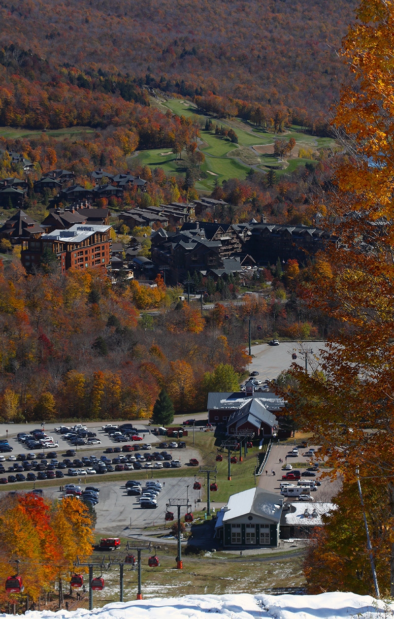
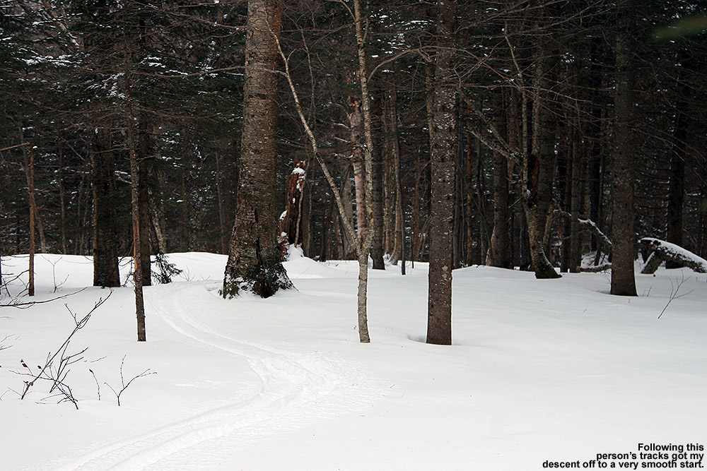
A view of some of the powder turns on Perry Merrill. While yesterday was definitely the best day to get out in terms of fresh snow quality, today still delivered some very nice turns as long as you were high enough and early enough to avoid the warming temperatures.
With this latest round of autumn snow culminating in over a foot of accumulation on Mt. Mansfield, the setup was calling for some early season turns. With the way the temperatures were expected to rise today, I think yesterday was the way to go for potentially the best overall snow quality for powder turns, but I was too busy to get out to the slopes. I did get out this morning though, and while snow preservation was undoubtedly better yesterday, the clouds totally disappeared today to reveal incredible snowliage in the sunshine.
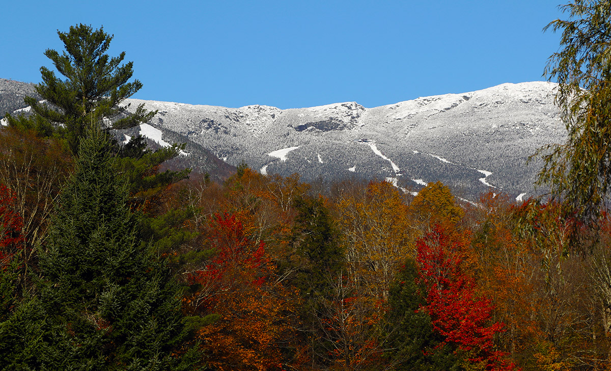
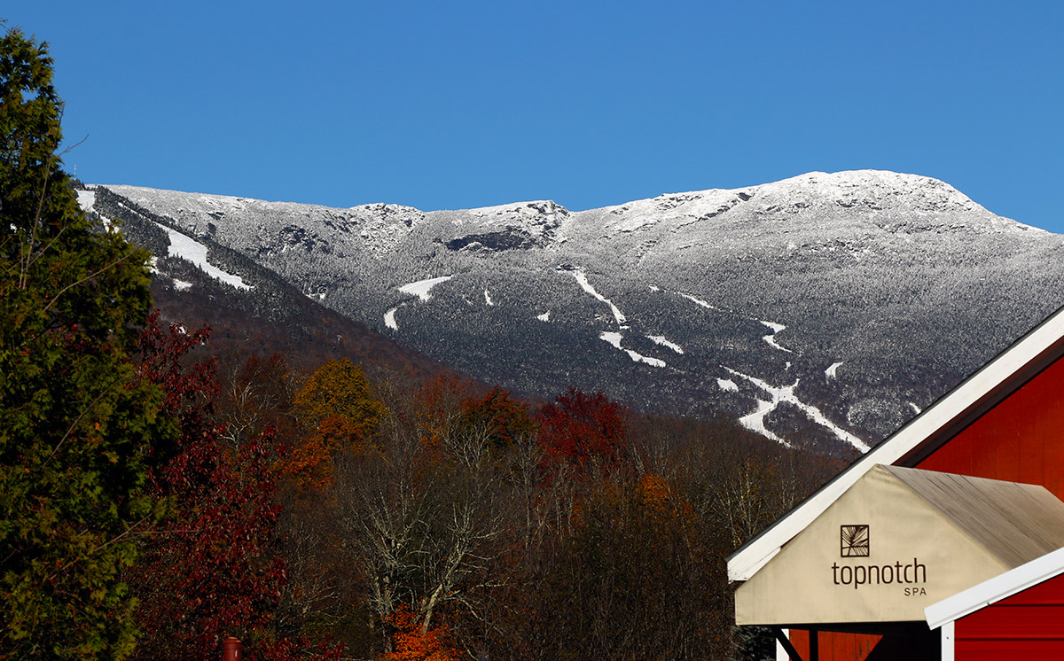
A view of the beautiful snow and foliage from the Top Notch area on my approach to the mountain today.
I started my ascent from the Gondola base at 1,600’ and walked with my skis on my pack for a few minutes to get above the areas with the most melting, then I transitioned for touring and skinned up from there. The snow was already becoming spring-like down low in the sun, and areas in the shade featured refrozen snow. So even yesterday, the freezing level made it above the base elevations. I encountered my first real winter snow that had not seen a thaw-freeze cycle at about 2,800’ in the shade, and then at around 3,200’ I began finding some winter snow even in the sun. I made snow depth checks along the way, and here’s the depth profile I found in the late-morning to midday period:
Depths had consolidated a bit even up at 3,600’ based on Powderfreak’s pictures from yesterday, and the sun was really doing a number on the snow down low. The Gondola terrain gets hit by the sun, and the accumulations down near the Gondola base were just about gone by the time I finished my descent.
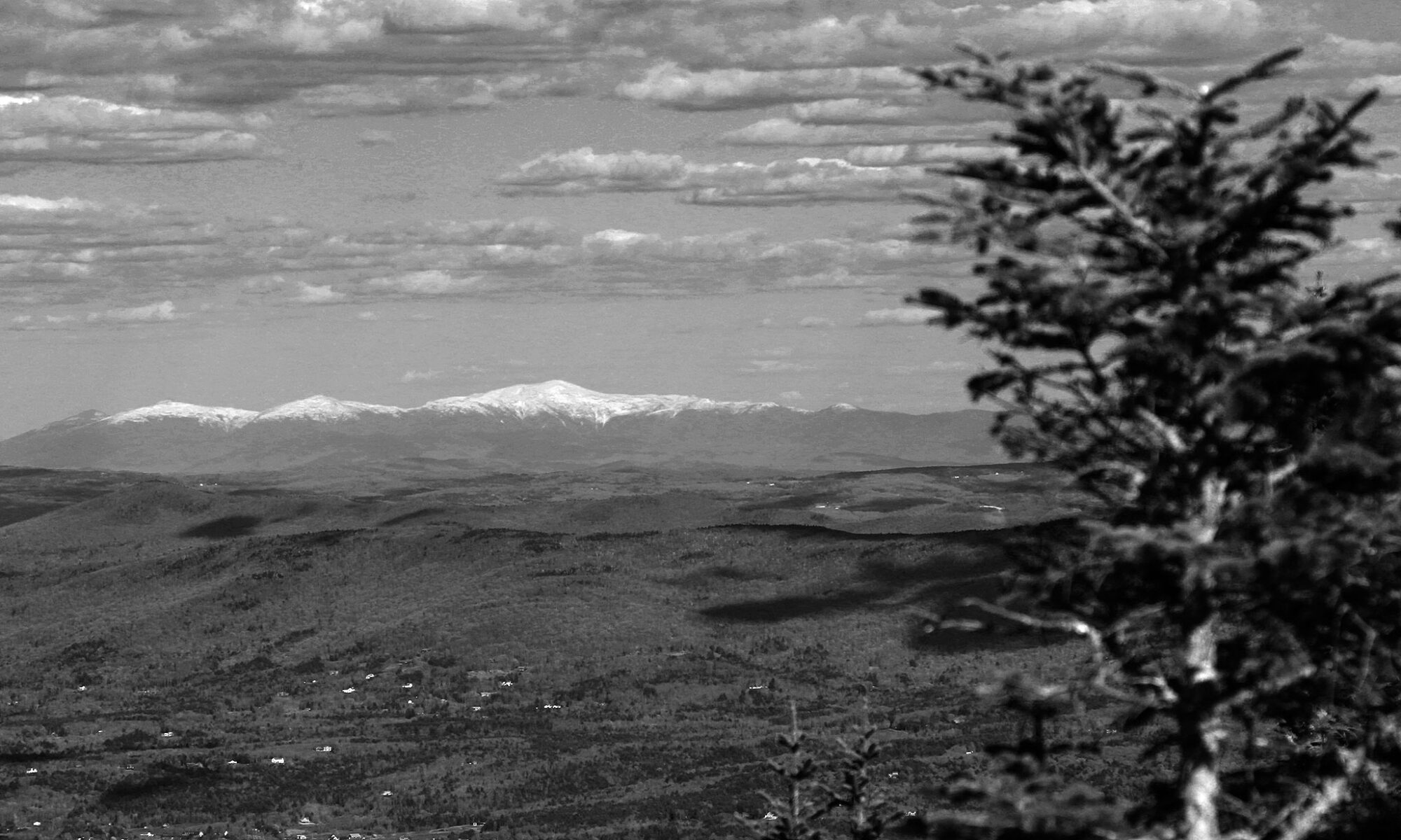
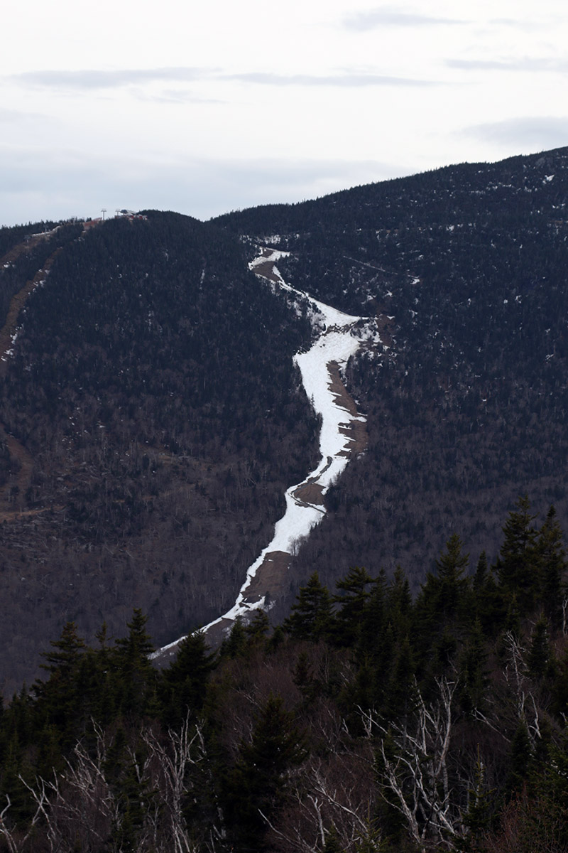
An eastward view out toward the snow-capped White Mountains of New Hampshire on today’s descent
In terms of the skiing, I encountered just about every sort of condition that Mother Nature can throw at you, from dense, silky powder, to refrozen areas with unbreakable melt crust, to spring snow, to sticky, freshly melted snow. Once you were down below the driest snow up top, the best approach was to fucus on the snow that was in that happy medium between seeing the most sun on the skier’s left, and that which had seen no sun on the far skiers right in the shade of the trees. The snow on the skier’s left that had seen some hours of sun was getting sticky, and snow that was shaded by the trees was still frozen with either an unbreakable or breakable melt crust, but in between there was an area of quality snow that had seen just enough sun to soften up but not get sticky. Once you were down below roughly 2,000’, everything was melting, so you just sort of kept going until you felt the snow was too thin. You could still make it all the way to the base with the help of shaded areas depending on what level of rock skis you might be on, but I took off my skis for the last few hundred vertical because I didn’t want to beat them up too much.
Snow cover was disappearing in sunny areas down at the base elevations of the resort as I approached the end of my descent
That was a solid dump for the middle of October though, and with the bonus snowliage it was a great way to kick off the season.
A view of the natural snow conditions at about 2,500′ on Lower Turnpike today.
Sometimes Mother Nature just lets you know that it’s time to get out to ski, and apparently today was one of those days. I was just about the head down to the basement for another pre-season leg workout… but somehow my head transitioned to thinking that we might just have hit that threshold where it was time to actually get out and ski. Perhaps it was time to move on from pre-season to… season. I’m sure it was partly due to the flakes that were falling just outside the window, but Powderfreak’s winter vibe Stowe pictures from Saturday definitely played a role in getting me motivated. We’ve had numerous rounds of snow thus far over the first half of November, and if Powderfreak’s photos were what the slopes looked like before this most recent storm, there had to be enough out there at this point for some low-angle turns.
The cloud ceiling seemed to be around 1,500’ to 2,000’ this morning, so I really couldn’t get a good view of the snow coverage up at Bolton Valley via their Main Base Webcam. What I could see on the cam was that everything was white… extremely white. The snow coverage looked great, but the clouds were just too thick to get a good sense for what the snow depths were like beyond the areas where they’ve made a bunch of snow. This latest system did just drop another round of accumulation though, even down to the lower valleys, and the natural snow from all the storms we’ve had in the first half of the month has not been melting back in the higher elevations.
Even without a real-time view, it felt like the snow from this latest storm should have pushed the snowpack to the point where it was ready for some touring on low-angle slopes, so I decided to pop up to the mountain this morning on my way to Burlington. With this latest storm, the snow never really seemed to accumulate much to the west of our area in the lower elevations, so there were only a few traces of snow in Bolton Flats and at the base of the Bolton Valley Access Road. Accumulations gradually increased as I headed up in elevation though, and here’s a rough summary of the snow depth profile I encountered this morning:
340’: T
1,000’: T-1”
1,200’: T-2”
1,500’: 1-2”
2,000’: 2-3”
2,250’: 3-5”
2,500’: 4-6”
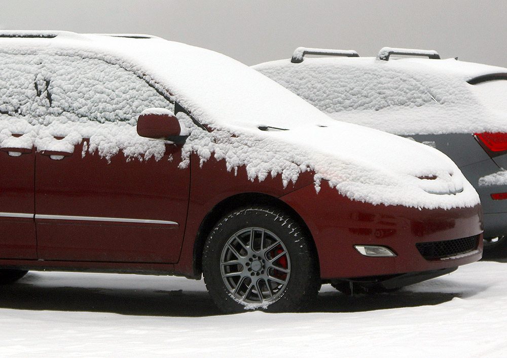
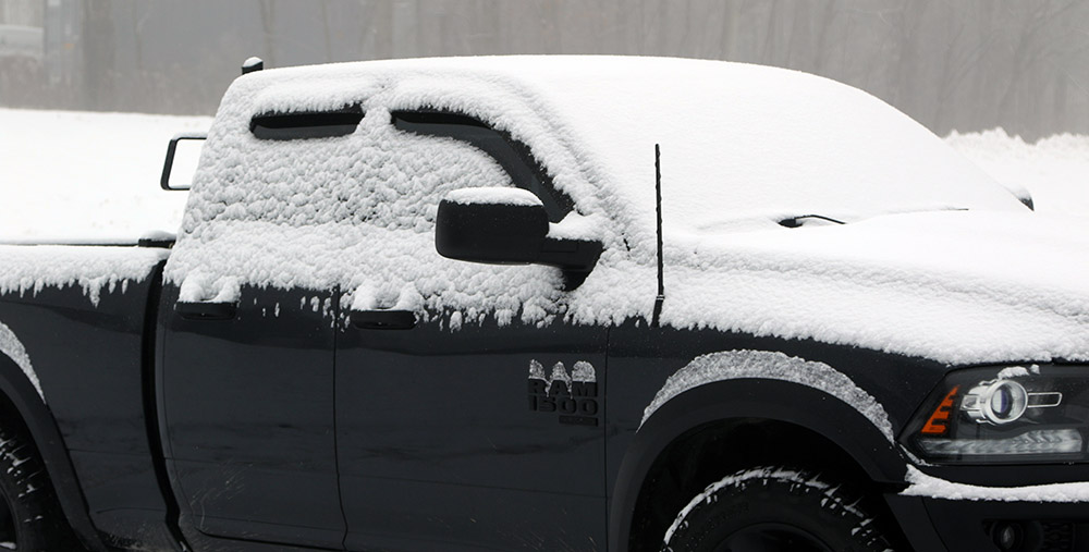
A truck in one of the Village parking lots displays a bit of the snow that fell from this recent November storm
As the summary shows, the depths increased slowly at first, and it wasn’t until somewhere in the 1,200’ to 1,500’ elevation range where snow coverage became continuous. Assessing the depths in the Bolton Valley Village parking lots at around 2,000’, I wasn’t initially sure if I was going to end up ski touring or just going for a hike, but I threw my skis on my pack because it looked like touring would be good to go as long as the base snow was substantial enough. Snow depths increased notably above the 2,000’ mark, and a few minutes into my ascent, it was obvious that I was going to be able to ski on the descent. I had my climbing skins in my pack, but never put them on my skis because the hiking was easy enough, certainly easy enough that I didn’t want to add the extra transition time that putting on the skins would throw into the tour. If one does want to skin on the ascent though, there’s plenty of base to do it.
Indeed it’s the sufficient base snow that sealed the deal in terms of the skiing. Below these recent couple of inches, there’s a good amount of consolidated snow at varying degrees of depth. I only had time to tour up to about 2,500’, but the depths did look like they were continuing to improve above that point. It’s best to seek out low-angle, nicely maintained, grassy terrain at this point, but with that, you’re good to go for some very nice powder turns. I saw a couple of older ski tracks on my tour, but nothing from this morning, and that was helpful – untouched snow provided the very best powder turns, so staying away from any footprints or other snow traffic is the best bet. In the untouched snow, turns were bottomless, and I was only on 86 mm skis. The top half of my tour definitely offered the deepest snow and most ability to play around in the powder, but it was still decent all the way back down to the main base around 2,000’. In the lower couple hundred feet of vertical though, you just had to be more selective in sticking to the untouched snow for the smoothest turns. Rock skis or regular skis are both options if you know the terrain you’re going to be on. I didn’t have rock skis, but only made a hard touch or two to objects below the subsurface. Touching below the subsurface is pretty inconsequential on grassy, low-angle terrain, and thankfully, Bolton’s Wilderness area has plenty of those types of slopes.
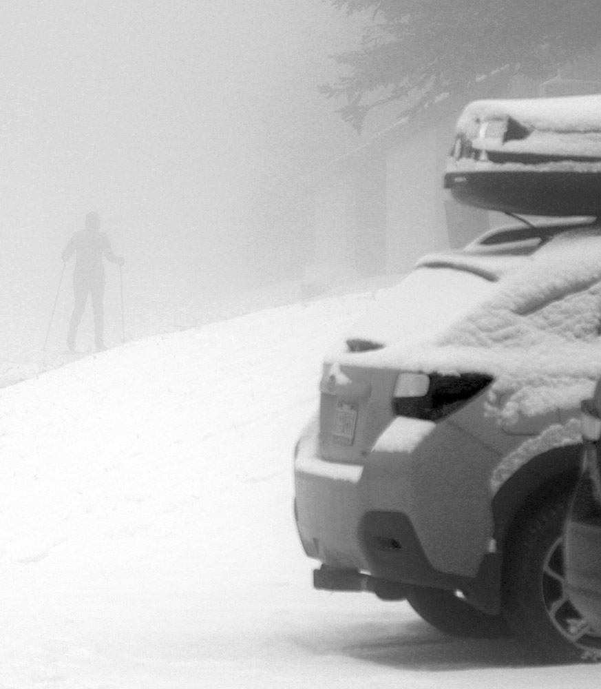
While we haven’t had any huge winter storms yet this season, all throughout the mountains and mountain valleys there’s been a nice winter vibe. With these typical November rounds of snow, accumulations have been melting back in the valleys, but in the mountains they’ve been building up to the point that people are definitely getting out to enjoy it. Just as I was finishing up my ski tour, I spotted someone who was out for a Nordic ski around the Village, and I bet it was someone who lives right up there at Bolton Valley. I saw them passing above me while they skied the access road, and I quickly fired off a bunch of shots before they disappeared into the clouds. And while the combination of thick, low clouds and mid-November sun angle made for some notably low-light conditions today, it really just helped to give the outing that November/December early season mystique.
A Nordic skier out for a Village tour disappears into the low clouds that enveloped the mountains today.
Snow in the North Slope area was still nearly continuous today, but there are a couple of breaks down by the base
Unlike the previous couple of weekends, there were no real concerns about the weather for skiing this weekend – both days have been looking quite reasonable without any major bouts of precipitation expected. Today looked great with clear skies all morning, so I eventually headed back out to Mt. Mansfield for some turns.
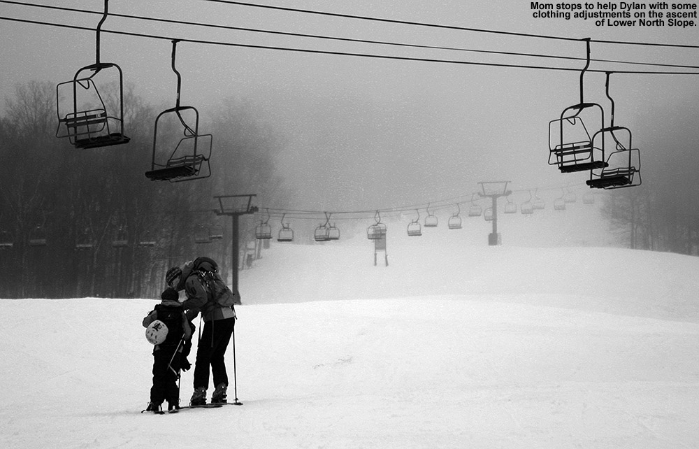
I was torn between skinning and hiking for the ascent. There appeared to be nearly continuous snow through various routes on The Nose side of the resort, but there were also plenty of areas in which the snow had melted out and dry ground was present. Because there were some breaks in the snowpack near the base area on Lower North Slope anyway, and since I’d been skinning for the past couple of weeks, I decided to set myself up for hiking on the ascent.
To generally stay on dry ground, I kept my ascent on trails to the south of the main North Slope/Lord route, and it made the route a bit less steep. There was still a lot of snow around, so I’d often find myself skirting the snow line on various trails, and I ended up mixing it up with some hiking on the snow as well.
I set my goal on ascending until I found a major break in the continuous snowpack, but I couldn’t really spot any obvious ones from the route I took, and I eventually topped out by the Octagon/Fourrunner Quad Summit. The views of the Presidential Range were impressive, and it’s obvious that there have been recent snows in the elevations above tree line.
On my descent of the main North Slope/Lord route, I did discover that there’s a fairly large break of about 50 feet or so in the continuous cover on North Slope, but I just couldn’t see it from where I ascended. Coverage is pretty much continuous aside from that break, and the couple of breaks in snowpack down by the base.
I saw a mix of people who were both skinning and hiking while I was out, and if I was to do it again, I think I’d bring along my skins so that I had them with me. The snowpack is strong enough in a number of areas such that there are long stretches where skinning is the more practical and efficient approach, and having the flexibility to swap back and forth between skinning and hiking would be a nice option to have for a smooth ascent. The skiing is still quite good with some great corn snow, and it will probably be around for a few more weeks unless we get some really warm spells.
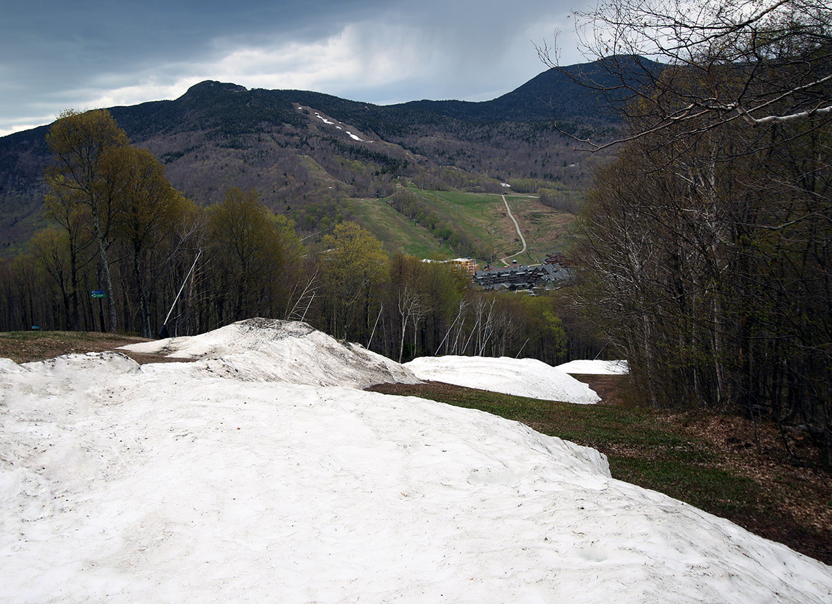
I had enough extra time today, so I headed back out to Stowe for a hike and some more turns. Based on what I’d seen on Spruce on my last outing, as well as the views across to Mansfield at that point, I decided it was time to check out something by the Mountain Triple. There’s some easy access snow right down to the base over there, and that fit the time I had.
Topping out near the Crossover Trail on today’s hike
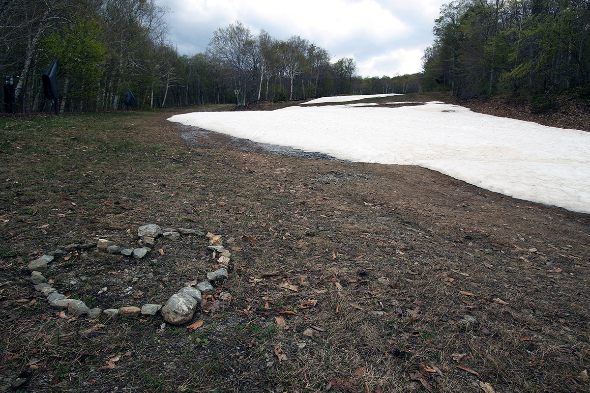
As I walked along past the Triple, I surveyed the snow situation and headed toward Lower Standard, which seemed to have the best coverage. That area makes for a pleasant stroll because it’s generally quite grassy with modest pitches. Somebody had built the shape of a heart out of rocks on the ground near the ropes course, so that was kind of a nice accent to the area. The snow on Lower Standard is definitely more broken up than what it was a week earlier, and there are a couple of gaps near the bottom that are really best walked vs. trying to skip across on your skis.
That afternoon we had thunderstorms in the area, and as usual, there were some great views surrounding the resort and toward the Notch as the peaks worked their magic and forced the clouds around. While I was hiking I started to hear thunder to the east and northeast, off past Spruce Peak and over toward Madonna and Sterling. Eventually I started to see some tendrils of virga over there, and the thunder was becoming more expansive. I was just getting up toward the Crossover elevation, which was about where I was going to stop anyway because the snow petered out there, but the timing seemed good with the thunder building. I started seeing the first visible flashes from lightning just as I was getting back to the car, and the first drops of rain began to fall, so that timing really did work out well. I would have stayed around for some lightning photography over toward the Notch, but none if was producing visible bolts, it all seemed to be well up in the clouds or too distant.
Looking up at the slopes of Spruce Peak today to get a sense for the best areas to put together some turns.
I haven’t been following the state of the snowpack at Stowe too closely over the past couple of weeks, but Powderfreak’s recent post on American Weather forum definitely provided a nice look at some of the snow on the slopes of Spruce Peak. I probably wouldn’t have even had Spruce Peak in the mix of top spots to head for turns if I hadn’t seen how much snow was still there, but it was obvious from the post that there was plenty.
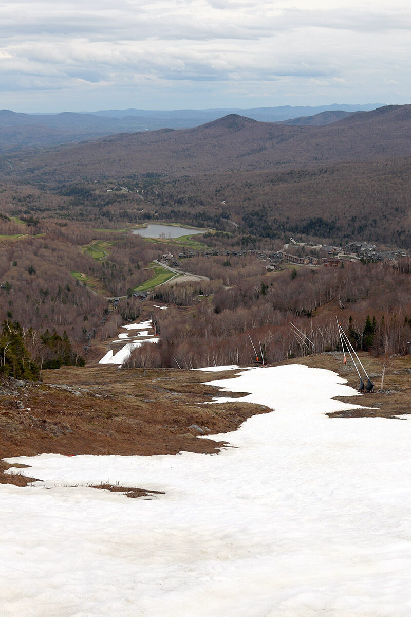
Today I had time to get out for exercise, so I chose to enjoy a hike and ski in the Main Street area. The snowpack is certainly not continuous top-to-bottom of course, but there’s several hundred vertical feet worth of nice turns with deep base as Powderfreak’s image showed. The snowpack there is starting to get a bit sun cupped, but it’s nothing that really hurts the experience yet at this point, unless perhaps you were to stray the extreme edges where the snow has taken a bigger hit and there’s been no skier traffic.
I was encouraged by plenty of spots with deep snow on my ascent of Main Street today.
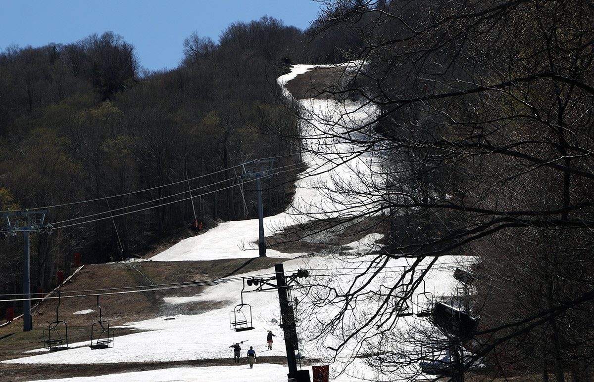
Even if natural snowpack on Mansfield is still below average for this time of year, I have to think the coverage there on south-facing Spruce had got be at least typical for this far into May. From the view across the resort, I could see that the usual spots like Nosedive and some of those areas around the Mountain Triple still have some decent coverage, so it would be fun to mix it up with something over there next. That Main Street snow has some very deep areas, but it’s just getting a bit too broken up into segments that one eventually has to make the call to go with something with a bit more continuity for efficiency and longer flow of turns on the descent.
Checking out the snow on Nosedive as I look across from Spruce Peak toward Mt. Mansfield
It is always fun this time of year getting to see which parts of the resort are holding the snow best for those late season turns. It’s different each season depending on the combination of where Mother Nature deposited snow and where the guns were blowing when temperatures were optimal as has been noted in some of Powderfreak’s comments in ski-related discussions at American Weather.
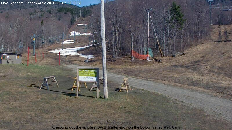
A snapshot from the Bolton Valley Web Cam today – the patches of snow on the bottom half of the mountain got me interested enough to see what the higher elevations held.
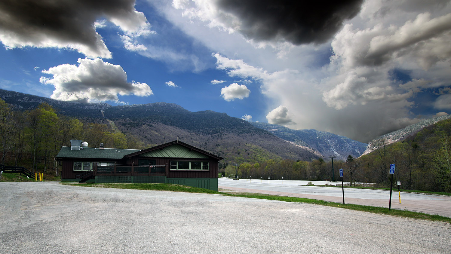
Our protracted stretch of pleasantly warm and sunny weather has continued this week, and it’s allowed the ground to dry to the point that on Tuesday, I headed out for a mountain bike ride to sample some of local terrain by the house and into town. Indeed even some of the typically wettest terrain down by the Winooski was dry enough for riding, so things are ready on that front, but after seeing Powderfreak’s ski report from yesterday at Stowe, it reminded me that I should probably get back out on the slopes while the snow is available. I can still see bright areas of white snow on the slopes of Bolton Valley from my office in Burlington, but from that distance it’s hard to know exactly how continuous the coverage is. I popped up the image from the Bolton Valley Web Cam and could see that there were only patches of coverage on Beech Seal on the bottom half of the mountain, but it looked as if the snow at the bottom of Bear Run might be stretching upward for some substantial coverage.
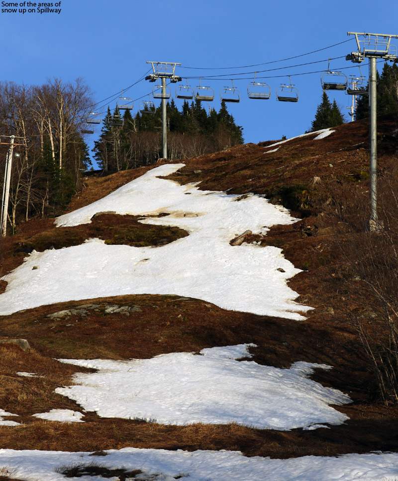
I headed up to the resort with plans to at least get in a hike, since the areas without snow already looked pretty dry. I saw the first signs of snow along the Bolton Valley Access Road at the base of Timberline at 1,500’, and it was clearly leftovers of manmade snow. Up in the Village it was very quiet, and I’d thought about getting a sandwich from the Deli, but it was closed. This is probably one of the quietest times of the year, so I guess that shouldn’t be too surprising. I took a quick walk up to the slopes and could see that Spillway had some large areas of snow, and it was enough to suggest that I should throw my skis on my pack and bring them along.
The snow on the lower parts of Spillway ended up being rather patchy, so I headed toward Sherman’s Pass
The visible snow near the base that appeared to head up to Bear Run was the start of a reasonably long section that went about halfway up the trail, and from there to Mid Mountain the coverage was a lot more fractured or nonexistent. Above Mid Mountain I began to hike toward Spillway, since I’d seen the snow up there, but once I saw far more substantial coverage on Sherman’s Pass, I switched my route in that direction. I stopped my ascent at around 2,600’ near the top of the steeper Sherman’s Pass terrain above Mid Mountain, since there was another gap in coverage at that point.
For the descent, I found that the snow definitely had some sun cups and dirty areas, but there were a variety of areas with decent turns, and the coverage there basically brought me down to Mid Mountain before I took off my skis to connect to the lower half of Bear Run. That bottom part of Bear Run offered the longest stretch of continuous snow, and it carried me to within about 50 yards of the base lodge. With Bolton’s western exposure and more limited snowmaking than some of the larger resorts, May turns are often spotty, and this year was fairly typical in that regard. Based on what I saw, today’s turns were likely my last of the season at Bolton Valley, so that’s probably it until the fall. There’s a ton of snow left at Stowe and some of the other resorts around, so hopefully I can get out to some of those spots for more turns this month.
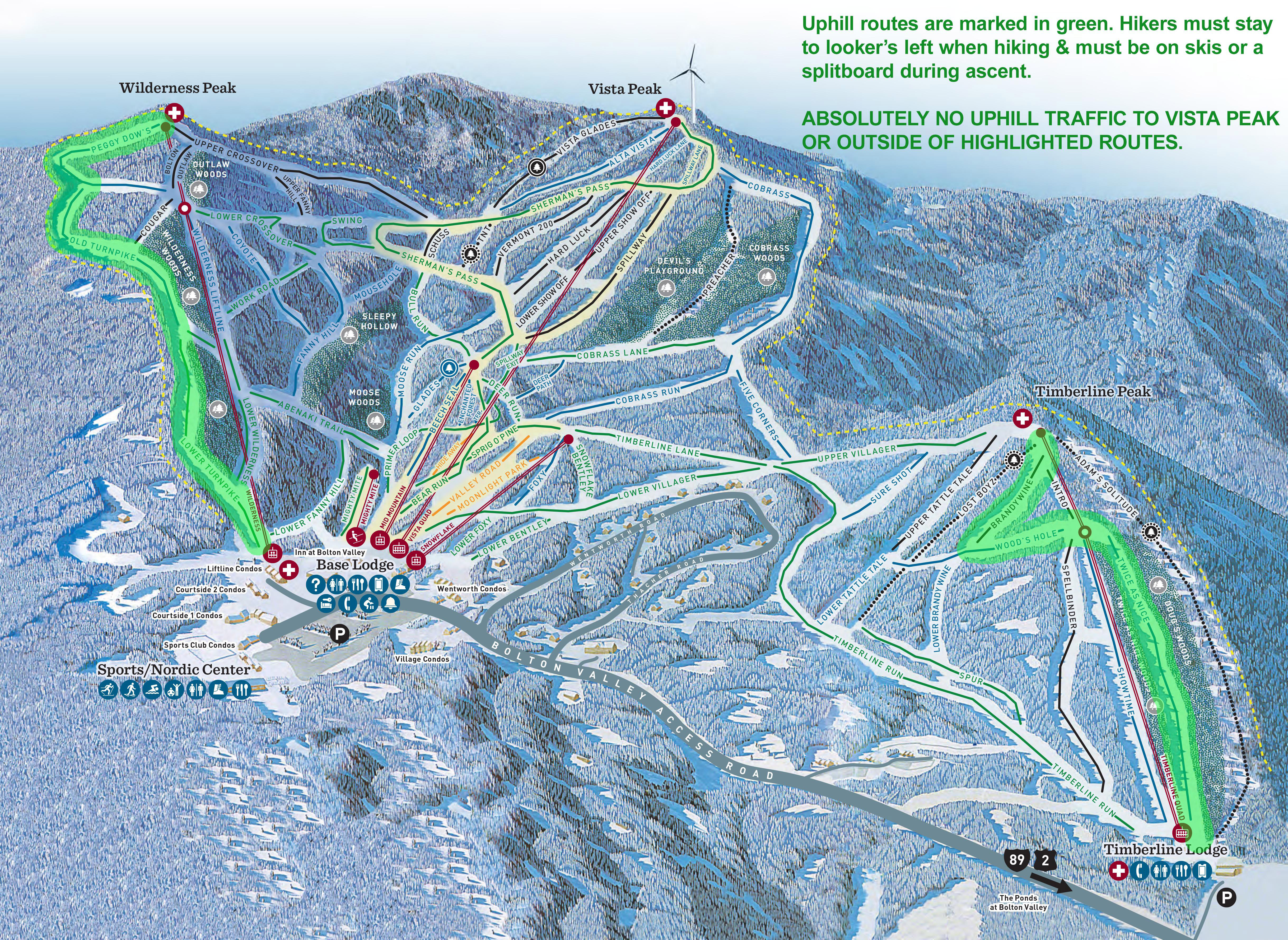
Bolton Valley now has an official uphill travel policy in place for all those skiers and riders who enjoy making the uphill trek under their own power.
As with most ski areas in Northern Vermont, I’ve always found Bolton Valley to be very accommodating of skiers and riders hiking, skinning, or snowshoeing up their slopes under their own power in order to ski down. Although there wasn’t necessary a formal policy in place, the practice was at least tolerated as long as the individuals were respectful of operating hours, mountain operations, and other factors involving skier safety. So, as a Bolton Valley season’s pass holder who frequently visits the resort for both lift-served and self-powered ascents, I was very intrigued last month when I found out that they had initiated an official uphill travel policy. There are two designated uphill routes: one on Wilderness, and one on Timberline, and although I haven’t seen them yet, Stephen and one of my students told me the resort even has signs marking the uphill route on Wilderness.
“In general my depth checks of the powder revealed 4 to 6 inches, with some spots up to 8 inches.”
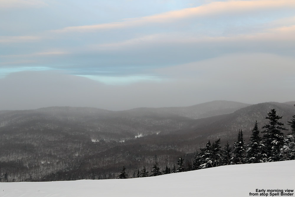
I’ve visited the Bolton Valley Nordic & Backcountry Network over the past couple of weeks, but today was the first time I’ve made an ascent on the alpine trail network since the announcement of the uphill travel policy. The impetus for my ski tour in this case was that Winter Storm Juno just hit the area yesterday, and it meant that this morning would be a good time to check out the new snow. While the Green Mountains certainly didn’t get the storm totals of up the three feet that were seen down in the Boston area, the Vermont ski areas did pick up general accumulations of 3 to 8 inches throughout the state. Even without a huge snowfall in the area, it seemed like it would be worth getting out for some turns; the ski conditions have just been so darned good over the past few weeks that even a modest dump makes for some excellent skiing.
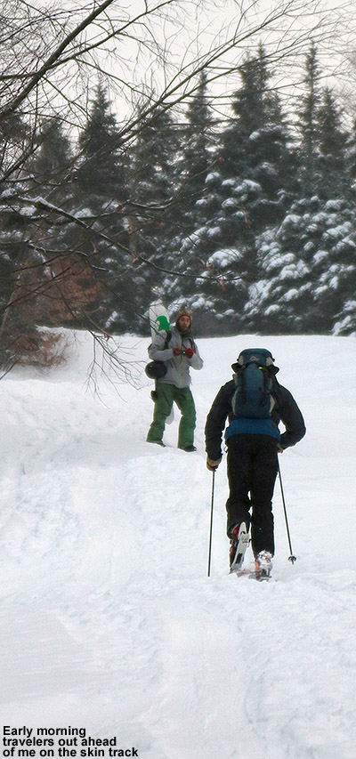
I headed out the door early this morning, and decided to go with an efficient Timberline outing to leave me plenty of time to get to work. Temperatures were in the middle single digits F at the house, and low single digits at the Timberline Base. So indeed it was cold, no doubt about that, but the air was fairly calm and that helped keep it manageable. There were about a half dozen cars parked in the usual spot off to the right in the main lot, and I could see a couple people either prepping their skins for a run, or packing up their gear as they got ready to depart. There were just a few flurries in the air, but there was a healthy coating of snow all around, and I was able to start my skinning ascent right from the car.
There were a few folks out early this morning to enjoy the new snow at Bolton Valley.
I was a little surprised that the skin track started on the hiker’s right of Twice as Nice, since it’s typically on the left in line with the uphill travel policy, but I wasn’t going to eschew a track that was already there. I was measuring surface snow depths in the 4″ range, and it was medium-weight powder. As is often the case with big storms, there had been some wind, so some of the powder was pushed around in spots. But, it really hadn’t been hammered or packed too hard, and it looked like turns would be nice. Up ahead of me on the skin track I saw a snowboarder, and behind him a skier. After a few minutes I noticed that the skier was struggling to get up one of those short steep pitches that roll over – he finally managed to get past it with a little herring boning and/or side-stepping. When a similar pitch came up a little while later, he was struggling again and eventually let me pass. He said that it was actually his first time ever trying out skins, and he’d come to Bolton Valley after reading online about the uphill travel policy. As I seemed to have no trouble with those slick spots, he said that wanted to watch how I managed them. After we were both past that spot, I first asked if he had full-width skins, since I know that not having full width has given me trouble in those types of areas in the past, and he said he did. We then chatted about the balance between getting up on your ski edges or staying the skins, and finding out what worked best when you began to slip. He said that what I seemed to do was just keep my momentum really going through those tough spots. I hadn’t thought about it, but I guess I do. I also let him know that I keep a lot of pressure on my poles, and ensure that I’ve got a very good plant so that if I do slip, my arms can help pull me through. After a couple of pitches, the skin track switched to the more typical left side, and there were actually a couple of skin tracks there, so we were able to skin alongside each other and chat for a bit. Eventually I stopped to get a few pictures, and he headed on ahead. Like me, he said his goal was the Timberline Mid Station, and he thought that he might like to do that instead of the Timberline Summit and do a couple of laps.
“As I got down into the more moderate angles below, I was getting a lot more bottomless turns…”
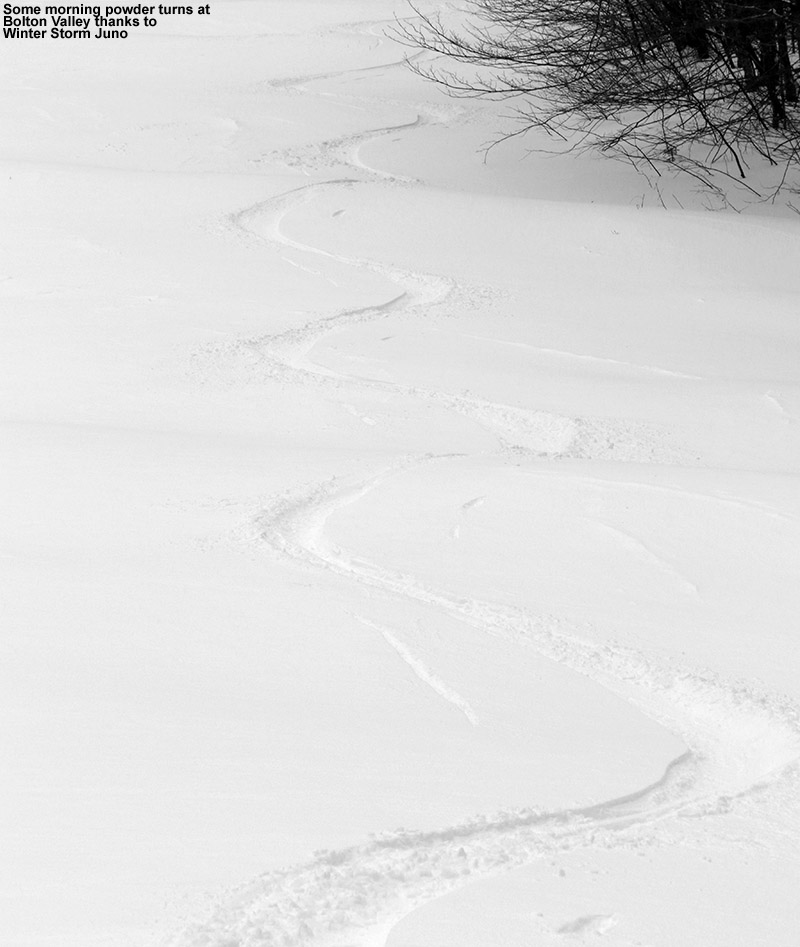
When I reached the Timberline Mid Station, the skier I’d ascended with was just taking off his skins. We chatted for a few moments, I wished him well on his first descent, and then I headed across toward the top of Spell Binder. I switched over for the descent, did a quick survey of the snow on the headwall, and opted for the skier’s right. There were a couple of old tracks in there that looked like they’d been made yesterday, and the snow had been pushed around a bit by the wind, but the overall conditions were quite good. I worked my way toward the middle of the headwall and found even smoother snow, although the powder was perhaps a bit shallower there. On the steep pitch of the headwall, the new powder certainly wasn’t bottomless, even on my 115 mm AMPerages; I was touching down to the base at least a bit on most turns, but I’d say the snow delivered a pretty smooth ride. As I got down into the more moderate angles below, I was getting a lot more bottomless turns, and if the wind had played with the snow a little up on the headwall, it definitely hadn’t done much to the powder lower down. In general my depth checks of the powder revealed 4 to 6 inches, with some spots up to 8 inches. The skiing did feel a bit slow with temperatures around zero F, but I didn’t find any issues with movement, even on the shallowest pitches. When I got to the bottom of Spell Binder, I made a few turns on the corduroy, and boy, that was some sweet groomed snow. The snow from this storm is really just topping off what are already fantastic conditions, so folks who were coming out for a day at the resort were really going to be in for a treat.
Thank you Juno!
On the way into Burlington, I stopped off at the Williston rest area, and one of my former students was there. He said he thought he’d seen me up at the mountain, and now he was sure of it. After hearing about the uphill travel policy, he’d actually been up skinning on the main mountain using the Wilderness route this morning, and he’d had a great time. He said that he and a friend often went out ice climbing in the early morning, but they think they’ll be mixing in some ski touring as well. I had first heard about Bolton’suphill travel policy in a post on the Vermont Backcountry Alliance Facebook Page, and it wasn’t too surprising based on Bolton’s history in that area. What was surprising though was finding out that Sugarbush now has a hiking/skinning policy in place. That’s exciting news, because they have not generally allowed uphill travel in recent years. I also just saw that Bolton Valley will be having an uphill ski demo day on February 7th, where people can try out alpine touring, Telemark, and split boarding equipment. Hopefully that will serve for a great introduction for people that have been curious about trying ascents on their own power on that type of equipment.
It looks like our next winter storm could be coming into the area tomorrow night; it’s expected to be an Alberta Clipper type of system with the potential for 6 to 8 inches in the local mountains.
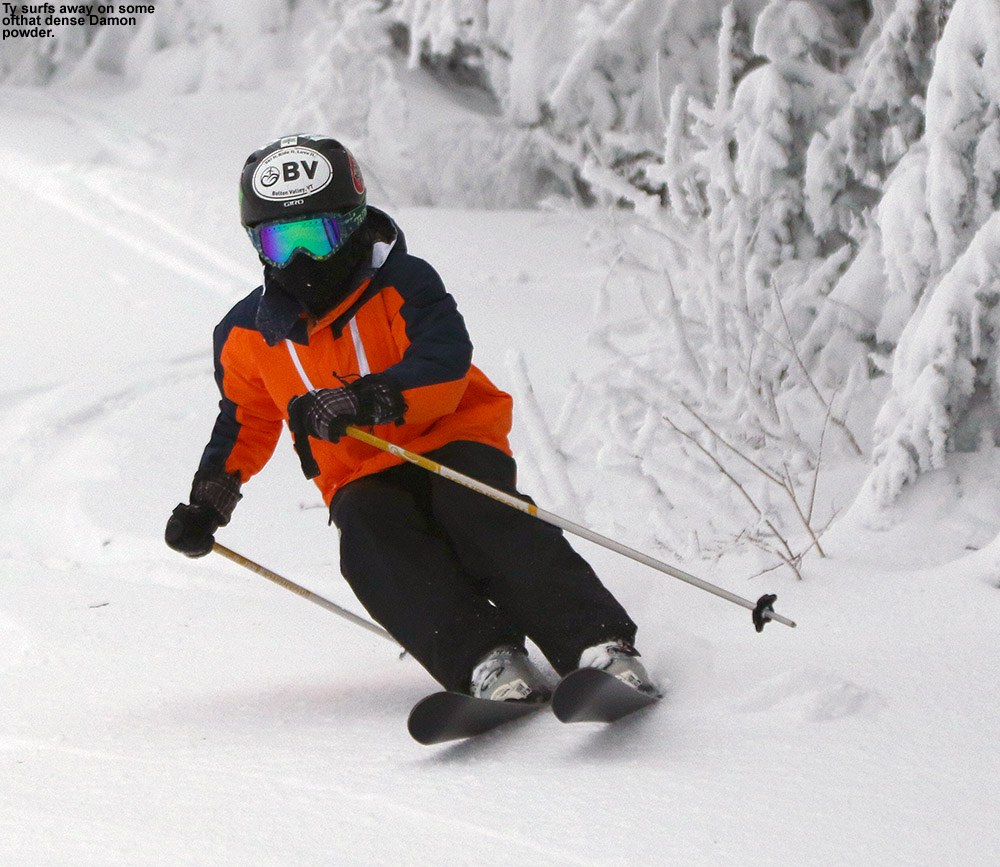
Getting out to Bolton Valley this afternoon to surf some of the bounty left by Winter Storm Damon
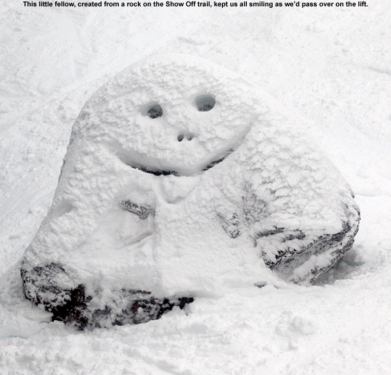
‘Tis the season for being very busy around our house, but the boys and I did find a bit of time to head up to the mountain this afternoon to see what Winter Storm Damon had done for the slopes. We’ve had some periods of sun this weekend, such as the ones we experienced at Stowe yesterday, but temperatures have been staying generally at or below freezing in the mountains to keep the recent snow in midwinter form. So, we anticipated finding some great conditions today on the slopes of Bolton Valley, which thanks to winter storm Damon, has most of its terrain open on the main mountain. A couple feet of dense snow can do that.
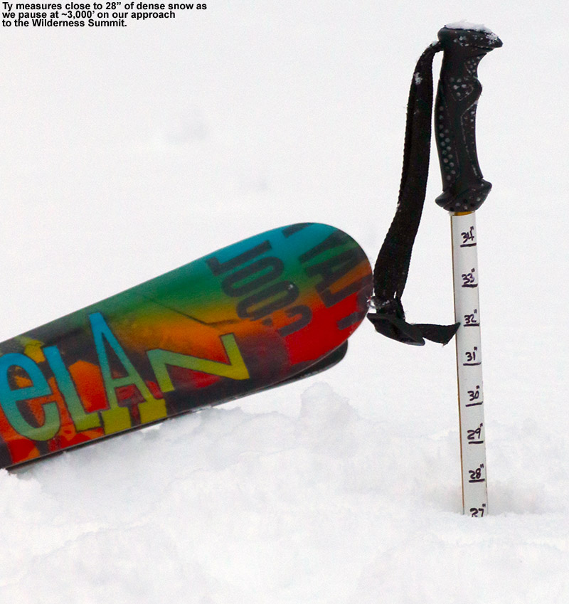
“With 2 to 2 ½ feet of dense snow, the ascent was easily twice as hard as it would have been on skins.”
Low clouds hung over the upper half of the mountain as we rode that Vista Quad, and being well into the afternoon, the mountain was really starting to quiet down. The overall feel at the resort was exactly in line with one of those dark December days; the base was plentiful, the snow surfaces were well preserved, and the low clouds seemed to lock in an intimate feeling across the mountain. It’s the holiday season before the commotion of the main holiday week, and with the current amount of terrain and quality of snow surfaces available, it’s a great time to be skiing the resorts around here in Northern Vermont.
The coverage and snow quality was saw from the lift looked simply outstanding, even on the steep trails of the upper mountain, so the boys and I jumped right onto Hard Luck to test out the snow with some real pitch. All you can say is that Damon set down a really solid resurfacing – there’s just a lot of deep, dense snow out there. You can just carve the surface snow away and be confident that there’s simply more of that below. The only real downside that I’ve seen from the storm was that the powder skiing hasn’t been quite up to the quality we typically get around here with lighter snow. The rounds of fluffy snow at the end of the storm cycle weren’t quite substantial enough to keep you off of the denser snow below, so you’re still getting into that thicker stuff, and of course it doesn’t ski like champagne powder. Still, I don’t think I’d trade this recent storm for fluffier powder; it was just too perfect for setting up the core of this season’s base snow.
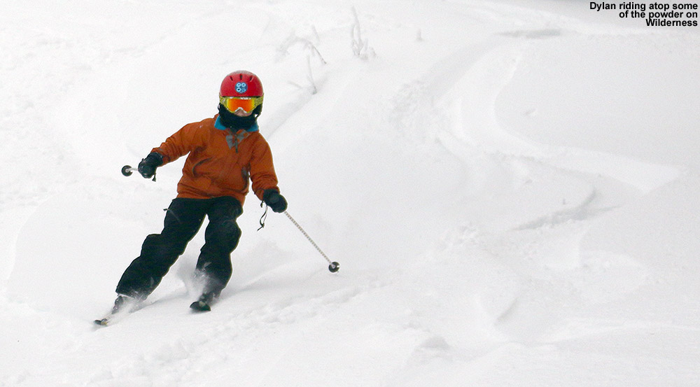
The powder was still skiing reasonably well for being rather dense, so we headed over to Wilderness on our next run to get into some untracked snow. Although we were only skiing in the top few inches of the snow, untracked areas were silky smooth and a lot of fun. It was enough fun that when I asked the boys if they wanted more, I was hit with a resounding, “Yes!”
With that in mind we set off on the next run for the summit of Wilderness. There was a skin track in place for the ascent, and a bit of a boot track that comingled with the skin track in places, but that boot pack wasn’t very well established. Since we hadn’t brought our skins, that meant we had to go the boot pack route, which was a real slog at times. The rudimentary boot pack that was in place helped us some, but it contained plenty of post holes that required extra effort to climb out of, and then there were times when I’d post hole my way into the snow unexpectedly, which is always a big waste of energy. With 2 to 2 ½ feet of dense snow, the ascent was easily twice as hard as it would have been on skins. I made sure to explain to the boys that this was the perfect example of why you want to skin up the mountain whenever possible vs. trying to walk in your boots.
Ty uses his measurement pole to reveal just how much snow was in our path.
After a brief break at the summit, we descended via Bolton Outlaw in the gathering dusk. The powder was dense like we’d experienced elsewhere, but there were plenty of good turns to be had. This is where the boys would have profited from having their powder skis, but they were on their regular carving alpines based on the fact that we’d planned on mostly on piste skiing. Dylan had a couple of prereleases that send him crashing into the powder, and I’m sure the skinnier nature of the skis wasn’t helping the matter. But some good turns were had by all, despite the fact that it was really dark and foggy as we descended the lower half of the mountain.
Dylan riding atop some of that dense powder from Winter Storm Damon
I had to head off to a Christmas party once we got home, so I’d actually tried to call in a pizza order from Fireside Flatbread for E and the boys when I was up on the Wilderness Summit. I didn’t have a great signal, but it didn’t matter… unfortunately they don’t open until Friday. I ordered instead from Zachary’s in town, but it meant we had to go a couple miles past the house. The James Moore Tavern seemed to be running at full steam tonight though, so that’s currently an option for those seeking après ski fare.
On the weather front, it looks like we’ve got a weak system coming through in the midweek period, and the models show the potential for another storm toward the end of next weekend, but that’s a long way out so we’ll have to see what develops with that one over the next several days.
Getting out this morning to experience some of the powder at Stowe
Areas downwind of the Great Lakes such as Buffalo have been making headlines due to feet upon feet of lake-effect snow falling in rather short order, and in Northern Vermont we’ve picked up an inch or two of snow here and there thanks to being downwind of Lake Ontario. On Tuesday evening though, we got into the action a bit more as things aligned correctly to drop roughly a foot of snow on Mt. Mansfield. We only picked up about an inch and a half of snow at our house in Waterbury, in association with that event, so I didn’t even suspect that Mansfield had been lit up with that kind of snowfall. However, mountain valleys farther to the east of the Green Mountain spine picked up a few inches, and that was a bit of a tip off that something was up. When Powderfreak started sending in powdery pictures to the American Weather Forum noting the substantial accumulations at Stowe, it was becoming clear that there was some nice powder skiing out there.
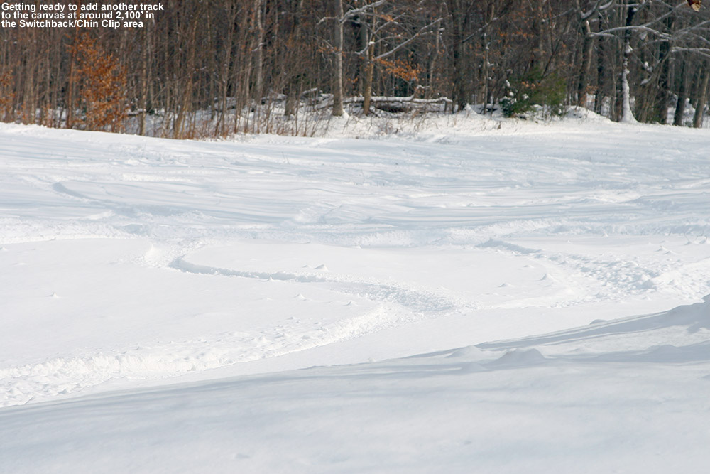
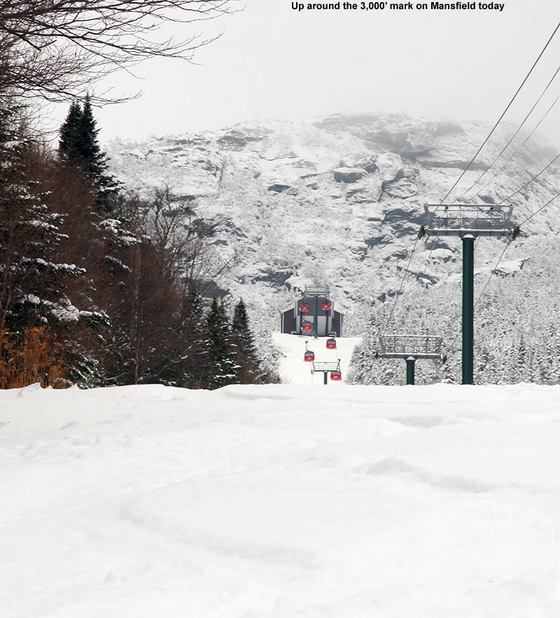
I didn’t have time to check out the snow yesterday, so this morning I headed out for an early ski tour on Mansfield, and found 3 to 4 inches of snow at the Midway Lot near the base of the Gondola. I followed a well established skin track that headed up Chin Clip Runout, and then diverged to follow Switchback for the next part of the ascent. When I reached Gondolier I decided to just finish out the ascent to the base of the big Gondola waterfall on the skin track I saw there. I didn’t have time to travel any higher, but up at that ~3,200′ elevation there was roughly 6 to 7 inches of powder, which sat atop a few inches of dense base snow.
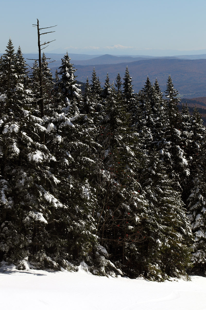
Enjoying the powdery view today at Stowe up around the 3,000′ elevation mark
The snow depths I observed for the powder above the base today were as follows with respect to elevation:
I dropped in for the descent on Perry Merrill, and there were just a couple of additional tracks there, so plenty of fresh powder was available. I’d pulled out the fat skis, and they were the perfect tool for the occasion – they kept me floating and gave me some really great stability. I did have to watch out for a few rocks here and there, and at times I switched to alpine turns when it seemed like the base was a bit thinner or the rocks a bit bigger. I found that alpine stance kept me floating a bit higher, and today I really noticed how the AMPerages actually seemed to make it easier to ski alpine style in Telemark bindings. It’s not always easy to ski alpine with a loose heel, but I was very surprised at how stable it felt in today’s conditions. I think the stability and rocker of the fat skis were really playing their part. I eventually made my way back over toward Switchback and connected to Chin Clip Runout to finish off my run, and the grassy slopes down there were perfect for where the powder and base was a bit shallower. It was still fantastic skiing though, and some of my favorite turns of the outing were down there below the 2,100′ elevation. That terrain is so grassy with few rocks that it was easier to just let it ride without worrying about rocks. Rock skis would give you a bit more ease of line selection out there and more peace of mind, but you can certainly get by and have some fantastic turns with regular skis as well.
Since the end of the school year was keeping E rather busy last weekend, the boys and I just made a quick day trip out to ski the Mt Washington snowfields on Sunday. The turns were good, and with things lightening up for E by this weekend, we again kept our eyes on the weather for some possible camping and skiing. The forecast ultimately looked even better than it did for last weekend, suggesting warm, dry weather both Saturday and Sunday, so we packed up and headed off to New Hampshire yesterday around midday.
“…Ty started banging out runs pretty quickly on that upper section because he really liked the short hike back up.”
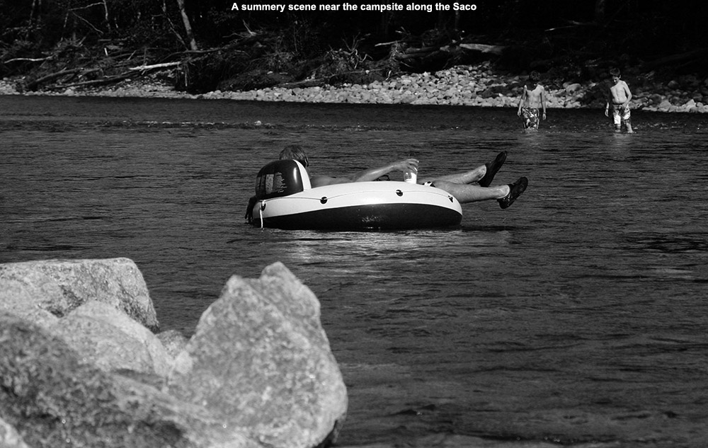
We set a course for the Glen, NH area to see if we could get a site at the Glen Ellis Family Campground similar to what we’d had last spring. We’d never been to the campground before that trip, but we really liked the riverside campsite we had along the beautiful Saco River. Since the Sunday forecast looked even a bit better than Saturday with respect to the potential for clouds and wind, we headed right to the campground yesterday and found that they had a number of the riverside campsites available, even ones with electrical power, which we find great for charging up various mobile devices. It was a warm afternoon in the 80s F, and tubing on the river was a popular activity. They’ve really got a great setup there for running laps in the river; you just ride down as far as you want, and walk your tube back up along the edge of the campground. We spent a chunk of the afternoon working on Dylan’s throws and playing some disc golf in the campground’s massive grassy fields. After we’d spent so much time practicing, it was great to see how often Dylan was able to hit the disc golf basket. We then had dinner at the campsite, and finished off the day with some evening exploration of the shoals and islands in the river. Dylan discovered that the campground had Wi-Fi, and we had an excellent signal even all the way out by the river, which is almost a half mile away from the main office. They must have an impressive wireless setup to be able to span the 65 acres of their campground. I did a test on Speedtest.net and found that the upload and download speeds were both 1.0 Mbps, which is plenty of bandwidth unless you need to stream video or do something similarly intensive.
Enjoying the views along the Saco River
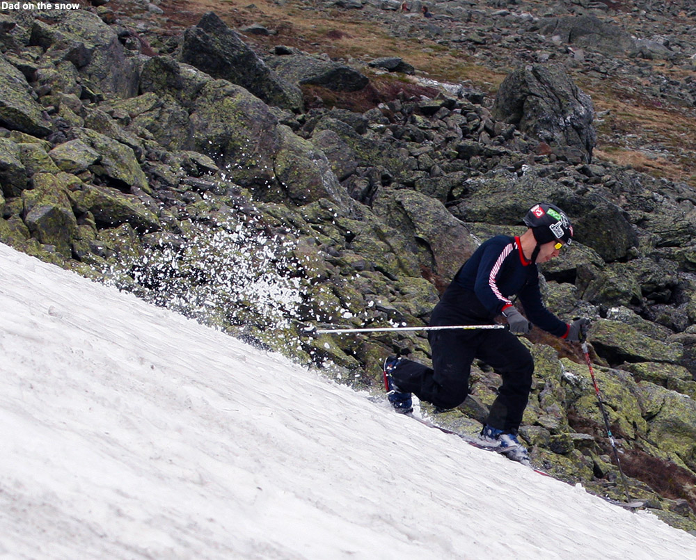
This morning we had breakfast, gradually broke down the campsite, and headed north on Route 16 for the quick trip to the Mt Washington Auto Road. Thanks to the available Wi-Fi at the campsite, I was able to do a check on the Ravines Cam to see the current state of the snowfields. It was clear that the main Ball Crag Snowfield had lost a lot of snow in its middle sections, and the snow had the look of a backwards letter “C”. The main area of the East Snowfields had broken up a lot, such that largest remaining section didn’t seem to have much more vertical than what seemed available on the Ball Crag Snowfield. With that information and our knowledge from last week about the ease of access, we decided that the Ball Crag Snowfield area was still probably the best bet for today’s trip. After reading another trip report at the Time For Tuckerman Forum last week in which someone monitored their gas mileage up the Auto Road, we decided to monitor ours, and found that it was right around 9.0 MPG up to the 5,700′ parking area in the Subaru; since the other report indicated that they managed 10 MPG in a hybrid vehicle, and we were loaded with four passengers and lots of camping and ski gear, I guess that’s not too bad. Presumably there’s not much gained in a hybrid on a long, continuous climb like the Auto Road, but whatever vehicle it was, it’s likely to be a fuel efficient one anyway. As we unloaded our gear, one of the Mt Washington Auto Road Coaches passed by, and the driver reminded us to make sure we stayed on the rocks so that we didn’t harm any of the fragile alpine flowers and other vegetation. I hadn’t seen much vegetation flowering last week, but he noted that some of the flowers were just starting to make their way up to these elevations now. It actually wasn’t as sunny as we thought it might be, and gray clouds almost looked like they might throw down some precipitation, so everyone packed light shells in their packs just in case. Being just a few minutes from the car, we find that one can pack minimally if they want to, but if rain really came down, we’d want to have something on hand.
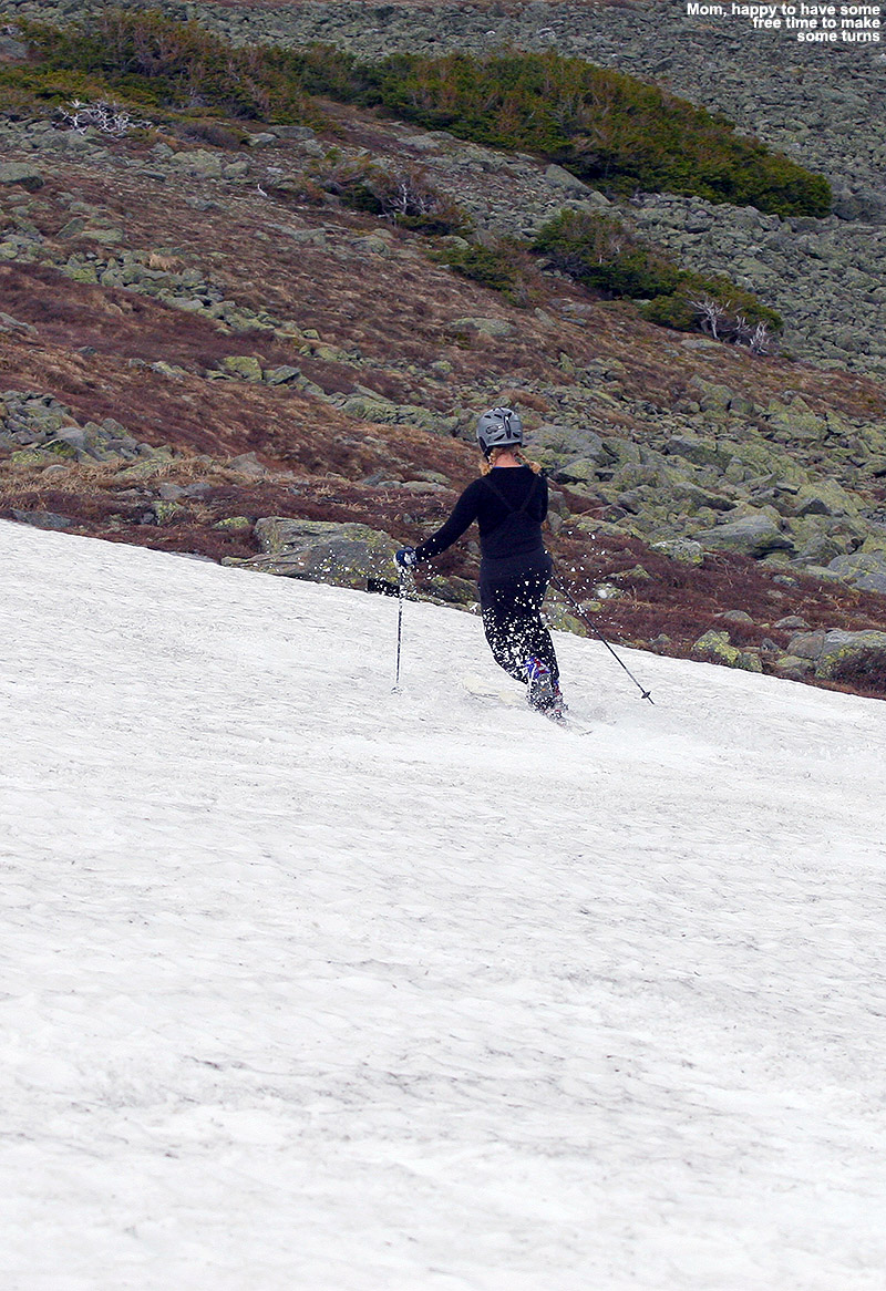
After missing last week, E was able to get out on the snow today.
It was again a short trip to the snowfield, and we could start to get a sense for how what the ski options were going to be. Since last week, we could see that there hadn’t been too much change in the areal snow coverage in the upper section of the snowfield, but the lower section showed dramatic differences due to the past week’s melting. The lower section was much smaller, and the snow was no longer continuous into that area. That made laps in the upper section most practical, and Ty started banging out runs pretty quickly on that upper section because he really liked the short hike back up. E slid out a bit on her first run and even got into the rocks at the bottom, but she was OK – it was definitely the most dramatic encounter with the rocks we’ve seen though, even more than when Dylan got into them a little bit last week. We often talk about how much we really need our helmets on these outings on the snowfields, since there are rarely other skiers around, but E’s slide was another great example of why we make sure to wear them. As she was sliding, even though she was in good shape being feet first, she was very happy to know that she had that helmet on. Ty kept cranking out the runs, and even Dylan whipped out a couple of quick runs before taking a break. I started to make some runs to see if I could catch up to Ty, but every time I’d take a run, he would do another with me, so there was no catching up that way. He was having fun with that, knowing that as long as he did a run every time I did, there was no way that I’d be able to catch up. It made for some fun runs where he worked on mirroring my turns, and although I couldn’t see him while we were skiing, now that I look at some of the photos, I can see he was doing a really nice job. For our last run, Ty and I connected down to the lower snowfield for a few extra turns on our way to hike out, so in the end we called it an extra quarter run, so Ty wound up with 7 ¼ runs to my 4 ¼ runs, with Dylan at 3 runs and E at 2 runs. We joked with Ty that he didn’t even do as many runs as the rest of us, because before that last run, he was quite proud that he had! The sky remained with one and off gray and sometimes fluffier clouds, with the occasional break of sun, and fortunately there were no signs of any precipitation.
The boys had wanted to head up to the summit of Mt Washington and visit the Sherman Adams Summit Building on our last outing, and we didn’t really have time, but this time we’d planned on it, so we stopped in at the visitor’s center for a while. We used our tickets to the new exhibit area in the museum, which is focused on the extreme nature of Mt Washington in the winter, and indeed it has been heavily updated relative to what was there before. The whole area seems very new and modernized all around, and there’s some impressive use of high-definition screens and other video technologies. It’s certainly worth a visit to the new exhibit if you have not seen it since it’s opening in May. We stopped in Gorham for a bite on the way home, and ate at one of the picnic benches on the Gorham Town Common, where the boys hit the playground for a bit. I’d say that’s just about it for the snowfields this season, so most of the activity will be shifting to Tuckerman Ravine. For some strange reason, the availability of snow only seems to decrease this time of year!


