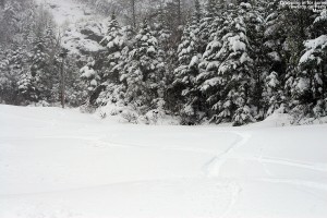
Stowe, VT 26MAY2013

An image of ski tracks in powder on the Perry Merrill trail at Stowe Mountain Resort in Vermont during a spring storm on Memorial Day Weekend
Visiting Mt. Mansfield for some glorious Memorial Day Weekend powder today

For the past several days, the meteorologists and weather enthusiasts in the New England Regional Forum at American Weather have been talking about a late-season snowstorm with the potential to unload on the northern parts of New York and New England.  Around mid month, a thread discussing the Memorial Day Weekend weather was started, and even at that point there was a suggestion that the weather could be cool.  However, by Thursday, just a couple of days before the weekend, it was obvious that a late-season snowstorm was developing, and the discussion began to focus on just how much snow the Northern Greens were going to get.  I hadn’t been following the weather too closely, but when I stopped in to check the board and found out about the impending snowstorm in the local mountains, my interest was definitely piqued.  We spent last weekend skiing in spring snow on Mt. Washington, and it began to look like this weekend would bring winter skiing on Mt. Mansfield.

“…you didn’t have to
 worry about hitting
anything underneath
and you could just let
it rip.”

Saturday arrived with a nor’easter developing just like the weather models had suggested.  For folks that had outdoor, warm-weather plans for the big holiday weekend, you almost couldn’t find a nastier combination of weather.  Temperatures were in the 40s F, and there was plenty of wind and rain.  We wondered if we were going to have to turn the heat back on in the house.  Reports began to come in about the snow in the mountains, and by mid afternoon, Whiteface was already reporting that they had received 18” of new snow.  As the afternoon wore on, even valley temperatures fell down well into the 30s F in many places in New England, and fairly low elevation spots began to report snow mixing in with the rain.  Although we weren’t getting any snow down to the low elevations in our area, we lost power from about 8:30 P.M. to 9:30 P.M. for some reason, so we headed off to bed early and decided to see how things were going in the morning.
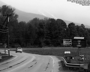
An image of ski trails and a status sign for Route 108 through Smuggler's Notch in Vermont indicating that the notch road was closed due to snow over Memorial Day Weekend
Snow closed down the road through Smuggler’s Notch today.

I made my morning CoCoRaHS observations at 6:00 A.M., and after checking back in on the weather board and looking at some of the mountain web cams, I decided to head to Mt. Mansfield for a ski tour.  I couldn’t tell quite how low the snow line had gotten, but it was still below freezing in the higher elevations, and the precipitation had continued through the night.  There was a good chance that a nice shot of snow had accumulated on Mt. Mansfield.  I didn’t try convincing E or the boys to try to join me, since they were all still in bed, so I got into my ski clothes, let E know that I was on my way, and loaded up the car with my gear.  I don’t typically find the ski gear vying for space with the baseball stuff in the back of the car, but it definitely was today.  I headed off to the mountain around 7:30 A.M. or so, and temperatures throughout the mountain valleys in the WaterburyStowe area were in the lower 40s F on my drive.  The precipitation was generally light rain until roughly the point where the electronic sign indicates the status of Route 108 through Smuggler’s Notch, and not long after that, the rain became much heavier.  The sign, by the way, read “NOTCH ROAD CLOSED… DUE TO SNOW”.  The road through the notch tops out near 2,200’, so clearly the snow was accumulating at that elevation on paved surfaces.  The temperature remained in the lower 40s F until that final rise above The Matterhorn to Stowe Mountain Resort, where they dropped into the upper 30s F.

“You could do laps
up there from 2,500’
to 3,600’ and think
it was midwinter.”

I parked at the Midway Lodge (~1,600’), where the temperature was in the mid to upper 30s F, and the precipitation was generally snow, but certainly some rain as well, and the snow that was falling was of course incredibly wet.  It was pretty nasty at that point, with 25 MPH winds and driven wet snow/rain.  The snow wasn’t quite accumulating there, but it was close, and you could see the accumulations just a few hundred feet up the trails.  The weather was nasty enough that I left my lens hood on my camera in its protective orientation, even when it went back in my pack.  I rarely feel the need to do that, and typically flip it back around for storage, but that speaks to just how wet and windy that snow was to make me take that extra step to minimize the amount of precipitation getting on the lens filter.
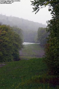
An image of the 2,100' snow line on the Nosedive trail at Stowe Mountain Ski Resort in Vermont during the Memorial Day Weekend Storm of 2013
Snow line in sight on Nosedive at 2,100′

In the Midway parking lot there were a few dozen vehicles belonging to skiers, and most of the people were heading up Gondolier, but my initial ascent was via Nosedive; it’s often a good bet for decent snow coverage and preservation in these early and late-season storms.  Also, based on what I saw in the report from AdventureSkier.com last Sunday, it looked like there would be some decent base snow left in case the new snow depths were marginal.  The first traces of snow accumulation on the ascent were at 1,800’, by 2,100’ there was generally complete coverage of the trail, and by ~2,200’ the depth was a couple of inches and it was consistent enough that I switched from hiking to skinning.  Even with those couple inches of snow, I was beginning to experience some occasional slipping as I hiked, so it was nice to get the skis off the pack and on the snow where the skins had beautiful traction.  There was a faint skin track from an earlier ascender, but it was intermixed with some of the descent tracks of skiers and a bit hard to follow.  I met up with another guy that was making the Nosedive ascent, and we chatted a bit about skiing as we made our way up the mountain.  He was just hiking in his boots with his skis on his back, which seemed like a bit more work as the snow got deeper and deeper, but it didn’t appear to slow him down too much.  Listed below are the snow depths I found on the ascent of Nosedive with respect to elevation:

1,600’:  0”
1,800’:  Trace
2,100’:  1”
2,200’:  2”
2,500’:  4”
2,600’:  5”
3,000’:  8”
3,300’:  10” – 12”-15”

We stopped our ascent at 3,300’ because as we approached the switchbacks at the top of the trail we got some beta from a couple of skiers coming down Nosedive – they indicated that everything above that elevation in the switchbacks was scoured and really not worth it, and indeed that was obvious once we got to the landing below that final switchback at 3,300’.  I’m going to call the average snow depth there 10” to be on the conservative side, but there were plenty of areas with 12”-15” of snow; there was just variability due to the effects of wind deposition.  I stuck my measurement pole right in the snow in the center of that landing, and found 15” of snow depth.  The guy that had ascended with me headed up just a bit higher to catch some turns along a drift of snow, so I pulled out the camera and got some action shots as he made his way down.
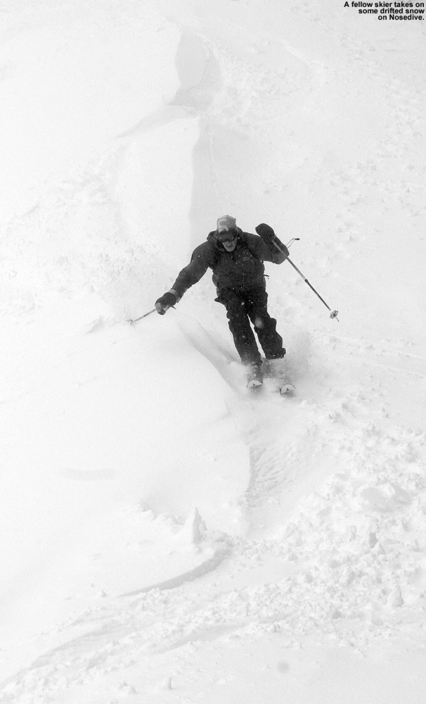
An image of a skier  on the Nosedive trial at Stowe Mountain Resort in Vermont during a Memorial Day Weekend snowstorm
I didn’t get his name, but he had quite a blast ripping up the powder on Nosedive today.

An image of Vanilla Bean GU Energy Gel

Before beginning my descent, I downed a packet of GU Energy Gel to see if it would provide that extra boost of energy to my legs to permit proficient and aggressive Telemark turns.  I’ve noticed that after fairly long and/or quick ascents, my legs are often still recovering, and not to the stage where they can handle a lot of rigorous Telemark skiing right away.  Alpine turns are typically no problem, since they’re easier and more stable to begin with, and after decades of alpine skiing, my muscles have the memory to really let them do it efficiently.  But those Telemark turns take a lot more work, and it seemed like a little extra boost of quick energy would get me where I needed to be.  So, I took a cue from the boys, who like to have a GU when they’re starting to fade while we’re biking or skiing – the Vanilla Bean flavor is a favorite among all of us.  I usually don’t find that I need to worry about having enough energy on outings with the boys along; the pace is so slow that E and I usually don’t get drained.  The boys certainly push themselves though, often needing some sort of recharge due to their smaller energy reserves, and when that’s the case, it’s GU to the rescue.  On bigger, faster paced outings by myself though, I also feel the drain, and today I wanted to give a recuperative GU shot a try.  I had the GU just a few minutes before my descent, and it absolutely worked.  It helped give my legs that quick energy that they craved, and they had no trouble making Telemark turns.  It was great having maximum powder to drive the legs, and while there’s no way to know exactly how my legs would have performed without the shot of GU, it was certainly my hero for today.  I can still remember when I first learned about those energy gels back in the early 2,000s when Scott and Troy and their Dirtworld.com mountain biking team would use them.  They’d strap them to their handlebars and down one on each lap to keep their energy up.  With the way it performed today, I think a shot of GU before each earned descent is going to become part of the routine.

“There were plenty of
untracked lines to ski,
and it was dense, wall-
to-wall snow…”

As for the snow conditions, indeed there was some leftover base snow on Nosedive, and that offered up great turns, but the new snow itself was extremely dense (probably 12-14% H2O or so) and as long as there was enough of it, there was no need for previous base because it kept you off of anything below.  I caught some beautiful bottomless powder on the skier’s left below the switchbacks, and then a lot more on the skier’s right along the edge of the trail.  The Telemark turns were definitely flowing, and despite the fact that it was dense snow that could easily have been challenging to ski, it wasn’t.  I immediately thought back to that storm last year on April 10thMt. Mansfield picked up more than two feet of dense snow that covered everything, but it was quite a challenge to ski on the Teles.  Sometimes you would punch through the snow too far, perhaps with one ski, making lateral balance tough, and fore-aft balance was also extremely challenging.  It’s possible that there was snow of varying densities in that storm, with some less dense snow underneath the topmost layer.  That’s “upside down” snow, which is typically more challenging to ski.  It was after that storm that I really decided that I wanted some fat, rockered Telemark skis for powder, and eventually got the Black Diamond AMPerages.  I can only wonder how they would have performed in that storm – they would have been nice today, but being unsure of the snow depths I went with my older Atomic RT-86 midfats, and there were no issues.  Really, the most challenging aspect of today’s skiing was negotiating areas of thinner snow as you dropped in elevation.  I was actually quite impressed with the quality of some of the powder skiing on Nosedive today, but little did I know it wasn’t even going to hold a candle to what was in store over at the Gondola.
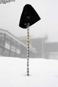
An image showing a ski measurement pole indicating 22" of snow at the Cliff House at Stowe Mountain Resort in Vermont on Memorial Day Weekend
22″ of new snow up at the Cliff House today

I had no time limits, and plenty of energy left in the tank with the shortened ascent, so I skied down to the junction of Nosedive and Cliff Trail, and continued my tour by skinning up Cliff Trail.  Within a few moments of starting my ascent, it was obvious that snow depths were substantially greater on Cliff Trail than they were on Nosedive at equivalent elevations.  I wasn’t sure if it was because I was heading toward the Gondola, or because Cliff Trail offers better protection from the wind, but coverage was deep, wall-to-wall.  Unlike what I’d seen on most of Nosedive, there were no signs of whatever lay beneath the snow.  It wasn’t an illusion either; the depth at 3,000’ on Cliff Trail was 11”, vs. the 8” on Nosedive.  The snow just continued to increase as I ascended toward the Gondola, there was 12”+ by the junction with Perry Merrill at 3,400’, and 12” – 15” easily up at the Cliff House.  That’s on the conservative side for what you could find up there, and in general the snow depth was somewhat deceptive because you didn’t sink much into the dense snow.  But right in the middle of Perry Merrill just beyond the Cliff House I measured 22” of new snow in flat terrain with no drifting.  The usual measurement off the top of the picnic tables was deceptive as well – there was about a half foot of snow on the tables, but you could tell that the snow was much deeper because the table’s seats were just about buried.  I measured in the open space between the tables and got a depth of 18”, so presumably the tops of the tables didn’t accumulate the snow well due to wind, melting, or some other effect.  Here’s the summary of the depths I found on the Gondola side ascending via Cliff Trail:

3,000’:  11”
3,400’:  12”-15”
3,600’:  12”-15” – 18”-22”

“…at times it was dense
enough that you’d be
smearing turns right
on the surface.”

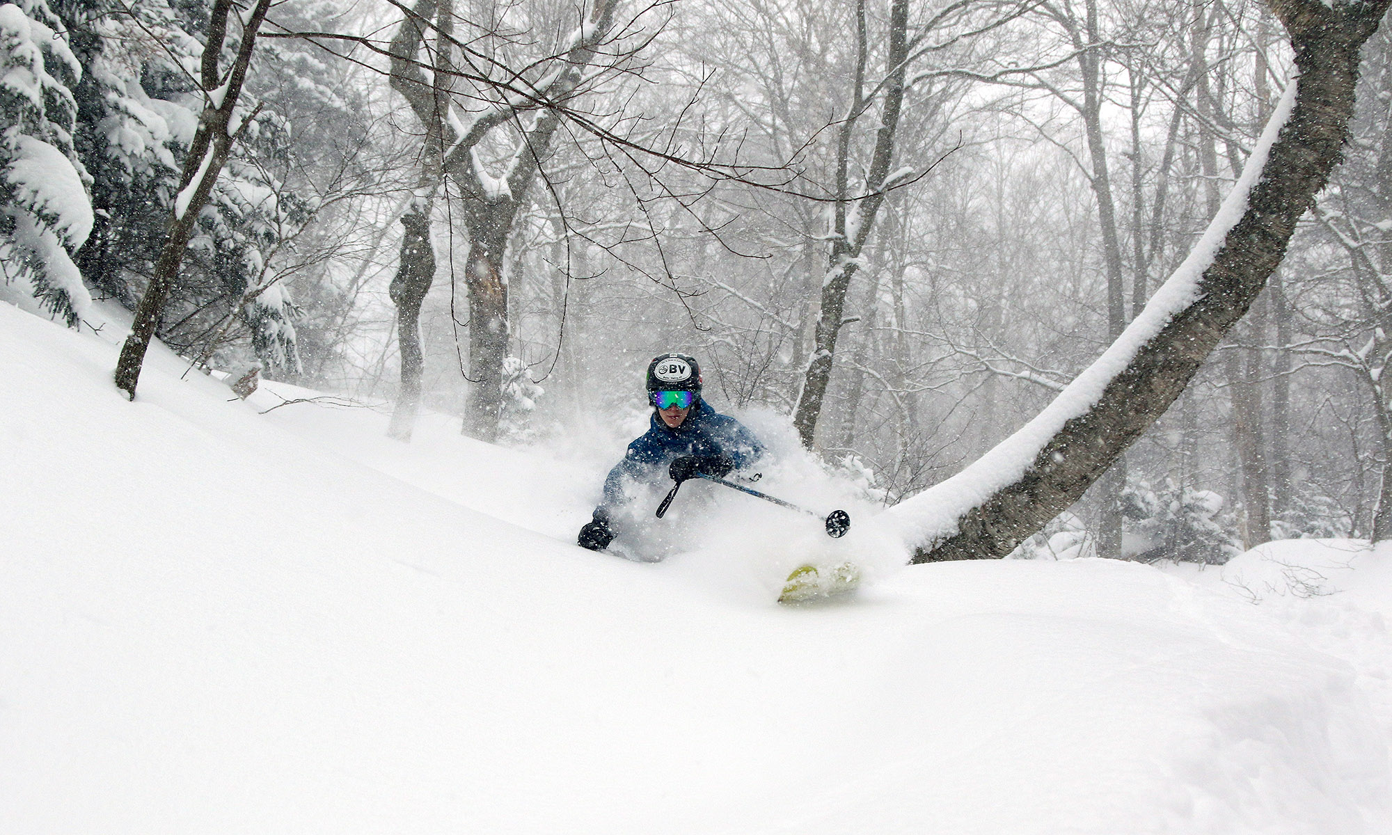
I had another GU and got ready for my descent.  Even that first steep pitch of Perry Merrill had great coverage comprised of that dense snow.  Typically you’d sink in a few to several inches, but at times it was dense enough that you’d be smearing turns right on the surface.  It took a moment to adapt when that was happening, but somehow the variability in the turns didn’t seem to disrupt the flow of the skiing – it was just really fun.  I almost headed back down Cliff Trail since the coverage was so complete, but there were already a couple of tracks on it, and it’s fairly narrow, so I opted to check out Perry Merrill instead.  I was hoping it would live up to the coverage I’d seen on Cliff Trail, and indeed it was just as good, if not even a bit better.  There were plenty of untracked lines to ski, and it was dense, wall-to-wall snow, all the way down to 2,500’.  You could do laps up there from 2,500’ to 3,600’ and think it was midwinter.  The snow certainly wasn’t fluffy Vermont Champlain Powder™, it was dense Sierra Cement, but it wasn’t wet or sticky.  It made for plenty of base and just skied really well – it was right near the top on quality that I’ve experienced relative to many similar early and late-season dense-snow events.  Sinking into the snow only a few inches or so was inconsequential compared to the fact that you didn’t have to worry about hitting anything underneath and you could just let it rip.
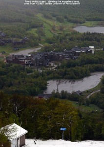
An image looking down at the base area of Stowe Mountain Resort in Vermont from a snowy Perry Merrill trail down toward a snowless base area during a Memorial Day Weekend snowstorm
The view from white to wet

I stopped my descent at around 2,300’, as the snow was down to about 4” and it was getting notably wetter.  You could probably go down to around 2,100’ easily if you had your rock skis.  I hiked down the last 700’ back to the Midway Lodge, and the last vestiges of snow disappeared right around 1,800’ just like I’d seen over on Nosedive.  The precipitation was snow down to just a couple hundred feet above the base, and back down at the lodge it was mostly rain with some snow mixed in at times.  There were some really good bursts of snow on my descent, even in the lower elevations.  The temperature had increased a few degrees to ~40 F at the base, but it was midday at that point, so that was still quite impressive.

Overall, I was really excited about how my equipment and supplies performed on this tour.  My Gore-Tex did its job in keeping me dry, despite the driving rain and snow.  My skins held like glue even in the wet snow, and hiking both up and down in my Telemark boots was a joy.  I remembered to put them in walk mode for the walking sections (and put them back in ski mode for the descents) and it was almost like being in my hiking boots.  And then there was the GU.  It really quickened my recovery for the descents, and I’m going to be keeping that on the tour menu going forward.  The boys won’t be able to borrow GU from me as easily though when they need it.  While the GU certainly did its thing, I’m sure my stop off at Dunkin Donuts to fuel up before the tour also helped.  I was feeling so great when I got home at midday, that I was ready to go for another round of skiing if E and the boys wanted to.  It was still nasty and rainy outside, and not really conducive to doing too much else, but we had some fantastic winter powder skiing sitting up there in the high country.  I couldn’t convince them to go though, so they unfortunately missed out this time.  We did get some quality time indoors though, which I’m guessing a lot of families were doing this weekend.  Ty, Dylan and I had a great round of “The Settlers of Catan” while E did a bit of shopping.  It was quite a storm though, with Whiteface and other areas of the high peaks really cleaning up and putting out some amazing pictures.
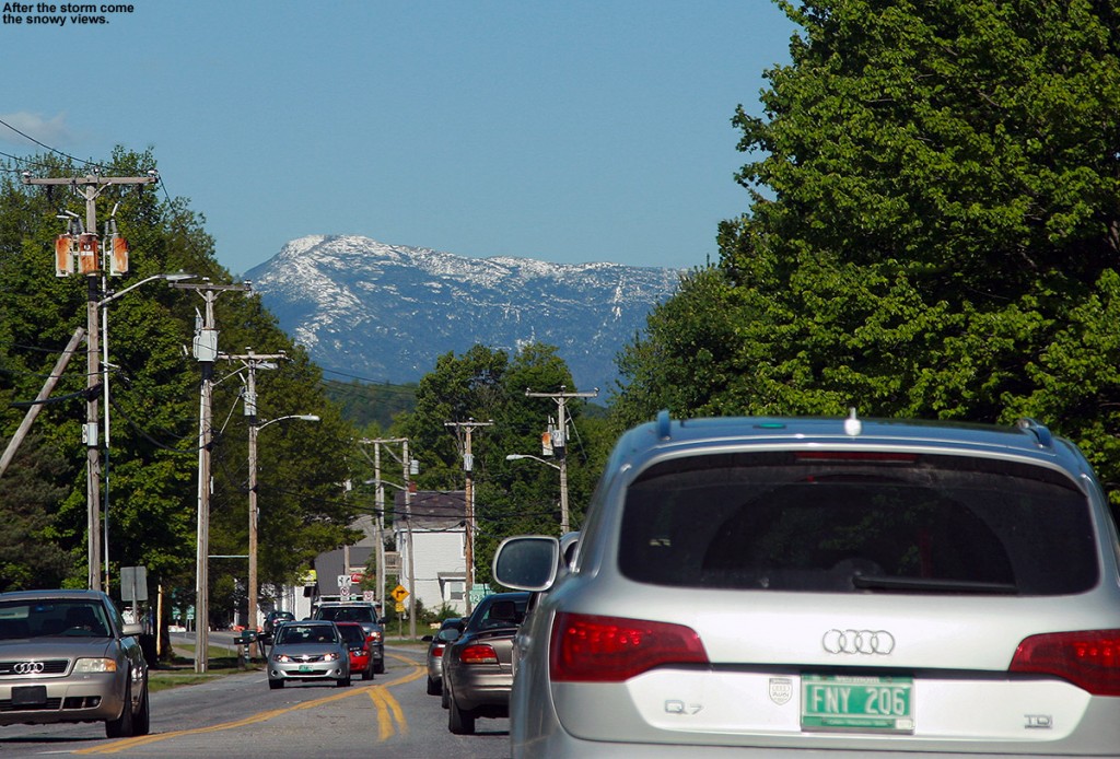
An image of snow-capped Mt. Mansfield in Vermont from the west after a Memorial Day snowstorm
…and this is what you get for Memorial Day

Monday update:  The clouds cleared out today to produce crystal blue skies, and naturally that revealed some amazing vistas of the spring foliage and snow-capped peaks everywhere.  Mt. Mansfield and Camel’s Hump were topped with white, shimmering in the strong sun of late May, and the high peaks of the Adirondacks were brilliant.  We traveled around from Waterbury to Vergennes to Cambridge doing various activities, so we took in numerous vantages of the Greens and Adirondacks.  It turned out to be a spectacular Northern New England Day for the holiday, almost as if Mother Nature was trying to strike as sharp a contrast as possible against the recently departed storm.
Bolton Valley Nordic/Backcountry & Bolton Mountain 20FEB2012

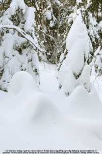
An image of evergreens caked and buried with powder snow along the Catamount Ski Trail north of Bolton Valley Ski Resort in Vermont
Despite this winter’s low snowfall so far, the snowpack is quite deep along the high elevations of the Catamount Ski Trail and Bolton Valley’s backcountry network.

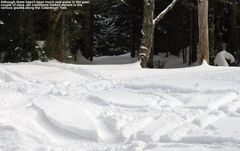
A little fresh snow fell when we were out on our tour in the Bolton Valley backcountry yesterday, but in general we’ve been in between systems over the past couple days.  That’s presented a great opportunity to explore the backcountry with the boys though, and yesterday they completed their longest tour to date as we took them out to one of the glades along the Catamount Trail.  E and the boys had to head back to school today, but I had the holiday off and decided to do a tour similar to yesterday’s, with some additional exploration along the Catamount Trail past the glade we’d visited.

I parked down at the edge of the tennis court lots as usual, made my way up to the Wilderness Lift, and connected over to Heavenly Highway from the Wilderness Summit.  Snow conditions were very much like yesterday – I checked the depth of the powder atop the base snow along Heavenly Highway and found it to be around 9 to 10 inches.  The big change from yesterday was that there was nobody out on the backcountry network trails – Monday afternoon on a holiday weekend must have meant that most people had already headed home.

“It was so quiet that even
the nearly silent shuffling
of my skins through the snow
had me feeling like a marching
band crashing through a
sleepy town in the
middle of the night.”

Once past that first glade along the Catamount Trail, I was into what was for me, uncharted territory.  I continued along the trail, which gradually rose as it headed generally north-northwest toward Bolton Mountain.  One of the most impressive aspects of this part of the trail was seeing the impressive depths of snow that have built up, in what has really been a very low season for snowfall.  The general area below the Catamount Trail junction with Raven’s Wind, which is sheltered like parts of Heavenly Highway, revealed evergreens that were just choked, buried, and ensconced with snow.  Around every corner I was finding fantastic, gravity-defying deposits of powder.  Once past the junction with Raven’s Wind, which marks the last outpost of Bolton’s backcountry network, the Catamount Trail began to level off and skirt along the eastern edge of Bolton Mountain.  At over 3,300’ in elevation, this area marks the highest point on the entire Catamount Trail.

An image of ski tracks in powder snow above the Cotton Brook area connected to the Catamount Ski Trail and Bolton Valley's backcountry ski network in Vermont
Ski tracks leading to the Cotton Brook area provide a rough sense of the snow conditions out along the Catamount Trail today.

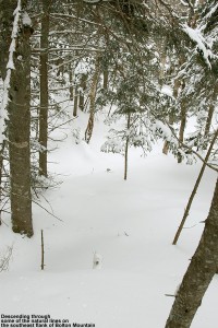
I contoured along the southeast face of Bolton Mountain as the trail switched to a northeasterly direction; I couldn’t see the summit of Bolton Mountain (3,680’) through all the evergreens, but the steep rise in the terrain off to my left let me know that it was looming up there about 400’ vertical feet above me.  As I continued to scan the elevated terrain to my left, I quickly noticed that the density of the evergreens had become sparser, and I began to see potential ski lines through the trees.  I eventually decided that I’d gone far enough out on the trail for the day, and chose a spot to ascend a bit and see if I could start my descent up in the trees above me.  The terrain was fairly steep, but there was that consolidated base below that top layer of powder, so I wasn’t wallowing in bottomless fluff as I broke trail.  With the evergreens all around me, the air was deathly still.  It was so quiet that even the nearly silent shuffling of my skins through the snow had me feeling like a marching band crashing through a sleepy town in the middle of the night.  I continued generally westward and upward, following what looked to be the most open lines through the trees.  The terrain began to flatten out ahead of me, and I could see on my GPS that I was approaching the Long Trail along the ridgeline; I decided that that was a good goal to mark as my turnaround point.  I know that I was very close to meeting up with the trail when I finally stopped my ascent, as I was definitely on the ridgeline and the land clearly began to drop off to the west.  I was tempted to go a little farther and make the trail connection, but it just didn’t seem worth it to lose elevation.  It was after 3:00 P.M., I was well away from the Catamount Trail, and I was alone.  It was at least generally downhill back to the Catamount Trail from my location, and there was no need to push my luck.

“Some trees even displayed that
hanging moss that I’ve often seen
in the mountains of the Pacific
Northwest and British Columbia…”

I stripped off my skins and reversed my course, traveling along generally flat, ridgeline terrain at first, and negotiation a steep south-facing gully as well.  When I’d finished crossing the flattest terrain and could see that I was about to begin the descent to the Catamount Trail, I stopped in a comfortable spot and pulled out some of my food supplies.  I ate a Clif Bar and had a couple rounds of the hot tomato soup that I’d packed in my thermos like yesterday.  That absolutely hit the spot.  I definitely needed the recharge after throwing in all that extra trail breaking on top of the ascent of the Catamount Trail.  The energy expenditure had been enough that I was getting a bit drained, and I definitely wanted something in the tank for the descent.  Once I stopped moving, the silence around me was redoubled, and it was indeed eerily quiet.  Such is the scene at times when one is alone in the deep woods of winter.

An image of a ski line through the trees above the Catamount Trail on Bolton Mountain, north of Bolton Valley Ski Resort in Vermont
Catching a line through the trees high on Bolton Mountain

I packed up my food and gear and began the real descent through the evergreens.  There were indeed some reasonably open spaces and nice turns, but it was steep enough that it really would have been better with deeper powder for the available tree spacing.  The 9 to 10 inches that were there were OK, but I’d say something around 18 inches would be more appropriate.  And, although the natural lines through the trees were good, they could be dramatically enhanced just by clearing off the all the dead branches that were still on the lower parts of the evergreens.  That would be a great off-season project for someone to tackle, and the process could continue right on down below the Catamount Trailas well, because the terrain just keeps going.  In any event, even in its natural state I’m keeping that terrain in mind for a place to visit after a reasonably big dump with depths of powder that will fit the pitch and spacing of the trees.

I popped out on the Catamount Trail and had begun to head back toward the resort, when I ran into the first pair of people I’d seen all day.  It was a couple of younger guys, and they asked me if I knew the area.  I said that I knew it fairly well, but when they asked me what lay to the north of where we were, I told them that that was out of my range of knowledge – I was currently the farthest north I’d ever been on this section of trail.  In terms of descents, I said that I’d recommend descending back in the Cotton Brook area if they were unsure of where they were, because I knew that one could ascend back out of there quite easily.  It was likely that one could traverse and get out from areas to the north as well, but one never knows just what the terrain would be like until they’re actually in there.  I’m not sure what they ended up doing, but since it was well after 3:00 P.M. by that point, I hope they made an appropriate choice.

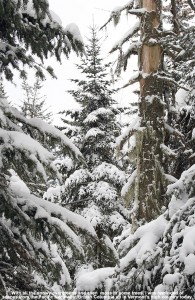
An image of evergreens with snow and some hanging moss along the Catamount Trail north of Bolton Valley Ski Resort in Vermont
Views of countless snow-covered evergreens and even hanging moss as I travel through the high elevations of the Catamount Trail

I was tempted to do a little extra exploration on my return trip, especially as I looked at the vast expanse of evergreens below me.  Some trees even displayed that hanging moss that I’ve often seen in the mountains of the Pacific Northwest and British Columbia; as if the deep snowpack wasn’t enough, the sight of the moss seemed to me like a real testament to just how much precipitation falls in the higher elevations of the Northern Greens.  As much as it would have been nice to poke around, ultimately I wasn’t willing to explore a descent down into the Cotton Brook area with the time of day, so I descended back toward the resort on the Catamount Trail itself.  The trail isn’t very wide, so the descent below Raven’s Wind was quite a hoot.  Let’s just say that I’m glad that I didn’t “run” into anyone ascending at that time of day.  It’s definitely an exhilarating descent back toward the main glade though if you can catch it without any uphill traffic.  I enjoyed a descent of the main glade back toward the Cotton Brook Trail junction, but despite the decent amount of powder, the combination of tracked snow, irregular surface underneath, and some previously work by the sun, made it rather challenging and nothing special in terms of flow.  It’s definitely time for another storm.
I cruised quickly back along the Catamount Trail to the Bryant Cabin area, and headed right onto Gardiner’s Lane and North Slope.  I was determined to find that glade that I’d missed with E and the boys yesterday, and after a bit of searching, I did.  I made another mental note on the entrance to set myself up for next time, and had a fun ride down through there.  When I finally got back down to the lower Nordic trails, I saw a couple of other people, but amazingly that was it for the entire tour of almost six miles.  I can’t wait for my next chance to get out in the farther reaches of the Catamount Trail and explore it further.

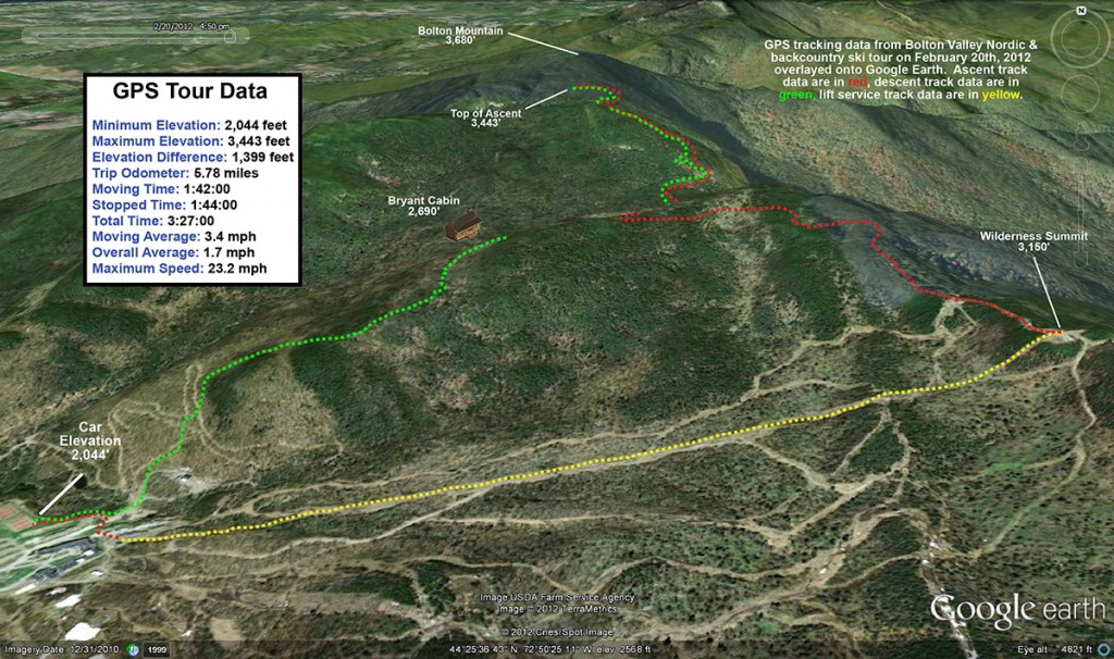
A Google Earth GPS map tracing of my tour on the Bolton Valley Nordic/backcountry network of ski trails and the Catamount Ski Trail in Vermont on February 20, 2012
The Google Earth GPS track for today’s tour

Bolton Valley, VT 29DEC2011

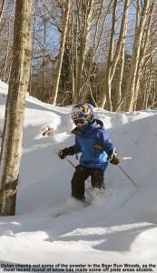
An image of Dylan skiing powder in the Bear Run Woods at Bolton Valley in Vermont on December 29, 2011
The two feet of snow from the storms this week has finally allowed at least some minimal off piste skiing to get going at Bolton Valley.

Thanks to the second big snowstorm of the holiday week, the mountains picked up another foot of snow, so we decided to hit Bolton to check it out.  When I’d headed up for turns yesterday afternoon/evening, it was still snowing very hard with plenty of wind, but it looked like areas that weren’t affected by the wind were going to offer up some excellent powder turns today.  One downside to the storm was that it also ushered in some fairly cold air, bringing temperatures down to around 0 degrees Fahrenheit.  With that in mind, we didn’t rush right off to the slopes in the morning, but let the air warm up a bit because we knew it was going to be a bit rough for the boys.  By mid morning we’d reached the mid teens F at the house, so we decided it was time to get going.  We also got a little extra incentive to ski when we discovered that the mountain was beginning to open up some new, natural snow terrain for the first time this season due to all the additional snow.  In the morning snow report on the Bolton Valley Website, the indicated that trails like the Wilderness Lift Line would be opening, and that was very exciting to hear.  We also let the boys have a go at their powder skis for the first time this season, so that got them psyched up a bit for the outing, even if it wasn’t a mega dump of snow and were weren’t rushing out for first tracks.

An image of Bolton Valley's Timberline area on December 29, 2011 with ski tracks from people earning turns
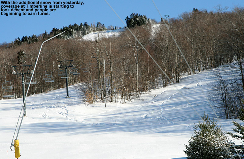
The natural snow has gotten deep enough that people have even been out earning turns at Bolton Valley's Timberline area.

Even down at the lower elevations of the Timberline area (~1,500’) we could see the effects of the new snow – the Timberline trails looked to have decent coverage, and ski tracks were visible, indicating that people had clearly been out earning turns.  We found that the temperatures were in the upper single digits at the main base of the mountain, but the bright blue skies at least meant that the sun would be giving us a bit of warmth.  That sort of fooled E and the boys though, in that they waited outside by the base area ski racks while I parked the car and went into the lodge to put on my gear.  They had to wait outside for a decent stretch of time, but they seemed to be doing OK, we all hopped on the Vista Quad together for a run off the top.  It was indeed colder and windy up top, not the sort of place that one would want to hang around, but the snow surfaces were much improved on the upper mountain compared to when we had first skied Sherman’s Pass on mostly manmade snow on Saturday.  We decided to take Alta Vista, which was newly opened thanks to snowmaking.  It was pretty firm since it was all manmade snow, but at least it was an alternative to Sherman’s Pass off the top.  The mountain had also opened up the Swing trail and Work Road, connecting over to Wilderness, and those were nice on all natural snow.  The Wilderness Lift Line had its usual pleasant natural snow skiing, and coverage was fine, even if the powder was a bit wind-affected in spots and the snow seemed a little “slow” due to the cold temperatures.  It was nice to see the boys enjoying their powder boards, which were certainly helping them out if they ran into any of the wind crust.  Once we were back at the base, everyone deemed it was time for a break because the boy’s fingers were definitely cold from their extended wait while I parked the car and got into my gear.

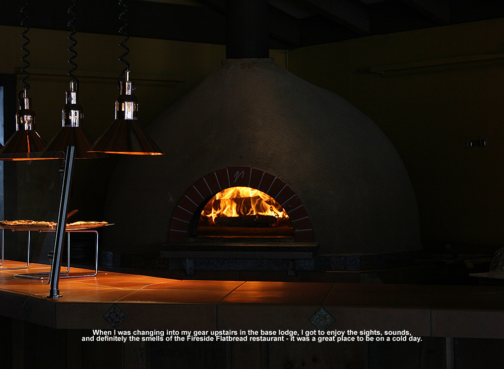
An image of flames in the wood-fired oven up at the Fireside Flatbread Restarant at Bolton Valley ski resort in Vermont
The warm, fiery glow of the wood-fired oven at Fireside Flatbread

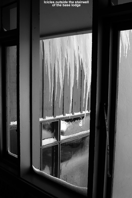
We ate upstairs in the lodge, and took a nice long lunch with plenty of hot tomato soup for everyone to get their bodies warmed up.  The influx of cold did make for some nice wintry scenery around the lodge though, with icicles outside the main staircase, and beautiful patterns of frost on some of the windows.

An image of icicles outside a staircase at Bolton Valley Ski Resort in Vermont
Icicles outside the base lodge hinted at some of the cold temperatures today.

We finally decided to head back out into the cold for another run, and this time took Alta Vista and the more standard Sherman’s Pass route below that to mid mountain.  With all the new snow, we decided to check out the Bear Run woods, since we’d seen a lot of tracks in there.  We found that they were skiable, although a lot of the area was pretty marginal because the shrubbery had not been freshly cleared this season in a lot of the area.  It was fun to get into a bit of powder, but there were definitely obstacles underfoot so one had to be very cautious and we didn’t deem it worth another round of skiing.  From what I was hearing though in talking to folks on the mountain, off piste areas that had been well trimmed were offering up some decent turns, although one still had to be very cautious.  We decided to finish off with a mid mountain run, which let us avoid the more extensive cold and wind of the Vista Summit area.  We had a final good run enjoying the groomed Bear Run, which was skiing very nicely with all the new snow incorporated by the groomers.  We are certainly looking forward to some warming temperatures and the chance to get into some additional powder in the upcoming days.  I expect that the mountain will be able to open more natural snow terrain based on what we saw during today’s outing.