Light snow falls in the Bolton Valley Village in the fading afternoon light as Ty and I finish up our ski tour today.
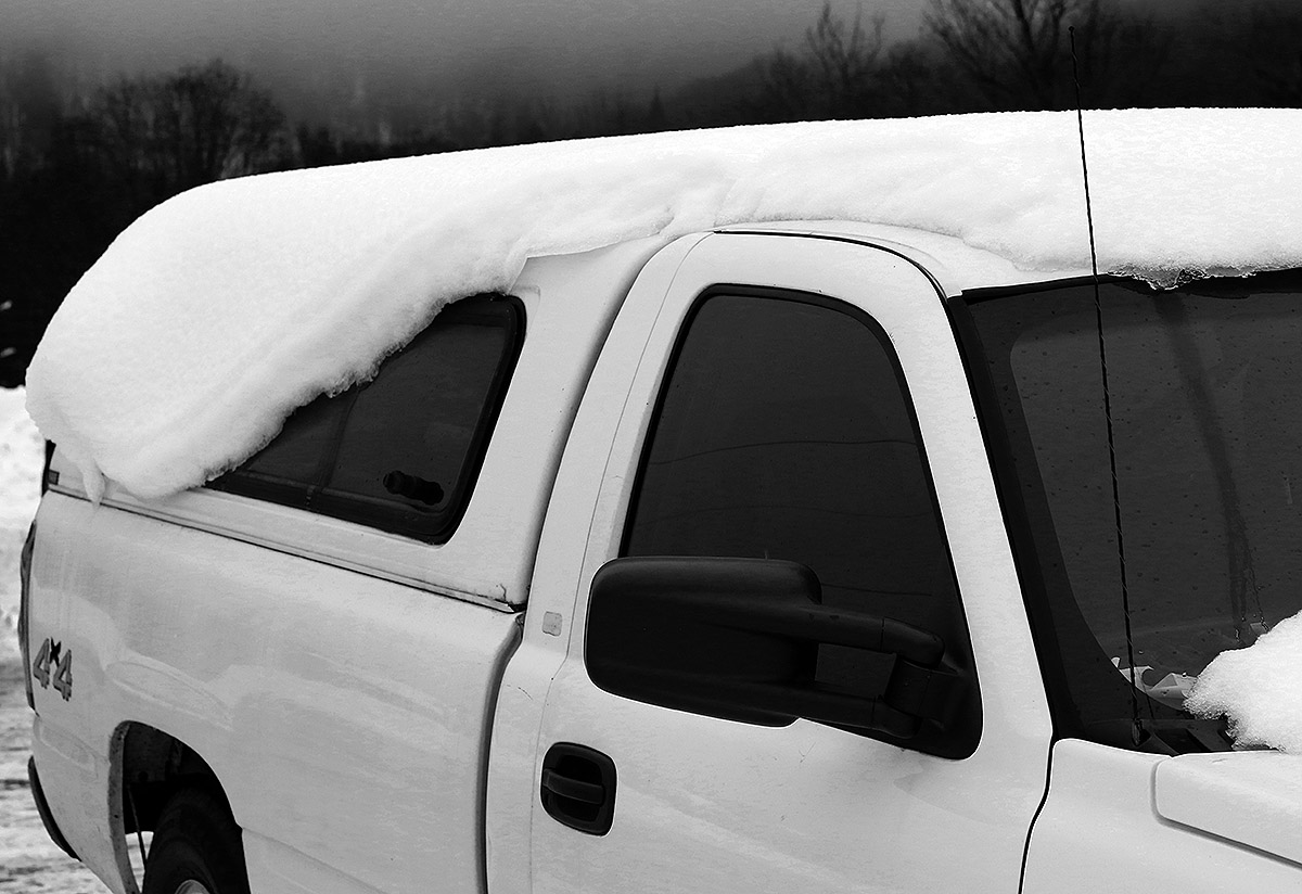
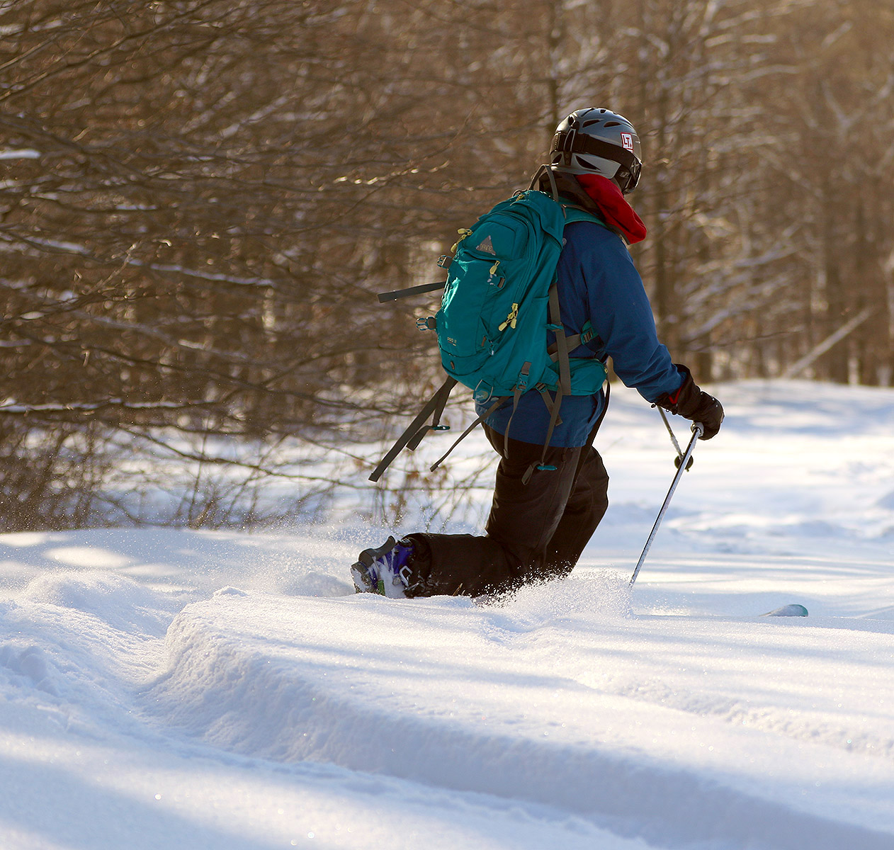
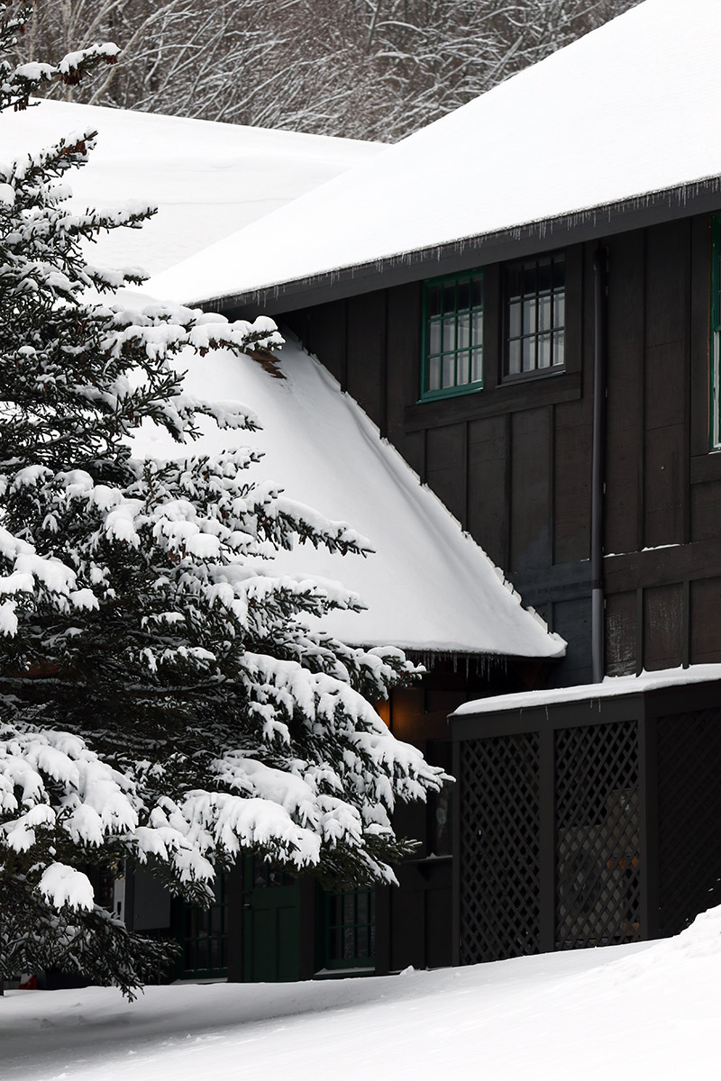
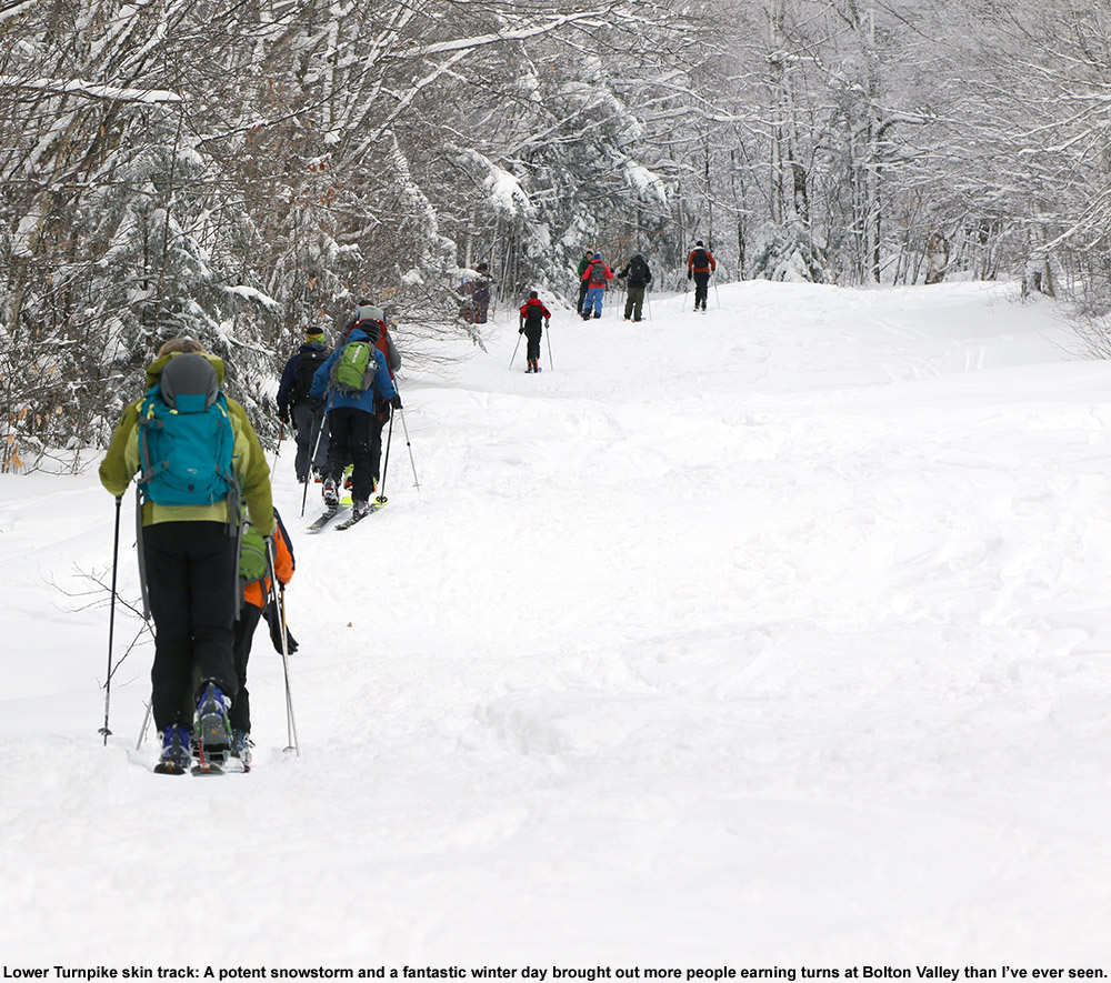
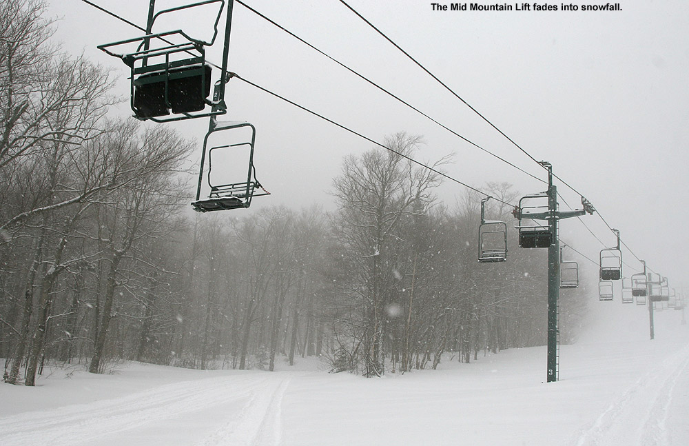
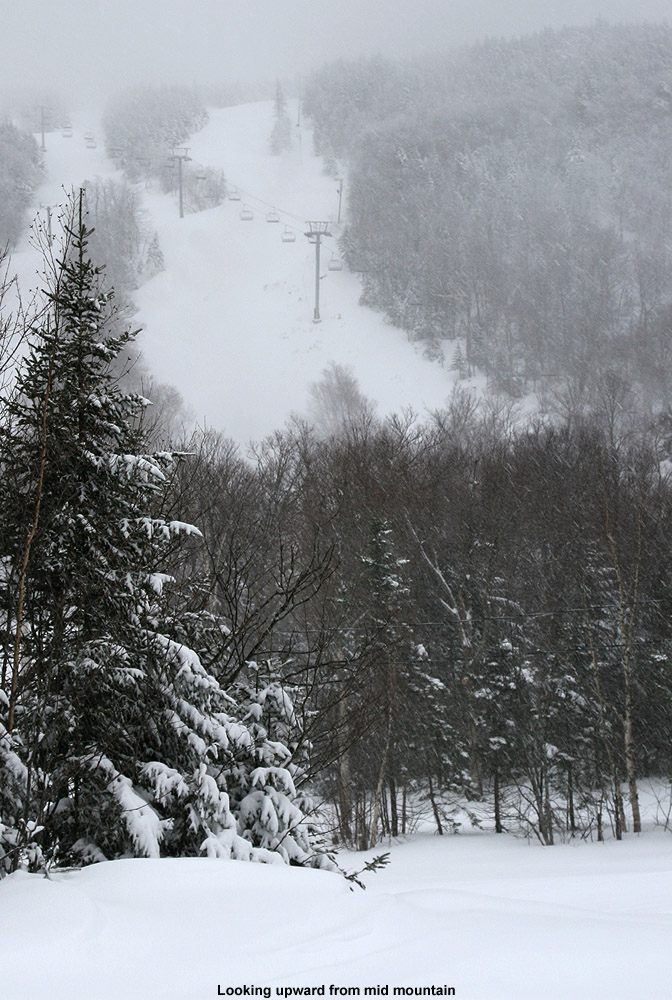
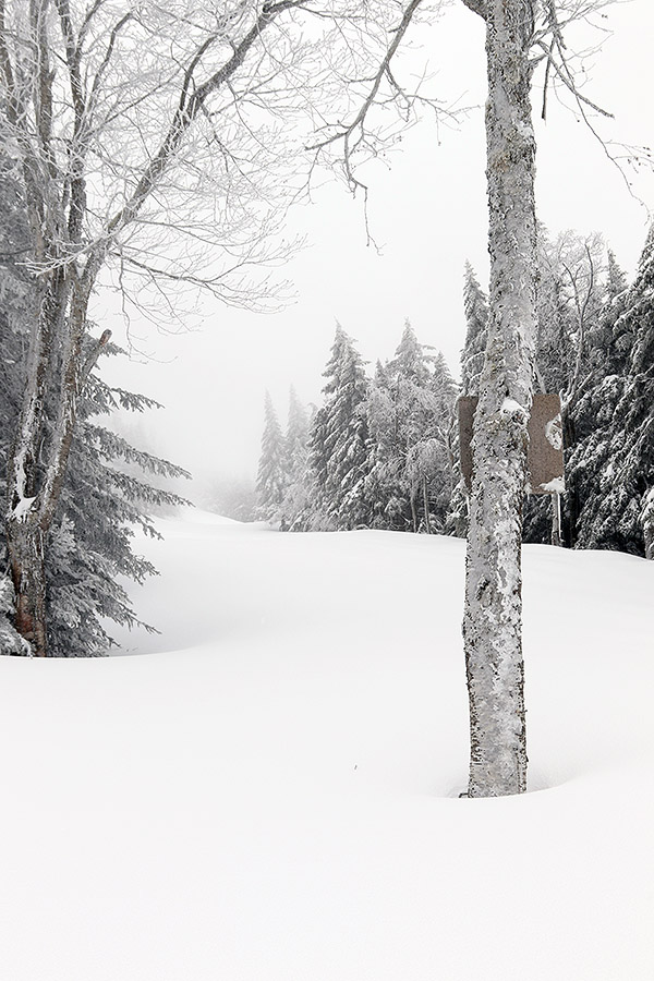
It was Winter Storm Bellamy that hit parts of the Midwest fairly hard yesterday to become TWC’s second named storm of the season, and then the system continued its eastward trek and started to affect our area by early this morning. Throughout the day it brought light snow to the area, and by the afternoon we’d picked up about an inch of accumulation in the valley. Coupled with the accumulations from the midweek system, I figured it would be worth a quick ski tour to see how the powder was building up in the higher elevations, so Ty and I headed up to Bolton Valley in the mid to late-afternoon.
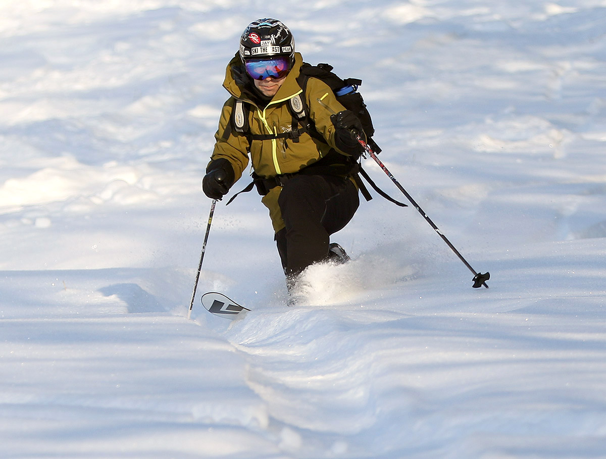
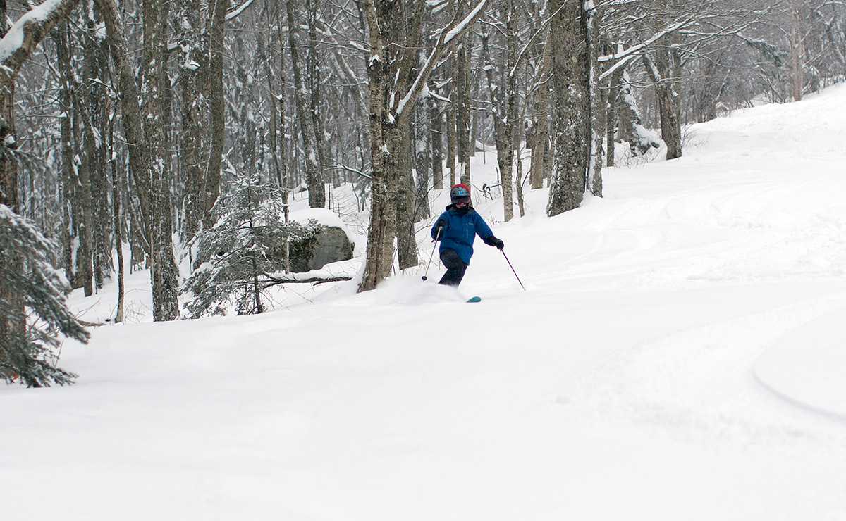
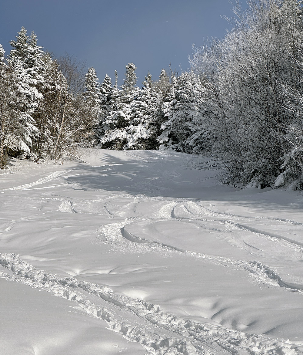
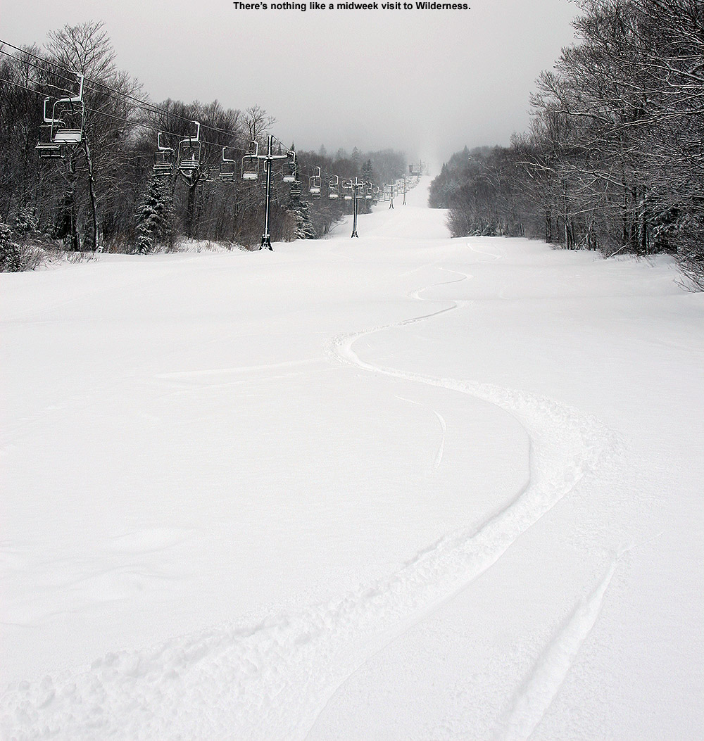
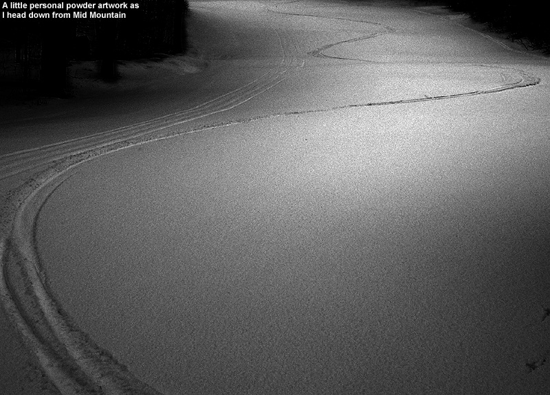
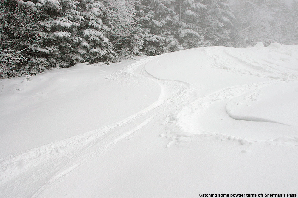
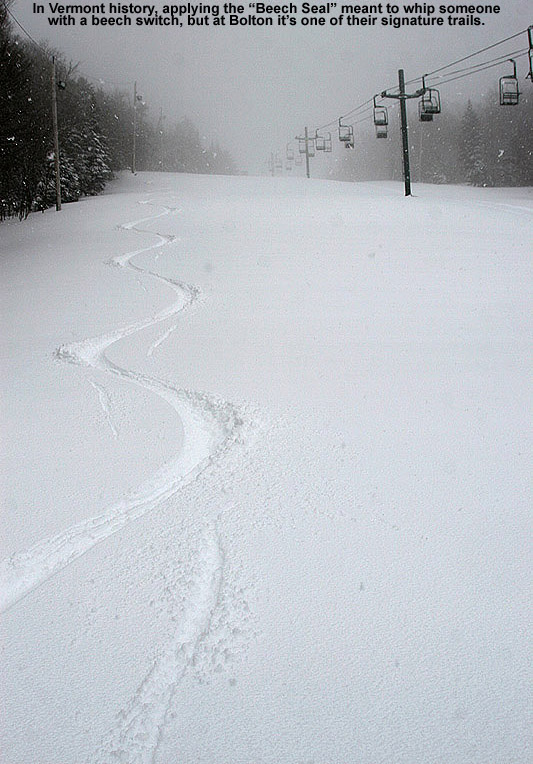
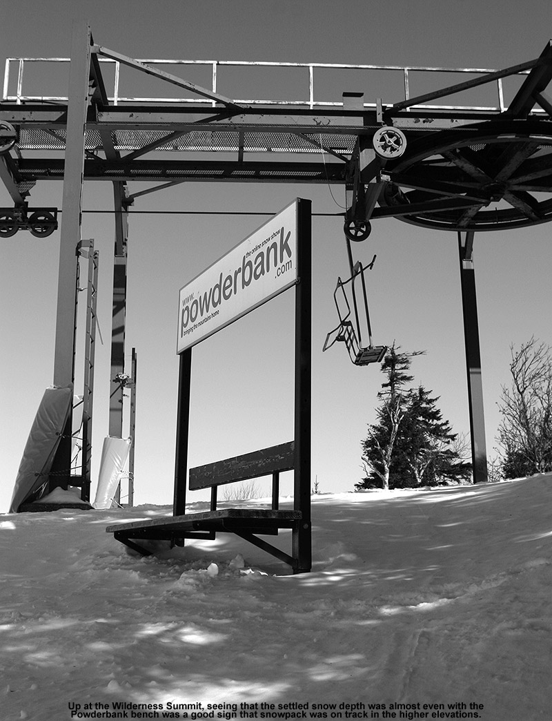
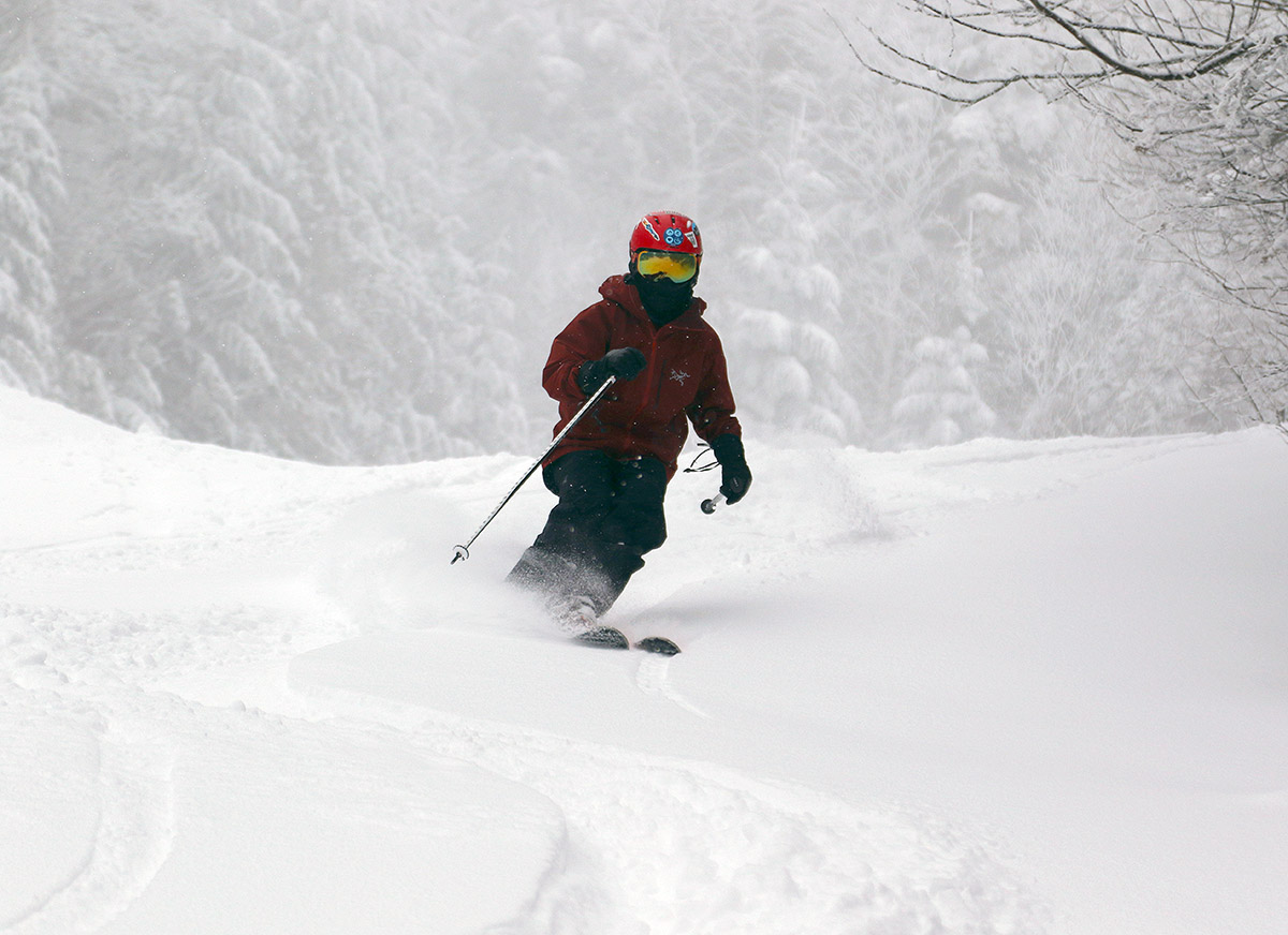
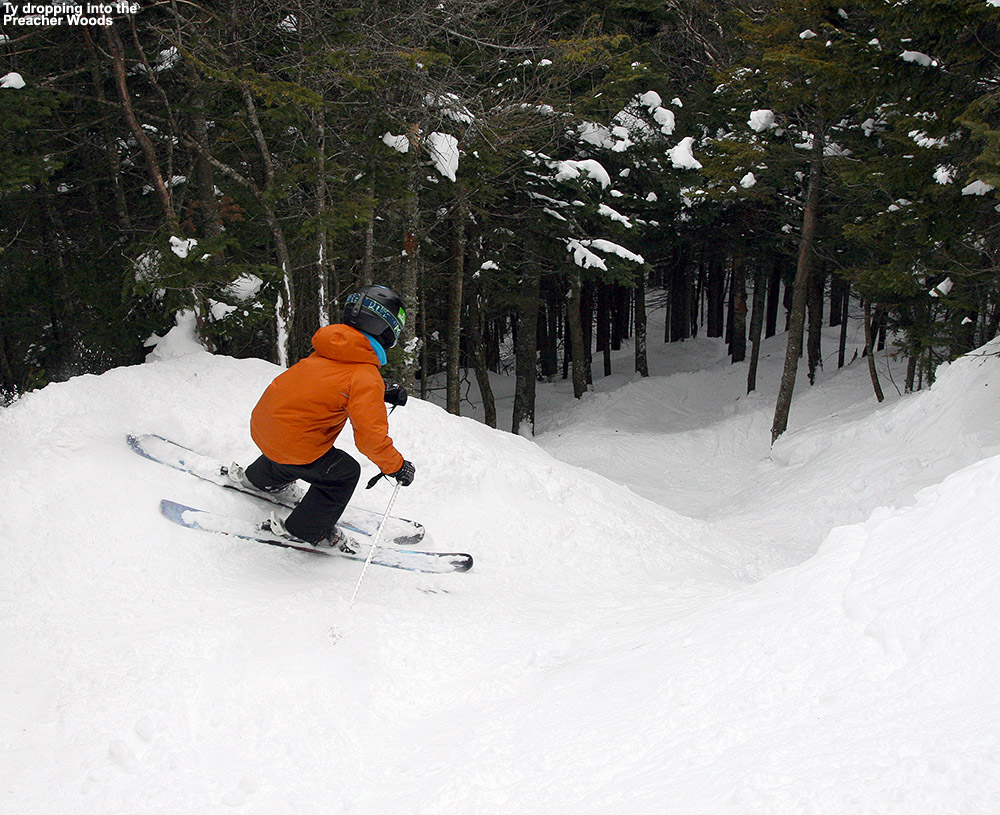
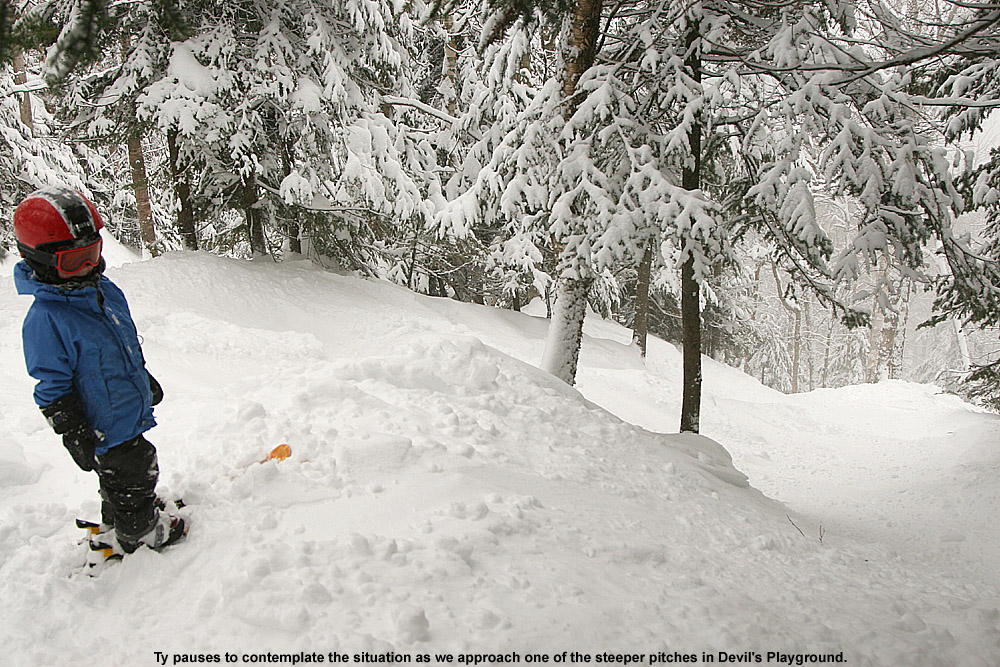
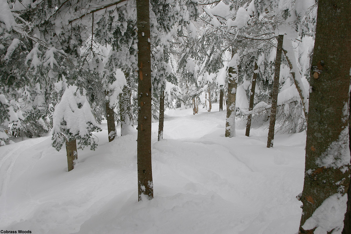
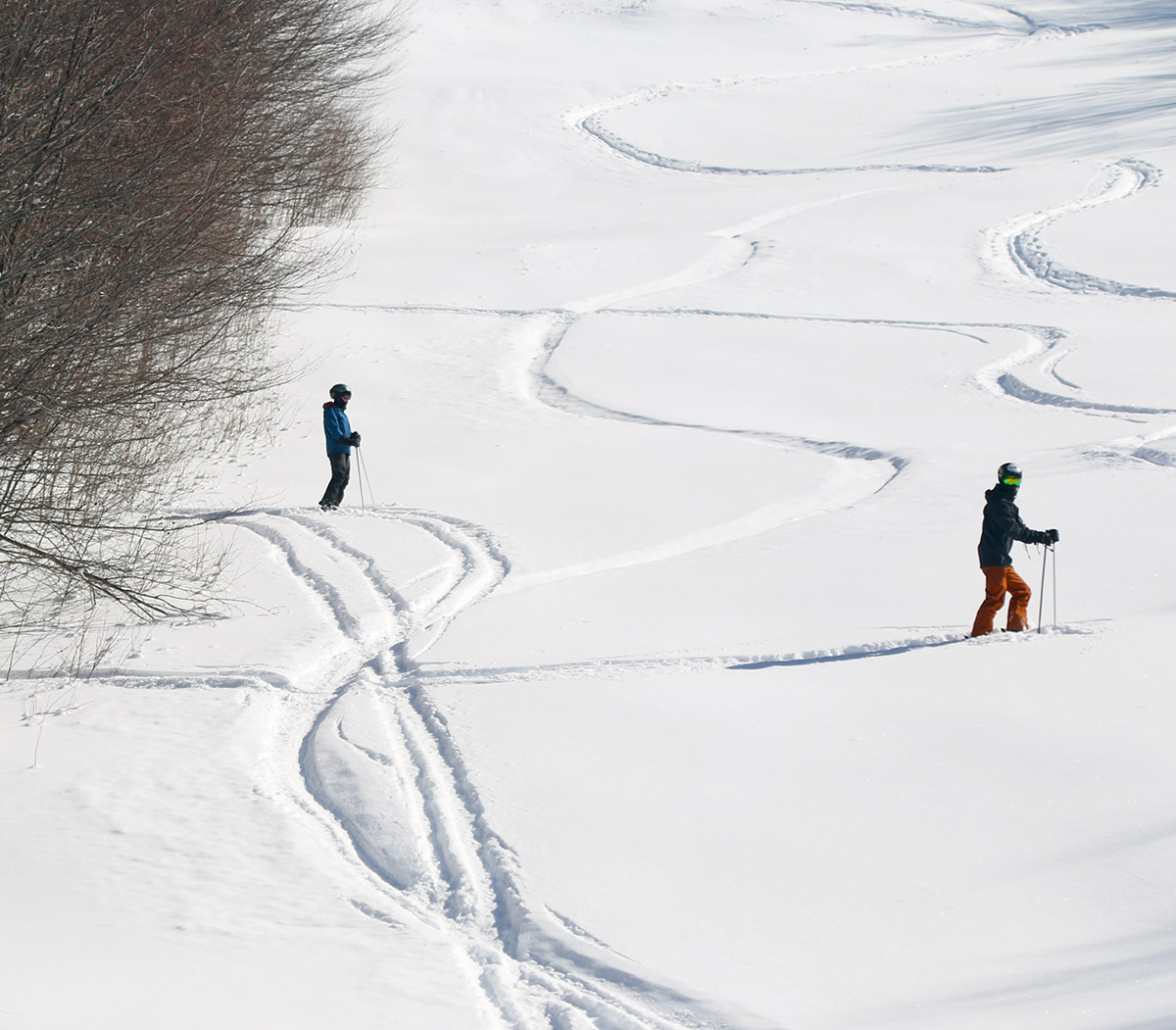
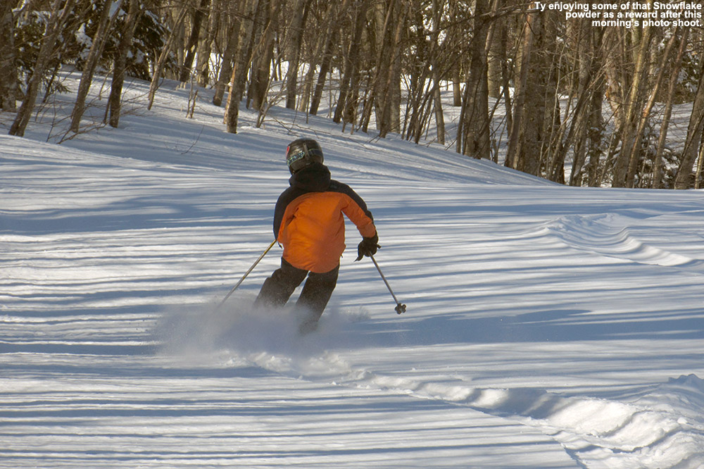
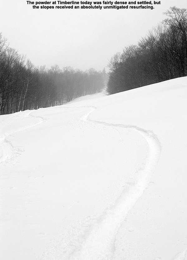
We toured on the lower 2/3 of Wilderness and found a general 3 to 4 inches of powder coating the existing base in untracked areas. That seemed about what one might expect based on picking up a couple of inches from each of these past couple of systems, and conditions were actually a bit better than I’d expected because I was worried that the wind might have blown the snow around and left us with little powder to ski. Indeed the snow was fairly light and dry (my liquid analyses from the two storms averaged out to snow in roughly the 5% H2O range for liquid equivalent), so it was nowhere near enough for a full resurfacing, but it definitely offered up some nice turns on lower angle terrain. Most turns weren’t bottomless, but you’d get some here and there where the powder had settled in a bit deeper. This was certainly a case where denser snow would have made a huge difference in resurfacing, but there was only so much liquid equivalent with these past couple of systems in this area, so they could only do so much to cover the subsurface.
The next storm in the queue has been named Winter Storm Chan, and it looks like it could add a more substantial shot of snow to the slopes – Winter Storm Warnings and Winter Weather Advisories are going up throughout the area. So, on top of the snow that’s already fallen in the past few days, it definitely holds the potential to kick the conditions up another notch.
Snow guns blast away on the Bear Run route as Bolton Valley prepares some of its beginner terrain for upcoming days
As of this morning, the resorts of the Northern Greens from Jay Peak down through Stowe were reporting roughly a foot of new snow with the assistance of moisture coming off the Great Lakes, but south of that area, snow totals fell off rather quickly. Checking Bolton’s snow report, they weren’t reporting any new snow, so I wasn’t planning on making any turns, but Dylan and Colin were looking to get out for some runs with me and E, so we ended up heading out for a morning ski session.
It turns out that the resort did pick up at least a couple of inches of snow based on what we saw, but the accumulations varied a lot with the wind and perhaps their standard measurement spots didn’t hold onto any of the snow to a degree that they felt confident enough to report it. The resort is working on beefing up the manmade base on their main Bear Run beginner route on the lower mountain, so there was no beginner terrain in play today, and I think that helped to keep the number of visitors lower than it might have been. Conditions on their main Sherman’s Pass/Beech Seal route were decent, with some manmade snow of course, but some natural mixed in and a nice amount of loose snow that gave you something to carve on. The relatively low skier traffic kept the morning groomed surfaces lasting longer than they typically might, but by late morning the skier traffic was starting to pick up, and you could tell that the surfaces were getting a little firmer.
Bolton Valley has been putting up some impromptu mini terrain parks near the base these past couple of weekends with just a feature or two, and it seems like folks are having a lot of fun with that. They’re short enough that you can literally hike back up in 20 seconds and hit the features again. Dylan had fun with the one they have set up near the Mighty Mite and made a couple runs down the rails on our way out.
We’ve had a number of winter storms so far this November, and many evergreens in the higher elevations are already holding onto heavy accumulations of snow.
The clipper system that came through the area over the past couple of days was relatively weak, but in general agreement with the forecast, we still picked up close to 2 inches of new snow at our site down in the Winooski Valley. I was up in the Bolton Valley Village yesterday, where it was snowing at a decent clip, and as of their evening snow report, they indicated that they’d already picked up 3 inches of new snow. I’m not sure how much more they picked up overnight, but at the pace the snow was falling, it seemed like it was worth taking a tour to check things out.
Valley temperatures were marginal for parts of the event, and as I headed up the Bolton Valley Access Road this morning, there weren’t any substantial signs of new snow until I’d reached roughly 1,000’ of elevation. After a couple of tours from Timberline’s lower base elevation over the past several days, it was clear that the better play with this system would be to start my tour up at the Village. The cloud ceiling as I ascended was around 1,800’, and above that point, everything was socked in with dense clouds and lightly falling snow.
Light 1-2″ snow accumulations and huge snowbanks greeted me as I started my ski tour in the Bolton Valley Village this morning.
At ~2,000’ in the Bolton Valley Village, I found 1-2” of new snow accumulation. From my visit to the mountain on Saturday, I knew that temperatures above freezing had affected the snowpack, at least up to the 2,500’ elevation. So, the new snow from our small system certainly wasn’t going to resurface that snowpack, but I was curious about what was going on in the higher elevations.
The accumulations of new snow did increase the higher I went, but more importantly, at some point between 2,500’ and 3,000’ you reach a level where it’s clear that the temperatures haven’t gone above freezing in quite some time. The snow quality there is excellent aside from areas affected by the wind or some sort of skier of resort vehicular traffic.
I did my best to estimate the accumulations from this latest system at various elevations, but once you get up to the point where there’s no consolidated melt layer to mark the surface of the old snowpack, it becomes difficult. In any event, here are the estimates for accumulations I found from this event at various elevations in the Bolton Valley area:
All the snow from these November storms has really been accumulating on the trees, and in places where it hasn’t gone above freezing to melt some of it off, it’s a lot of weight on the evergreens. In fact, I saw several evergreen trees that had recently fallen onto the trail along the Wilderness Uphill Route. There’s also a layer of ice on the trees that accumulated from whenever we had some mixed precipitation earlier in the month, and that is definitely adding to the weight the trees are bearing. While I was up at the Wilderness Summit, I watched a small section of trees on Ricker Mountain just collapse from the weight of the accumulated snow and tear away a large chunk of soil as they tumbled down the slope. In any case, many of the evergreens in the higher elevations are absolutely caked with midwinter levels of snow.
Passing through the Lower Fanny Hill area during today’s ski tour
Checking out the new fingerpost and taking in the views today in the Bolton Valley Village
I was last out on the mountain for turns on Thursday, and the powder from our early week storm was holding up well. There had certainly been some consolidation of the snowpack, with sunny areas seeing the effects more than shaded areas, but the general consistency of the snow was dry, and there was no melt layer or melt crust.
A couple days have passed now, and we haven’t had much in terms of new snowfall. High temperatures in the mountain valleys have remained in the 30s F, but the lower elevations have definitely been above freezing, and the snow has seen some thaw-freeze cycles. I didn’t know how high the freezing line had gone and how the snow quality might have been affected in the mountains, but I figured I’d head up for a ski tour today and check it out.
I decided to tour at Timberline as I’d done on Thursday, which would give me a good point of comparison with respect to changes in the snow. From today’s tour I can say that the freezing line has definitely been above 1,500’ on the western slopes, and even above 2,000’. The snow hasn’t consolidated much more from where it was on Thursday, but the above-freezing temperatures have definitely degraded the quality of the snow. Even shaded areas have a melt layer in the top few inches of the snowpack, so you’re not dealing with fluffy, right-side-up powder skiing. Thankfully the humidity has been relatively low, so the melt layer has a spongey consistency instead of being a refrozen aggregate. I’d still recommend alpine fat skis with some decent rocker or a snowboard as the best riding tools. The powder is a bit upside down now with that melt layer on top and drier snow below, but shaded snow is still reasonably surfy if you’re on a nice big platform that can ride up in the higher areas of the snowpack. I was on my 115 mm Telemark boards, but I made only a few Telemark turns – I stuck with alpine turns for the most part because the more consolidated platform and tighter stance was a much better fit for those snow conditions. As long as you have the appropriate tools on your feet and stick to untracked areas of snow, you can get some decently surfy turns. Tracked or packed areas of snow aren’t offering up great turns right now – the snow there has consolidated enough that it’s just bumpy terrain and you’ll get tossed around for a much rougher ride. At least in those lower elevations, we’ll need a decent storm to get back to fluffy powder conditions.
One of the views today from Bolton Valley out toward the Adirondacks
Today was supposed to be fairly benign with respect to the weather, but in true Northern Greens form, as soon as I started gearing up at the Timberline Base, a snow squall moved in and pounded the area with heavy snow/graupel and reduced visibility for several minutes. It was nothing that resulted in substantial accumulations, but it was a definite reminder from Mother Nature that she’s there. In their early morning forecast discussion, the BTV NWS mentioned two areas of weather interest for today passing to our north and south, leaving us in “no man`s land” with no active weather, but in later updates they noted that there was going to be plentiful cloud cover across much of the region in the afternoon as an upper-level shortwave passed through and supported cold air advection and snow showers. We even picked up accumulating snow down at our place in the valley, so there was certainly some wintry weather out there, even during this relative snowfall lull.
but in the spirit of all the November snow we’re received, they started the lift-served season today. Lift Operations Manager Scott Beasley and President/CEO Lindsay DesLauriers made a fun social media post on Thursday to break the news to the community. They’re only running the Mid Mountain Chair and the Mighty Mite at this point, but since I was up at the mountain anyway and had to hit the main base to take care of some passholder stuff, I figured I’d stop in for a few lift-served turns. Conditions were fine, with a mix of manmade and natural snow, but with manmade snow in the mix, there were certainly some firmer areas. You can tell it was a bit of an impromptu opening since they hadn’t full groomed the Bear Run route, but that left some fun contours on the terrain and made it even more interesting. The highest elevation I reached today was up to Mid Mountain at 2,500’, but even at that elevation, you could see that the snow had been affected by the temperatures, so you really have to go higher than that to find pristine winter snow at this point. The resort was bustling though, so it’s great to see them get off to a great start. I heard that they expect to open the Vista Quad Chair for Friday, which is their original planned opening date.
A view of the Village Circle area at Bolton Valley today as temperature begin to edge above the freezing mark and the snow settles
With warming temperatures in the forecast today, I figured the slopes would be softening up, so it felt like a good day for some lift-served skiing. Temperatures were still well below freezing this morning though, so I was unsure how quickly surfaces would soften, and I decided to sharpen the edges on my mid-fat Telemark skis. Last time I really seemed to need edges earlier this month, I found them sorely lacking, so it felt like it was time. I can’t recall the last time I sharpened the edges of those skis, but it has to have been at least a couple of years
Out on the slopes I found an interesting mix of conditions. We’ve had some mountain temperature inversions in place recently, so I actually found some of the softest conditions up high near the summits, while groomed slopes with manmade snow were notably firmer on the lower mountain. While there was nothing that was outrageously icy, it was nice to have the extra sharpness to my edges on the manmade snow.
One exciting thing I saw in the Bolton Valley Snow Report this morning was that resort had finally opened up the Cobrass area, which included Cobrass and nearby trails like Preacher, Devil’s Playground, and Cobrass Woods. Today being my first chance to check out the conditions in that area, I headed right down Cobrass for my first run. Being up near the summit where the warmer temperatures of the inversion had been around for a bit, I found that the snow on Cobrass had already softened up nicely. The skier’s right of the steep upper section had excellent soft snow that had been built up by skier traffic. It was so good that I went right back to it on my next run. I also hit Alta Vista off the Vista Summit, and it was nice, but it didn’t offer up quite as much soft snow as Cobrass.
Fun snow shapes were starting to appear today as the recent snow softens and begins to move around.
We’re moving out of the quiet period of weather that we’ve had over the past several days in a more active regime. The system moving into the area over the next couple of days doesn’t look like it will provide any snow, but the one behind it should give the local mountains their next shot at substantial accumulation, with the potential for upslope snow on the back side.
E joined me for today’s ski tour in that excellent Timberline powder.
I’ve been telling E about the fantastic powder conditions I’ve been finding on my outings up at Bolton Valley, so today she joined me for a ski tour. I returned to Timberline and brought her on the same tour that I did yesterday, and the powder continued to be just as fantastic as it’s been the past several days. She was definitely impressed with the quality of the powder, and we talked a lot about exactly what was making it come together for such perfection and effortless turns. It came down to the fact that the gradient in it is just ideal; it’s right-side-up with no intervening hollow or dense layers. The top also has a subtle layer of extremely delicate surface hoar, or surface hoar-like crystals, and that really finishes off the uppermost layer of the powder with extremely dry snow to set the starting point of the density gradient. Anyway, the turns were silky smooth, and the skier traffic was very light, so there are still plenty of fresh lines out there for folks who want to check out some really primo powder. Tomorrow might be the last day of this current weather regime though, since some warmer temperatures are coming. Our next potential snowstorm could be coming in just a few days though; the models suggest there could be something around the New Year’s holiday.
Late day sun lights up some ski tracks in the absolutely stupendous powder currently covering the slopes of Bolton Valley’s Timberline area.
High-quality powder snow is generally ephemeral; it’s best skied when it’s fresh because it loses loft as it settles, and the bubby “champagne” effect is reduced. I say “generally” because there are times when powder can improve over time. We’re in one of those weather regimes now, and every time I head out, the areas of untouched snow just seem to ski better and better. The humidity is low, and each night we’re dropping into the single digits above or below zero F; it’s a recipe for great powder preservation. I already noted the improvement in the snow between my ski sessions on Monday and Tuesday, and here we are on Thursday and the powder just continues to impress.
I had some time to get out for a tour this afternoon, and I managed to catch some sunset skiing on Timberline. Since I’d had such good snow on Tuesday, I actually followed that same route today and stuck to Spell Binder. The top layer of the powder is just feathers, and it gradually gets denser the deeper you go into the snowpack, which is just the way you want if for skiing. I hadn’t been sure if the skiing could be any more effortless than what I’d experience on Tuesday, but perhaps it was today.
A view of some of the powder near the Timberline Base Area that continues to linger on everything
Touring skier traffic hasn’t been too busy at Timberline in the past few days, but as always, another storm would be welcomed. It’s certainly not that the quality of the powder needs a reset, but we could use a reset of the ski tracks on the trails. Untracked lines are still there, but they won’t hold out forever, and eventually new snow will be needed.
Erica on Sprig O’ Pine as we enjoy some of Bolton’s great Christmas Eve ski conditions thanks to 8 inches of snow from our most recent Alberta Clipper system
As of their early morning snow report, Bolton Valley had received 8 inches of accumulation from the clipper that began affecting the area yesterday evening, so I headed up for some morning turns with my wife and our younger son. We’re not fully into the holiday week yet, so visitation at the resort was still fairly modest – around the time of the opening of the early lifts, folks were parking in the second and third tiers of the main Village parking areas.
I’d say we found about 8 inches of new snow at most elevations, so that’s right on track with the snow report. The powder was dry, midweight snow – my snow analyses for the storm up to that point came in at 7 to 8 % H2O. Total liquid equivalent from the system stands at 0.42 inches at our site in the valley, so that’s very much in line with the forecasts, and the mountain was probably somewhere in the range of a ½ inch of liquid equivalent. While not enough for a massive resurfacing, it did a decent job of resetting the surfaces atop subsurfaces that are already of decent quality from the past couple of systems.
After a couple days of below average temperatures, we’ve warmed back up into the 20s F now, and with light snow falling and no wind, the weather was fantastic out on the slopes today. We started off with a run on the Vista Quad, and Alta Vista had nice powder and chowder available – it was enough to be bottomless in untouched areas on moderate slope angles. Our timing was perfect for catching the opening of the Wilderness Lift, so we did a couple runs there, then finished off with more runs off Vista and Snowflake. The resort even hit Spillway hard with snowmaking and it’s good to go – my wife and I didn’t ski it, but my son and his friend did and said it was fine for manmade snow.
Conditions on the slopes are certainly good, but the natural snow trails could still use more cover, and the resort will need that to expand terrain into areas where they aren’t making snow. They haven’t yet opened Timberline, most of the Snowflake area, or the Cobrass area, so there’s a lot of terrain still to be made available.
Powder lingers in the trees as cold conditions have preserved the snows from recent storms in the Northern Greens.
The turns yesterday at Timberline were quite good, so I headed back up to Bolton Valley again today for more ski touring. Compared to yesterday, temperatures were about 10 degrees warmer today when I arrived at the Timberline Base. Even though it was cloudy all afternoon ahead of our next incoming storm, the warmer temperatures were quite apparent.
Yesterday I toured in the Twice as Nice and Showtime areas, so today I decided to mix things up a bit and spent most of the tour on Spell Binder. With our sub-zero F temperatures overnight, the snow was extremely well preserved, so the depth and quality of the powder was essentially the same as what I encountered on yesterday’s tour. There may have been a subtle bit of settling in the powder overnight, but I’d actually say today’s turns were better and even more consistent than yesterday’s. It’s hard to say if it was just better overall snow deposition and protection in the Spell Binder area, or the pitch was just right for the conditions, or the snow just settled a bit and set up an even better density gradient in the powder. Perhaps all those factors contributed to varying degrees, but whatever the case, the powder skiing was excellent out there today – bottomless turns with about 8 to 12 inches of medium weight right-side-up powder that made the skiing nearly effortless on fat boards.
Drifted snow and snow-covered chairs out behind the Timberline Base Lodge
Some of the accumulations from our recent storms near the Timberline base
The forecast for today called for even colder temperatures than yesterday, but more snow from the back side of our recent clipper system continued to fall even into last night as the cold temperatures allowed Lake Champlain to contribute moisture for lake-effect snow into the mountains. Thanks to the moisture boost from the lake, we picked up 5 to 6 inches of snow down at our site in the valley, and as of this morning’s snow report, Bolton Valley had picked up 16 inches of snow in the past 48 hours.
With temperatures hovering in the single digits F, touring was the call for today’s ski outing, and based on what I saw up at the mountain yesterday, Bolton’s Timberline area looked ready for exploration. It was 2 F when I pulled into the Timberline base area in the middle of the afternoon, but thankfully there was no wind, and the afternoon sun really helped reduce the chill. There were a few other groups out touring as well, but overall, it looked like a fairly quite Sunday afternoon at Timberline.
The Timberline Uphill Route is in excellent shape, and perhaps because of the temperatures, skier traffic on the Timberline terrain has been quite light. The powder depth at 1,500’ at the Timberline Base is about 6 to 8 inches, and up in the 2,000-2,500’ elevation range it’s 8 to 12 inches. There’s not really much base below the powder down at the 1,500’ elevation, and it’s probably a couple hundred vertical feet up before you start getting a decent amount of base snow. Thankfully, the base elevations down near the Timberline Base Lodge are manageable with the available snowpack because most of the on-piste terrain there isn’t too steep. Above that elevation, the base is sufficient for great skiing aside from scoured areas, steep areas, or areas with underlying obstacles in the snow. The Timberline terrain can certainly support touring traffic right now, but there’s no way it would support lift-served levels of skiing, so we’ll need more snow or the resort will need to put some manmade snow down if they want to start up Timberline lift service in the short term.
As the lake-effect snow continued last night, the flakes transitioned from more dendritic to rather small and grainy, so snow ratios came down to the 8 to 10% H2O range for my last couple of snow analyses from the event. Consistent with those observations, what I found out there today was fairly medium-weight powder. It did a better job of covering the subsurfaces than super light powder would have, and it was still dry enough that bogging down wasn’t any issue even on shallower pitches. I was on 115 mm fat skis, which helped of course, but I don’t think most folks would find movement an issue with whatever skis they had.
Making great use of the cold temperatures: Snowmaking taking place at the 4×4 Center by the Timberline Base
A clipper system is forecast to start affecting the area tomorrow, and Winter Weather Advisories are already up for the western slopes of the Northern Greens. It’s not a huge system, but snow forecasts for the local mountains are in the 6 to 8-inch range and liquid equivalent is up around a half inch in some of the modeling, so it would be a nice boost to the snowpack and snow surfaces if it plays out like that.