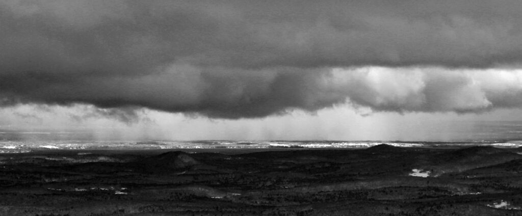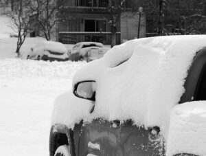
One more round of October snow for Vermont

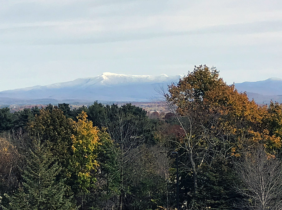
An image of Mt. Mansfield in Vermont taken from the Burlington area in late October showing some valley foliage and snow in the mountain peaks from a recent storm
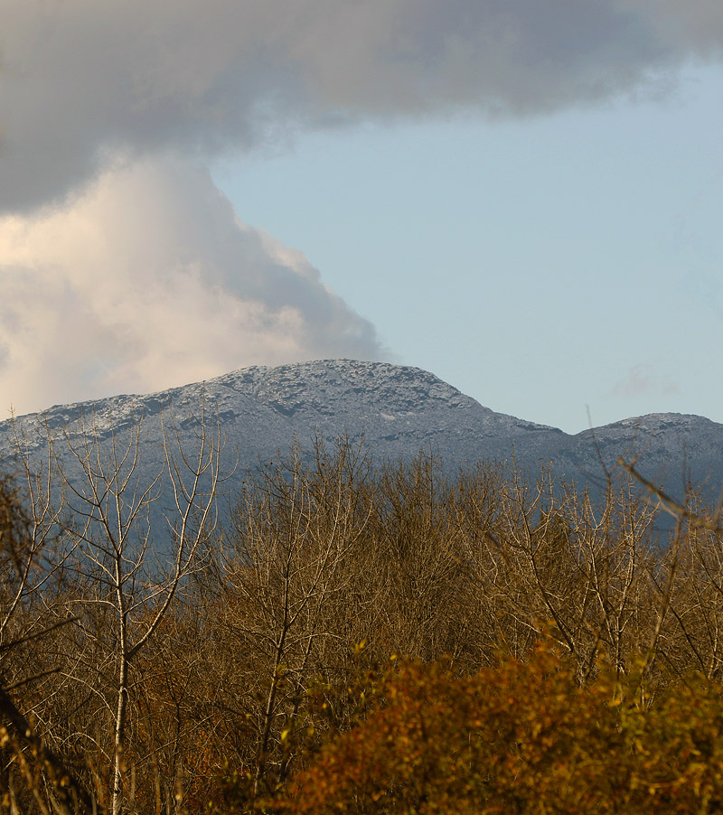
An image of Mt. Mansfield today taken from my office at UVM showing signs from the recent storm and fall foliage still hanging on in the valley.

The local mountains picked up some more snow in what looks to be our final snowfall event for the month of October.  Down here in the valley at our house, I found a few flakes on my snow measurement board yesterday evening, but no measurable accumulation.  This storm was more notable down in Southern New England where there were totals up around 7 inches in the Worcester, Mass area.

Powderfreak got a beautiful picture of the slopes of Stowe Mountain Resort today, which he posted in the Northern New England thread at the American Weather Forums.  I grabbed a shot of Mt. Mansfield from the other side of the range when I was in my office today because it was so great to see the snow starting to come back to the peaks.

Snow for the valleys in northern Vermont

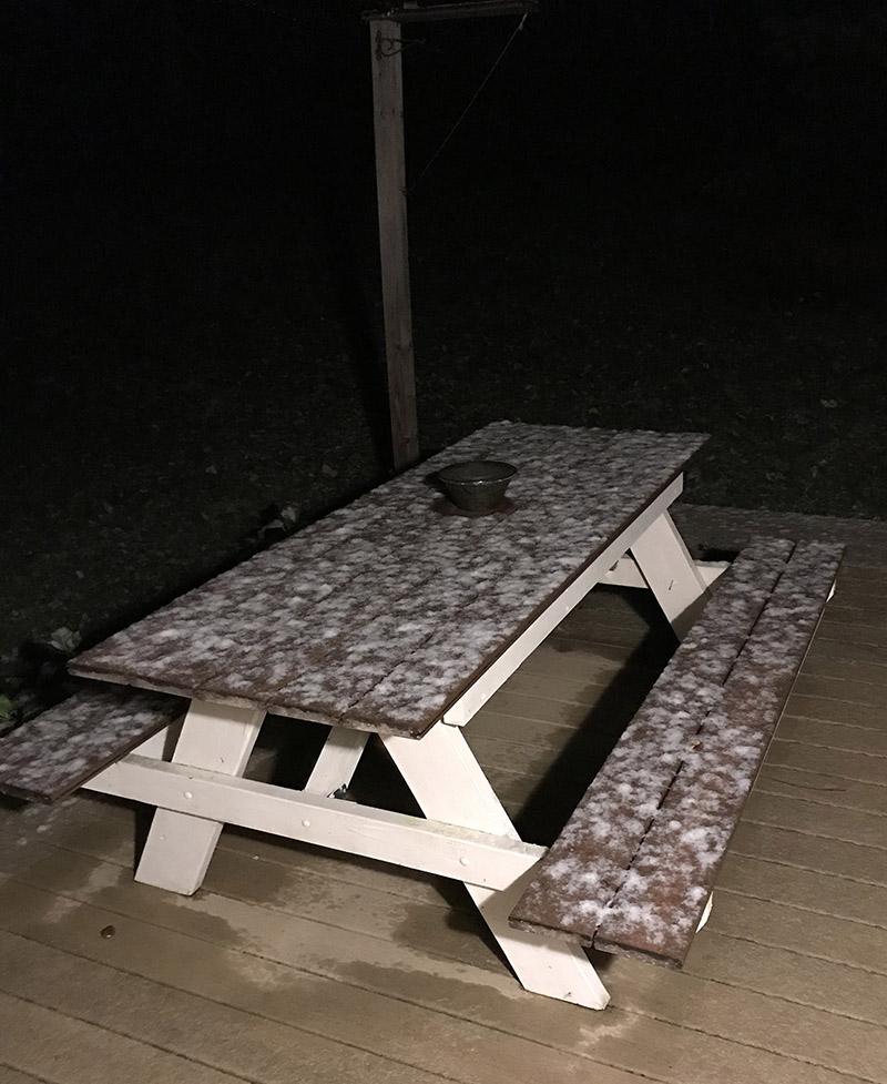
An image of October snow on a picnic table in Waterbury, Vermont
I woke up this morning to find snow accumulating on grassy and elevated surfaces like this picnic table on our deck. It’s the first accumulation we’ve seen in the valley this season!

I woke up this morning to find snow on the grass and elevated surfaces at our house, most notably our picnic table out back on the deck.  This was the first snow I’ve seen at our house this season, and although our weather forecast did suggest there was some potential for accumulation, you never quite know how it’s going to play out in marginal situations like this one.

In any event, the snow stuck even down here at 500’, so it should have easily accumulated in the higher elevations.  I measured 0.6” on the boards at observations time, and it did look like it could have melted some since the point at which most of it fell.

This is about a week on the late side for average occurrence of first frozen precipitation here at our house, but just a day off for the average date of first accumulating snow, so it’s very typical in that regard.

Details from the 6:00 A.M. Waterbury observations:

New Snow: 0.6 inches

New Liquid: 0.09 inches

Snow/Water Ratio: 6.7

Snow Density: 15.0% H2O

Temperature: 34.0 F

Sky: Light Rain/Snow (1-2 mm flakes)

Snow at the stake: 0.5 inches

Accumulating snow for the mountains of Vermont

An image of the Mt. Mansfield Chin in Vermont with some early season October snow
An image of foliage in the Newport, VT area along Lake Memphremagog with the mountain Owl's Head visible off in Canada.
Foliage in the Newport, VT area along Lake Memphremagog with the mountain Owl’s Head visible off in Canada.

A low pressure system moving along the coast of New England brought a chance for some accumulating snow to Vermont starting last night, and white could be seen in the peaks this morning.  The snow line over here in Vermont seemed to be around 2,500’, with a very sharp elevation cutoffAccumulations were 3-4” up around 4,000’ on Mt Mansfield, and similar atop Jay Peak.  I heard reports of some frozen precipitation up high earlier this season, but this was the first notable accumulation around here.  Off to the east over in New Hampshire and Maine, the snow line was much lower, and accumulations were even more substantial.  Some accumulations in northern New Hampshire were over a foot.

An image of the Mt. Mansfield Chin in Vermont with some early season October snow
The Mt. Mansfield Chin today with some early season October snow

While in many areas around the state, the leaves have mostly fallen and it’s looking like stick season, there are still a lot of beautiful scenes with fall foliage.  We were up in Newport today for a soccer game, and the views of foliage along Lake Memphremagog were beautiful.

Bolton Valley, VT 12MAY2020

An image of a motorcycle covered in fresh snow from a mid-May snowstorm in the village parking lot at Bolton Valley Ski Resort in Vermont
An image of ski tracks in powder snow after a mid-May snowstorm at Bolton Valley Ski Resort in Vermont
Close to a foot of fresh powder fell in the higher elevations around Northern Vermont thanks to this latest mid-May snowstorm.

This latest winter storm sort of snuck up on us.  Our local forecast at home did indicate the chance for a touch of snow during the overnight, but I was well into the wee hours before we’d expected to see anything. Yesterday afternoon though, it was pouring rain down here in the Winooski Valley, and with temperatures in the 30s F, it seemed suspiciously cool.  Around 5:00 P.M. I decided to check on a couple of the local webcams at the resorts, and was surprised to see that it wasn’t just snowing at elevation, but in line with the pouring rain down in the valleys, intense snowfall was occurring in the mountains.  It looked like the snow line was somewhere around 2,000’.

Within an hour the snow line had dropped all the way down to our house at 500’.  It went from pouring rain to pounding flakes very quickly, and it was obvious that the intensity of the precipitation hadn’t changed; there was still a lot of liquid falling from the sky.  When stepping out on the back deck into the snowfall to get accumulation measurements, I was immediately soaked if I didn’t put on some sort of waterproof coat.  Over the next couple of hours, I saw a number of reports and images of lower elevations snows from around the area in the New England forum at the American Weather discussion board, including Jericho, Barre, Stowe, and Hyde Park, which had already picked up 3.5 inches.  Up near the top of Lincoln Peak at Sugarbush, their snow cam showed that they’d already picked up 8 inchesEven Powderfreak seemed to be caught off guard by the impressive accumulations.

“I’d say fat skis were the way to go today, and indeed turns up high were bottomless and smooth, with little need to worry about hitting the base.”

By 8:00 P.M. we’d picked up about an inch of snow at the house, and with continued snowfall in the valleys, it seemed very likely that the mountains were going to have a solid new accumulation by the time the night was over.

In the Bolton Valley area this morning, there were accumulations all the way down to the base of the access road at 340’, and the accumulations slowly increased as one headed up to the resort.  The snow depths started to increase more rapidly around the elevation of the resort Village, with 3 to 4 inches there, and those totals doubled by the 2,500’ elevation.  Essentially all the snow above 1,500’ was winter-dry, and temperatures were still in the 20s F this morning from probably 1,500’ on up.  I’ll have to look back at all the April and May storms we’ve had this season, but this was some of the driest/wintriest snow I can recall in the past few storms.

An image showing a skin track through fresh snow along snow-covered evergreens after a mid-May snowstorm at Bolton Valley Ski Resort in Vermont
A skin track heads up along powder-covered evergreens at Bolton Valley after this recent May snowstorm.

I’ve got the elevation profile for new snow accumulations below, and as you can see, the largest increases in depths indeed came from a bit below 2,000’ up to about the 2,500’ range before the rate of increase tapered down:

340’:  0.5”
1,000’:  1”
1,500’:  2”
2,000’:  3-4”
2,500’:  7-8”
2,800’:  8-9”
3,100’:  9-10”

The storm was probably mostly snow above 2,500’, and with 1.21” of L.E. down here at the house, it was a decent resurfacing above 2,000’, and a very solid, “no worries” type of resurfacing above 2,500’.  I’d say fat skis were the way to go today, and indeed turns up high were bottomless and smooth, with little need to worry about hitting the base.  Indeed, midwinter-style powder is always appreciated in May.

Bolton Valley, VT 28APR2020

An image taken from Interstate 89 of Mount Mansfield in Vermont covered with snow after a late-April snowstorm
An image of sunshine and snow on evergreens after a late-April snowstorm at Bolton Valley Ski Resort in Vermont
The sun came out and offered brilliant views of the fresh snow today at Bolton Valley.

It cooled back down overnight, and with continued snowfall, I suspect the snow levels dropped based on the fact that it was down into the 30s F at our place in the valley.  I would have liked to see where accumulations stood as of this morning, but I had a car maintenance appointment, so I couldn’t stop by the Village until about midday.  All that new snow at elevation made for some impressive views as I drove on I-89 returning from Burlington, and I stopped at Williston Southbound Information Center in I-89 to get a few images of the Green Mountains.


An image of Bolton Valley Ski Resort in Vermont taken from the Southbound Information Center on Interstate 89 near Williston after a late-April snowstorm
Looking out from I-89 in Williston today toward the snowy slopes of Bolton Valley

By the time I got up to Bolton today I’d say accumulations were generally back to what I reported yesterday, so accumulations were really only beginning to appear up near the Bolton Valley Village elevations.  Temperatures had risen well above freezing by that point as well, so the snow was getting quite wet and dense.  As the brilliant late-April sunshine appeared, it felt downright hot out as I was touring.  The sun created fantastic views of the fresh snow gleaming white on all the trees, and the views had an almost midwinter feel.  The temperatures and sunshine had the snow pretty quickly melting off the trees on aspects facing toward the sun, so the sound of dripping water and crashing piles of snow was the most prominent thing accompanying me on my tour.

With the new snow getting quite wet by the time I was out, the descent portion of the tour was pretty much just a free ride down with a few turns here and there, but there weren’t really notable powder turns like we had yesterday.  It was of course still great to be out in the fresh snow getting exercise on such a beautiful day.

We’re almost on to May now, but it does sound like snow potential is going to stay around for a couple of weeks with the weather pattern, so we’ll see what Mother Nature brings us.

Bolton Valley, VT 27APR2020

An image of the Wilderness double chairlift taken during a ski tour during a late-April snowstorm at Bolton Valley Ski Resort in Vermont
An image of snow on the trees during a late-April snowstorm at Bolton Valley Ski Resort in Vermont
Our current late-season snowstorm has been bringing a lot of snow to the higher elevations, with already over a foot of fresh powder on the mountain as of this afternoon.

We’ve got another late winter storm taking place in the area, with fairly high snow levels up around 2,000’.  As of this morning, the Bolton Valley live webcams were suggesting new accumulations of an inch or two at 2,100’, and perhaps a couple more at 3,150’.  The Vista Summit new snow depths were hard to judge though, and it was still snowing, so I planned to head up in the afternoon to check out the scene and get some exercise of my schedule allowed for it.

Although I haven’t seen it being an issue at Bolton Valley, we’ve purposefully stayed off the mountain for the past couple of weeks as we learned that the local ski resorts have asked people to refrain from touring because of potential crowding at base areas.  As of today though, with the strong positive strides Vermont has made in limiting the spread of the COVID-19 coronavirus through its social distancing, Governor Scott took another notable step in relaxing the restrictions.  The new order states that, “Expanding on Addendum 10, outdoor businesses, construction operations and recreation maintenance work may operate with a maximum of five total workers per location. (Effective April 27).  It’s only outdoor work that is being phased in at this point, but that makes sense to ramp that activity up first where people are not in the close confines of interior spaces.  With respect to the pandemic, we’ve been fairly lucky here in Vermont with our small total population, and relatively low population density, so the spread of the virus appears to be on the decline locally.  Modeling was already reflecting the positive trends here as of 10 days ago, with Vermont being one of only four states that could potentially begin loosening social distancing measures as early as May 4th.

“…the snow depths increased dramatically as I headed up above the base elevations.”

From down here in this part of the Winooski Valley, even this morning at the coldest part of the day, you wouldn’t know that there was a solid amount of snow falling with this storm if it weren’t for some of the resources like Bolton’s webcams.  I don’t think I’ve seen a flake here at 500’, and even our local hills surrounding the valley that top out around 2,000’, don’t have signs of white on them.

An image of the Bolton Valley Village at Bolton Valley Ski Resort at an elevation of approximately 2,000 feet above sea level with some fresh snow from a late-April snowstorm.
Accumulations were just starting to take hold today in the Bolton Valley Village Elevations around 2000′.

Seeing what was on the webcams though, it was obvious that snow was falling and accumulating at least down to the elevation of the Bolton Valley Village.  My trip up the Bolton Valley access road allowed me to get a sense for what was going on with the accumulations.  I knew the snow line had to be way up there, but I just kept climbing and climbing, and there were no signs of new snow anywhere.  The first signs of old snow from the remaining winter snowpack were around 1,400’, but even at the Timberline Base at 1,500’, the precipitation was all rain.  The rain didn’t even change over to snow until about 1,900’, just before I reached the Bolton Valley Village.  That’s also right about where I saw the first accumulations of new snow taking hold.  The snow accumulations picked up quickly with 1-2” at the main parking lots at 2,000’ and 2-3” at 2,100’ near the base of the main lifts.

An image of ski trail signs and trees covered with snow during a late-April snowstorm at Bolton Valley Ski Resort in Vermont.
Dense snow was sticking to everything with today’s storm, and accumulations quickly grew as I ascended on my ski tour.

The snow was dense, but not really wet, and the snow depths increased dramatically as I headed up above the base elevations.  Thankfully there were some skin tracks to use, because as the depth of new snow surpassed a foot, breaking trail was tough in many areas.  The skiing was definitely challenging in the dense snow, akin to the snow from that storm that Erica and I encountered when we skied at Schweitzer Mountain Resort back in 2001.  This storm didn’t drop four feet of that dense stuff all at once, but I’d brought my mid-fat Telemark skis because I hadn’t anticipated the depths I found, and my fat skis would have certainly been the better tool for the conditions.  Some of the best turns I had on my mid-fats today were actually in the middle elevations around Five Corners, where the snow depths were still more than plentiful for bottomless turns, but not so deep that they pushed your skis around with strong resistance.

Here’s the full accumulations profile for this storm as of ~5:00 P.M. based on what I saw up to the Village and beyond.  It gives a pretty good sense for the elevation ranges with the largest jumps in accumulation, but on average it looks like once accumulations took hold, they increased by more than an inch per 100’ of elevation gain:

340’:  0”
500’:  0”
1,000’:  0”
1,500’: 0”
1,900’:  0-1“
2,000’:  1-2”
2,100’:  2-3”
2,300’:  4-5”
2,500’:  8-9”
2,750’:  11-13”
3,000’:  13-14”
3,100’:  14-15”

An image of snow falling at the base of the Snowflake lift during a late-April snowstorm at Bolton Valley Ski Resort in Vermont.
The snow was still pouring down at the base of the Snowflake Lift when I was leaving after my tour today.

It was still dumping at the base when I left, and the radar has shown continued precipitation tonight, so I wouldn’t be surprised at all to see those numbers increase a bit more by tomorrow.

Bolton Valley, VT 11APR2020

An image of Erica and Dylan skiing powder together during an April snowstorm at Bolton Valley Resort in Vermont
An image of Dylan Telemark skiing in powder during an April snowstorm at Bolton Valley Ski Resort in Vermont
With additional snowfall overnight, depths of new snow on the mountain today were hitting a foot or more, and Dylan was making quick work of the fresh powder riding Mom’s fat Telemark skis.

Although I headed out on yesterday afternoon’s ski tour alone because I was unsure of just how good the snow was going to be, my concerns turned out to be quite unfounded.  With 4-5” of fresh snow at Village elevations, and 8-9” up top, the power skiing was already good to go… and Mother Nature was only making it better.  Yesterday evening, the upslope snow continued to crash into the spine of the Greens, and as temperatures came down, we began to pick up accumulations in the valleys again.  With the snowfall anticipated to continue overnight at all elevations, it was definitely going to be worth getting the family out for a tour.

A close-up, wide-angle image of Jay Telemark skiing in powder during an April snowstorm at Bolton Valley Ski Resort in VermontMorning revealed some additional snow accumulation at our house at 500’ in the Winooski Valley, and as we climbed the road up toward Bolton Valley we could see that the snow levels had indeed come down compared to what I’d seen on my tour yesterday.  After whatever settling occurred since that point, total accumulations at 2,000’ in the Village were now up to roughly 8”.  We topped out at around 2,800’ on today’s tour, and accumulations are a foot plus from there on up.  The elevation profile from yesterday’s tour is updated below with the addition of today’s total new snow depth numbers, which are in bold below:

340’: 0” –> 0”
600’: —–> T
900’: T –> ½”
1,000’: ½-1” –> ½-1”
1,500’: 2” –> 5”
2,000’: 4-5” –> 8”
2,500’: 7” –> 9-10”
2,800’: 12”
3,000’: 8-9” –> 12”+

An image of Erica Telemark skiing on powder during an April snowstorm at Bolton Valley Ski Resort in Vermont
E said that she really enjoyed the peace and quiet of the skiing today – it was certainly the type of snow where you could just set yourself on autopilot and go.

So with depths of new snow hitting a foot or more in the higher elevations, and snow continued to fall during our tour as well, the skiing was of course even better than yesterday.  Indeed, the snow was deeper and drier, and the turns were even more bottomless and effortless.  We saw a few other skiers out there on the slopes, but traffic was quite light and fresh tracks were in great supply.  I gave Dylan my Canon EOS 30D with a Canon EF-S 10-22mm f/3.5-4.5 USM wide angle lens, so we had a couple of cameras available to document the outing, and it was great to be out with the family.  Ty was working in the morning, but he would definitely had been there if he was free.

Bolton Valley, VT 10APR2020

An image of ski tracks in powder snow on the Bolton Outlaw trail after an April snowstorm at Bolton Valley Ski Resort in Vermont
An image of fresh snow from an April snowstorm at Bolton Valley Ski Resort in Vermont
With the current storm ongoing, a trip to the higher elevations revealed that there’s already been a solid coating of fresh snow put down

As the forecasts have been hinting at over the past several days, a late season winter storm has moved into the area as we close out the week.  The forecasts have been suggesting the potential for a foot or more of snow along the spine of the Northern Greens, and as is common in these late season events, substantially lower accumulations were expected upon descent down into the valleys.

While the initial stages of this storm were focused in New Hampshire and Maine, producing more than a half foot of snow at relatively low elevations, the more potent part of the system for our area was expected to be the upslope precipitation on the back side of the storm.  The precipitation at our house at 500’ elevation down in the Winooski Valley had largely been rain for this event, but this morning we began to get some snow and a bit of accumulation.

The snow really struggled to accumulate in the valleys today, but up in the mountains it was a different situation.  By midafternoon as I checked on the Bolton Valley live webcams I’d say there was already an inch or two at 2,100’ in the Village.  For the local mountains, the slightly lower temperatures had definitely helped promote accumulations today relative to yesterday, where you could see the new snow down at the main base kind of accumulate and melt back to expose areas of old snow.  Those areas of snow were pretty well covered up this afternoon.  From images shown by the Vista Peak cam, it was clear that there had been at least a few inches of snow up at 3,150’, but it was hard to get a detailed sense for the new snow due to the winds.

What I’d seen from the webcams by the afternoon was certainly enough to get me to head up to the mountain for an exploratory tour, but I wasn’t quite sure enough of conditions to entice the rest of the family to go.

At the base of the Bolton Valley Access Road at roughly 340’, there were no signs of snow accumulation, but right around 900’ you could see the first traces of white, and they quickly jumped up by the time you hit the Bolton Valley Welcome Sign at ~1,000’.  There were a couple of inches of new accumulation at the Timberline Base, and continuing on up to the Village. I found a solid 4-5” in the parking lots.  Heading farther upward with my tour in the Wilderness area revealed the following elevation profile with respect to storm totals:

340’: 0”
900’: T
1,000’: ½-1”
1,500’: 2”
2,000’: 4-5”
2,500’: 7”
3,000’: 8-9”

Right near the start of my ascent on Lower Turnpike, a skier cam swishing by through the powder on his descent and shouted “Don’t head up, it’s not worth it!”, but I laughed in reply because it was obvious he was being sarcastic.  The turns looked fantastic and belied his remark even down at that elevation with a nice 5-6” of medium-weight powder.

An image of the Wilderness Chairlift with a fresh coating a of April snow at Bolton Valley Ski Resort in Vermont
The chairs at the bottom of the Wilderness Lift revealing a fresh coating of snow.

Indeed, despite this being a late season storm, the snow wasn’t really wet at all out there today (at least where I was touring in the 2,000’+ range).  It was reasonably dense and offered plenty of bottomless turns, but certainly not unlimited bottomless turns on all the steepest pitches.  We’ve had roughly 1.25” of liquid equivalent from this event down at the house, so there’s certainly a decent amount of L.E. in that snow at elevation where they’ve had little if any rain.  Today I toured up to the Wilderness Summit, then around to Bolton Outlaw and on back down toward Lower Turnpike.  The turns were excellent and there had been very little skier traffic.

It was interesting up on the mountain today because a bit of sunshine appeared near the start of the tour, but by the time I was finishing up it was pounding heavy snow made up of big flakes.  It was in the 20s F and snowing so hard in the Village at that point that it felt like it had to be accumulating down in the valley, but it was an impressive gradient as I headed back down the mountain and the snow still wasn’t really accumulating much below the 1,000’ level.

Bolton Valley, VT 07APR2020

An image of the upper part of the Brandywine trail near the junction with Intro below the Timberline Quad chairlift at Bolton Valley Ski Resort in Vermont
An image of ski goggles with a reflection at the end of a ski tour by the Timberline base area of Bolton Valley Resort in Vermont
Catching a reflection at the end of today’s tour.

Today was even a bit warmer than yesterday, with temperatures in the valley this afternoon topping out around 60 F.  So, I decided to get in another round of exercise with a Bolton Valley ski tour.

The strip of snow just to the climber’s right of the Timberline Quad base station had broken up even a bit more than yesterday, but I still traversed the gap with skins to start my tour.  To mix things up today, I headed up Timberline Run and over toward Brandywine for my ascent.  That area is more shaded from the sun, but with the warmer temperatures I figured it might be softened up enough for some smooth turns.

“The slightly warmer temperatures today made the snow quality even better, so the trend has just been one of increasing snow quality of these last few sessions.”

The snow there was fine, but once I got back into the snow below the Timberline Quad near the top, I could see that the exposure to the sun had made the snow just so much better there.  I couldn’t resist that snow, so I ultimately ended up descending via Showtime as we’ve done on the past couple of outings.  The slightly warmer temperatures today made the snow quality even better, so the trend has just been one of increasing snow quality of these last few sessions.

It’s beginning to look more and more likely that we’re going to get a winter storm toward the end of the week with the possibility of substantial snow for the mountains, so hopefully we’ll be able to get back into some powder skiing.  The spring skiing has been very nice, but a change of pace with powder skiing would of course be welcomed as well.

Bolton Valley, VT 06APR2020

A view of a tower and some of the chairs on the Timberline Quad Chairlift during a spring ski tour at Bolton Valley Resort in Vermont

We had another nice day of weather today with some sun and temperatures in the 50s F, so I headed up to Bolton Valley for another ski tour at Timberline.  The strip of snow just to the climber’s right of the Timberline Quad base station that we used for skinning during our ski tour on Saturday, was slightly broken up now with a small gap.  It was just a few feet of dry grass in the break though, so I easily continued right across it, and coverage was great from there on up.

An image looking west toward Lake Champlain and the Adirondack Mountains from the Timberline Summit area at Bolton Valley Ski Resort in Vermont
An afternoon view from the Timberline Summit out toward Lake Champlain and the Adirondacks

On Saturday, we stopped our tour at the Timberline Mid Station because it was our first outing in a little while and I figured it was good to take it easy, but today I headed right up to the Timberline Summit.  The views were nice with some late day clouds to the west over Lake Champlain and the Adirondacks.  The snow on Showtime was even a notch better than Saturday, I think thanks to a bit more sun to soften it up and create a smoother, more even surface today.

It looks like we’ll have more spring weather in the first part of this week before it becomes wintrier in the latter part of the week.