
We had our first reported snow of the season here in Vermont over a month ago when flakes were spotted atop Jay Peak, but this latest round of winter weather has now brought us the first actual accumulations of the season. Our initial images of the accumulations came out yesterday morning when Powderfreak sent out some shots from the higher elevations of Mt. Mansfield during his usual Stowe Mountain Resort duties. Later in the day he sent along a nice image of the cloud ceiling and flakes falling on Spruce Peak while he was out on an afternoon hike. The snow was down to at least the 3,100’ elevation as of the afternoon, and with more moisture pushing into the spine of the Greens according to the radar, the potential for some additional overnight accumulations was looking good. The moisture seemed to be drifting a bit south though, and I saw a comment from Powderfreak that he felt the Central and Southern Greens would have the better chances for accumulations during the overnight period.
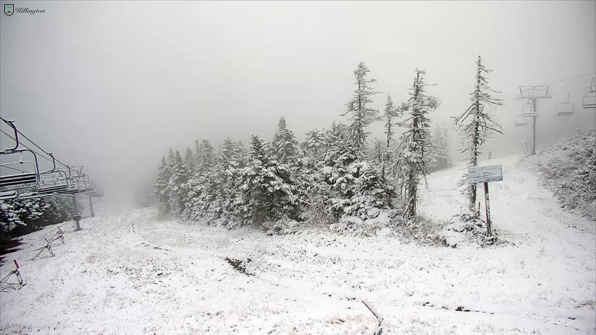
His thoughts were right on track, and by morning we were alerted with pictures from the Killington North Ridge Webcam of some more substantial accumulations. Up here in the Northern Greens, where the mid-level lifting mechanisms for precipitation weren’t as strong, the higher elevations of Mt. Mansfield picked up some ice accumulations and another coating of snow.
Looking at the data for the average date of first accumulations on Mt. Mansfield, October 9th is right on track for first accumulating snow on Mt. Mansfield – the mean date is October 11th ± 14 days, and the median date is October 10th. Last year was a bit on the later side on October 22nd, but the year before was very similar to this one with snow coming on October 8th.
So, the 2024-2025 snowfall season has begun here in Vermont, and we may see more snow in the coming days. The snowfall maps from the weather models are starting to suggest accumulations next week, and the National Weather Service office in Burlington mentions that there is possibility for accumulations above 2,000’ in their most recent area forecast discussion.