Bolton Valley, VT 05DEC2024

An image of Ty skiing in the Snow Hole area in early December after a continuous flow of smaller winter storms builds up the snowpack at Bolton Valley Ski Resort in Vermont
An image of Ty getting some early season Telemark ski turns in the backcountry after a series of small storms begins to set up the snowpack at Bolton Valley Ski Resort in Vermont
Ty getting in some early season backcountry turns during today’s ski tour at Bolton Valley

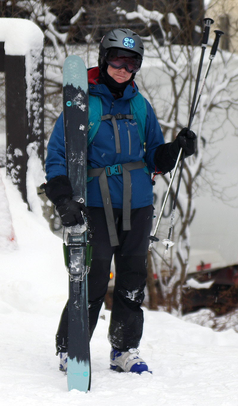
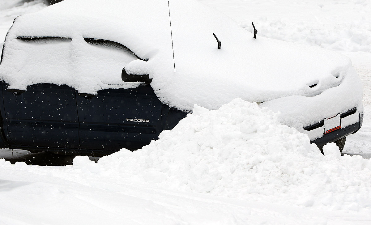
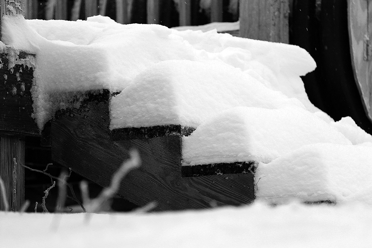
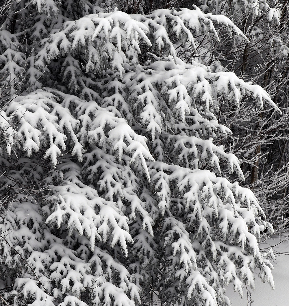
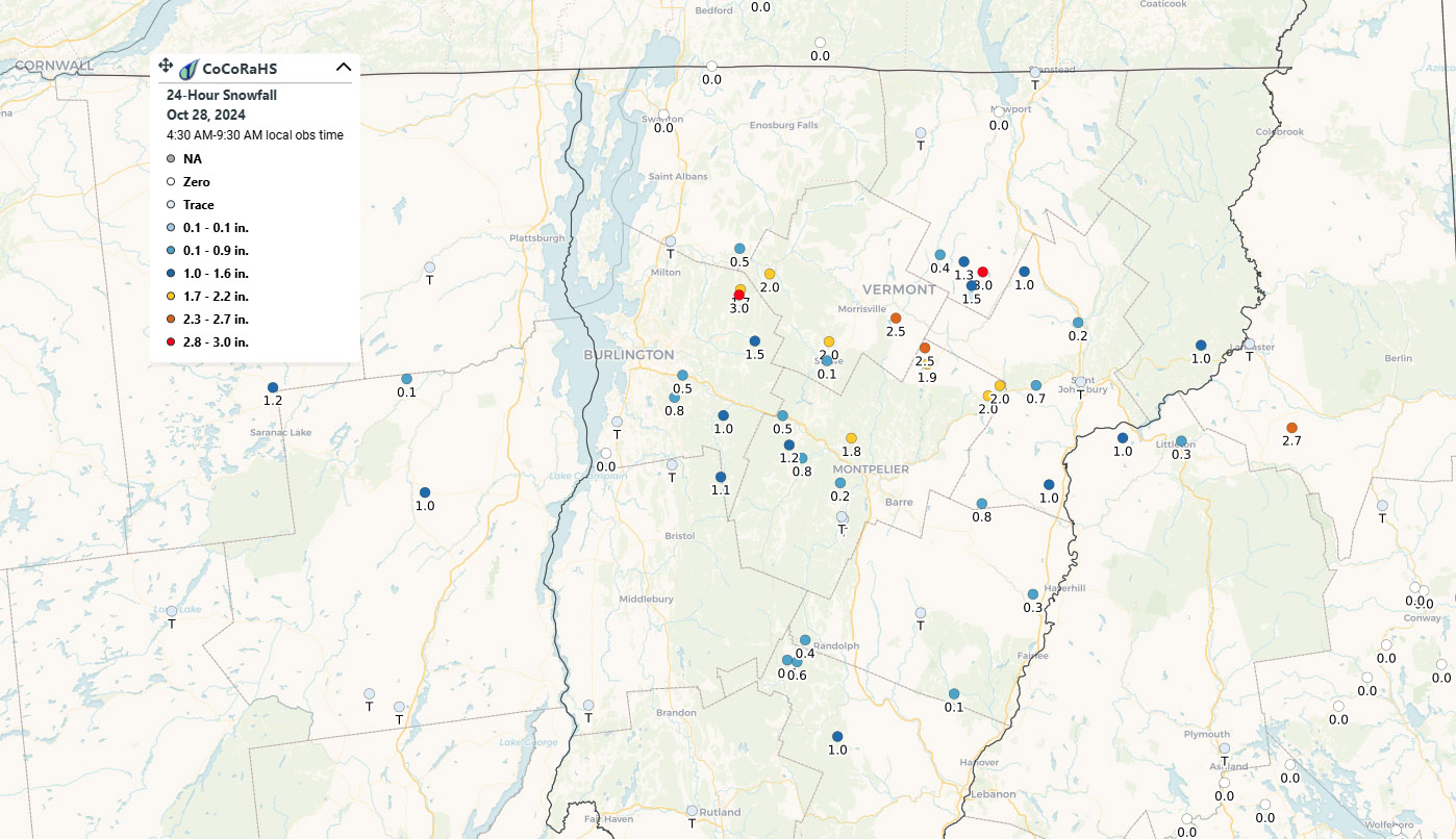
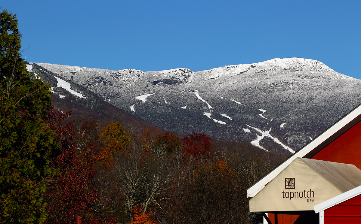
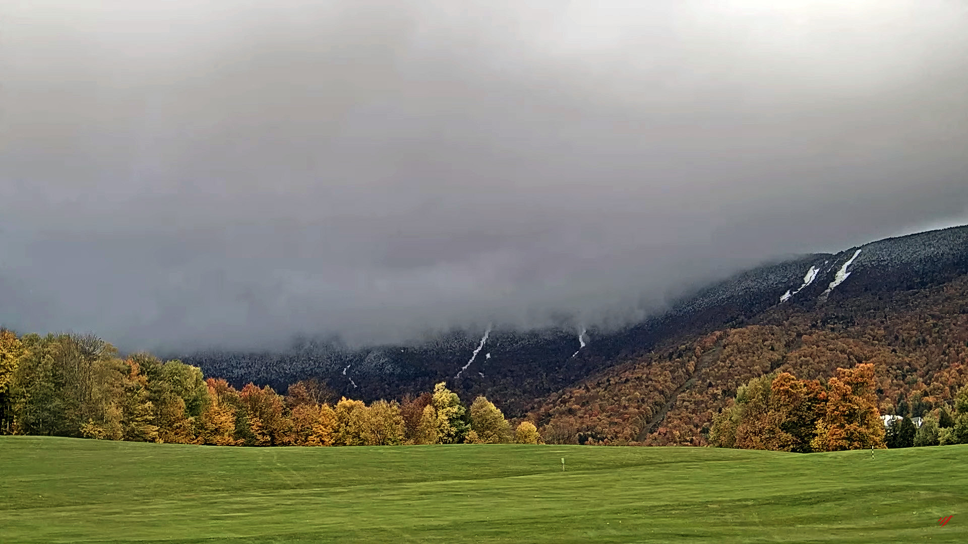
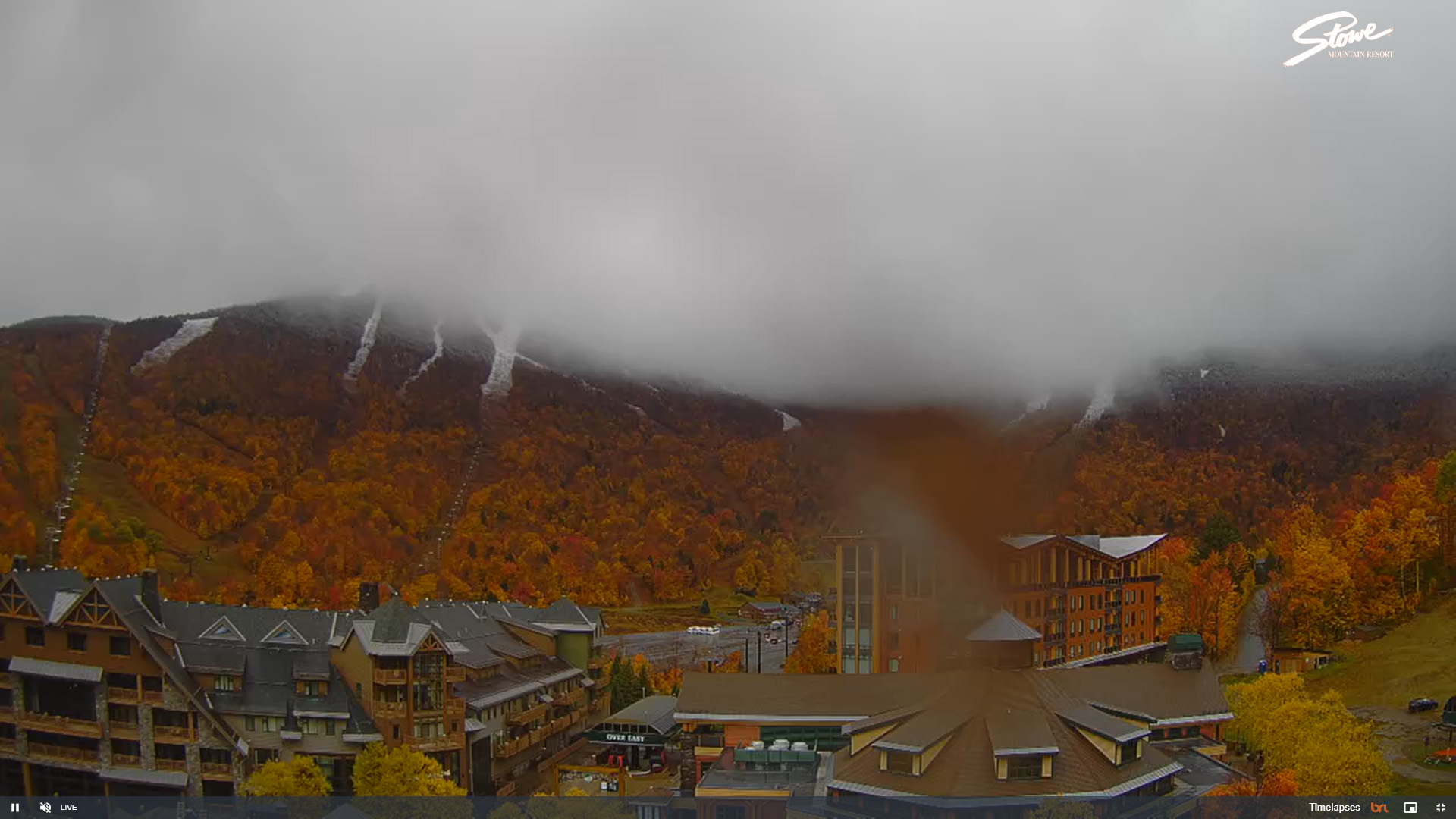
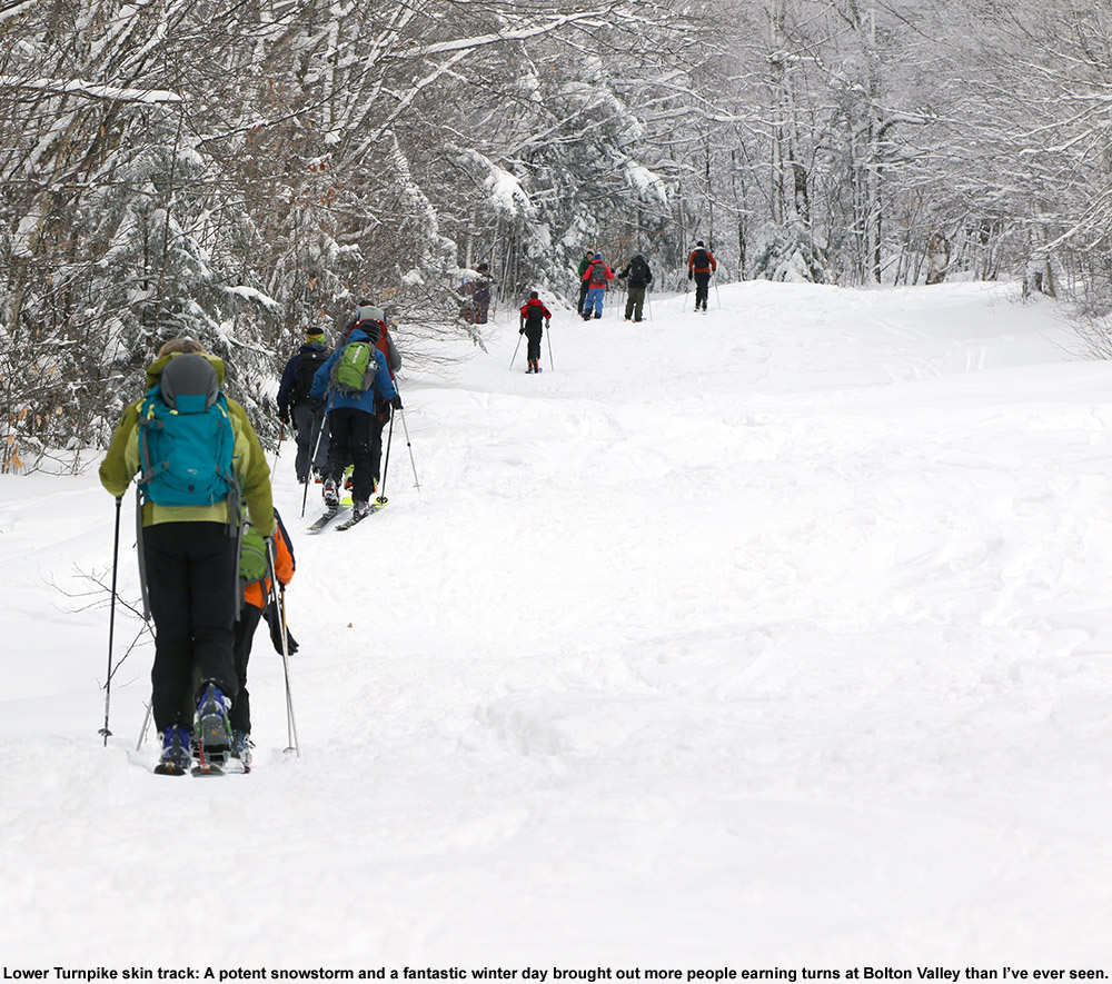
Ty was off from work today, so the two of us decided to head up to Bolton Valley for some turns. With the generally unconsolidated snowpack, it was a bit tough to tell how much new snow fell from this most recent Clipper system, but based on the resort’s snow report, it seemed like they picked up a few inches, similar to what we received down here in the valley.

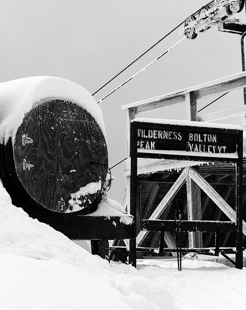
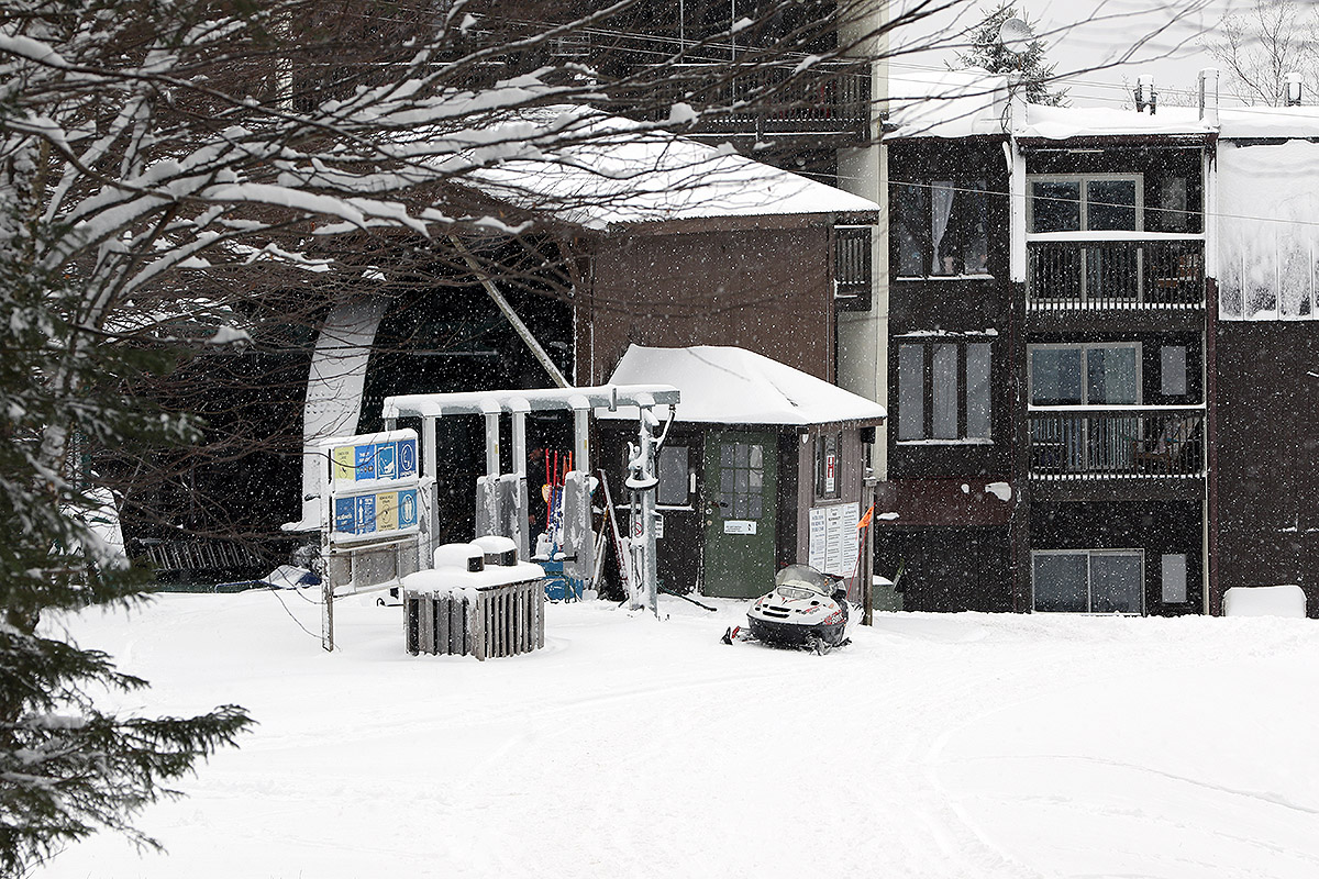
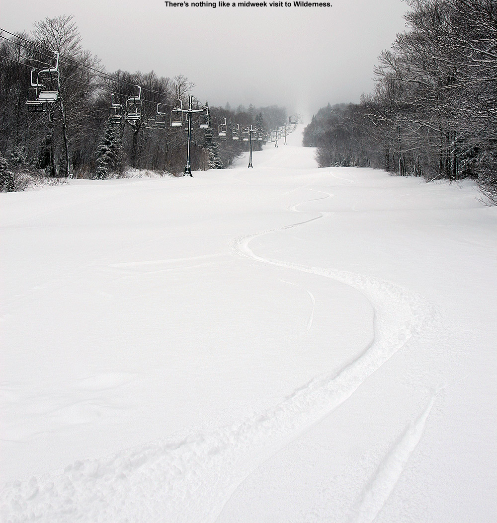
With tomorrow being their opening day, there was a lot of activity on the mountain today as they made final preparations for opening. At the base, one of the patrollers asked if we could stay off Wilderness for touring and instead head over to the Nordic and backcountry network, so we were happy to oblige. Although there’s no snowmaking on Wilderness, there snowpack is substantial enough that they could open the area for lift-served skiing if they wanted to. I wouldn’t be surprised if they were doing some grooming and prep work/obstacle marking over there today, so I suspect they wanted to minimize skier traffic as much as they could.

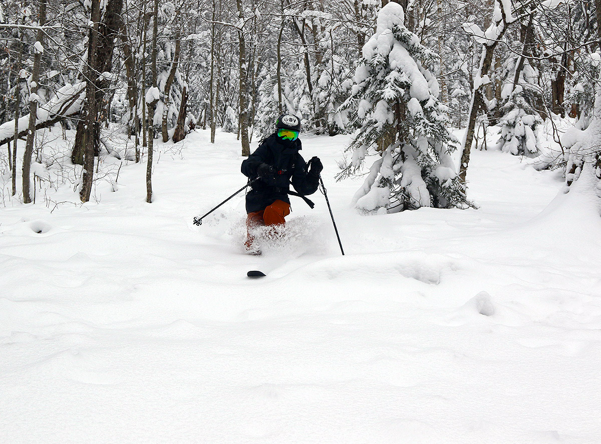
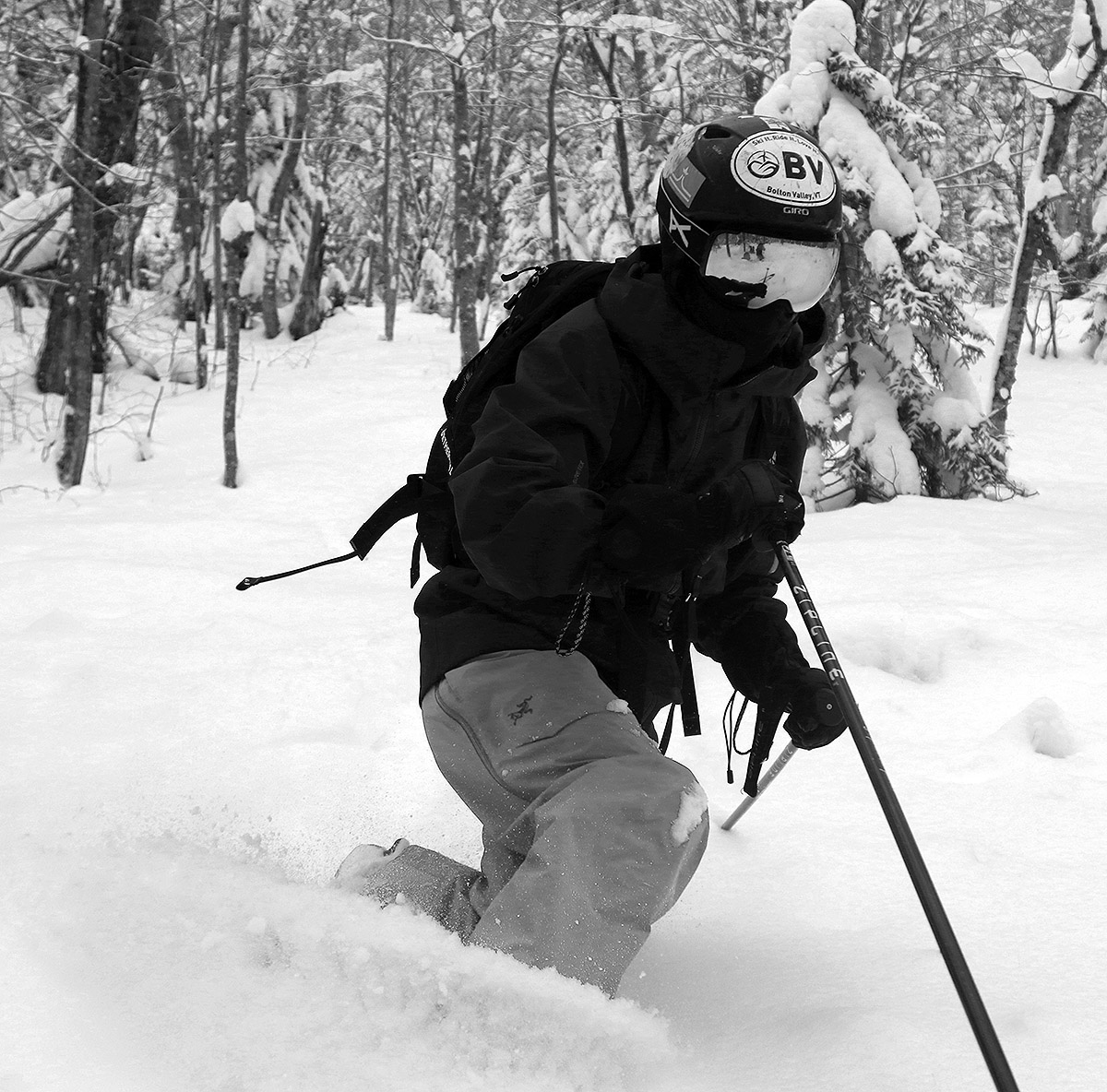
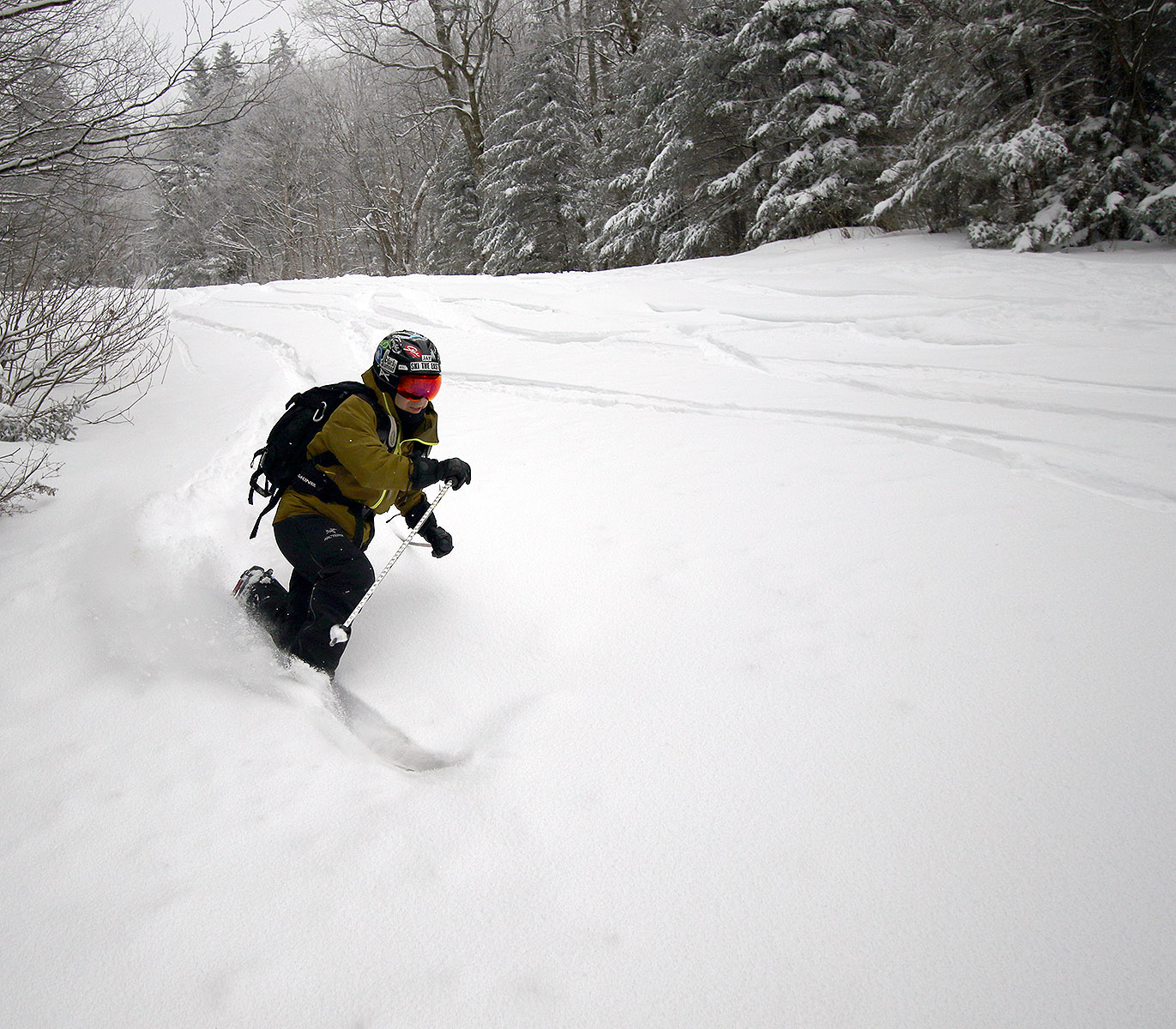
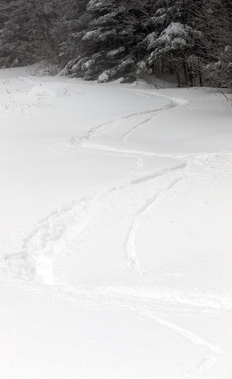
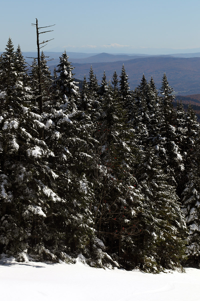
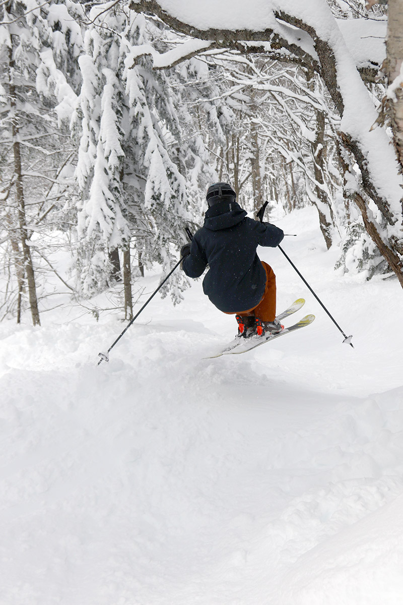
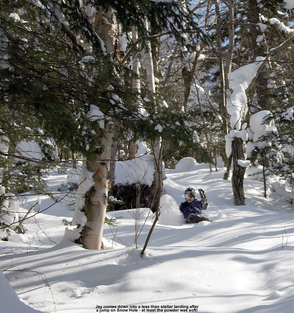
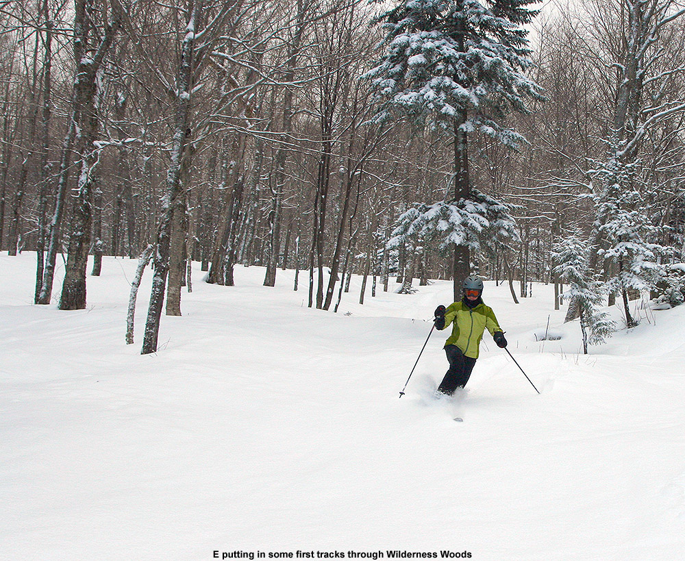
I wouldn’t normally have defaulted to touring on the Nordic and backcountry Network at this stage of the early snowpack, since the Wilderness trails are just a safer bet for quality turns; they have been mowed and have a more substantiated base due to some skier traffic packing it down. But since I’ve been out on Wilderness for a few ski tours now this season, getting out onto the nearby backcountry terrain gave me a nice opportunity to compare the quality of the turns in both places. Although we made our ascent on the Nordic and backcountry Network terrain, we were actually touring in the area over near Snow Hole and made most of our descent on the edge of the on piste Wilderness terrain. That allowed us to directly experience the skiing in both areas today.

An image of early December snow accumulations from various modest storms recently affecting the Village area of Bolton Valley Ski Resort in Vermont
Views of the recent accumulating snows in the Bolton Valley Village during today’s ski tour. We’ve had round after round of snow from a series of modest systems coming through the area, and they look to continue for days to come.

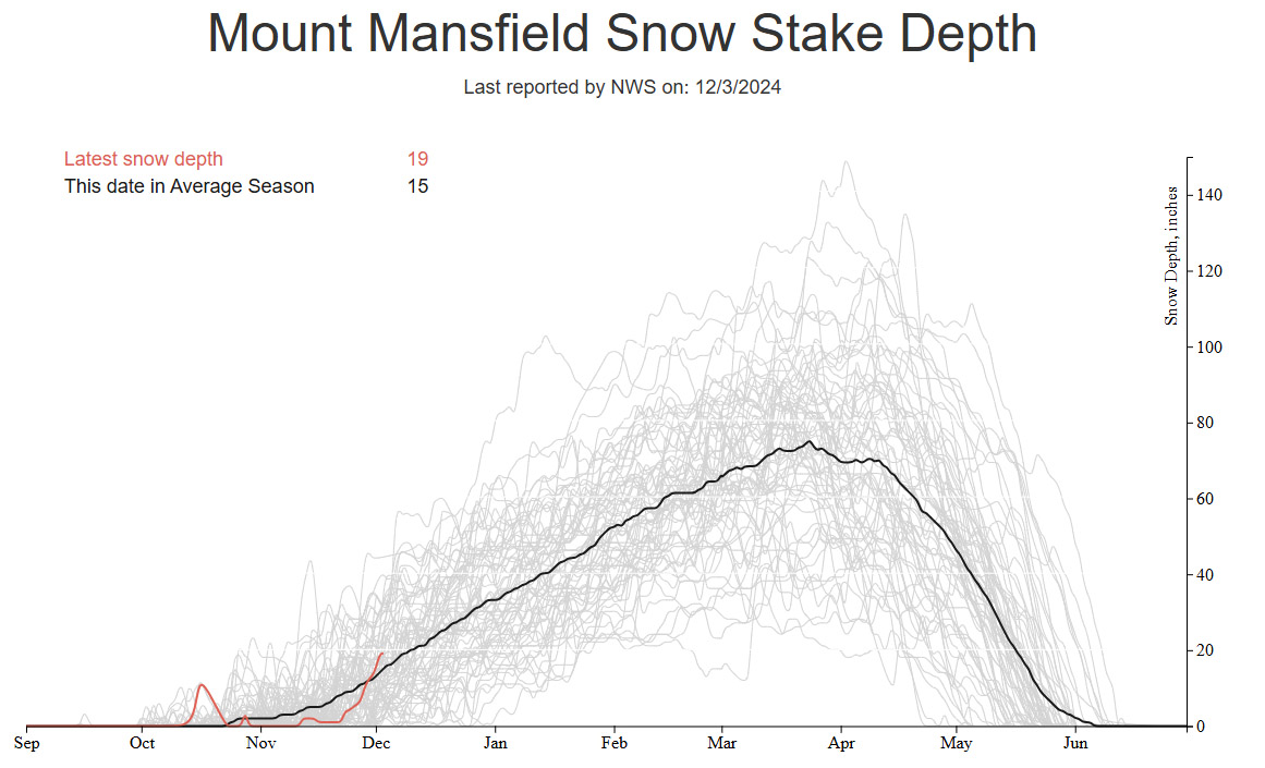
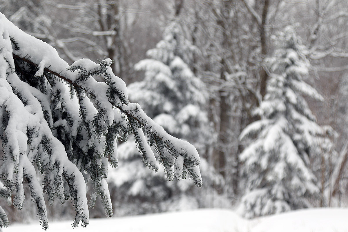
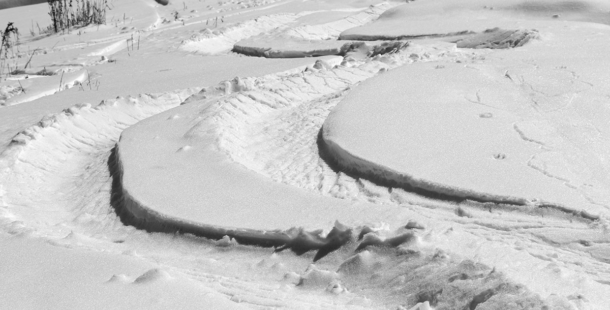
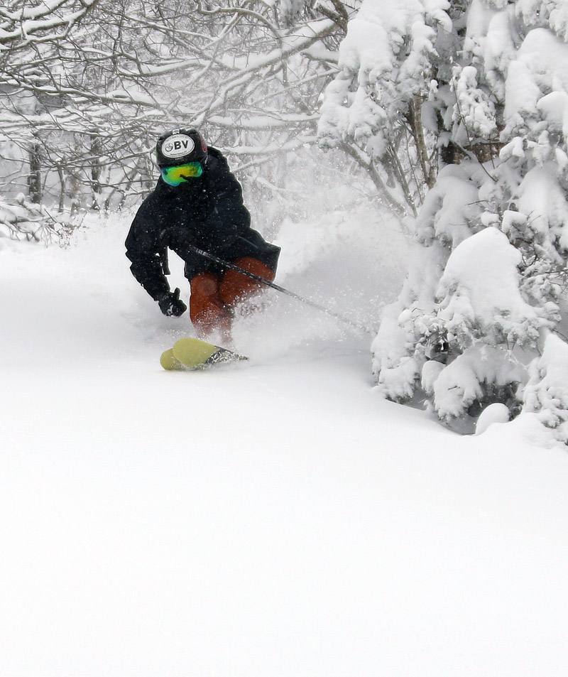
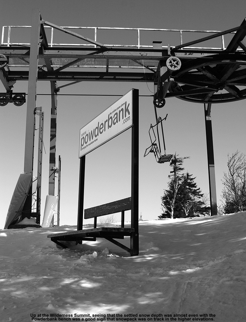
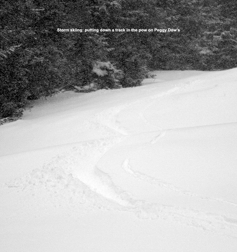
For overall skiing and powder turns, the experience was unquestionably better on piste at Wilderness. It’s not an issue of overall snow depth on the backcountry terrain; snowpack depths were closing in on 20 inches when I was out for my ski tour on Tuesday, and that was before the Clipper and the cold front brought a lot more snow to the area over the past couple of days. The depth of the snowpack has gone up substantially at this point – as of today the depth at the Mt. Mansfield stake is at 30 inches. What’s needed off piste to really improve the quality of the skiing is some consolidation. There is some base snow in the snowpack below the fluff, and it’s a decent base for on piste turns, it’s just not enough to sufficiently cover the contours of your typical off-piste terrain yet. Although a storm with above-freezing temperatures isn’t going to be great for snow quality, it would help in that consolidation. Alternatively, a nice dense snowfall storm would also help, and of course that would be much better for snow surfaces in general. It would temporarily ruin the current dry powder and might give us a bit of an upside-down snowpack, but it would really help set things up long term. The only other alternative would be to continue to get the type of dry snow we’re getting and wait a while for settling over time as the lower layers get compressed. This just takes a lot longer and requires a lot of snow, going the route of a continental/Colorado type snowpack.

From our experience touring today, it’s not that the off-piste skiing is horrible, it’s just that you need to stick to places that have seen a bit of skier traffic, or you know are well manicured with minimal hazards underfoot.

Bolton Valley, VT 03DEC2024

An image of evergreen branches, an old snowcat, and the Little Rock Rental Shop covered in powder from rounds and rounds of early December snow up at Bolton Valley Ski Resort in Vermont
An image of snow on tables and railings during early December in the Village area at Bolton Valley Ski Resort in Vermont
The views of the snow were gorgeous in the Bolton Valley Village today; we’ve been getting hit with rounds and rounds of continued light snow as impulses come into the area and help push along moisture streaming over from the Great Lakes.

I hadn’t been up to the mountain since Saturday, so I was eager to get out for a ski tour when I had time today. There’s been no specific synoptic storms in the area, but the snow has been piling up the thanks to the continuous feed of moisture off the Great Lakes and the upper-level low pressure to our north. Seeing the snowpack depth at the Mt. Mansfield stake quickly jump up to near 20 inches is a strong sign that it’s been snowing around here. Having that closed upper low over Hudson Bay with broad upper level troughing is a great setup when you have a 4,000’ wall of mountains sitting downwind of a moisture source like the Great Lakes.

A plot showing the snowpack depth at the Mt. Mansfield Snow Stake in Vermont on December 3rd, 2024
The snowpack depth at the Mt. Mansfield Stake has been shooting right up above average over the past few days thanks to the continuous parade of smaller weather impulses affecting the area as well as the moisture pushing into the area from the Great Lakes.
An image from the Wilderness Summit during a ski tour in early December at Bolton Valley Ski Resort in Vermont
Up at the snowy Wilderness Summit above 3,000′ on today’s ski tour

Even without data from the Mt. Mansfield stake to go on, I know it’s been snowing because we’ve recently had several inches of new snow down at our place in the valley, so the snow is hitting all elevations with the current temperature regime. Indeed, I found that snow depths were up substantially at all elevations during today’s ski tour. I toured again using the Wilderness Uphill Route, so I was able to check snowpack depths from the valley on up and compare them to what I’d last seen on Saturday. The updated snow depths are below, with Saturday’s depths listed first, then today’s depths following in bold. The depths I found up at 3,000’ and above are certainly consistent with what is being reported for the snowpack depths at the Mt. Mansfield stake.

340’: T-1: –> 1-2”
500’: 1” –> 2”
1,000’: 2” –> 3-4”
1,200’: 2-3” –> 4-5”
1,500’: 3” –> 6-8”
2,000’: 6-8” –> 8-12”
2,250’: 8-10” –> 10-14”
2,500’: 10-12” –> 12-16”
2,750’: 11-13” –> 14-17”
3,000’: 12-14” –> 16-18”

Concomitant with the increasing depths, the quality of the powder skiing even jumped another notch relative to the already great conditions we experienced on Saturday. In fact, even though the surface snowpack is excellent right-side-up powder that is beautifully dry, it’s getting deep enough that it’s starting to be a bit too much for the lowest angle slopes if you’re in fully untracked snow. I’d brought my 115 mm fat skis for today’s tour because they had already been a good choice on Saturday, but I was glad to have them for planing more efficiently on the lowest angle slopes today.

An image of a fence with fresh snow and a snow gun generating manmade snow in early December at the base of Bolton Valley Ski Resort in Vermont
Along with all the natural snow they are picking up, the resort in blowing lots of snow as well in anticipation of opening in a few days.

Indeed, it was snowing today during my tour akin to what’s been happening for the past several days, but today’s snowfall was lighter and less consistent than what I experience on Friday or Saturday. Our next Clipper system is now coming into the area though, so snowfall should pick up with that. We’re under a Winter Weather Advisory here along the spine of the Northern Greens, and the latest BTV NWS Event Total Snowfall map currently has some areas of 8-12” and 12-18” shading.

Bolton Valley, VT 30NOV2024

An image of Jay Telemark skiing in powder on the Cougar trail in the Wilderness area of terrain during a November lake-effect snow event at Bolton Valley Ski Resort in Vermont
An image of Erica standing with her Telemark skis after a ski tour during a November lake-effect snow event at Bolton Valley Ski Resort in Vermont
Erica is done with her first ski tour of the season and is happy to have had great powder conditions for the outing.

I told E about how good the skiing was yesterday, so she was interested in getting out and the two of us headed up to Bolton Valley today for another tour. Thanks to the ongoing lake-effect snow from Lake Ontario, surfaces have been getting some nice freshening. Since my report detailing the snow conditions during yesterday’s tour, we’ve had another inch or two of additional snow down at the house in the valley, so I’m sure Bolton has had at least that much as well. It was really dumping when I left yesterday afternoon, so that period alone should have contributed some nice accumulations.

Between settling and the additional snow that’s been falling, snow depths seemed to be just about where they were yesterday, so just refer to the detailed snow depth profile I provided in that post for approximate snow depths that were out there today. Temperatures were in the mid-20s F out on the mountain early this afternoon, so it was just a bit cooler than yesterday, and consistent with that, the snow was a bit drier. Whereas yesterday I estimated the upper layers of powder in the snowpack to be in the 8% H2O range, today I’d say we were hitting powder that was more in the 6 to 8% H2O range. E is notorious for getting out on the snow one day too late when conditions aren’t as good as the day before, but that wasn’t the case this time. While there were a few more tracks out there today than what I found yesterday, the dry air and drier snow falling kicked the quality of the powder up a notch. The existing base snow, the continued settling of the lower layers of surface snow, and new rounds of dry snow coming in have set up some beautiful right-side-up powder. The drier nature of the powder was evident in the way it was even easier to ski lower-angle slopes; I’d brought fat skis to help in that regard, but my wife was on mid-fats, and she had no issues maintaining speed on even the mellowest pitches. So once again, essentially any mowed terrain from roughly single black diamond pitch down to gentle slopes was in play for great powder turns today.

An image of evergreen branches with fresh powder while ski touring snow during a November lake-effect snow event at Bolton Valley Ski Resort in Vermont
A view along our ski tour in Bolton’s Wilderness area today – we had beautiful temperatures, no wind, and fantastic powder for Erica’s inaugural tour of the season.

In terms of the ongoing snowfall, today was much like yesterday with continued light snowfall of varying intensity throughout our tour, and it was steadier when we were finishing up our descent, but not nearly as heavy as when I was leaving yesterday. The direction of the more intense incoming moisture from Lake Ontario seemed to be a bit more to our north today, but it sounds like the Jay Peak area has been doing well from that setup.

Bolton Valley, VT 29NOV2024

An image of snow falling at the base of the Wilderness Double Chairlift during the Thanksgiving 2024 snowstorm at Bolton Valley Ski Resort in Vermont
An image of ski tracks in powder snow on the Wilderness Liftline  during the Thanksgiving 2024 snowstorm at Bolton Valley Ski Resort in Vermont
I wasn’t initial sure what to expect from the Thanksgiving snowstorm at Bolton Valley, but with a solid shot of new powder over the existing base snow, there were excellent soft turns out there today.

With the Thanksgiving winter storm wrapping up overnight, today was clearly a day to get out for some skiing, but I wasn’t initially sure where I was going to go. The storm seemed to be more potent further south based on observations that I’d seen, as well as images from mountain cameras like the Okemo snow stake webcam and the Sugarbush snow stake webcam – they both showed about a foot of new snow at elevation. We’d been watching Bolton Valley’s webcams throughout the storm, and the resort was certainly getting some decent accumulations, but Bolton doesn’t have a specific snow stake webcam and it was a bit difficult to get a feel for just how much they’d received from the wider views. This morning, I perused a variety of mountain webcams from around the state, and in the end, there didn’t seem to be all that much difference in practical base area accumulations and coverage between what I was seeing at Bolton and the various resorts father south. I also checked on how much liquid equivalent was in the new snow, since that has such a big impact the quality of the skiing, and while the Vermont CoCoRaHS numbers seemed to be around an inch of liquid to our south, we’d picked up over 0.6 inches of liquid in the snow that fell at our house in the Winooski Valley, so I’d expect Bolton Valley to have picked up at least that much. With some base snow already in place at Bolton, that felt like plenty of snow for some good touring and turns.

An image of pickup truck covered in snow in the Village area during the Thanksgiving 2024 snowstorm at Bolton Valley Ski Resort in Vermont
A view of some of the growing storm accumulations in the Bolton Valley Village today

Overall, the decision ended up being relatively easy, and I headed up to Bolton around midday. Down at the base of the Bolton Valley Access Road at 340’, new snow accumulations were just spotty, with areas of grass visible, but by the time I hit the Village at 2,000’, I found 6 to 8 inches of fresh snow, so the skiing prospects were looking good. I ascended by the Wilderness Uphill Route, and the skin track was nicely set. I probed snow depths throughout the tour, and by the time I hit the Wilderness Summit at roughly 3,150’, depths were in the 12 to 14-inch range. Above 2,000’ there was already existing snowpack in place, so the higher-elevation snow depths I measured on today’s tour weren’t necessarily all from this most recent storm, but here’s the detailed snow depth profile from today:

340’: T-1:
500’: 1”
1,000’: 2”
1,200’: 2-3”
1,500’: 3”
2,000’: 6-8”
2,250’: 8-10”
2,500’: 10-12”
2,750’: 11-13”
3,000’: 12-14”

An image of steps covered in snow at the Wilderness Summit area during the Thanksgiving 2024 snowstorm at Bolton Valley Ski Resort in Vermont
Some accumulations of snow up near the Wilderness Summit during today’s ski tour

Although the precipitation from this storm was 100% snow even at our site at 500’ in the valley, temperatures were around freezing down low, so the accumulations were quite dense. That wasn’t the case up on the mountain though – the snow was considerable drier, and the powder was of good quality. It was clearly sub-10% H2O powder, and if I had to guess it was probably in the 8% H2O range above 2,000’. I’d brough mid-fat skis today since I was initially unsure of how deep the powder was going to be and how good the overall coverage would be, but one could easily go with fatter skis if they wanted. With some existing dense base snow in place, even black diamond terrain was easily in play today. You’ll still want to be on mowed, on-trail terrain though – I suspect that venturing onto anything with too many obstacles would find you hitting things below the base. And the trees are still not ready yet – the base isn’t deep enough to cover the typical obstacles in the woods. Today’s powder turns were great though, and the snow was dry enough that even low-angle terrain was fun. Fat skis could help there for a bit more planing and speed if you’re on the fence about what width to shoot for.

An image of evergreen branches covered in snow while out on a ski tour during the Thanksgiving 2024 snowstorm in the Wilderness are at Bolton Valley Ski Resort in Vermont
One of the views of the early season accumulations from along the slopes during today’s tour

Thanks to our upwind friend Lake Ontario, snow was falling the entire time I was out touring. For most of the tour the snowfall was of varying light intensity depending on whether a larger pulse of lake moisture was hitting the spine or not, but it jumped up to borderline heavy snowfall when I was leaving a bit before 2:00 P.M. There was a good shot of moisture hitting the mountain at that point and the top half of the Bolton Valley Access Road had taken on enough accumulation that people were really taking their time on the descent. With the lake effect snow event taking place right now, we’ve had about another inch of new snow down here in the valley, so I suspect they’ve had at least another couple of inches up at the resort. And there’s more moisture pushing into the area this evening based on the radar, so there should be some additional freshening of the powder surfaces for tomorrow.

Fourth round of early season Vermont snows brings accumulations to the Green Mountain valleys

An image showing a CoCoRaHS weather observations map with snow accumulations in Northern Vermont from an October snowstorm
An image showing residual accumulations of snow on Mount Mansfield on one of the webcams at Stowe Mountain Ski Resort in Northern Vermont after an October snowstorm
Residual accumulations visible on the Stowe Mountain Resort webcam thanks to our most recent round of early season snows

The first flakes of the season at our site in Waterbury were back on the 16th of the month with that last big snow event, but thanks to the system moving through yesterday into today, we accrued the first accumulations I’ve seen here. Temperatures were certainly above freezing here in the valley, but the intensity of the precipitation is what brought on the accumulation when one of the more active cells on the radar came through our area.

A radar animation image showing a cell of precipitation bringing the first accumulating snows to the Waterbury area of Vermont
Accumulations finally started to take hold down at our elevation of 500 feet in the Winooski Valley in Waterbury when one of the more potent cells of precipitation crossed the spine of the Green Mountains in our area.

Based on posts that were showing up in the Northern New England thread at the American Weather Forum yesterday, it was clear that many valley locations were starting to see accumulations as the temperatures came down. Temperatures dropped well into the 20s F overnight, so by morning, CoCoRaHS reports revealed valley accumulations of anything from a trace to as much as a few inches in a stripe across Northern Vermont.

An image showing a CoCoRaHS weather observations map with snow accumulations in Northern Vermont from an October snowstorm
As our latest fall snowstorm moved through the area yesterday and into the night, many sites in a stripe across Northern Vermont reported accumulations to CoCoRaHS this morning.

Stowe, VT 17OCT2024

A view of some of the snowy trails of Stowe Mountain Resort in Vermont from the Mountain Road under brilliant sunshine with foliage after a mid-October snowstorm
Ski tracks in powder snow on the Perry Merrill trail at Stowe Mountain Resort in Vermont after a mid-October snowstorm brought more than a foot of snow to the higher elevations
A view of some of the powder turns on Perry Merrill. While yesterday was definitely the best day to get out in terms of fresh snow quality, today still delivered some very nice turns as long as you were high enough and early enough to avoid the warming temperatures.

With this latest round of autumn snow culminating in over a foot of accumulation on Mt. Mansfield, the setup was calling for some early season turns. With the way the temperatures were expected to rise today, I think yesterday was the way to go for potentially the best overall snow quality for powder turns, but I was too busy to get out to the slopes. I did get out this morning though, and while snow preservation was undoubtedly better yesterday, the clouds totally disappeared today to reveal incredible snowliage in the sunshine.

An image of Mount Mansfield in Vermont with the snowy ski trails of Stowe Mountain resort visible in bright sunshine after a mid-October snowstorm brought over a foot of snow to the higher elevations
A view of the beautiful snow and foliage from the Top Notch area on my approach to the mountain today.

I started my ascent from the Gondola base at 1,600’ and walked with my skis on my pack for a few minutes to get above the areas with the most melting, then I transitioned for touring and skinned up from there. The snow was already becoming spring-like down low in the sun, and areas in the shade featured refrozen snow. So even yesterday, the freezing level made it above the base elevations. I encountered my first real winter snow that had not seen a thaw-freeze cycle at about 2,800’ in the shade, and then at around 3,200’ I began finding some winter snow even in the sun. I made snow depth checks along the way, and here’s the depth profile I found in the late-morning to midday period:

1,600’: T-2”
2,000’: 4-5”
2,500’: 9-10”
3,000’: 12-13”
3,600’: 13-14”

Depths had consolidated a bit even up at 3,600’ based on Powderfreak’s pictures from yesterday, and the sun was really doing a number on the snow down low. The Gondola terrain gets hit by the sun, and the accumulations down near the Gondola base were just about gone by the time I finished my descent.

An image looking eastward from Mt. Mansfield in Vermont out toward the snow-capped White Mountains of New Hampshire while ski touring at Stowe Mountain resort after a mid-October snowstorm brought over a foot of snow to the local peaks
An eastward view out toward the snow-capped White Mountains of New Hampshire on today’s descent

In terms of the skiing, I encountered just about every sort of condition that Mother Nature can throw at you, from dense, silky powder, to refrozen areas with unbreakable melt crust, to spring snow, to sticky, freshly melted snow. Once you were down below the driest snow up top, the best approach was to fucus on the snow that was in that happy medium between seeing the most sun on the skier’s left, and that which had seen no sun on the far skiers right in the shade of the trees. The snow on the skier’s left that had seen some hours of sun was getting sticky, and snow that was shaded by the trees was still frozen with either an unbreakable or breakable melt crust, but in between there was an area of quality snow that had seen just enough sun to soften up but not get sticky. Once you were down below roughly 2,000’, everything was melting, so you just sort of kept going until you felt the snow was too thin. You could still make it all the way to the base with the help of shaded areas depending on what level of rock skis you might be on, but I took off my skis for the last few hundred vertical because I didn’t want to beat them up too much.

An image of the Gondola base are of Stowe Mountain Resort in Vermont with melting snow after a mid-October snowstorm brought over a foot of accumulation to the higher elevations of Mount Mansfield
Snow cover was disappearing in sunny areas down at the base elevations of the resort as I approached the end of my descent

That was a solid dump for the middle of October though, and with the bonus snowliage it was a great way to kick off the season.

Third round of early season snows for Vermont’s Green Mountains have been the most impactful yet

An image showing a mid-October 2024 snowstorm with over a foot of snow in the upper elevations of Stowe Mountain Resort in Vermont
An image showing mid-October snow accumulations in the mountains as viewed from the golf course webcam at Sugarbush Ski Resort in Vermont
The Sugarbush Golf Course Webcam was starting to reveal the mountain snows on Tuesday as our latest round of winter weather hit the Greens.

We’re wrapping up our third round of early season snows here in the Green Mountains of Vermont, and this cycle has certainly raised the bar with respect to accumulations. For several days, the weather modeling has shown the potential for a solid shot of snow at elevation, and as of Sunday’s runs, it was becoming more obvious that the event was coming together.

Personal observations related to this latest cycle of snow began for me on Sunday – I was up at Bolton Valley around 2,500’ and was getting into some frozen precipitation even down at that elevation. Right around that time, Powderfreak reported in from the upper elevations of Stowe Mountain Resort at the Gondola with a picture of big flakes coming down. As of later that afternoon, the snow level was around 3,200’, but it was expected to potentially mix all the way down to the valley floors by Monday. Late that evening, the 3,000’ Lookout plot on Mt. Mansfield was showing about a half inch of snow, so accumulations were clearly beginning.

By midday Monday, the Mt. Mansfield Lookout plot was at 2 inches of accumulation, and later that evening, snow was mixing in down to the valley floors as expected.

As of Tuesday, snow accumulations were pushing farther down the mountainsides, and the evening update from Powderfreak was that the 3,000’ Lookout plot had seen 7 inches of snow up to that point in the event. Snow was even mixing in with the rain down at our house at the 500’ elevation in the Winooski Valley, and our site recorded its first trace of snow on the season.

An image of mountain snows with fall foliage during a mid-October snowstorm at Stowe Mountain Resort in Vermont
By Tuesday, accumulations were starting to appear in the upper elevations of Mt. Mansfield, with snow levels continuing to drop and accumulations jumping as the event continued on into Wednesday.

Wednesday was the culmination of the event, with accumulations on Mt. Mansfield topping out around 15 inches. At Stowe Mountain Resort, the snowmobiles and snowcats were out trying to open the Gondola for summer/fall operations for the tourists. The snow depth at the famed Mt. Mansfield Stake came in at 12 inches, which is certainly solid for mid-October depths.  Powderfreak put together a great collection of photos from the upper elevations of Mt. Mansfield that nicely showed the accumulated results from this early season snowstorm.

This was a great early season event for the local mountains, and even at elevation, there were still enough leaves left on some of the trees to create excellent snowliage images.

Another round of Vermont snows: accumulations have begun

An image of early October snow from the North Ridge Webcam at Killington Resort in Vermont

We had our first reported snow of the season here in Vermont over a month ago when flakes were spotted atop Jay Peak, but this latest round of winter weather has now brought us the first actual accumulations of the season. Our initial images of the accumulations came out yesterday morning when Powderfreak sent out some shots from the higher elevations of Mt. Mansfield during his usual Stowe Mountain Resort duties. Later in the day he sent along a nice image of the cloud ceiling and flakes falling on Spruce Peak while he was out on an afternoon hike. The snow was down to at least the 3,100’ elevation as of the afternoon, and with more moisture pushing into the spine of the Greens according to the radar, the potential for some additional overnight accumulations was looking good. The moisture seemed to be drifting a bit south though, and I saw a comment from Powderfreak that he felt the Central and Southern Greens would have the better chances for accumulations during the overnight period.

His thoughts were right on track, and by morning we were alerted with pictures from the Killington North Ridge Webcam of some more substantial accumulations. Up here in the Northern Greens, where the mid-level lifting mechanisms for precipitation weren’t as strong, the higher elevations of Mt. Mansfield picked up some ice accumulations and another coating of snow.

An image of early October snow from the North Ridge Webcam at Killington Resort in Vermont
A shot from Killington’s North Ridge Webcam of today’s new snow during our period of first snow accumulations for the 2024-2025 winter season. Accumulations began in the area yesterday and the Central Green Mountain s picked up some of the best snows overnight.

Looking at the data for the average date of first accumulations on Mt. Mansfield, October 9th is right on track for first accumulating snow on Mt. Mansfield – the mean date is October 11th ± 14 days, and the median date is October 10th. Last year was a bit on the later side on October 22nd, but the year before was very similar to this one with snow coming on October 8th.

So, the 2024-2025 snowfall season has begun here in Vermont, and we may see more snow in the coming days. The snowfall maps from the weather models are starting to suggest accumulations next week, and the National Weather Service office in Burlington mentions that there is possibility for accumulations above 2,000’ in their most recent area forecast discussion.

First flakes of the season for Vermont’s Green Mountains

With our latest stretch of cool, early autumn weather, many valley locations have been seeing low temperatures in the 40s and even 30s F. Mount Washington in New Hampshire was even reporting freezing drizzle with a temperature of 30 F yesterday morning. Today there was some video of flakes at Jay Peak, which I believe are the first of the season I’ve seen reported here in Vermont. It looks like we have some nice warm fall days ahead, but Vermont’s 2024-2025 snow season is officially underway.

Bolton Valley, VT 06APR2024

A picture of Ty in the air as he gets set to fly underneath a leaning tree into the powder from Winter Storm Tormund in the Outlaw Woods area of Bolton Valley Ski Resort in Vermont
An image from behind of Ty diving into the Outlaw Woods as we ski the third day of Winter Storm Tormund in April 2024 at Bolton Valley Ski Resort in Vermont
Ty dives into the Outlaw woods during today’s Bolton ski outing as we take on the snow from the third day of Winter Storm Tormund

Today was the third day of our ongoing storm cycle, and Winter Storm Tormund has now brought Bolton’s storm total to 32 inches after another few overnight. E and I headed up for a morning session of turns with Ty, and it was a great chance to see how conditions were looking as the system began to wind down. Bolton wasn’t kicking off lift service from the Vista Quad until 10:00 A.M., so there was no need to rush up to the mountain first thing in the morning. As a bonus, the Wilderness Chair was opening at 10:30 A.M. for the first time since the storm cycle started, so that represented a nice opportunity to get into some fresher snow.

Snow was starting to mix with and change to rain in the valleys when we headed up to the mountain, but the snow line was still relatively low overall – certainly below 1,500’. More snow continued to fall all morning while we were out on the mountain, but it was of moderate to only occasionally heavy intensity. The clouds were also not as thick as they’d been earlier, and at times the weather was a mix of sun and snow, so the snowfall wasn’t accumulating as efficiently as it had over the previous couple of days. The upside of the thinner clouds was that the light intensity was much higher than it had been, so it made for some easier action photography. There was some wind when we first arrived up at the resort, and it really set up an overly wintry feel, but those winds dissipated before too long even up near the summits, and it started to feel more like a late-season ski day.

“Today was the third day of our ongoing storm cycle, and Winter Storm Tormund has now brought Bolton’s storm total to 32 inches after another few overnight.”

Since temperatures had come down overnight, the new accumulations of snow were once again drier than what had been falling yesterday afternoon, so like I’d experienced yesterday morning during my tour at Timberline, the quality of the powder this morning was better than it was in the afternoon. It does show the importance of typically getting out early for powder as we move through April, since the sunlight intensity is growing stronger, and it more easily affects the quality of the snow.

An image from behind of Ty skiing the Outlaw Woods during the third day of Winter Storm Tormund in April 2024 at Bolton Valley Ski Resort in VermontI brought E and Ty for a run through Vista Glades, since it had been so nice yesterday afternoon, and it delivered once again. Up at those elevations around 3,000’, the snowfall has been quite dry at any time of day, so you’re really getting some of the best conditions. We spent the rest of our session on Wilderness, taking advantage of all the new terrain it offered, and the lower traffic definitely helped supply a lot more fresh snow. Bolton Outlaw was skiing great, we had some nice turns in the Outlaw Woods, and a couple of great runs in the whole length of Wilderness Woods. We explored some of the tree skiing terrain to the skier’s left of Peggy Dow’s that was really nice, and that’s a place I don’t visit too often.

An image of Ty making a turn in powder snow in the trees during the third day of Winter Storm Tormund in April 2024 at Bolton Valley Ski Resort in Vermont
Ty surfing and slicing through our third day of Winter Storm Tormund powder

The freezing level seemed to be climbing as our session continued. Toward the end of the morning, on each run it seemed that the snow began to get wetter at a higher elevation. It did keep snowing all morning, but it was comfortable with the lack of wind and there was certainly an “April” feel to the storm today because it didn’t have as much bite as a midwinter one. It looks like we’ll be moving out of the wintry conditions into more spring-like conditions in the coming days based on the forecast, so it should be fun to see how the snow changes. The snowpack should have some extra staying power after all these substantial late-season storms though.