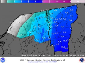
Thursday afternoon NWS snow accumulations forecast update

BTV NWS Storm Total Snow Forecast map
The Thursday afternoon update for the Storm Total Snow Forecast map from the National Weather Service in Burlington - click for the full size image

The afternoon update to the Storm Total Snow Forecast map from the National Weather Service in Burlington suggests a few inches less accumulation all around.  A comparison to the previous map is in my afternoon post to the Northern New England thread at Americanwx.com.

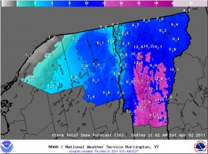
NWS potential snowfall update from mid morning

Snowfall accumulations map for Vermont and Northern New York
Mid morning update on potential snow accumulations from the National Weather Service in Burlington - click for full size image

The National Weather Service in Burlington updated their potential snowfall accumulations map mid morning today, so I’ve added the latest version here.  I discussed some differences from yesterday afternoon’s map in a post in the Northern New England thread at Americanwx.com.

Storm incoming, 1 to 2 feet possible for the Greens

Winter Weather Advisories Map from the BTV NWS
The winter storm watches from yesterday have been upgraded to winter weather advisories and winter storm warnings today

I’ve added the updated advisories and warnings map from the National Weather Service Office in Burlington, but their projected accumulations map looks similar to yesterday, so I’ll just refer to the one that was already posted earlier in the blog.  In his forecast from this morning, Roger Hill suggested the potential for 1 to 2 feet in the Green Mountains, with 6 to 10 or 8 to 14 for some valley locations and the potential for school closures.  Looking at the winter storm warnings from BTV, it seems that the biggest totals are more south of here, although as is often the case, if upslope gets into the picture later in the storm cycle, the Northern Greens seem to do pretty well.  The current point forecast for our location in the Winooski Valley at ~500’ suggests 5 to 10 inches through tomorrow, and then additional snow Friday night, Saturday, and Saturday night.  We’ll have to see how this system goes around here, but similar to what we saw in 2007-2008, we would be closing in on the 200-inch mark for seasonal snowfall at our location if we get a decent dump.

Afternoon update on potential snowstorm

BTV NWS Accumulations Map
Snowfall predictions from the Burlington NWS updated this afternoon - click for the full size image

I’ve added the latest Storm Total Snow Forecast map from the Burlington office of the National Weather Service in this post.  The models are still moving around with the exact track of the system, but the NWS meteorologists feel that we’ve got a shot at some decent snow in the area.  More details and a comparison of the morning and afternoon maps for potential accumulations are in my afternoon post in the NNE thread at Americanwx.com.

Potential April Fool’s Day Storm

BTV Winter Weather Warnings Map
Winter Storm Watches are up for Vermont and New York as of this morning

There appears to be a storm on the way for the Northeastern U.S. in the Thursday through Saturday timeframe. The exact effects on our region aren’t known yet, but there is the possibility of some decent snowfall. I’ve added the latest Burlington NWS advisories and potential accumulations maps to this thread, and more details are in the NNE thread at Americanwx.com.

Potential Snowfall Accumulations Map
Initial snowfall projections from the Burlington office of the National Weather Service - click to view the larger image

A little more snow today, possible storm this weekend

I measured 0.3 inches of snow today at the house due to the upslope snowfall activity that has been hanging around, bringing our location to 39.6 inches for March and 192.6 inches for the season.  Details are in my post in the Northern New England thread at Americanwx.com.  There is the potential for a larger storm this weekend, and there’s plenty of good discussion going on in the Americanwx.com New England Forum.

Stowe, VT 27MAR2011

Image of the Chin of Mt. Mansfield and the Stowe gondola
Looking back toward the Chin of Mt. Mansfield and the Stowe gondola from the Nosedive Glades

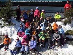
It was ski program day at Stowe today, and since Johannes and Helena are done with their programs at Bolton, Stephen and the kids tagged along with our group.  I had to drop off Ty at the Stowe Shaw’s to be picked up for a birthday party, but I eventually caught up with Claire, Stephen, and all the kids just as they were heading up the gondola for their first Mansfield run.

Off piste conditions were fantastic, since the upslope pattern was delivering well and Stowe had seen a foot and a half of snow since the Monday event.  I added some of the totals into my update at Americanwx.com, and it showed quite the north to south trend with Jay Peak cashing in nicely:

Jay Peak: 30” (359”)  Stowe: 18” (311”)  Bolton Valley: 14” (316”)  Killington: 4” (251”)

In one of our traverses we stumbled onto a gully in the Lower Goat woods that everyone skied – it had some really steep walls and reminded me of one of those Jackson Hole gullies.  To see the full text and pictures, head to the Stowe trip report from today.

Good powder in the local mountains

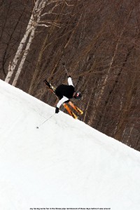
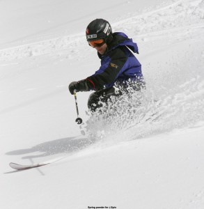
Jay in the powder at Bolton valley
Jay skiing the powder at Bolton valley yesterday

Waterbury event totals: 2.8” Snow/0.06” L.E.

After that quick inch of snow we picked up yesterday, that was it for snowfall down here at the house as far as I can tell.  We were back up at Bolton for some more turns starting around midday, and it was snowing pretty hard for the first part of the afternoon.  Friends that we met up there said that it had snowed like that all morning.  It’s nice to see what’s going on up at Jay, because they were a bit left out of the pattern earlier in the season with so much activity focused to the south.  I’ve added the 7-day and seasonal snowfall totals for some of the VT resorts below:

Jay Peak: 30” (359”)
Stowe: 18” (311”)
Bolton Valley: 14” (316”)
Killington: 4” (251”)

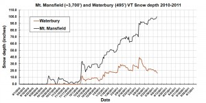
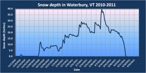
Right now the snowpack is 98 inches at the Mt. Mansfield stake, and if one looks at the SkiVT-L plot for the snow depths, this is right around the date for the typical maximum.  The historical data suggests a small dip after the end of March, but the snowpack really seems to hang around at this level until roughly mid April before it actually starts to fall off., so I could see the peak snowpack depth being anywhere in that range, especially with the current weather pattern.

Bolton Valley, VT 26MAR2011

Image of Jay skiing in powder
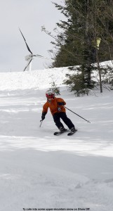
Jay comes into view skiing some of the beautiful powder in the Villager Trees at Bolton Valley.

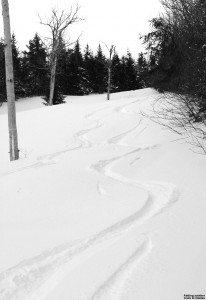
The upslope snow has been rolling in, and although we haven’t had a ton of snow from this event yet, snow surfaces are getting a nice freshening.  This morning down at the house we were on our way toward picking up a quick additional inch of snow to put us at 2.8 inches for this end of the week event, and 9 inches for the week.  Bolton was reporting 13 inches over that span, with the snow continuing to fall.  Today we were back up at the mountain again for an afternoon session with Stephen and his kids, and for the first half of the afternoon it was snowing at a good clip.  Everyone joined in for a run on Spell Binder, and using the knowledge about the aspects with best snow that the boys and I had learned yesterday, there were some really awesome bottomless turns available on the skier’s left.  Even with just a few inches of additional snow, the skiing took quite a jump up in quality.  We found the same snow setup on Tattle Tale, and all three boys had fun ripping up the powder in their own way.  We gave Johannes first tracks on one line, and he decided that a figure 11 was the way to go, while Ty and Dylan accented his line with some curves.  We’re starting to nickname Johannes “11”.  For the full text and all the pictures, click through to the Bolton Valley trip report from today.