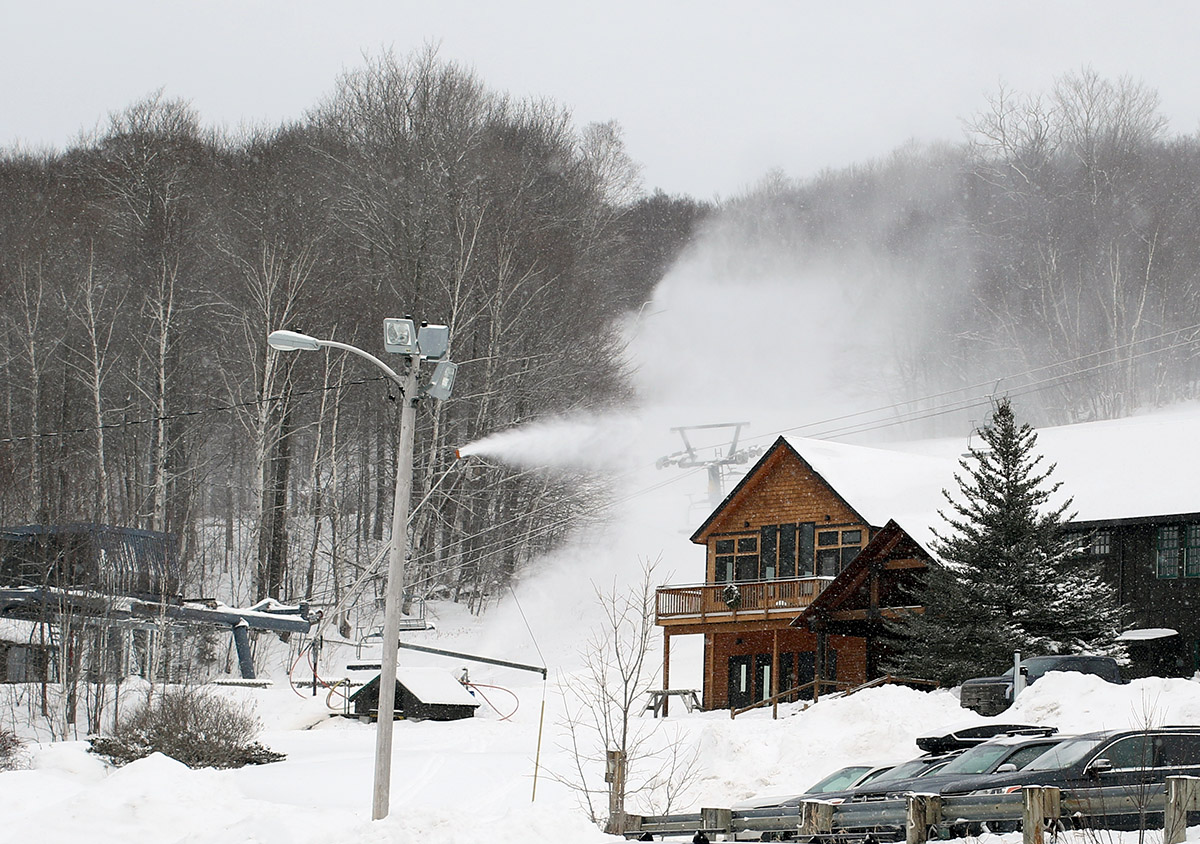
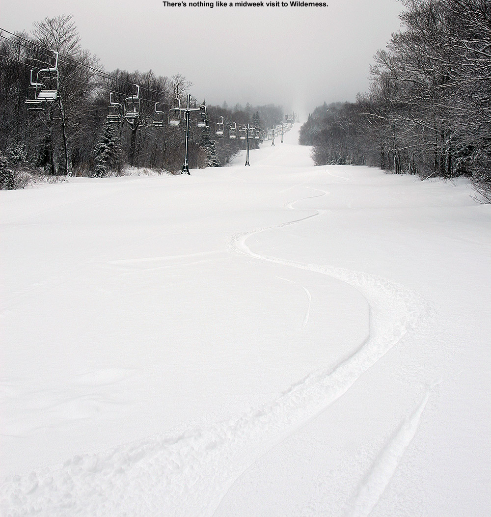
Bolton Valley has finally fired up snowmaking at the base of the Timberline area, so Timberline’s slopes will likely be opening to lift-served skier traffic soon.
Our recent long-duration system finished up on Friday, and the next winter system moved into the area today, so Mother Nature continues to deliver snow and enhance the conditions on the slopes. E and I headed up to Bolton Valley this morning to check out the conditions with some lift-served skiing, and there’s no doubt that the word is out about the conditions. It was midmorning when we arrived at the resort, and people were already parking at the third tier of Timberline and being shuttled up to the main base. The good news is that they resort has fired up the snow guns on Timberline, so they’ll probably be opening that area to lift-served skiing soon.
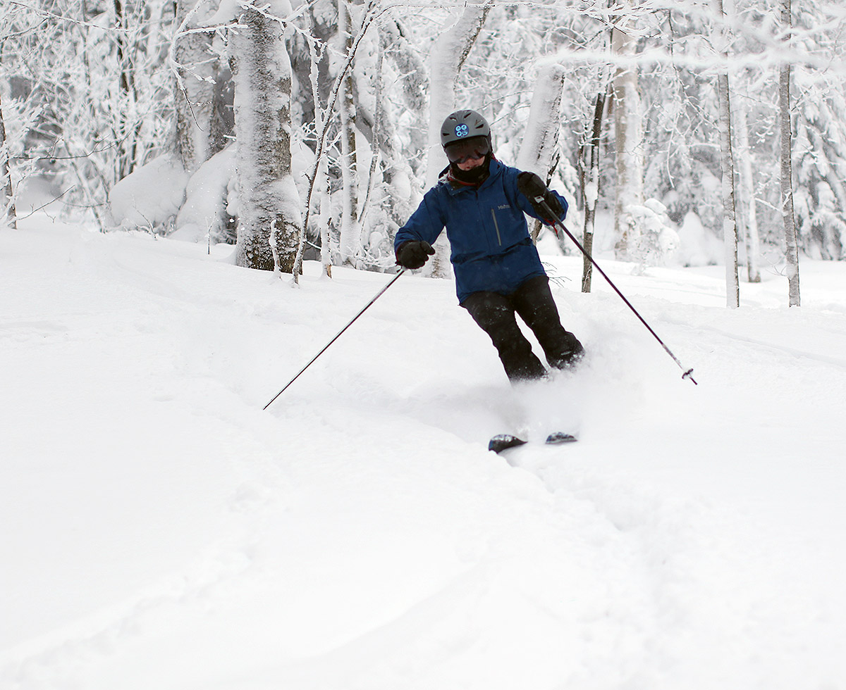
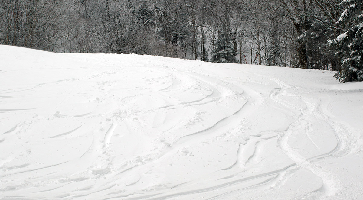
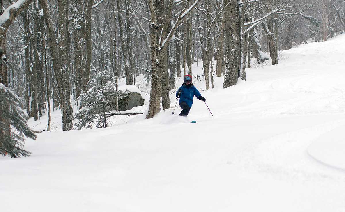
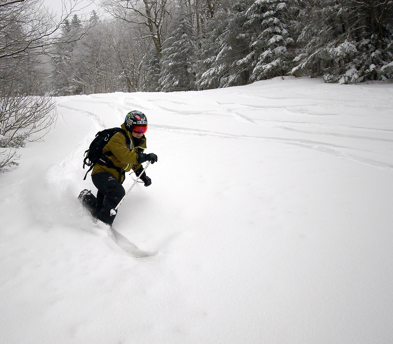
Erica enjoying some powder today in the Snow Hole area
After the run of relatively cold, windy (and thankfully snowy) weather we’ve had for the first third of January, today was extremely comfortable with temperatures around 20 F, no wind, and light snow falling. So, everyone we saw at the resort seemed to be excited about that. The resort had received another few inches of snow as the previous system wrapped up, and conditions on the slopes were very similar to what I experienced on Wednesday and Thursday with a touch of improvement thanks to the additional snow and more grooming. The scoured areas were still thin on snow, but grooming had definitely help equalize and soften the conditions there a bit. Natural snow areas out of the wind continue to offer fantastic snow – and when that snow is groomed it skis beautifully; you’re not hitting anything under the packed powder. Off piste, there is a lot of powder as one would expect. We were finding depths of around 20 inches, which is similar to what I’ve been finding this week. In general, areas with that sort of deep powder are skiing fine, but it’s not outstanding powder skiing. The powder is of roughly medium-density, but its density is generally equivalent throughout its depth, so you can sink in pretty far and get a bit bogged down on lower-angle terrain. It’s not upside-down powder, but it just doesn’t ski as well as it would with a really nice right-side-up arrangement. Some areas did offer a better powder experience though. They have finally opened up more of the Snowflake terrain, and we found about a foot of powder over places that had either been groomed or had more settled snow underneath, and those spots offered some very pleasant powder skiing today.
Areas protected from the wind continue to offer great powder turns as our second long-duration winter storm this month dops more snow in the local mountains.
I had time to head up to Bolton Valley for another ski tour this morning, and the weather was very much like what we’d had in the mountains for the past few days: temperatures in the single digits F with a lot of wind. Thankfully, yesterday appeared to be the coldest of the days this week, and the temperatures this morning were about 5 to 10 degrees F warmer.
Yesterday I’d done a bit of lift-served skiing after my tour, but today I decided to make my tour a bit longer instead of sitting on the lifts. On my ascent I topped out around 2,900’ on Wilderness, and I figured I’d gone high enough to get a good sampling of the snow at various elevations.
With a few more inches of snow each day, the conditions on the slopes have just continued to improve aside from those areas exposed to the wind where scouring has been incessant. Exposed areas just continued to be scoured, and I wouldn’t be surprised if some of those exposed spots had less snow than they did before this system began. Protected areas had simply fantastic snow though. Like yesterday, I typically measured 20 inches or more of powder in protected areas today, and the subsurface snow is a distant memory there. I also measured depths as great as 35 inches in some non-drifted spots, where it seemed like I was just pushing down into the older layers in the snowpack without even hitting any firm layer to differentiate the snows from these recent couple of systems. That’s a good sign about the overall quality of the snowpack though if you can’t even find a subsurface layer until you head down 35 inches into the snow.
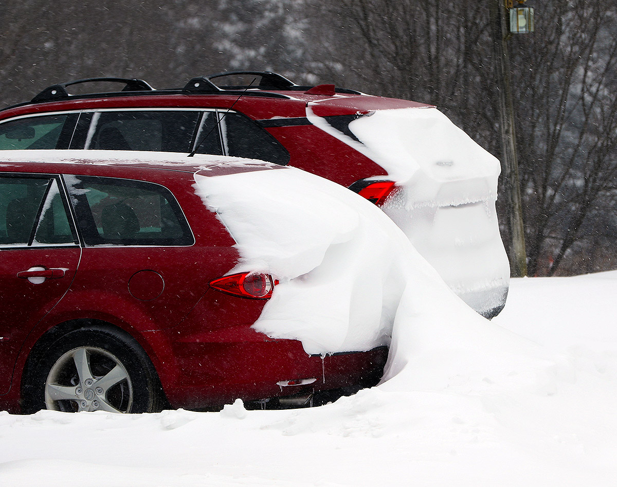
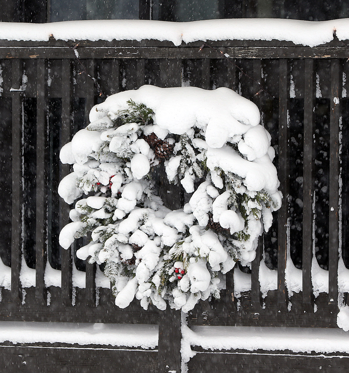
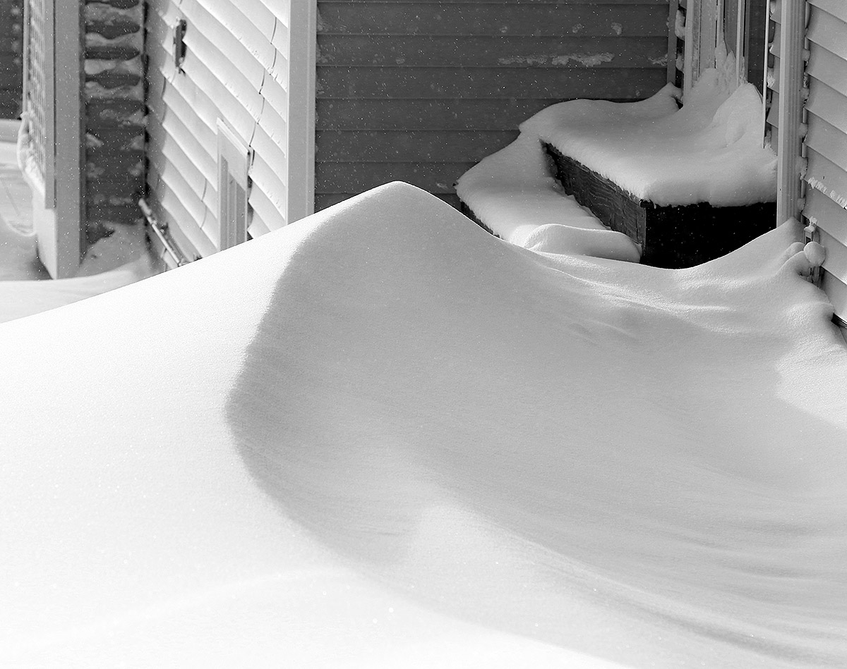
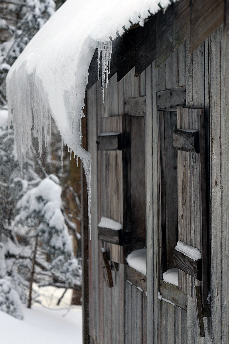
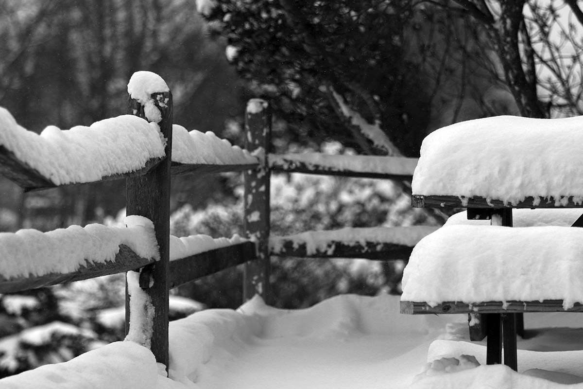
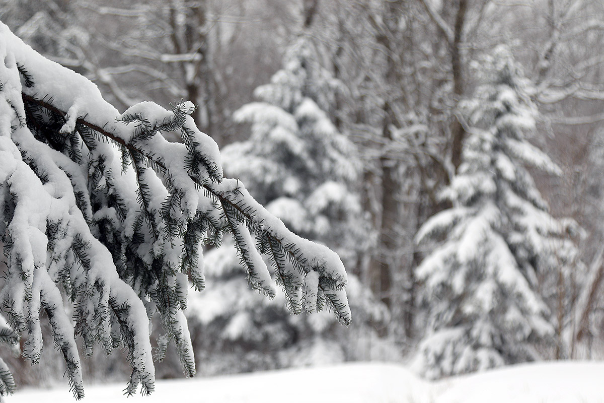
Throughout the Village, snow has been accumulating in various ways on all sorts of surfaces due to the continued wind and snow from our ongoing long-duration winter storm.
With the end of this most recent long-duration system, it looks like we could be moving into a pattern featuring some Clipper systems. The first one is coming into the area tomorrow, with another expected for Monday into Tuesday.
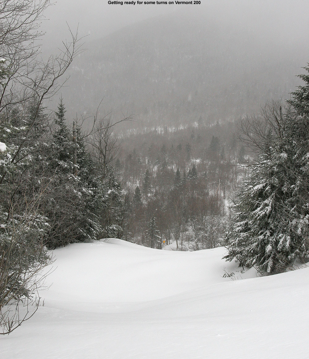
Peering down Vermont 200 this morning, it was clear that its protection from the winds was allowing some nice snow accumulations to settle in for some great soft conditions.
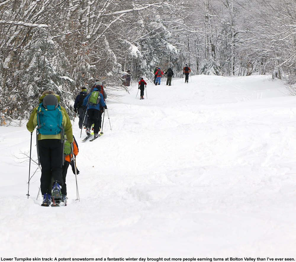
I’d hoped to head up to the mountain for some turns yesterday afternoon to see how accumulations were settling in from our current system, but it was a bit close to sunset after I finished the work I wanted to get done. I wasn’t too worried about it though, since this is another long-duration system, and the snow accumulations are slowly building up. I did manage to get out for some turns this morning on my way into Burlington, so I can report on that outing. In the weekly forecast, today had the coldest temperatures of any day, with valleys in the single digits F. So, in that respect, this wasn’t my preference for days to get on the skis, but it’s been snowing, and it worked out.
In most respects, the weather up at the mountain was sort of status quo for what we’ve had over the past several days – at the Village elevations it was still in the single digits F. In this case, the temperature was barely in the positive category, but it can definitely get far worse in January. A big current factor in comfort on the slopes though is the wind – those winds are still howling out there with this system. With that in mind, I started the morning with an ascent via the Wilderness Uphill Route to get my body up to temperature, and that worked well. Then I was warm enough to take a trip up the Vista Quad and make another run.
As the snow continues to fall, the persistent northwest upslope winds are forming drifts all across the resort in exposed areas.
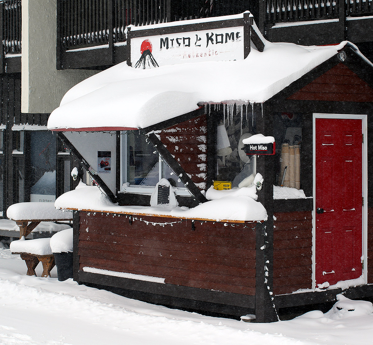
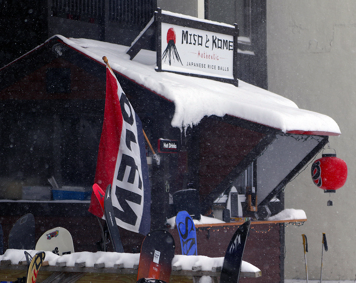
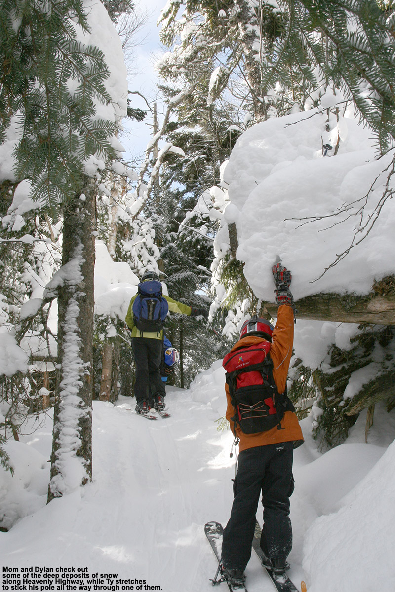
The snow report from Bolton Valley was indicating 6 inches for their 48-hour total/storm total as of this morning, which doesn’t seem like much, but this system has brough decent moisture with it. The flakes have been small in many areas because of poor dendritic growth. Combine that with those winds blowing it around and packing it together, and measuring accumulations in the mountains has been tough. For example, I’ve recorded almost a foot of snow from this system down at my house in the valley, not because we actually got more liquid equivalent than the higher elevations, but because we’re sheltered from the high winds, and the dendrites can actually stack up with loft and not get smashed and compacted. In any event, we’ve recorded about a half inch of liquid equivalent from this storm so far at the house, so the mountains have probably picked up somewhere between a half inch and an inch of liquid. In areas protected from the wind, such as by the Miso Toh Kome hut, there are some snow stacks that give you a nice sense of how much has fallen with this event in unscoured areas, and the stacks looked like they were about 10 inches deep.
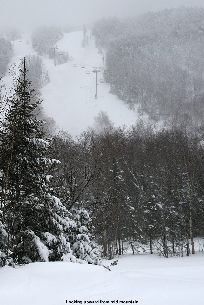
In terms of the ski conditions, with a lot of its terrain facing west, those usual exposed areas at Bolton without snowmaking are scoured down to just a couple of crusty inches. Areas out of the wind have lots of great medium-weight powder though. Measurements I took in protected, non-drifted areas in the 2,000’ to 2,500’ elevation range revealed up to 20 inches of powder, so where it’s not blown away, even the lower elevations of the main mountain are really starting to accumulate quite a stack of surface snow atop the base. I skied Lower Turnpike on my touring run at Wilderness, and being protected from the wind, it had great snow wall-to-wall, with some spots having a foot of powder, and others just a few inches of powder if they had seen grooming and/or skier traffic. With the cold temperatures, the snow was a bit slow, but not so slow that I had trouble maintain speed even in those deeper areas of powder. Off the top of Vista, I stayed away from Spillway and Hard Luck, which are much more exposed and get scoured, and chose Vermont 200, which is much more protected. It had just a couple of small, scoured spots, but beyond that it was a playground of 1 to 3 feet of nearly untouched powder depending on whether or not you were blasting through a drift.
Traffic at the resort was fairly light this morning, with some trails having just a few tracks as the snow from our current windy storm system just continues to bury the mountains.
Although we’re not currently getting tons of champagne powder turns from this system with its prodigious winds, I did notice one great thing that this current system is doing. Aside from some nice resurfacing outside of the exposed areas, the winds are really filling in any of those deeper water bars in the lower elevations that just hadn’t managed to get there yet. I really noticed it on Lower Turnpike – there are those certain water bars in lower elevations where you have had to direct yourself to an optimal spot along the width of the trail because it’s got the smoothest transition for crossing. That issue has largely disappeared now with this meaty snow being driven into the hollows of the water bars by those winds.
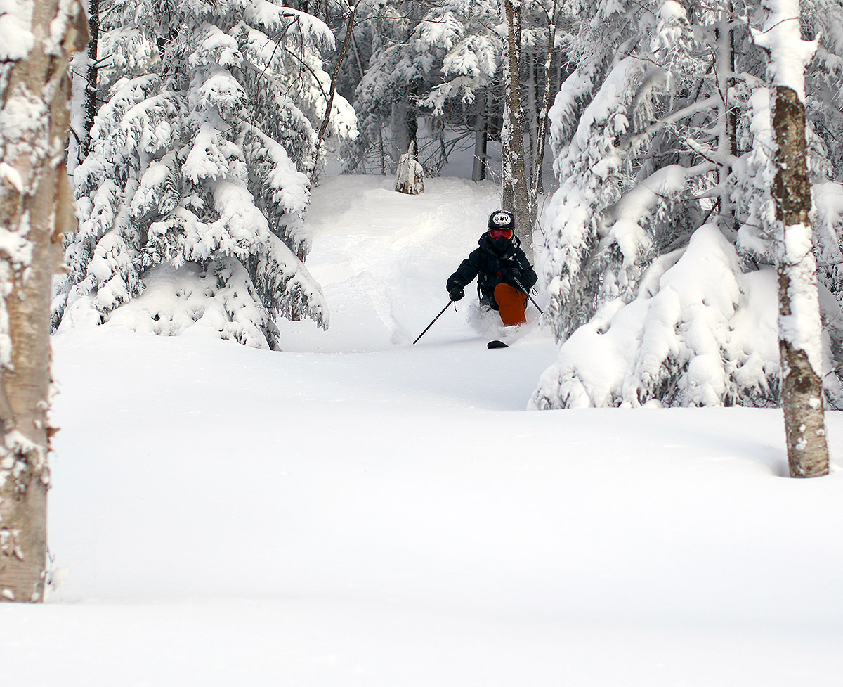
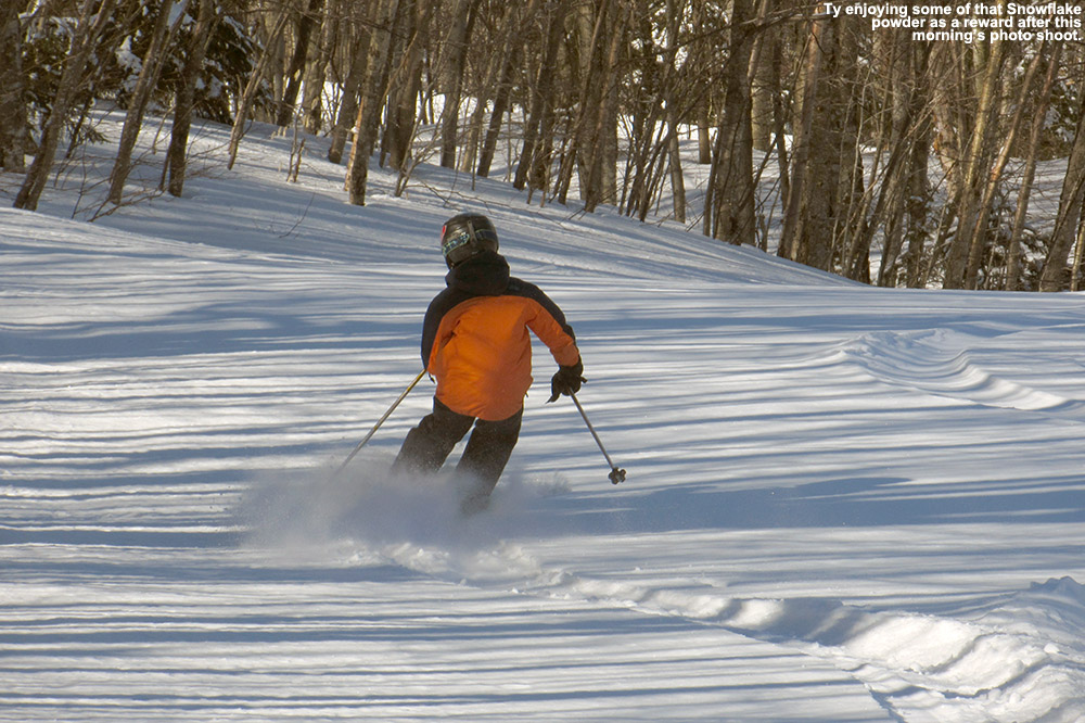
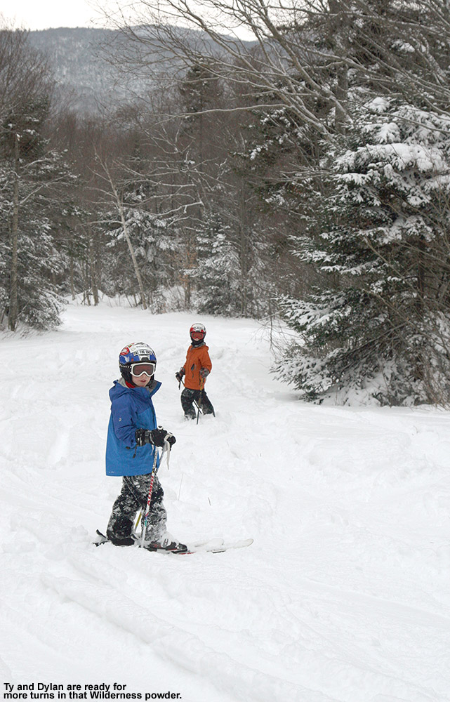
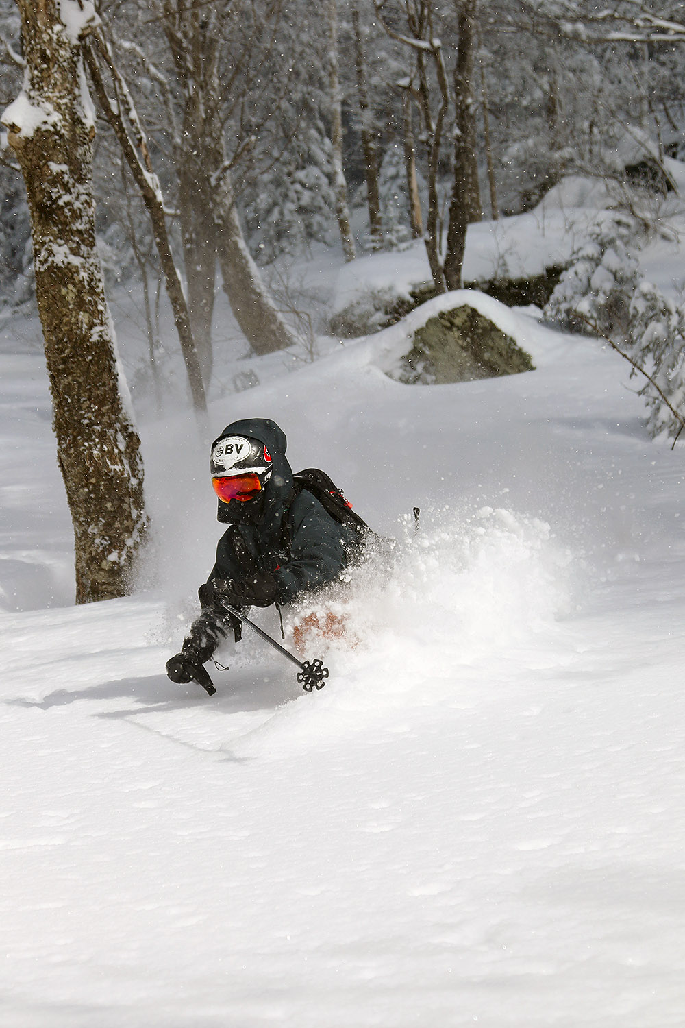
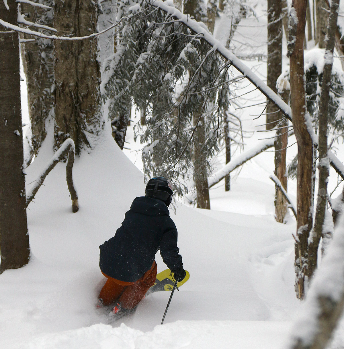
Ty diving through the powder on today’s tour as we descend in Bolton’s Snow Hole area
Based on the quality of yesterday’s skiing, I was leaning heavily toward heading out for another tour today. The backcountry conditions around Bolton are already quite good, and they were reporting another 2 to 4 inches of new snow this morning, so that was a nice bonus. Temperatures were expected to be about the same as yesterday, which meant single digits F.
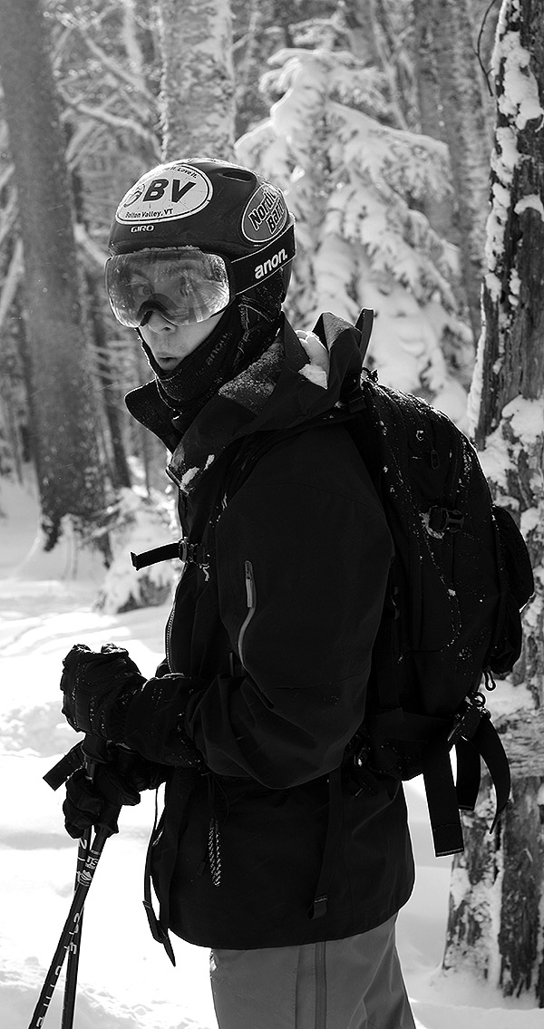
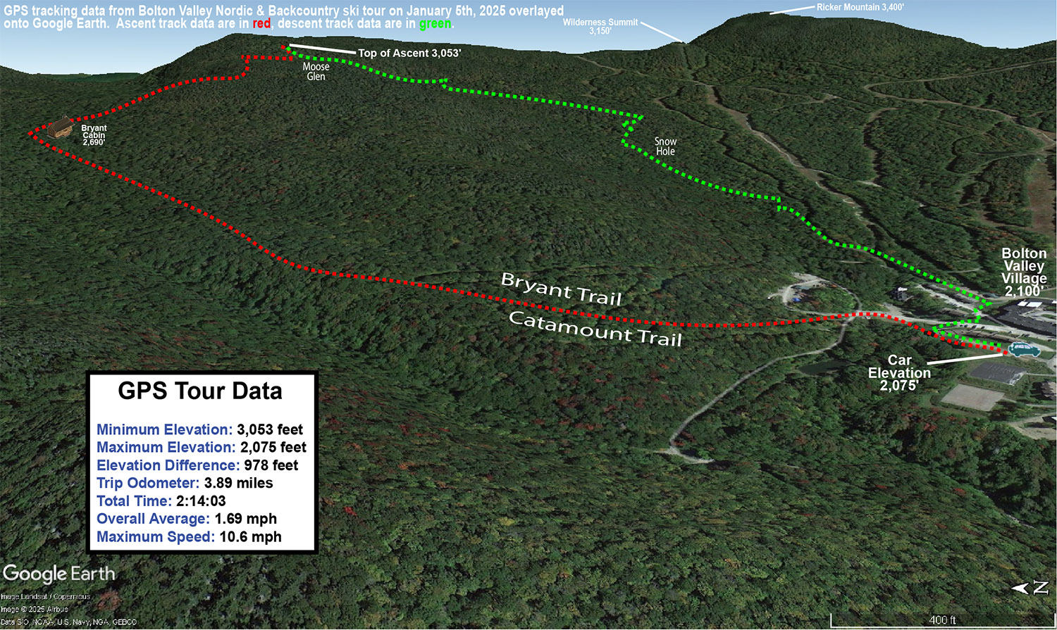
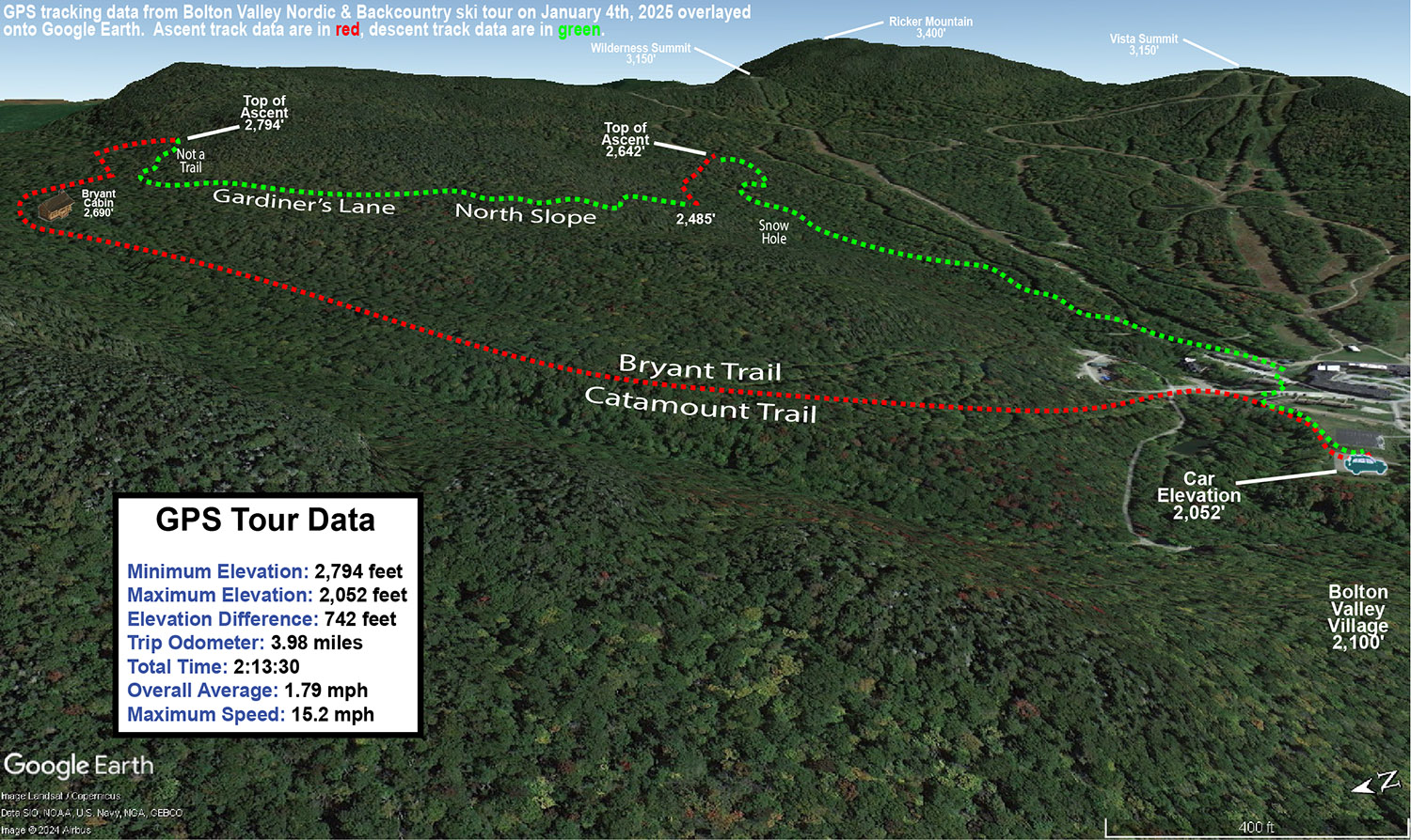
Ty was able to join me today, so it was great to have company, and we were able to get some actions shots in the powder. We did a tour somewhat similar to what I did yesterday, but we lengthened it out a bit more. Instead of heading up to Heavenly Highway and working our way down to North Slope, we went all the way up to Moose Glen and then wrapped around on a descent toward the glades around Snow Hole, which was roughly a four-mile tour. I chose that route to get us some relatively high altitude turns after observing the notable improvements in the overall snowpack above 2,500’ yesterday.
The number of visitors at the resort seemed a bit less today – there was no sign posted about the Village lots being full, and we easily grabbed a parking spot in the upper lot by the entry to the Backcountry Network. With cold temperatures preserving the snow, conditions were similar to yesterday with 1 to 2 feet of powder available wherever wind hadn’t scoured it to lower depths. Touring some of the higher elevation trails allowed us to see the various areas that had been hit by wind, and you just had to be cognizant of where winds had affected the snowpack to pick the lines with the best undisturbed powder. The middle elevations were much less disturbed by the wind, and you could pick just about line and get some great powder turns.
The Google Earth map with GPS tracking data for today’s ski tour on the Bolton Valley Nordic & Backcountry Network
The models suggest we might have another long-duration system like this past one starting up tomorrow night and running right through the week, and I see that Winter Weather Advisories are already up for the Northern Greens in anticipation of some of that snowfall.
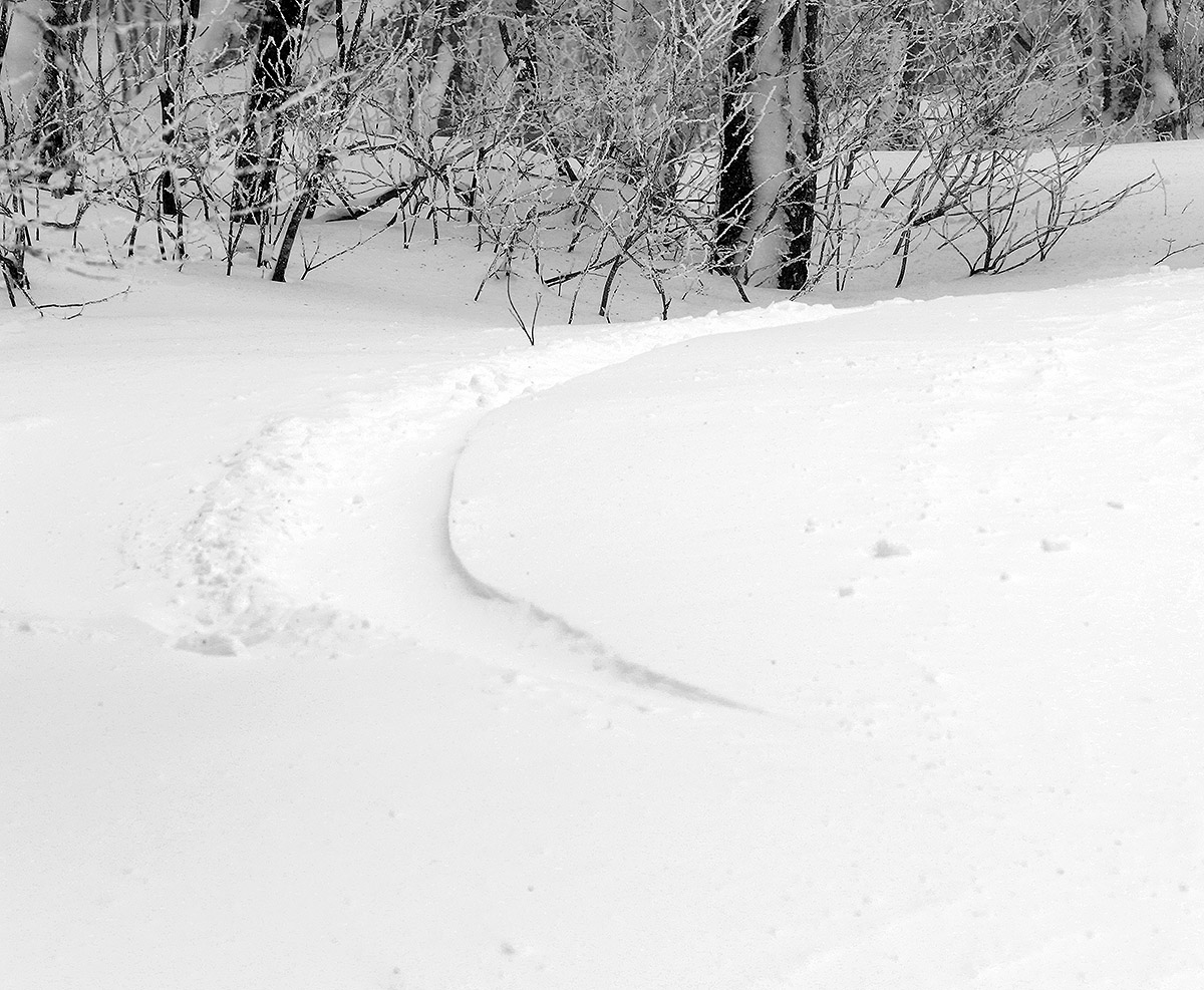
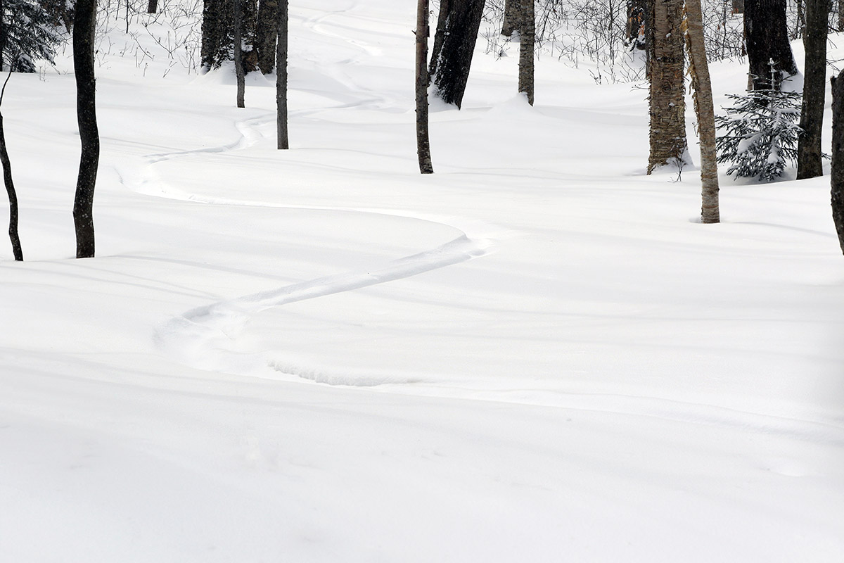
The powder is great and the backcountry ski traffic has generally been light – as I passed by, I saw just one old set of tracks in the Cup Runneth Over area.
Our current storm cycle started up back on Wednesday, with low pressure deepening as it passed over southeast New England and up into Maine. It then headed on up into eastern Quebec, stalled there for a bit, and finally moved to northwest to James Bay, where it’s expected to sit until about Monday. While this isn’t a stacked low-pressure system sitting in the Canadian Maritimes feeding continuous 1+”/hr. snows into the Northern Greens, the broad cyclonic flow supported by the various positions of the low pressure has kept the area in a nice moist westerly/northwesterly flow that’s been feeding snow into the mountains. So, this isn’t a typical 24-, 48-, or 72-hour type of storm cycle; it’s a much more drawn-out sort of “cycle”. I wasn’t sure how the positions of this low would actually play out with respect to snowfall, but since well before the start of the storm the National Weather Service Office in Burlington has been on it – they felt that the potential was there for solid amounts of snow over the protracted period. And they certainly weren’t wrong. It’s been a little tough to total up the mountain accumulations for the full event because it’s already been going on for four days, and the resorts typically only report up to 48-hour accumulations, but it looks like anywhere from roughly 1.5 to 3 feet have fallen in the Northern Greens from the system as of today.
Bolton Valley was reporting 4 to 6 inches of new snow overnight on top of their previous accumulations from the system. I’d already been finding snow accumulations of 9 to 10 inches when I was out touring at Bolton on Thursday, so between whatever fell Thursday night into Friday, plus these additional Friday night accumulations, there seemed to be some good powder potential out there. Temperature forecasts for the mountains were in the single digits F today, so touring seemed to be the best option. E was initially going to join me for a ski tour, but after thinking about the temperatures for a bit, she ultimately decided to work out at home instead.
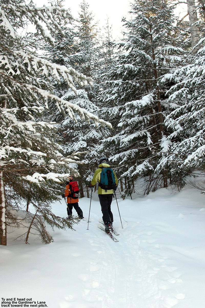
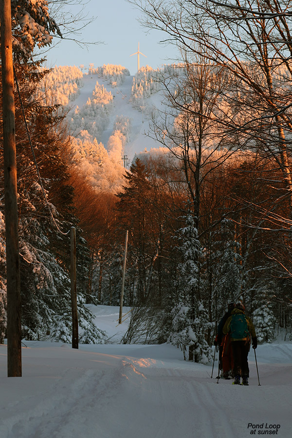
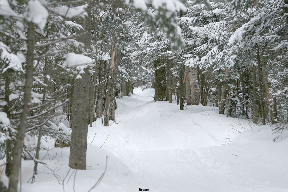
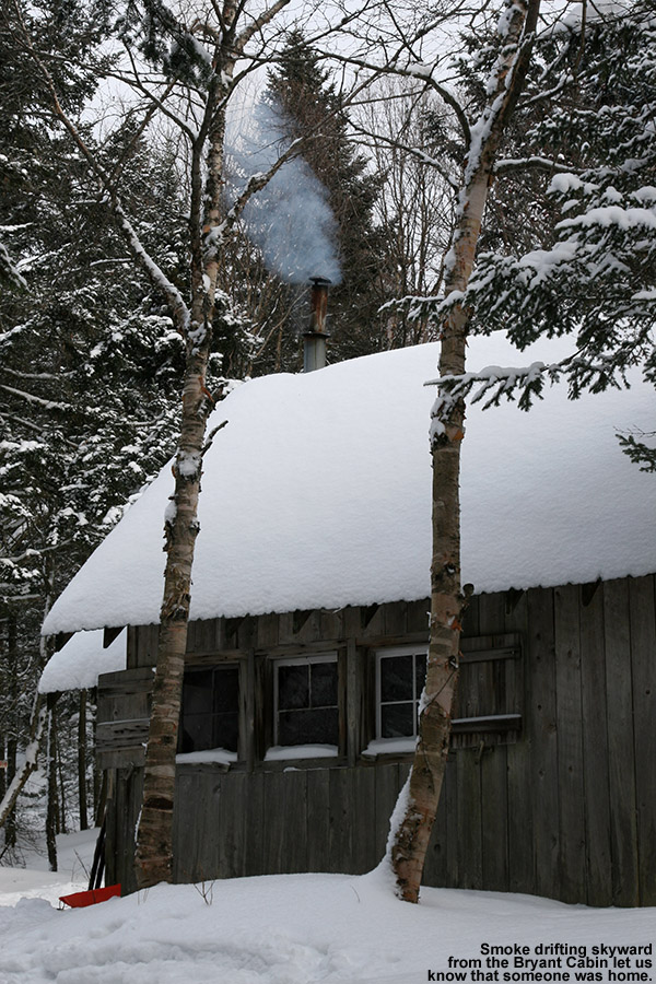
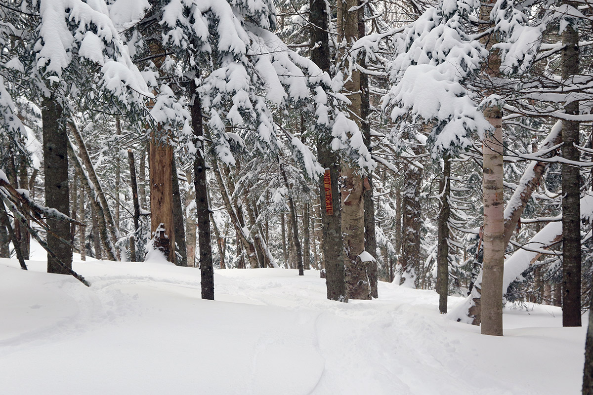
I headed up to the mountain a bit after noontime, and people certainly didn’t seem to care about the temperatures – the signs were up for visitors to park at Timberline because the upper lots were full. Being after noon, I knew I’d be able to get a spot from someone who was leaving for the day, so I headed up to the main base anyway. I still ended up getting a spot in the lowest tennis court lot though, and that changed up my touring plans a bit. I had initially planned to ascend at the start of the Wilderness Uphill Route and then make my way toward Gardiner’s Lane, but since I was parked right down by the Pond Loop area with easy access to the Bryant Trail, I ascended there instead. I had just planned to loop around Bryant Cabin and then head out to start my descent on North Slope, but the temperatures felt great while touring, so I continued on up to Heavenly Highway, topped out around 2,800’, and started my descent via the “Not a Trail” glade. From there I continued down North Slope and then made a second ascent to ski some of the glades in the Snow Hole area.
Up above 2,500′ there were frequently areas with 24 inches of powder atop a substantial base for what must have been a snowpack depth in the range of 40 inches
It was clear that powder depths had increased at the resort since I was last there on Thursday. Winds have died down substantially now, so measuring the snow is much easier, and right at the car at ~2,000’ I was getting 8-12” depths for the surface snow above the base. By 2,500’ the typical depths were in the 12-16” range, and around 2,800’ I’d say they were 12-18”. I’d still think that’s somewhat conservative though, because I was often finding powder depths of 24” up around 2,700’-2,800’. Right now, getting up above 2,500’ makes a real difference in the snow though, because those areas must have done really well during our previous warmup – the interface between the surface snow and the base has mostly disappeared by that point (making it harder to measure just the new snow), and the skiing is really good. Dropping into my initial descent, I could tell that the overall snowpack was really deep. Below that top 24” of powder there was substantial base, and I’d say the snowpack there has to be 40 inches. The snowpack at the Mt. Mansfield Stake was at 39” as of a couple of days ago, and it hasn’t been updated since then, but based on what I found out there today a few miles to the south, it’s got to be over 40 inches by now.
Anyway, I’d recommend doing most of your touring up in that 2,500’ to 3,500’ elevation range if you can – it’s just a notable improvement in the overall snowpack below 2,500’. It’s still nice skiing down there, but it’s sort of mid-fat powder conditions below 2,500’, and full-fat conditions above 2,500’. I toured on mid-fats today, but I was wishing I had fat skis in that deep snowpack above 2,500’. The powder is of medium weight, so there’s plenty of liquid equivalent in there to really keep you off the base. As of this evening we’re approaching an inch of liquid equivalent from this system at our site in the valley, so you know the mountains have had at least an inch of two of liquid equivalent from this system so far, and it definitely felt like it based on what I experienced above 2,500’ today.
A Google Earth/GPS map of today’s tour out on the Bolton Valley Nordic & Backcountry Network
With respect to the ongoing storm, there was generally light but consistent snow falling when I was out on the mountain today. The flakes were small, in the 1 to 2 mm range, so it was hard to gauge snowfall rates, but I had to clean a decent layer off my car when I got back to it after just an hour or two of touring. Toward the end of my tour, the flake size was picking up noticeably to roughly 2 to 8 mm flakes. Down here at the house, we’ve had light snow all day, but it’s picked up more this evening with larger flakes, especially when strong echoes come through as more pronounced shortwaves embedded in the overall cyclonic flow move through the area. Based on what we’ve been seeing here at the house this evening, there should be at least another few inches out there by tomorrow morning for the mountains.
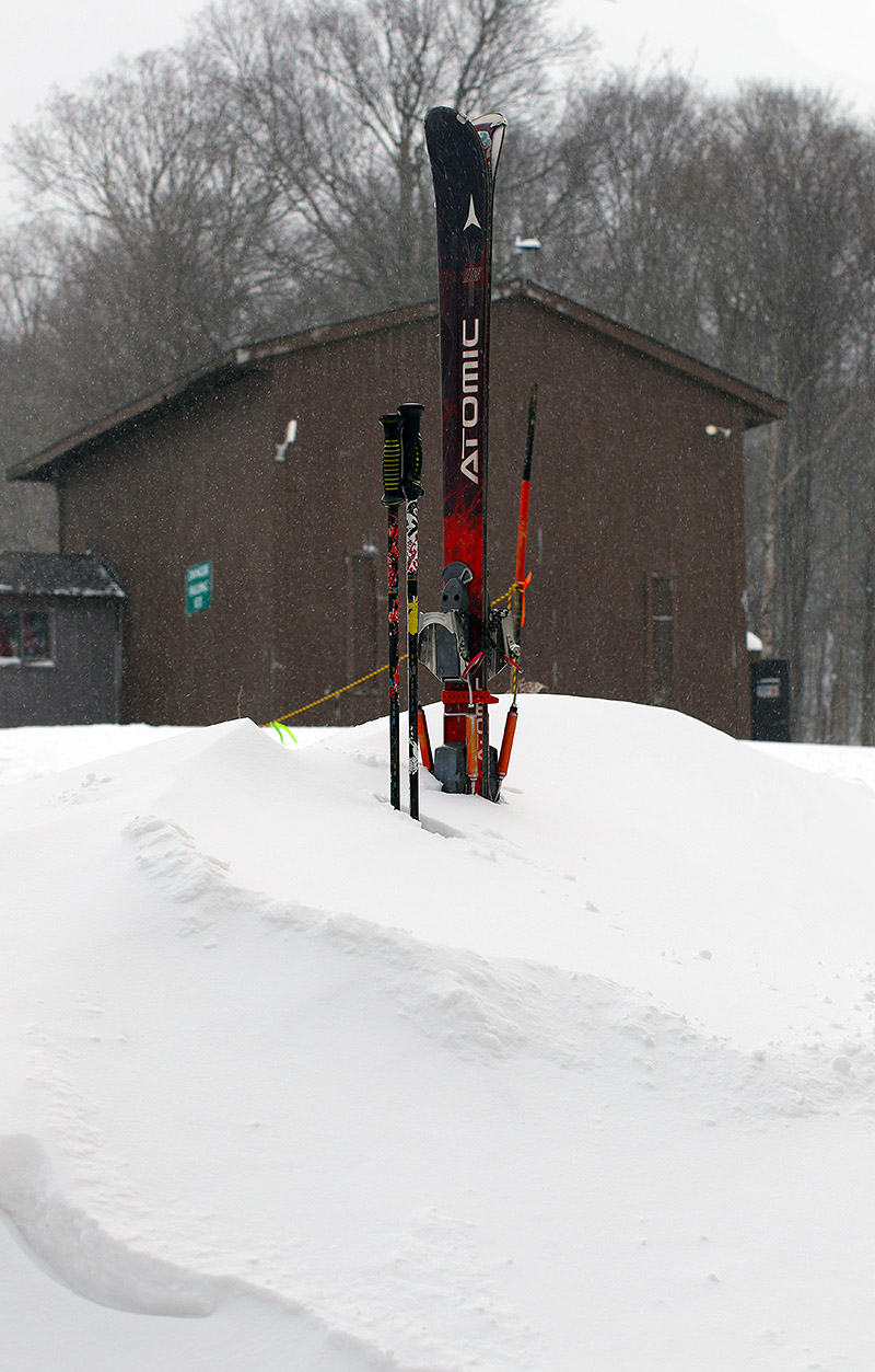
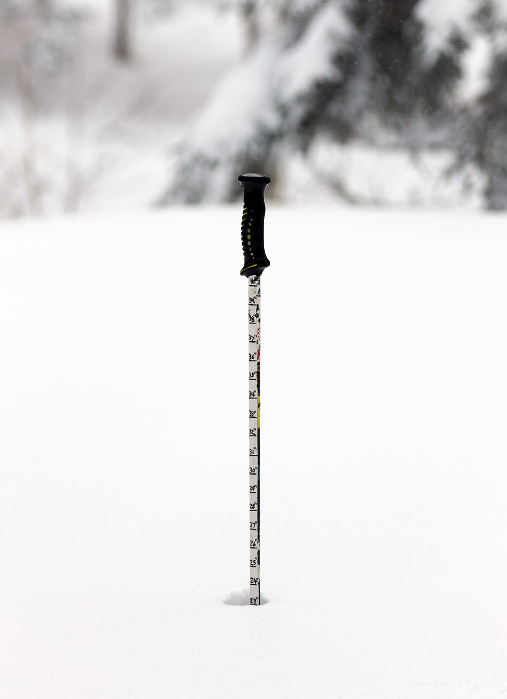
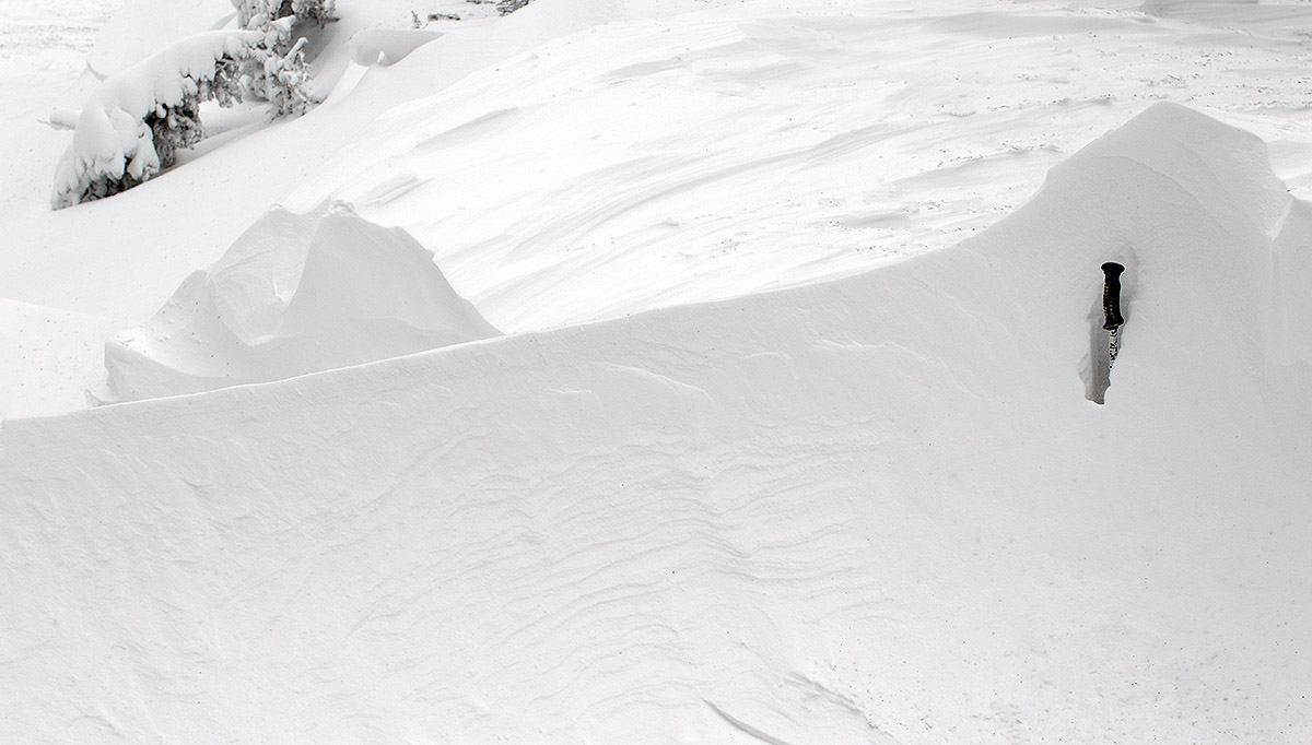
Snowdrifts were certainly on the menu during today’s ski tour. Howling winds from the upslope portion of our current storm cycle have pounded the Northern Greens and whipped up the snow into formations 5 to 6-feet deep as my buried ski pole can attest.
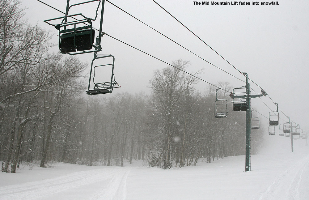
Our anticipated long-duration storm system began in the area yesterday with some light snow accumulations for the mountains and valleys, but snowfall really picked up overnight, so I decided to head up to Bolton today for some turns. As of this morning, Bolton Valley was reporting 7 inches of new snow from the storm, and snowfall has continued today. Their reported storm total seemed like a good amount for some ski touring, so that was my plan if I was heading up to the mountain alone. Dylan didn’t work until the afternoon, so he was planning to head up for a morning lift-served session with his fried Parker, and E had the day off due to school closures from the storm and she was thinking of going as well. Those plans fell through though – the winds were so strong that the Vista Quad Chair was on wind hold before it ever opened, and even the Mid Mountain Chair quickly went on wind hold in the morning. The only chairlift running by mid-morning was the Snowflake Chair, and with most of the Snowflake terrain not open, we generally felt that it wasn’t worth heading up for such minimal terrain. That brought me back to my original plan of ski touring on Wilderness.
Down at our place in the valley we’d picked up 4 to 5 inches of snow from the storm at that point, but the contrast in accumulations was stark as I dropped down into Bolton Flats on my way to the mountain – the snow accumulation there looked like an inch at most. Accumulations were the same at the base of the Bolton Valley Access Road at 340’, and I had to get above 1,000’ before I really started seeing accumulations of at least a few inches. Up in the Village parking areas, it was impossible to find a sheltered spot to get a reliable measurement of accumulations at 2,000’, so I had to wait until I got into the relative shelter of the Wilderness Uphill Route to really check the snow depth. Once one the ascent though, I checked the snow depth along the sheltered edge of Wilderness numerous times, and the measurements were all between 8 and 9 inches, with one measurement of 7 inches. At 2,500’ I was measuring 9 to 10 inches of accumulation, and I never got any reliable measurements higher than that, even up above 3,000’. I stress “reliable” because the winds had wreaked havoc on the snow in many areas. Some spots were scoured down to the old base, and some places had 5-foot drifts. Up at the Wilderness Summit at 3,150’ the winds were absolutely howling – they had to be in the 50 to 60 MPH range at times. Finding a sheltered spot to pack up my skins was a huge challenge. Thankfully, temperatures were in the 20s F, so there wasn’t frigid cold to go with those winds. Photographs of gentled-settled powder snow were difficult to come by today, but if you wanted to get images of drifts… they were everywhere.
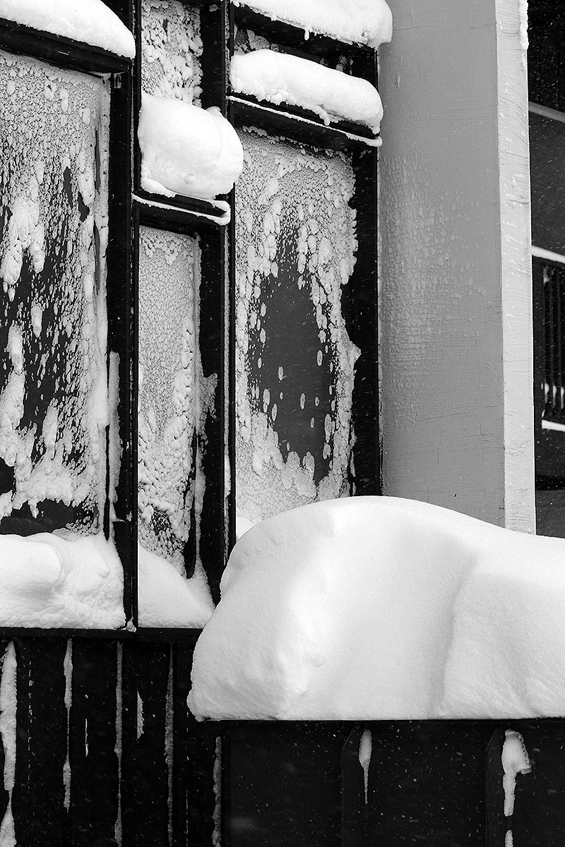
Oh those drifts out there today! Even down at the Village elevations, the wind had sculpted the new snow into all kinds of formations and covered objects in many different ways.
Here’s the snow accumulations profile I saw as of midday in the Bolton Valley area for this ongoing storm:
The skiing turned out to be excellent though. As long as you avoid any wind-scoured areas, there’s been a really decent resurfacing from this storm so far. We’ve picked up ¾” if liquid equivalent from the storm at our site down in the valley, and the mountains should have had at least that much, so an inch of new liquid equivalent up there seems very reasonable based on what I experienced today. The new snow our there certainly wasn’t fluff; with all the wind, it was actually feeling like typical 10% H2O synoptic snow, and out of the wind, the new snow was substantial enough to even resurface black diamond pitches. So, while it wasn’t sublime champagne powder, it was decent medium-weight powder, and it was much more what the slopes needed with respect to resurfacing.
We didn’t get too much accumulation (about an additional half inch) during the day today here at our house along the spine because as forecast, the Froude Numbers went well above 1.0, but they may have come back down a bit because we’re getting some decent accumulation this evening with these more recent bands of moisture pushing through.
Erica on Sprig O’ Pine as we enjoy some of Bolton’s great Christmas Eve ski conditions thanks to 8 inches of snow from our most recent Alberta Clipper system
As of their early morning snow report, Bolton Valley had received 8 inches of accumulation from the clipper that began affecting the area yesterday evening, so I headed up for some morning turns with my wife and our younger son. We’re not fully into the holiday week yet, so visitation at the resort was still fairly modest – around the time of the opening of the early lifts, folks were parking in the second and third tiers of the main Village parking areas.
I’d say we found about 8 inches of new snow at most elevations, so that’s right on track with the snow report. The powder was dry, midweight snow – my snow analyses for the storm up to that point came in at 7 to 8 % H2O. Total liquid equivalent from the system stands at 0.42 inches at our site in the valley, so that’s very much in line with the forecasts, and the mountain was probably somewhere in the range of a ½ inch of liquid equivalent. While not enough for a massive resurfacing, it did a decent job of resetting the surfaces atop subsurfaces that are already of decent quality from the past couple of systems.
After a couple days of below average temperatures, we’ve warmed back up into the 20s F now, and with light snow falling and no wind, the weather was fantastic out on the slopes today. We started off with a run on the Vista Quad, and Alta Vista had nice powder and chowder available – it was enough to be bottomless in untouched areas on moderate slope angles. Our timing was perfect for catching the opening of the Wilderness Lift, so we did a couple runs there, then finished off with more runs off Vista and Snowflake. The resort even hit Spillway hard with snowmaking and it’s good to go – my wife and I didn’t ski it, but my son and his friend did and said it was fine for manmade snow.
Conditions on the slopes are certainly good, but the natural snow trails could still use more cover, and the resort will need that to expand terrain into areas where they aren’t making snow. They haven’t yet opened Timberline, most of the Snowflake area, or the Cobrass area, so there’s a lot of terrain still to be made available.
A view from near the Bolton Valley Snowflake Lift summit station amidst today’s snowfall
It was a cold one out there today; indeed, it was really a good day to just enjoy lots of indoor activities. But we did just have another storm push through the region, and the conditions on the slopes are good and keep getting better, so I still wanted to get out to see what the new snow was like and get some exercise.
Bolton’s Wilderness Chair was set to open at 10:00 A.M. again, and with the cold temperatures I definitely wanted to warm up with some touring. So, I decided to go with a session like the one on Thursday, which I kicked off with some touring before moving to lift-served turns. When I arrived midmorning in the Bolton Valley Village, it was 7 F according to the car thermometer, and single digits F is definitely midwinter cold. There wasn’t much for wind in the parking area at that moment, so I was encouraged by that while gearing up.
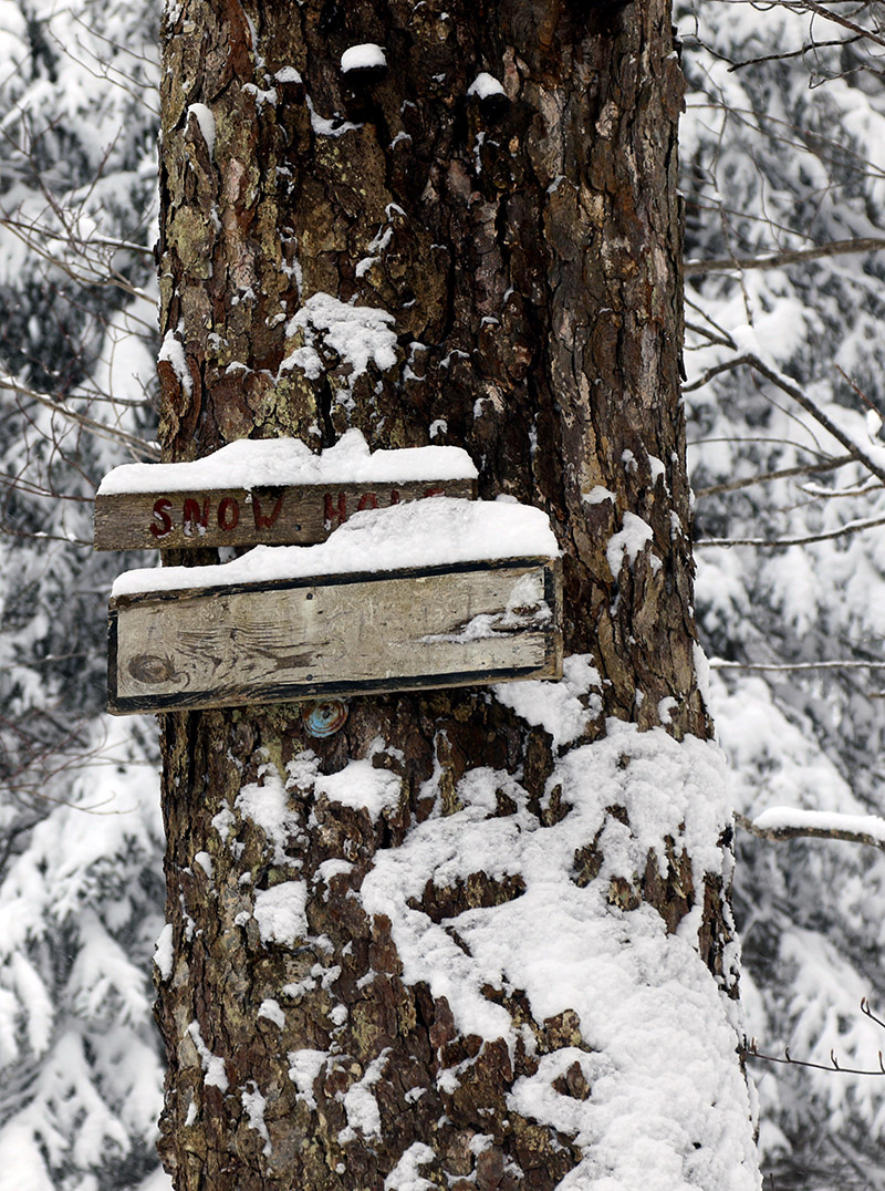
Catching sight of an old Snow Hole trail sign covered with snow along the Wilderness Uphill Route during today’s ski tour ascent
Ascending via the Wilderness Uphill Route was quite comfortable, since it’s well out of any wind, and I was generating plenty of heat. I stopped my tour at 2,500’, enjoyed a run through the powder along the edges of Lower Turnpike, and then hopped on the Wilderness Chair for a ride. My body was warmed up for the touring and Telemark turns, and the wind was happily at my back while I was on the lift, but I could tell it was pretty brutal up there at the Wilderness Summit above 3,000’. The calm conditions from below were gone, and the biting winds along the ridgelines made their presence known. After that trip, I didn’t have much interest in heading up to check out the Vista Summit, so I just stayed low and enjoyed a run off the Snowflake Chair. The warm-up touring definitely helped me stay comfortably warm for a couple of lift rides at least before I headed home.
Powder depths have obviously been bolstered by this most recent system, and conditions are good, but certainly nothing stratospheric for the Northern Greens. One factor in that assessment is that this latest storm was nice, but the snow was quite dry, and it was less of a resurfacing than the previous storm. We picked up about 0.20” of liquid equivalent from this system compared to 0.40” of liquid equivalent from the previous one, so scale those up a bit according for Bolton’s elevation and it gives you a sense for their contributions to resurfacing. The resort is opening more terrain all the time, but lift-served natural snow terrain could still use another solid resurfacing storm with an inch or two of liquid equivalent to take care of the tougher areas. Overall, the natural snow terrain that’s open is quite skiable with good coverage and quality surfaces, and there’s a decent, consolidated base above 2,000’, but you still need to pick and choose your lines somewhat in those spots exposed to wind that get scoured.
The resort was indicating 3-6” of new snow in their early morning report, and I can’t separate out accumulations from this storm specifically, but the changes in surface snow depths between Thursday and today give a sense of the contributions from this most recent event at various elevations. Thursday’s surface snow depths are on the left, and the approximate depths I observed today are on the right in bold:
So, there’s a lot of nice, fairly deep powder above 2,000’, and it’s right-side-up and skiing great thanks to this latest storm’s snow being dry. My observations from down at the house have been giving me snow densities in the 2 to 6% H2O range throughout this latest storm, so indeed it’s some quality powder. The back side of this system has actually been aided by some direct lake-effect off Lake Champlain. The bands were mostly oriented to affect the Champlain Valley earlier in the morning, but as midday approached, the bands shifted such that they were more directly hitting the mountains. That definitely helped keep it extra snowy throughout the day and boost accumulations.
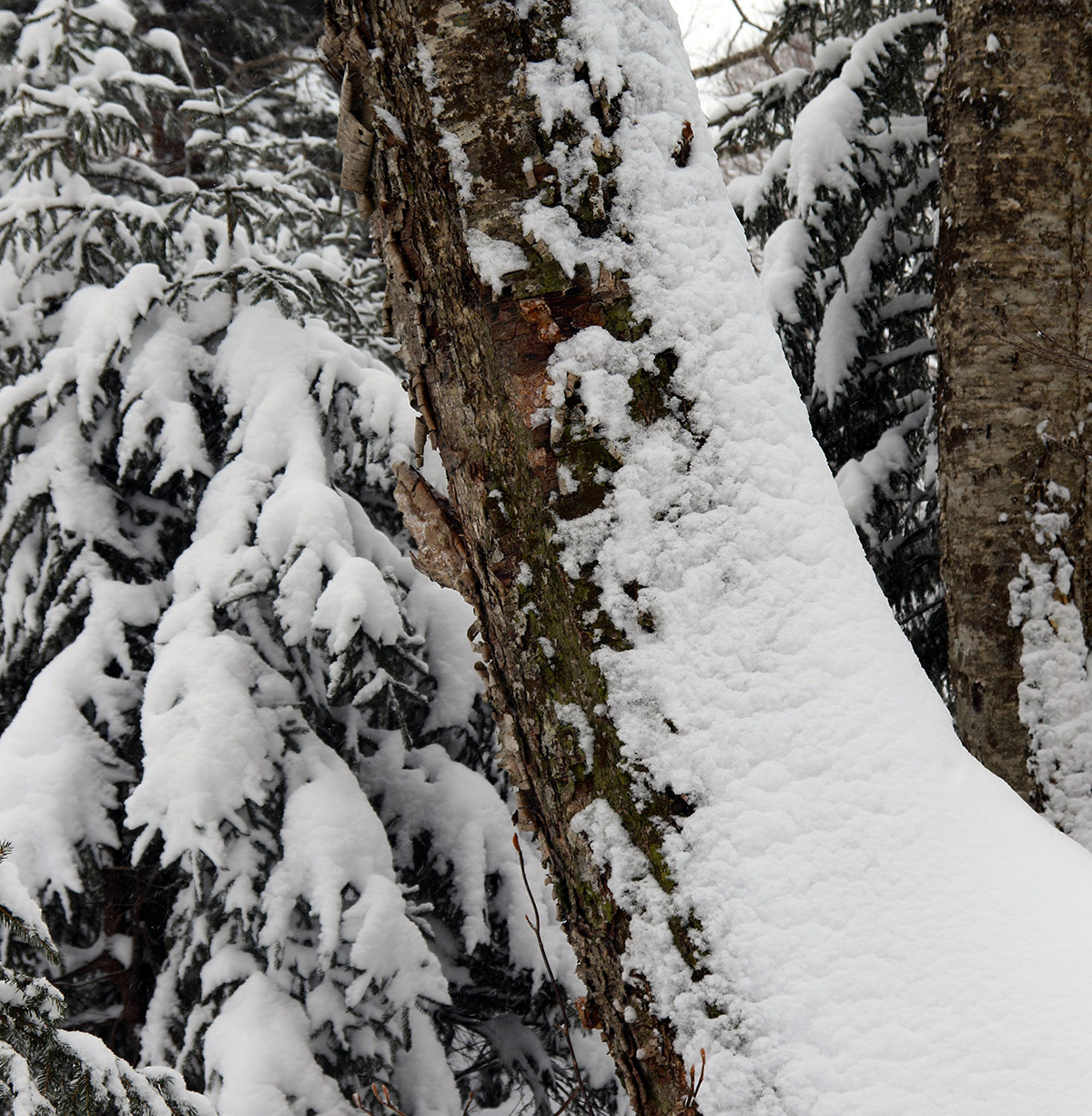
Enjoying some of the snowy trees in the Wilderness glades on my ski tour this morning at Bolton Valley
Tomorrow is supposed to be even a bit colder than today, so if I head out it will just be for a tour vs. riding any lifts. After the warming and consolidation earlier this week, it looks like Timberline is probably getting in shape to support some good touring and powder skiing again, so I may stay low and tour there if a ski session comes together. We’ll see how much additional snow the resort is reporting in the morning, but since we were getting hit at our place by those lake effect bands right into the evening today, Bolton should have been getting even more of that snow. The models suggest we’ve got another couple of clippers affecting the area over the next few days, with warmer temperatures as well, so that’s looking nice moving into the holiday week.
The views of the snow were gorgeous in the Bolton Valley Village today; we’ve been getting hit with rounds and rounds of continued light snow as impulses come into the area and help push along moisture streaming over from the Great Lakes.
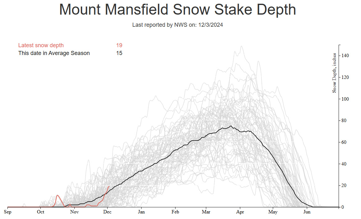
I hadn’t been up to the mountain since Saturday, so I was eager to get out for a ski tour when I had time today. There’s been no specific synoptic storms in the area, but the snow has been piling up the thanks to the continuous feed of moisture off the Great Lakes and the upper-level low pressure to our north. Seeing the snowpack depth at the Mt. Mansfield stake quickly jump up to near 20 inches is a strong sign that it’s been snowing around here. Having that closed upper low over Hudson Bay with broad upper level troughing is a great setup when you have a 4,000’ wall of mountains sitting downwind of a moisture source like the Great Lakes.
The snowpack depth at the Mt. Mansfield Stake has been shooting right up above average over the past few days thanks to the continuous parade of smaller weather impulses affecting the area as well as the moisture pushing into the area from the Great Lakes.Up at the snowy Wilderness Summit above 3,000′ on today’s ski tour
Even without data from the Mt. Mansfield stake to go on, I know it’s been snowing because we’ve recently had several inches of new snow down at our place in the valley, so the snow is hitting all elevations with the current temperature regime. Indeed, I found that snow depths were up substantially at all elevations during today’s ski tour. I toured again using the Wilderness Uphill Route, so I was able to check snowpack depths from the valley on up and compare them to what I’d last seen on Saturday. The updated snow depths are below, with Saturday’s depths listed first, then today’s depths following in bold. The depths I found up at 3,000’ and above are certainly consistent with what is being reported for the snowpack depths at the Mt. Mansfield stake.
Concomitant with the increasing depths, the quality of the powder skiing even jumped another notch relative to the already great conditions we experienced on Saturday. In fact, even though the surface snowpack is excellent right-side-up powder that is beautifully dry, it’s getting deep enough that it’s starting to be a bit too much for the lowest angle slopes if you’re in fully untracked snow. I’d brought my 115 mm fat skis for today’s tour because they had already been a good choice on Saturday, but I was glad to have them for planing more efficiently on the lowest angle slopes today.
Along with all the natural snow they are picking up, the resort in blowing lots of snow as well in anticipation of opening in a few days.
Indeed, it was snowing today during my tour akin to what’s been happening for the past several days, but today’s snowfall was lighter and less consistent than what I experience on Friday or Saturday. Our next Clipper system is now coming into the area though, so snowfall should pick up with that. We’re under a Winter Weather Advisory here along the spine of the Northern Greens, and the latest BTV NWS Event Total Snowfall map currently has some areas of 8-12” and 12-18” shading.
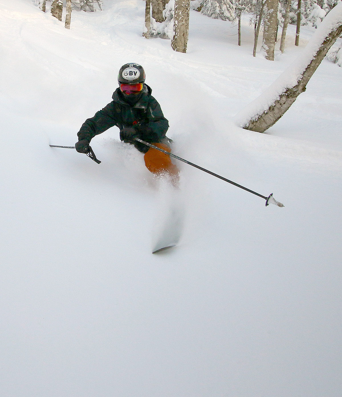
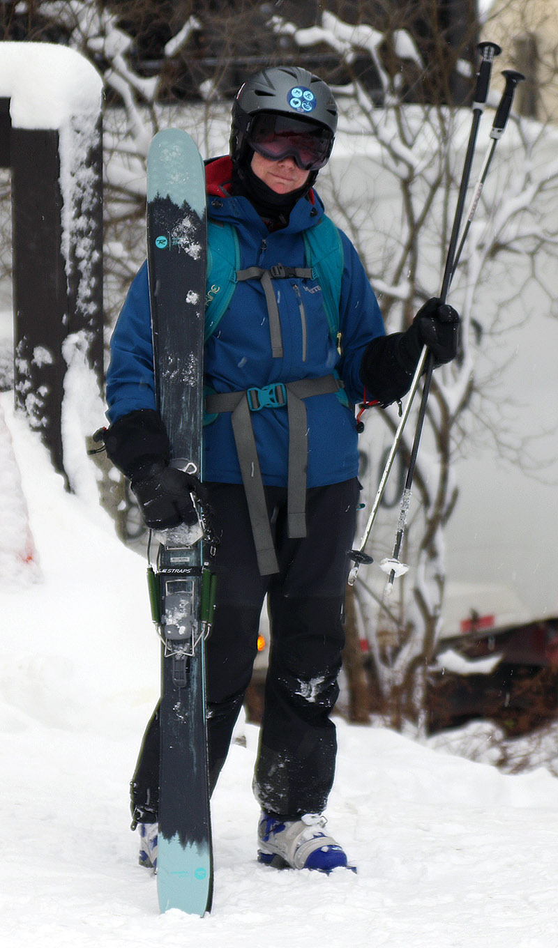
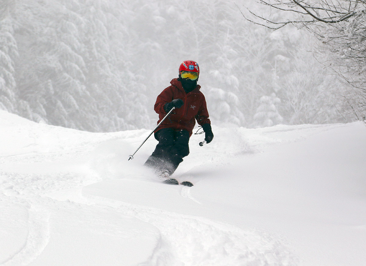
Erica is done with her first ski tour of the season and is happy to have had great powder conditions for the outing.
I told E about how good the skiing was yesterday, so she was interested in getting out and the two of us headed up to Bolton Valley today for another tour. Thanks to the ongoing lake-effect snow from Lake Ontario, surfaces have been getting some nice freshening. Since my report detailing the snow conditions during yesterday’s tour, we’ve had another inch or two of additional snow down at the house in the valley, so I’m sure Bolton has had at least that much as well. It was really dumping when I left yesterday afternoon, so that period alone should have contributed some nice accumulations.
Between settling and the additional snow that’s been falling, snow depths seemed to be just about where they were yesterday, so just refer to the detailed snow depth profile I provided in that post for approximate snow depths that were out there today. Temperatures were in the mid-20s F out on the mountain early this afternoon, so it was just a bit cooler than yesterday, and consistent with that, the snow was a bit drier. Whereas yesterday I estimated the upper layers of powder in the snowpack to be in the 8% H2O range, today I’d say we were hitting powder that was more in the 6 to 8% H2O range. E is notorious for getting out on the snow one day too late when conditions aren’t as good as the day before, but that wasn’t the case this time. While there were a few more tracks out there today than what I found yesterday, the dry air and drier snow falling kicked the quality of the powder up a notch. The existing base snow, the continued settling of the lower layers of surface snow, and new rounds of dry snow coming in have set up some beautiful right-side-up powder. The drier nature of the powder was evident in the way it was even easier to ski lower-angle slopes; I’d brought fat skis to help in that regard, but my wife was on mid-fats, and she had no issues maintaining speed on even the mellowest pitches. So once again, essentially any mowed terrain from roughly single black diamond pitch down to gentle slopes was in play for great powder turns today.
A view along our ski tour in Bolton’s Wilderness area today – we had beautiful temperatures, no wind, and fantastic powder for Erica’s inaugural tour of the season.
In terms of the ongoing snowfall, today was much like yesterday with continued light snowfall of varying intensity throughout our tour, and it was steadier when we were finishing up our descent, but not nearly as heavy as when I was leaving yesterday. The direction of the more intense incoming moisture from Lake Ontario seemed to be a bit more to our north today, but it sounds like the Jay Peak area has been doing well from that setup.


