Stowe, VT 15NOV2012

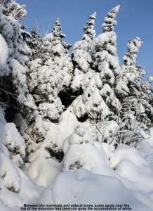
An image of snow on evergreens near the summit of the Fourrunner Quad at Stowe Mountain Ski Resort in Vermont
Blue skies today with a combination of natural and manmade snow coating the trees at the summit of Stowe’s Fourrunner Quad

I was in Morrisville today, so on the way home to Waterbury I stopped in at Stowe to make some turns.  From the Stowe Village area, the view is quite nice with all the trails covered in white from the snow at the beginning of the week.  Even at midday, the temperature was just a bit above freezing at the base (~1,500’) and the resort was cranking out snow from top to bottom.  The bulk of the snowmaking was taking place on the main routes in the Lord/North Slope area, although snow was also being blow over on the lower slopes of Spruce Peak in the same places that we’d seen it on Sunday.  To avoid the roar of the guns, I decided to make my ascent up Nosedive.  Hiking was in order at the start of the ascent, since natural snow doesn’t appear until roughly the 1,800’ elevation.  The air was generally calm and the temperatures pleasantly cool as I hiked, and finally when I reached the 3,000’ elevation it seemed that the snowpack was sufficiently deep and consistent enough to strap on the skis and start skinning.  There were a couple of descent tracks from people who had skied the upper parts of Nosedive, and while the snow was actually quite nice with some powder and sugary surface hoar, you’d certainly want to use your rock skis based on the coverage.  I topped out at the Fourrunner Quad summit area, and switched over for the descent on the plateau above Nosedive away from the snow guns.  Estimates of the natural snow depth at various elevations on the ascent are as follows:

1,500’: 0”
1,800’: T
2,000’: 0.5”
2,500’: 2”
3,000’: 3-4”
3,600’: 4”

“The descent featured all sorts
of conditions, such as bottomless
manmade snow, sticky manmade sludge,
refrozen moonscape, and thankfully,
some areas of packed powder and
partially groomed manmade snow.”

The descent featured all sorts of conditions, such as bottomless manmade snow, sticky manmade sludge, refrozen moonscape, and thankfully, some areas of packed powder and partially groomed manmade snow.  I started the descent on Upper Lord, and that was where I found the bottomless manmade that had recently been blown.  After my experience with the snow on my November 4th tour, I have to say that I find that unconsolidated manmade stuff even more horrific to ski than Sierra Cement or Cascade Concrete, at least on Telemark gear.  The turns often feel like an accident waiting to happen as you glide across the top and then suddenly cut into the paste with random frequency as you pressure the turn.  Fortunately that ended by the time I reached the top of the Lookout Double.  Snow was still being made, but the guns weren’t as densely packed and you could get around so that you were riding on older snow.  Those middle elevations offered some of the best turns, with some nice packed powder to be found.  The manmade snow that had had some time to dry out and/or had been packed by other traffic skied quite nicely.  I did get into trouble in one spot where a gun was blowing fresh snow that turned out to be on the wet side – as soon as I stopped, several inches of it glommed onto the bottom of my skis and I had to slowly work it off while I got moving.  I did my best to avoid any of the snow being blown by the lower mountain guns after that point, but it seemed like that one was just especially bad because of the mixture it was putting out.  On the bottom half of the mountain there were still some areas of nice snow, but also refrozen and slick areas where one had to be careful to avoid a sliding out.  At the bottom of my run, the guns were blowing in the North Slope Terrain Park, and I was dreading the thought of what the snow would be like down at that elevation.  I watched a snow cat head right up through the gut of the trail, so I waited for him to make it above me in order to stay out of his way.  That turned out to be very beneficial, because the best snow was actually in the track that had been churned up by the treads.  It hadn’t been fully smoothed out, but by breaking up the top skin of the manmade snowpack, it produced some really nice packed powder.  Those turns were actually great as I made my way back and forth in the swatch of the snowcat, and it gives me confidence that once Stowe’s snow is appropriately groomed, it’s going to ski quite nicely.
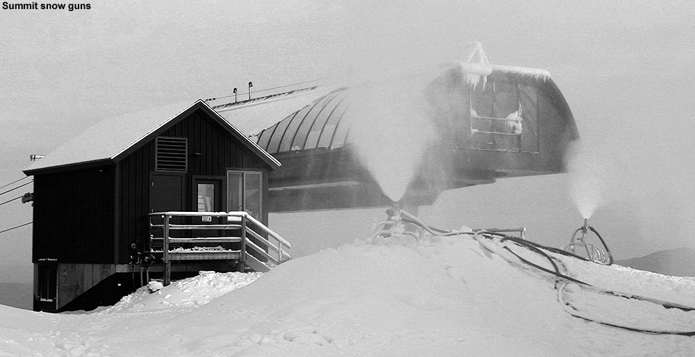
An image of the summit area of the Fourrunner Quad at Stowe Mountain Ski Resort in Vermont with a couple of snow guns making snow
Today at the summit of the Fourrunner Quad

So, I definitely found some nice turns out there today.  Today’s skiing scores well above what was available when I went out for a tour back on November 4th, but it wasn’t quite up to the consistency we found in the corn snow on Sunday’s outing, so today will fall in the middle of the pack for this November’s turns.  It looks like we’re going to continue with this stretch of generally clear weather into next week, so while we can’t expect much natural snow during that time, at least the temperatures are such that plenty of snowmaking can take place.
Stowe, VT 04NOV2012

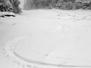
An image showing ski tracks on the Sunrise trail at Stowe Mountain Resort in Vermont after an early November snowfall
Catching a few early season turns on Sunrise today

It’s been snowing in the Green Mountains since Friday, and accumulating down to the 1,500’ to 2,000’ level.  We’ve even had some flakes reach down to the mountain valleys, and although the lower elevations have generally seen rain and we haven’t had any accumulation at the house, we’ve picked up 0.39” of liquid over the past couple of days.  Even as early as yesterday, snow depths had reached the point where it looked like it was worth making a few turns, so I headed to Stowe today to check it out for myself.

I left the house near midday under cloudy skies and a temperature of 39 F, but a few minutes into the drive, the temperature dropped to 37 F in the Waterbury Center area, and snow began to fall.  It snowed lightly all the way to the mountain, and accumulations began to appear just as I hit the resort base at ~1,500’ in elevation.  The temperature had really dropped as I ascended the last stretch to the resort, and as I parked in the Midway lot, the temperature was right around the freezing mark.

Accumulations in the Midway area were generally a trace to an inch, so I stowed my skis on my pack and headed over toward Nosedive to use that standard route of ascent.  As I approached the 2,000’ mark, the snow depth became a bit more consistent, generally in the 1”-2” range, and I switched to skins.  I was probably a touch early on putting on my skins since I encountered a few more spots of mud, but that’s what rock skins are for, and it made for a lot less slipping than hiking in my boots.  The precipitation that had been snow at the start of my ascent turned into more of a freezing mist as I headed into the clouds around 3,000’.  Up around 3,600’ at the Stone Hut it was windy, well below freezing, and quite chaotic with Stowe’s snow gun firing off what seemed like a 21 gun salute.  I sheltered behind the hut to keep out of the wind and the roar of the snow guns as I switched to descent mode and had a much needed snack.  The wind made for plenty of drifting during my ascent, but I’d sum up the snow depths with respect to elevation as follows:

1,600’: T-1”
2,000’: 1”-2”
2,500’: 2”-4”
3,000’: 4”-6”
3,600’: 6”+

I’d only encountered a couple of groups descending on Nosedive while on my ascent, but there were plenty of tracks from previous visitors and the snow was quite packed out, so I decided to descend some other terrain off to the south.  The combination of wind, freezing mist, low visibility, and manmade snow made for a really challenging descent, especially on my skinny Telemark skis, so I generally just took it easy and stuck to mellow terrain.  In general I didn’t find much in the way of decent turns until I got down onto Sunrise below the snowmaking, and pretty quickly after that the snow depth was getting a bit meager.  I did manage some nice turns here and there, but eventually it was more gorilla-style survival turns until I finally decided to call it at the elevation of Crossover.  I strapped the skis back on my pack and had a nice stroll back to the car.  I’d say at this point the skiing isn’t worth putting in a ton of effort, but it’s definitely fun to get out for a few turns if you’re close by.  We’ll have to see if anything comes from the Nor’easter that’s expected this week though, because the current snow could serve as a decent base for another round of accumulations.

Checking out today’s snow at Bolton Valley, Vermont

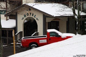
An image of the village area at Bolton Valley Ski Resort in Vermont - November snows have just coated the slopes along with the village.
Today’s snow up at Bolton Valley

On our way toward Burlington to run some errands today, we headed up to Bolton Valley in the mid afternoon to get our season’s passes.  Temperatures were in the low 40s F at the house, but started to drop pretty quickly as we ascended the Bolton Valley Access Road.  The first signs of snow on the ground along the road were just above the Timberline Base in the 1,700’ elevation range, but I also noticed that slushy snow was still present on vehicles in the parking lot of the Timberline Base Lodge (1,500’) even though there was nothing left on the ground there.  I suspect that the snow line was a bit lower last night, but I’m not sure quite had far down it reached. Up in the village at 2,100’ it was snowing with temperatures in the low to mid 30s F, and we found about an inch and a half of accumulated snow on the ground/elevated surfaces.  It was quite a contrast descending the road and spending the afternoon in the Burlington area, where the temperatures were in the mid 40s F and it was hard to imagine that it was snowing even below 2,000’, the lapse rate actually seemed steeper than usual today.  In the Champlain Valley it was often just cloudy with the feeling that precipitation had wound down, but as the afternoon wore on, spits of precipitation and bouts of light rain became more common.  At times we’d have bursts of more moderate precipitation and it was nice to know that moisture was still heading to the mountains and falling as snow.  Leaving Burlington later in the evening we went from 42 F in Williston to ~37-38 F at the house.  There no accumulating snow to report down here as the temperature is sitting around the 37 F mark, but we’ve got light to moderate rain right now and 0.18” of liquid in the rain gauge since it was emptied this morning, so it’s probably still accumulating at elevation.  A few pictures are available from our visit to the higher elevations of Vermont today.

Third October snowfall finally reaches to the valleys in Vermont

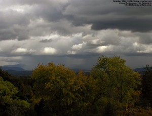
An image of early-season October snow falling in front of Bolton Mountain in Northern Vermont, obscuring the Green Mountains from view
Today’s snow along the western slopes of the Green Mountains, blocking them from view

White tendrils of snow began to appear along the western slopes of the Green Mountains late this morning as the cold air moved into the area, and people started seeing snow all the way down into the valleys.  Although the snow from Monday and Thursday only affected the mountains, we picked up our first accumulating snow at the house today as a heavy graupel storm came through in the afternoon.  Tonight is supposed to be the coldest of the season so far, and there’s still the chance for a bit more snow before the weather warms up going into next week.  For more information about today’s snowfall, be sure to check out my post in the American Weather Forum.  For the full details on this storm, head to the detailed report at the winter weather section of our website.

2011-2012 Winter Weather Summary

Summer is moving along here in Northern Vermont, but at J&E Productions we’ve still been thinking about the winter of 2011-2012, and we’ve finally analyzed our reams of weather data and put together our 2011-2012 Winter Weather Summary. In this post I’ve hit on some of the highlights that came out of the data, and attached our various plots and graphs, but to get to the full data set, you can use the following link:

2011-2012 WINTER WEATHER SUMMARY

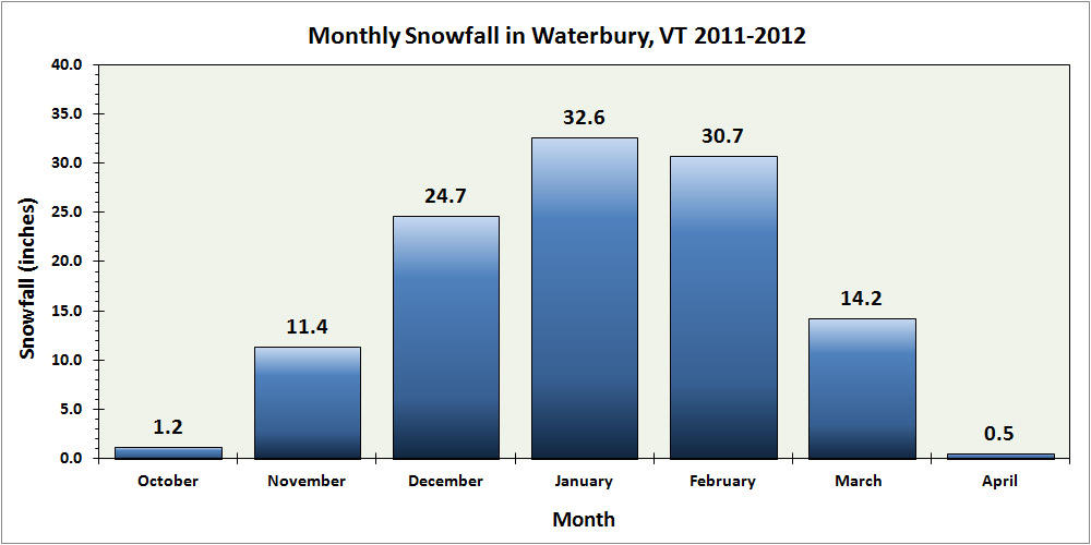
The first item that I’ll highlight from the winter of 2011-2012 is the monthly snowfall plot for our location. As meager as the snowfall was this season at our location (just 115.3″ of snow, or 67.0% of our 2006-2011 average), the monthly distribution of snow did retain an aesthetically symmetrical look, peaking in January with February close behind:

A bar graph of the monthly snowfall at our location in Waterbury, Vermont for the 2011-2012 winter season
Snowfall at our house in Waterbury was relatively low during the 2011-2012 winter season, but the monthly distribution was quite symmetrical, peaking in January.

So although 2011-2012 will go down as our least snowy in the six years that we’ve been collecting snowfall here in Waterbury, the 67.0% of our 2006-2011 calculated average is relatively decent compared to the snowfall experienced at some of the first-order New England stations like Burlington (51.4%) or Boston (21.2%). These types of seasons happen, but next season is already closing in fast, and hopefully snowfall totals will be much improved.

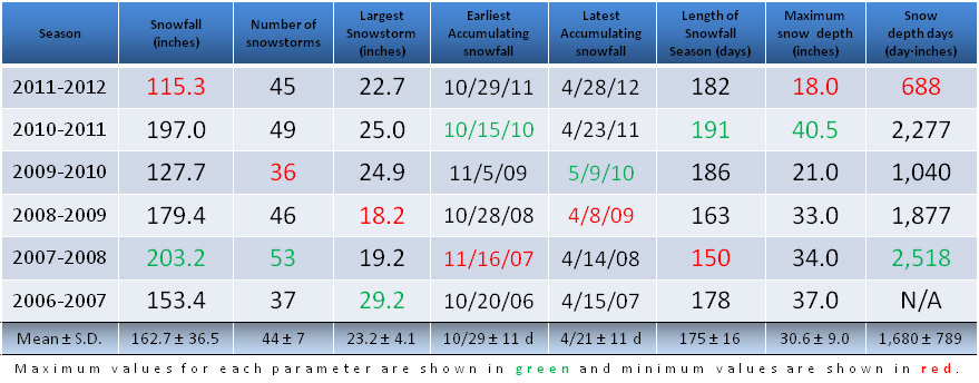
The next piece of information is our updated yearly snow/snowfall data table, with the 2011-2012 season now included.

A table showing some key winter weather parameters for the 2006-2007 through 2011-2012 winter seasons at our house in Waterbury, Vermont
When compared to the previous five seasons, the 2011-2012 winter season at our house in Waterbury was the lowest in snowfall, maximum snow depth attained, and snowpack on the ground as assessed by snow depth days. As you can imagine, it gets pretty cold at the house and so it’s always important to make sure that the heating system works. Maintaining it can be easy if you get hold of professionals in your area such as these – thecomfortdoctors.com/heating-and-cooling-services-wilkes-barre-pa/.

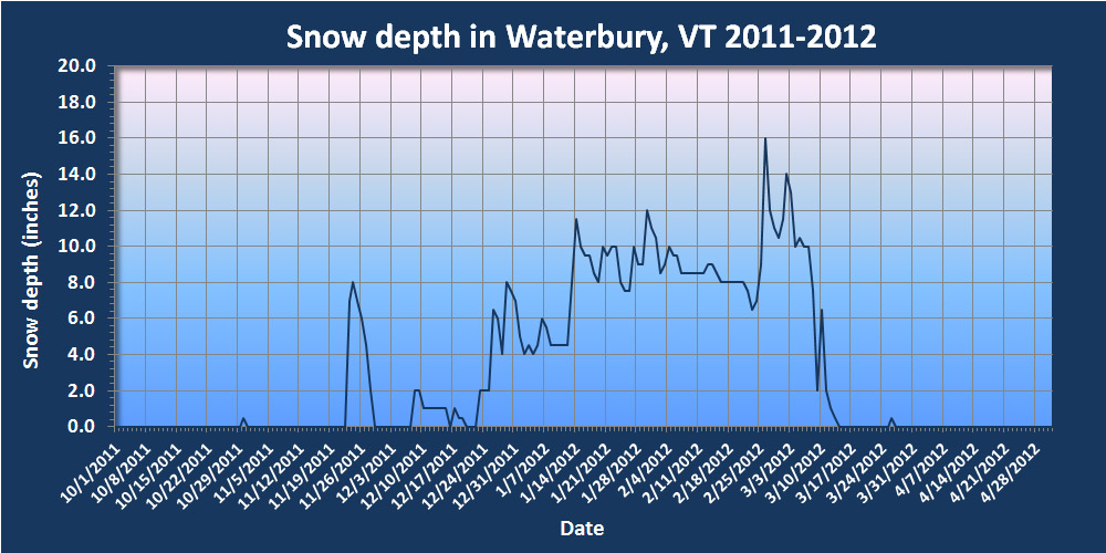
The table touches on some of the highlights (or in this case lowlights) from this past winter season (top data row of the table). The 2011-2012 winter season had the somewhat dubious honor of being the “worst” in our data set in three categories: total snowfall, maximum snow depth, and snow depth days (see the red entries in the top row). The snowfall and max snow depth values weren’t all that far from the runner up values, but the big standout was snow depth days, which was well below the next closest season. It’s amazing to see a number so far below the 1,000 day·inches mark, which speaks to the state of the snowpack this season. We still had continuous snowpack at the house for about three months (vs. the typical four months) but the big factor in the low snow depth days was that the snowpack just never got that deep. It sat around at a bit below the one foot mark for most of the season and just didn’t build beyond that except for a couple of periods in February/March:

A plot showing the snowpack depth during the winter of 2011-2012 at our house in Waterbury, Vermont
At our house in Waterbury, the 2011-2012 winter season featured a fairly meager snowpack that sat around the one-foot mark for much of the season, and topped out at just one and a half feet.

With only six seasons worth of data, the low snowfall this season did deal quite a blow to the overall calculated snowfall average, dropping it by almost 10 inches from up above 172 inches per season down to 162.7 inches per season. That’s probably Mother Nature at work getting to her real averages after some banner years. Even though two of the past six seasons have been up around 200 inches of snowfall, presumably that is going to happen only so often. Nonetheless, snow of any size will cause extremely cold temperatures. As a result, make sure your heating is working properly. If not a repair kc team will be able to ensure everything is in working order. However, if you are unable to use these services you must look around for ones that are in your vicinity and can get to you in the proper amount of time. You may want to check here to see who may be available to you. Now back to the science that can help us determine the measurement of snowfall.

As for the rest of the parameters that I track in the table, they were either right around or slightly better than average this season. An interesting note is that the number of snowstorms this season (45) was right around average, so naturally with low snowfall, the amount of snowfall per storm had to take a hit. Indeed, while the average amount of snowfall per storm is typically up around 4 inches, this season it came out at just 2.6 inches, so there were clearly a lot of systems that were weak on snow. This average snowfall per storm was a huge deviation from the mean (almost 2 S.D.), so that must say something about the weather pattern during the past winter, even if I’m not exactly sure what it is at this point.

While the detailed reports of the 45 accumulating snowstorms from the past season are available with more information at the 2011-2012 winter weather summary page, they’ve also been posted here for quick access. If you know of a storm that interests you, you can head right to it. The reports are comprised of text, links, graphs, photos, etc., and much of the text is derived from my posts and dialog from the Americanwx.com New England regional forum. Thanks to the great features available on the forum, you can click on the icon associated with any quoted text in the report, and you’ll be linked right to that post its respective thread. Hopefully this will be useful for folks that are researching/reviewing winter storms. The list of linked winter storms observed at our house is listed below:

01. 10/29/11
02. 11/11/11
03. 11/17/11
04. 11/23/11
05. 12/02/11
06. 12/07/11
07. 12/09/11
08. 12/13/11
09. 12/17/11
10. 12/19/11
11. 12/21/11
12. 12/23/11
13. 12/25/11
14. 12/27/11
15. 12/30/11
16. 01/02/12
17. 01/05/12
18. 01/06/12
19. 01/10/12
20. 01/12/12
21. 01/17/12
22. 01/19/12
23. 01/21/12
24. 01/23/12
25. 01/26/12
26. 01/28/12
27. 01/29/12
28. 01/31/12
29. 02/03/12
30. 02/11/12
31. 02/13/12
32. 02/16/12
33. 02/21/12
34. 02/22/12
35. 02/24/12
36. 02/28/12
37. 02/29/12
38. 03/02/12
39. 03/04/12
40. 03/08/12
41. 03/09/12
42. 03/26/12
43. 03/28/12
44. 04/04/12
45. 04/26/12

Something new that we’ve also added this season is a gallery of our snow measurement devices in action, so other folks that measure snowfall may enjoy those images:

SNOWFALL MEASUREMENT PAGE

The various data charts and graphs from this season’s analysis can also be viewed in the gallery below:

Stowe, VT 27APR2012

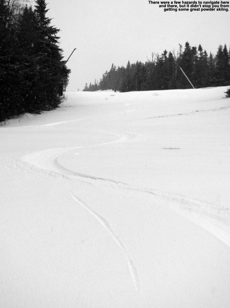
An image of ski tracks in late April powder on the Sunrise trail at Stowe Mountain Resort in Vermont
Catching some turns today in the virgin powder on the Sunrise trail at Stowe Mountain Resort

For this latest spring storm, the temperature dropped below freezing on the Mt. Mansfield ridgeline in the wee hours this morning, and presumably any precipitation changed to snow around that point as well.  I found close to a half inch of liquid in my rain gauge at my 6:00 A.M. CoCoRaHS report, and even if part of that was snow up in the higher elevations, it was going to mean some decent accumulation.  There were definitely some winter-like temperatures moving into the higher elevations though, and that even translated down into the valleys to keep the lower elevations in the 30s F all day.  It was pouring rain at the house when I left around 7:00 A.M., and snow was even reaching down into the lowest valleys at times.

I checked on the Bolton Valley Web Cam a couple of times during the day today, and knowing that it was snowing the whole time in the mountains, I headed off to Stowe in the afternoon to do a tour and ski some of the new powder.  Temperatures remained in that upper 30s F through the Winooski Valley and into Waterbury Center; and although it wasn’t accumulating, it snowed continuously in the mountain valleys.  It was right around 1,000’ near the Matterhorn that I first started seeing accumulations of snow on the ground, and by the time I’d reached the base of Mt. Mansfield at around 1,500’, the temperature was near freezing and the snow was accumulating easily.  I found an inch or two of new snow outside the Mansfield Base Lodge, and even down at that elevation it was quite dry.

I put on my gear and skinned up in the North Slope area, knowing that it had a decent base of snow thanks to Powderfreak’s snow reports from the past few days.  Light snowfall continued during my ascent, but the wind wasn’t bad, and temperatures just a few degrees below freezing were pleasant.  I followed the vestiges of a skin track that while presumably fairly recent, wasn’t very deep, and indeed the new snow and at least some wind erased it in many spots.  There was visible grass poking through the snow in the lowest elevations below Crossover, and even a bit above that level, but at around 2,000’ atop the bottom steep pitch of North Slope, the coverage got more consistent and things really started to look appealing.  The snow depth didn’t really increase all that rapidly with elevation; there were probably 3 to 4 inches in the middle elevations, and some areas were scoured a bit, but some areas were also a bit deeper.

I continued my skin on up on Lord and Lower Ridgeview, and the snow had reached a depth of about 5 inches at 3,500’ where I stopped my ascent just a bit below the top of the Fourrunner Quad on Lord Loop.  It was a little tough to get an accurate measurement of the snow depth due to drifting, but I’ll go with 5 inches as my best guess for up near the top of the quad.  I did find areas where accumulations were as deep as 7 inches, but those seemed to be spots where snow had collected efficiently with help from the wind.  As of 5:20 P.M., the depth of snow at the Mt. Mansfield Stake had gone up by 4 inches, so that certainly seems to be in the range of what I found up in the higher elevations.  I saw a couple of small groups of skiers and riders during my ascent, but there really weren’t too many people out on that North Slope route.

I descended generally in the region of my ascent, since I’d seen the state of the base coverage there, although I did make a side excursion onto Sunrise because I was presented with a huge expanse of unbroken snow that looked like it had decent base.  I touched down on firm stuff a couple of times, but it was definitely worth it.  I was unsure of the coverage lower down on that route, but I was able to make my way back toward the main North Slope route by using what I think was part of Toll Road.  Anyway, the snow was nice medium-weight powder, and although this storm hasn’t delivered as much as that last one a couple weeks ago, the powder is of much higher quality.  It’s not totally bottomless powder skiing everywhere, but in many areas it is, and with the nice base snow below, it makes for some smooth and effortless turns.  In the last few hundred vertical feet of the descent below Crossover, there are certainly areas where there’s no base, but the snow is deep enough and of enough substance that the turns are smooth all the way to the top of the stairs above the Mansfield Base Lodge.  You certainly want to be careful to watch out for rocks, but one doesn’t really need rock skis unless they really want to venture well off the beaten path into areas that don’t have any sort of base.

An image of spring powder turns on the Sunrise trail at Stowe Mountain Resort in Vermont
There were a few obstacles to navigate around today, but the rewards were some really sweet powder turns on the slopes of Mt. Mansfield.

Back at the car, I spoke with another guy who had skied in the Nosedive area, and he said it was fabulous in the upper elevations, and OK toward the bottom, but I’m not sure if there is quite as much base in the lower elevations there based on what I’ve seen from afar.  Temperatures were dropping when I left the resort around 6:30 P.M. or so, and I saw accumulating snow all the way down to The Gables Inn on the Mountain Road, which is around 750’.  I met E and the boys for dinner at Frida’s, and when we were done, snow was accumulating right in the center of Stowe at around 700’ as the temperatures continued to drop.  It snowed on and off all the way back to our house in Waterbury (495’), and I found a couple of tenths of an inch of accumulation on the snowboard as of 8:00 P.M.  It’s continued to snow all evening, it’s still been light, but there’s another tenth of an inch or two on the board now.  It’s going to be quite cold the next few nights, and not really that warm during the day, so the new snow should be around for some good skiing during that time.

Bolton Valley, VT 23FEB2012

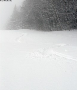
An image of ski tracks in fresh powder on the Snowflake Bentley trail at Bolton Valley Ski Resort in Vermont
Catching some fresh tracks down from the top of Snowflake Bentley today

After a slow stretch of winter weather for much of February, the last third of the month has been picking up in that department.  Three systems have been forecast to come through the area, each one with the potential for more snow in the mountains.  The first one came through Tuesday night into yesterday, and dropped 1.7” of snow here at the house and a few inches in the mountains.  The second system started up yesterday, and as of this morning we’d only picked up some rain here in the valley, but it was definitely a step up in accumulation for the northern mountains.

With only rain down here in the valley, it was difficult to assess what the mountains had picked up for snow around 6:00 A.M. when I was trying to make the decision about taking some runs, but fortunately Stowe was out with a nice early report indicating at least 5” up high.  With fairly high snow levels, I wasn’t surprised to see that it was a steep accumulation gradient with elevation; Stowe was only reporting 1” new at the base.  Still, the high-elevation number of 5” was enough for me to suspect that the main mountain at Bolton, which is all at 2,000’+, would be in great shape, so I prepared my gear and decided to stop in up at the mountain on the way to Burlington.

It was interesting to find that it was actually snowing way down at the base of the Bolton Valley Access Road (340’), but there was just a skiff of new white there.  In fact, the snow line for getting into to good snow was actually pretty high.  Even up at 1,000’ on the access road I’d say there wasn’t much more than a dusting of new snow, and there was probably only an inch up at the Timberline Base at 1,500’.  In the Village at 2,100’ I found 2-3” of new snow on the ground, although that was probably the accumulation from the last two days because the cars that appeared to have spent the night in the lot probably had an inch or so on them.  The temperature there at the main base was 31 F, and light snow was falling.

I was only about 30 minutes away from the opening of the Vista Quad when I started skinning up the mountain, so I stuck to the Wilderness side to stay out of the way of any potential downhill traffic.  Wilderness wasn’t scheduled to open until 10:00 A.M., so I had a good cushion of time.  The 2-3” of snow I’d seen at the base grew to 4-5” at ~2,500’ as I headed up Fanny Hill.  I made my way toward Upper Crossover, and stopped my ascent at the top of Bolton Outlaw.  Up there at around 3,000’, new snow depths were in the 5-6” range.  It was past 8:30 A.M. by that point, and I was just starting to hear the hoots and hollers of folks descending off Vista, so I didn’t linger long before I dropped in to see how the turns were going to be.

The powder was medium weight, not sticky at all, but with plenty of substance.  Still, I was touching down in spots, so it wasn’t completely bottomless with the steepness of Bolton Outlaw.  Turns were great though, and if this is just a taste of what’s to come when the third storm gets here, the next couple of days are going to be great on the slopes.  I continued on down to the Wilderness Lift Line, where turns became bottomless with the slightly lesser pitch.  Nobody had been down to Wilderness by that point, so it was first tracks all the way down until I merged into the Vista Trails.
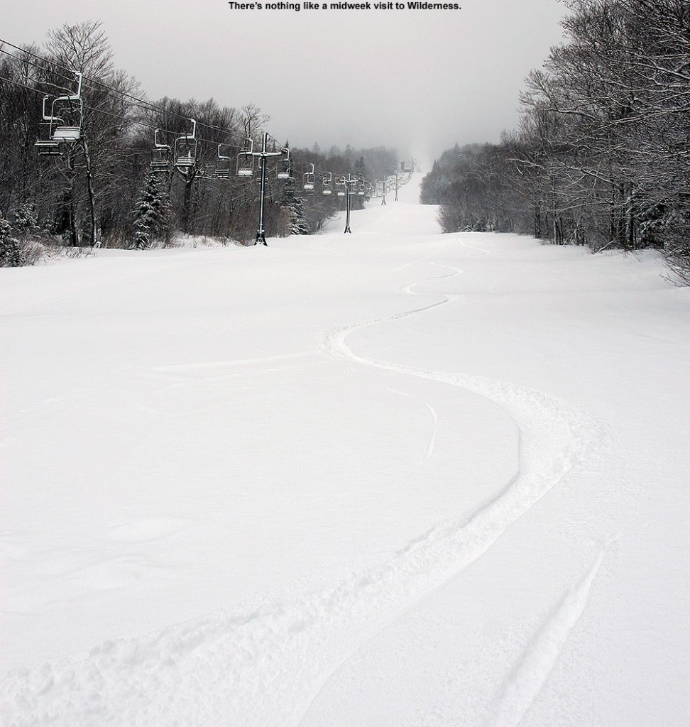
An image of ski tracks in fresh powder on the Wilderness Lift Line at Bolton Valley Ski Resort in Vermont
Catching first tracks on the Wilderness Lift Line today

I decided to stick around for another couple lift-served runs, and first hit Hard Luck.  It had seen a few tracks, but the turns were excellent.  I cut through to Show Off, which was untracked at the point, and the turns were generally bottomless.  I finished off with a run below the Vista Quad above the Jungle Jib.  I opted for Vermont 200 on my next run, where I actually found the snow depths topping out around 7”.  I hit some woods, and then cut across on Deer Run to get to the top of Snowflake.  I combined the top part of Snowflake Bentley, which was about half groomed and provided some nice turns, with Lower Foxy, which allowed me to ski past the Wentworth Condos and out the access road.  The powder was excellent almost all the way back down to the main base, although I’d say the last couple hundred vertical were just a little thick – certainly enough that I noticed.  It was easy to see that the main mountain was the place to be though; dropping down to the elevations of Wilderness would likely have seen a dramatic decrease in both the quantity and quality of the powder.
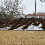
A dusting of snow is seen on the mulch surround the "UVM" bushes at the University of Vermont
A touch of snow remained among the "UVM bushes" this morning.

The temperature was still at 31 F when I was leaving the mountain, and the light snow continued to fall as it has the entire time I was at the mountain.  The temperature was in the mid 30s F back down in the Winooski Valley, and on the way into Burlington, I saw that there were actually pockets of accumulation even in the lower elevations, with a decent coating in Richmond, and another good coating at the I-89 rest area in Williston.  There were even a few pockets of accumulation visible at UVM.

With the addition of this second storm, two-day snow totals are just shy of the 1 foot mark at some of the Northern resorts like Jay Peak and Smuggler’s Notch, with totals tapering to the 5 to 8-inch range in the Sugarbush through Stowe stretch of the spine.  So, we’ve already had a nice couple of appetizers leading up to the third storm, which is expected to start tomorrow.  Winter Storm Warnings are up for the mountains and mountain valleys, with 6 to 10 inches of snow expected through 7 A.M. Saturday, and then additional upslope snow on top of that.  If the third storm comes through as expected, it should be a great weekend out on the slopes.

Bolton Valley, VT 18FEB2012

An image of Ty skiing powder in the Outlaw Glades at Bolton Valley Ski Resort in Vermont
As Ty demonstrates, the Outlaw Glades were really delivering the goods today at Bolton Valley.

For much of January the weather pattern in Northern Vermont featured winter storms with mixed precipitation.  The storms weren’t actually that bad in terms of how they affected the ski conditions, but with the mixed precipitation robbing some of the potential snowfall, they just didn’t have that oomph of full-blown winter storms.  So naturally everyone was excited when February rolled around and the weather pattern appeared to be undergoing a change.  The only problem was… it was a change to essentially no storms at all.  That’s good for a few days to perhaps a week if it comes with good snow preservation, but soon the powder gets harder to find, and the groomed snow just gets old.  We’d hit that point by last Saturday – the quote from Stephen was that the snow was “beaten down”, and I’d say he nailed the general demeanor of the slopes perfectly.  To put some numbers on it, through today (February 18th) we’ve had just 5.0 inches of snowfall at the house for the month… a month that averages roughly 45 inches of snow down here in the valley.  So when we got to mid February and it looked like the weather was going to switch back to the pattern of storms with mixed precipitation like we saw in January, I think there was some relief… we probably just didn’t know how good we had it before.  The storm ushering in this change started up on Thursday, and it was pretty weak on precipitation overall, but by this morning the local mountains were approaching a half foot of new snow, which was more than enough to whet our appetites for the slopes.  Powderfreak has been keeping us apprised of the conditions at Stowe, and based on his powdery pictures from yesterday, we knew that the good snow was out there.  Combined with a weather forecast of partly cloudy skies and temperatures in the low to mid 30s F, it was looking like a mighty fine day to hit the slopes.

Bolton’s Timberline area finally opened last weekend, and although I suspected that the warmth this week was going to undermine the conditions on those lower elevation trails, we still wanted to base ourselves out of Timberline for the day due to the convenience it offers.  It’s a holiday weekend, so parking in the village and dealing with the main base would likely be a bit chaotic.  When we arrived at the Timberline Base (~1,500’) around mid morning today, the snow situation was actually looking a bit grim; the temperature was already in the mid 30s F and the snow surfaces looked like just a couple of inches of new snow over a refried base.  I was optimistic though; I knew the higher elevations would be in much better shape, and our real goal was to get ourselves over to the main base area and up to Wilderness.

Just as we were getting our gear on we saw Stephen and his crew at the base of the Timberline Quad.  I inquired about the snow conditions and Stephen didn’t sound enthusiastic.  I asked him if he’d been over to Wilderness yet and he said no, so I was still holding out hope.  While snow surfaces did look bland at first, they quickly improved as we rode up toward the Timberline Summit (~2,500’), and all my fears were allayed by the time we got off the lift.  I checked off the side of the trail and found a good 4 to 6 inches of powder there for the taking, with still more in some spots.  I even took a quick jaunt in the Timberline Run trees, and found the same stuff.  By this point I knew we were in for some good powder skiing, and I was more than happy to share this thought with E.  She was quite unimpressed with some of the off piste conditions last weekend, and her enthusiasm for today was painfully low at first.  As I passed by Lower Bentley on our way to the main base, I saw some great looking powder off to the side of the trail and really wanted to dive in, but our goal was Wilderness and we had to stay on task.

Stephen and his kids were all on board for a run in Snow Hole, so we hopped on the Wilderness Lift with a group plan in hand.  As we ascended through the Wilderness terrain, it was quickly obvious how good the snow was going to be.  We began to see tracks in the powder on the Wilderness Lift Line, and the depths were increasing nicely.  We found great snow in Snow Hole, a general 4 to 6 inches of powder outside of the high traffic areas where the snow had already been packed down.  The hobblebush is sticking out a couple of feet in the big open area up top though – it could probably use a trim this off season, but it’s presence is also just a function of the low snowpack this year.

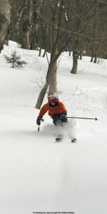
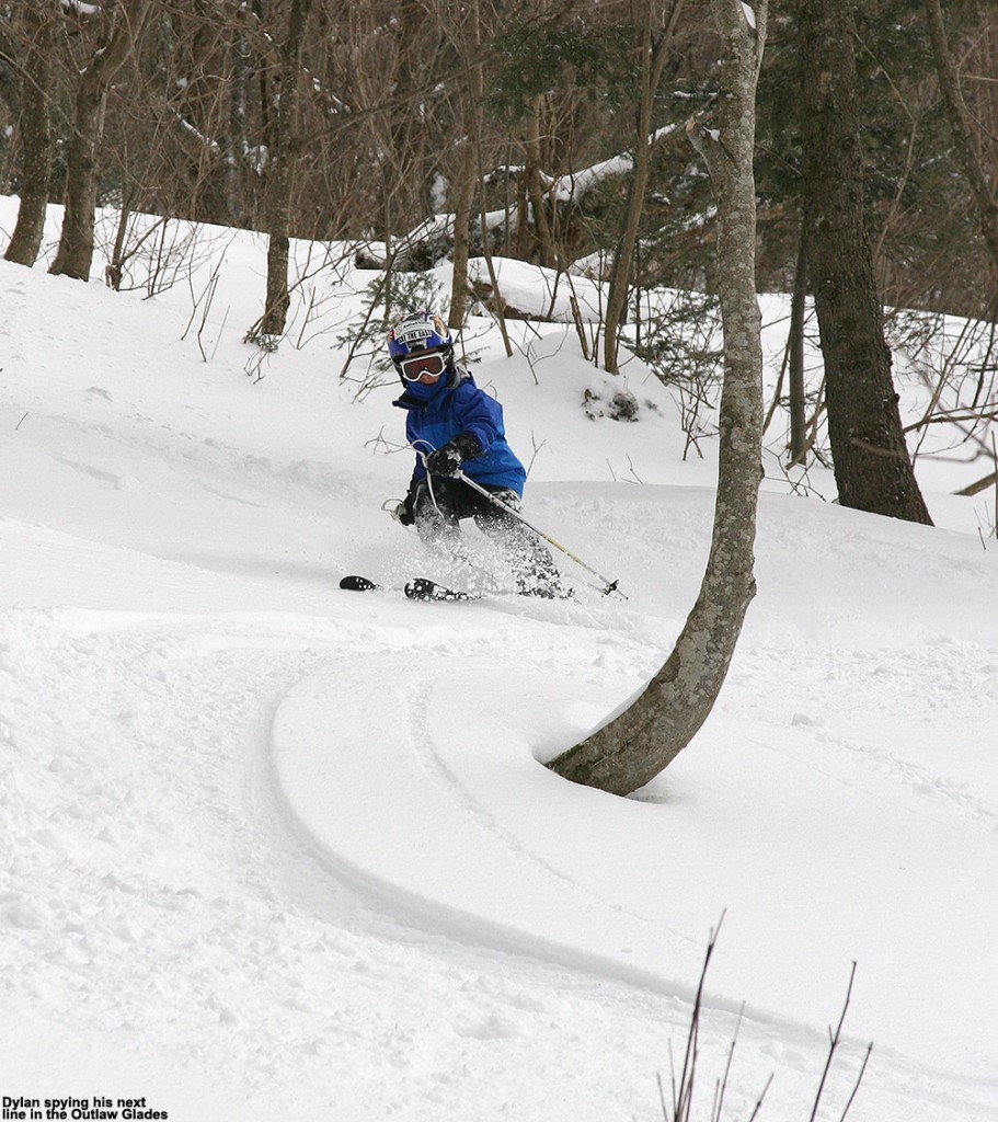
Stephen, Thomas, Johannes, and Helena had to head in for lunch after that run, but E and the boys and I went up for another Wilderness run to hit Bolton Outlaw and its surroundings.  Bolton Outlaw had seen enough traffic that it unfortunately held a lot of slick areas, but the glades around it were fantastic.  The boys ripped up some of the fresh lines in there and the snow quality had everyone excited.  We poked around in some lower elevation glades as we descended back to the base, with some decent turns, but nothing quite up to the level of those Outlaw Glades.  The Wilderness Lift Line provided some nice turns though, consistent with the quality-looking snow we’d seen from the lift.

An image of Dylan skiing in the Outlaw Glades at Bolton Valley Ski Resort in Vermont
Dylan enjoys some of that powder in the Outlaw Glades.
An image of Hot Chocolate topped with whipped cream at the James Moore Tavern at Bolton Valley Ski Resort in Vermont
A yummy addition to lunch in the Tavern today

The boys were already talking about lunch by the time we got back to the base, and we headed into the lodge with a plan to go to the James Moore Tavern.  Stephen and his group were ready to head back out onto the slopes, and had to leave by 1:00 P.M., but Ty and Dylan were just too hungry to be talked away from lunch.  The lodge was really hopping though with holiday business; we even had to wait about 10 minutes to get into the Tavern.  With the wait we had plenty of time to hang our ski stuff in the clothing area, and we made an impressive and compact assembly of all our gear, even the helmets.  Lunch was a fun time; we sat next to a mom and her toddler, who kept everyone entertained for the entire meal. The boys got some impressive-looking hot chocolates to start things off, and for me, lunch was an easy choice.  As soon as we entered the tavern I smelled that barbeque smell from the pulled pork sandwich, and my mind was immediately made up.  I’ve had it before, but this one was especially good.

An image of the pulled pork sanwich along with coleslaw and onion rings at the James Moore Taver at Bolton Valley Ski Resort in Vermont
I knew I was going with pulled pork as soon as I walked into the Tavern today.

We headed back out to the slopes after our filling lunch, and Wilderness was all we had on our minds; there was no lift queue, the snow was fantastic, and there was powder to ski.  Based on what we’d heard from Stephen about the Vista area, there was no need to go anywhere else.  We ran the same couple of runs that we’d hit earlier, and powder pickings were a little slimmer, but the snow was still quite good.  We did notice that areas of powder in the sun below about 2,500’ were getting a little thick, so presumably the freezing line was creeping up a bit in elevation.  Those Outlaw Glades were again the standout of the afternoon, and E said that she had her best Telemark turns of the day in there.

We eventually decided to call it a day and headed over to Snowflake to get us back to Timberline.  We were actually thinking of doing an extra run off Snowflake, but there was a lift queue of a few minutes so we just decided to skip that plan.  A nice bonus on the trip back to Timberline though was Lower Tattle Tale.  For whatever reason, people had not been skiing it from the middle entrance, and the skier’s left held lots of powder.  I thought it might be too low in elevation to hold onto such good soft snow, but it was more than fine, it was sweet!  Judging by what we found on the trip back to the Timberline Base, I’d say that around 2,000’ was the elevation at which the powder really started to peter out.  The groomed trails began to get slick as well, so below that elevation was where temperatures must have gotten just a bit too far above freezing over the past couple of days.

Although temperatures had definitely stayed below freezing on the upper mountain, it was still above freezing when we got back to the car, so the lower elevation snow at Timberline will probably do a bit of temperature cycling tonight.  It seems like everything above 2,000’ is going to continue to be mighty fine though, so all the holiday visitors should keep on getting those good turns.  Based on the fantastic conditions we saw up high on Wilderness, we’re thinking of going for some backcountry skiing tomorrow – it looks like another comfortable midwinter day with sunshine, so there should be some opportunities for excellent earned turns.  We may also get a couple more of those mixed precipitation storms in the coming week, and even if they’re not perfect, at least they’ll keep the slopes fresh – and we’re going to appreciate that as much as we can.

Bolton Valley, VT 14JAN2012

An image of Dylan skiing powder in the Villager Trees at Bolton Valley Resort in Vermont
Dylan smiles away as he blasts through the powder at Bolton this afternoon.

The complex winter storm that has been affecting the region finally wound down today, and it’s been a great boon for the Vermont ski areas.  The storm began on Thursday morning when it delivered some fairly standard synoptic snowfall, and through Thursday evening we’d picked up 3.7 inches of 9.2% H2O snow at the house, with the mountains picking up about a half foot.  Thursday night into yesterday morning we were in the dry slot of the storm, and then yesterday afternoon the second round of snow began… and boy did it come on strong in the evening.  While the first half of the event had favored the eastern slopes of the Greens, the second half pounded the western slopes, and that was very evident as I headed home from Burlington on Friday evening.  Our bus took Route 2 instead of I-89 because of storm-related travel issues, and at one point yesterday evening at the house we picked up roughly 3 inches of snow in an hour.  After last night’s snow, the storm totals wound up at 11.7 inches for our location in the valley, and in the 1.5 foot range up in the mountains, with Jay Peak approaching 2 feet.  It was ultimately enough snow to get Stowe’s ski terrain 100% open.

The downside of the new snow was that cold air came with it – it was approximately 10 F this morning at the house, and 3 F up in the Village at Bolton Valley.  Fortunately, there wasn’t any wind, but we still brought hand and foot warmers for the boys in case they needed to take the edge off the chill while skiing.  E wasn’t all that impressed with the conditions on Sprig O’ Pine after their preliminary run while I parked the car, but I was hoping that was due to effects of the wind and the exposure of that terrain.  After a little debate, the boys decided that they were cold enough that they would head into the lodge to fire up some of the hand warmers and put them in their boots and gloves, and then we headed back out into the cold in search of more powder.

Leaving the Mid Mountain Lift, we quickly saw that the Enchanted Forest looked extremely powdery with little traffic up to that point, so we headed in.  We found the coverage and powder to be pretty nice, but in general the snow just felt a little “slow” with the cold temperatures.  With this in mind, we headed to Glades to get a little more pitch, and that helped move things along a little better.  Glades had seen a fair bit of traffic to track up the snow, but we found some good shots of untracked in the jug handle area.

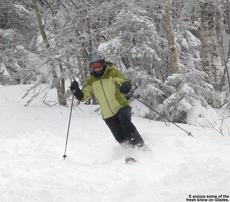
An image of Erica in a Telemark turn in the fresh snow at Bolton Valley Ski Resort in Vermont
E arcing through a Telemark turn in the fresh snow on Bolton Valley's Glades trail

The snow was decent, but none of us really seemed to be grooving, and Ty appeared especially glum and ornery about the day up to that point.  It turned out that his hands were still cold despite the hand warmers, so we decided to make another trip inside and have lunch in the process.  When we got into the lodge, we were astonished to discover that all the hand warmers the boys were using were stone cold.  That was extremely disconcerting, as we’d bough a big box of them at Costco, and were expecting them to work.  We fiddled around with them for a bit, and I also headed down to the ski shop and bought a couple packets of a different brand for comparison.  The new packets fired up right away and got quite hot.  With a little more shaking and processing we were actually able to get our original packets going as well, but they didn’t cook like the new ones, they just seemed to be of the “slow burn” variety and only got up to lukewarm relative to the hot ones.  Once we were done with lunch, we hooked the boys up with a combination of the “slow” and “fast burn” varieties of hand warmers, and headed out to see if we could finally get that groove going.

To get some challenge and potentially find Ty some “satisfying” turns, we headed up on the Vista Quad and descended via Vermont 200.  That turned out to be a good choice, with generally great coverage, lots of good snow, and only a couple of icy ledges to navigate.  Ty definitely got some of the turns he had been seeking, and everyone enjoyed the challenge and powder/chowder we found.  Below Mid Mountain we headed back to Glades and hit the jug handle area as we’d done before.  Both boys seemed to have fun ripping that up.

An image of Ty skiing fresh powder in the Villager Trees at Bolton Valley Resort in Vermont
Ty cruising through that fresh powder in the Villager Trees

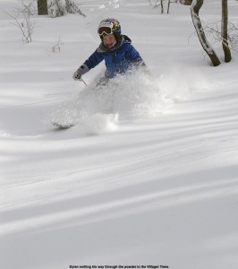
To continue with the positive energy, we sought out some untracked snow in the Villager Trees, and found an impressive snowpack for what has been a slow season for snowfall – I stuck my measurement pole in a representative protected area at ~2,600’ and got a depth measurement of 30 inches.  While we explored around, the boys amused themselves by taking down some huge icicles from one of the ledges.  On the descent, the powder was deep and thoroughly bottomless, and while many fun turns were made, the powder was almost too deep for some of the pitches in there.  The turns were so good though that we were able to call it a day after that and finished off with more powder on the sides of Lower Bentley.  It had actually gotten sunny and warmed up a bit as well, into the high single digits, and with the hand warmers cranking the boys didn’t have any more issues with the cold.  Back at the car we found out that the “fast burn” hand warmers had already burned themselves out after just a couple of hours, while those of the “slow burn” variety were still going.  At that point everything seemed to make sense – a combination of the two types would really be optimal.  So after a slow start today, things really picked up and we managed some decent powder from what has been the biggest winter storm of the season up to this point.

Significant mid-January winter storm for Vermont

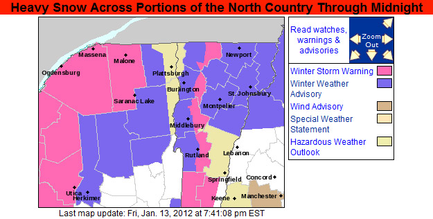
Over the past couple of days we’ve been affected by a fairly significant, two-part winter storm that has really resurfaced the slopes.  The storm began on Thursday with some synoptic snow, where we accumulated 3.7 inches of snow comprised of 0.34 inches of liquid equivalent at the house, and the mountains picked up about a half a footWe headed up to Bolton for some skiing in the evening, and we found pleasant temperatures and nice powder.  Yesterday we were generally in the dry slot of the storm, but toward the afternoon and evening, the back part of the system came through and it really started to unload fluffy Champlain Powder™ in both the mountains and valleys.  Here at the house we picked up almost 3 inches of snow in one hour while the snowfall pounded the area around dinner time, causing temporary road closures and prompting the issuance of Winter Storm Warnings for the western slopes of the Green Mountains:

An image of the Winter Weather Warnings map put out by the National Weather Service in Burlington in the evening on January 13, 2012
Due to the heavy snowfall yesterday evening with rates of 3 inches per hour in some locations, Winter Storm Warnings went up for the western slopes of the Green Mountains.

Down here in the valley, the storm finished up today with a total of 11.7 inches of snow comprised of 0.91 inches of liquid equivalent.  Up in the mountains, snow totals were generally around 1.5 feet, with Jay Peak topping out around 2 feet.  The north to south storm totals list for the Vermont ski areas is listed below:

Jay Peak: 23”
Burke: 12”
Smuggler’s Notch: 15”
Stowe: 18”
Bolton Valley: 15”
Mad River Glen: 16”
Sugarbush: 18”
Middlebury: 13”
Suicide Six: 8”
Pico: 14”
Killington: 14”
Okemo: 8”
Bromley: 10”
Magic Mountain: 12”
Stratton: 12”
Mount Snow: 11”

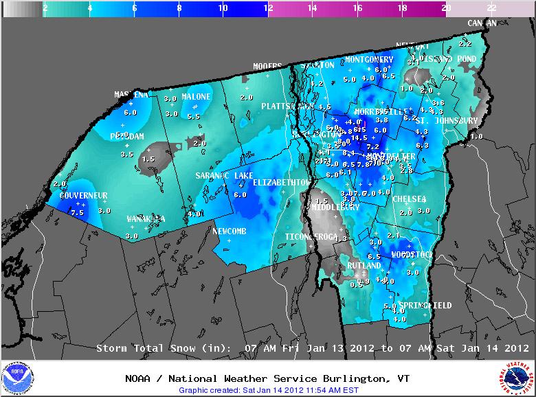
The National Weather Service Office in Burlington generated a snowfall map for the second part of the storm, where totals in the Stowe area pushed past the 1-foot mark:

National Weather Service map of snowfall totals from January 14, 2012 for Vermont during the second half of  the two-part mid-January snowstorm
Snow totals topped the 1-foot mark for the second half of the storm alone in parts of the Stowe area.

For more full details on this storm, head to the detailed report at the winter weather section of our website.