Some light upslope snow showers are passing through the area this evening
There’s a bit of snow falling and accumulating here, so presumably the mountains are getting some as well. It’s all small flakes that I’ve seen falling in the past 15 minutes, but I guess some larger flakes fell earlier because there are some huge globs on the snowboard and a couple tenths of an inch of accumulation. I’ve added the latest radar shot with this post.
The streamers of moisture heading into our area at around 10:45 P.M. last night
We picked up 5.3 inches of total snow with this event down in the valley thanks to the second burst of snowfall that came through last night, and up at Bolton Valley as well as Stowe, they picked up a total of 8 inches of snow. I’ve added a picture of the radar image from around 10:45 P.M. last night that shows the snow still streaming into the area. I’ve added the north to south list of storm accumulations for the Vermont ski areas below, and additional details can be found in my morning update in the Northern New England thread at Americanwx.com.
The second round of precipitation approaching the area this evening
As of 8:00 P.M. we’ve had about 4 inches of snow here at the house, and it looks like there’s still a bit of snow to go. We got a surprisingly good shot of snow this evening after the main round earlier today; I’ve added a radar shot of the evening snowfall as it was coming into the area. More information can be found in my evening update at Americanwx.com.
The storm total snow forecast from the Burlington National Weather Service, click for the full-size image
The forecast calls for the first spring snowstorm to come into our area today. It sounds like it could be close to a foot for some of the local mountains, but some of the latest thoughts in the Northern New England thread at Americanwx.com are that the northern parts of the area might be out of the more substantial moisture. We’ll just have to see how it plays out, but it seems like at least some snow is on the way. I’ve added in the accumulations map from the National Weather service in Burlington this morning, and additional details can be found in my post in the Northern New England thread at Americanwx.com.
We picked up 0.3 inches of snow this morning that I hadn’t really been expecting. That puts us at over 30 inches for the month of March, with the next couple of snow chances coming up this week. Additional weather details can be found in my morning update in the Northern New England thread at Americanwx.com.
We did pick up a couple of tenths of an inch of snow this morning, but that was about it for this elevation. Some folks got a bit more in the higher elevations, and I saw reports of a few inches off the east in New Hampshire. Weather details are in my update in the Northern New England thread at Americanwx.com.
It looks like the next snow event in our area is on tap for tomorrow, with low pressure tracking into Southern New England. Checking in on the discussion from the National Weather Service office in Burlington, the snow level is expected to rise to the 1,500’ to 2,000’ range, with mixed snow and rain below that. The point forecast for our elevation in the Winooski Valley at ~500’ suggests 1 to 3 inches of snow in the Wednesday timeframe, with a bit more possible on Wednesday and Thursday nights. In his broadcast this morning, Roger Hill was suggesting the potential for a couple of inches of snow tomorrow morning affecting the commute. Point forecasts for the higher elevations to our north have 2 to 4 inches in the Wednesday timeframe, and farther to the south, 3 to 5 inches is coming up where the NWS says a good combination of the surface track placement and 500 to 700 mb lift get together. After that, the next storm is expected to come into the area Thursday, and provide precipitation chances through Sunday. It’s another warm system, but there will be chances for snow, especially in the higher elevations.
When I woke up, wet snow was falling and new snow was accumulating on the playset out back.
I woke up to find wet snow falling here at the house. I’ve added an image of the new snow from out back, and the Intellicast colored radar image as well. Full details are in my morning report to the NNE thread at Americanwx.com.
Snow heading into the Northern Vermont area this morning on the Intellicast colored radar
Bolton is starting off this storm cycle with about a foot of powder to greet midweek visitors.
By the time I’d left the house (495’) at 7:30 A.M. this morning, we’d picked up 0.6 additional inches of snow since the 6:00 A.M. snowboard clearing, bringing the event total to 4.1 inches. It had been snowing lightly at the house when I left, but when I arrived up at the Bolton Valley Village area (2,100’) it was snowing moderately and still accumulating. The mountain had reported 7 inches of new snow as of their 6:45 A.M. update, but I suspected I’d find a bit more based on the way it was coming down. The lifts weren’t going to start loading until 9:00 A.M., so I kicked off the morning off by skinning for some turns, taking the route straight up Beech Seal. I first checked the consistency of the snow near the base area; I couldn’t quite make a snowball out of it in my hand, so I guess I’d describe it as medium weight powder. Beech Seal had been groomed at some point earlier, but I found about 2 to 4 inches of additional new snow on top of the groomed base.
“…today Spillway offered up some gorgeous steep powder.”
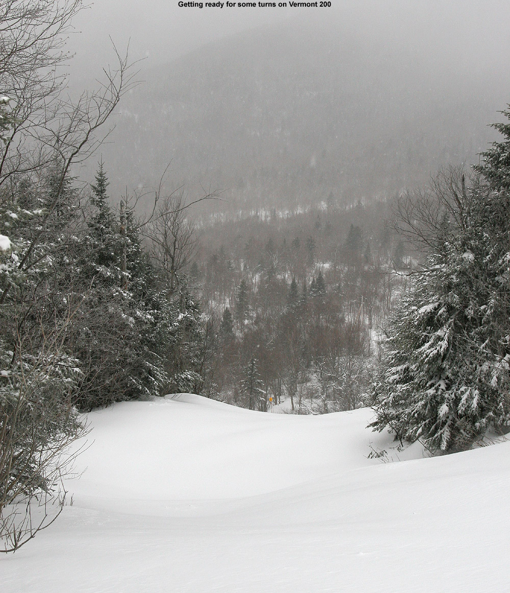
When I reached mid mountain (2,500’) I checked the depth of the powder in an undisturbed location and it came in right at 12 inches. That should represent the combination of powder from last week’s midweek system (~6 inches) as well as whatever had come down up to that point with this new event, so that seemed reasonable. Wind doesn’t appear to have been much a factor with this system, so getting measurements was easy. I was thinking of skinning up in the Cobrass area, but there was enough powder to keep me following one of the snowmobile tracks for my ascent. At about 9:00 A.M. I’d reached the top of Vermont 200 (~3,000’), and when I checked the depth of the new snow there I found that it was at 9 inches.
“It was really nice to see all the visitors getting rewarded with such a splendid day on the slopes.”
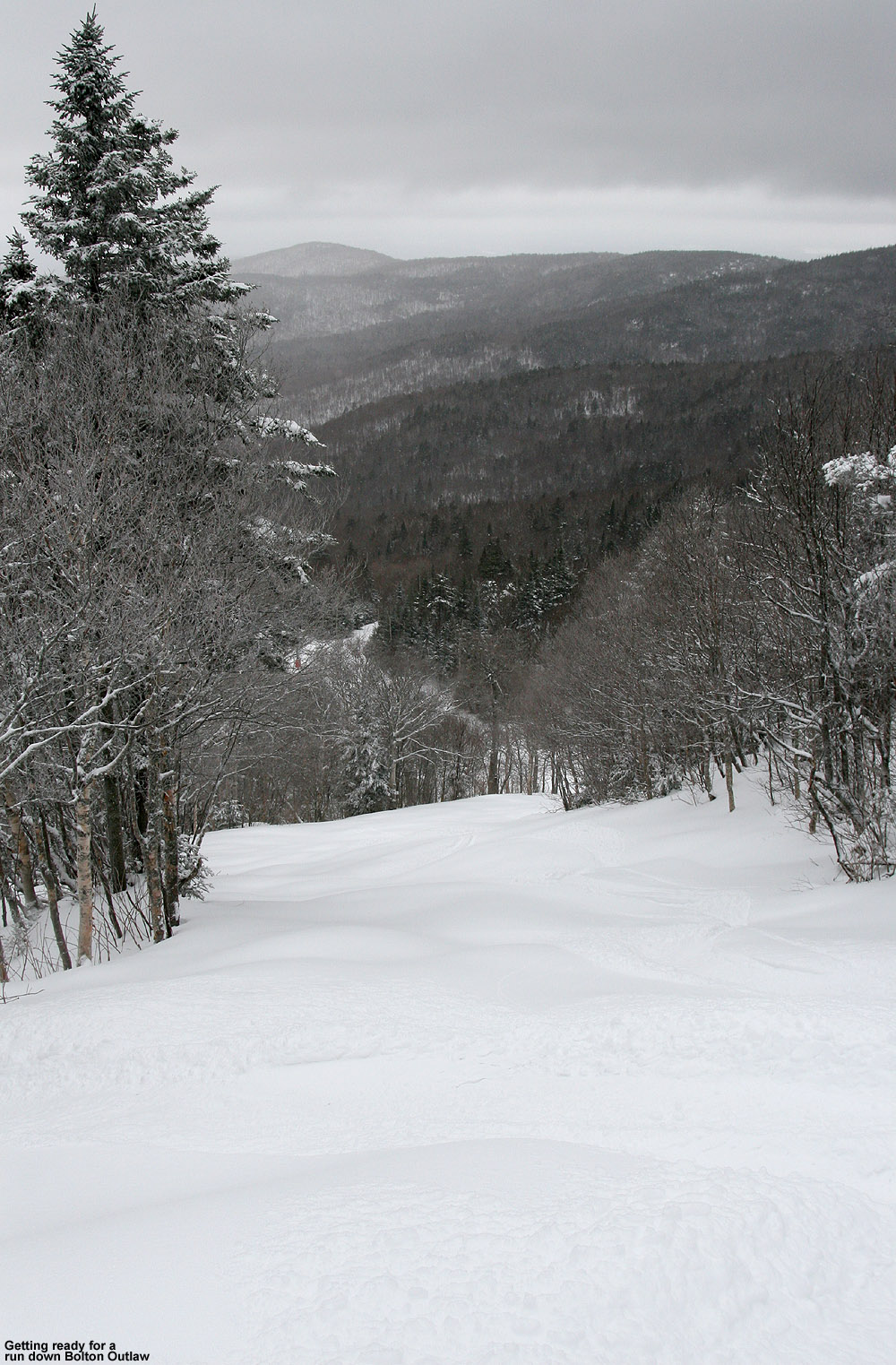
I enjoyed first tracks down Vermont 200, and this new round of snow had settled in nicely. The medium-density powder was just what the doctor had ordered in terms of getting the windswept steeps back into shape. I was on my Telemark skis, and found that the consistency of the snow made for really easy turns. After my initial descent I stayed around for some rides on the lift, and unquestionably the trail pick of the day for me was Spillway. Usually I avoid it like the plague between its man-made snow, exposure to the wind, and traffic, but today Spillway offered up some gorgeous steep powder. The fact that it has seen grooming in the past made the subsurface the most consistent and provided lots of nice bottomless turns, and since there didn’t appear to be much wind with this event, there were no issues on that front. I had to hit it twice because it was so good, and I’d say it was better than even Hard Luck or Vermont 200. The Wilderness Lift opened right around 10:00 A.M., and I was fortunate to catch one of the first few chairs. The way the steeper trails had been skiing so nicely, I opted for Bolton Outlaw from the Wilderness Summit, and it was in great shape. After that descent I traversed back toward the main mountain. I followed a random set of tracks off New Sherman’s Pass and found a nice region of glades that I’d never explored before.
Things were looking great on Bolton Outlaw today
The mountain definitely had more than its usual midweek handful of people this morning. A lot of the extra folks I saw were children, and I think some of the schools in the Northeast have vacation right now because I heard what sounded like a Boston-style accent on a couple of occasions. It was really nice to see all the visitors getting rewarded with such a splendid day on the slopes.
The moderate snowfall had gradually tapered off through the morning, and when I left the mountain around 10:40 A.M. there was just light snow and the temperature at my car (~2,100’) was 34 F. The temperature stayed fairly stable through most of the descent down the Bolton Valley Access Road, but at the bottom (340’) it was up to 35 F. The precipitation was light snow as I drove westward through the Winooski Valley to the center of Richmond. The temperature there was up to 36 F however, and I was surprised to see that Richmond appeared to have picked up little if any snow from this event. When I’d reached the I-89 rest area in Williston, the temperature was up to 37 F and the precipitation was over to rain, which was coming down at moderate intensity for a while. In the South Burlington area the temperature was up to 38 F, and when I finally arrived at the UVM campus it had hit 39 F.
Bolton Valley was officially reporting 8 inches from this event as of their 10:05 A.M. update, so I don’t think we’ll have any trouble getting into Scott’s 10-20” inch prediction range with some upslope. It sounds like this is one of the best upslope setups we’ve seen this season, so it should be fun to see how it plays out for the mountains and even the mountain valleys over the next couple of days. It’s expected to start up tonight so I’ll certainly report on whatever makes it down to our elevation in Waterbury. Images from today can be found in the gallery below, and full size versions are also available in the report to SkiVT-L from today.


