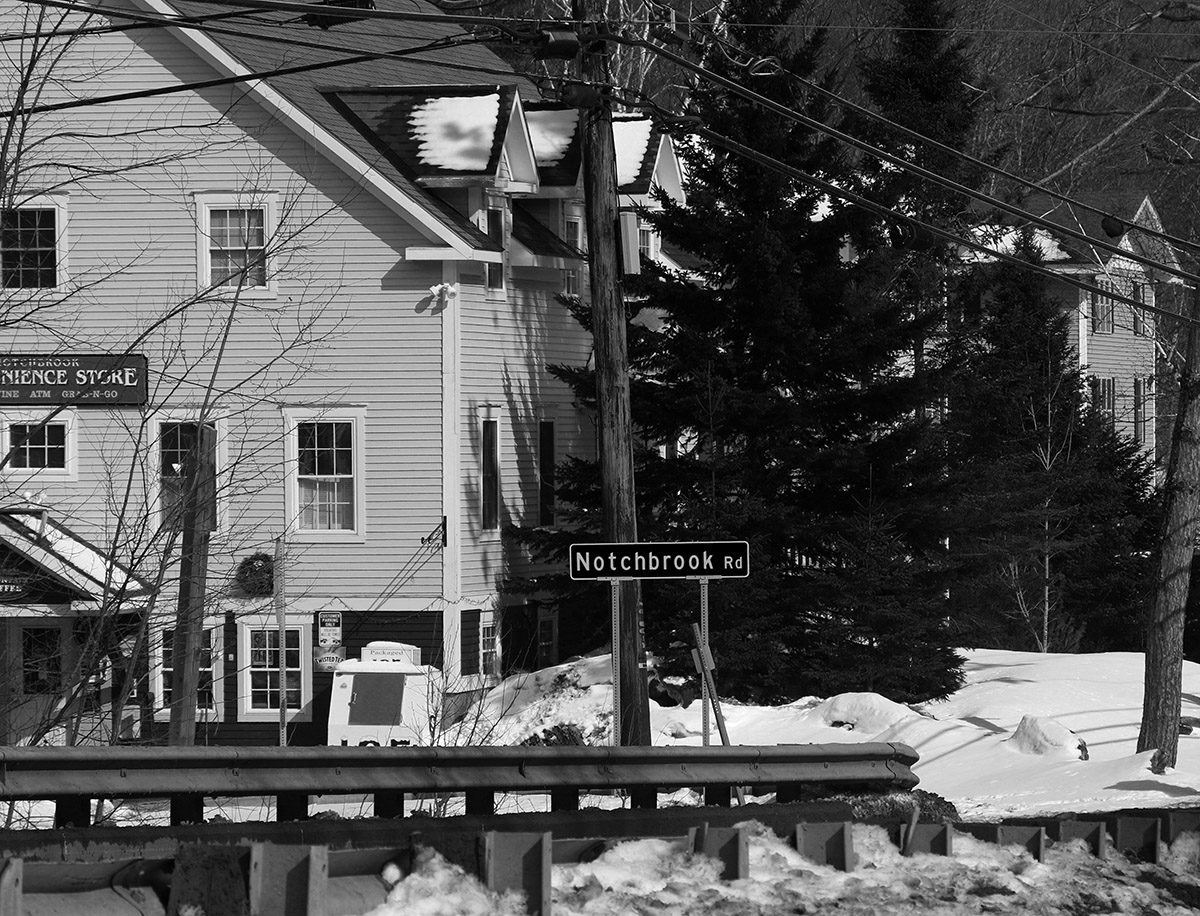
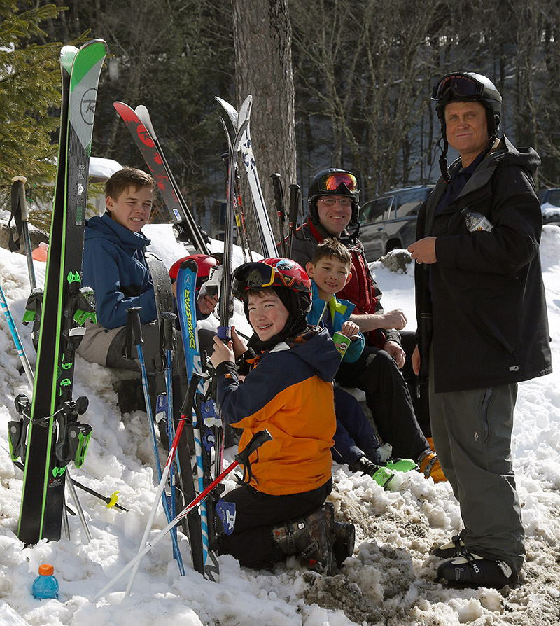
Snack Time! A good trip up to the Nose of Mt. Mansfield and down the Bruce Trail deserves a good snack, and here we’ve got most of today’s hearty crew enjoying a snack in the sun by the Notchbrook Convenience Store.
It’s March, and the snowpack is deep here in Northern Vermont, so we planned to take a trip down the Bruce Trail today during our BJAMS ski session. E had recently been chatting with Brian and Joe in the program, and they were both interested in taking their kids on the Bruce, so we all joined together as a group for the run.
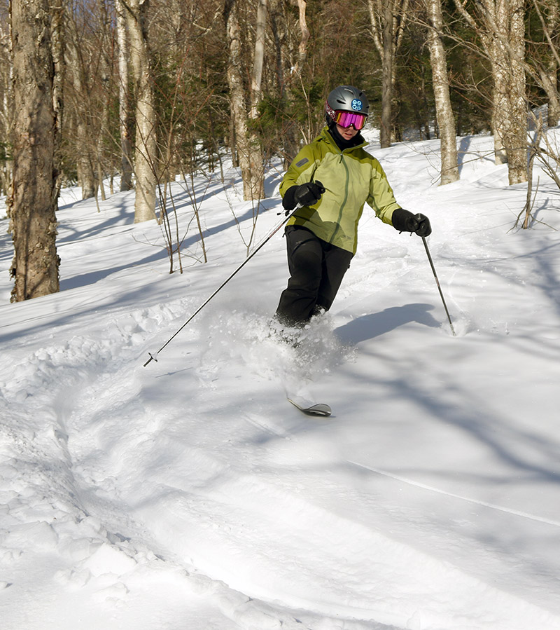
Knowing the round trip would take most of the afternoon, we started right off heading over to Mansfield and up the Fourrunner Quad. I brought everyone up for the requisite visit to Old Nosedive to enjoy the views and add a bit of bonus vertical to the run. Old Nosedive was packed with snow from our recent storm. It was dense powder similar to what we experienced yesterday at Bolton, but it skied quite nicely.
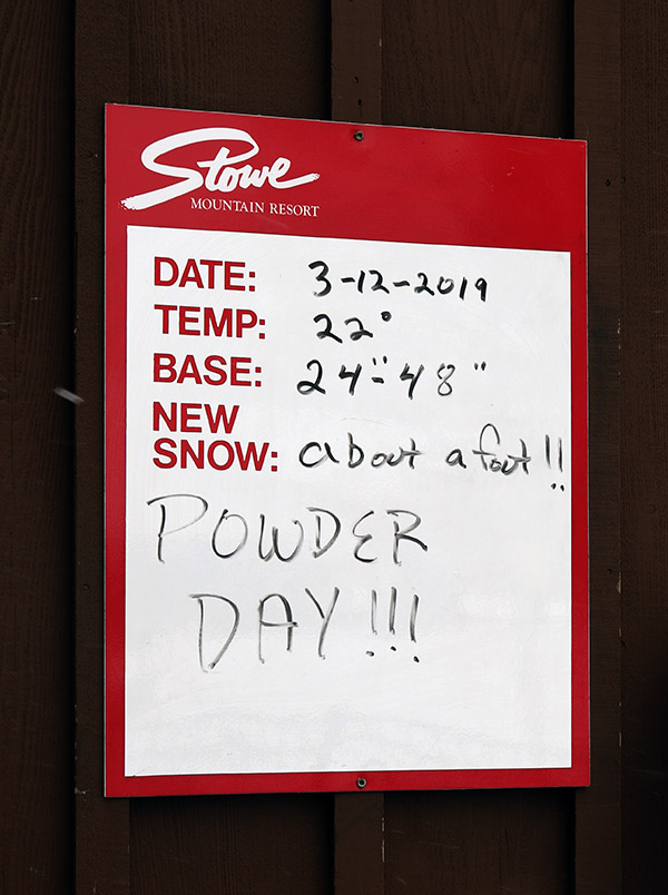
“The Bruce is in simply fantastic shape. That’s not surprising with over 10 feet of snowpack at the Mt. Mansfield Stake, so even the Bruce’s steep, south-facing slopes that lose coverage first are covered with literally feet of snow.”
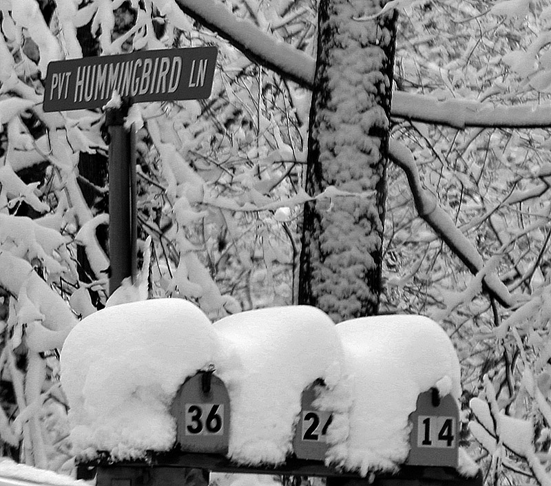
The Bruce is in simply fantastic shape. That’s not surprising with over 10 feet of snowpack at the Mt. Mansfield Stake, so even the Bruce’s steep, south-facing slopes that lose coverage first are covered with literally feet of snow. The snow consistency varied from dense powder and skier-packed powder up high, to thick creamy snow in the middle elevation trees, to more spring-like snow in the lower elevations. The powder in the lower-elevation hardwoods was definitely getting a bit sticky with sun and warming temperatures, but it still skied quite well in all but the very sunniest spots. Even in the lowest elevations down near 1,000’ on the Nordic area terrain, the snowpack is substantial. Crossing over the bridges along the Nordic trails we found the snowpack to be at or above the level of the bridges’ railings – which are four to five feet tall! You can literally stand on the railings simply by moving to the edges of the snowpack.
The snowpack is level with the bridge railings!
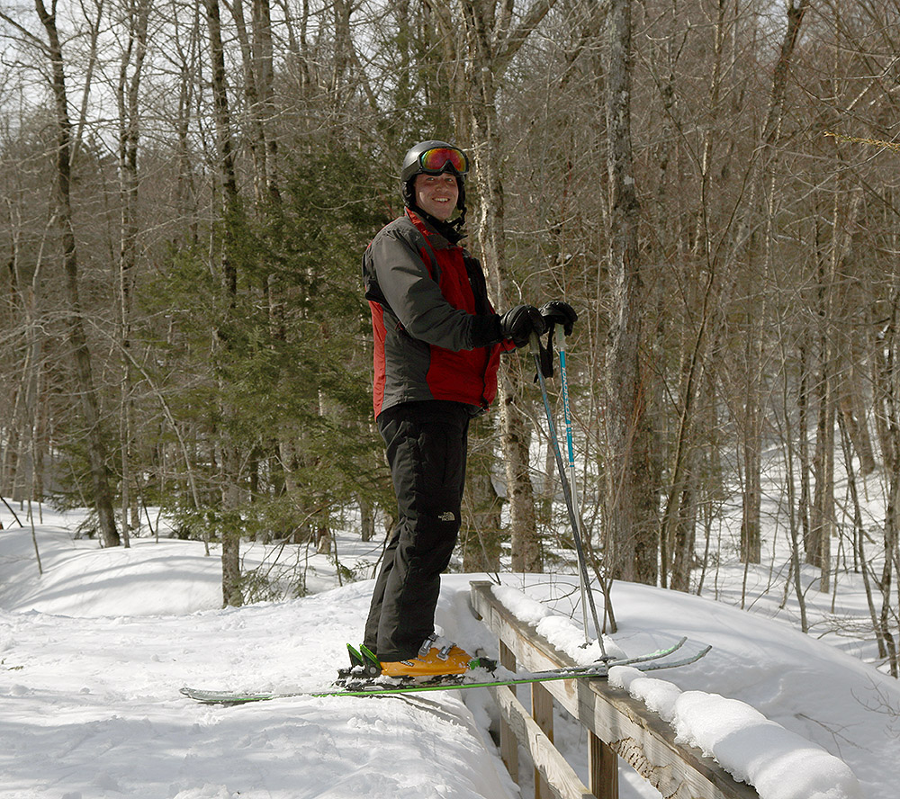
The spring snow made the final part of the Bruce descent through the Nordic areas a bit slower than when the snow is more winter-like, but we all simply took our time and enjoyed the casual pace along the meanderings of the Ranch Brook on such a glorious late winter/early spring day. We had plenty of time for snacks while we waited for the Mountain Road Shuttle, so we made ourselves some seats in the snowbanks near the Notchbrook General Store and soaked in some rays as we waited for the bus and discussed our day’s adventure.
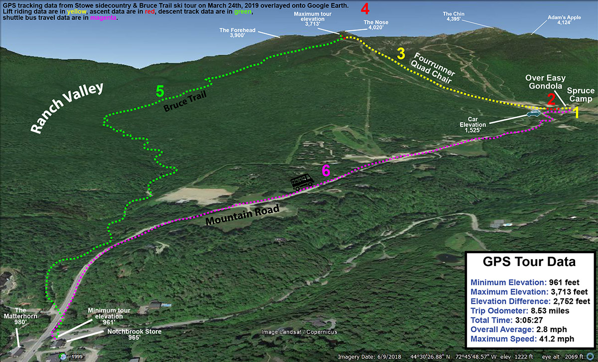
A Google Earth map with GPS Tracking data from today’s ski tour on the Bruce Trail in the Mt. Mansfield sidecountry near Stowe Mountain Resort
Although our latest round of snow was rather dense, that helped it cover everything in the mountain and put down a solid resurfacing of the slopes. It may not have been the most “champagne” of powder, but it certainly skied nicely.
Well ahead of our current winter storm, the weather models were predicting it to be quite a whopper of a system. Multiple upper-level lows were expected to consolidate over the area, then a low pressure center would move up the coast and into Northern Maine before finally departing. Low pressure systems in that area are in a very sweet spot for our local mountains, since it’s excellent positioning to allow Atlantic moisture to be grabbed and wrapped around to the north until it slams into the Green Mountain Spine. It wasn’t surprising that storm totals were expected to approach 30 inches in the mountains. Indeed the local peaks got pounded with snow yesterday and overnight, and when the reports came in this morning, storm totals reached and even exceeded 30 inches.
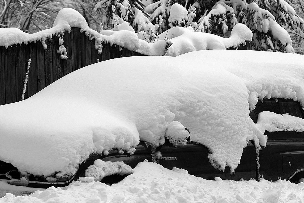
What a spring storm! – a snow-covered car along the Bolton Valley Access Road tells the tale.
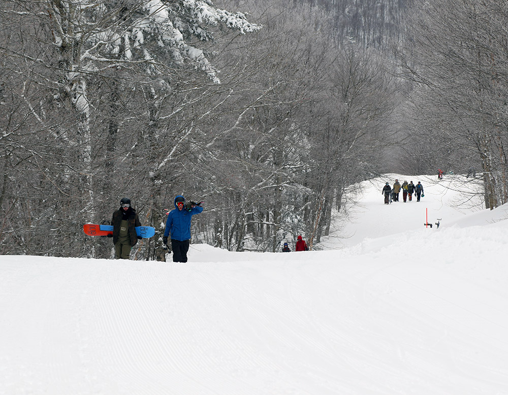
Our plan was to head up to Bolton for some turns today, but all the lifts were initially on wind hold except the Mighty Mite, so we packed Tele and alpine gear and were all set to skin at Timberline until they started running things. By midmorning though, the resort was announcing openings of the Mid Mountain Chair and the Timberline Quad, so we’d be able to start lift-served skiing once we got there. Unfortunately, they were still plowing out the Timberline parking lot and asking people to park up at the main base. This meant connecting over from the main base to ski Timberline, however the Snowflake Chair, which is the best way to connect over, was down for maintenance. This made for a big line at the Mid Mountain Chair, and that connection still requires a short hike anyway, so we made the hike up Villager to get over to Timberline. We chatted with a patroller coming down Villager, and he wasn’t thrilled about our hike because it wasn’t a designated uphill route, but he understood under the circumstances. He just reminded us to stay to side, well out of the way of any resort vehicles that might be using the trail. It’s not really a long hike, but it did have the benefit that we got in some of our cardio today even though we didn’t end up skinning.
Wind holds on various lifts at the mountain today made it challenging to get from the main base over to Timberline, so many folks made the trip up the Villager trail to get there.
“Indeed the local peaks got pounded with snow yesterday and overnight, and when the reports came in this morning, storm totals reached and even exceeded 30 inches.”
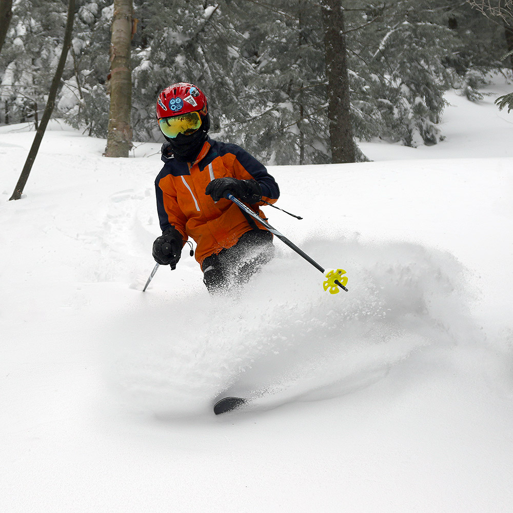
In terms of the skiing, I’d say that the quantity of the new snow was absolutely there – it was a fantastic resurfacing and the groomed slopes were skiing as beautifully as one could imagine. The powder skiing definitely left something to be desired relative to our typical off piste conditions from a storm though. The snow was quite dense, and often windblown. We found that the trees offered some protection from the winds, so we typically got our highest quality turns there, but it was still Sierra Cement/Cascade Concrete type stuff and it would toss you around easily if you weren’t on your game or as it became more chopped up. It actually looked like a nice day to be on a snowboard with the dense snow. The skiing was still awesome of course, but it was just surprising that the backside champagne never developed enough to set the impressively right-side-up turns we’d anticipated. Presumably the parameters for optimal snow growth didn’t come together everywhere as the storm was finishing up
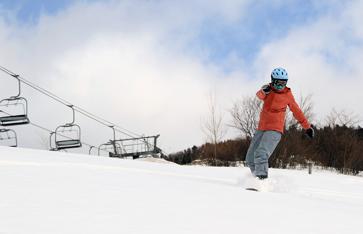
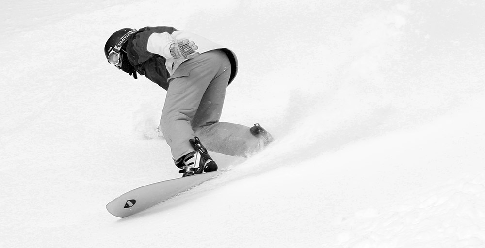
Thanks to some fresh snow from the back side of Winter Storm Ulmer, we were able to get in some powder boarding today at Stowe during our BJAMS ski program session.
“I found several inches of new snow and bottomless turns along the trees to the skier’s right of Upper Meadows on my snowboard, so things were definitely looking up.”
This morning revealed a storm total of 3.3 inches of snow at the house, and 4 to 5 inches at the local resorts of the Northern Greens. We were eager to find out how well the new snow had covered up the old base as we headed off to out afternoon session at Stowe, so as soon as I’d grouped up with Molly and Dylan, we took a quick run off the Meadows Quad to get a sense for the conditions. I found several inches of new snow and bottomless turns along the trees to the skier’s right of Upper Meadows on my snowboard, so things were definitely looking up. I could see that snow options must have been pretty nice in the morning when the trails were relatively untracked, but there was definitely enough snow for use to head over to the Toll House terrain and surf some of the new powder on the boards.
Erica catching some powder turns in the Toll House area this afternoon
E was potentially going to join us on her snowboard once she’d taken care of ensuring everyone was in their ski groups, so our group picked up Molly’s friend Julia on her skis and did a quick run off the Adventure Triple to take in some of the powder that remained below the lift. We all got together with E, and immediately made our way over to the Mountain Triple Chair on Mansfield to take in what we hoped to be a nice long run full of surfy powder turns down to the base of the Toll House Lift. I was a little leery of brining everyone into the Sunrise Glades because I wasn’t sure about their comfort level in the trees on their boards, but once we got past the Stowe Mountain Chapel and could see all the untracked powder in the various Toll House trees, everyone just dove right into the woods. There were a good 3 to 5 inches of powder with few if any tracks, and with that amount of cushion, I had no concerns about people’s ability to make turns or experience the tumbles we would all inevitable take. We rode the usual assortment of trees down much of the length of Toll House, and everyone had a great time surfing their way along. The moderate pitches there were just what the doctor ordered for the amount of powder we had available, and the exploration and practice riding in the trees made the experience a huge hit. We wouldn’t have been in there riding that fresh powder if it hadn’t been for the overnight snow.
The classic view of trails wiggling their way down Mt. Mansfield as viewed from Stowe’s Toll House Chairlift
We worked our way back to the Spruce Peak Village to end the day with a food break, and another one of my old straps on my snowboard broke, so that made for an adventurous return trip. I really do need to invest in some new bindings since mine are 20+ years old and the plastic is obviously getting brittle. Perhaps I’ll find an end of the season deal on something. I wouldn’t mind some of those Burton Step On® bindings – I’m so sick of dealing with those snowboard binding buckles, especially my broken ones!
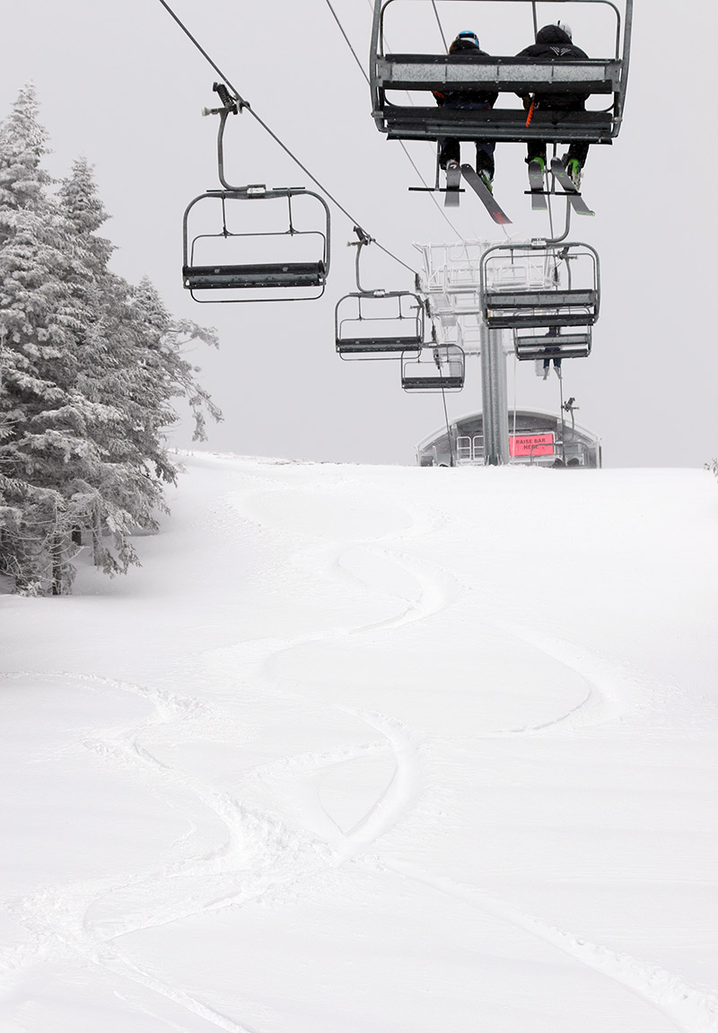
I was planning to head to Bolton Valley for a bit of touring this morning, but when I saw they were reporting about 4 inches overnight, whereas Stowe had early reports of 8 or 9 inches, I switched up my plans and decided to do a few lift-served runs at Stowe instead. My snow analyses from the morning indicated that the new snow had come in around 5% H2O, which was a setup for some great powder turns.
Enjoying some powder and views as I run one of my laps on the Sunny Spruce terrain today.
I had a bit of interesting serendipity on this morning’s outing. I parked in the upper Gondi lot, planning to do most of my skiing there, but I had a pass issue that required me to head over to Spruce. Once I’d gotten things straightened out with my pass, I decided to just roll with it and catch some runs while I was over there. I headed out to the lifts and noticed something surprising – the Sensation Quad was running, but the Sunny Spruce Quad was down. The reverse is common if there are wind issues, but certainly not the combination they had today (it turns out it wasn’t a wind issue, it was mechanical I guess). Anyway, with Sunny Spruce down, it was pretty much country club powder skiing on that terrain for the few folks that felt like accessing it. I did an initial run on Sensation, which was pretty quiet aside from the NorAm races, and got some of the first tracks down Spruce Line. After that I did a couple of laps on the vacant Sunny Spruce terrain, running a circuit with the Meadows Quad and Sensation Quad, and of course including a hike to the top of Spruce Peak each time to get in that extra powder and make up for the fact that I was riding lifts instead of skinning.
One of the snowboarders I encountered surfing the powder as we hit the snowfields near the summit of Spruce Peak today
“It was skiing much deeper than a foot at times, and doing some checks I was getting powder depths of 22 to 24 inches.”
It was snowing nice fat flakes all morning, and the increases in snowfall intensity were often quite notable as you headed up in elevation. It typically wasn’t an intense pounding snow, but often nice and steady, and sometimes you’d have that fairly decent snowfall with sunshine at the same time. There were a couple of times with the perfect simultaneous combinations of flakes and sun that I had to stand there in awe and soak in the mountain scene. And it was all gorgeous upslope flakes – the 5% H2O I’d found in my morning snow analyses was probably about what we had where the snow wasn’t affected by any wind. It was simply great snow quality with some good right-side-up nature to it thanks to some dense snow that had fallen at the beginning of the storm cycle.
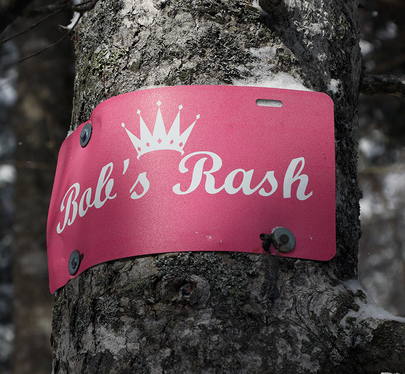
Most off piste (and even some on piste) terrain I encountered was definitely delivering that 48-hour total of 13” that I’d seen in Stowe’s snow report. My first depth check of the day was in the Meadows East Glades, and my measurement came right in at 12 inches. I checked in spots off Upper Sterling and was typically getting 12-14”. I eventually got back over to the Gondola terrain and was really impressed with the skiing in the Bench Woods. It was skiing much deeper than a foot at times, and doing some checks I was getting powder depths of 22-24”. I did push through some sort of slightly thicker layer in those measurements, but it must not have been too sturdy because I was definitely skiing a lot of lines where the snow had that “up to the thighs” feeling. That’s typically in the two-foot realm vs. the one-foot realm. I found a sign I’d never seen in that area that said “Bob’s Rash”, and I have no idea how much of the terrain that sign was meant to cover, but the lines below it were beautifully steep and loaded with the kind of powder that billows up above your waist.
Exploring the awesome powder in the Bench Woods area this morning during my ski session at Stowe
Today it was Winter Storm Taylor that greeted us with some snowfall to freshen up our afternoon for the BJAMS ski program at Stowe.
We’ve got Winter Storm Taylor currently affecting the area, and this morning it brought a burst of snow that delivered a few inches to ski resorts around the state. The snow is expected to continue on and off through Tuesday, and I’d on and off is what we experienced today at our BJAMS ski program at Stowe. Around midday when we were arriving we had some nice flakes coming down in the Spruce Peak Village to help freshen the snow surfaces, and there were also some winds keeping the upper mountain lifts on wind hold.
My ski group today was exactly the same as I had at last Sunday’s session: Adrian, Sienna, and Sienna’s mom Jessica. To get a sense for how the new snow had settled in, we warmed up with a run on the Meadows Quad. There were at least a couple fresh inches of dense snow around on the lower traffic areas of the trails, and there was an especially deep area along the Meadows Catwalk as it wrapped back around below the lift. It almost seemed as if half the trail there hadn’t been groomed, because there were several inches of dense snow there. I urged everyone to check out that snow, especially since I know Jessica had been looking to get a feel for what it was like to ski in powder. She took quite well to the soft snow, and enjoyed the fact that turns were easy without worrying about firm spots, so I continued to search out the powder for her throughout the afternoon. Eventually I didn’t have to find the snow for her though, she was really seeking it out herself.
We’ve got Winter Storm Taylor currently affecting the area, and this morning it brought a burst of snow that delivered a few inches to ski resorts around the state.
Conditions were overall much improved from last weekend, and with Adrian’s persistent inquiries I eventually decided that the group could try the steep face of West Slope. It’s marked as intermediate, but it could easily pass for a modest black diamond as well. We listened to the sounds of skiers making turns down West Slope while we rode the Sunny Spruce Quad, and hearing no noise from their skis, I knew conditions would be amenable to a run for the group. I also knew that even with the nice snow, it was going to be quite a challenge for everyone. Ultimately it was a very good push for Sienna, who needed to figure out how to engage her edges to hold her skis in place. Getting on that steeper slope was just what she needed though. Everyone had a successful run, and I’d say that was the most challenging slope that any of them had faced up to that point. One great aspect of tackling West Slope is that they now get to easily view their accomplishment right from the Spruce Peak Base Area and every time they ride the Sunny Spruce Quad.
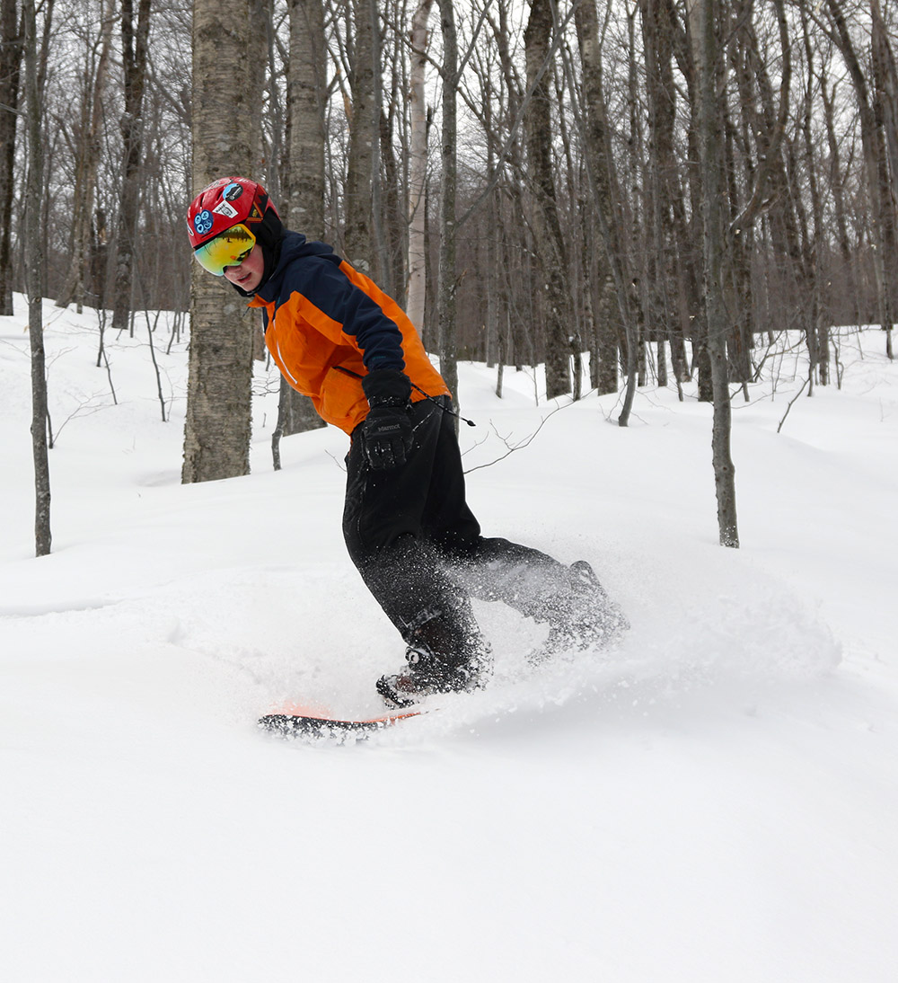
Dylan in the snow hole area at Bolton Valley today, working his way through some of the powder from the past few days
It’s been quite a cold week with low temperatures in the single digits above and below zero F, but as of today the weather is warming up to be a bit more in tune with March. Like yesterday, the forecast for today was absolutely clear, and with temperatures expected to edge into the 30s F, Dylan, E, and I headed up to Bolton Valley to catch a few afternoon runs. The temperature was in the mid-30s F at our house in the valley, and right around the freezing mark when we arrived up at 1,500’ at the Timberline Base.
The mountain has picked up 8 inches of new snow in the past three days, but I was unsure about how well it would cover up the old base. It turned out to be fine, and the powder was in great shape at all elevations aside from the sunniest spots where it had been affected a bit by the warmth. My depth checks on the upper mountain typically revealed about 8 inches of powder, so the mountain probably picked up a bit more than that before settling.
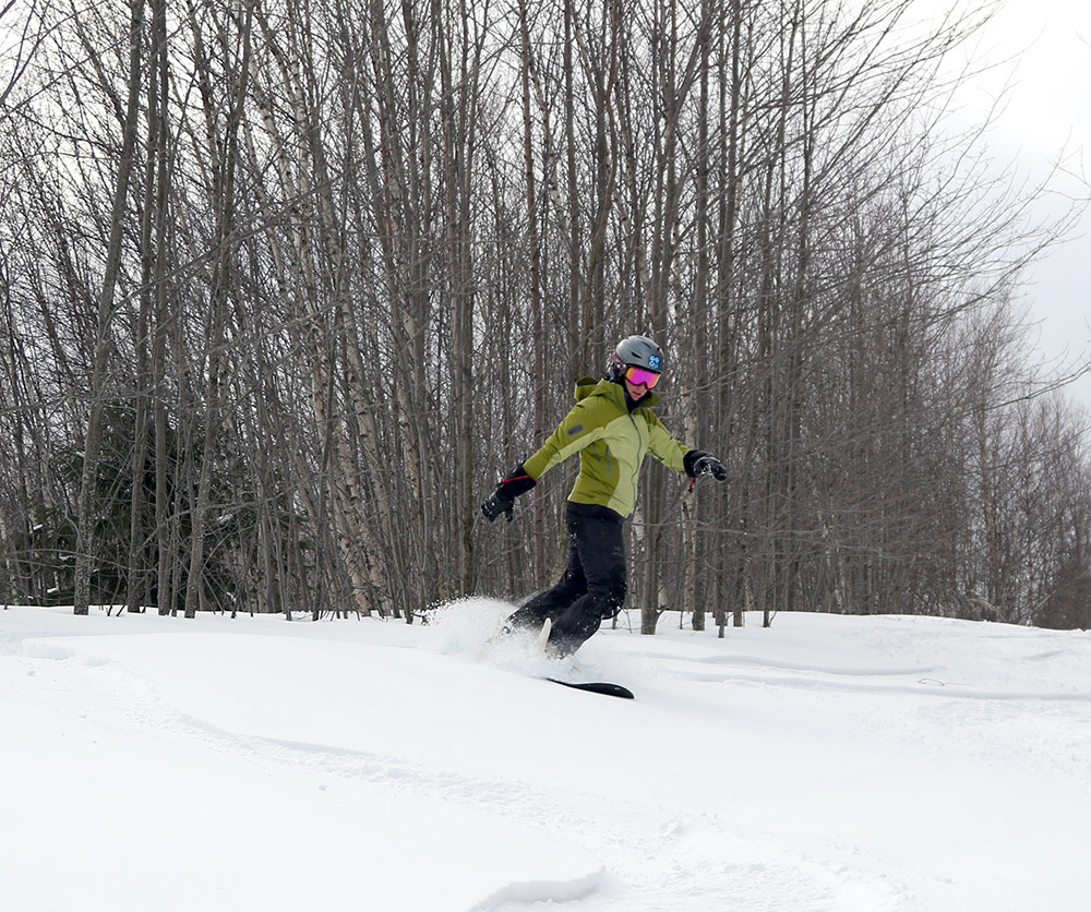
Telemark turns, blue skies, and powder this afternoon for E!
“My depth checks on the upper mountain typically revealed about 8 inches of powder, so the mountain probably picked up a bit more than that before settling.”
The lower elevations of Timberline were nicely warming in the afternoon sun to produce some beautifully soft surfaces on the groomed runs, but we didn’t really find any snow that had lost its winter consistency. We ventured all the way over to Wilderness and in those high elevations we found some nice powder on White Rabbit and Snow Hole. Even down in the Timberline elevations we found that the KP Glades held a multitude of fresh lines through dry powder.
The waffle cabin, adored with skis and starting to disappear under the snow, was a huge hit with today’s gorgeous weather based on the size of the line out front.
Starting tonight we’ve got Winter Storm Taylor moving into the area, which should bring some fresh snow to the slopes for tomorrow. The forecast indicates that the upslope snow on the back side of the storm cycle should continue right through Tuesday.
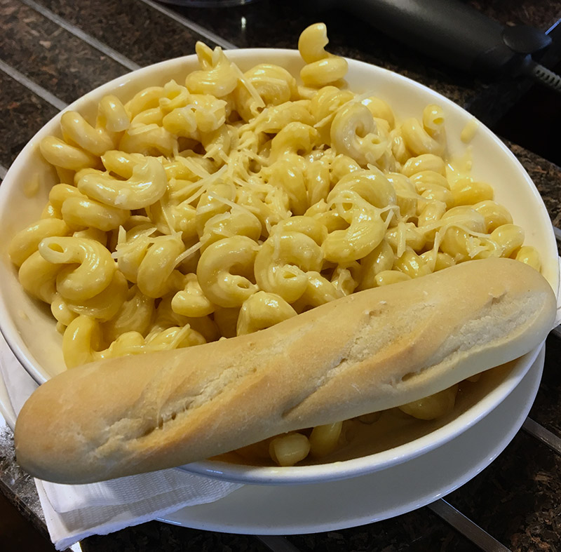
Ahhh that mac and cheese from the Great Room Grill. Dylan finally got to have it at lunch today after missing his chance when last week’s ski session was cut a bit short.
Today was our weekly BJAMS ski day at Stowe, but before our program in the afternoon, we got together with our friend Weston, who I know from back in graduate school. Weston had to head back to Connecticut by midday to stay ahead of incoming Winter Storm Scott, but we got to ski a couple of early runs with him off the Fourrunner Quad. We haven’t had much new snow this week, so conditions were fairly firm and unpleasant in general, but we did find a few areas with decent groomed snow on Sunrise and T-Line.
After Weston departed, we took an early lunch in the Great Room Grill, and Dylan got to have the mac-n-cheese that he unfortunately missed out on a week ago when Ty got injured and our afternoon got cut short. It was good, and very hearty – enough so that he had to store half of it in a takeaway box for later.
“He said his legs were definitely cooked, but that’s an excellent way to be after a good ski session.”
Dylan wasn’t part of my group today, but after our morning session on alpine skis, he switched to Telemark skiing for his afternoon session. E and I warned him that it can be quite a workout on Stowe’s long trails, but he said he’d just alpine as needed if he had to rest his legs. I find that still requires a lot more work than regular alpine skis, but it sounds like he made it work. He said his legs were definitely cooked, but that’s an excellent way to be after a good ski session.
My ski group for the afternoon included Sienna and her mom Jessica, and Adrian. E’s student didn’t show up, so she was with us as well. We had some great runs off the Meadows Quad, and everyone was doing so well that they all moved up to a run off Sunny Spruce. That was a huge step up for everyone, and I pointed out to Jessica that what she skied today would be even easier and far more fun on better conditions. She’s eagerly awaiting a powder day to see what the skiing will be like, so hopefully she’ll get a chance at one of those soon!
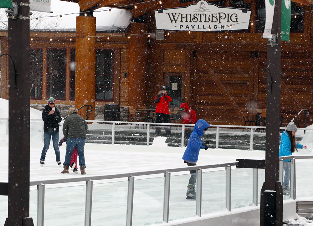
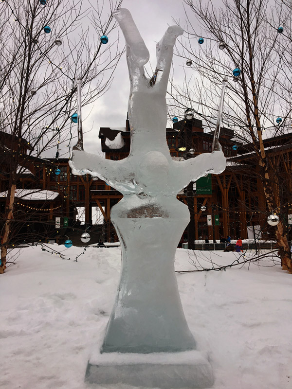
It’s that time of year again – checking out one of the ice sculptures in the Spruce Peak Village today
My first impression seeing the mountain in person was indeed, “Hey, that’s steep!”
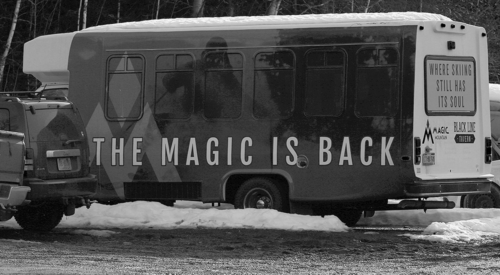
In fact, none of the family had ever been to Magic Mountain, and I don’t think the boys had even skied anywhere south of Killington. Living in Northern Vermont with so many great ski areas close by, it takes a bit of extra incentive to head south, and finding out that Magic was on the Freedom Pass was just what we needed. Today’s forecast for sunshine and temperatures well up into the 40s F sealed the deal, and we made plans to head down to Magic for the afternoon.
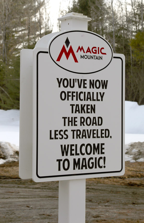
I’ve always heard of Magic Mountain being referred to as the “Mad River Glen of Southern Vermont”. The main reason for the comparison has traditionally been Magic’s steep and challenging terrain, akin to what’s offered at Mad River Glen. Magic’s terrain stands out especially well because in general, the ski areas in the southern half of Vermont aren’t as steep as what’s up north. Magic bucks that trend, and now having explored the mountain I can tell you that it bucks that trend hard. The mountain has a lot of impressively steep terrain, and I especially noticed it in their numerous areas of glades.
On our way to Magic, we found that the snowpack was minimal down in the Connecticut River Valley, but it increased consistently as we headed westward along Route 11 into the Green Mountains. Above 1,000’, snow depths were actually a couple of feet in some people’s yards. My first impression seeing the mountain in person was indeed, “Hey, that’s steep!” When we we arrived we were a little worried when we saw a sign indicating that parking lot A was filled, but we sort of laughed once we realized that “Lot A” really only looks like it holds about 30 to 40 cars, and “Lot B” is just another couple hundred feet past it.
“It was a bit tricky to find the entrance, but we eventually did, and boy did it have some seriously steep pitch.”
E really liked the feel of the base area. The people were very friendly, and she said it had a bit of a Bolton Valley vibe with what she called a “log cabin” smell. The woman who got us our Freedom Pass tickets was quite cheerful, and all of us adults had fun when Ty and Dylan were a little thrown off by the old fashioned metal wickets. Ty actually remember how it worked thanks to our recent mountain biking trip to Burke, but both boys have used them many times… it’s just been so many years since they’ve skied with one that they seemed extremely foreign.
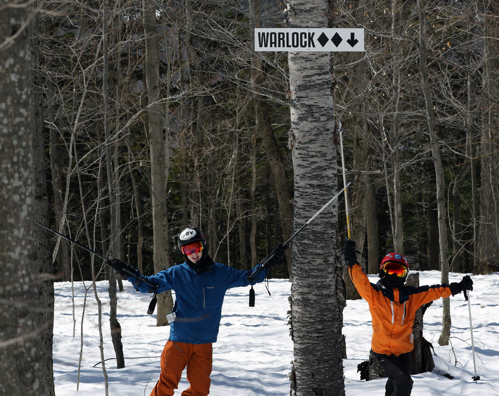
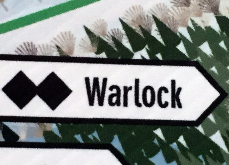
Ski conditions today were an interesting mix because despite the full sun and mild temperatures, shaded areas actually remained plenty firm. Also, there haven’t been enough freeze/thaw cycles to fully convert the snow to corn yet, so many areas in the sun featured sticky snow The best skiing we found was between in what we called “The Goldilocks Zone” – most trails had a shady side, and a sunny side, and right in between the turns were awesome. We really enjoyed the trail named “Trick” because of its good snow, and from what we heard it’s actually one of the main routes down the mountain. The mountain’s trails are generally named with a magical theme, and we were all interested in checking out the “Warlock” glade, since that’s the type of character Dylan plays in the video game “Destiny”. It was a bit tricky to find the entrance, but we eventually did, and boy did it have some seriously steep pitch. Coverage was already getting a bit lean in there, so we had to pick our way down in spots, but it was a lot of fun.
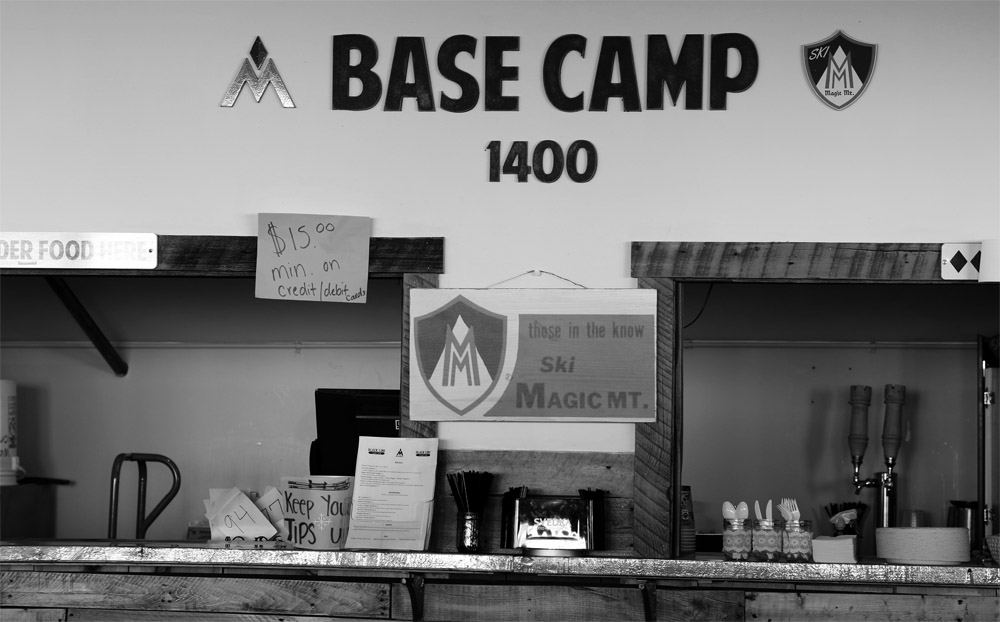
At Base Camp 1400 (we’re guessing that’ the elevation in feet) you can easily order food from the Black Line Tavern.
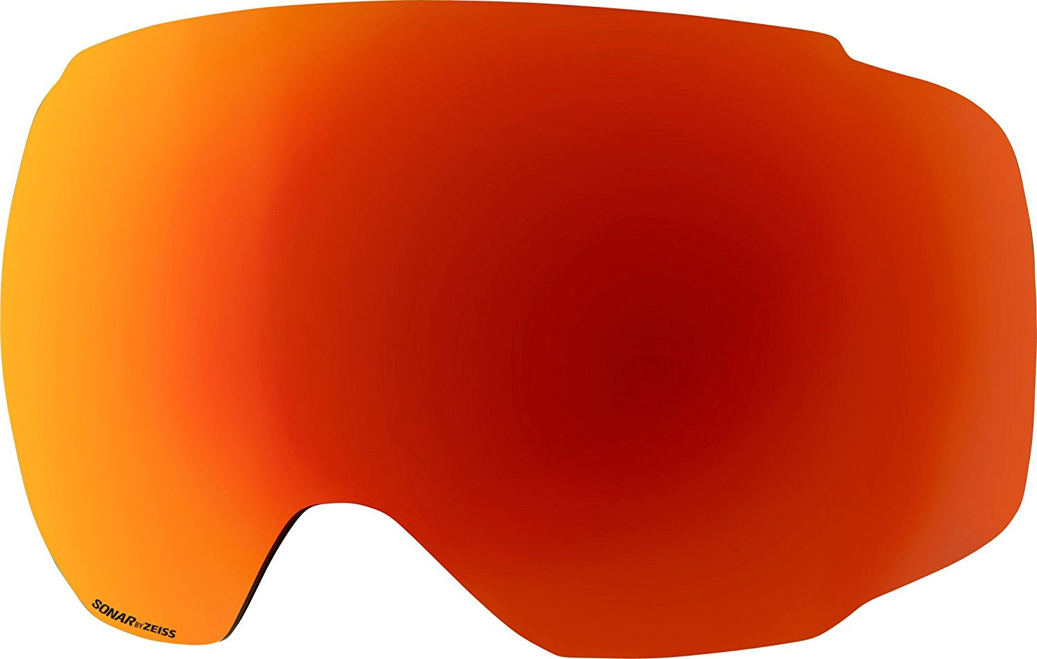
We had a fantastic lunch at the Black Line Tavern, with burgers cooked at the grill right outside on the deck, and the boys had fun on the huge “Connect Four” game they’ve got set up in the dining area. Our lunch break was well into the afternoon, but we were able to get in a couple more runs after that thanks to the mountain running the lifts until 5:00 P.M. Naturally with the warm temperatures and spring snow, it was only a matter of time before the boys started getting into battling with snowballs on the slopes. E and I were the usual victims. With today’s bright sun, it was a great chance for me to try out the Sonar Red lens for the Anon M2 Goggles. It only lets through 14% of the visible light, so it’s great for days like this. It’s also got a variable tint so that up top where the sun is going to be in your field of vision, more sunlight is blocked. I did get to try out the Sonar Infrared lens as well today, since the boys and I were swapping lenses around to see how they fared in today’s light. Sonar Infrared lets through 57% of the visible light and seems to give the world a much more neutral color (vs. the reddish coloring of the Sonar Red) but I didn’t find myself needing to squint with those lenses on either.
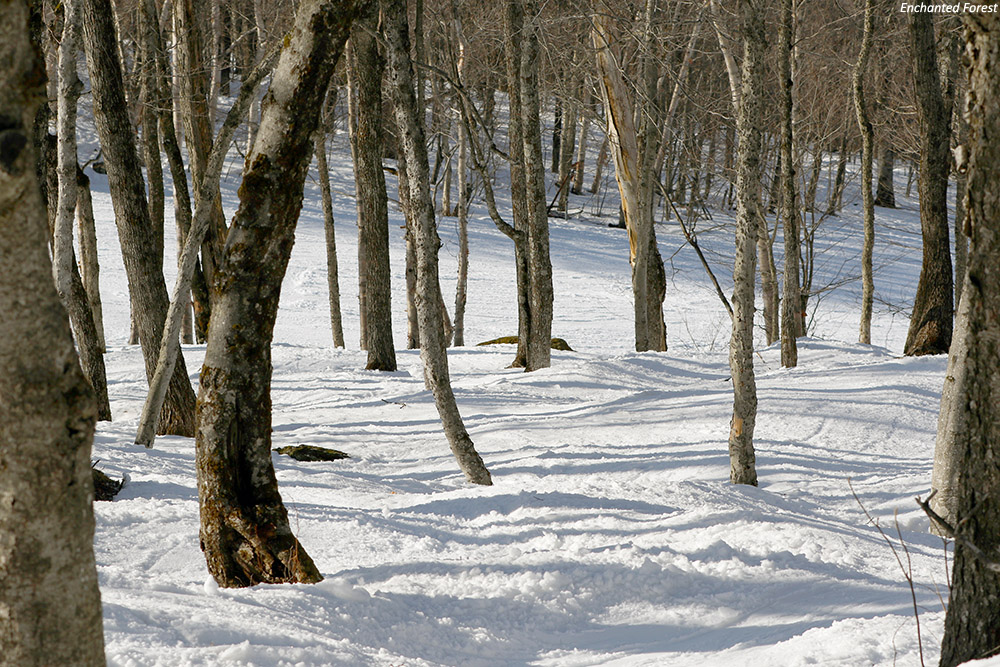
The Enchanted Forest glade right up near the top of the Red Chair
As is typically the case with just about any mountain that you don’t get a chance to visit with two feet of powder, we all want to head back to Magic at some point with fresh snow to try out more of those glades. Unfortunately, with how steep a lot of the mountain’s terrain is, and average snowfall of only about 200 inches a season, it’s got to be tough to really get those glades in prime form a lot of the time. I can see why they are emphasizing more snowmaking to keep things going through the tougher stretches, even if that won’t help out the steep glades. In any event, there are certainly going to be those stretches where the mountain really makes out well in the snowfall department and has sufficient natural base snow in place (such as much of March this year) to really offer some amazing skiing.
Well, with today’s visit to Magic Mountain, the only major ski area in Vermont that I’ve yet to ski is Stratton. Next after that would be Suicide Six, but then we start to get into the really small areas that don’t even get covered on the Ski Vermont website. Those are still interesting places to visit, but it takes a bit more effort to track them down and find out when they’re open.
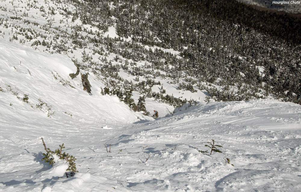
Robbie, Dylan, Wiley, and Ty are poised in the steep upper section of Mt. Mansfield’s Hourglass Chute as they get set to drop in on their first descents of this famed run in the alpine terrain above Stowe Mountain Resort.
Thanks to Winter Storm Skylar, the snow depth at the Mt. Mansfield Stake hit the 100-inch mark around the middle of the month. When the snowpack starts getting that deep up there, it’s time to really think about heading above tree line into the alpine, because everything is filled in and the skiing really gets good. While last Sunday’s weather in the higher elevations was frigid, with wind chills well below zero F at the summits, today’s forecast with minimal winds and temperatures in the 20s F was looking perfect for some above tree line adventures on Mt. Mansfield. With the weather looking good, my only remaining concern was how much spring cycling the alpine snow had seen in the recent stretch of sunny days we’ve had around here. Either way though, that wasn’t going to be a deal breaker, so I had E inform any interested students and coaches from our BJAMS ski program that we’d plan to hike up above Stowe’s terrain into Mt. Mansfield’s alpine for our Sunday afternoon session.
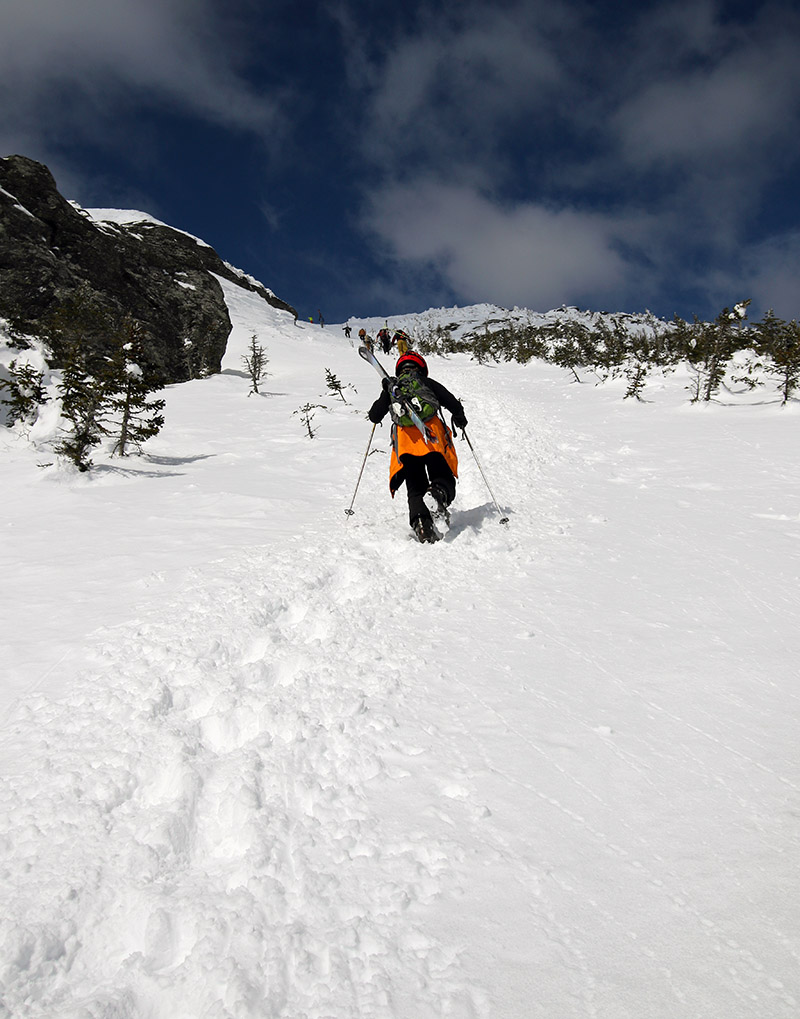
Dylan heads up toward the Mt. Mansfield ridgeline and The Chin under sunny skies as he ascends the boot ladder in the Climbing Gully.
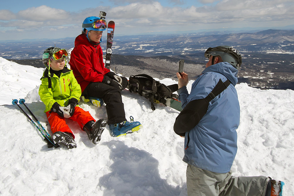
We ultimately had a crew of eight for today’s alpine adventures, with our usual suspects from my group along with Jonah and his brother and dad, who was willing to make the trip with the boys even though he’s got one injured arm in a sling! As soon as program started in the afternoon, we headed right up to the Climbing Gully and found an excellent boot pack in place. With some pretty decent southern exposure, the snow in the Climbing Gully had softened in the sun and sat somewhere between winter and spring consistency. Once we hit the Mt. Mansfield ridgeline though, the consistency of snow was all winter, and that allayed at least some of my fears about the consistency of the snow above tree line. You could feel the nice cool breeze along the ridgeline doing its job to keep the snow from baking in the late March sun, and I knew that any terrain without strong southern exposure up in the alpine was going to be in fine midwinter form. The views were stupendous, so we took a few minutes to enjoy the scene and fuel up. Ty had been silly and not eaten much in the morning, so he’d been bonking on the climb up the Climbing Gully. I made him quickly have a couple packets of GU around the middle of the ascent, and then I told him to get at least one granola bar into him on the ridge to make sure he’d have enough in the tank for the rest of the tour.
Josh snaps a photo of Agi and Jonah as today’s ski groups takes a break on our ascent to the Chin to enjoy the views from the Mt. Mansfield ridgeline.
“Profanity was loaded with snow, and up at those elevations, even south-facing terrain had a surface that was a chalky midwinter consistency.”
After our ridgeline break, we headed up to The Chin, and I first checked out the condition of Profanity Chute, which was my initial plan for today’s descent. Profanity was loaded with snow, and up at those elevations, even south-facing terrain had a surface that was a chalky midwinter consistency. I knew from Powderfreak’s pictures and comments that Winter Storm Skylar had really dropped a ton of liquid equivalent on the mountain and filled everything in, but it’s still most impressive to see it firsthand. Even more impressive to me than how filled in Profanity was, was just how plastered all the usual windswept areas of the summit were. The Chin is so exposed to the wind that it’s more typical to see a mix of rocks and snow vs., the area being covered wall-to-wall in white, but that’s how it’s been since Winter Storm Skylar. People were even skinning all the way to the summit, which you’ll only see when you get a storm of plentiful, dense snow that really covers all the rocks.
“From what I can find in the SkiVT-L archives, where Stephanie McConaughy reported measuring the slope of Hourglass, the pitch tops out around 50 degrees at the throat.”
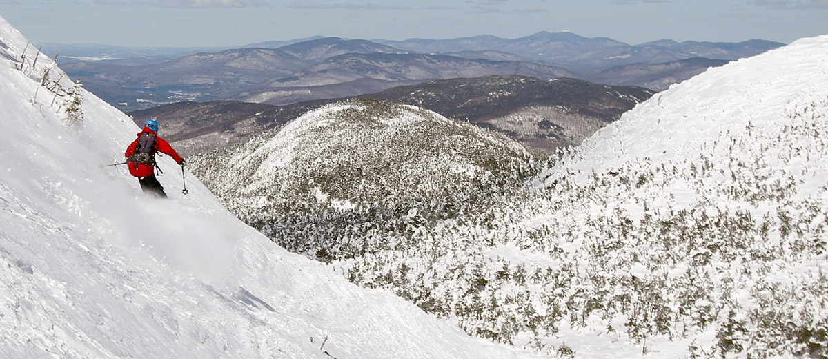
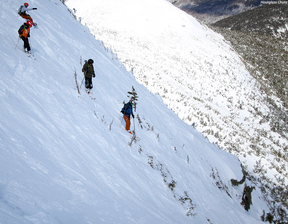
While the group congregated at the summit, I also took a look down at Hourglass Chute, and I was very impressed with what I saw. The snow quality and coverage looked excellent. Hourglass is narrower and steeper than Profanity, and I’ve never brought to boys down it, but it was starting to look like today might be the day. It was hard to pass up the great aesthetic look of Profanity with the current snowpack, but the boys have now skied it a number of times, and after surveying everyone to see who was interested, the boys were definitely game to give Hourglass a shot. Looking down on Hourglass from above, it’s a pretty intimidating view with plenty of exposure. From what I can find in the SkiVT-L archives, where Stephanie McConaughy reported measuring the slope of Hourglass, the pitch tops out around 50 degrees at the throat. That’s a pretty impressive pitch wherever you are, and with the apparent exposure of the chute from above, I was sort of dumbfounded that none of the boys even gave it a second thought. Jonah, Wiley, Robbie, Ty, and Dylan were all simply ready to jump right in, and they seemed confused as to why I was even making a big point to thoroughly confirm that everyone was on board. I was worried that it might just be ignorance on their part, but they stood there right atop the chute with a clear view of everything and didn’t even blink, so it is what it is I guess.
A look down Hourglass Chute from above as Robbie just finishes passing through the throat onto the apron below
I dropped down above the throat of the chute (Hourglass is so named because of the relatively open upper headwall and apron areas, with a tight, rock-lined middle section) and set up for some photography of the boys. I had the wide-angle Canon EF-S 10-22mm f/3.5-4.5 USM on my camera body at that point, and the spot I was in was a bit too steep to comfortably change it out, so I ended up sticking with it. Even at 22 mm it was too wide to really get nice shots of the boys going through the throat of the chute, but I did give a nice side-angle shot of everyone above the chute as they waited, and you can get a good idea of the pitch of the slope. Everyone ultimately did fine skiing the chute, although Dylan did take a tumble at the end of the throat as he was doing a jump turn, and I heard that Jonah also had a tumble down there. Fortunately, even with that steep pitch, it’s still not “No Fall Zone” terrain with the decent snow conditions we had. I saw Dylan slide headfirst for a time after his fall, and Ty was below ready to help him arrest, but he’d stopped before that point. Anyway, everyone seemed to have a great time skiing Hourglass, and all the snow was a fantastic midwinter consistency. Even after skiing it, none of them seemed to feel that it was a very big deal, so I guess I was much more impressed with how they did than any of them.
“…they stood there right atop the chute with a clear view of everything and didn’t even blink…”
We caught some steeps along the apron, managing our descent as much as possible to make for an easy cruise over toward and around the Adam’s Apple to catch the Hell Brook Trail. The Hell Brook Trail was in its usual state for this time of year, with terrain exposed to the south/sun getting crunchier and crunchier as one descended in altitude, but the sheltered snow on the skier’s right of the gully was continually fantastic. The whole area is really loaded with snow now, and in conversations with Ty and Dylan during the descent, we all really loved those steep, open faces on the south side of the gully that held the protected winter snow. Although he’d skied Hourglass beautifully, Ty was feeling off his game and heavy on his feet in the tighter sections of the Hell Brook gully (probably because of not initially fueling up properly), so he was really enjoying those more open areas that didn’t have any moguls.
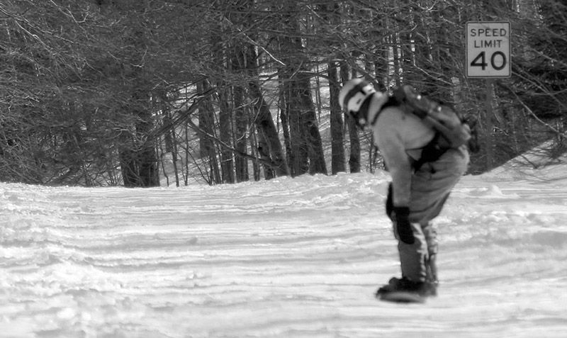
You’re not going to break any speed limits returning to the resort from the bottom of the Hell Brook Trail on a snowboard, but we saw plenty of people like Robbie making it work.
The ski out was relatively quick because the snow wasn’t sticky at all, although I hadn’t noticed that Wiley and Robbie had chosen a route without a good bridge across the final stream, so they had to take some time working their way through the lower woods to find a good crossing. Robbie was of course a trooper doing the whole thing on his snowboard, both above and below the Hell Brook Trail there are plenty of spots that are no big deal on skis, but can be a headache on a board. Down there on Route 108 it totally felt like spring, with lots of sunshine, and winter recreationalists out enjoying any manner of snow and ice travel. I’d had a lot of fun on today’s outing because I guess it’s been about 20 years since I last skied Hourglass Chute. Hopefully it won’t be so long before I get to do that again!
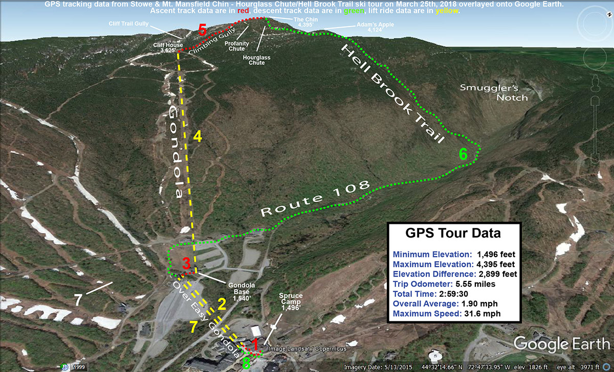
A Google Earth map with GPS tracking data for today’s ski tour at Stowe Mountain Resort and the Mt. Mansfield Chin featuring Hourglass Chute and the Hell Brook Trail
Both Dylan and I got to try out our new Anon M2 Goggles, the same model of goggles that Ty got at Christmas with the magnetic interchangeable lenses. Dylan and I were both in need of new goggle for various reasons, and it seemed like a no brainer to get the same model that Ty has to be able to quickly share all the lenses between us. We even got a few extra lenses for various conditions – we’ll just have to be good about not fighting over them!
Dad and Dylan joining Ty as they try out their new Anon M2 goggles today!
By the time we got back to Spruce Camp, the program session was just about over. I do like that a typical hike to The Chin with a Hell Brook run is just about perfect for one of our afternoon program sessions, since everyone is pretty cooked by the end anyway between the hike in and the traverse out. Ty was famished, so we headed up to the Great Room Grill for some food with Mom, and Ty got one of their huge burgers. He devoured it, not surprisingly, and E and had time to remind him not to try pulling ski outings like that on a nearly empty stomach. There’s nothing quite like a hearty meal after being famished from a good winter tour, but you have to know your metabolism and where the empty line is on your tank or you can easily get into trouble before you get to that next feast.
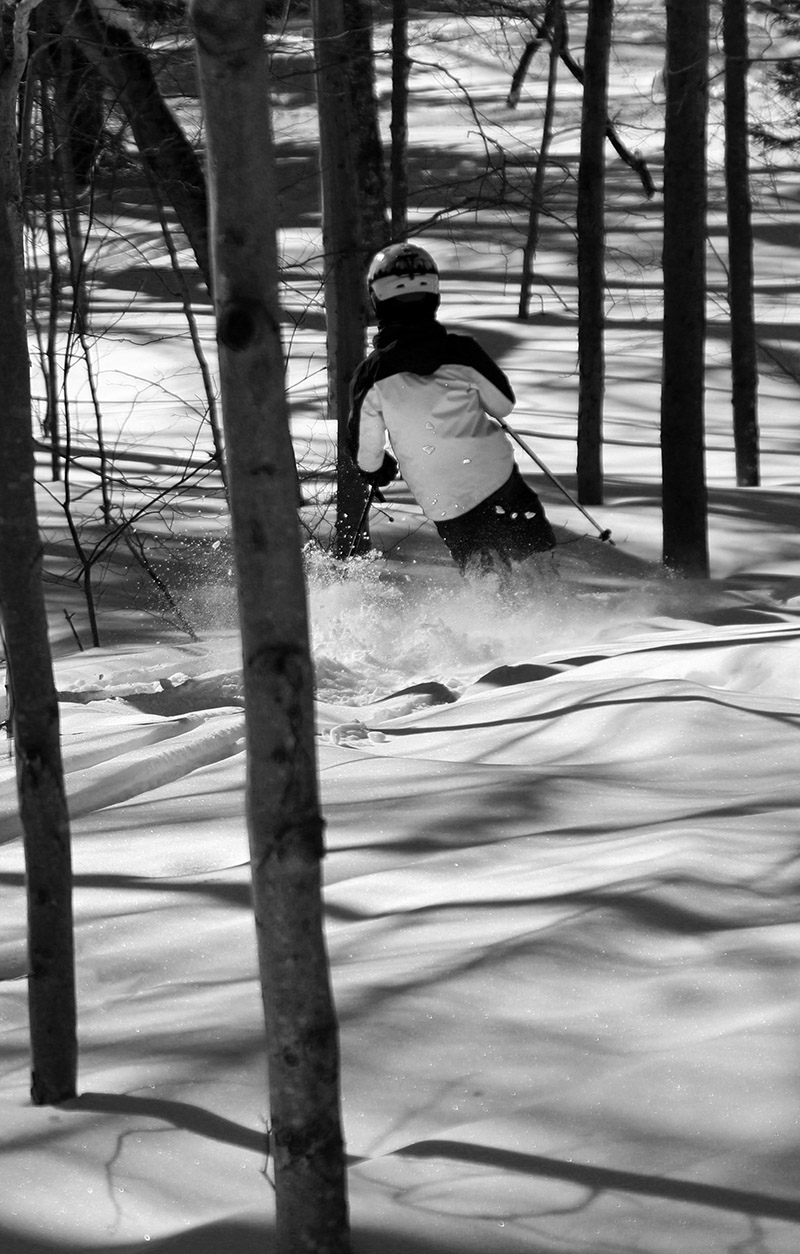
Powder turns today during explorations in the lower elevations of the Woodward Mountain Trail
Wind chills were forecast to approach -30 F today on the upper elevations of Mt. Mansfield at Stowe Mountain Resort, so E did a “soft cancel” of our BJAMS ski program. The program was still on, and families could go if they wanted to, but no coaches were required to go, and students wouldn’t have to deal with those potentially frigid temperatures.
Although I was glad to not have to battle the nasty wind chills up in the higher elevations, it was still a gorgeous late-winter day out there, so I thought about heading out for a ski tour on something local, relatively low elevation, and sheltered from the wind. Eventually, an exploration of the lower elevations of the Woodward Mountain Trail came to mind. The base of the trail is just a couple miles from our house in Waterbury, and with the healthy snowpack that extends all the way to the bottom of the local mountain valleys, the ski conditions there should be outstanding.
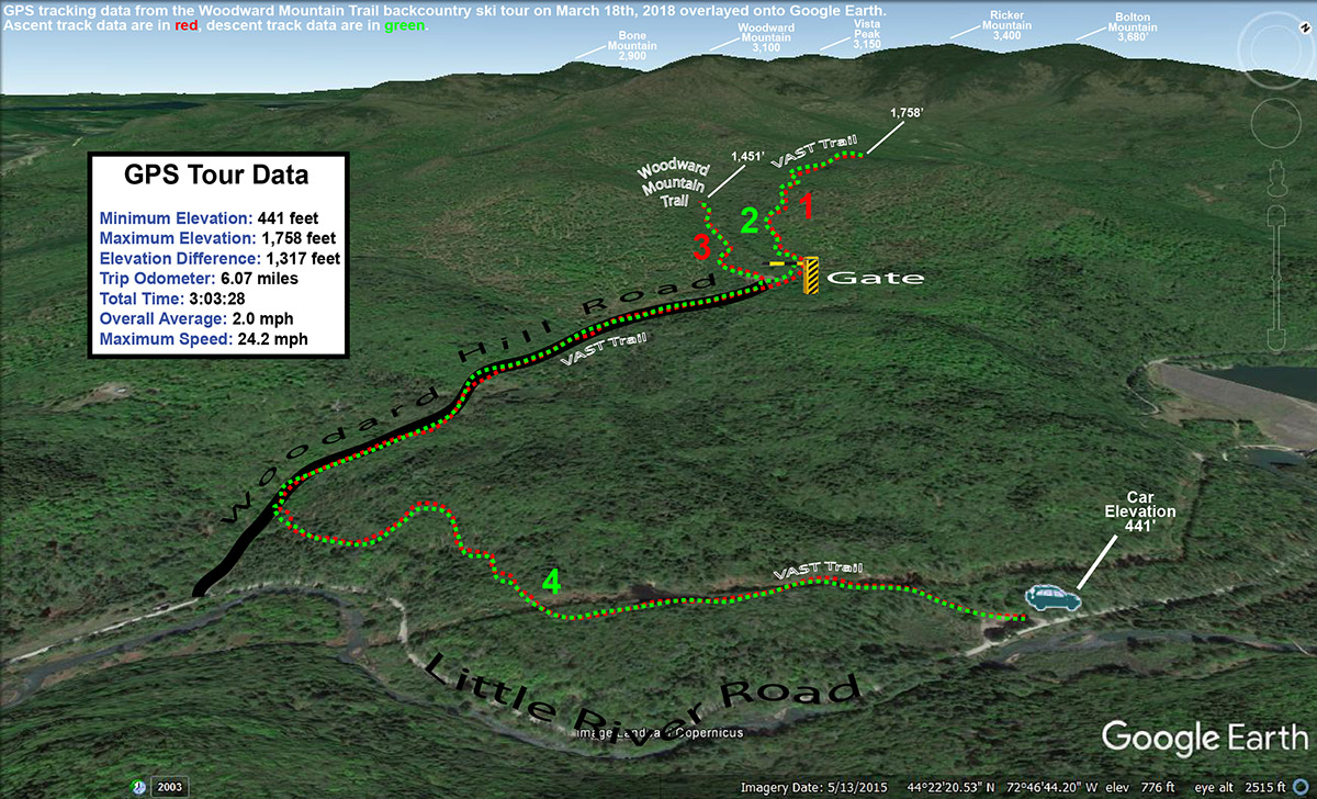
The Woodward Mountain Trail is quite a route, running six miles and dropping over 2,500 vertical feet in elevation. The traditional way to ski the trail is to spot a car at the VAST parking area (450’) at the bottom on Little River Road near the Waterbury Reservoir, then drive up to Bolton Valley Resort and use the Vista Quad to get to the top of Vista Peak (3,150’). From there, you ski southward along the ridge between Vista Peak and Woodward Mountain, before descending eastward off the flanks of Woodward Mountain itself down to Little River Road in the Waterbury Reservoir and Little River State Park area. I’ve skied the upper elevations of the trail before, but I’ve heard route finding for the ending (and middle for that matter) portions of the trail can get a bit tricky. At some point it would be great to get family and friends together for a full run of the trail, so my goal with today’s outing was to orient myself to the twists and turns at the bottom of the trail to hopefully make that experience a bit more efficient. And with the great snowpack and plenty of powder out there, I hoped to get in some good turns in the process.
“…my goal with today’s outing was to orient myself to the twists and turns at the bottom of the trail to hopefully make that experience a bit more efficient.”
I used my copy of David Goodman’s classing backcountry guidebook “Backcountry Skiing Adventures: Vermont and New York” to get myself oriented with respect to the lower regions of the route. His book has a nice description of where to park, as well as a topographic map with the route outlined. The guide is excellent, with just one problem in my case – the guide is built for following the trail down, so it’s not perfect for guiding you up from the base of the trail if you want to try that approach. In any event, with the map from the guidebook and my GPS in hand, I knew I’d be able to orient myself reasonably well to what the bottom of the trail held in store, and I’d always be able to come back again if necessary on a future trip with my own first experience in hand.
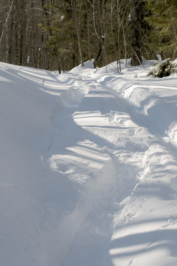
Temperatures were probably around 20 F when I parked at the VAST lot on the west side of Little River Road. There were a few cars there, most with snowmobile trailers of course, although one car looked like it might be backcountry skiers waiting to pick someone up. Starting from the parking lot, you’re immediately on the VAST trail, and it climbs a steep pitch before leveling out and going through some fields along the power line leading up to the dam. It was easy to see from the map in the guidebook that this part of the trail is a bit circuitous – you’re doing a big loop that doesn’t immediately bring you toward the rest of the Woodward Mountain Trail. This is due to the layout of the VAST trails, but with the topography of the ridges, valleys and streams down there, you’d probably just waste a ton of time trying to break trail through the snow if you wanted to follow more direct route from the parking area anyway. It’s hard to put a price on having a packed, well-marked trail to get you through the backcountry, even if the route is a bit indirect. The energy-saving and route-finding efficiency of having an established packed trail are simply huge. I was a bit dismayed to find that there was one fairly substantial downhill section (which of course means uphill on the way out) on the route in. I’m talking about a substantial enough slope that you’re likely going to have to take off your skis and walk, or put your skins on to deal with it.
After 0.9 miles on the well-packed VAST trail, I came to a T junction. The trail I was intersecting was part of the VAST system, but it was also a road, Woodard Hill Road. It had actually been groomed (and apparently even plowed) down in that area, so the snow cover was a bit thin in spots. I headed upward and to the right on Woodard Hill Road, which was the obvious route to take based on the guidebook map. I passed a couple of hunting camps on the left, and eventually at 1.75 miles into the route I came to a gate that seems to be the one indicated on David Goodman’s route. This is where the utility of the map in his guidebook broke down a bit for the ascent. His route appears to be shown passing through the gate, but it’s also shown staying to the south of the main drainage in that area. If you go through that gate, you’re crossing a bridge to the northerly side of that drainage, so those two pieces of information don’t line up. On the south side of the drainage there is a clearing that had seen some snowmobile activity, but I didn’t see any obvious ski tracks coming down from there to suggest it was near the Woodward Mountain Trail.
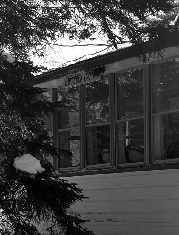
One of the hunting camps seen during my ski tour along Woodard Hill Road
I decided to play it safe on my first look and simply follow the VAST trail through the gate to see if any obvious trails branched off from it. The “safe” aspect of this choice was that I could continue to follow a well-packed, well-marked trail for a while, wherever it was going to take me. At 2.65 miles and an elevation of ~1,750’, I hit the local peak of that VAST trail and hadn’t seen any obvious trails converging on it, so it was time to see what potential the clearing on the other side of the drainage held. I de-skinned and switched to descent mode, and actually had some fun turns in the terrain off the sides of the VAST trail.
“At the very start of my tour down around 450’, the powder was generally 8 to 12 inches deep, but up in the 1,500’ to 2,000’ range where I topped out it was in excess of 20 inches deep. So there were a lot of good turns today at all elevations.”
Coming back down to the gate and bridge area, I headed up into the clearing and could see what had to be the outlet of the Woodward Mountain Trail. The clearing was full of powder, and the reason I hadn’t seen any ski tracks coming out among the snowmobile tracks was simply due to the fact that the last person to use the trail had done so before our recent bout of snowfall had stopped. Once I looked up the trail, I could see that there was an obvious ski/skin track. I put my skins back on and started up the trail. Fortunately, only about 6 to 7 inches of light fluffy snow had accumulated since the last person’s track, so breaking trail wasn’t really too much of a chore. I ascended for a bit within what my schedule allowed, and then had a nice ski back down that section of the trail with some smooth powder turns.
Back at the VAST trails, I descended until I hit the VAST stop sign at the junction of the final leg back to the parking lot. I was reading Ski Maven’s report of her trip on the Woodward Mountain Trail, and it sounds like her group went right through this junction, which left them at the base of Woodard Hill Road about a mile from the parking lot where they had spotted their car. This meant that they had to walk that distance back on Little River Road to get to where they’d parked. Froom that VAST trail junction though, it’s really a short downhill jaunt (just a couple tenths of a mile) to get to the base of Woodard Hill Road. This would actually be a much better place to park a car for finishing the Woodward Mountain Trail. Unfortunately, there’s not the expansive VAST parking area that you get following the other route, but I’ve seen cars parked down at the base of Woodard Hill Road, and I’m sure that’s why. I can tell you, having returned the 0.9 miles to the main parking lot on my tour today via the standard route in the guidebook, with its one substantial uphill and extensive flat sections, that continuing down on Woodard Hill Road would be tremendously more fun and efficient. It shortens the travel at the end of the route by almost a mile, and it’s all downhill. Even if parking isn’t available at the bottom of Woodard Hill Road, and you had to park at the VAST lot, you could still have everyone in your party continue that way and have one strong member follow the regular route and pick the rest of the party up at the road. It would honestly give people a much more enjoyable finish to their tour.
A Google Earth map with GPS tracking data showing today’s tour on the Woodward Mountain Trail
At the very start of my tour down around 450’, the powder was generally 8 to 12 inches deep, but up in the 1,500’ to 2,000’ range where I topped out it was in excess of 20 inches deep. So there were a lot of good turns today at all elevations. At some point I’d like to get to the middle portions of the Woodward Mountain Trail, but I’ve now learned a lot about the layout of the upper and lower sections, and would definitely feel comfortable guiding people in those areas. The middle portion of the route is supposed to have a lot of fun glades though, so I can’t wait to check those out.


