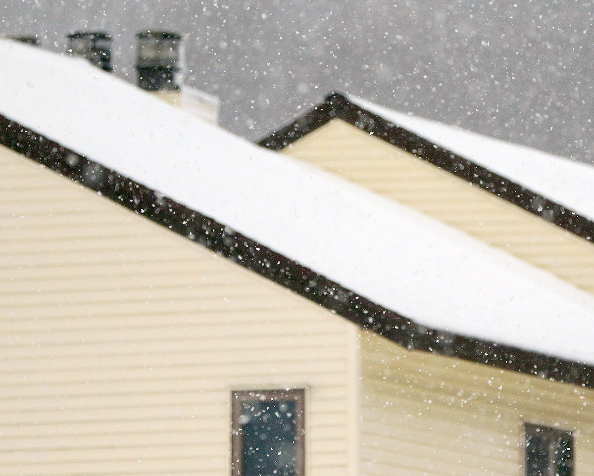
We had our first reported snow of the season here in Vermont over a month ago when flakes were spotted atop Jay Peak, but this latest round of winter weather has now brought us the first actual accumulations of the season. Our initial images of the accumulations came out yesterday morning when Powderfreak sent out some shots from the higher elevations of Mt. Mansfield during his usual Stowe Mountain Resort duties. Later in the day he sent along a nice image of the cloud ceiling and flakes falling on Spruce Peak while he was out on an afternoon hike. The snow was down to at least the 3,100’ elevation as of the afternoon, and with more moisture pushing into the spine of the Greens according to the radar, the potential for some additional overnight accumulations was looking good. The moisture seemed to be drifting a bit south though, and I saw a comment from Powderfreak that he felt the Central and Southern Greens would have the better chances for accumulations during the overnight period.
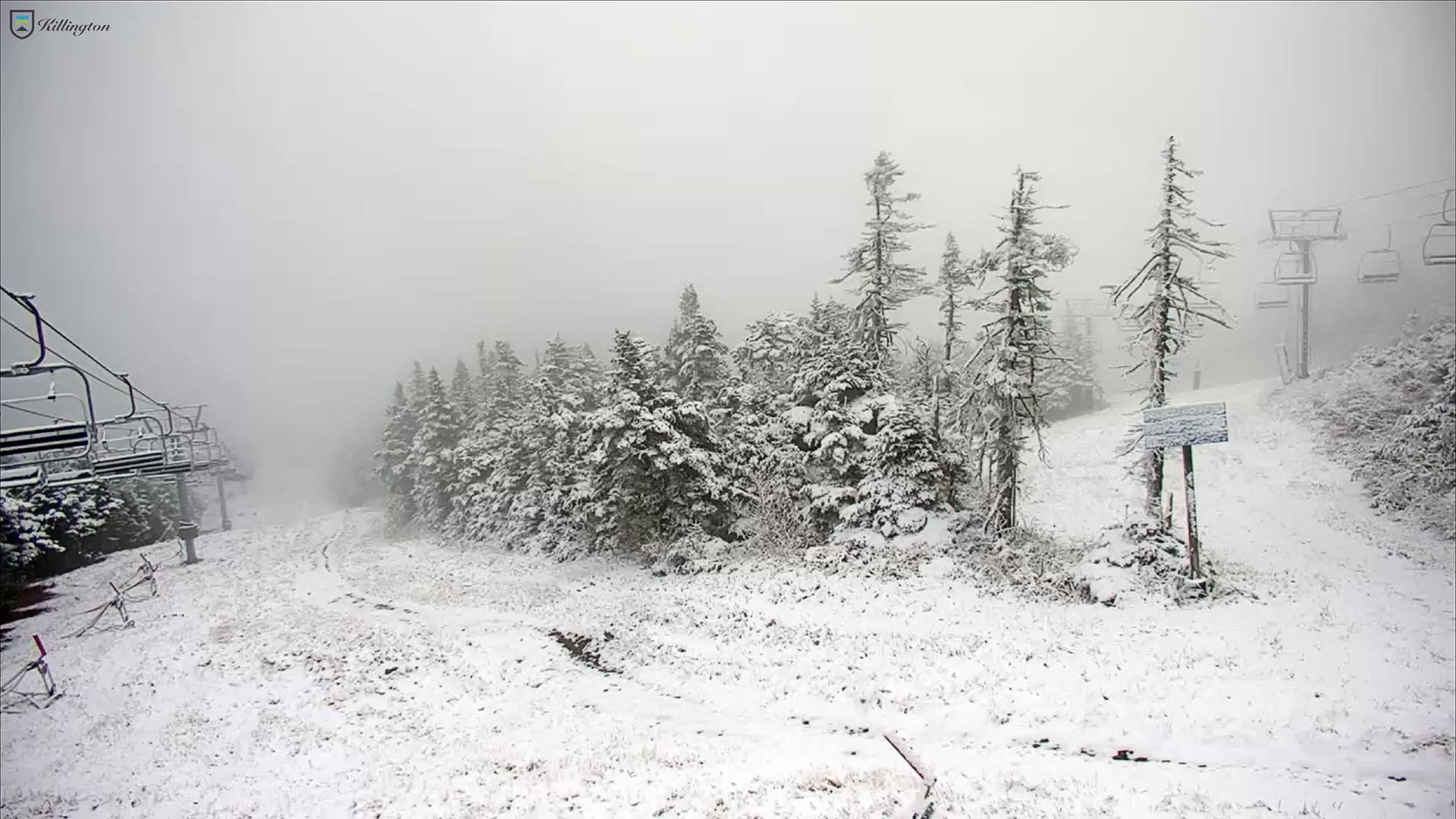
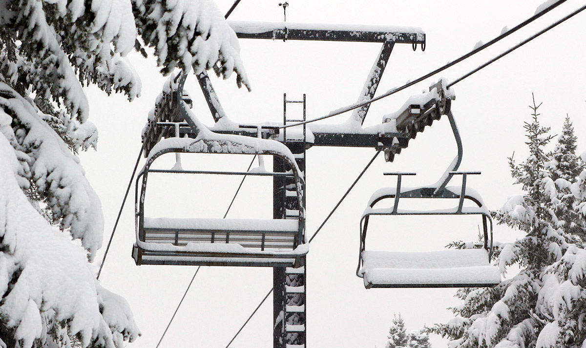
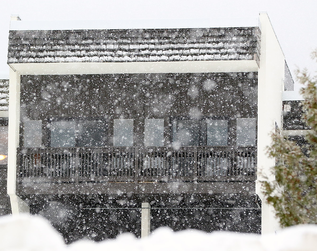
A shot from Killington’s North Ridge Webcam of today’s new snow during our period of first snow accumulations for the 2024-2025 winter season. Accumulations began in the area yesterday and the Central Green Mountain s picked up some of the best snows overnight.
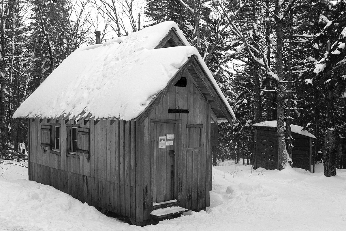
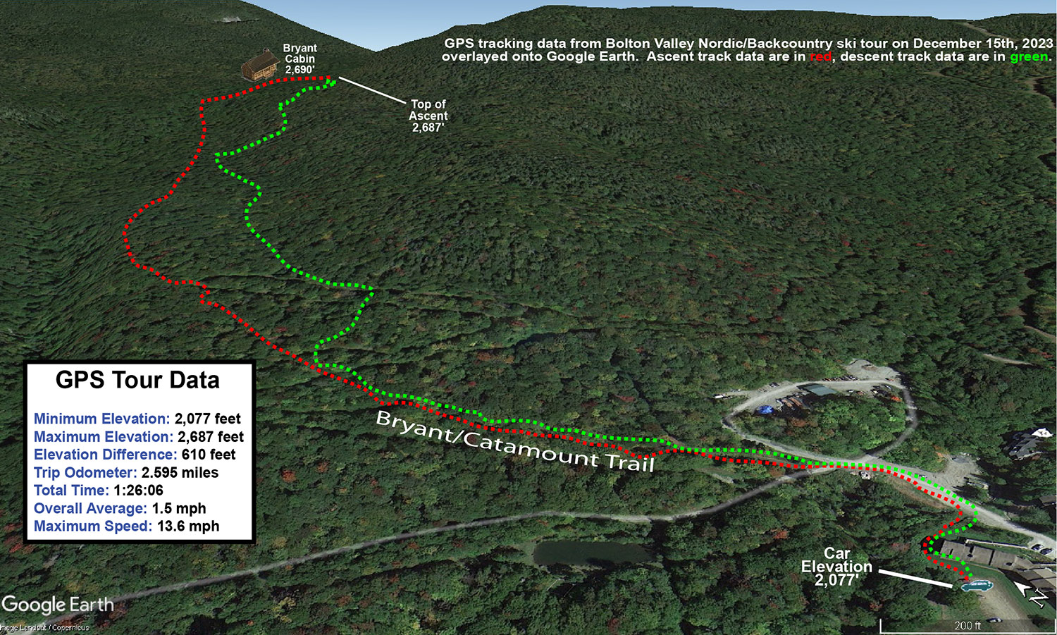
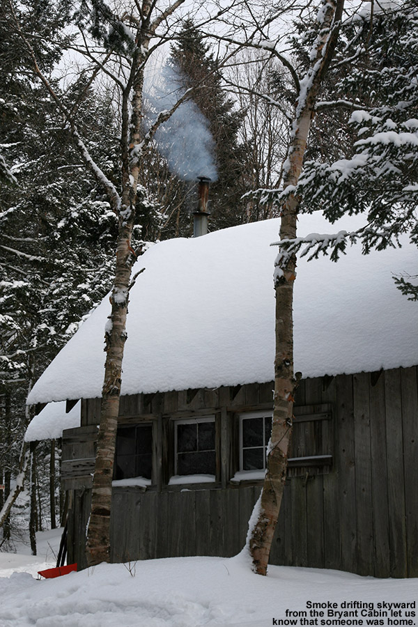
A view of the Bryant Cabin while Ty and I were out on our backcountry ski tour at Bolton Valley today
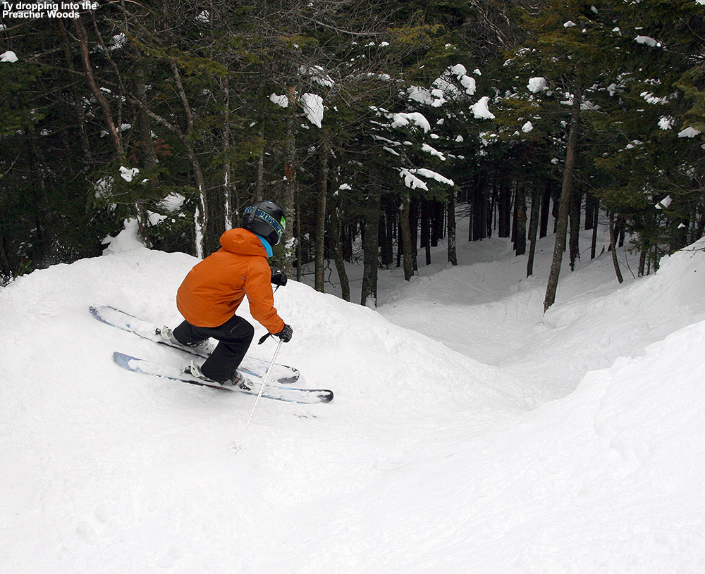
I haven’t been up to the mountain since Tuesday, but Dylan was out for some lift-served turns on Wednesday with friends and he said that Bolton’s conditions were fantastic. Similar to what I’d observed on Tuesday, he said there was a still a lot of roped terrain due to various hazards, but he also noted that his group was able to ski lower down on Preacher, and the untracked powder was going strong. That area is well protected from winds, and with the lower traffic due to the current need to traverse in, he said that conditions in there were better than he often sees in midwinter. The resort had also opened up the lower part of Wilderness that can be easily accessed from Vista, and he said the powder there was excellent as well.
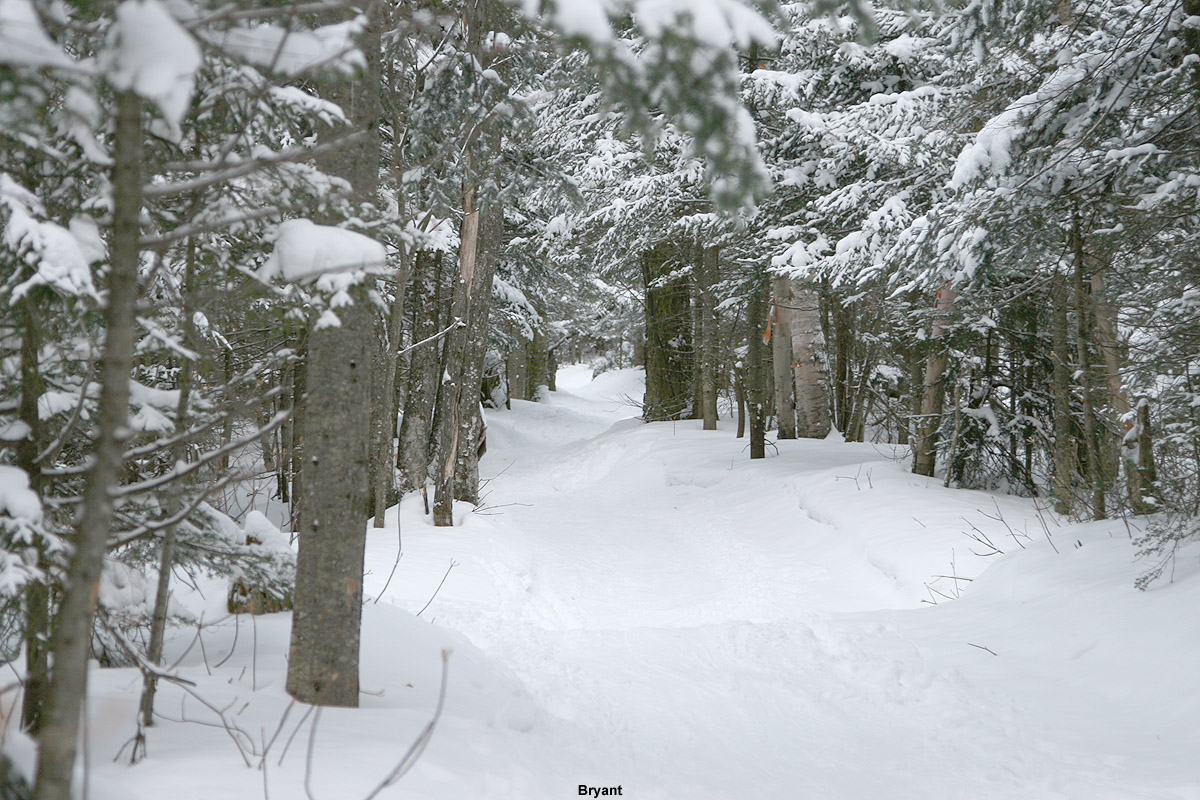
Since it hasn’t snowed for a couple of days, I decided that the timing would be good to head out onto Bolton’s Backcountry Network. This was my first time out on the Network this season, so it was a great opportunity to see where the snowpack stands. In terms of skiing the glades, coverage is quite good, and there are no major issues there. Out in the glades is feels like something that is approaching a midwinter snowpack, but what gives it away that we’re not quite there yet are the water bars on the main access trails. Some water bars are fine, but there are many that seem like they are stuck in early season condition, probably because they got blown out somewhat by the warm start to the last system. I haven’t noticed that issue quite as much on the lift-served terrain, likely because the grooming and greater skier traffic help to pack in the water bars more, but those factors aren’t there to tamp down the snow on the backcountry terrain. There are a number of spots on the Bryant Trail where people have diverted the skin track around the water bar area instead of trying to bridge it.
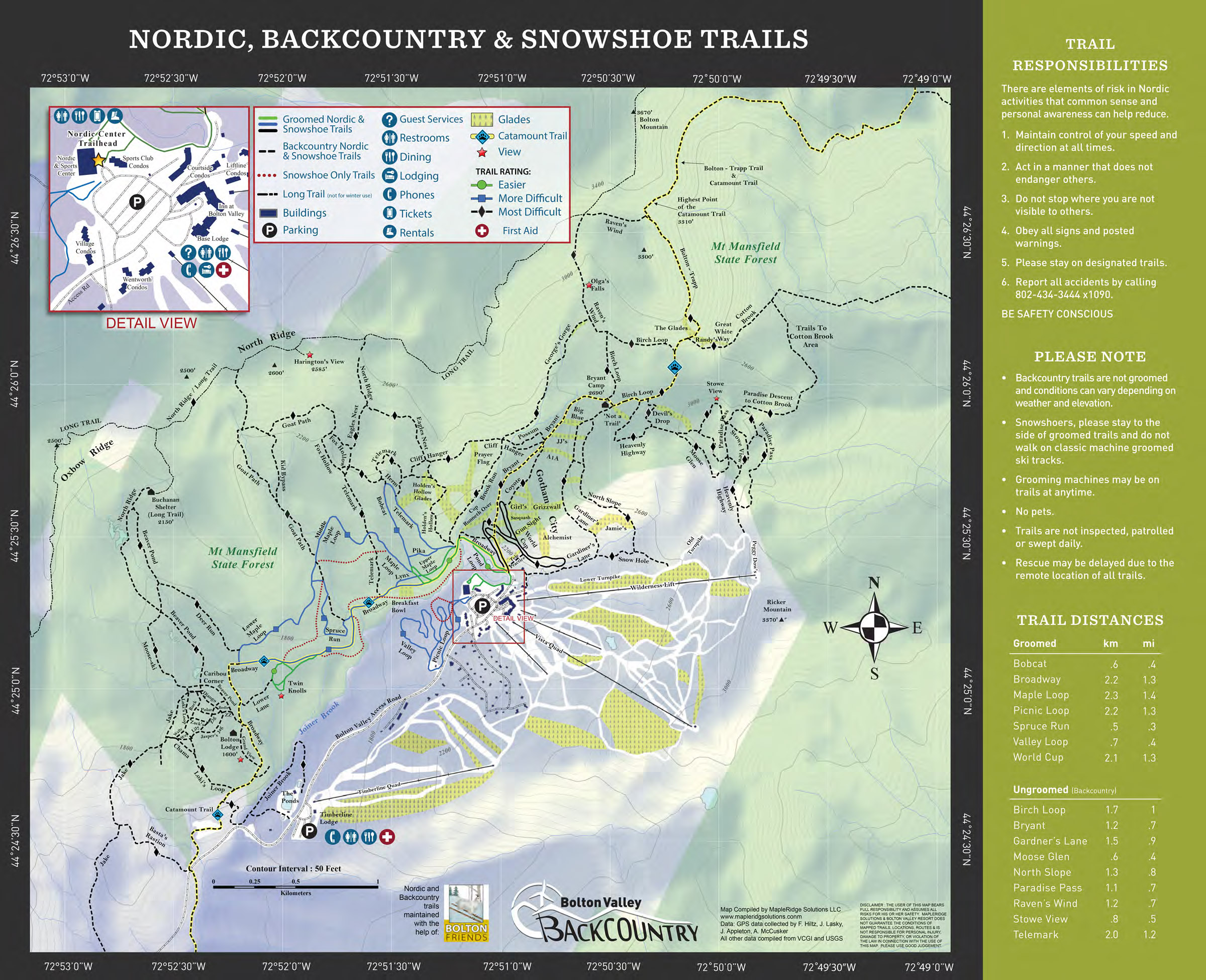
The Bolton Valley Nordic & Backcountry trail map which lists a lot of the glades.
Today we toured up the classic route to the Bryant Cabin, and then descended through some of the more popular glades. I was surprised to find that even above 2,000’ the temperature was edging above the freezing mark, so the snow was getting a bit thick in some areas. This effect seemed to diminish with elevation, and thankfully most of the powder skied well and wasn’t sticky, probably because the air is still fairly dry. As we descended below 2,500’, we started to run into areas where the powder became sticky, and I figured it was due to elevation, but we got back into drier powder in lower areas and that makes me think the stickiness was just in areas that had seen the sun. In any event, even with the temperatures being a bit marginal, there’s still plenty of good powder out there at elevation if you avoid areas that got hit by the sun.
A Google Earth map with GPS tracking data from today’s ski tour out on the Bolton Valley Nordic & Backcountry Network
It’s not surprising that the backcountry snowpack is getting a midwinter feel, because the snowpack depth at the Mt. Mansfield Stake is at 40 inches, and that’s the depth at which people start to feel comfortable skiing most off piste terrain around here. Those water bars in certain areas do seem to give it away that we’re still in early season though. Bolton’s snow report indicates that they are just shy of 100 inches of snow on the season, and I see that Jay Peak is reporting 115 inches on the season, so both resorts seem to have done well with these early season storms we’ve had thus far. We’re within a couple inches of average snowfall to date down at our site in the valley, but I bet those numbers from the resorts are ahead of their average pace due to the substantial elevation-dependence we’ve see with these recent systems. In any event, 100” of snow by mid-December is a solid start to the season, even at elevation in the Northern Greens.
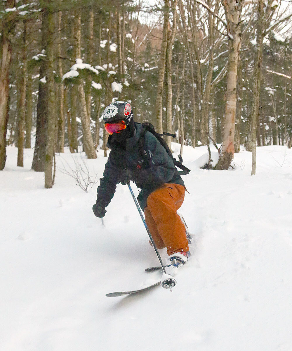
Coverage and snow quality were excellent today on natural snow trails like Glades off the Mid Mountain Chair
With last night’s continued snowfall on the back side of the system, Bolton Valley reported 18” for their storm total as of this morning. Since I’d missed out on the chance for any lift-served turns yesterday due to the power outages, I popped up to the mountain for some runs this morning since power was fully restored and the lifts were back in action. The resort is still somewhat in early season mode though, and they’re not running all lifts on weekdays, but the Vista Quad was running, which serves the bulk of the main mountain’s terrain. I haven’t been up to Vista at all yet this season, so this was a chance for me to see how the snow was doing up there.
The resort obviously got a boatload of snow from this most recent storm, with another excellent shot of liquid equivalent for the snowpack thanks to all the dense snow that fell on the front end of the system. Even with all the snow, there was a ton of terrain that was roped off this morning. The snow report indicated that between the warm front end of the storm and winds that came through, there were areas of water bars, melting and scouring that need some work to be safe for skiers. I’m sure ski patrol will be working hard to open as much terrain as they can as they have time to sort it out.
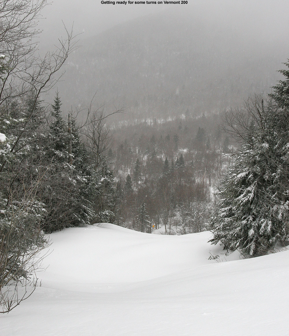
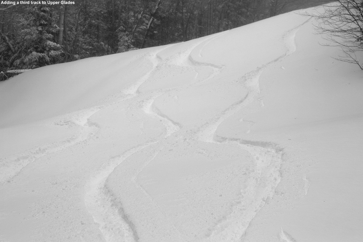
The standard snowmaking/groomed routes off Vista were definitely the main pipeline of open terrain, and the snow report noted that nothing else had been groomed. While so much terrain was roped off, there were some gems that had made the cut, such as Vermont 200 and Glades. I think Vermont 200 is sheltered enough that it holds the snow despite strong winds, and let’s just say, without any grooming, it was a great example of how spicy the terrain is out there. Vermont 200 normally has a lot of contour with plenty of rocks and ledges and stumps and dips and all that, but it feels exaggerated 10-fold with the current snowpack. There is plenty of snow in there though, and it’s a wild ride. Glades was another great ride because the Mid Mountain Chair wasn’t running, so getting to the top entry of Glades meant a bit of skating was required across the Mid Mountain Flats, and most people weren’t interested in that. So, the top of Glades had seen very few skiers and held a lot of fresh powder. Lower down, people were coming in from Upper Glades/Moose Run, so the conditions were more tracked, but still excellent.
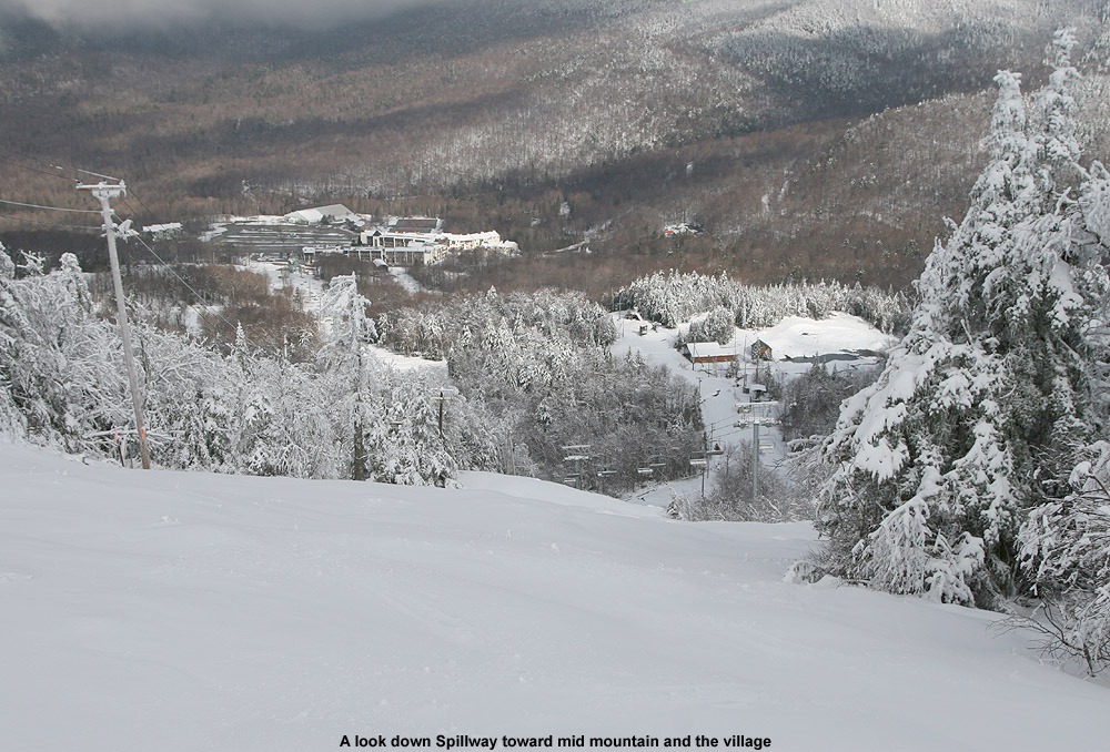
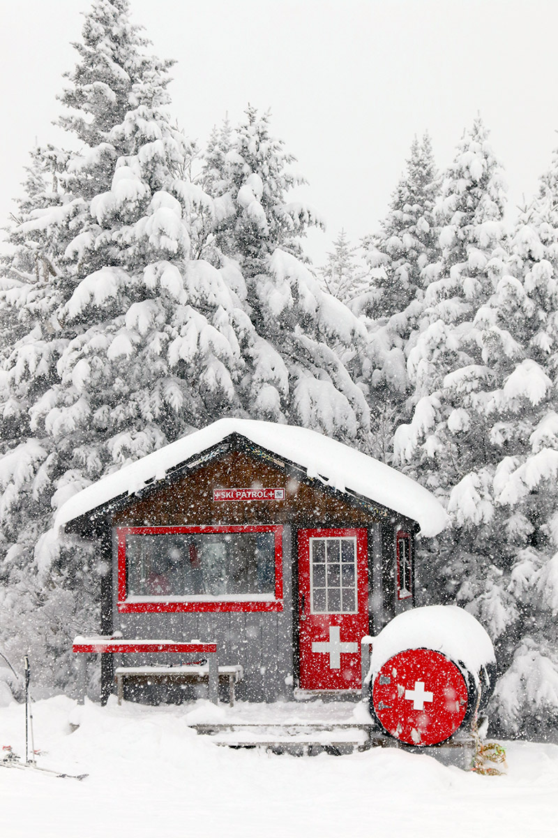
Members of the the Bolton Valley snowmaking crew were hard at work today augmenting the natural snow that is already present on the steep slopes of Spillway.
The snowmakers were out working hard on Spillway, so that seems to be where they’re putting their efforts for additional manmade snow at the moment. Even with all this new natural snow, Spillway still needs that snowmaking base because it’s wide and exposed to the wind so that it’s constantly getting scoured. Additional snow is falling today with the cold front and northwest flow squalls that are coming through, and then it looks quiet for the end of the week before a potential larger storm affects the area Sunday night into Monday. The models still seem to have some sorting out to do with that system though.
Bolton Valley has already picked up more than a foot of snow from our current winter storm, and the Timberline Quad Chair is showing the results of some of the mid-elevation accumulations.
As of their 4:00 P.M. update, Bolton was reporting a foot of new snow so far from this current winter storm, and I’m sure they’ve cruised right past that mark with the way it was snowing up there when I left the mountain this afternoon.
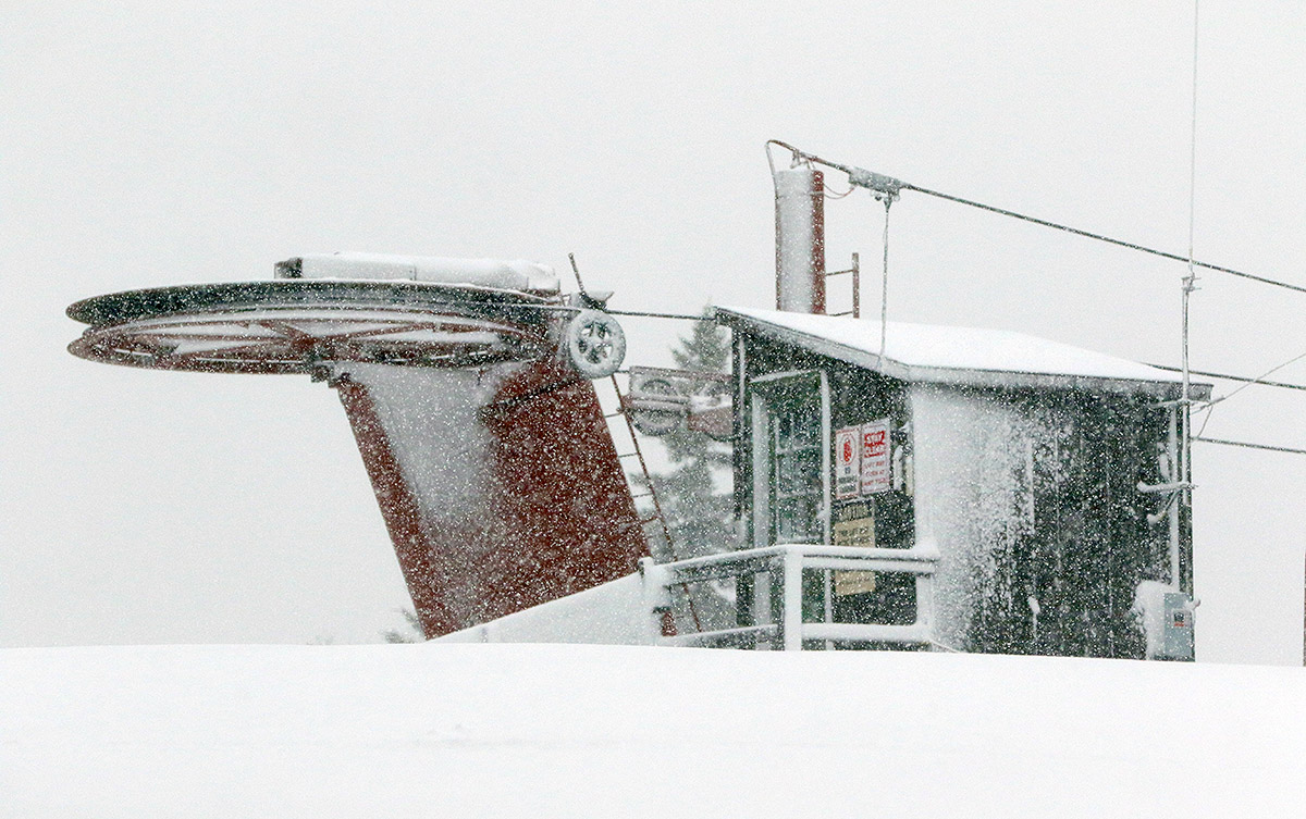
The early morning report from Bolton was 6 inches new up top, so my wife and I planned to let a few more inches accumulate and then head up in the afternoon for some lift-served runs. That plan quickly changed around 11:30 A.M. when we noticed that their main base area live webcam was frozen. We checked their website and they’d updated the snow report to indicate that they’d lost power. They were working directly with Green Mountain Power and hoped to get it back up in an hour, but that was very much up in the air.
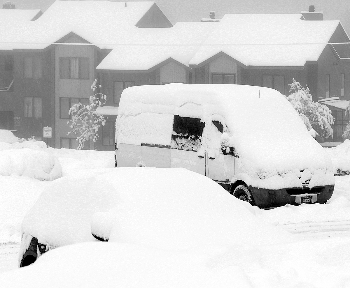
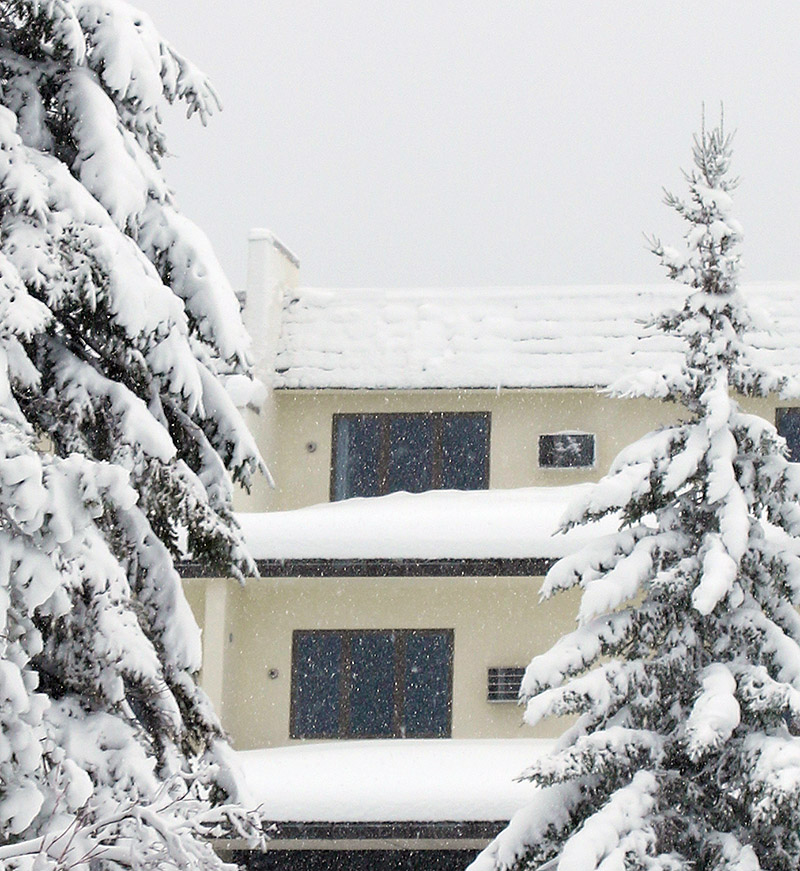
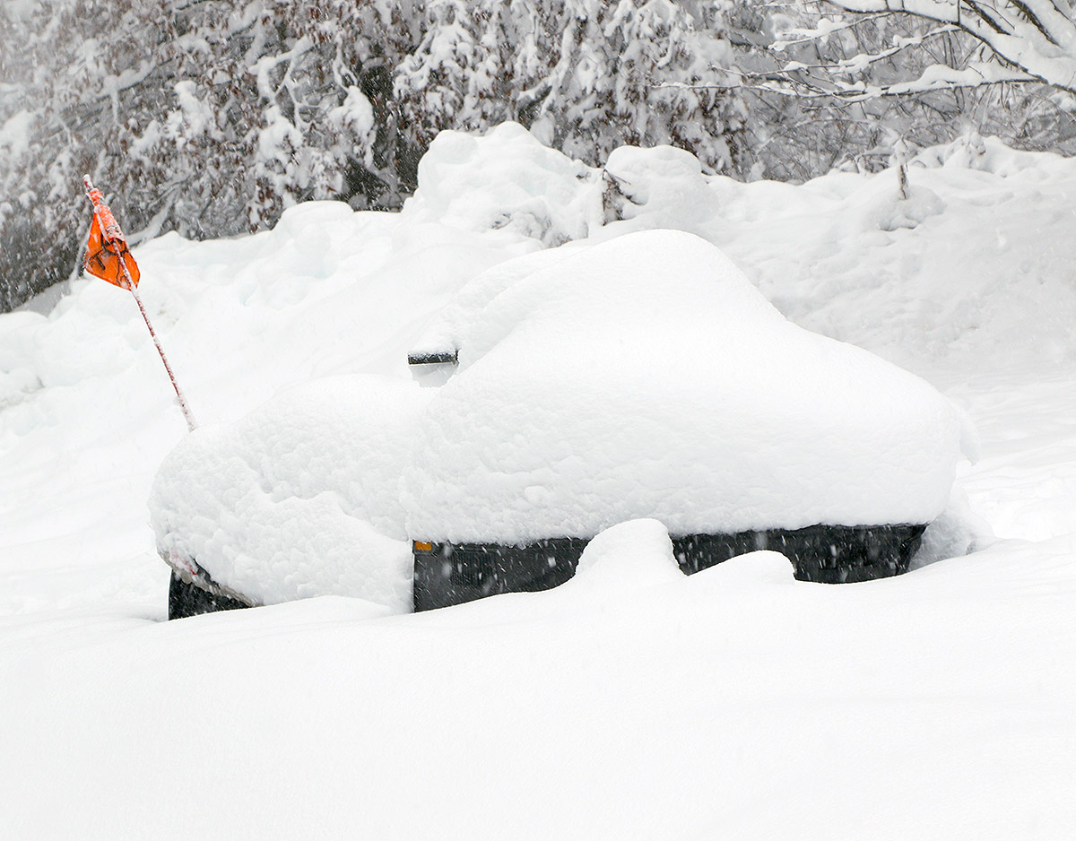
Even at the Village elevations in the parking lots you can see the results from our ongoing winter storm.
About an hour later with no change in operating status at the resort, I figured it was time to head up for some ski touring to get out in the new snow, since the potential for lift-served skiing was just too uncertain. When I first arrived up at the mountain, the snowfall was steady but I’d say only moderate in intensity. I did some quick depth checks around the Village to get a sense for how much new snow was there, but it was tough to gauge. In many areas, the new snow was so well blended with the old snow that it was hard to determine where the interface was. Overall, that’s a great sign because it indicates that the snowpack wasn’t hit too hard by the warmer temperatures on the front end of this system. In some spots I could find a thicker layer below the new snow, but even at that point I was often getting surface snow depths of 12 to 14 inches. Whatever the accumulations, there’s plenty of new snow and it’s coming together nicely with the underlying snowpack.
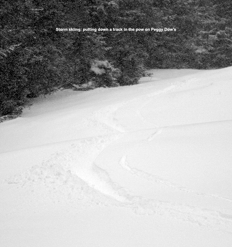
When I reached the Wilderness summit during today’s ski tour, the snowfall was quite intense, often in the 1 to 2 incher per hour range.
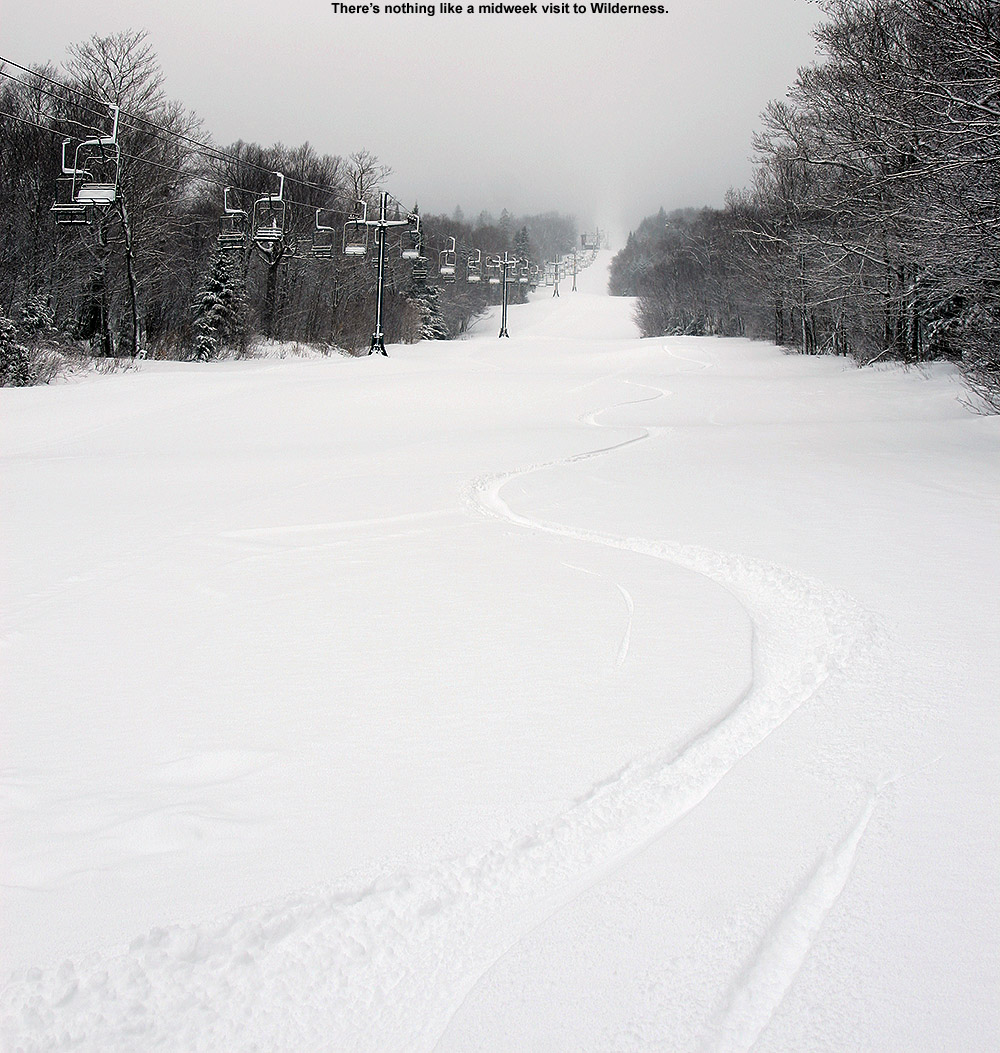
I skinned up to the Wilderness Summit, and touring traffic at that point seemed very light – there were just a couple of tracks down Peggy Dow’s. As I ascended, the intensity of the snowfall increased, and when I was up above 3,000’ on Wilderness it was definitely in the 1-2”/hr. range at times. I know it’s really dumping by how quickly my gear takes on snow accumulations during touring transitions, and this was one of those times where I was constantly having to brush off the snow.
Fat skis were the call again today, and this snow is on the denser side, so you want some pitch for the best turns. In terms of density, at 2,000’ the snow seemed to be a bit above the 10% H2O range, and up at 3,000’ it’s definitely drier; it’s got the feel of something in the 7 to 8% H2O range. The turns are great anywhere at elevation of course; it’s simply bottomless powder everywhere with this storm putting down plenty of liquid equivalent. I was worried about some of the water bars getting blown out with the warmer front end of this storm, but in general they seemed similar to how they were before. The snowfall didn’t actually slow down when I descended back to the Village, so it wasn’t just 3,000’+ that was getting hammered at that point – the intensity of the snowfall had definitely increased in association with the back side of the storm.
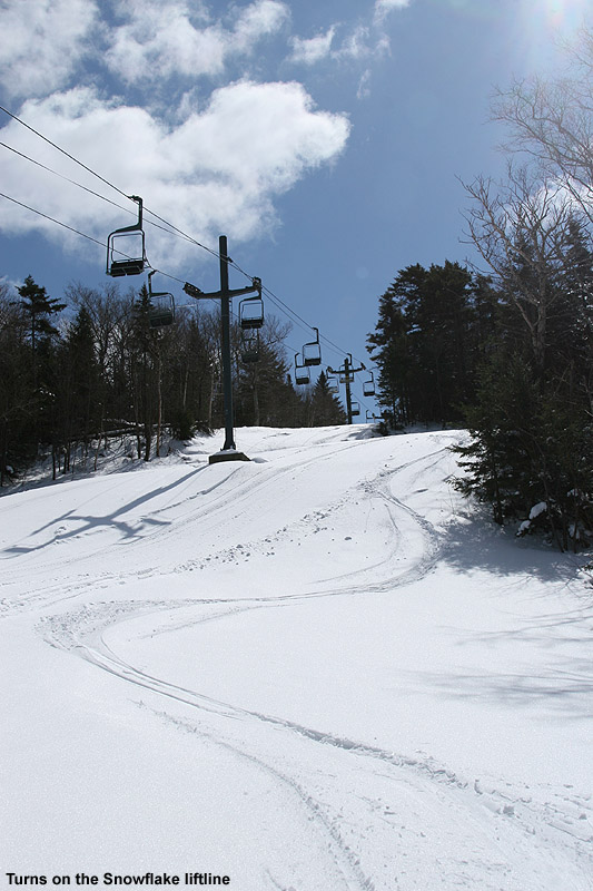
The mountain had been running at least the Snowflake Chair when I started out on my tour, so my plan was to swap over to mid-fats and get in a few lift-served laps to finish off the session. Well, when I arrived back at the main base, power was out again everywhere, so that plan was out the window. There was an easy solution to that though; I just slapped the skins back on and kept touring. I was initially thinking a nice little tour up to the Snowflake Summit would be a great way to finish off the session, but when I got to Five Corners I suddenly thought about hitting the Timberline Summit. I haven’t been up to Timberline at all yet this season because the snow depths at the Timberline Base are still a bit lean compared to the stronger snowpack above 2,000’, but that part of the tour gave me a chance to check out Timberline’s higher elevations. There’s been hardly any skier traffic over there, so it’s nearly untracked everywhere.
It was a winter wonderland out there at the resort today as my ski tour brought me around through the Bolton Valley Village, up to the Wilderness Summit, and even up to the Timberline Summit.
Heavy snowfall continued to pummel the area right through to the end of my ski tour, and my car had been loaded with snow in just the couple hours that I was out there. It took me probably 10 minutes to clean off the snow. The temperatures had definitely dropped as I was heading down the access road, and the heavy snowfall didn’t start to abate at all until I was below 1,500’. We’ve been accumulating better even down in the valley now that the temperatures have dropped below freezing.
During a break from skiing today at Bolton Valley, I took a short walk around the Village and remarked at how the snow is piling up as we move toward mid-December.
It’s a busy weekend for me and I wasn’t certain if I was going to get out for turns, especially since I was unsure if surfaces were going to be soft with temperatures in the 30s F, but comments about the great snow in the New England subforum at American Weather helped tip the balance. If we’d had a notable thaw-freeze, then 30s F probably would have cut it with respect to softening things up, but the snow hasn’t really cycled above freezing for a while – it’s already in such good shape that it doesn’t need to soften. With the next storm moving in soon to make the weather more questionable tomorrow, today also seemed like the better day to hit the slopes. That aspect helped motivate us to get out while the weather was relatively stable.
E and I headed up to the mountain in the midafternoon period, and we were a bit leery about parking because the snow report indicated that Bolton had already filled their upper lots and people were parking down at Timberline. We were late enough that plenty of spots were opening up though as others finished their day and headed home.
The resort is definitely humming as they start to move to every day operation this week. They had all the lifts going except Timberline, where I don’t think they’ve made much snow yet, and the natural depths down at 1,500’ aren’t quite there to support lift-served traffic. Patrol has opened up just about everything else though – low angle, moderate angle, steeps, trees, people are skiing it all. Some steep, and even moderate natural snow terrain requires various levels of negotiation around the usual patches depending on whether you’re using rock skis or not, but you really can ski just about anything.
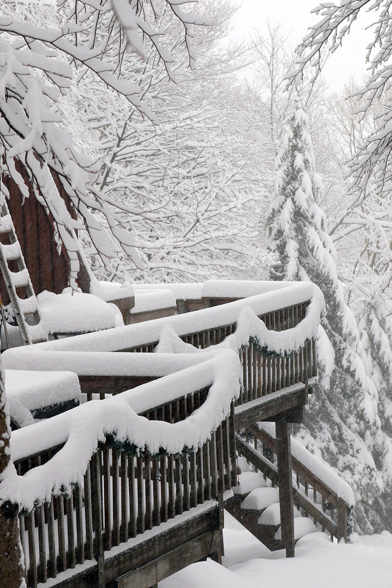
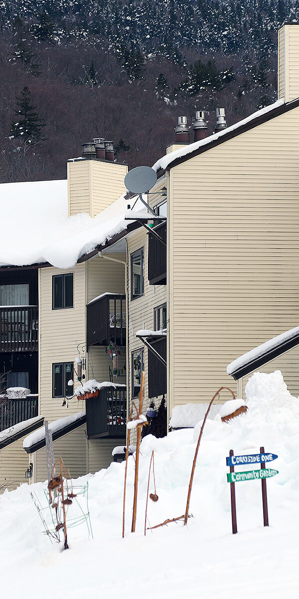
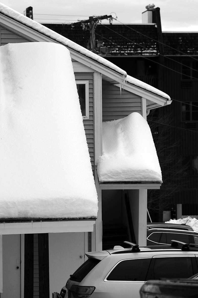
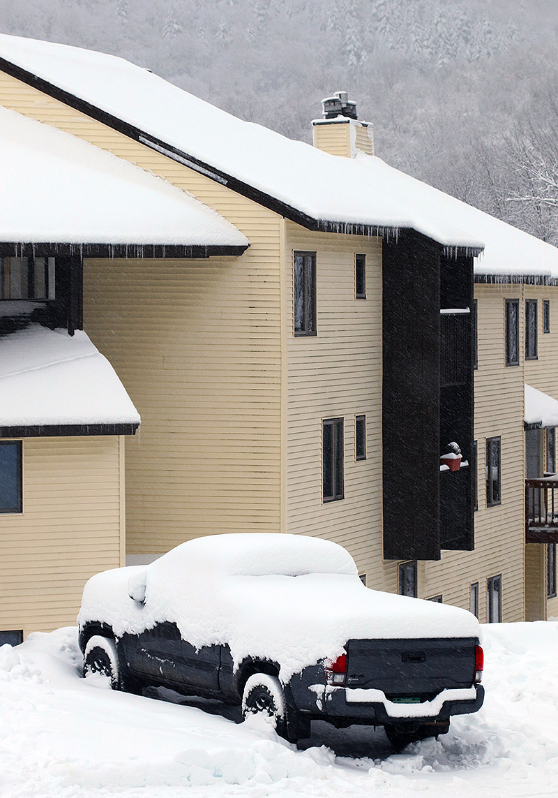
Snow has been piling up at the resort as displayed by some of the roofs in the Bolton Valley Village
The snow quality we encountered was fantastic, soft and carvable but not sticky at all, and there’s no ice anywhere to speak of because of the huge resurfacing we got from those recent storms. The resort has all of Wilderness open with zero grooming, so they’re just letting people have at it as nature intended. That means that there’s plenty of uneven terrain and occasional water bars to negotiate, but the snow quality is so good that it’s simple to deal with any obstacles you encounter.
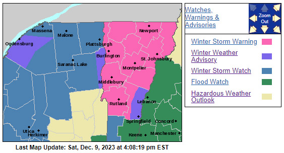
Dylan was up with a bunch of friends from UVM, so while we were waiting to meet up with them at the bottom of Wilderness, I walked around the Village a bit and grabbed some additional photos. It’s been a few days since the last storm, but there’s tons of snow all over the place up there that’s piled up and sticking to things. The snowpack is certainly in good shape for early December. We’ll soon see what this next storm does for the slopes – Winter Storm Warnings are already up as it approaches.
Winter Storm Warnings are already up in our area ahead of the next big wintry system that is expect to impact the area.
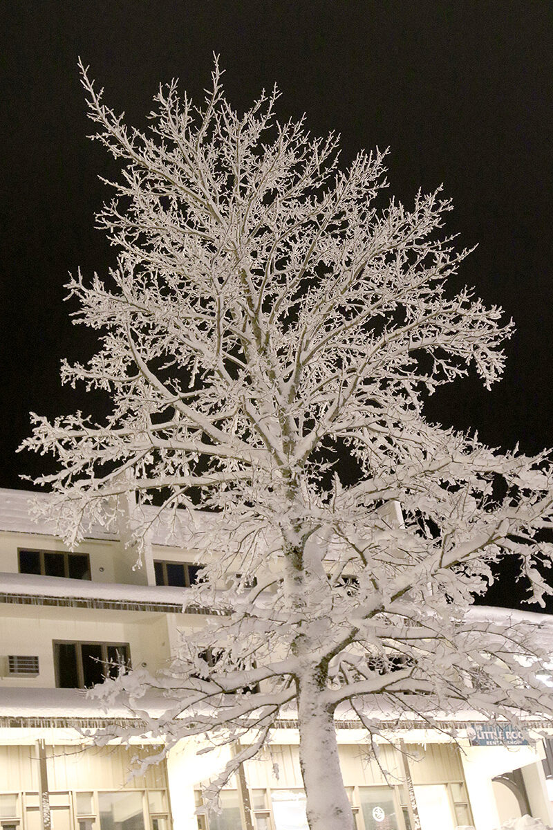
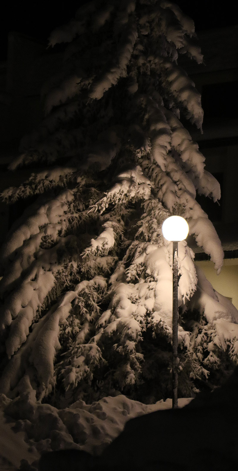
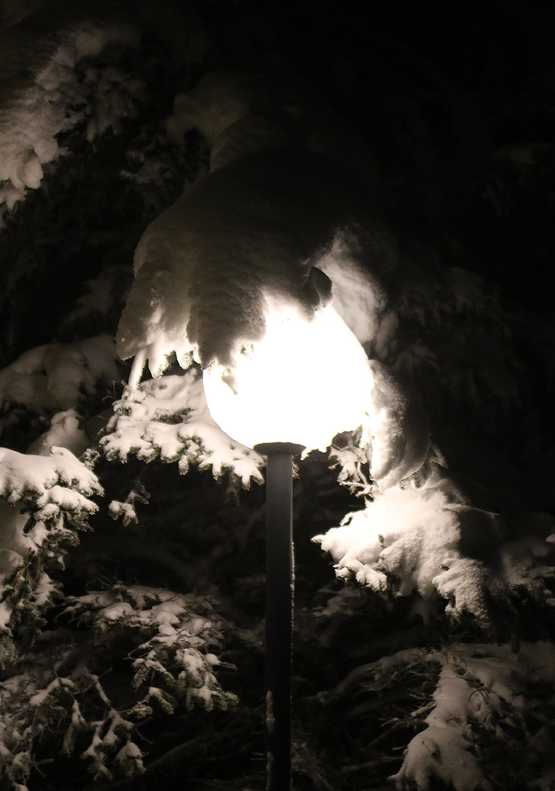
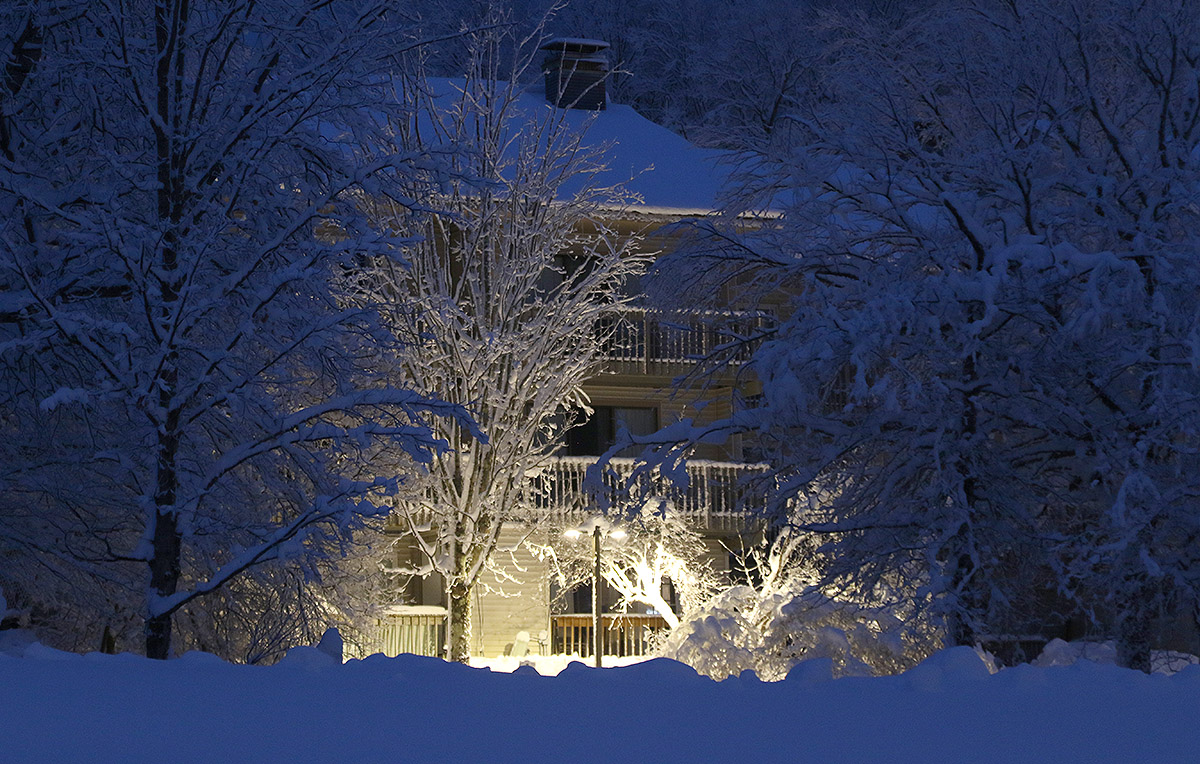
A light in the Bolton Valley Village reveals evergreens caked with snow from the most recent storm to hit the area. The Village was teeming with skiers this evening setting out for ski tours with their headlamps to enjoy the fantastic snow conditions
I was busy through most of the afternoon, but still wanted to get out to the mountain today to check on the additional snow that fell on the back side of our most recent system. As the temperatures dropped yesterday, the density of the snowfall fell to 10% H2O by the afternoon, and finally down into the 3-4% H2O range overnight. Bolton Valley was reporting another 5 inches of accumulation as of this morning, and that drier snow atop the substantial amounts of denser snow from the earlier part of the storm would likely set up some excellent turns.
Since I was starting my tour around dusk, I fired up my headlamp because I knew I’d need it on the descent. What amazed me this evening was the number of people who were out touring by headlamp as well. I knew that folks got out for Wilderness tours after dark because I’d sometimes see them on their way up when I’d be finishing a late descent, but I had no idea just how substantial the numbers were. During the course of my relatively short tour this evening I saw at least a couple dozen skiers out there for headlamp touring, and most of them were actually ascending or just starting out at the parking area. Indeed, the Village parking lot was teeming with skiers, more than I’ll typically even see for a morning session. I guess that part of local ski culture is clearly alive and well. And I can’t blame folks for getting after it this evening, it was dead calm with temperatures in the 20s F with new dry powder atop a substantial base. I can remember a couple decades ago when folks would need to set up these elaborate, heavy battery packs to run their powerful halogen lamps to have enough light for skiing at night, and that all seems pretty irrelevant now with modern LED headlamps. My little LED headlamp was more than powerful to enough to provide light for me to ski, even on its lowest setting. I did use the brightest setting on the descent since I figured I might as well, and it was potent.
In terms of the snow, with settling I generally found 2 to 4 inches of the new drier snow in the 2,000’ to 2,500’ elevation range. In some spots it was easier to distinguish the demarcation between this drier snow and the denser snow below as I probed around, but at higher elevations where even the base snow was drier, it became more and more difficult to separate the new snow from the old. In any event, the quality of the skiing took a nice notch upwards with the addition of the new powder. I’m sure the earlier snow dried out a bit as well, but with this new snow on top, turns were much silkier than yesterday, and lower angle terrain was much more in play and enjoyable since you were gliding through fluff instead of sinking into the denser stuff. There’s excellent midwinter skiing to be had out there right now in the Northern Greens, whether you go during the day… or at night.
A scene from up at Bolton Valley this evening – the lights of the Village were setting all the snowy trees aglow as people headed out for ski tours, or just for a walk in the evening scenery
Today on Fanny Hill at Bolton Valley – the snow just keeps falling, so we’ll keep making turns!
Of the 11 winter storms we’re recorded so far this season at our site in the Winooski Valley, 3 have delivered more than a half inch of liquid equivalent, and they’ve had a notable upward trend in L.E. The November 21st storm brought 0.72” of L.E., the November 26th storm brought 1.14” of L.E., and this most recent storm that began on December 3rd brought more than 1.40” of L.E., with snowfall continuing tonight. These storms have really helped to build the mountain snowpack, and the snow depth at the Mt. Mansfield Stake is now more than a foot above average.
The snow just continues to pile up in the Bolton Valley Village with these weekly larger systems and the smaller ones in between.
Bolton Valley was reporting another 14” of snow in 24 hours, and I popped up to the mountain this afternoon to check it out. Elevation has had quite an impact on the snow from this most recent storm, and the snow depth profile coming up out of the Winooski Valley is quite extreme. There’s really no snow at the base of the Bolton Valley Access Road aside from leftover piles, and it’s like that all the way up above 1,000’, and then the depth begins to ramp up. Here’s the snow depth profile I found on today’s ski tour:
Folks up in the Bolton Valley Village are constantly having to clear the snow with storm cycles frequently affecting the area in the past few weeks.
It was more challenging to get depth readings in those upper elevations since the pack is getting pretty deep and there are a lot of different layers with varying consistencies, but that general trend I’ve seen on the mountain recently of almost an inch of depth increase per 100’ of elevation gain seems to generally be holding. The depths I was getting at 3,000’ also seem generally in line with the current reading at the Mt. Mansfield Stake of 33” at 3,700’.
I arrived up in the Village in the early afternoon to a maelstrom of huge flakes coming down in association with the back side of the storm system, so the mountain continued to tack on more to the snow totals. Fat skis were unquestionably the play for today. The accumulations from this storm definitely came in denser than the previous one, and while fats were of course great for stability, they were also really nice for planing on lower angle slopes and getting additional turns out of that snow. Even though you were only sinking maybe 6 to 10 inches into the powder because of the density, it was still slow going if the slope angle got too low. Steep slopes indeed offered the best turns, and the base is so dense and deep that even on those pitches there’s not much to worry about in terms of coverage on the upper mountain.
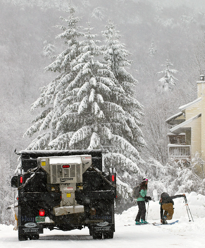
A pair of skiers gets ready for a ski tour as a snow plow works its way through the Bolton Valley Village trying to keep up with the continuing snowfall
Catching some turns on the Sprig O’ Pine trail at Bolton Valley this afternoon during heavy snowfall from our latest winter storm
Down here in the valley at 500’ our precipitation has generally been snow, but the temperatures have been marginal, so thus far we’ve had less than an inch of accumulation. It’s been a different story at elevation though. We’d been watching the Bolton Valley Base Area Webcam since this morning, and more often than not it’s shown moderate to heavy snowfall with some big fat flakes. Even from the webcam you could tell it was accumulating, so I waited until the afternoon to let some of new snow build up, then I headed up to the mountain for some runs.
Coverage has mostly melted back at the base of the Bolton Valley Access Road at 340’, and the precipitation there was a mix of rain and wet snow, but cars coming down from the resort had at least a couple inches of fresh snow on them. As I ascended, somewhere in the 1,000’ to 1,500’ range, the precipitation instantly flipped to 100% snow, and you could tell that you’d hit a critical temperature threshold. Up in the Village at 2,000’ it was pounding big flakes. There were visibility issues just like yesterday, but while yesterday was due to thick low clouds and fog, today it was due to the snowfall.
A view of the main base lodge at Bolton Valley – heavy snowfall greeted me as I arrived up in the Bolton Valley Village for some afternoon skiing.
Like yesterday, I skied again off the Mid Mountain Chair, and you could tell that the base snow had stiffened up where it had been groomed, at least up around 2,500’. From about 2,200’ and below, there was a notably softer base. At those higher elevations where the base was starting to tighten up, the new snow was definitely helping to take the edge off, but with on piste skier traffic, the fresh snow had been pushed around a lot, and you had to move off the groomed terrain to really take the best advantage of the new snow. In areas that hadn’t been groomed, there was no demarcation between the new snow and more recent layers below it, and my off piste adventures generally yielded turns in 12-14” of powder. The powder did get a bit denser as you dropped in elevation, but it was still quite manageable. I was on mid-fats and never even felt the need to switch to alpine turns; the snow was dry and consistent enough that Telemark turns were still comfortable all the way.
Heavy snowfall continued up at Bolton today throughout the afternoon while I was out on the mountain
The freezing level was slowly dropping in elevation while I was out on the mountain, and by my last run it was only right down at base elevations where the groomed base still had that initial softness I’d encountered. Driving down the access road at closing time was a bit hairy with the pounding snow and fresh accumulations. The road accumulations finally started to abate around 1,500’, and road surfaces switched to just wet below that. The snowfall rate was easily an inch an hour at times, and even thought it occasionally slowed down for periods earlier in the afternoon, it looks like it averaged around that inch per hour mark because the resort was reporting 4 inches of new snow as of 4:00 P.M. closing. If the snowfall keeps up for a while this evening like it did this afternoon, they’ll have another great shot of snow to cover up the slopes by the morning.
E glides through some of the soft snow that met us up at Bolton today, with temperatures in the 30s F and low clouds for very December feel
With temperatures in the 30s F today, I was unsure if snow surfaces up at the mountain were going to soften. Dylan was up at Bolton Valley with some friends though, and when we texted him for an update, he said that indeed the snow had softened up. With that news, E and I headed up for a few runs this afternoon. Visibility was near zero on the mountain with low clouds and fog, but it did give the mountain that low light solstice/holiday feel.
Indeed the snow surfaces were great. We’d waxed our skis pretty thoroughly just in case, but we didn’t encounter any areas of sticky snow, it was just buttery smooth spring-style snow that you could really sink an edge into. I’m not sure if the snow was stiffer up high, but we were just lapping the Mid Mountain Chair, and everything on the lower mountain was great. The Wilderness Lift was also open today, so the natural snow terrain that they’ve opened is still in decent shape. Those surfaces that have softened will of course tighten up when temperatures drop back below freezing, but hopefully the storm coming in to the area tomorrow will do a decent job of covering up the current base. There certainly seems to be the potential for a decent resurfacing of the slopes with an inch or so of liquid equivalent in the forecast.
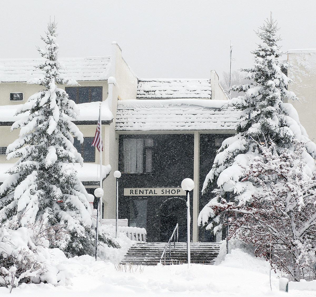
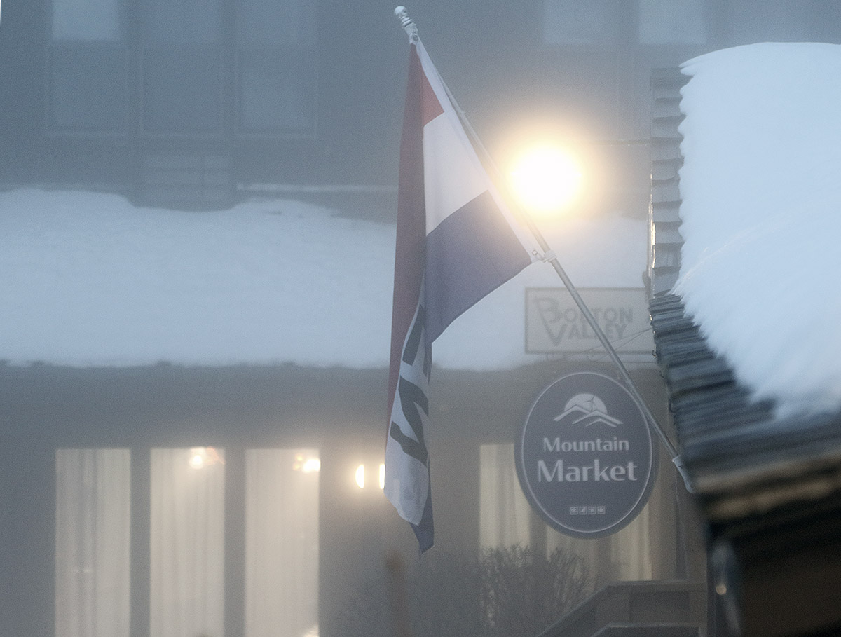
Some low clouds and a December feel by the Mountain Market in the Bolton Valley Village


