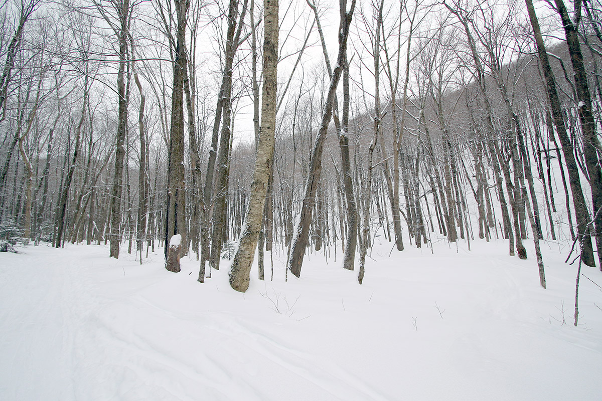
Some of today’s snowfall as I enjoy the views on my trip through the Nebraska Valley up to the Catamount Trail
With the strong snowpack in the area now, I decided to head out to the Nebraska Valley for some ski touring today. The last time I toured in the Nebraska Valley I was on the valley’s north side, but I’ve now heard from multiple students of mine that the south side of the valley offers some great skiing off the Catamount Trail. I didn’t have too much information beyond the fact that you can just use the Catamount Trail as a collector for the ski terrain in the area, but it sounded pretty straightforward, fun, and convenient.
I was able to park right at the Catamount Trail parking area on the south side of Nebraska Valley Road, so the trail access was very easy. It had started snowing around midday, and there was steady snowfall through much of my tour in the afternoon. Following the Catamount Trail southward, the options for great backcountry skiing are indeed very obvious. From the trailhead at an elevation of ~1,000’, the trail rises at a moderate grade for about 400 feet of vertical over the course of perhaps ¾ of a mile, and then the terrain flattens out into a relatively broad valley with the main drainage on your left, and steep slopes rising up to your right. The slopes consist of very open hardwood forest throughout, with tree spacing in many areas as much as 20 or 30 feet. I couldn’t see all the way to the top of the terrain, but there must be hundreds of acres there with very obvious ski lines, and the fact that there were tracks coming down out of this terrain suggested that it held good potential. At around a mile from the trailhead I came to the first obvious skin track that headed up off the Catamount Trail into these slopes, so using that was a clear option for some great runs.
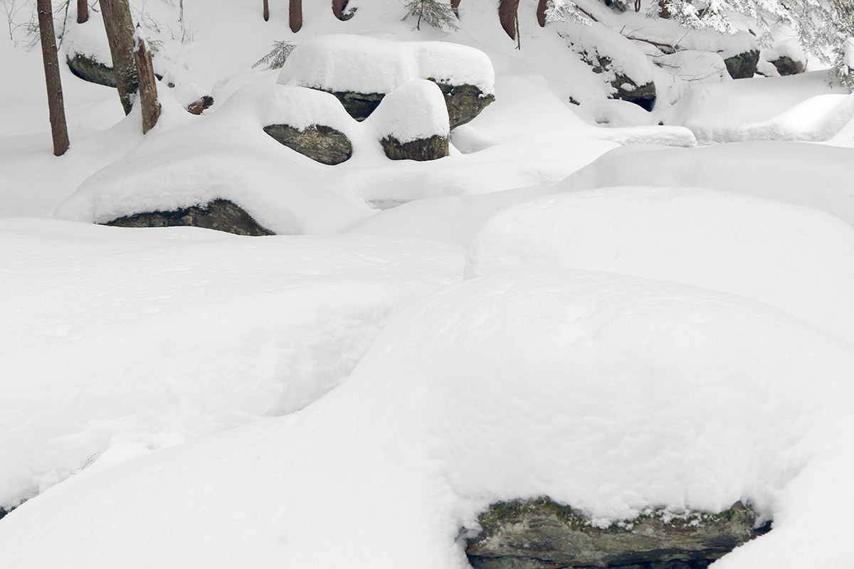
I was able to enjoy gorgeous midwinter views of the ice and snow on the local tributary of Miller Brook as I made my way up the Catamount Trail.
I just happened to run into one of my students descending on the Catamount Trail as he and his group were finishing up their session for the day, and he said that if I had the time, I should head higher up because the snow was better. Being my first time in the area, I did want to take a long enough tour to get the lay of the land, so I continued another mile or so and toured up to around 2,500’. The snow was indeed even better higher up, but the tree lines weren’t as open as the beautiful looking terrain I’d seen lower down. That higher elevation terrain was plenty steep, and certainly offered decent skiing, but I’d say those initial slopes rising from the valley at around 1,500’ are the best bang for your buck as long as the snowpack and snow quality are good at those elevations.
It was snowing quite hard up at 2,500’ when I began my descent, hard enough that I would have been worried about being out there in such weather if I didn’t know the forecast wasn’t calling for sustained accumulations. The snow had added another couple of inches to top off the snowpack, which certainly helped make the powder even a bit fresher. Temperatures had been cold much of the afternoon, but on my descent I quickly realized that the freezing level had risen. I descended out of the heavy snowfall down into mixed precipitation by ~1,500’, and just sprinklings of rain down at the trailhead elevations of ~1,000’. I was glad that I’d finished my tour by that point because the lower elevation snow was definitely getting sticky and more difficult to ski.
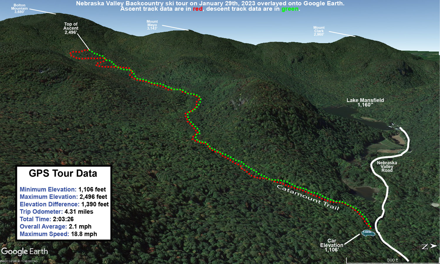
A Google Earth map with GPS tracking data of today’s backcountry ski tour along the Catamount Trail in the Nebraska Valley
The glades on Dewey Mountain held some fantastic Champlain Powder today.
I’m sure there are many interesting stories that begin in a dark room, but in this case, the story begins in a darkroom. It was early June of 2010, and I was in the Pharmacology darkroom on the third floor of UVM’s Given Building. It must have been a popular day for western blotting, because I was in there with another guy as we both queued up some films for the developer. I can’t recall his name, but I think he knew I was a skier, and as he was as well, the conversation almost inevitably migrated in that direction. As backcountry skiing was discussed, he told me that I should check out the west face of Dewey Mountain sometime – he said you just drive up to the top of the road, put on your skins, and go up. It all sounded pretty straightforward from what I could tell. Being well entrenched in the warm season at that point, there was of course no way I was going to run off and check it out anytime soon, but I made a mental note and figured I’d check it out at some point in the future when the time was right. As one might expect, things happened to align, and that time was today.
“I was thankful to be able to use the track, because that powder was indeed deep – my checks were giving me measurements of 20-24″ of fluff.”
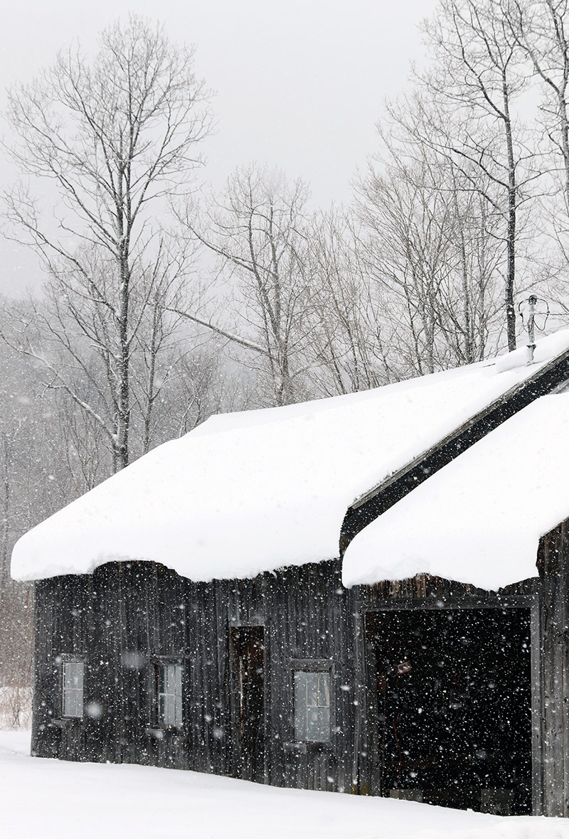
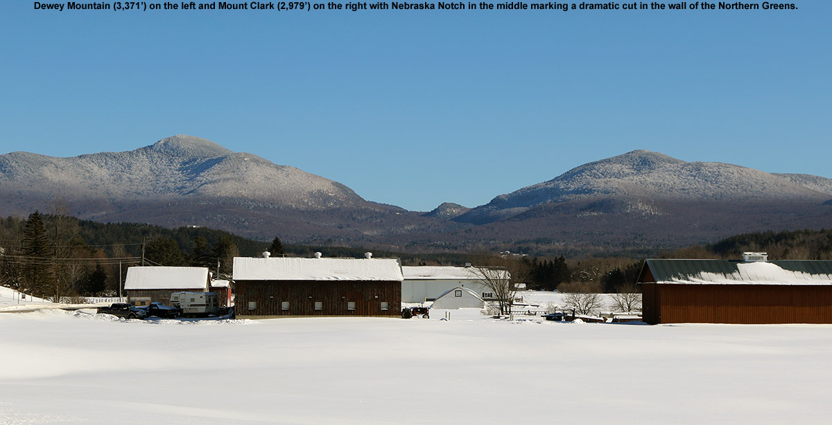
Our most recent snowfall in the Northern Greens came yesterday from Winter Storm Kari; it wasn’t an especially big storm up here, but much of the Champlain Valley picked up a half a foot of snow, and the west side resorts like Bolton Valley and Smuggler’s Notch received more than a foot. While yesterday’s temperatures were quite pleasant (and the skiing fantastic from what I hear), the storm pulled down more arctic air and was back into highs in the single digits F for the weekend. Combined with wind, temperatures would be well down into the negative numbers, and E and the boys had no interest in going out in that. I didn’t really feel like riding the lifts in those temperatures either, so another backcountry day was calling. I’d been a bit leery to head to the western slopes with the way they were lagging in snowpack earlier in the season, but with the way they cleaned up in this most recent storm, it seemed like the time had come. I had enough time to head out toward Underhill, so I figured I’d finally head to the top of the road and see what Dewey Mountain had to offer for snow and terrain.
“The best way to describe what’s up there is simply “steep and deep” terrain.”
It turns out that “the road” that you head to the top of, is Stevensville Road coming out of Underhill Center. There’s a fairly large parking area there, and I’d actually just visited it this past fall when Mark and I did a shuttle hike up to the ridge line of Mt. Mansfield and down to Underhill State Park. I’d never been there in the winter though, and it was an interesting drive. Even though this past storm wasn’t a big one, as I got into the upper elevations of Stevensville Road, I could see that they had a ton of snow, and it looked like a mini fluff bomb had gone off in the area. Delicate upslopeChamplain Powder™ snow was piled on everything. The prospects for some powder skiing were looking very good.
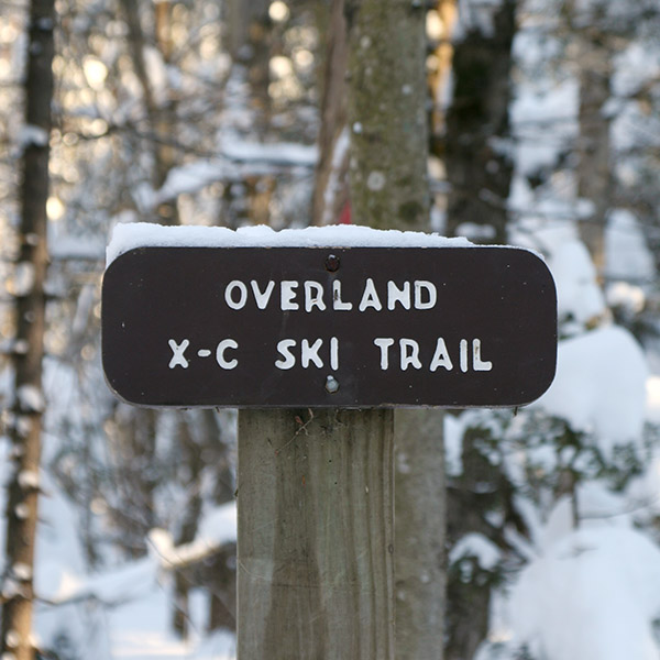
There were about a half dozen cars in the parking area as I geared up and hopped onto the skin track at the east end. It was really more than a skin track; there had been enough use that the trail was essentially packed. It reminded me of a narrower version of the Bryant Trail at Bolton Valley. It wasn’t long before I came to a junction that gave me the option to follow either the Overland X-C Ski Trail or the Nebraska Notch Trail. My initial assessment of the area on Google Earth had me planning on the Overland side, and with the vast preponderance of skin traffic heading in that direction, it sealed the deal. I did a few checks on the depth of the surface snow as I continued onward, and was getting measurements in the 15-16″ range. Even down in that 1,400′ to 1,500′ elevation range, the area had clearly been reeling in some good snows as of late.
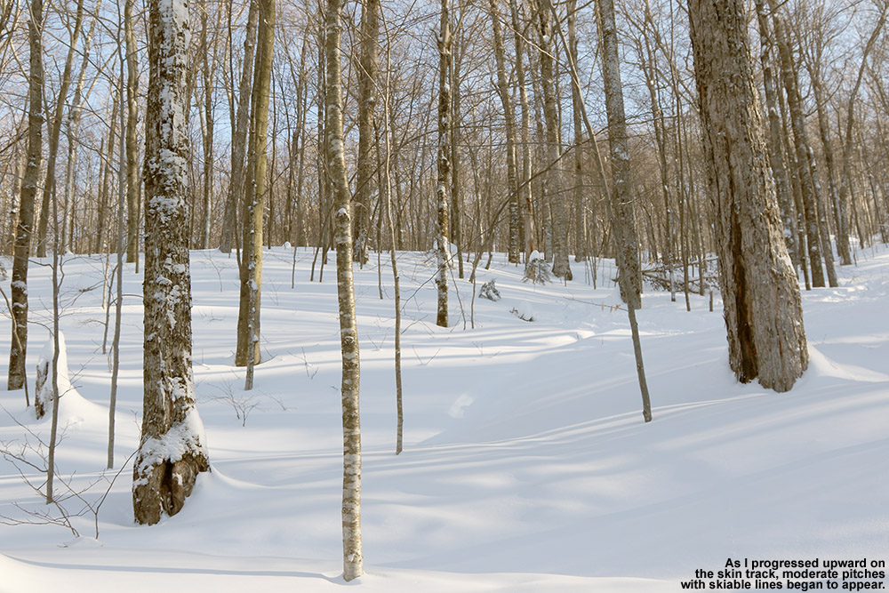
Catching views of skiable lines along the skin track accessed by the Overland Trail
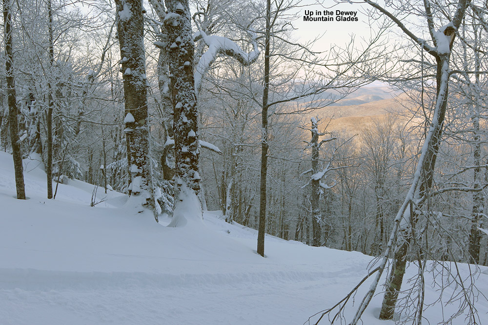
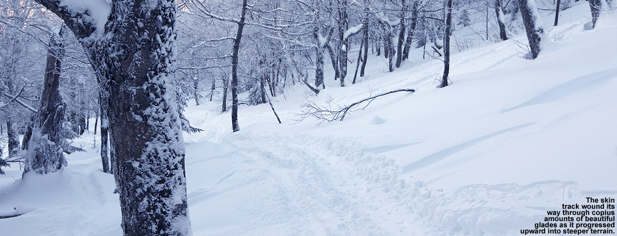
After about a half mile, the blazed Overland Trail seemed to head off to the north across the local streambed, but I stayed on straight ahead following the majority of the skin traffic. The skin track meandered upward through hardwoods, and I could see that people descending in the area would sometimes head off to the sides of the trail and ski the surrounding powdery terrain. The skin track began to steepen, and at some point above the 2,000′ mark I began to get into more obvious glades. Based on the distribution of mature trees vs. hobblebush and striped maple saplings, it looked like the area had seen some pruning at some point in the past. The skin track steepened further, and very obvious ski lines through glades with mature trees became more apparent. I caught sight of a couple of women who were ascending the skin track ahead of me, and eventually caught up to them at an elevation of around 2,700′ as they were switching over for a descent. We were just hitting the evergreen line, and I could see why they would start a descent there, but as I could also see a good number of ski tracks coming down from the evergreens above, I decided to push on a bit farther. We exchanged greetings as I prepared to step up above the skin track to get around them, but they happily moved when they saw just how hard it was to step into the powder and go around the track. I was thankful to be able to use the track, because that powder was indeed deep – my checks were giving me measurements of 20-24″ of fluff. I continued on up into the evergreens for about another hundred vertical feet, following a mish mash of skin tracks and possibly descent tracks, until I found a nice spot to stop that looked like it would give me a good start to a run.
Beautiful glades along one of the skin tracks on the west face of Dewey Mountain
I actually had a nice sheltered spot among some evergreens; it would have kept me well out of the wind, but I really hadn’t experienced any during the trip anyway. I poured some soup from my thermos to let it cool in the snow, and began the gear switch for the descent. It was definitely one of those “one skin at a time” types of transitions, as the powder was so light, fluffy, and deep, that it would be a hassle getting out of my skis entirely. I’m sure the temperature was somewhere below zero up there, and I made the switch to my heavier gear quickly before I began to cool down post-ascent. I had my soup, gathered my gear, and got set to push through the evergreens to look for a line.
“…it’s not the sort of terrain that would be great without sufficient snow – you’d be bottoming out all over the place.”
A little traversing through the evergreens was all it took, and I was into skiable terrain. The best way to describe what’s up there is simply “steep and deep” terrain. It’s indeed steep, probably 25 degrees or so, and you really want the deep because it’s not the sort of terrain that would be great without sufficient snow – you’d be bottoming out all over the place. Fortunately, that’s not the case with the current snowpack. The roughly two feet of powder up there provided plenty of cushion, as well as resistance. There’s plenty of spacing in the hardwoods, and you can open up the turns; even slower Telemark turns were comfortable thanks to the tree spacing and depth of the surface snow. Well, some credit in that department is definitely due to fat, rockered skis as well. Also, any concerns about west side base depths was pretty much erased on this outing – if there were no concerns on that really steep terrain, it’s not an issue. The steep terrain goes on for several hundred vertical feet before it starts to become more moderate. I hung to the left and continued downward, eventually finding a popular catch track that actually headed up a short incline and off to the skier’s left away from the area of the skin track. I suspected that this would work in some additional lines down to the skin track, but available daylight and air temperature suggested that it would be best to save that exploration for another time. I headed down through the various trees around the area of the skin track, and there were plenty of additional turns to be made. Eventually as the pitch of the terrain became shallower, the Overland Trail itself was the most practical route, with just occasional forays off into the powder as speed allowed.
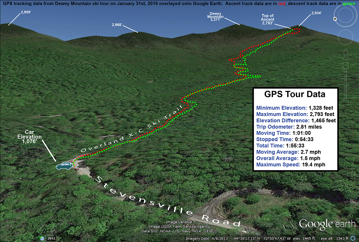
A Google Earth map showing GPS tracking data from today’s backcountry ski tour on Dewey Mountain
One nice aspect about the current snow conditions up there is that they allowed for good skiing in both the steep terrain, as well as the more moderate terrain below – the depth of the powder decreased pretty well in concert with the terrain’s pitch. One could easily ski just some of the lower sections of terrain if the depth of powder didn’t suit the steep shots. In any event, thanks to the quality and depth of the snow, it was some pretty fantastic skiing for an exploration that started in a darkroom. I guess there might have been some nice symmetry to the report if I finished my run as darkness approached, but with these temperatures it’s not wise to push your luck being out there too late.
Gliding through some backcountry powder in the Nebraska Valley area today
The weather yesterday was very comfortable, with highs in the local mountains around 30 F at ski resort base elevations. Today was a different story though; mountain temperatures were expected to start in the single digits and drop in the afternoon to produce wind chills well below zero. With that forecast looming, E and Claire decided to cancel today’s BJAMS ski program at Stowe to avoid any frostbite issues with the students. The program can make up the session later in the spring anyway, hopefully on a nice warm day.
“The ski lines were obvious and everywhere, there’s no hunting around necessary if you’re looking for some moderate angle powder to ski.”
With the chilly forecast and some extra time in the afternoon, I decided to head out for a backcountry ski tour in the Nebraska Notch area. Some of the higher elevations of the Northern Greens did pick up as much as 4 to 6 inches of snow overnight, so that added a little extra incentive to get out and see how conditions were faring. I’ve wanted to do an exploratory tour near Nebraska Notch for a while, and I’m familiar with the tour highlighted in David Goodman’s book that starts on the west side of the notch. I’d been through some of that area this past summer when our family was on a backpacking trip with the Handler’s, so I thought that something on the east side would be a fun alternative. From Jacquie, I’d heard about the backcountry skiing potential above the overnight parking area near the Lake Mansfield Trout Club, so I decided I’d give that a shot. It’s a quick trip from our house in Waterbury, and I’d be able to take care of some necessary grocery shopping on the way home as well.
“I’m not sure how deep the base was, but surface powder was 13-14″ in the trees just above the parking area (~1,100′), and pushing two feet up high depending on prior wind and sun exposure in underlying layers.”
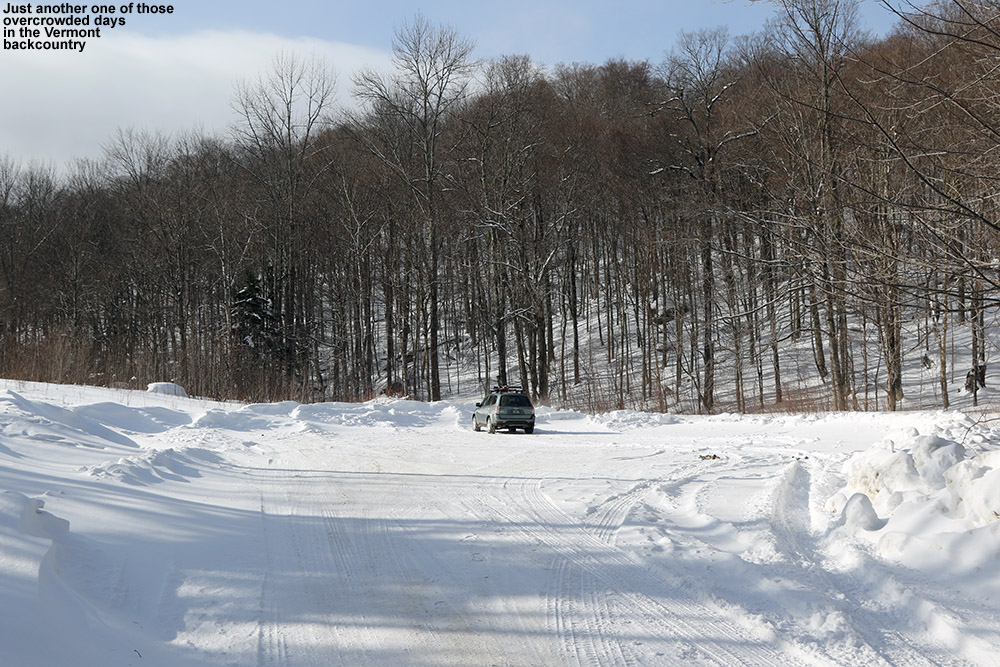
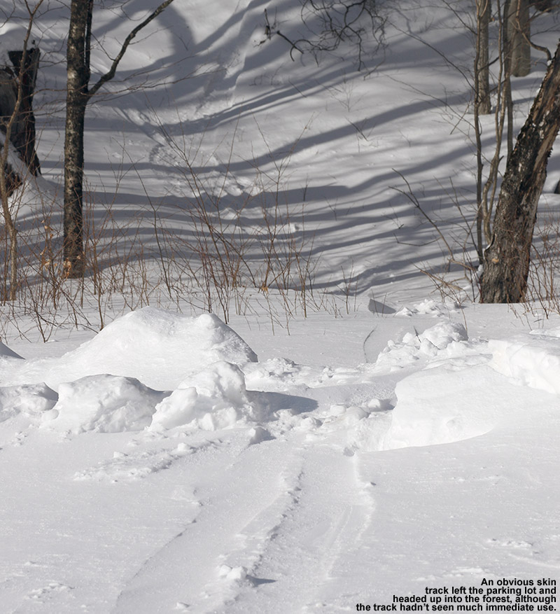
Heading up Nebraska Valley Road, I noticed that as I approached the 1,000′ elevation mark, the snowpack really took a jump. It went from the 8-12″ that we’ve currently got in many of the lower mountain valleys of the Northern Greens to something more, and you could really see how the higher elevations of the Nebraska Valley were holding the snow. I pulled into the lot for overnight recreational parking, and it was empty. There was probably space for 20 cars, but mine was it. I guess it’s just another one of those harbingers of the overuse and overcrowding associated with skiing in the Vermont backcountry. In any event, I could see an obvious, although apparently lightly used skin track off to the right heading up into the forest. More importantly, I could see the associated ski terrain looming right above me; well-spaced hardwoods appeared to fill the entire slope, and you could immediately see that there was some great skiing right down to the parking area.
An old skin track from the parking area marked an obvious route of ascent.
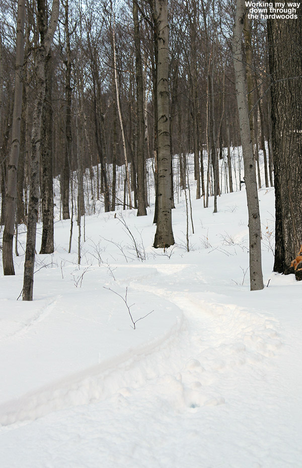
The skin track ascended through the hardwoods on what appeared to be an old logging road, and it sliced right through an impressive chunk of ski terrain. The ski lines were obvious and everywhere, there’s no hunting around necessary if you’re looking for some moderate-angle powder to ski. After looking at the area on Google Earth this morning, I’d decided to explore a drainage off to the northwest of the parking area, and conveniently that’s just where the logging road and skin track headed. After a few hundred feet of ascent I could see that there were a number of ski options, but three main ones were very evident: You could ski the logging road itself, which was relatively narrow and contained the skin track, but would serve up some decent turns. Much more expansive options were to either contour off to the east and make turns in the vast face of terrain containing the hardwoods, or head westward and ski steep gullies down into the drainage. I had plenty of time to survey the topography and decide on descent routes as I continued up the skin track; it’s set at a very nice, consistent pitch with none of these steep spots that might promote slipping.
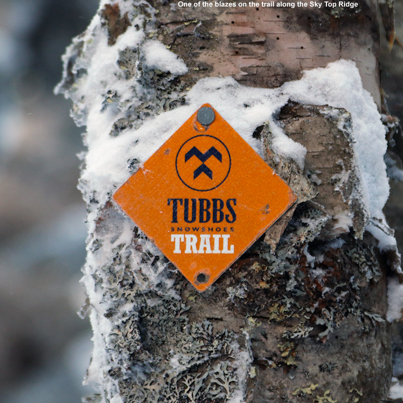
At around 2,100′, evergreens began to mix in with the hardwoods, and the logging road gradually gave way to a skin track that worked its way more tightly through the forest and ascended small streambeds. By 2,500′ I was into exclusively evergreens, and the available snow was getting deeper. I’m not sure how deep the base was, but surface powder was 13-14″ in the trees just above the parking area (~1,100′), and pushing two feet up high depending on prior wind and sun exposure in underlying layers. I hit the ridge line (Sky Top Ridge east of Dewey Mountain) at an elevation of roughly 2,800′, and headed off to the east on the ridge line trail. Appropriately, the trail on the ridge is known as the Skytop Trail, and David Goodman’s Backcountry Skiing Adventures: Vermont & New York book has a specific chapter on touring there. I found it marked with red blazes, but I also noticed a “Tubbs Snowshoe Trail” sign as well. I continued on the Skytop Trail for another few minutes until I hit a local high point where I decided to halt my ascent.
“Some exploring would have been fun, but with the time of day, cold temperatures, and being solo, there really wasn’t much margin for messing around.”
Up there on the ridge it was cold, noticeably colder than the 10 F at the parking area. I was out of the wind, but it wasn’t a temperature to hang around in. I poured some soup and let it cool a bit while I changed over for the descent. My plan was to head back down in the area of the skin track for that first chunk of the descent, since I hadn’t come across any obvious lines in other areas. Some exploring would have been fun, but with the time of day, cold temperatures, and being solo, there really wasn’t much margin for messing around. During the ascent I’d seen that there were plenty of steep, ledgy areas above the open hardwoods. Those ledges and some dense evergreens lay right below me, and from what I’d seen it would be very easy to get cliffed out up there. Any exploration of that terrain will have to wait for another time.
“Being south-facing, it’s not the kind of terrain that one would want to ski on sunny days when temperatures are getting marginal, but on a midwinter day like today, the snow was great.”
The descent up high along the general area of the skin track was very nice – the powder was deep and there were occasional options of ski lines that cut corners or veered away temporarily from the track. When I was back into the open areas of hardwoods, I cut left of the track following a previous skier’s lead, and traversed out into the face of terrain that sat well above the parking area. It was classic Vermont hardwood ski terrain; there weren’t any obvious maintained lines, but you didn’t need them. It was pretty much see it and ski it. The powder was a little shallower on some pitches, no doubt a function of that fact that the terrain faces south and can get plenty of sun due to the leafless deciduous trees. Being south-facing, it’s not the kind of terrain that one would want to ski on sunny days when temperatures are getting marginal, but on a midwinter day like today, the snow was great. I eventually ran into the skin track again, and cut to the other side as I saw some attractive ski lines heading in that direction. I finally had to do a short traverse to get back to the last pitch above the parking area, but with the open nature of the forest, navigation was pretty easy.
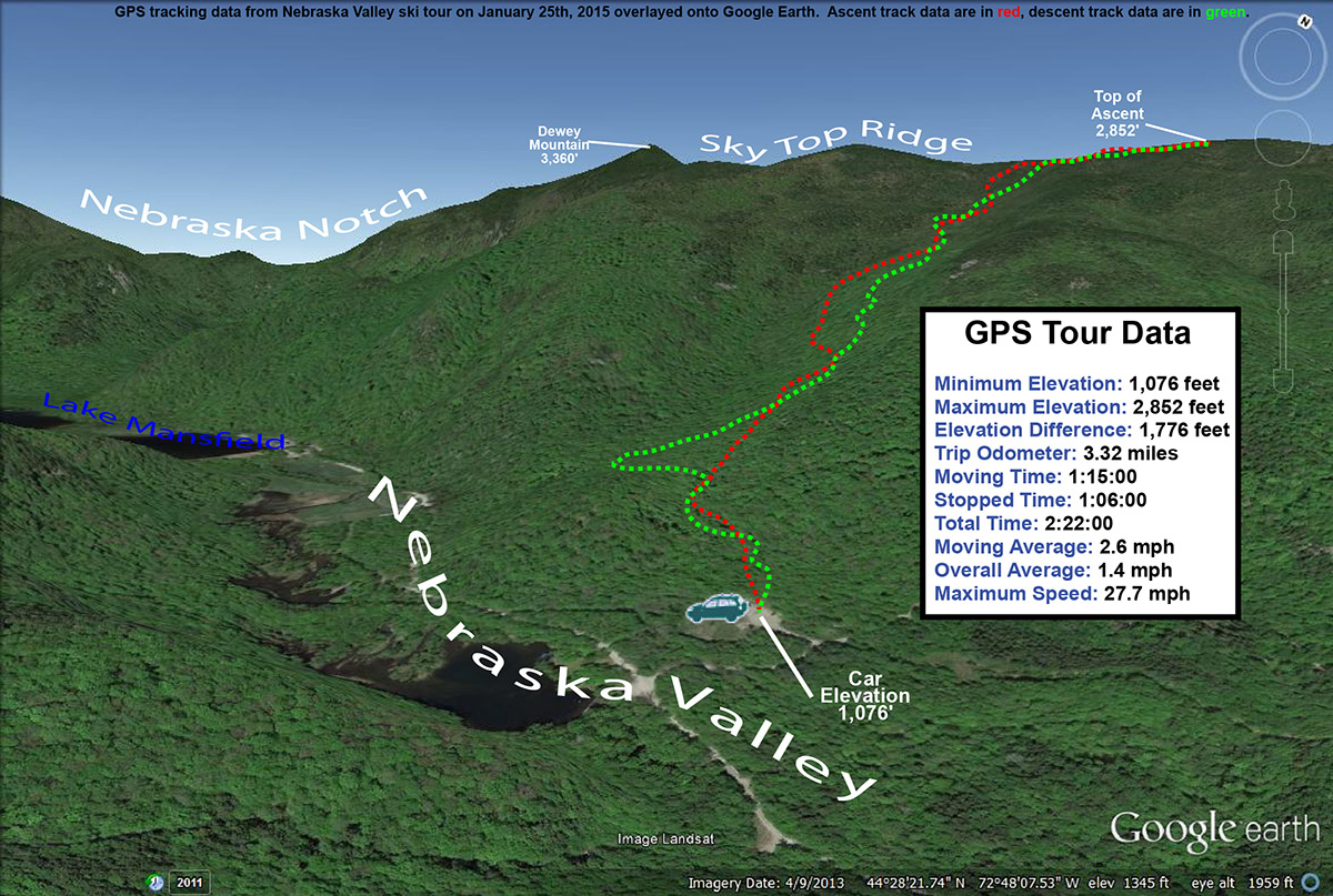
The GPS tracking data of today’s backcountry ski tour in the Nebraska Valley of Vermont plotted on Google Earth
I’d say today was a great first visit to the area; those hardwoods are exceedingly skiable, with the main downside being that it’s south-facing, so the quality of the snow needs to be watched with respect to recent weather trends. The snowpack isn’t even especially deep right now, and I only encountered the occasional underlying obstacle to contend with. As usual, if you throw another couple feet of base down, more and more lines will simply open up and get even cleaner as additional saplings and other trees get buried. On that note, there’s another winter storm (Juno) coming into the area over the next couple of days – it sounds like the bull’s-eye areas are down to the south, but it’s expected to give us a moderate shot of synoptic snow up here as well, which should further improve base depths.


