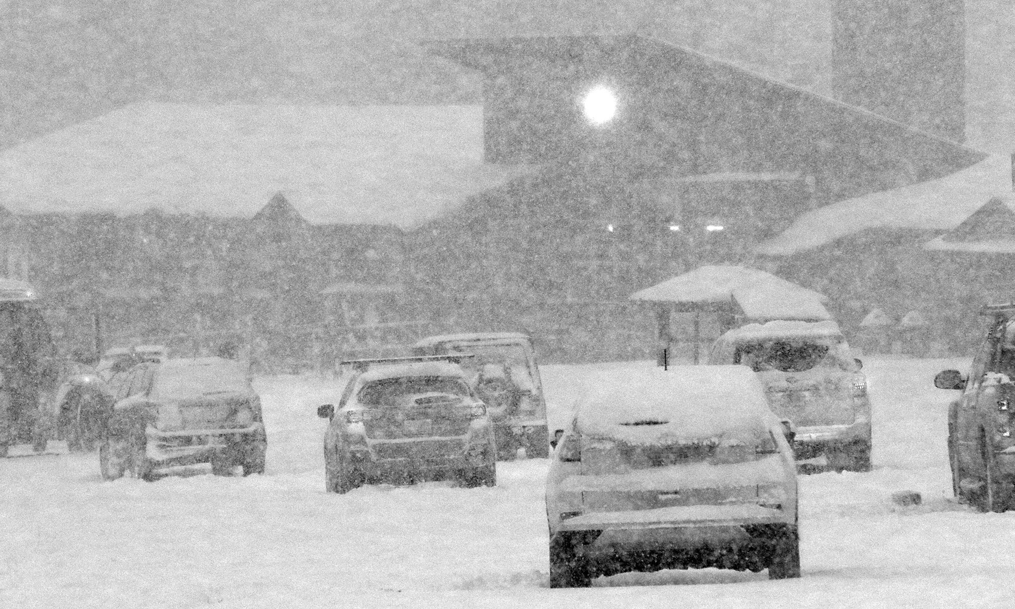
Ty was free this morning and joined me for some ski touring in the fresh powder up at Bolton Valley.
The mountain snowpack that had been building up over the first half of the month melted back somewhat in the middle elevations at the end of last week, but this latest winter storm seemed to have the potential to replenish it. As of this morning, we’d picked up roughly 4 inches of new snow composed of 0.6 inches of liquid at the house, so the local mountains should have added enough new snow to set the table for more low-angle touring in the powder. Bolton Valley was reporting 3 to 4 inches of new snow overnight, and 5 inches in the past 48 hours. Assuming a similar density of snow to what fell at our house, plus whatever snow was in place before, it definitely felt like it was worth a visit. I didn’t expect the snow quality to be outstanding enough to suggest that E or the boys should join me, so I expected it to be a solo tour. As I was about halfway through preparing my gear, Ty woke up and let me know that he was actually interested in getting in some turns before work, so that meant I’d have some company!
Some of today’s snow sliding off the windshield of a car as temperatures warm in the Bolton Valley Village
In the Winooski Valley at the base of the Bolton Valley Access Road, we found 1 to 2 inches of new snow from this most recent storm, and up in the Village, total depths were 4 to 5 inches. Temperatures this morning were around the freezing mark, with a mix of wintry precipitation types as we set out on our tour. We found that snow depths increased a bit with elevation, hitting 5 to 6 inches around 2,500’ and 6 to 7 inches where we topped out around 2,700’.
The powder skiing was decent, with snow that was relatively dense but not sloppy or soggy on the upper half of our tour. The density did increase a bit more as we descended back toward the base around 2,000’, but the snow still hadn’t progressed to that spring-style sticky stuff. I had freshly waxed up my skis in the morning, and that did appear to help give me an slightly easier time than Ty, who hadn’t waxed.
Folks had clearly been out having fun with all the new snow in the Bolton Valley Village
While today’s powder was decent, the snow I found while out ski touring last week was definitely superior. I think that last week there was a touch more base, the snow overall was a bit deeper, and most importantly, the snow was notably drier. All those factors came together to set that skiing above the quality of what we found out there today. This dense snow that we just received does have the water content to set up a more substantial base though, and it’s really going to be great with some additional rounds of snow on top. The models do suggest that there are some events in the pipeline over the next week, so we’ll see what the mountains get from those.
A view of the natural snow conditions at about 2,500′ on Lower Turnpike today.
Sometimes Mother Nature just lets you know that it’s time to get out to ski, and apparently today was one of those days. I was just about the head down to the basement for another pre-season leg workout… but somehow my head transitioned to thinking that we might just have hit that threshold where it was time to actually get out and ski. Perhaps it was time to move on from pre-season to… season. I’m sure it was partly due to the flakes that were falling just outside the window, but Powderfreak’s winter vibe Stowe pictures from Saturday definitely played a role in getting me motivated. We’ve had numerous rounds of snow thus far over the first half of November, and if Powderfreak’s photos were what the slopes looked like before this most recent storm, there had to be enough out there at this point for some low-angle turns.
The cloud ceiling seemed to be around 1,500’ to 2,000’ this morning, so I really couldn’t get a good view of the snow coverage up at Bolton Valley via their Main Base Webcam. What I could see on the cam was that everything was white… extremely white. The snow coverage looked great, but the clouds were just too thick to get a good sense for what the snow depths were like beyond the areas where they’ve made a bunch of snow. This latest system did just drop another round of accumulation though, even down to the lower valleys, and the natural snow from all the storms we’ve had in the first half of the month has not been melting back in the higher elevations.
Even without a real-time view, it felt like the snow from this latest storm should have pushed the snowpack to the point where it was ready for some touring on low-angle slopes, so I decided to pop up to the mountain this morning on my way to Burlington. With this latest storm, the snow never really seemed to accumulate much to the west of our area in the lower elevations, so there were only a few traces of snow in Bolton Flats and at the base of the Bolton Valley Access Road. Accumulations gradually increased as I headed up in elevation though, and here’s a rough summary of the snow depth profile I encountered this morning:
340’: T
1,000’: T-1”
1,200’: T-2”
1,500’: 1-2”
2,000’: 2-3”
2,250’: 3-5”
2,500’: 4-6”
A truck in one of the Village parking lots displays a bit of the snow that fell from this recent November storm
As the summary shows, the depths increased slowly at first, and it wasn’t until somewhere in the 1,200’ to 1,500’ elevation range where snow coverage became continuous. Assessing the depths in the Bolton Valley Village parking lots at around 2,000’, I wasn’t initially sure if I was going to end up ski touring or just going for a hike, but I threw my skis on my pack because it looked like touring would be good to go as long as the base snow was substantial enough. Snow depths increased notably above the 2,000’ mark, and a few minutes into my ascent, it was obvious that I was going to be able to ski on the descent. I had my climbing skins in my pack, but never put them on my skis because the hiking was easy enough, certainly easy enough that I didn’t want to add the extra transition time that putting on the skins would throw into the tour. If one does want to skin on the ascent though, there’s plenty of base to do it.
Indeed it’s the sufficient base snow that sealed the deal in terms of the skiing. Below these recent couple of inches, there’s a good amount of consolidated snow at varying degrees of depth. I only had time to tour up to about 2,500’, but the depths did look like they were continuing to improve above that point. It’s best to seek out low-angle, nicely maintained, grassy terrain at this point, but with that, you’re good to go for some very nice powder turns. I saw a couple of older ski tracks on my tour, but nothing from this morning, and that was helpful – untouched snow provided the very best powder turns, so staying away from any footprints or other snow traffic is the best bet. In the untouched snow, turns were bottomless, and I was only on 86 mm skis. The top half of my tour definitely offered the deepest snow and most ability to play around in the powder, but it was still decent all the way back down to the main base around 2,000’. In the lower couple hundred feet of vertical though, you just had to be more selective in sticking to the untouched snow for the smoothest turns. Rock skis or regular skis are both options if you know the terrain you’re going to be on. I didn’t have rock skis, but only made a hard touch or two to objects below the subsurface. Touching below the subsurface is pretty inconsequential on grassy, low-angle terrain, and thankfully, Bolton’s Wilderness area has plenty of those types of slopes.
While we haven’t had any huge winter storms yet this season, all throughout the mountains and mountain valleys there’s been a nice winter vibe. With these typical November rounds of snow, accumulations have been melting back in the valleys, but in the mountains they’ve been building up to the point that people are definitely getting out to enjoy it. Just as I was finishing up my ski tour, I spotted someone who was out for a Nordic ski around the Village, and I bet it was someone who lives right up there at Bolton Valley. I saw them passing above me while they skied the access road, and I quickly fired off a bunch of shots before they disappeared into the clouds. And while the combination of thick, low clouds and mid-November sun angle made for some notably low-light conditions today, it really just helped to give the outing that November/December early season mystique.
A Nordic skier out for a Village tour disappears into the low clouds that enveloped the mountains today.
Afternoon light hitting the Wentworth Condos beyond the base of the Snowflake Chair
Temperatures were expected to warm above freezing today, so I was thinking of heading up to the mountain in the afternoon to catch some turns in soft snow. Dylan and his friends headed up to Bolton Valley in the morning, and said that things were indeed softening up by the time they’re returned in the early afternoon.
Since Ty wasn’t working today, he decided to join me for some skiing, and based on the limited terrain that was open, I recommended that he bring his Telemark gear so that he could get in some practice. With only the Mid Mountain and Snowflake Chairs running along with the Mighty Mite, there were actually some lift queues, but we still had a fun session getting in a few fun runs on the available terrain. We didn’t encounter much in the way of soft snow though. I’m not sure if we’d just missed the window of softening, but looking at just how low that sun was with its November sun angle, it made me wonder how much softening could actually occur – even on a sunny day like today. The only softened snow we actually found was on the south facing terrain near the top of Bear Run.
Ty had a good time working on his Telemark turns, and he commented that what he needed to work on was smoothing out his transitions from one turn to another. I told him that’s exactly what Mom and I had discovered when we first started Telemark skiing. The transition from one Telemark stance to the next is much more challenging than a typical alpine turn, because it’s a longer duration, a longer distance, and there’s a lot more body movement to do. But, once you get a smooth transition down, your Telemark turns can really flow and you can have a lot of fun with it. It’s still a tremendous workout compared to alpine skiing, and that’s part of the allure if one goal of your outing is to get in some exercise.
Soft snow and low clouds at the summit station of the Snowflake Lift today
After some initial frozen precipitation at our house this morning, we’d had on and off rain in the valley heading into the afternoon. It had been steady at times, but nothing too heavy. I got a bit worried though when I encountered a couple of downpours while driving through Bolton Flats, because the thought of skiing in the pouring rain wasn’t all that enticing. I was happy to see that the rain changed over to snow around 1,500’ at the Timberline Base, so that alleviated the concerns about having to potentially be out on the mountain in a downpour. The drive up the Bolton Valley Access Road definitely gave its usual introduction to the local temperature profile – the temperatures ticked right down at a steady pace and dropped from the lower 40s F in the valley to the lower 30s F by the time I hit the base village.
A look down the Sprig O’ Pine trail during today’s ski outing
I was getting concerned that the snow surfaces were going to be quickly tightening up as colder air moved in, but the lower mountain seemed to be just enough around the freezing mark that the snow remained soft. I could tell it wouldn’t be too long before the surfaces would be getting firm though – the wind had really picked up as the back side of the storm system was pushing through, and the Mid Mountain Chair appeared to close early because of it.
In the Bolton Valley Village today with some of the November snows
With the recent shift to colder temperatures in the area, ’tis the season for cargo boxes and snowfall up at Bolton Valley.
Our first widespread winter storm of the season came into the area this morning, and I had a chance to stop by Bolton Valley this afternoon to check out the snow.
Here’s the snow depth profile I found in the midafternoon timeframe:
The settled snow depths depended heavily on the underlying surface – grassy areas that insulated the snow from the ground tended to have a couple more inches of depth, so it really seemed like there was some consolidation/melting due to warm ground.
Snow falling in the Bolton Valley Village this afternoon
Even at 2,000’ in the Bolton Valley Village area it edged above freezing this afternoon, and it was somewhere in the 2,700’ elevation range where temperatures finally dropped below the freezing mark. The snow above the point was much less consolidated, so the snow below that elevation is actually better set up to serve as a base. Liquid equivalent thus far at our house for this storm is 0.70”, so the mountain should be somewhere in that range or higher.
The most notable jump in accumulations was between 1,500’ and 2,000’, and perhaps somewhere between there was when consolidation jumped a lot due to the temperatures. The increase in depth was really quite slow above 2,000’, and it was hard to see much of a change until I hit the freezing line around 2,700’ – the depth got a bump there because above that point it was still quite dry and hadn’t seen any consolidation.
Afternoon accumulations of snow in the Bolton Valley Village area today
The freezing line was dropping as the afternoon wore on, and backside snows had started up rather vigorously when I was heading home. That snowfall appeared to be confined to the higher elevations around here though, because I haven’t seen any back side snows yet down here at our house.
A view of a skin track on today’s ski tour. The deep snow across the mountain made for many trench-like ascent and descent tracks.
For several days the weather modeling has suggested an early winter storm would be affecting the area after Thanksgiving, and indeed it really began to ramp up the snowfall yesterday. The ski area webcams were suggesting some nice accumulations at elevation, so I headed up to Bolton this morning for a bit of ski touring.
In terms of snow accumulations, what I found is definitely more than what they’ve got in their snow report (5-8”), but they did indicate they had trouble with blowing at their stake. It’s possible my measurements were getting down into existing snowpack, but it seems like that should have been consolidated from recent temperatures. The backside upslope snow was also coming down while I was out there today, so that likely added a bit to the totals:
Snow depths I found today topped out around 16 inches at the 3,000-foot elevation.
Like what we picked up down at the house, the snow I found at the mountain was generally dense, and it put down a substantial addition to the base on the slopes. We picked up over an inch of liquid at our site in the valley from this storm, and I’d say the slopes of Bolton easily picked that up as well. It feels like there’s at least an inch of L.E. at the base elevations, and probably something like two inches of L.E. up high. Some of the higher elevation snowpack could have come from previous events, but in any case, that’s a substantial amount of L.E. in place.
There were a couple inches of drier upslope snow to finish off this storm cycle, but the bulk of it was that denser snow, and that’s definitely what set the tenor of the skiing. There were no concerns about hitting anything under the snow on trails without any overt obstacles like large rocks, and any terrain that was smooth up to the level of single black diamond pitch was fine to ski unless it was wind scoured. In fact, the snow was too dense for skiing any low angle terrain, so you really had to be on moderate to steep terrain or you would be bogged down and just have to straight-line to maintain speed. Skiing on terrain with the right pitch was quite good though, and you could carve right into the powder and just let the skis surf.
The snow tapered off in the afternoon, and then in the evening, the second system came into the area. That storm delivered another several inches overnight, and in the morning, I head up to Bolton for a ski tour.
In terms of the ski conditions it was certainly a fairly typical early season affair, and I’d say waiting for that second storm to put down the extra snow was the way to go. I opted to tour up at the main base, and there were clearly at least a couple more inches of settled depth up there (~2,000’) vs. what I found at the Timberline Base (~1,500’).
I could tell from the get go as I was ascending the Lower turnpike skin track and watching other skiers descend there, that the density of the snow was going to call for more moderate angle terrain vs. low angle terrain. The snow was fairly medium weight powder, which was of course good with respect to providing some base for skiing. There was obviously no existing snowpack below these storms, so if these recent snow had been 2-4% H2O champagne, there would have been a lot of dicey contact with the ground. But, this medium weight snow was dense enough that there was just too much resistance for low angle terrain – skiers and riders had to straight line their way down and/or use old tracks to keep moving on those angles.
Viewing a snow squall in the Champlain Valley from the top of Bolton Valley.
Here’s the settled snow depth profile I observed during my tour:
340’: 4”
1,000’: 4-6”
1,500’: 6-8”
2,000’: 8-10”
2,500’: 10-12”
3,000’: 12”+
Terrain in the medium to low-angle range was required for solid turns, and that meant that it was a balancing act between choosing terrain that had enough pitch for turns, but not too much pitch that you were going to be outskiing the available snow depth. There was also the factor of finding relatively protected terrain – that first storm especially, had some ridiculous winds, and scouring of the exposed slopes was rampant.
Down in the Bolton Valley Village today
So, good knowledge of the local terrain was important, but once you found the appropriate setup there were some nice midwinter powder turns to be had. There was as always that exercise of not going too steep, aggressive, or rocky to outperform the available snow, so of course having knowledge of those grassier options was important in providing the best ski experience.
It was a solid first day out at the mountain, and it looks like we’ve got some warmth coming in the next week or so before we have any additional chances for snow.
Getting Dylan out for his first turns of the season today, we found up to a foot of powder in some areas thanks to the three storms we had this past week.
Temperatures continued to run below average today, but were expected to top out around 20 F in the midafternoon, so Dylan and I headed back up to the mountain to check out the new snow and get in a ski tour. Not surprisingly, we found snow that was much improved over last week. At base elevations around 2,000’ we were finding 5 to 7 inches of powder atop the base, and up around 2,700’-2,800 where we topped out, depths were right around a foot.
Dylan is in the process of getting new equipment and gear since he’s outgrown so much of his stuff, so he was using E’s powder Telemark skis and Ty’s outwear. It all seemed to work really well for him though, and he was ripping up the powder when we found it. I’d say that was actually the main issue on the day; since the big storm was back on Monday and Tuesday, people have skiing that snow all week and large areas of untracked snow were at a premium on the lower slopes of Wilderness. We definitely got in some nice turns, but we had to really stick to the edges and seek out those spots that people has missed.
We’ve got yet another winter storm coming into the area tomorrow into Tuesday. This one’s expected to be a bit messy on the front end with some freezing rain, but it’s supposed to change over to snow as the system pulls off to the east. Whatever the case, it should all represent more material for building the base. It looks like there’s another storm expected toward the end of the week as well, so we’ll be watching to see how that will set things up atop the current base of snow.
The local ski resorts hadn’t picked up too much more than we had, but totals in the 6 to 10” range seemed typical, and that was certainly enough to entice me out for some early season turns. With that in mind, this morning I decided to head up to Bolton Valley to get in a ski tour and check out the new snow. With the fairly fluffy nature of the snow and based on what we’ve seen at the house over the past couple of days, I’m sure there had been some settling since it fell, but here’s the snow depth/elevation profile of what I found from the base of the Bolton Valley Access Road up to the local summit areas:
I started my ski tour around midday, when temperatures were just edging a bit above freezing at our house down in the valley, but above 1,500’, and certainly above 2,000’, temperatures never got above freezing so the snow was all winter consistency.
In terms of the skiing, it was undoubtedly early season, and rock skis would be your best bet if you’re going on anything with substantial pitch. I actually found the skiing better on the lower half of the mountain because there was a bit of a base there – I think more of the snow down in those elevations was melting on contact with the ground to create that dense layer. Up higher, the consistency of the snow was more straight fluff from top to bottom. As is often the case, most water bars had reasonable crossings at least at one point, but a few were dicey and took some extra navigation. There’s still running water in plenty of spots, and ponding in some flat areas. On my descent it was obvious that my skis got in contact with at least traces of that moisture, because about halfway down I had to pull out a credit card and spend probably 10 minutes doing a scrape down on the ski bases to really get things back in shape for gliding.
That effort was worth it though, because for the bottom half of my run I was on Lower Turnpike, and that offered what was unquestionably the best skiing of the tour. The combination of that bit of dense snow that accumulated as some base down in those elevations, plus some skier traffic packing down areas of the new snow as well, clearly created the best subsurfaces I encountered. On top of that you’ve got the fact that Lower Turnpike is essentially all grassy terrain, and it has a pitch that isn’t really overbearing for the amount of snowpack we’ve got, and it comes together for real winning combination. Even with some skier traffic, there was still plenty of powder to play around in throughout the trail, so that was a great way to finish off my run.
Enjoying the wintry views at the end of my tour as drifted snow adorns some of the condos by the base of the Wilderness Lift
For anyone heading up, you may still want to hit the summit areas to check things out and get the exercise from a more substantial tour, but if you’re just looking to get out from some quality turns, Lower Turnpike is probably going to get you the most bang for your buck. It’s one of the designated ascent routes anyway, so there’s a nice skin track and it’s an efficient way to in some nice turns on the new snow.
I just got an alert on my phone this morning that we’re under a Winter Storm Watch in association with the next system. This one looks more substantial than this past one, but we’re still a day or two out so we’ll need to watch for any final refinements to the forecast.
One approximate measure of when the potential natural snow/off piste skiing begins each season here in Northern Vermont is the date when the snowpack at the Mt. Mansfield Stake reaches 24 inches. This is by no means an exact date, especially since it’s possible to get great turns on just a few inches of snow if the snow is dense and the underlying surface is grass instead of rocks. You can indeed get by with much less than 24 inches of snowpack if the snow is very dense, but not if it’s all Champlain Powder™ fluff. Based on empirical observations and reports from skiers in the area each season though, hitting the 24” mark is reasonable for most situations.
With that preface, let’s take a look at where last season sits with regard the start of the natural snow/off piste skiing around here. By most accounts, last season started off with bang. Even in the local mountain valleys, the winter snowpack started as early as November 10th. That’s very early for the valleys, and when the valleys are doing well, the mountains certainly are too.
The updated plot for the 60+ seasons in the Mt. Mansfield Stake database is below, with last season represented by the red star:
The updated plot showing the date of reaching 24-inches of snowpack at the Mt. Mansfield Stake. The point for the 2018-2019 winter season (November 27th, 2018) is indicated by the red star.
Before I add a bit of context to last season’s start, here are the stats for the data set:
n: 64
Mean: Dec 12th
Median: Dec 9th
Mode: Dec 16th
S.D.: 18.8 days
Entry of this year’s data point had no effect on the mean, mode, or S.D. (within a tenth of a day), but it did drop the median by one day from Dec 10th to Dec 9th.
The plot would suggest a reasonably good start, but nothing outrageous: last year’s 24” date was Nov 27th, which is only 0.78 S.D. ahead of the mean, so well within 1 S.D. That puts it in roughly the top 22% of seasons, so about 1 in 5 seasons will have a similar or earlier 24” date.
While the 24” date is a nice snapshot for the start of the natural/off piste season, there are of course a number of other factors to take into account that made last November more impressive than that number alone:
1) Near miss: If you look at the raw November stake depth data (posted below), you can see that the snow depth at the stake reached 23” on Nov 21st. That’s as close of a miss as you can get to hitting 24”, so even as of the 21st of the month, the snowpack had essentially hit that two-foot level. Getting to that level by the 21st brings a season past 1 S.D. and into that top ~15% of seasons. That’s not a huge bump in this regard, but having nearly an extra week of borderline two-foot snowpack at that part of the season could easily mean an entire additional weekend of natural snow skiing potential.
2) No going back: This is a much bigger feather in last season’s cap. Even from about mid-month, the snowpack never really took a major hit, and once it did hit that 24” mark on Nov 27th, there was really no going back. It sailed past 24” and just kept climbing as you can see in the numbers at the end of the month. I haven’t added the December numbers below, but even with the lackluster December we had, the snowpack never dropped below ~40”. That can’t be said for all of the seasons on the left side of the plot (certainly not Mr. October out there in front, which was the 2006-2007 season – he was back to 0” at the stake by mid-November).
3) Snow-depth days: I haven’t calculated this for any November with the stake data, but it will obviously be a good integrative measure of how much snow was on the ground for the start of the season. I’m sure last November would have a solid ranking if I put those data together.
So, if we look into that left side of the plot, do we have any other recent seasons in there that we can use for comparison to last season?
Actually, that lone star (Nov 25th) just to the left of the red star for last season is for 2007-2008. We know that was a solid season around here. The snowpack began building in the first week of November, and there was really no going back there either. Unlike this past season, that solid November was followed up by a stellar December (almost 70” of snow here at the house) and the Mansfield snowpack was hitting five feet by the holidays. With a solid December, last season certainly would have given 2007-2008 a run, but instead it was languishing at around 40” at the stake during the holiday period.
With regard to some of the other stars up at that end of the plot:
The two compatriots of last season on the plot, those other two stars on Nov 27th, are 1997-1998 and 1977-1978. 1997-1998 looks pretty solid with a snowpack start in the first week of November, and snowpack at about that five-foot mark by the holiday period. There’s also a nice-looking bonus stretch of snow at the end of October, with snow at the stake for almost the last third of the month, and the depth peaking at 16”. Checking my archives, I actually went for some lift-served skiing at Sugarbush on Oct 28th, so that speaks to that period snow being a bit of something special. 1977-1978 was before my time around here, but it looks a bit tamer. There was nothing in October, then snowpack began to build around mid-November and was getting around the four-foot mark by the holidays.
The two stars right at Nov 20th are interestingly, back-to-back seasons of 1967-1968 and 1968-1969. Both had a little October snow, and then a snowpack start in the first week of November. Both had pretty steady climbs right through November and December, with 1967-1968 getting to around 40” for the holiday period, and 1968-1969 hitting a very robust 6+ feet of snowpack for the holidays. I guess that shouldn’t be too surprising, as that was just the start of a season that would become legend.
The star at Nov 18th is 1965-1966, and the progression looks sort of like 1967-1968. That’s quite a 4-year stretch of good early seasons from ’65-’66 to ’68-’69 with those three solid starts.
The star at Nov 16th is 1980-1981. That season is interesting in that the snowpack started building on Oct 20th and sailed right into November without ever going back to zero. Snowpack was 4+ feet for the holidays, but the rest of the season looks modest (relatively speaking) with the snowpack depth never getting above 6 feet.
The star on Nov 14th is for something more recent: 2003-2004. I was out in Montana for that one, but snowpack started building in the second week of November, it was 4+ feet at the holidays, and hit the 100” mark in March.
The star on Nov 13th is for 1976-1977. That looks like an impressive start, with snowpack taking hold in the second half of October, climbing right through November, and hitting roughly the 4-foot mark for the holidays. The stake didn’t quite top out at 100” that season, but it did pretty well topping out at 94”.
The final early star I haven’t mentioned yet is the one on Nov 11th, that’s for the 1990-1991 season. It seems like the only other boom and bust start to go with Mr. October (2006-2007). There was a little inkling of snow at the end of October and start of November, but snowpack started building at the end of the first week of the month and topped out at a very impressive 45” on Nov 14th! It was a downhill slide after that though. The snowpack never went lower than 9” but there were only 12-18” on the ground for the holiday period, and on Dec 30th it dropped from 18” to 13”, so that must have been quite a dagger in the holiday week (I guess that depends on whether it was a nice spring skiing day or a nasty rainstorm). The rest of that season seemed pretty blasé because the snowpack never even hit 5 feet. I don’t recall much about that season, but I’m assuming there was nothing too remarkable.
The November 2018Mt. Mansfield snow depth data are below – note that there are a few days with no depth data available: