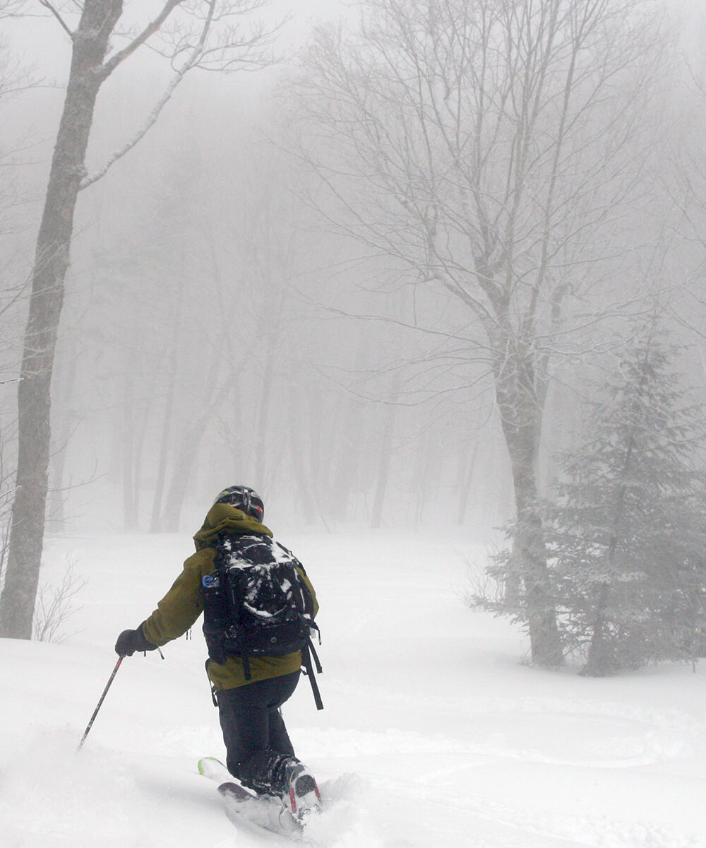
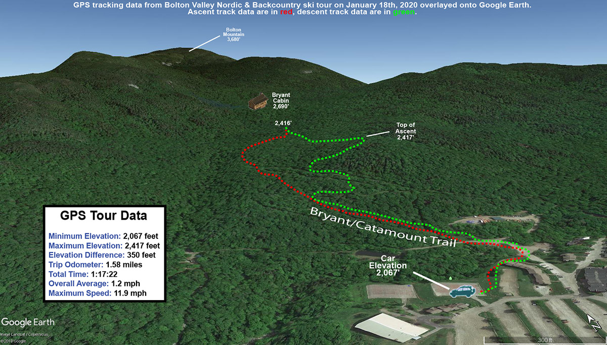
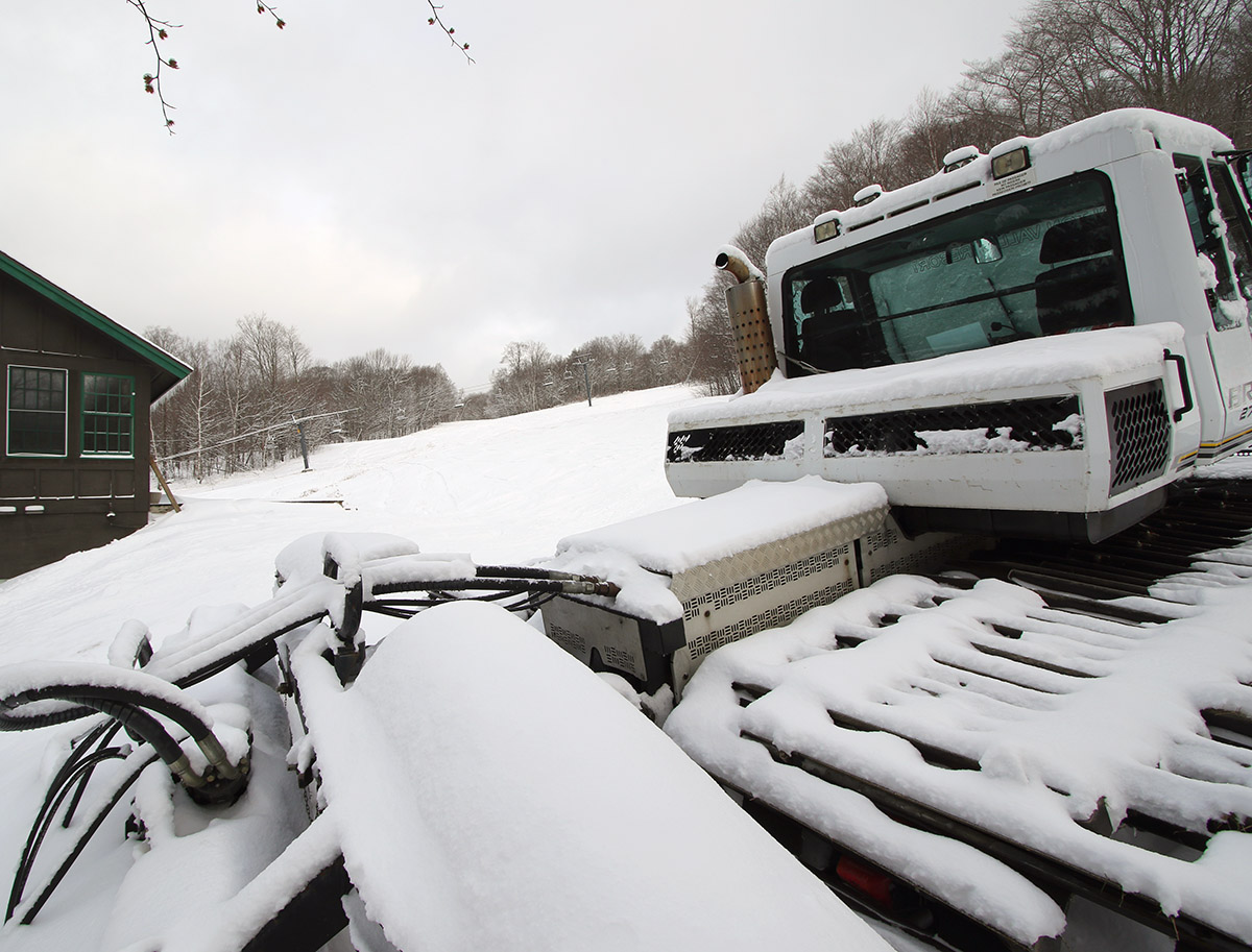
Today was even a bit warmer than yesterday, with temperatures in the valley this afternoon topping out around 60 F. So, I decided to get in another round of exercise with a Bolton Valley ski tour.
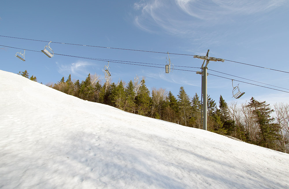
The strip of snow just to the climber’s right of the Timberline Quad base station had broken up even a bit more than yesterday, but I still traversed the gap with skins to start my tour. To mix things up today, I headed up Timberline Run and over toward Brandywine for my ascent. That area is more shaded from the sun, but with the warmer temperatures I figured it might be softened up enough for some smooth turns.
“The slightly warmer temperatures today made the snow quality even better, so the trend has just been one of increasing snow quality of these last few sessions.”
The snow there was fine, but once I got back into the snow below the Timberline Quad near the top, I could see that the exposure to the sun had made the snow just so much better there. I couldn’t resist that snow, so I ultimately ended up descending via Showtime as we’ve done on the past couple of outings. The slightly warmer temperatures today made the snow quality even better, so the trend has just been one of increasing snow quality of these last few sessions.
It’s beginning to look more and more likely that we’re going to get a winter storm toward the end of the week with the possibility of substantial snow for the mountains, so hopefully we’ll be able to get back into some powder skiing. The spring skiing has been very nice, but a change of pace with powder skiing would of course be welcomed as well.
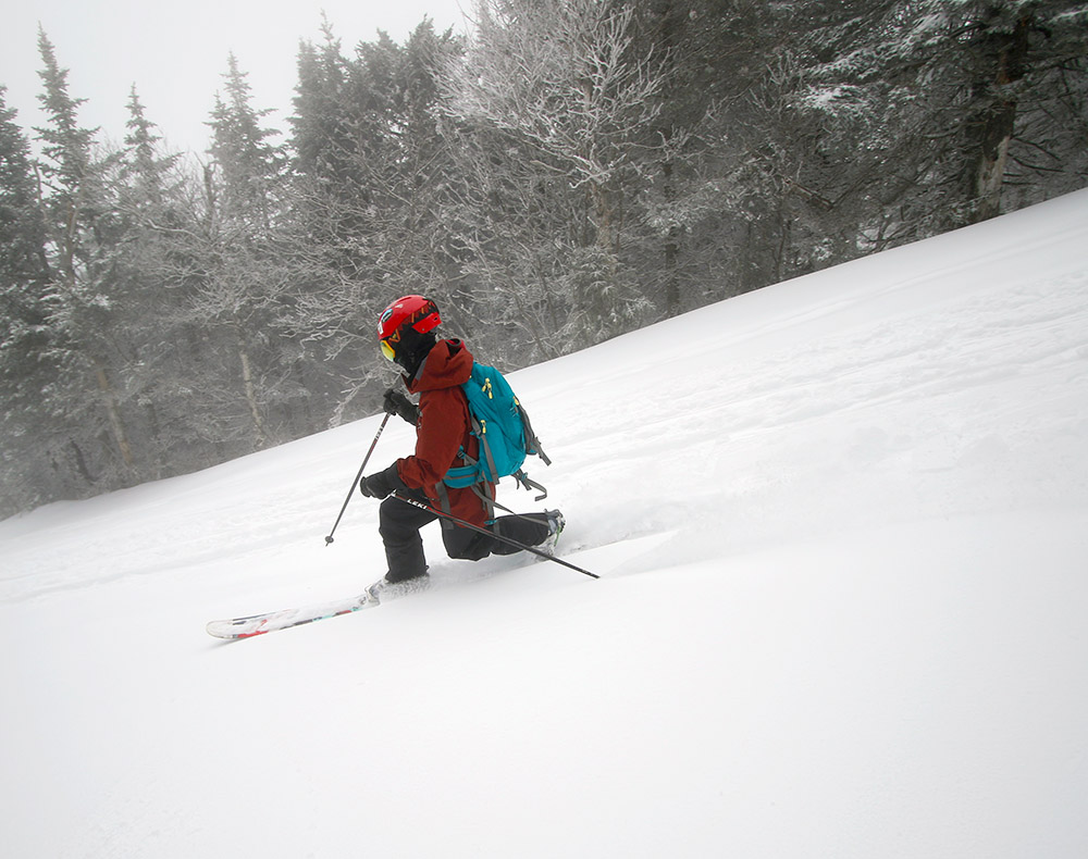
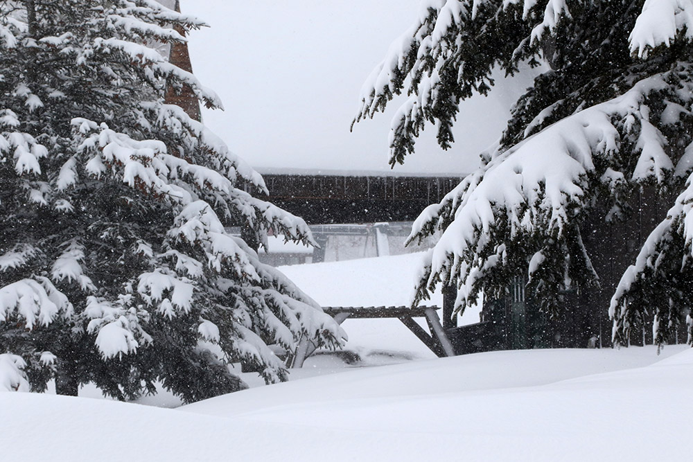
We had another nice day of weather today with some sun and temperatures in the 50s F, so I headed up to Bolton Valley for another ski tour at Timberline. The strip of snow just to the climber’s right of the Timberline Quad base station that we used for skinning during our ski tour on Saturday, was slightly broken up now with a small gap. It was just a few feet of dry grass in the break though, so I easily continued right across it, and coverage was great from there on up.
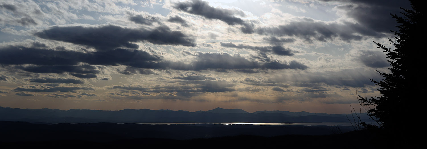
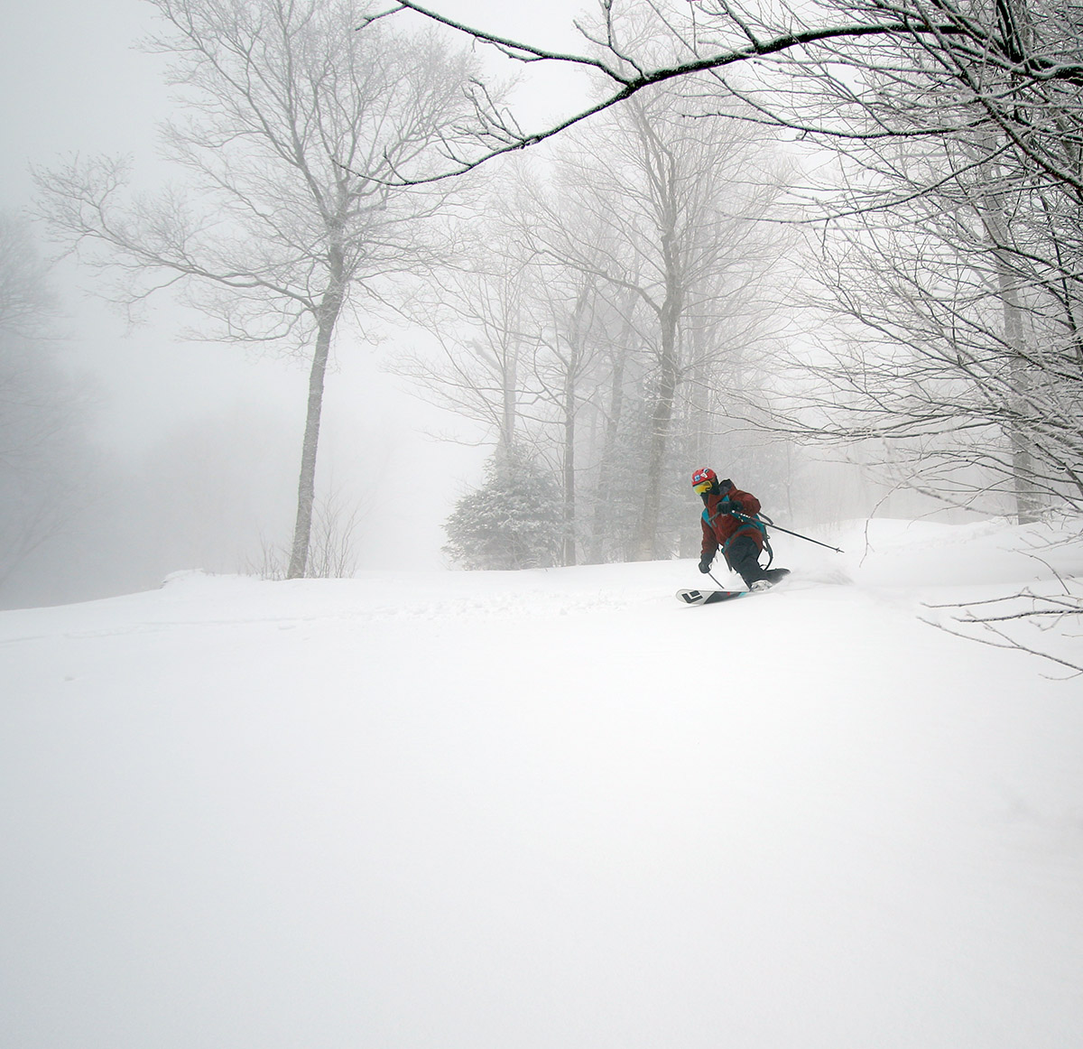
An afternoon view from the Timberline Summit out toward Lake Champlain and the Adirondacks
On Saturday, we stopped our tour at the Timberline Mid Station because it was our first outing in a little while and I figured it was good to take it easy, but today I headed right up to the Timberline Summit. The views were nice with some late day clouds to the west over Lake Champlain and the Adirondacks. The snow on Showtime was even a notch better than Saturday, I think thanks to a bit more sun to soften it up and create a smoother, more even surface today.
It looks like we’ll have more spring weather in the first part of this week before it becomes wintrier in the latter part of the week.
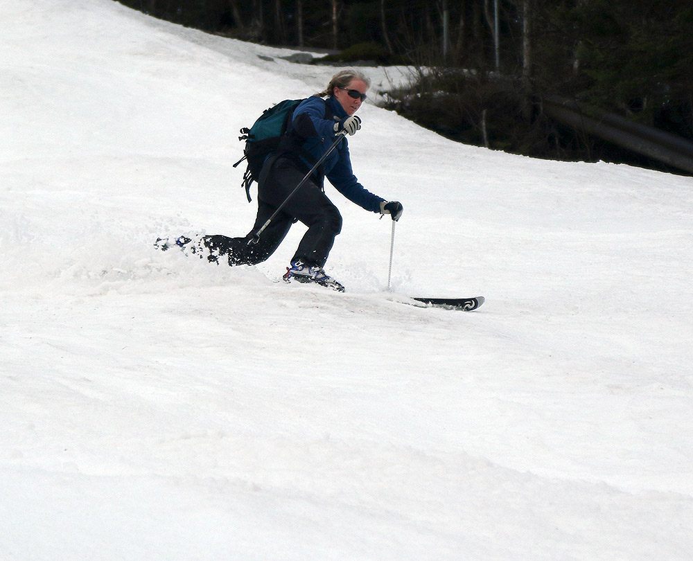
E enjoys some spring exercise as the whole family got out for a ski tour at Bolton Valley today.
Our most recent winter storm cycle was Winter Storm Quincy, which took place over a week ago. It brought a couple days of good powder, and D and I were able to get out for some fun turns, but since then we’ve sort of been back in the spring weather doldrums. We haven’t had another significant storm, and it hasn’t really been warm enough to soften up the slopes.
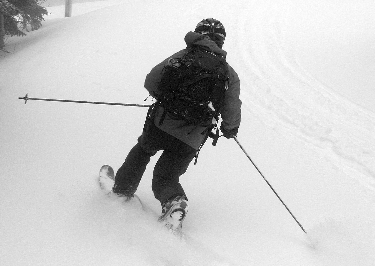
Some warmer, sunnier weather moved into the area today though, with temperatures in the 50s F, so the family headed up to Bolton Valley for a quick tour and some soft spring turns. Timberline still has plenty of continuous lines, so we toured from the Timberline Base, and up to the Timberline Mid Station. Just to the right of the base of the Timberline Quad there’s a thin line of snow that supports skinning right from the base, but that will probably melt out in a couple more days of warm weather. There’s solid coverage on the climber’s left of the quad base though, so that will probably be fine for ascents and descents for a while.
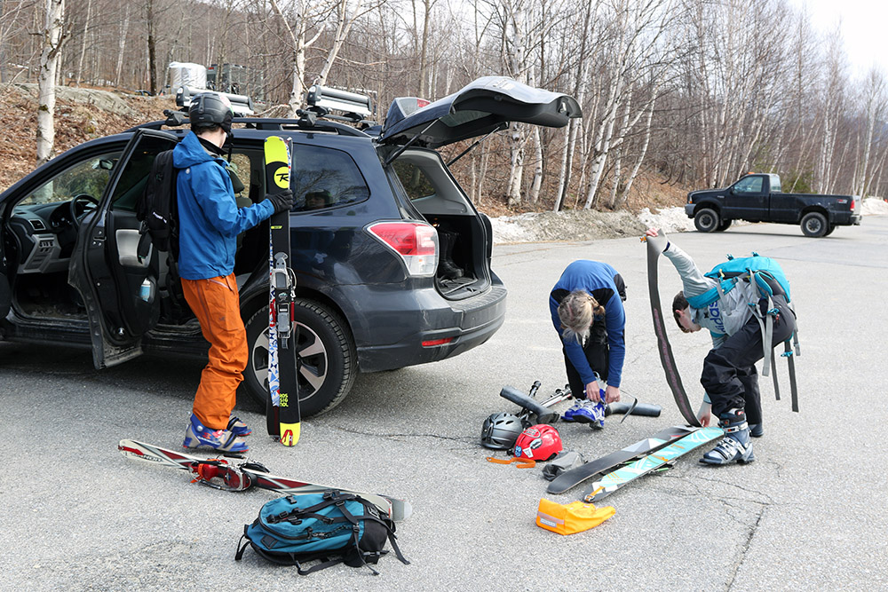
The family gets their gear set for the ski tour.
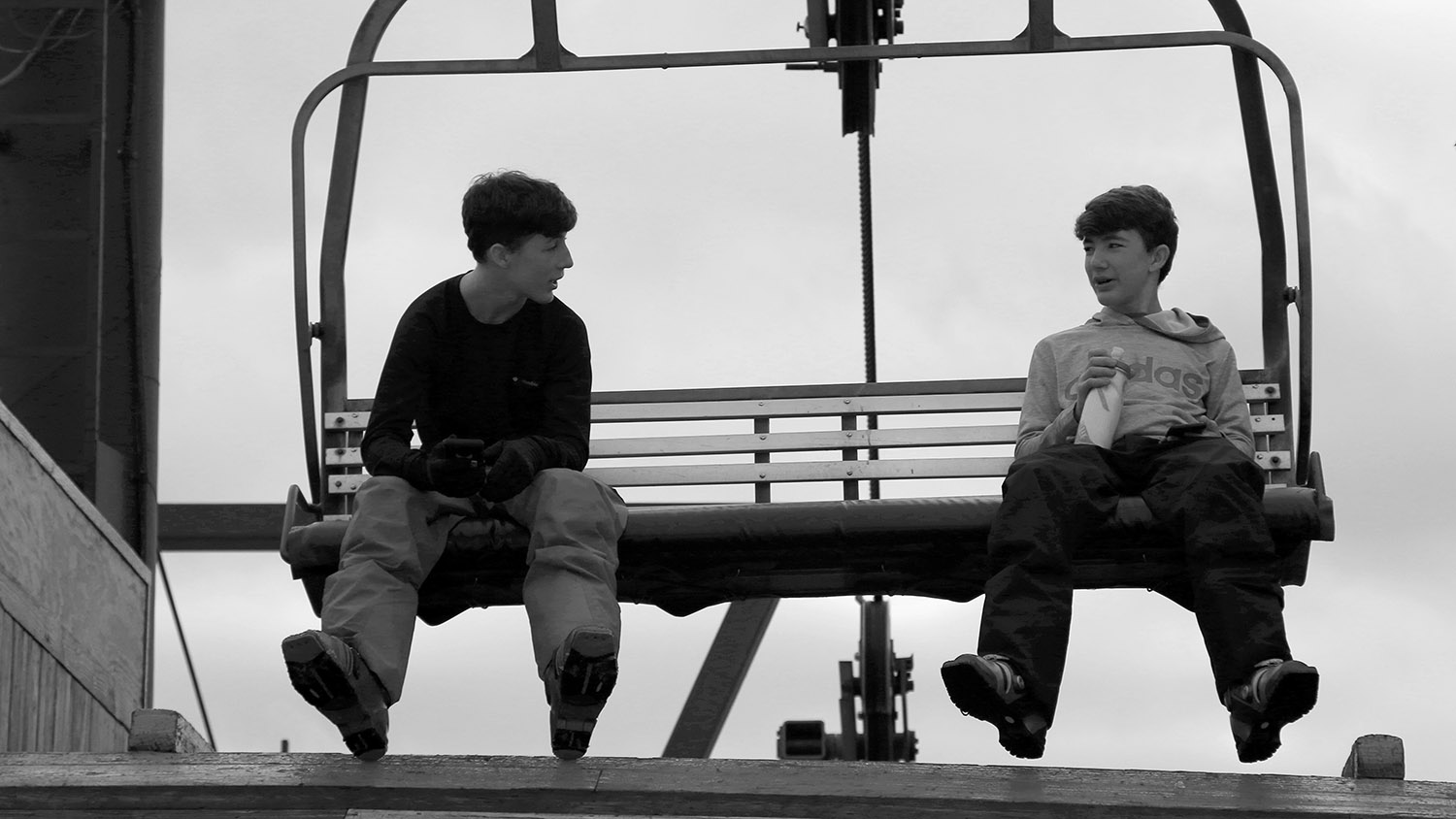
Ty cruised right up the hill on the ascent, with Dylan not too far behind, so the two of them had the chance to hang out at the top for a bit before I arrived. One of the chairs of the quad is nicely positioned at the mid station to make a convenient bench, so the boys really enjoyed hanging out there and enjoying the mountain views.
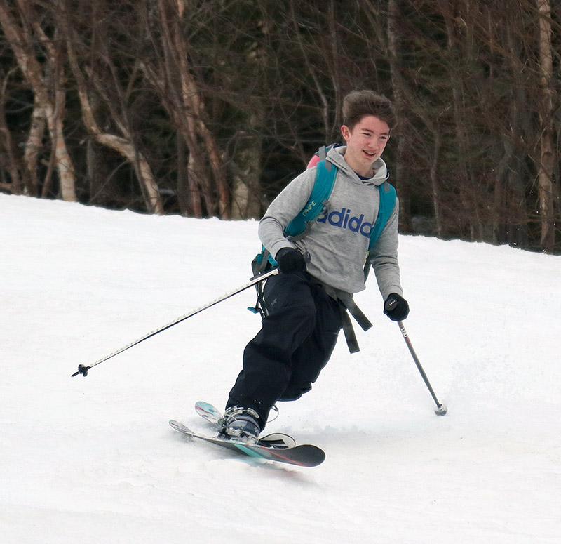
Showtime is doing the best with respect to coverage thanks to additional manmade snow, so we made our descent there. The snow was nice spring corn that had softened on Bolton’s usual afternoon sun, so the turns were quite good.
Dylan out on Mom’s fat skis today.
We only saw a couple of other cars in the parking lot, although it was fairly late in the afternoon, so most people had probably gotten their turns in earlier.
It looks like the weather is going to cool back down as we head into the latter part of this coming week, so we may be looking at more fresh snow coming to the mountains. We’ll see what happens, but I know everyone would be psyched to get out for some more powder.
As of last week, the ski areas in the state had ceased operations, which obviously has the potential to be a blow to many employees and ancillary businesses. All things considered, this timing hasn’t been too bad for the resorts, since they would all be tapering down winter services and staffing in the next few weeks to some degree anyway. From the skier’s perspective, the timing of these resorts hasn’t been horrible either – weather has been in that spring doldrums stage for the past couple of weeks. The usual thaw-freeze cycles that we get at this time of year have taken place, and we haven’t had any big storm cycles to resurface the slopes nor beautiful warm days with copious sunshine to soften them up. We last skied back on the 8th for the BJAMS ski program at Stowe, and regardless of the ski area closings, there hasn’t been much to entice us out since then.
“Our initial forecast called for a total of 2 to 4 inches of accumulation, but after we picked up 2.6 inches of snow in just a half hour (an impressive snowfall rate of over 5 inches per hour) yesterday evening, it was obvious that we were going to get more.”
That situation began to change yesterday though, as Winter Storm Quincy moved into the area and began dropping snow. I was returning from a meeting at work in the late afternoon, and the roads were already taking on some fresh accumulations. As of my 6:00 P.M. snow observations at the house we’d already picked up a couple of inches of snow. Our initial forecast called for a total of 2 to 4 inches of accumulation, but after we picked up 2.6 inches of snow in just a half hour (an impressive snowfall rate of over 5 inches per hour) yesterday evening, it was obvious that we were going to get more. I got a text alert around 7:30 P.M. that we’ve been put under a Winter Storm Warning here in Washington County, no doubt due to the continued heavy snowfall. By midnight, we’d picked up over 8 inches of snow at the house, composed of 0.65 inches of liquid equivalent. This storm was definitely entering the realm of a decent resurfacing for the slopes.
Since the resort is not posting snow reports now that they’re closed, we didn’t have a sense for how much snow Bolton Valley picked up in the storm, but Dylan and I finally had time around late morning to head up for a ski tour. On the way up the access road we stopped in at Timberline to check on the snow depth, and found about 7 inches of settled new accumulation at the base. We also noted that there were a couple dozen cars in the parking lot from folks that were out ski touring.
I was unsure of the base depths at Timberline, and figured they would be more substantial at the main mountain, so we continued on up to the Village. New snow depths were similar there, and indeed fairly similar all the way up to the Vista Summit. So overall, there really didn’t seem to be much change in accumulation with respect to elevations – from what we saw today, even up above 3,000’ the storm totals looked about the same as what we picked up in the valley at 500’
Dylan floats down through some of the powder today during our ski tour at Bolton Valley.
The turns we had today were very nice. The powder was of medium to perhaps slightly higher density, and temperatures were well below freezing even in the Village at 2,000’. The snow had a nice surfy consistency, with enough buoyancy for bottomless turns on even steep pitches in the black diamond range. You could certainly hit bottom on the very steepest pitches, but we focused on medium-angle terrain and it was bottomless all the way.
“Despite the number of people up at the resort, it was clear that even resort ski touring is still a great activity for social distancing. As is typically the case, we actually saw only a few people while we were out on the hill, and you still never had to go within 50 feet of anyone if you didn’t want to.”
With many people not going to work right now as the state strives to minimize the spread of COVID-19, and a fresh dump of powder on the slopes, I guess I shouldn’t have been surprised at how many people were out for turns. The number of people touring seemed notable though – between Timberline and the Village, there were at least several dozen cars out there. Where we really noticed that ski touring traffic was up was by the number of tracks on the trails. D and I definitely had to work a bit to find trails that had only seen a few tracks, but we just poked around until we found them. Fanny Hill delivered pretty nicely with only about four or five tracks on it and plenty of untouched snow. Despite the number of people up at the resort, it was clear that even resort ski touring is still a great activity for social distancing. As is typically the case, we actually saw only a few people while we were out on the hill, and you still never had to go within 50 feet of anyone if you didn’t want to.
Dylan was behind the lens of one of the cameras today as well, getting some shots of Dad when he had the chance.
There are a few early signs of another potential storm about a week out, but there’s nothing notable in the more immediate term, so we’ll be watching that timeframe to see if anything pops up.
I decided to go for a quick tour at Timberline, and arrived to find some fairly steady snowfall continuing. Temperatures were pretty comfortable, although there was a bit of wind that had filled in the skin track with a few inches of new snow since it was last used. I knew that elevation was a notable factor with this storm, and indeed that was verified with my measurements of the powder during my tour. I found about 6 to 7 inches of powder down at the Timberline Base at 1,500’, but 8 to 12 inches up around 2,250’.
The Twice as Nice skin track, disappearing under the new snow of Winter Storm Odell
I headed toward Spell Binder for my descent, and the huge drifts at the top suggested that a lot of snow had fallen. I dropped in and cut huge, bottomless arcs down the left side of the headwall. It felt like I’d just covered a third of the trail in seconds. The 8 to 12 inches of powder I’d found on level ground led to areas as deep as 20 inches in some spots, and there was plenty of density to ensure that I was nowhere near touching the base. I know I let out some “Woo Hoos” during the descent, not that anyone else was around to hear it. I spotted a couple vestiges of old tracks that had nearly been obliterated by the wind and continuing snowfall, but as far as I could see I had the only tracks on the trail.
“I dropped in and cut huge, bottomless arcs down the left side of the headwall. It felt like I’d just covered a third of the trail in seconds. The 8 to 12 inches of powder I’d found on level ground led to areas as deep as 20 inches in some spots, and there was plenty of density to ensure that I was nowhere near touching the base.”
The only notable deviation I found in snow quality was below roughly 1,800’ in elevation. Below that level the powder was notably denser and didn’t ski quite as beautifully as it did higher up. That’s pretty consistent with the way this storm started up though – for quite a while yesterday the snow line was around 2,000’, so below that point that snow was getting wet. The storm is continuing today though, with snow levels all the way down to the lowest valley floors, so even that lower elevation snow should be getting covered up with lighter and drier stuff.
I learned today on the Bolton Valley website that skinning at Timberline is actually closed in the 5:00 A.M. to 9:00 A.M. period for mountain operations. It was actually around 9:00 A.M. when I was starting my tour late today, so I was after that closed window, but it’s something to consider if you’re planning to earn turns at Timberline. During that window when Timberline hiking is closed, visitors are supposed to hike on the Wilderness ascent route.
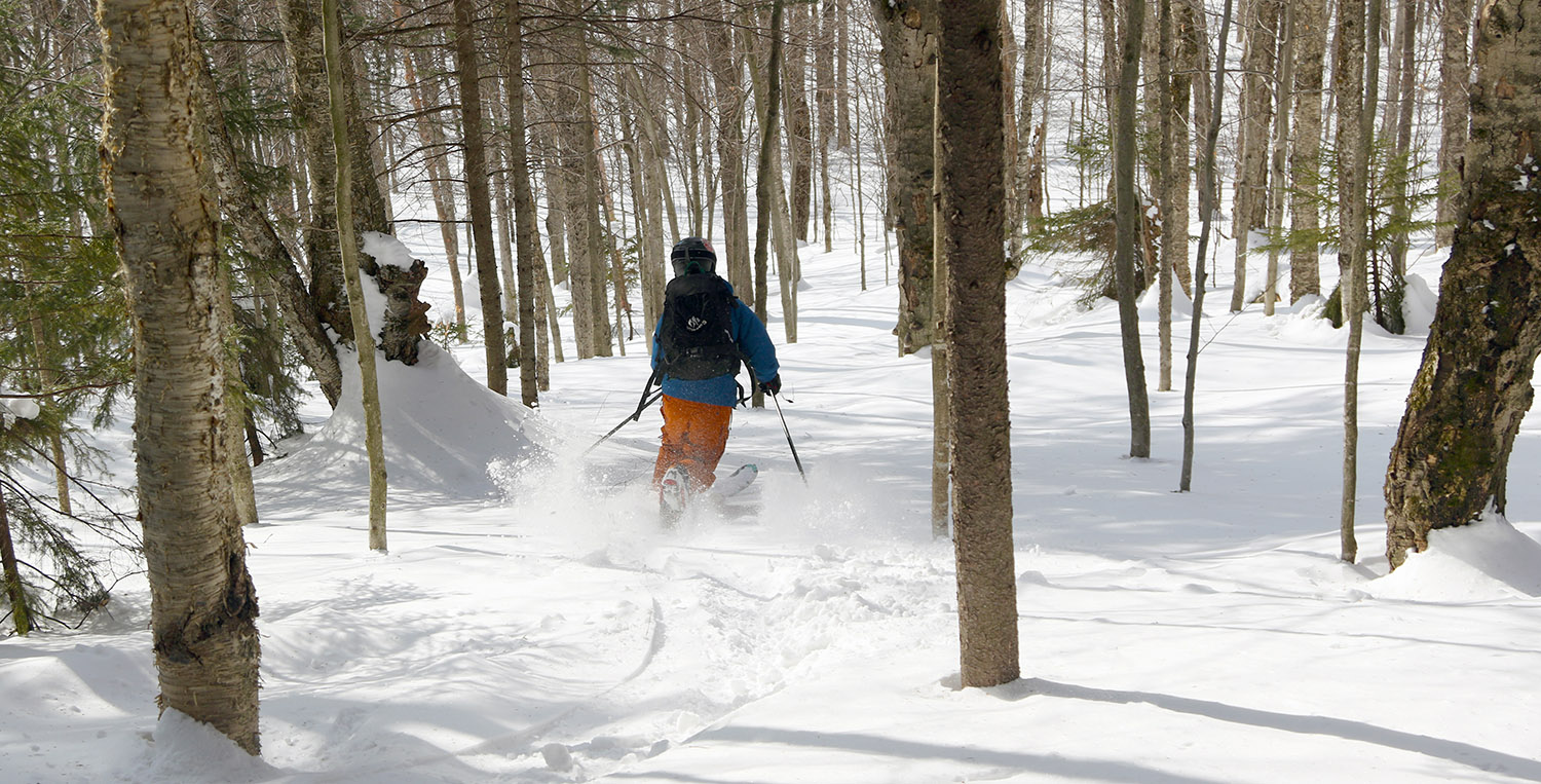
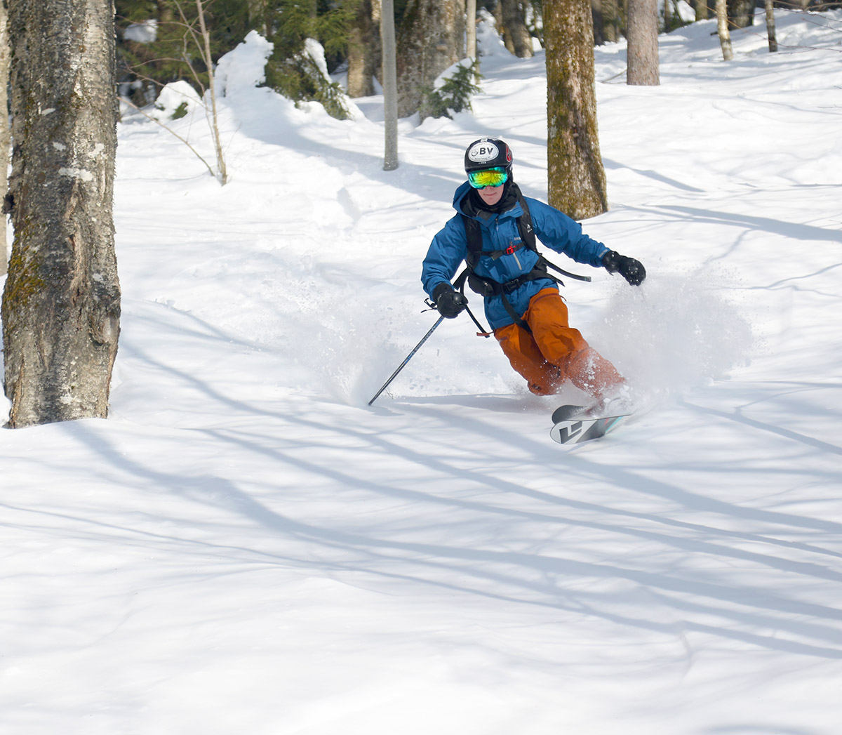
Ty drops into a line through some of the great snow we found today on the Bolton Valley Backcountry Network
Dylan and E were off to a sledding party this afternoon in Morrisville, but it was such a gorgeous day that getting out for a ski tour was definitely on my mind. Ty had to work until noon, and was heading to a friend’s house at 4 P.M., but we definitely had enough time to sneak a tour in that window. Once Ty was back and we’d gear up, we headed right to Bolton Valley.
You almost couldn’t ask for better weather today – we had blue skies, and temperatures at Village elevation were right around 30 F. That’s nice and comfortable for touring, but not warm enough to really start adversely affecting the powder. Visitation at the resort looked strong, but there were still available parking spots and we were able to get one right along the trails in the upper tennis court lot.
“The mountains have had several more inches of snow since then though, and today we really didn’t encounter any signs of that crust because it’s probably just buried deep enough.”
We toured over toward Holden’s Hollow today, and the theme was definitely efficiency. Ty is in really great shape, so his pace is even faster than mine, and within about 25 minutes we were already in position for a descent. Based on how fast we’d moved, I said we’d easily have time for a couple of laps, so we set up for an initial descent through a nice glade on the back side of the ridge. Ty worked on deskinning with his skis still on, and was quite fast with it, so our transition speed only enhanced just how efficient and quick we were overall.
We had first tracks for our descent of the glade, and the conditions were excellent. I’d actually describe the conditions as even better than what we encountered last Saturday when I was out at Bolton with Dylan – and that already wasn’t too shabby. The powder skiing on that outing with Dylan was decent, but there was a marginal buried crust present in some areas that knocked the overall feel down a notch. The mountains have had several more inches of snow since then though, and today we really didn’t encounter any signs of that crust because it’s probably just buried deep enough. Surface powder depths we found were right around 20 inches before getting down to the base, which is basically what we found last weekend. The powder was more consistent today though with any crust buried deeper. That 20 inches of powder is fairly settled at this point of course, so we’re not talking about sinking down 20 inches into fresh champagne, you’re more like 6 to 12 inches down in the powder, but the rest is serving as fantastic cushion above the base. Our first run was on a fairly south-facing slope, but the trees offered a good amount of protection from the sun. A few spots were just starting to get that first phase of the powder being affected by the sun, but those were few and far between.
An unblemished canvas for Ty to get first tracks on our initial descent of the tour
Once we were back down at the Telemark Trail, we switched over for another ascent, and I was much more efficient at the transition, so told Ty I’d start the ascent and he could catch up. This time, I broke trail through the powder beyond our previous lap, and headed up to the top to access the east side of the ridge. Ty caught up to me just as I was cresting, so it worked out perfectly.
“Surface powder depths we found were right around 20 inches before getting down to the base, which is basically what we found last weekend.”
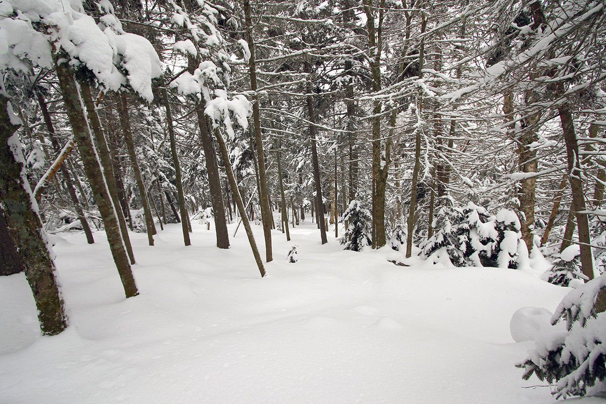
We descended in the C Bear Woods area that I’d visited back during my tour on the 1st of the month. We had first tracks there as well, but the powder wasn’t quite as good as what we’d found on our first ascent – I think wind effects up on that part of the ridge were the main culprit. The sun was also doing a bit more work on that snow, so in some areas it had lost a bit more of its winter fluff texture.
Back down at the bottom of that run, Ty and I skinned up for the final return to the car, and we found that we’d less than 90 minutes for the whole tour. It was fun getting things done so efficiently, and we really weren’t even pushing ourselves, it was just overall solid pace and good transitions between skinning and skiing.
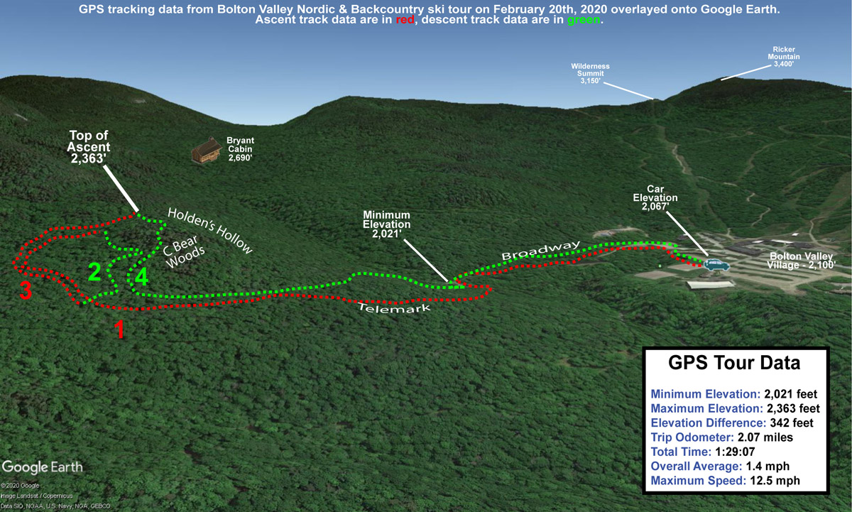
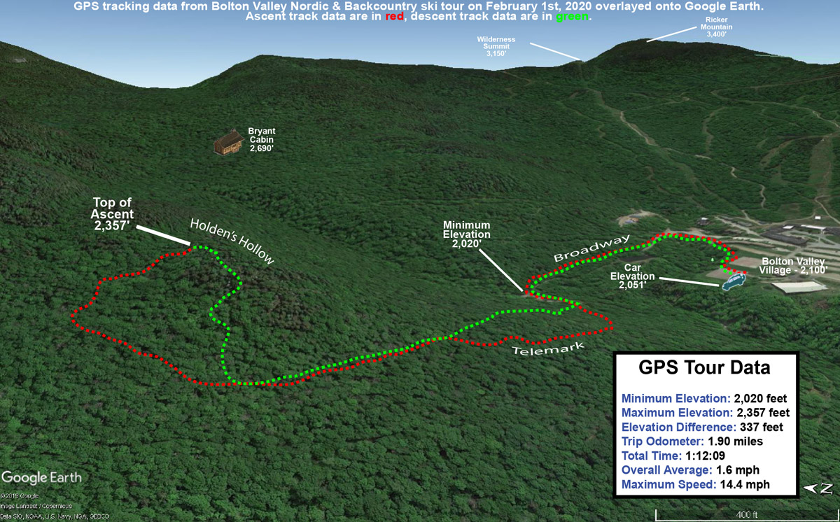
GPS Tracking data mapped onto Google Earth for today’s ski tour on the Bolton Valley Nordic & Backcountry Network
We’ve got another potential winter storm coming later this week, and it looks pretty nice for the mountains around here from what I’ve seen on the models. The initial snow might be dense since it not an especially cold storm, but unless things change dramatically it looks like another nice shot of liquid equivalent for the snowpack. Some of the models also show extended upslope snow on the back side of the cycle, which would be great to top off the powder skiing conditions.
Temperatures were really in a sweet spot today – they were just a bit below freezing, which meant that they were extremely comfortable, but not warm enough to ruin any of the powder. I think a lot of people know that today was going to be spectacular out there, because even the lots down by the Nordic Center were filling up when I arrived around 10:00 A.M. The upper tennis court lot was already filled, so I had to head to the lower one, but I got a nice trailside parking spot that let me gear up and jump right onto Broadway.
“The depths of powder I’d found down at the ~2,000’ Village level were generally in the 10-15” range, and up there in the 2,300-2,400’ elevation range I was finding a fairly consistent 16” of powder.”
I needed to pick up Ty from work at noon, so my plan was a quick tour out to the Holden’s Hollow area to get in some powder turns. Consistent with the parking lots, there were people all over the Nordic trails, and a number heading out onto the backcountry trails as well. Once I got up onto the Telemark Trail I didn’t see anyone else around however, and based on the skin track it looked like only about 3 or 4 people had even been out on that part of the network recently.
I had to break trail on the final stretch up to the ridgeline above Holden’s Hollow, and once I’d crested I found myself with a vast area of untracked snow below me. The depths of powder I’d found down at the ~2,000’ Village level were generally in the 10-15” range, and up there in the 2,300-2,400’ elevation range I was finding a fairly consistent 16” of powder.
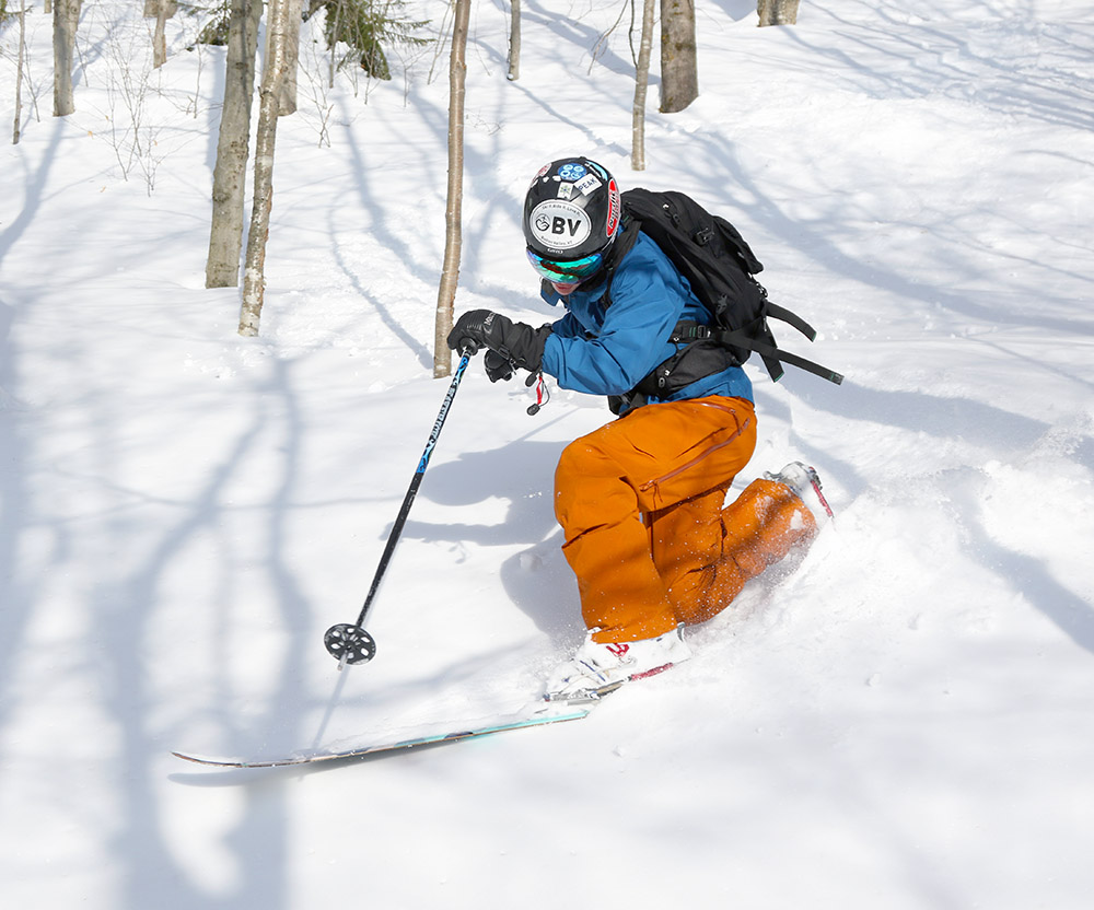
Getting ready for some untracked turns through the C Bear Woods area today.
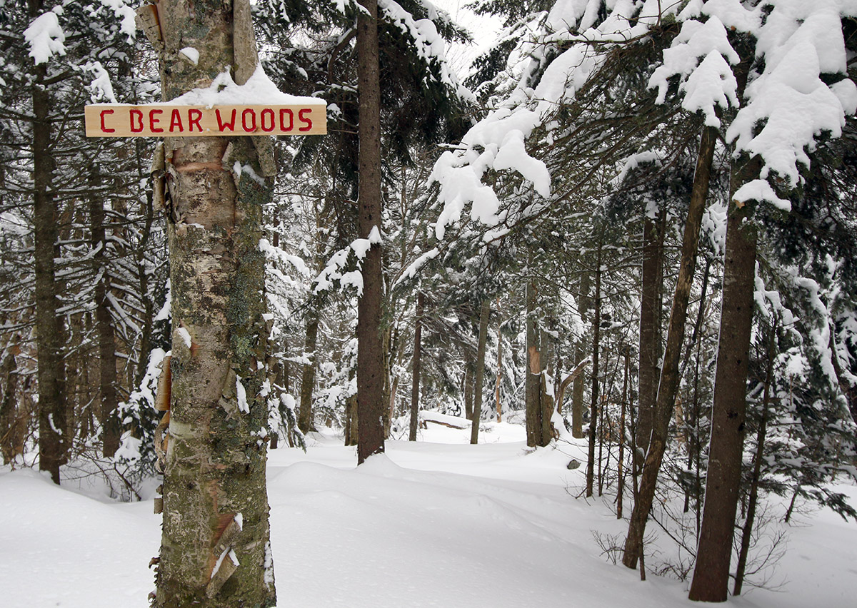
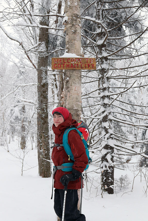
As I switched over for the descent, I noticed a trail sign just down the ridgeline from me, and figured it was one of the markers for some of the Holden’s Hollow Glades. Once I headed over to it though, I saw that it read “C Bear Woods”, and I realized it was a sign I’d never seen before. The sign looks new, so it’s either an area that was recently updated for skiing, or perhaps folks just got around to putting up a sign. Whatever the case, the glade below me was entirely untracked, and the powder was excellent. As I encountered on Thursday, there was a bit of a crust buried within the pack in some spots, but in this case it was either absent or buried deep enough that it was inconsequential.
I was surprised to find that the run actually brought me down on the back side of the ridge, which would have been great for doing another lap, but unfortunately I didn’t have time. I cut eastward through the trees and got myself over to the east side of the ridge where I was able to descend back to the Telemark Trail and Broadway with more untracked powder turns.
From the pump house/bridge area, I re-skinned my skis for my return to the Village – I’ve learned the investment of a couple minutes into putting on your skins is well worth it for that return trip with its slight uphill inclines.
A Google Earth Map with GPS Tracking data of today’s ski tour on the Bolton Valley Backcountry Network
When I got back to my car a bit before noon, even the lower tennis court lot had filled, and the parking lots in general looked packed to the gills. The mountain was definitely doing a booming business, and I guess that shouldn’t be surprising on a midwinter Saturday with a recent resurfacing of the slopes, full operation, and perfect temperatures.
I suspected that the most recent storm wasn’t going to be quite enough to get the backcountry into perfect shape, but the forecast called for chilly temperatures topping out in the 10-15 F range, so earning some powder turns in the new snow seemed like the way to go. Dylan joined me in my plan to head up and take a quick tour on some moderate terrain on the Bolton Valley Nordic and Backcountry Network.
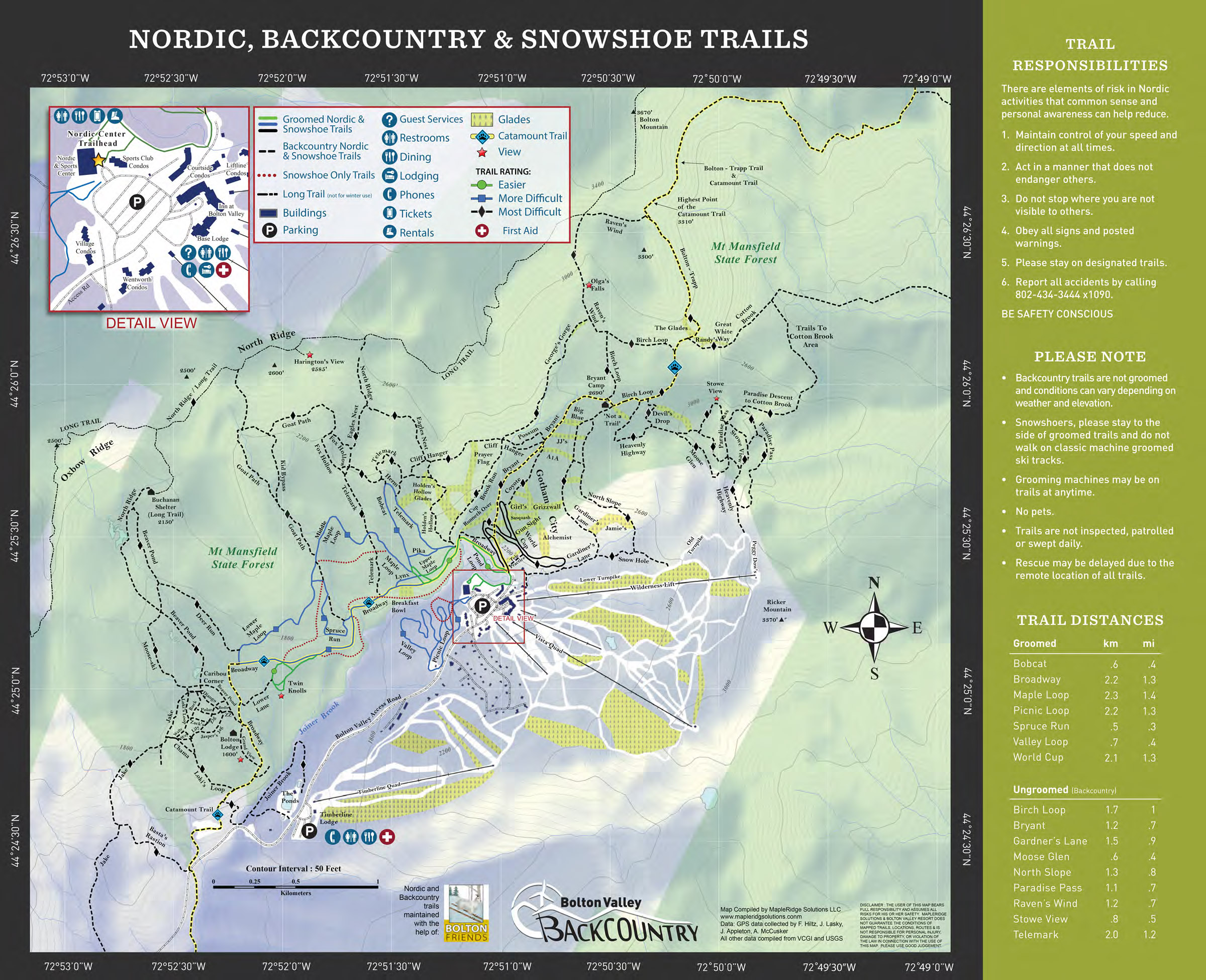
This season’s update of Bolton Valley’s Nordic & Backcountry trail map is once again listing a lot of the glades.
“Depth checks revealed about 6-12” of surface snow at Village elevations, and that increased to 12-16” in protected areas on the backcountry network where to topped out around 2,400’ or so.”
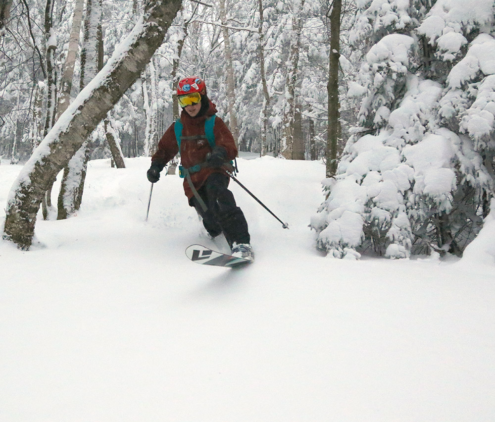
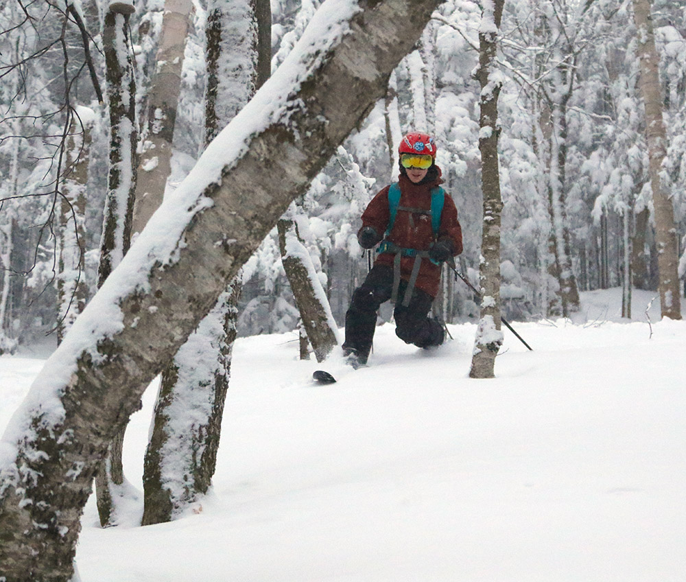
The idea for today’s tour was to head partway up the Bryant Trail, connect over to Gotham City, catch some turns in the Gun Sight area, and then finish off the run with some lower glades. Depth checks revealed about 6-12” of surface snow at Village elevations, and that increased to 12-16” in protected areas on the backcountry network where to topped out around 2,400’ or so. There were some nice powder turns in that snow, but the base depths are very inconsistent. In some spots the base snow was sufficiently deep, but in others there was little to no base, and obstacles like rocks and logs definitely needed to be avoided. Dylan’s most memorable quote of the day came after he had an altercation with some sort of obstacle under the snow and took a tumble. He was on Erica’s fat skis, and we were really hoping it wasn’t a rock. D quickly reassured me… “It was a log”.
Dylan enjoying the shelter of the trees and nice powder on today’s backcountry ski tour
We’ve actually got our next significant weather system, Winter Storm Jacob, starting to affect the area this afternoon. I’m not sure exactly when the snow from the storm first started to appear, but around 4:00 P.M. we were in Gotham City finishing our ascent, and I realized it was snowing. It’s kind of fun when you’re touring in the forest like that with limited views and protection from the elements, and before you know it you’re getting covered with fresh snow. The density of snow from this next storm will probably be on the high side, so it should make a solid contribution to the base to cover some of the obstacles we’ve been encountering.
A Google Earth map with GPS tracking data of today’s tour on the Bolton Valley backcountry network
Since yesterday morning, Winter Storm Henry has been bringing snow to our area, and Bolton Valley reported several new inches as of this morning. With the passage of the system came some wind however, which was enough to keep the Vista Quad on hold. Watching the Bolton Valley Live Web Cam from home, we could see that the Vista Quad closure led to long lines for the Mid Mountain Chair and Snowflake Chair. My colleague Stephen said that he’d been skiing in the morning, but the lift lines grew to 30 minutes as more people arrived and he’d eventually decided to call it a day.
Our family had planned to head up for some lift-served runs this afternoon, but the wind hold made that impractical and I ended up heading to the mountain to skin up for some turns instead. I figured this latest storm would be just about enough to get Timberline in reasonable shape for turns, so with the crowds at the main mountain, I decided to check it out.
“In general, I found 6 to 7 inches of powder in protected areas along the route, which was enough for mostly bottomless turns on low and moderate angle terrain.”
The main skin route on Twice as Nice was well established, but I could see that in general the west-facing trails had seen just a bit too much wind to provide really nice turns. Having seen that, I ended up descending by the more protected Wood’s Hole and Brandywine route, and that worked out well. In general, I found 6 to 7 inches of powder in protected areas along the route, which was enough for mostly bottomless turns on low and moderate angle terrain.
We’ve got yet another modest system coming through the area tomorrow, so that should bring conditions up another notch.
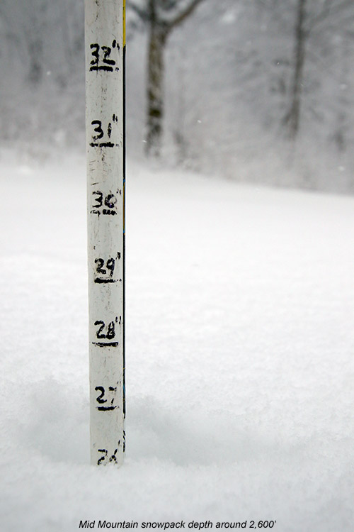
Checking the depth of the snowpack today at around 2,600′ near Mid Mountain. Total depth was around 27″, with about 20″ of it being powder from recent storms.
Last weekend, Winter Storm Ezekiel brought some hefty snowfall to the Northeastern U.S., with totals exceeding two feet in areas around Albany, NY and Southern Vermont. Up here in the northern part of the state we only picked up a few inches of snow from the storm, with totals falling off to almost nothing near the international border in a total reversal of the usual trend.
“My analyses at the house were revealing snow to water ratios of 50 to 1, and even as high as 85 to 1, so that’s incredibly dry powder with just 1 to 2% H2O content.”
The upslope snowfall on the back side of the Clipper looked like it would continue all day today, so I decided it was time for a quick trip up to the mountain to check out the new powder. Thanks to our cold November temperatures, Bolton Valley has actually been open for a couple of weeks now, and I hadn’t even picked up my season’s pass yet because I’ve been so busy. E and D were both a bit under the weather, and T was at work, so unfortunately they’ll have to wait until another trip to get themselves set up with their passes.
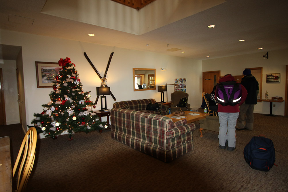
I was worried about a long wait to get my season’s pass, but once up at the mountain it turned out that picking it up was very quick. While I was walking toward the lodge from my car, I ran into a member of the resort staff who was checking in with everyone about picking up their passes. For pick up, he said to head right toward the Village Café, and they’d take care of everything. Indeed, there was only one person ahead of me picking up their pass, and it was very quick. The process of pick up and filling out the waiver was all done very efficiently on a handheld, wireless iPad-type device, and there was plenty of nice seating on couches in the lobby area so you could have a seat while you finished off the process.
Of course the greatest part of picking up my pass this year was the fact that Bolton has gone RFID!!! Dylan and I suspected it when we saw electronic gates by the lifts during a ski tour last month, but I can definitely say it’s for real. It’s so nice to be able to just stick the pass in my pocked (my Arc’teryx Sidewinder Jacket has a pocket on the sleeve that works perfectly) and I never have to mess with getting it out at the lifts. I tested out my pass at the Mid Mountain Chair and the process was perfectly smooth.
An image of the snowy Bolton Valley Village today after picking up my season’s pass
“I checked the total snowpack depth in that area and measured a healthy 27 inches, with about 20 inches of that being powder from recent storms, and the rest being base snow. Clearly Bolton has gotten clobbered from some these smaller systems we’ve had.”
In terms of skiing, my plan was to use an assist from the Mid Mountain Chair and head over to Wilderness to ski some of the fresh powder in that area. I figured there would be no one on the upper mountain without the Vista Quad running, but when I was traversing over on Fanny Hill, I ran into a patroller who was prepping the trail for opening because they were going to open Vista. He reminded me that I wasn’t on the designated uphill route, but thankfully let me continue on over since I was just about onto the Wilderness terrain. I checked the total snowpack depth in that area and measured a healthy 27 inches, with about 20 inches of that being powder from recent storms, and the rest being base snow. Clearly Bolton has gotten clobbered from some these smaller systems we’ve had.
Enjoying the snowy views along my skin track in the Fanny Hill area.
Once connecting to the standard skinning route, I finished my ascent on Peggy Dow’s to the Wilderness ridgeline and got ready for some turns. Light snow with breaks of sun that had been with me on the last part of my ascent were replaced with a sudden change to a maelstrom of huge flakes coming down as I began to descend. I really didn’t have to venture far afield from Peggy Dow’s and Turnpike to find powder – there was plenty of it throughout the route because skier traffic had been low enough. Powder depths ranged from as much as 15 to 20 inches on the upper mountain, to typically 12 to 15 inches on the lower mountain, so even with the incredibly dry powder there was plenty of it to keep you floating. I’d brought my 115 mm fat skis and they were definitely the right tool for the job. I was surprised at how quickly my legs got cooked from making Telemark turns – they’d often be fried after just a dozen or so turns! I guess it has been roughly three weeks since I last skied, so my legs are clearly telling me they need to get back into ski shape. Today should get the process started though, and hopefully ski days will become more frequent as we move into December and we continue to get snow.
On the weather side, it looks like we’ve got a warm system to start off this next week, which will consolidate the snowpack somewhat, and then temperatures should cool down for midweek with potential for some moisture from the Great Lakes affecting the area. Then there’s the potential for another large system next weekend, but it will be a bit before we can figure out how much snow we might get from that one.


