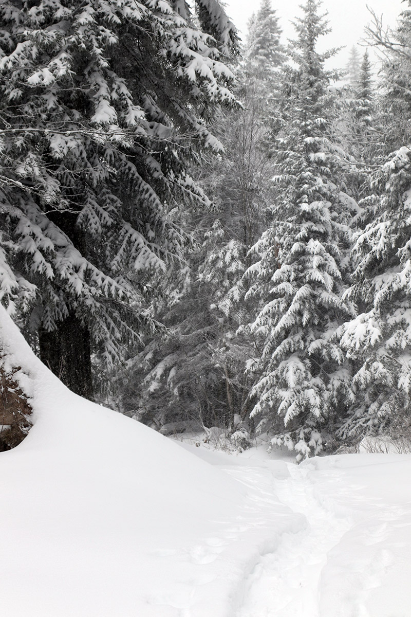
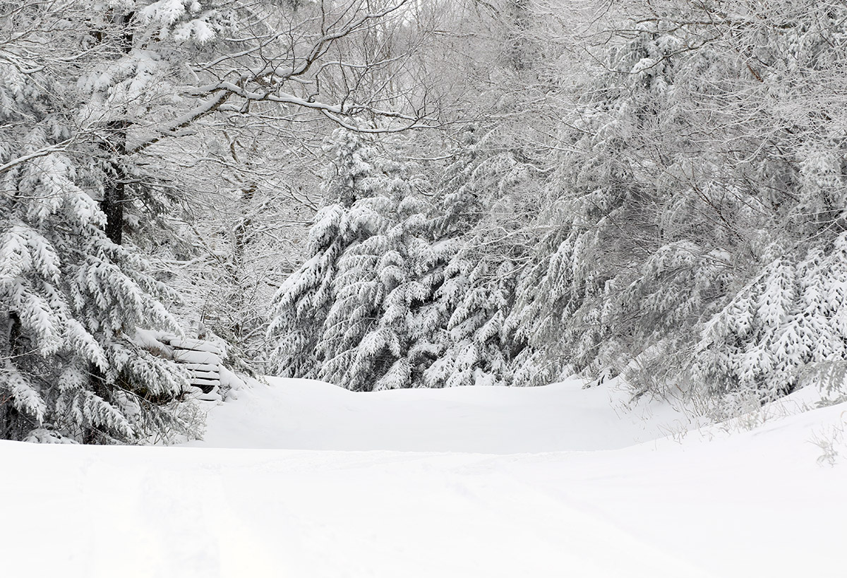
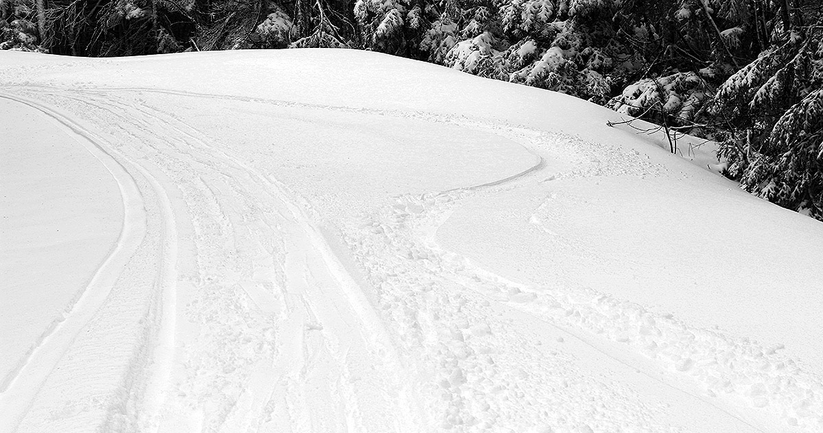
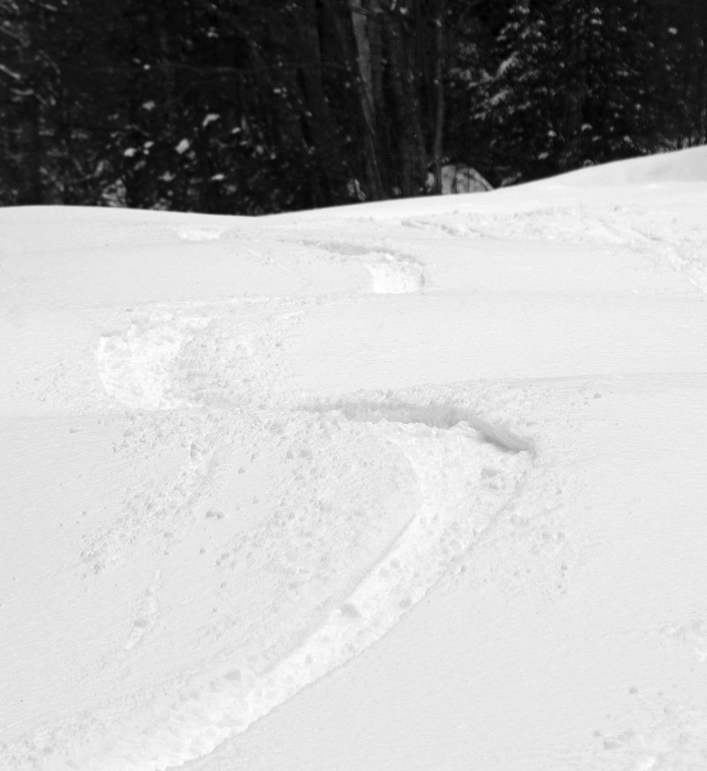
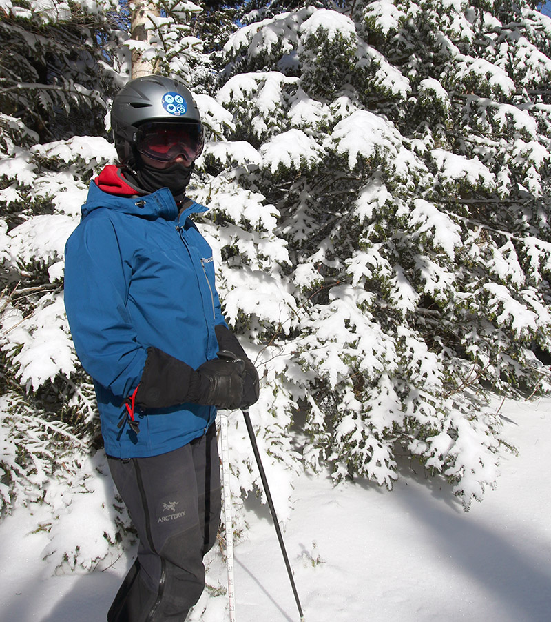
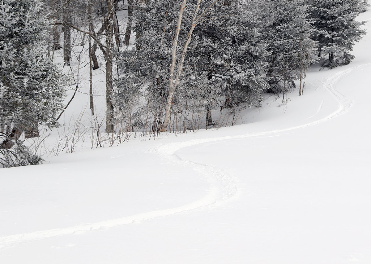
A view of a skin track on today’s ski tour. The deep snow across the mountain made for many trench-like ascent and descent tracks.
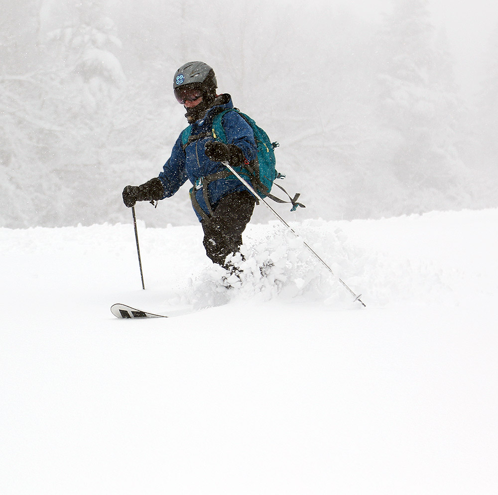
For several days the weather modeling has suggested an early winter storm would be affecting the area after Thanksgiving, and indeed it really began to ramp up the snowfall yesterday. The ski area webcams were suggesting some nice accumulations at elevation, so I headed up to Bolton this morning for a bit of ski touring.
In terms of snow accumulations, what I found is definitely more than what they’ve got in their snow report (5-8”), but they did indicate they had trouble with blowing at their stake. It’s possible my measurements were getting down into existing snowpack, but it seems like that should have been consolidated from recent temperatures. The backside upslope snow was also coming down while I was out there today, so that likely added a bit to the totals:
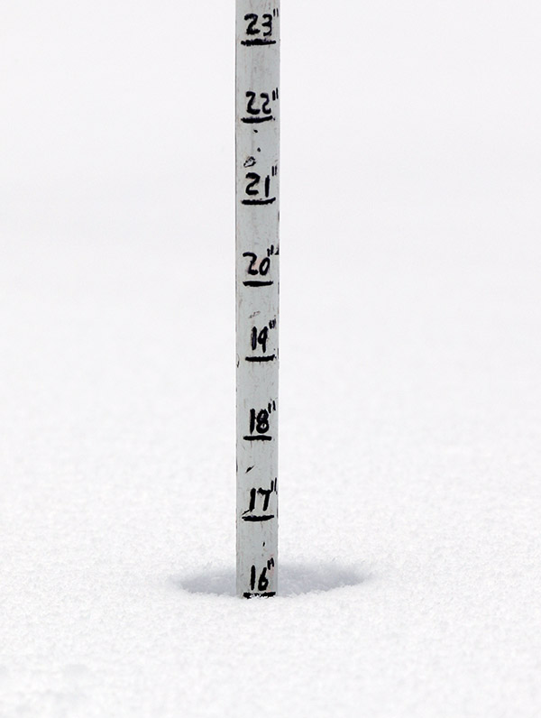
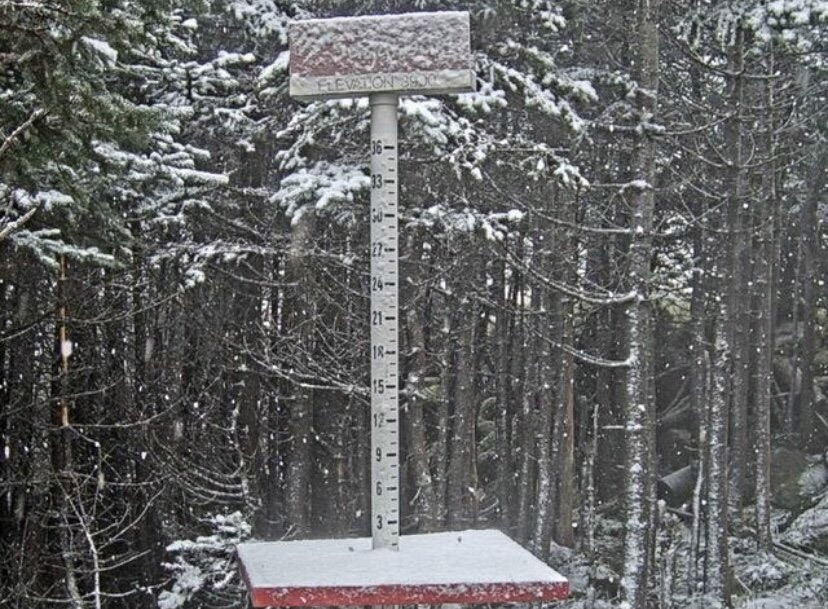
Snow depths I found today topped out around 16 inches at the 3,000-foot elevation.
Like what we picked up down at the house, the snow I found at the mountain was generally dense, and it put down a substantial addition to the base on the slopes. We picked up over an inch of liquid at our site in the valley from this storm, and I’d say the slopes of Bolton easily picked that up as well. It feels like there’s at least an inch of L.E. at the base elevations, and probably something like two inches of L.E. up high. Some of the higher elevation snowpack could have come from previous events, but in any case, that’s a substantial amount of L.E. in place.
There were a couple inches of drier upslope snow to finish off this storm cycle, but the bulk of it was that denser snow, and that’s definitely what set the tenor of the skiing. There were no concerns about hitting anything under the snow on trails without any overt obstacles like large rocks, and any terrain that was smooth up to the level of single black diamond pitch was fine to ski unless it was wind scoured. In fact, the snow was too dense for skiing any low angle terrain, so you really had to be on moderate to steep terrain or you would be bogged down and just have to straight-line to maintain speed. Skiing on terrain with the right pitch was quite good though, and you could carve right into the powder and just let the skis surf.
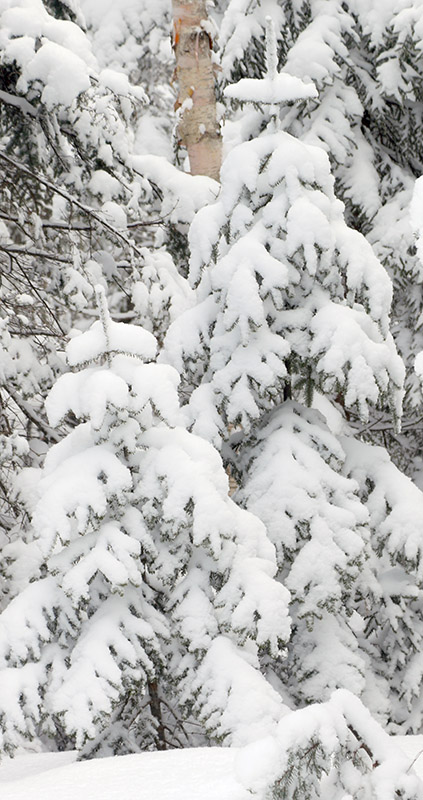
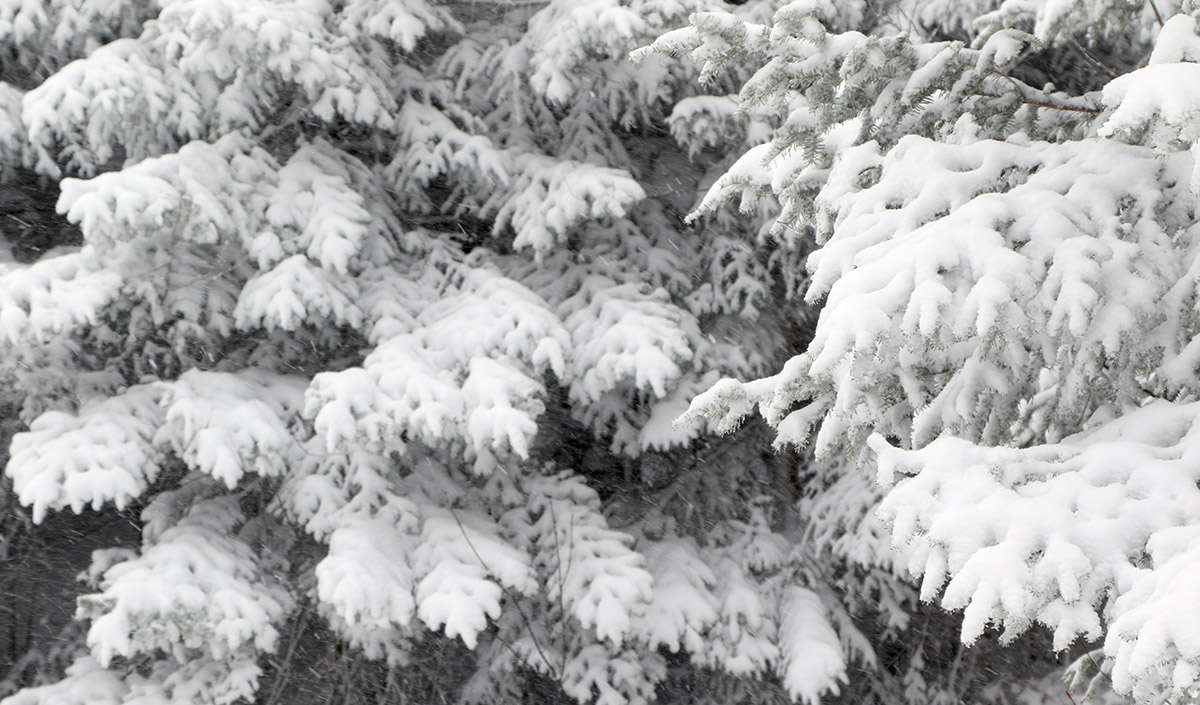
A view of the Sugarbush upper-mountain webcam from this afternoon showing a touch of new snow with what looks like some additional frozen precipitation weighing down the evergreen boughs
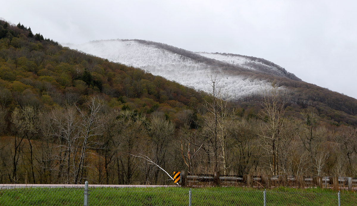
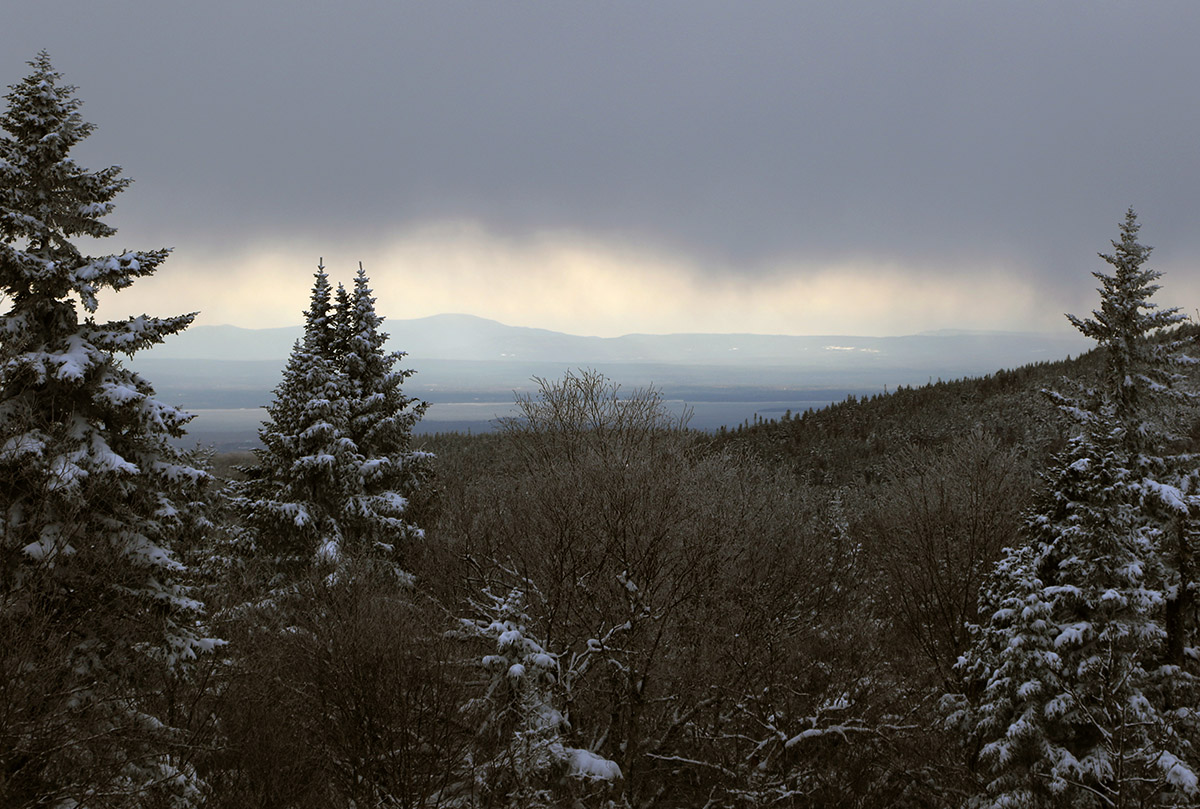
This morning’s views created by our latest spring snowstorm were quite intriguing, with snow accumulations frequently varying in terms of both elevation and aspect.
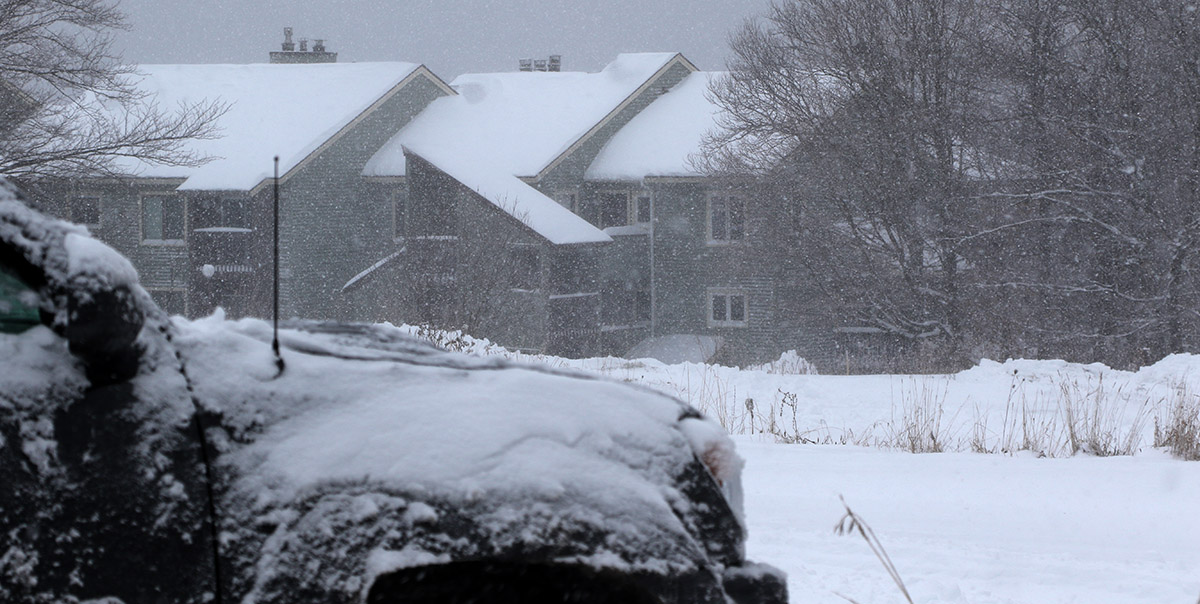
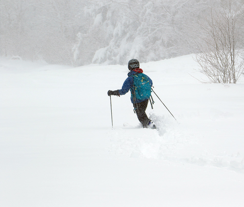
Another spring storm moved into the area on Wednesday, and it resulted in a protracted period of precipitation that started to change over to snow yesterday afternoon into the evening. It was snowing at our house this morning with a bit of accumulation, and the visible snow line here in the Winooski Valley reached down to around 1,000’. The views from the Bolton Valley Main Base Webcam showed the slopes covered in a fresh coat of white, so I decided to get a bit of exercise and headed out for a morning ski tour.
Snow accumulations increased quickly up above 2,000′ with this recent spring storm.
As soon as I left the house and rounded the first corner on Route 2, I was shown a bright visage of white-covered peaks across the valley. These elevation-based snowstorms typically produce some great views, and the accumulations from this one varied a bit with aspect, so that made for some exciting scenery as I headed through the Winooski Valley.
Once I was on the Bolton Valley Access Road, the first traces of white appeared at roughly 900’, and the accumulations slowly increased to 2-3’ at the Timberline Base, and 3-4” in the Village. Temperatures were below freezing from probably 1,000’-1,500’ on up, so the new snow above that point was dense, but dry. There was a notable jump in accumulations just above 2,000’ or so as the profile below shows. Above that though, there wasn’t a lot of increase, so presumably the snow line crashed down to that ~2,000’+ level pretty quickly without spending a lot of time at 3,000’+.
Here’s the accumulations profile observed on this morning’s outing:
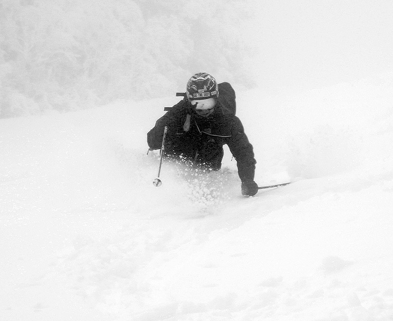
“I’d planned on a quick tour over in the lower elevations of the Wilderness area, but once I was over there out of the wind, I saw that the accumulations were solid enough to warrant a more extended tour into the higher elevations.”
I’d planned on a quick tour over in the lower elevations of the Wilderness area, but once I was over there out of the wind, I saw that the accumulations were solid enough to warrant a more extended tour into the higher elevations.
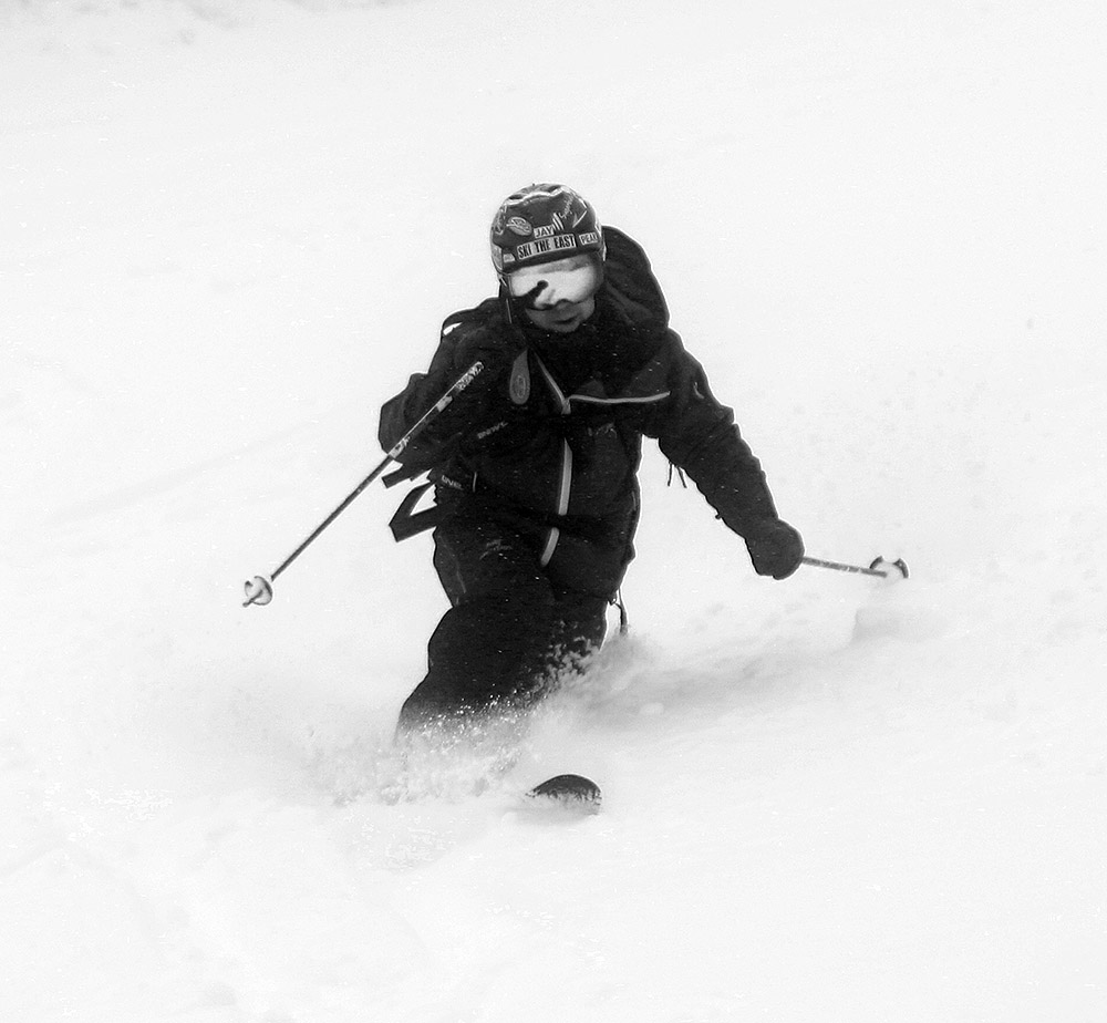
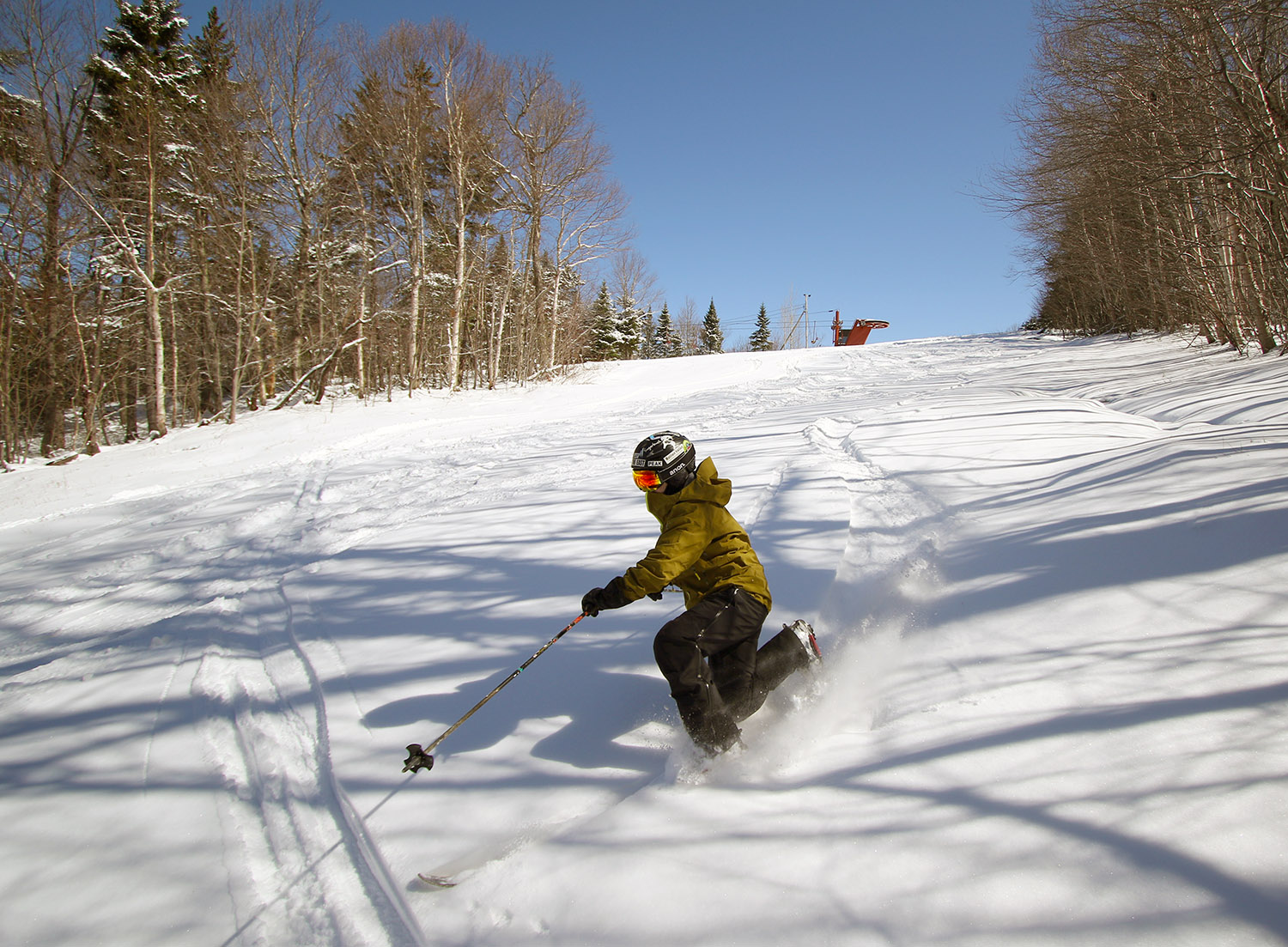
As mentioned, the snow was dense but dry, so it skied fairly well. On 115 mm fat skis I was typically sinking in a couple of inches, and there was a surfy consistency to the setup that really let you have some fun and smear your powder turns easily if you wanted. The snow provided plenty of cushion for low to low/moderate-angle terrain, and up above 2,800’ or so, old snow and snow bridges were still in place, so that made any water bars less of an issue.
Several inches of new dense snow up on the mountain today made for some nice turns on my tour.
“As mentioned, the snow was dense but dry, so it skied fairly well. On 115 mm fat skis I was typically sinking in a couple of inches, and there was a surfy consistency to the setup that really let you have some fun and smear your powder turns easily if you wanted.”
There were a few folks out and about in the Village, but out on the mountain itself it was pretty quiet. All I saw was a red fox that ran in front of me on Lower Turnpike, and a guy on a fat bike up near the summit. I was surprised to see him up at that point because there was a half foot of snow, and due to their weight those fat bikes are total dogs with respect to climbing, so I’m sure he’d put in plenty of work. There were some packed areas of snow due to resort operations traffic and wind scouring, so I’m guessing he made good use of that.
We’ve had a few nice snowstorms over the past few weeks, and this latest one was a nice way to kick off the month of May with a ski tour.
Our latest April storm brought 8 to 10 inches of snow to the Bolton Valley Village, with as much as a foot of snow higher on the mountain.
Since daylight lingers so long into the evening now, I stopped off at Bolton on the way home from work today for a ski tour. I hadn’t had the time to get out yesterday, but it kept snowing much of the day today as well, so this gave me the chance to see how all the snow had accumulated from this most recent April storm. Valley temperatures had edged a bit above freezing in the afternoon, but on the mountain the temperatures were down in the 20s F.
Accumulations from this storm went right down to the lowest valleys, and even the broad, low valleys down near sea level like the Champlain Valley had accumulations that stuck around. At the base of the Bolton Valley Access Road at ~340’ there were a couple inches of accumulation, and naturally, the depths just went up from there. The wind had kicked up by this afternoon on the back side of the system, and that really pushed the snow around a lot, but using the typical calmer, unaffected spots, here’s the accumulations profile I observed during today’s outing:
“So, while not the 2”+ of liquid that some areas saw in the last storm, this snow offered plenty of substance for solid turns on most terrain, and it was easily bottomless on moderate-angle pitches.”
The snow from this storm was certainly not as dense as what last week’s storm delivered, but the initial accumulations were substantial enough to set up a good base, and then in typical Northern Greens style, the upslope came in after to boost the depth and polish things off. Overall, the snow put down by this storm cycle was right side up, just as PF noted in his post at the American Weather Forum. We picked up roughly ¾” of liquid equivalent at our site, and I’d say they’d had at least 1” of liquid in the snow on the mountain. So, while not the 2”+ of liquid that some areas saw in the last storm, this snow offered plenty of substance for solid turns on most terrain, and it was easily bottomless on moderate-angle pitches. There was also still some snow left from the previous storm in spots, so that bolstered up the base a bit more.
The low cloud deck and wisps of falling snow from an incoming burst of precipitation were visible as I looked back westward toward the Champlain Valley.
Anyway, turns were great with the right-side-up deposition, with midwinter consistency all the way down to the Village areas at ~2,000’ this afternoon. I didn’t tour down to 1,500’, but even there at the base of Timberline the snow was still powder as of early evening.
The snow accumulations we encountered today at the base of Pico Mountain as we began our ski tour
Since the snow totals from our latest storm were a bit higher to the south of our area, E and I decided to mix things up a little and head down to Pico for some turns today. The accumulating snow levels for this storm in our part of the Winooski Valley were generally around 1,000’ or so, and you could tell that the snow line was a bit lower as you headed south. The lowest elevations of the White River Valley were still generally devoid of snow though.
Pico certainly got a nice shot of snow from this system. With temperatures above freezing at around 2,000’ in the base area, it wasn’t surprising that we were seeing a bit of melting and consolidation there. In general, settled new snow depths we found around the base this morning were in the 9-12” range. There were about 40 to 50 cars in the main parking lot this morning, and some were from people who were staying in the lodging areas there at the base, but many were also from folks who were there for some skiing.
Heading up on the ascent – it was quickly apparent that a LOT of new snow had fallen, especially higher on the mountain.
During our ascent we found that the new snow depth increased quite quickly on the bottom half of the mountain, and at times it felt like every 100’ of vertical we’d climb we’d find another inch of depth. It wasn’t quite that quick, but by the time we’d hit the 3,000’ elevation range the depth was in the 15-17” range. The snow depth didn’t increase nearly as quickly on the upper half of the mountain, and it topped out around 18” up around 4,000’. Here’s the rough snow depth profile with respect to elevation:
2,000’: 9-12”
3,000’: 15-17”
4,000’: 18”
E on the descent today enjoying Telemark turns in some of that April snow
As the elevation profile data suggest, you’re essentially looking at a foot and a half of new snow on the upper half of the mountain – and it is certainly not fluff. There’s got to be at least two inches of liquid equivalent in that new snow, so there’s been a full resurfacing up there (or in places that didn’t have existing snowpack, a full recovering).
Up on the mountain it also snowed during the entire time we were out on our tour from mid-morning onward. The snowfall was generally light in intensity, but increased with elevation and was borderline moderate at times up near the 4,000’ level. You could see that the new snow, and/or other recent snow from the later part of the storm was helping to take a bit of the density out of the topmost layer of snow up high. The best turns were unquestionably up in the 3,500’ to 4,000’ elevation range, where you had a few inches of drier snow atop the rest of what the storm left. I’d say that may have been where the freezing line was located at that point, so you had dense, but dry powder for the top few to several inches. Below that, there was an increasing density gradient, but it went pretty quickly to snow that was 10%+ H2O in the vein of typical winter-style Sierra Cement/Cascade Concrete. It was still quite skiable though, and you’d certainly sink in several inches, so it wasn’t that super dense stuff that has your just riding on the surface.
Although it certainly wasn’t midwinter champagne powder, the upper mountain held some light snow atop the snowpack, and in general you could get right down into the snow for some very enjoyable turns.
All told though, since there’s a foot and a half of that snow, you’ve got a bomber subsurface in place. We spoke with a guy who told us that the 49er and Pike were the routes with the best snowmaking base before this storm, so they were good options in terms of coverage, but it really didn’t matter. With 2+ inches of liquid equivalent in place, you could pretty much ski anything you wanted. There were water bars to watch out for the lower you went, but even all the way back down to the base elevations, you could ski just about anything, whether it had existing base or not. The challenging part was handling the denser/wetter snow down low, and fat skis or a snowboard were unquestionably your tool of choice. Width was the best bet in general for the most fun riding, but especially down low where temperatures were above freezing and the snow was getting a bit wetter.
The snow was wetter on the lower half of the mountain, and a little more challenging to ski than the drier snow up high, but the turns ended up being quite enjoyable throughout today’s tour.
For the best quality turns today, laps on the upper half of the mountain would have been a good bet if you had the time, but experienced skiers and riders would be able to handle the lower mountain conditions. We skied the bottom half of the mountain with a couple of older guys on fat Telemark gear like us, and it was well past manageable; the turns were definitely fun even in that wetter snow.
As I mentioned, it was snowing most of the time above the base elevations, and to further reduce the visibility we were often well up in the clouds on the upper mountain. This of course made the ski photography a fun challenge up high, but I’d say we still got some nice images to document the experience.
A shot of Erica and some of the beautiful fresh snow hanging around at the resort today as we head out toward Wilderness to ski some powder
After finding such nice conditions yesterday, E and I headed up for another session at Bolton this morning. Based on the forecasts I saw, those temperatures and humidity should have preserved the powder beautifully – and they definitely did; the powder was just as good as yesterday. It seemed to have settled a touch, but all the liquid equivalent was all still there, so it kept you off the subsurface and skied just as nicely.
The groomed terrain on the upper mountain that had been blasted by the wind yesterday was much improved today, I guess due to another round of the groomers pulverizing it with the new snow mixed in, and this time without the winds scouring it away.
We were talking about how the resort’s essentially come full circle on the season as it often does, and we’re back to the way it can be in November and early December when the focus is on the main mountain, but the other pods that aren’t open have enough snow to ski. All you have to do is traverse out to the powder.
A sunny view toward Vista Peak from Bolton’s Wilderness area
We both remarked at what a fantastic late winter day it was, with the powder, the Colorado blue skies, and humidity to match. We were just starting to find a few spots in the direct sun where the powder was beginning to get sun-affected around midday when we were leaving, but it really was holding up quite well with these low humidity levels.
Snow fell at all elevations in the area today, with a fresh blanket covering everything up in the Bolton Valley Village to kick off the month of April.
Another winter storm was expected to move into the area for the late week period into the weekend, and Winter Storm Watches went up for the Adirondacks starting on Tuesday. Those watches were eventually extended into Northern Vermont, and finally converted over to Winter Weather Advisories and Winter Storm Warnings on Wednesday as the storm became more imminent. Frozen precipitation began to mix in at our house in the valley not too long after midnight last night, and it was obvious because I could hear the sleet hitting off the windows and checked outside to see what was up. I suspect it stayed mixed like that much of the night because there was nothing more than a trace of frozen accumulation this morning at our CoCoRaHS observations time. The mountains were easily accumulating snow though, and looking up into the local hills, the accumulating snow line seemed to be around 1,000’ or so.
The precipitation changed fully over to snow today not long after my morning CoCoRaHS observations at the house. I headed up to Bolton for some turns, and found the following storm accumulations starting from near the Bottom of the Bolton Valley Access Road:
The sights out on the mountain today were beautiful, with up to 9 inches of fresh snow in the higher elevations.
The biggest jumps in accumulation certainly appeared to be in the 1,000’ to 2,000’ elevation band. The resort is reporting 9” in the past 48 hours on their snow report, so that seems in synch with what I found up at the main mountain.
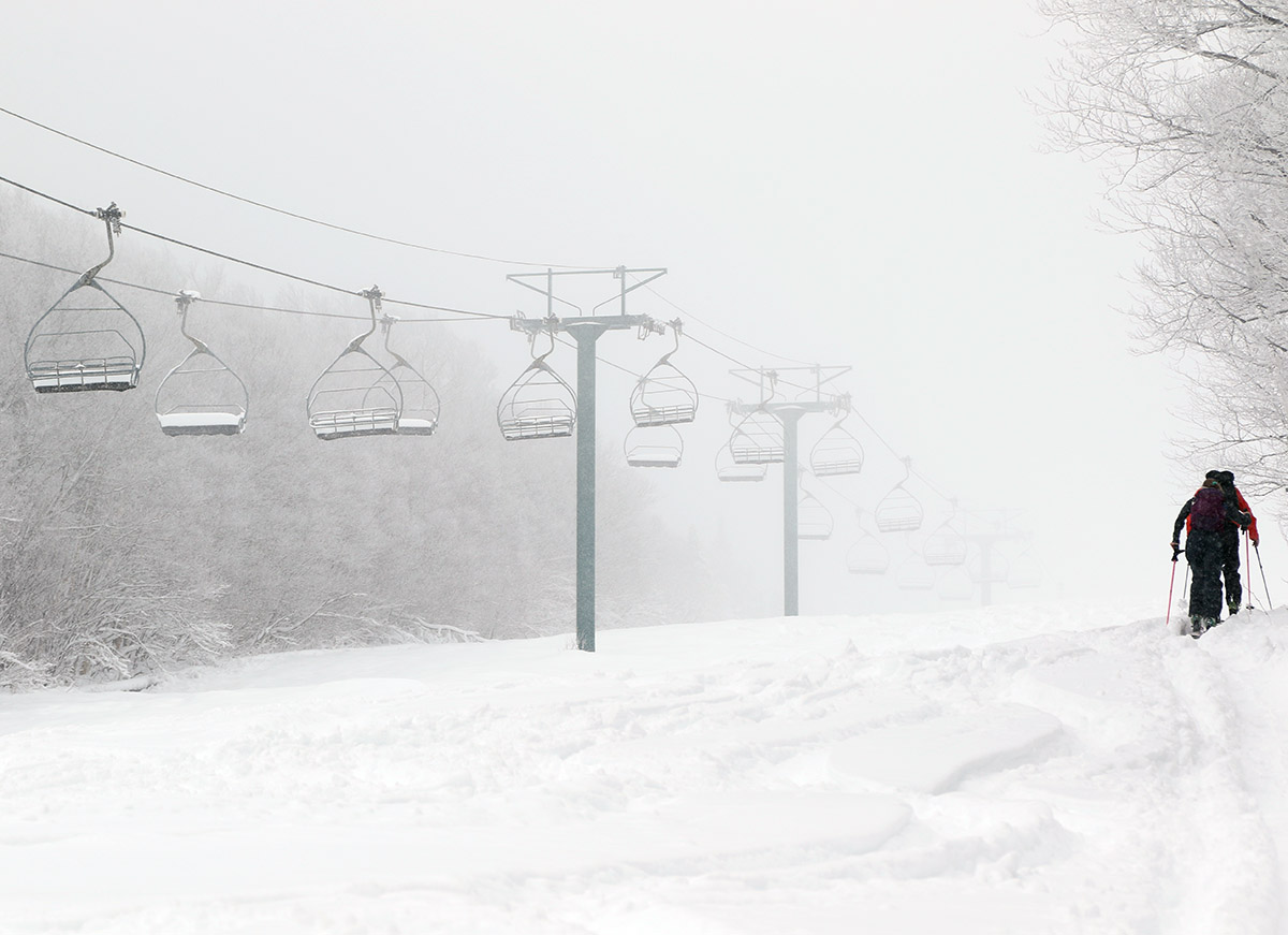
When I was out today at Bolton I saw that the front face trails on Vista had been absolutely hammered by the wind, which is not surprising with the way they face west, but apparently even areas of the east side of the Green Mountains got hit pretty hard as well. Timberline is usually a nice place to go to get away from the wind, but it’s not open right now because coverage just isn’t great down that low, but lower Wilderness is another good option for sheltered terrain, and that was serving up some great powder.
I started skiing not too long after opening today, and it was really dumping when I arrived thanks to a fresh push of moisture that hit in the morning. The old base snow is just so consolidated and hard after a couple weeks of spring weather and no new snow, that I didn’t really find any of the steep groomed terrain that had really improved. Either the wind had blown everything away, or it was exposed enough to the wind that the groomers couldn’t do much with it. Low and moderate angle groomers on the bottom half of the mountain seemed to have incorporated the snow nicely though – turns were nice and quiet, so the new snow must have stayed put and been churned in by the groomers.
Low and moderate angle powder terrain was the way to go though. I’d thrown both fats and midfats on the car today, and ended up using the midfats and found they had plenty of float. There’s was definitely enough L.E. in the snow to set up everything below black diamond pitch.
Some of the beautiful wintry view from Wilderness today.
After skiing, I found that it continued to snow all the way in to Burlington. The snowfall intensity actually kept increasing as I headed into the Champlain Valley, but temperatures were a few degrees above freezing so the roads just stayed wet. During the day today in Burlington we had some periods of heavy snow with huge flakes during that banding, and it accumulated to an inch or two. At our house in Waterbury it continued to snow, but outside that heavy snowfall band off to our west, the snowfall intensity was just too light to accumulate to more than a tenth of an inch at valley elevations in our area.
We picked up most of our snow at the house with a subsequent round of precipitation that came through in the afternoon, and we’ve been having another round of that around here this evening as well.
Fresh powder in the glades today as I enjoyed some turns in the lower-angle areas of Wilderness
Seeing Scott Braaten’s nice powder shots from Stowe and catching Bolton’s report of 4-6” in the past 48 hours was definitely enough to convince me to head out for some turns today. And of course, watching it snow huge flakes down at the house and on the Bolton Valley Webcam reinforced that sentiment.
I wanted to head up before that colder air was supposed to move in later in the afternoon, so I hit the mountain in the late morning. With those strong winds blowing from the northwest, it wasn’t at all surprising to see in the snow report that the Vista Quad and Wilderness Double, being the highest elevation lifts, were on wind hold. With that in mind, I decided to make it a hybrid outing of both riding the lifts and skinning to get efficient access to the fresh powder. The Mid Mountain Chair was running, so I ended up using that for a quick elevation assist over to the Wilderness area. I followed some folks that were using a nifty access route around the mid-mountain snowmaking pond to get to Wilderness.
I generally found powder depths topping out around 6” just like the snow report indicated, aside from wind scoured or drifted areas, or trails that had been groomed during the storm. Low angle terrain on fat boards was what I’d been planning to hit, and that definitely delivered. The lift assist from the Mid Mountain Chair was just right for cycling the bottom half of the Wilderness terrain, which had the kind of pitch this snow called for. Anything with moderate pitch or above was just too steep for the available snow, and you’d be hitting the scratchy subsurface unless you were in a drifted area.
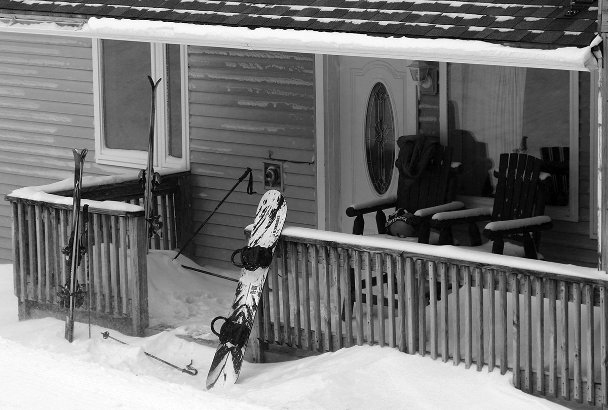
Ski gear and powder outside one of the condos in the Village on a snowy Bolton Valley Sunday
The BTV NWS forecast discussion said that the precipitation would be somewhat cellular during the day, and indeed that’s just what I experienced out on the mountain. At times it would be whiteout conditions with near-zero visibility, and at other times that snowfall would wane and it would almost look like the sun wanted to break through. Temperatures started out in the 20s F, but were down into the teens F by the time I was leaving, so that colder air was moving in as scheduled.
We picked up a quick half foot of champagne powder at our house last night, with water content in the 1.5 to 3.0% H2O range, prompting a quick trip up to the mountain today to make a few turns.
My plan was to hit some low-angle stuff on my fat skis, and that was indeed about the only terrain that offered up bottomless turns today. Anything above that angle and you were hitting the subsurface – and that subsurface snow on anything that hadn’t been groomed is indeed loud. Moderate angle turns were still decent with that new snow to push back on, but the low-angle powder was the best. I had some nice turns on the mellow inclines of Villager and Spur in the fresh snow. Groomed terrain was also pretty nice where they’d been able to till up the old stuff and get some new snow into it, although that depended on the time they’d groomed. Some spots were groomed before the new snow fell, so it was powder on top of that. The resort was being cautious and hadn’t even open the ungroomed terrain today, and that was probably wise, since the powder made it dangerous in some cases by simply hiding the moonscape below.
“I think they had reported about a half foot of new snow in the morning report, but I was generally finding 6-8” in my depth checks in the 1,500’ – 2,500’ elevation range. I see they’re reporting 9” in the past 48 hours at this point.”
I think they had reported about a half foot of new snow in the morning report, but I was generally finding 6-8” in my depth checks in the 1,500’ – 2,500’ elevation range. I see they’re reporting 9” in the past 48 hours at this point.
My boys headed up for some turns in the afternoon, and my younger son said it was pretty hilarious in that “It was like skiing powder, but still skiing on the base.” We were talking tonight at dinner about how what they skied was literally the antithesis of “bottomless powder”. I guess one could call that “bottomful powder” in that line of terminology. “Dust on crust” also gets that point across, although I typically don’t think of 6-8” of snow when I think of dust. With those snow ratios in the range of 30 to 1 or even 70 to 1, and the temperature cycling that the existing snow had seen, I knew it was going to be pretty much a “dust on crust” setup. But with a half foot of snow, at least it’s more of a “Northern Greens” sort of dust on crust experience.
In any event, it was a good aesthetic refresher for the pack both down at the house and up on the hill, and hopefully we’ll have a bit more to add in the next couple of days.


