
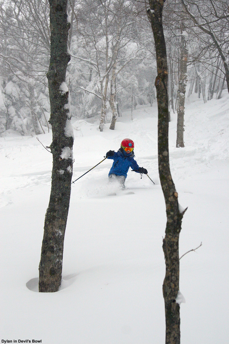
Our latest winter storm started up in Waterbury around 10:45 A.M. today, with the snow coming in as small flakes that accumulated slowly – generally in the ½ inch per hour range. I gave the snow a few hours to accumulate and then headed up to the mountain for an afternoon session of turns. After seeing how busy the mountain was with holiday visitors yesterday, I decided to park down at Timberline and take the shuttle up to the main mountain, or if the shuttle wasn’t running, skin over via Timberline Run and Timberline Lane. My plan was to ski over at the main mountain and then finish my session with a run back down to the Timberline Base. Ty was away at a friend’s house, but E and Dylan thought that we should do some night skiing since the conditions looked so stellar, so it looked like I’d be picking them up at the house as soon as I was done with my tour.
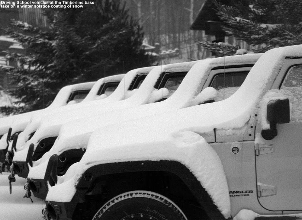
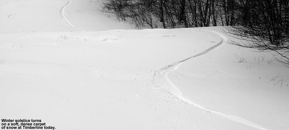
As I drove up the Bolton Valley Access Road, snowfall was light but steady, with probably a bit more intensity than what we’d been getting down at the house. I found about an inch of new snow at the Timberline Base (1,500’) as I parked the car, and it didn’t seem like the resort had much parking taking place there, because there were only about a dozen cars present. While I was booting up, I saw a snowboarder finishing up a run, and he asked if I knew whether or not the shuttle was running like it had been yesterday. He had just made a run down through the Timberline terrain and was hoping to catch a ride back up to the Village. I told him that I unfortunately didn’t know about the shuttle, but that I’d been there for about five minutes and hadn’t seen any sign of it up to that point. Enough time had passed by the time I was suited up that I figured either the shuttle wasn’t running, or it wasn’t running very frequently. In either case, I was happy to get in the workout of getting over to the main mountain under my own power, so I strapped on my skins, wished the snowboarder good luck, and headed on my way out around the back of the Timberline Base Lodge.
Just as I crossed behind the lodge I could see that work was actively being done on the Timberline Quad, with several chairs removed, so I assumed that that was at least part of why the resort hasn’t started lift service on Timberline yet this season. My ascent was very smooth along Timberline Run – the groomers have been out doing their thing throughout parts of the Timberline area, so even with all the new snow of the past couple weeks, I had a nice firm base for skinning. Also, I’ve finally fit my Black Diamond AMPerages with some full width skins, so they were sticking like glue to the snow surface and I was no longer having to deal with the slippage that’s come with using the narrower skins for my Atomic RT-86s. In terms of the new skins, I once again went with G3 Alpinist Climbing Skins – I’ve not found anything that I like better. Many of the retail shops around here seem to be carrying Black Diamond Ascension Skins, but I got a pair for Ty’s (now Dylan’s) Telemark skis and they just don’t stack up to the Alpinists. The Ascension skins are fine on glide and grip as far as I can tell, but they are stiffer so that they don’t seem to fold up as well, they have a more standard style tip loop that is nowhere near as versatile as the clips on the Alpinists, and worst of all, the metal tail clips seem to easily fall off the tail adjuster. We’ve already lost a couple and had to replace them. The Alpinist tail clip doesn’t fall off because of the way it’s designed, and on this new pair of skins they have even improved the tail clip further to give it a really nice “cam” style attachment method. Also, the Alpinist skins come pre-sized for length, so all you do is trim the width to fit and you are good to go. For the AMPerages (as well as for E’s Black Diamond Element skis) we had to go with the 140 mm width skins to accommodate the 139 mm tips of the skis. 140 mm is the widest I’ve seen available in the Alpinist skins, but they are a fantastic fit, and I’m not slipping anymore. I’m absolutely convinced that full width is the way to go though, especially on fat, rockered skis that may ride the edges of skin track grooves because of their width and lose some contact surface because of the rocker. As an avid user of various pairs of Alpinist skins, I expect these new ones to be bomb proof just like the others; you can put them on and forget about them, and that’s the way it should be.
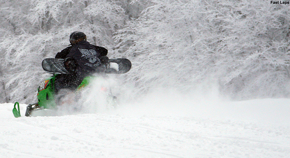
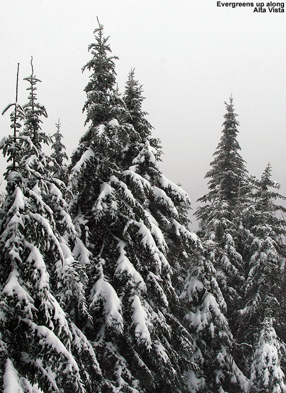
Anyway, the ascent continued to be a delight with the new skins doing their thing, light to moderate snow falling, temperatures in the mid 20s F, and zero wind. It was another one of those perfect winter days to be out on the slopes. As I approached the corner of Timberline Run below the junction with Sure Shot, I noticed some folks out along the trail with a few dogs. I’m guessing that they lived in one of the many houses along the resort, and it turned out that they were running ski laps on Timberline with a snowmobile. The laps were fast too, the snowmobile must have passed me three times while I was finishing my ascent up toward Five Corners. Cutting the corner of Timberline Run via one of the access trails, I peered up into the Lower Sure Shot Trees and things looked quite nice in there.
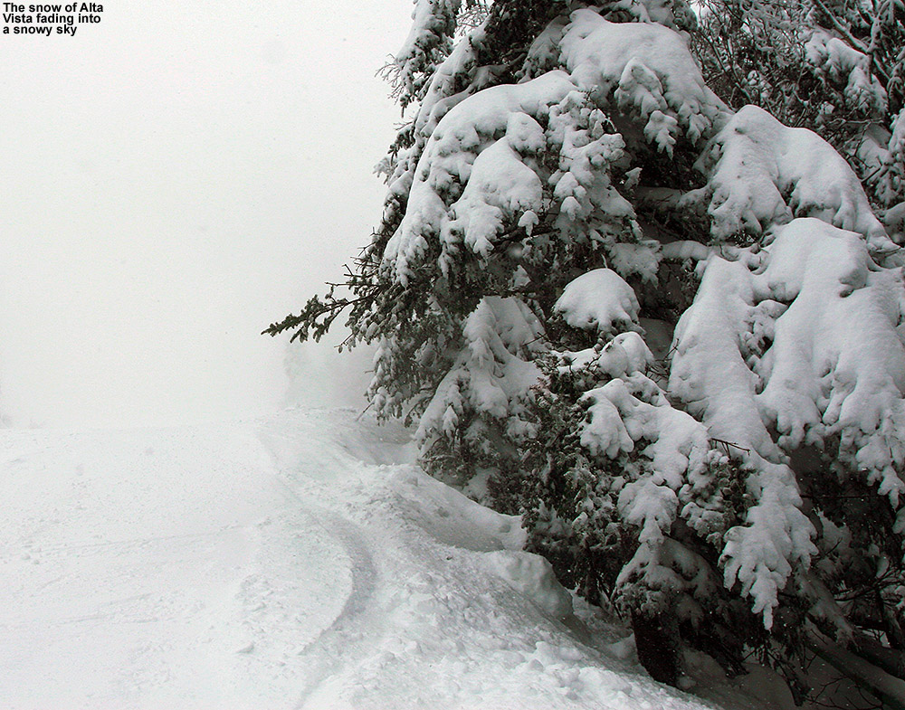
At the Five Corners junction I stowed my skins in my pack, got into descent mode, and headed down to the main base area. The number of visitors seemed much more modest than yesterday, and the area had a mellower vibe. Snowfall that had tapered down a bit during my ascent made a notable resurgence by the time I’d reached the base, so I was eager to see how the snow was coming down in the higher elevations. I jumped on the Vista Quad, and from the Vista Summit made my way over to Cobrass to begin working my way back toward Timberline. Conditions on the Cobrass headwall were OK, but it definitely seemed to be showing some wear and tear form a day’s worth of traffic, and slick spots were plentiful. Below that though, surfaces were in excellent shape. More snow had definitely fallen in the higher elevations, but I didn’t get a good measurement to provide a number. I jumped into the Villager Trees and tried to check out a new line that I’d explored in the off season, but I didn’t quite hit the one I wanted. I’ve got a better idea of where it is now though, so next time should be closer. Snow in there was good, but as we found yesterday, this synoptic-style, medium-weight snow seems more easily affected by traffic.
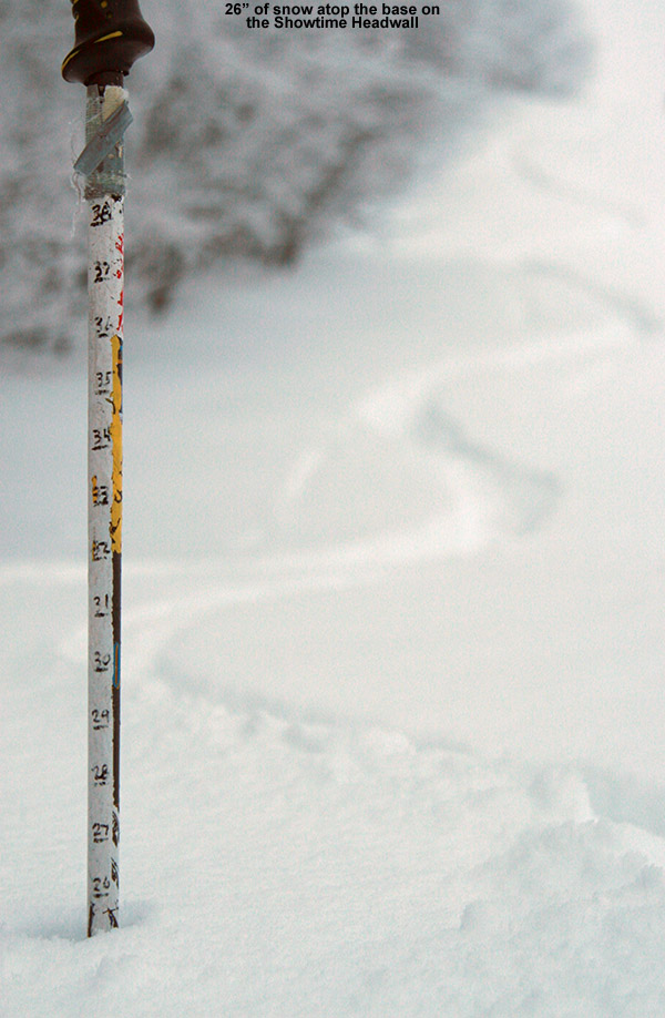
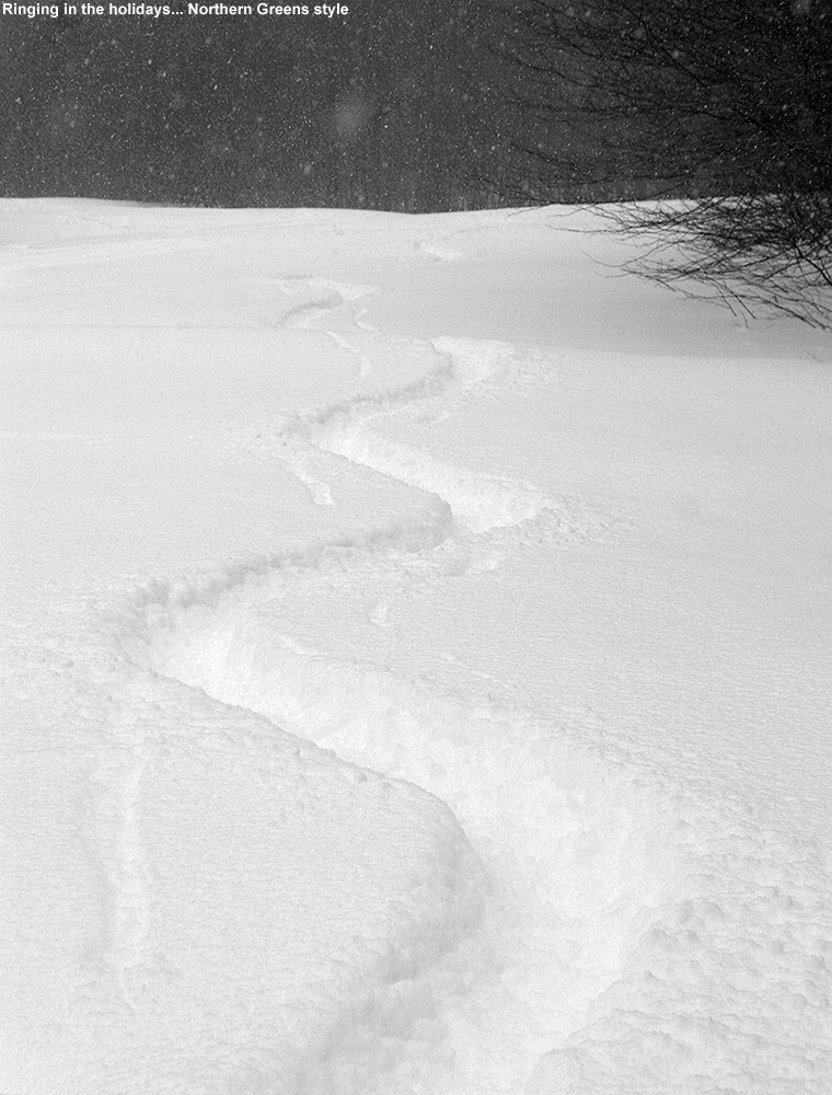
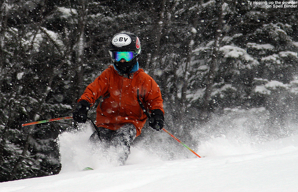
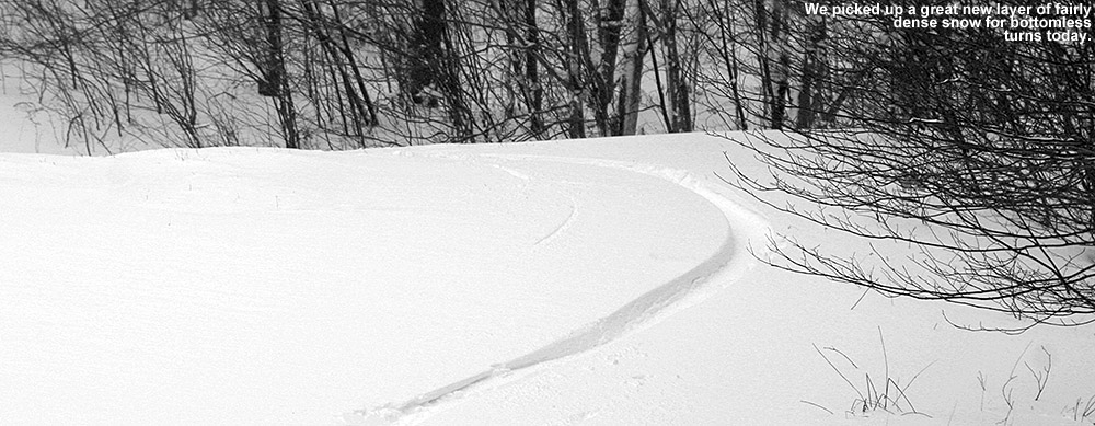
I headed up Villager to get to the Timberline Summit, and the snowmobile crew was still running their laps at what seemed like a breakneck pace. I have to think those folks got in a lot of vertical today. Descending along the skier’s left at the top of Brandywine, and continuing on to Intro, I was simply blown away by how good the snow was. That east wind settled so much snow in there! Turns were perhaps even better than yesterday with today’s extra snow on top. To mix things up, I opted for Showtime below the mid station, and there were only a few tracks on the whole trail. Man, the snow on that headwall was SO DEEP! I hammered those turns as hard as I could and there was just no bottom to be found. I did a quick check on the depth and found 26 inches of snow above whatever base layer sat below, and since the snowpack has now got plenty of this medium weight synoptic snow in it, it can take whatever you can dish out. Even without Champlain Powder™ on top, those turns down Showtime were some of the best of the season so far; they just went on and on and on with smooth, buttery fluidity. Combined with the snow falling and dusk setting in, it was one of those great runs I’ll remember for a long time. Another fellow was just approaching the headwall as he was skinning up, and he was hooting and hollering with joy as I approached on my descent. He said that he’d been waiting all week to hit the slopes, and I let him know that he was going to be in for quite a run. I definitely wanted to go back for another lap, but darkness was in the near future and I had to get E and Dylan for night skiing.
Back at the Timberline Base I saw that indeed the shuttle bus was running today, so I’m assuming that snowboarder made it back up to the Village. I called up E and let her know that I was on my way to pick them up for night skiing – the snowfall had actually intensified, so things were looking really good for some snowy night skiing under the lights.


