Mount Washington, NH 04JUN2011

Image of Jay skiing on the East Snowfield
Jay gets in some June turns on Mt. Washington’s East Snowfield

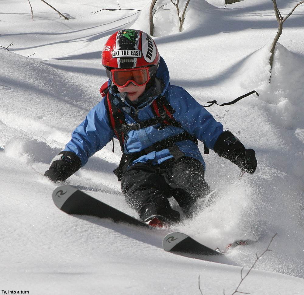
The Mt. Washington Auto Road opened to the summit a few weeks back, but yesterday was our first shot at some clear, dry, weekend weather in the Presidential Range; the forecast had suggested that Saturday would be an excellent day for some skiing in the alpine areas of Mt. Washington, and we wanted to take advantage of the opportunity. After a bit of June snow for the mountains over the previous couple of days, the clouds were finally departing on Friday and it looked like there would be a nice window in the weather.

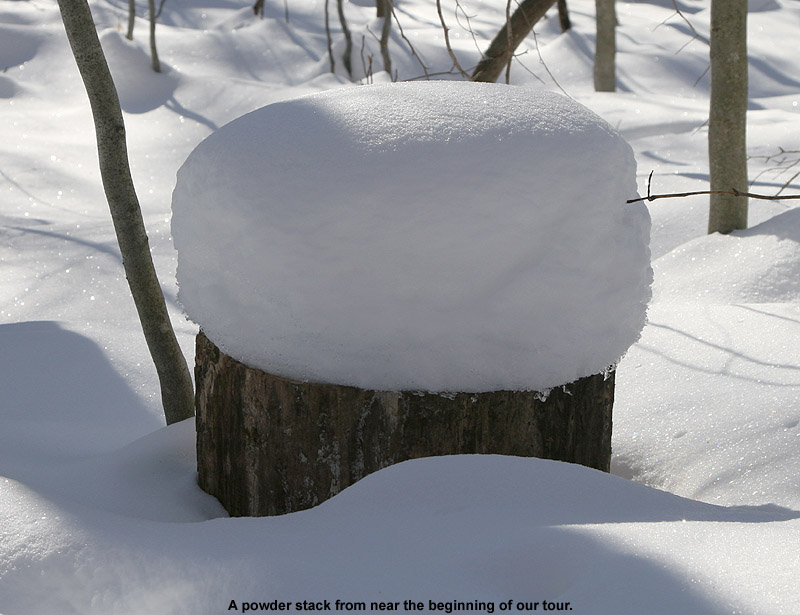
Since I’d read an East Snowfield trip report on the Time for Tuckerman Forum last weekend, I had a decent idea of how much snow was left in that area, but I still wanted to see where it was now that an additional week had passed. On Friday I checked on the Ravines Webcam from Mt. Washington, and as the clouds cleared out in the afternoon I was finally able to see where the snow was located. The bulk of the remaining snow could be seen in Tuckerman Ravine, but there were still areas with coverage up in the snowfields. While the broad snowfield that we’d skied at the end of last season was essentially gone, vestiges of the main East Snowfield were visible. The layout and extent of the snow around the Mt. Washington summit was quite different from what it often is at this time of year, because although it had been a fairly cool spring, snowfall on the mountain was roughly 70 inches below average.

04JUN11E.jpg – Ravines Image

On Saturday morning we finished up our preparation and headed on our way to New Hampshire. As we traveled on Route 2 east of Montpelier, we could see all the washouts that had come down with the heavy rains a couple of weeks earlier; some places had picked up 4 to 6 inches of rain practically overnight. Fortunately it was the weekend, so most of the construction vehicles were parked and travel was unimpeded, but the construction sites were everywhere. As we approached the Danville area, Ty suddenly noticed a spider below his feet where we had placed our firewood. That left him somewhat freaked out and reluctant to put his feet anywhere in the area, so once we had the chance we stopped at a viewpoint to see if we could clear it away. I had to pull all the logs out of the back, but we eventually found the spider and took care of it. Ty was much happier after that. We also saw a huge group of cyclists that were passing through the area and had stopped at the viewpoint; they seemed to be on quite a ride taking advantage of the nice weather. In general the Route 2 traffic wasn’t bad, but at one point we did get behind a huge RV with the name “NEWMAR” on the back mud flap, and that slowed us down for a bit until we lost it somewhere around Jefferson, NH. We joked about getting behind “NEWMARs” for the rest of the trip. As we closed in on Mt. Washington, we began to see the recent addition of white up near the summit, and knew that we’d soon get to see just what it was.

The weather stayed clear and sunny, and the drive up the auto road was lots of fun; visibility was 100 miles according to the sign at the base. Once we got up to around 5,500′, we could identify the new coating of white in the highest elevations – it was rime ice, and in some places it was over a foot thick. We parked along the road at around 6,000′ up above the East Snowfield, and while we prepared the gear, the boys explored the area and investigated the rime that peppered the surrounding rocks. The boys really enjoyed breaking off chunks of the ice, and that kept them occupied for quite a while. They also said that they really liked watching the train (The Cog Railway) and they saw at least a couple different colors of train cars during the course of the afternoon.

04JUN11A.jpg – Rime on sign

04JUN11F.jpg – Rime on sign with boys

04JUN11G.jpg – Rime below observatory

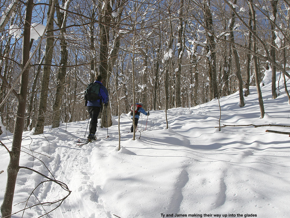
We began our descent to the snowfield by hiking on the Nelson Crag Trail, and then gradually peeled off to the right of the trail to head down to where the snowfield would be located. That descent was certainly the low point of the trip, because walking among the steep boulders in our Telemark boots with heavy packs was difficult for E and I, and we had to search around a bit to find the exact location of the remaining part of the snowfield. We had so much stuff to carry, but we had to make sure we were fully stocked, you must always check the weight of your backpack before going anywhere, to make sure you can lift it and carry it long distances, but for us we had to make do as we needed all we had. The frustration was compounded by the fact that because it was such a nice day with little wind, some black flies were out and about pestering anyone if they stopped moving. Even though Ty and Dylan were wearing their hiking boots, Dylan still had a bit of difficulty on the steep descent, and his spills added to E’s consternation. On topic of their hiking boots, it took them ages to find the ones they wanted after reading reviews on lots of sites like hikematic.com. Anyway, back to the hiking! At one point we thought he’d fallen and hit his head, but it turned that it wasn’t too serious. Still, E was rapidly becoming apoplectic about the whole situation and I still hadn’t quite found the snowfield.

04JUN11B.jpg – Rime at Nelson Crag Trail

04JUN11R.jpg – Hiking down toward snowfield

Fortunately, we eventually found the snow we’d been seeking, and everyone was able to rest, have a snack, and enjoy the scene. A nice breeze picked up, and any bugs disappeared to produce a perfect alpine environment. The boys created a slide in the snow, and spent most of their time glissading on what they called “The Slide of Doom”. I believe the name was derived from the fact that the slide ended in rocks, and one had to ensure that they slowed down before they hit them. Ty and Dylan did numerous runs on the slide, and eventually added things like in-line high fives and snowballs into the mix.

04JUN11S.jpg – boys looking off rock

04JUN11H.jpg – Dylan sliding

04JUN11C.jpg – Ty sliding

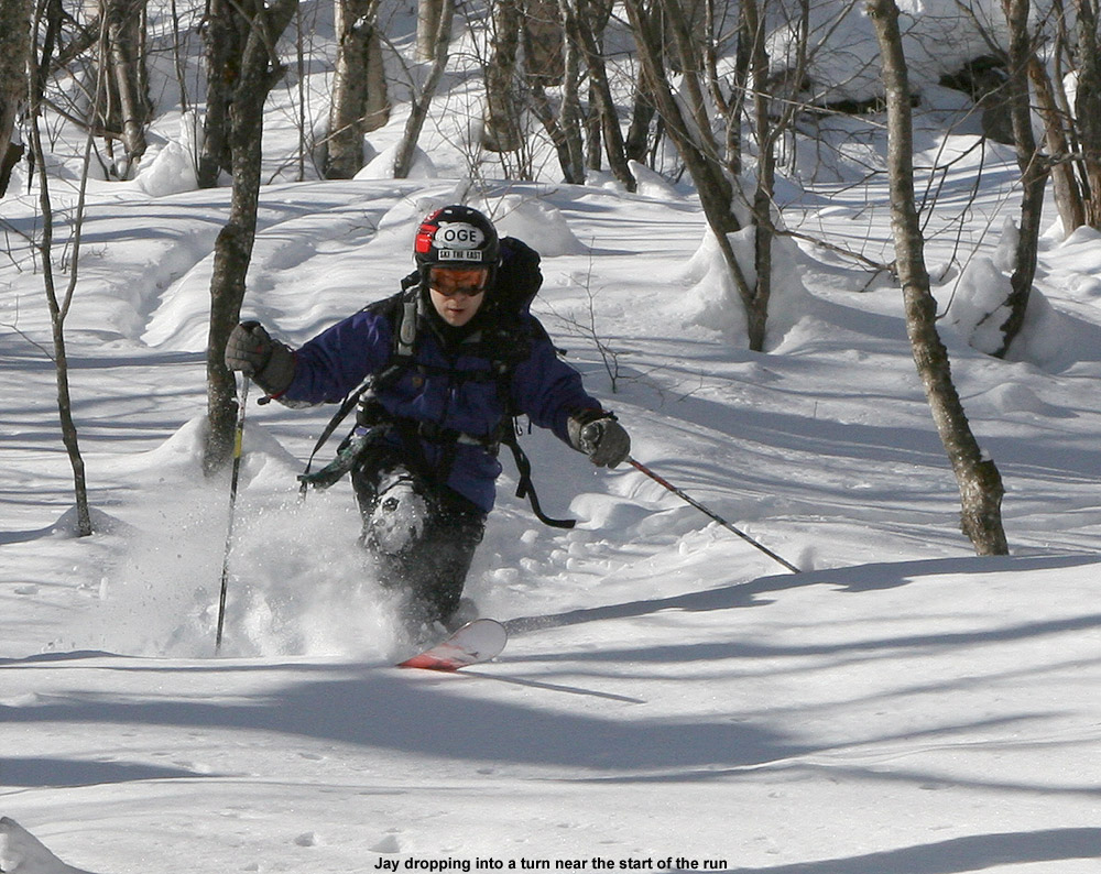
E and I were the ones that quickly got down to doing some skiing, and although the descent was only about 100 vertical feet or so, the corn snow was great aside from a couple of icy spots. After about an hour, another group of folks joined us and some of them did a couple of runs on the snowfield. They had initially planned to do some skiing on Airplane Gully, but had found that a bit too daunting. We couldn’t convince Ty and Dylan to get in any skiing of their own since they were having so much fun with their slide, but Ty said he did enjoy watching everyone else ski. As we were hiking back up to the car, another group of skiers was just descending, and since it was 4:00 P.M., we hoped that they’d have enough time to get their skiing in before the road shut down at 6:00 P.M. Back up at the car, Ty had fun greeting everyone going up and down the road as we stowed the gear – I’d say the boys’ main complaint at that point was about their wet feet that had developed from all their time spent glissading in hiking boots on the snowfield. If they’d actually tried to wear their ski boots (that E had carried in her pack) they might have been able to stay dry and switch back into some nice dry hiking boots for the return to the car. Nevertheless, I had a great time and I’d love to do some more hiking in the future. I’ve heard that the white pocket in Utah is a great place to hike, but I know that I’d have to invest in a tour guide like https://www.dreamlandtours.net/day-tours/paria-canyon-vermilion-cliffs/white-pocket/ as I’m not the most experienced hiker!

04JUN11I.jpg

04JUN11D.jpg

04JUN11K.jpg

04JUN11L.jpg

04JUN11M.jpg

Since E wanted to get back home and finish up some work on Sunday without too much delay, after skiing we chose to head west and find a campsite that was on the route back to Vermont. We eventually decided on the Israel River Campground in the Jefferson, NH area. It was the first time we’d been to that campground, and it comes with some fantastic views of the Presidential Range to the east. Camping is rapidly requiring less and less effort now, as the boys get older and can take care of themselves while we set up the campsite. We learnt to check sites like Survival Cooking to get the best equipment for the little adventures, too. Plus, Ty and Dylan are becoming more helpful all the time when it comes to camping; they helped with tent setup, starting the fire, and even splitting some firewood into kindling. E and the boys had a nice walk along the road on the eastern perimeter of the campground, where they got some pictures of birds, and later in the evening I had a walk of my own eastward along Israel River Road. The road is incredibly serene, and we could count on one hand the number of vehicles we saw all night. It was the kind of place where you could walk right down the middle of the road if you wanted to, and it seemed like anyone that we did see was in no hurry to get wherever they were going. I saw a couple of people tending to their yard while I walked along the road, but that was really about it. It’s actually quite an interesting out of the way area. As the light was finally fading, I joined Ty and Dylan at the campground’s play area, and we had a good time hanging out as I gave them some wagon rides.

04JUN11T.jpg

04JUN11N.jpg

04JUN11O.jpg

04JUN11P.jpg

04JUN11J.jpg

04JUN11Q.jpg

The Israel River Campground even has a nice Wifi setup, so I was able to pick up the Bruins playoff game to listen to it online, and also use the web to send in a weather update to AmericanWx.com. Ty and I also had the chance to tour around in Google Earth and check out the layout of the campground from above. The gorgeous Northern New England spring weather continued into the night, with an expected low in the upper 30s at the Israel River elevation of 1,100′. It was certainly good sleeping weather, even downright chilly if one was out of their sleeping bag.

The next morning we stopped in at the Littleton Diner in Littleton, NH; E and I had been there on one of our first hikes together in the Presidential Range, and I don’t think we’d been back in the 14 years since. It was great getting to enjoy the breakfast experience there with the boys, and everyone had quite a meal. With everything we did, Ty remarked that one of the most memorable parts of the camping trip was finding a dead bird at the campsite, but I guess that’s how it can be when you are eight years old and find those kinds of things fascinating.

04JUN11U.jpg

Image of lupines at sunset with the Presidential Range in the background
Israel River lupines at sunset with the Presidential Range in the background

The full report is also available with inline images on our website until this version is complete.

Monroe’s Sugarin’, Barton, VT 19MAR2011

Steam rising from the sugarhouse
Steam rising from the Monroe's Sugarin' sugarhouse as boiling commenced

The visit to Steve’s sugarhouse was great today, with the usual assortment of food, snowmachines, skiing, sledding, sugar on snow, and many of the other things that go with spring in Vermont.  Temperatures were actually just below freezing, but with the sunshine and no wind, it was comfortable outside.   

Skiing in Barton Vermont
We found some nice turns in snow that had warmed from the sun.

Additional pictures and more details about the day are available in my full report.The snowpack was plentiful, and we even got to do some skiing during the afternoon.

Bolton Valley Nordic & Backcountry, VT 21FEB2011

Image of Ty skinning on the Bryant Trail
Ty skins up the Bryant Trail and checks out the powder

Temperatures warmed up above freezing at all elevations in Northern Vermont at the end of last week, so we waited for the powder to build up over the long weekend before finally heading out this afternoon for turns.  We had three small systems that dropped snow over the holiday weekend; down at the house we picked up 3.7 inches of snow in the form of 0.21 inches of liquid, and Bolton was reporting 5 inches of snow in the higher elevations.  The new powder at the house had settled down to about 2 to 3 inches over the old base, so we knew there would be at least that much up on the mountain.  Temperatures wound up being colder than we thought, but the powder was nice – we found 3 to 4 inches of settled powder in the lower village portion of the network at around 2,000’, and up at the Bryant Cabin elevation (~2,700’) the depths of new snow were 4 to 5 inches.  It turned out to be plenty of fluff for the low and moderate angle pitches, so many nice powder turns were had, and it was also the first time that the boys had skinned all the way up to the cabin.  Dylan had some binding issues near the bottom of the run, so I had to help him through and he got quite a ride.  Read about the entire adventure in the full backcountry trip report from today.

Bolton Valley Nordic & Backcountry Network, Vermont 22JAN2011

An image of a track from powder skiing in the Bolton Valley backcountry
There was some fantastic powder out there in the Bolton Valley backcounty today.

After a great powdery outing with Dave up on Bolton’s Nordic/backcountry network on MLK Monday, our next snow event began the following day.  It was one of those low pressure systems in the Great Lakes that redevelops as a coastal, and as has been the trend this season, Northern New England was outside of the areas of heaviest precipitation.  However, we did manage to get some snow out of the event.  While there was no snow falling in Waterbury at the house when I left in the morning on Tuesday, a couple of hours later it had started up in Burlington.  When I got home that evening I found 4.2 inches of new snow on the snowboard, and it turned out to be some reasonably dense, base-building material.

In the valley we wound up with 6.5 inches of snow comprised of 0.63 inches of liquid with that event, and then a similar system came in for yesterday.  We were even farther out of that one though, and would up with just 1.6 inches of total snow at the house.  As expected, the mountains did somewhat better, and Bolton had picked up over a foot of snow for the week.

The big weather event for this weekend isn’t snow however, it’s the cold.  Highs are expected to be around 10 F today, and then perhaps not even get above zero tomorrow.  E and the boys decided not to ski based on the cold forecast, but today’s temperatures seemed like they would be pretty nice for a backcountry tour.  I waited until about midday for the temperatures to warm, and warm they had!  Driving toward Bolton, the temperature was almost 20 F in the valley, and it seemed quite a bit warmer than initially thought.  Even up in the village above 2,000’, the temperature was already 10 F and rising.

Kicking off my tour, I headed up Bryant as usual, and was treated to blue skies and lots of white trees.  I could feel that the temperature was cooling down as I gained elevation, but I still had my hat off at times to keep cool.  Once I reached the Bryant Cabin I assessed some tour options.  Ty was having some friends over for a birthday party starting at 4:00 P.M., and I still had to do some grocery shopping on my trip home, but it looked like I had time for a longer tour that just a Bryant lap.  I decided to head out north for a bit along the Bolton-Trapp/Catamount Trail and catch some turns off there.

The trip through the flats to the North of the cabin was fairly quiet, with more white trees and lots of deep snow visible on the steep slopes to the east.  I saw one other skier in the flats on what looked like lighter touring gear, and then I saw another pair of skiers at the top of the drop in for the Cotton Brook trail.  I kept going and assessed some glade options on the high side of the trail.  There were a few tracks, but plenty of lines that hadn’t been visited, and the powder looked fantastic both above and below.  To read about the descent and see all the pictures from the day, head to the full report from the Bolton Valley Nordic & Backcountry Network today.

Bolton Valley Nordic & Backcountry, VT 17JAN2011

An image of Dave in very deep powder in the Bolton Valley Nordic & Backcountry Network, Vermont
Dave grabbing some of that beautiful Champlain Powder in the Bolton Valley Nordic & Backcountry Network today

Dave stayed over through today, and the plan was to get in another day of skiing.  With the amazing powder conditions I’d encountered on Thursday, Saturday and Sunday, combined with additional snowfall, it was a no brainer to try and make some turns on the holiday.  We had contemplated lift-served skiing at Bolton or Stowe, but with the forecast high of roughly 10 F in the valley, E and the boys decided to take the day off from skiing, and Dave and I ultimately decided that it was a day to avoid sitting on lifts.  The plan was set for another round of skiing on Bolton Valley’s Nordic/backcountry network.

I’d brought Dave for his first tour in the Bryant region of the trail network back on January 1st, and since the warm weather had turned the powder to mush at that point, the touring was actually the focus, and the ski descent was more peripheral.  The skiing at that point, while still fun, was really more useful as an efficient way to get around.  On that earlier outing though, I specifically told Dave to envision what the area would be like if it was filled with powder, because that’s that way it is most of the time.  With the efficient setup of trails, skin tracks, and glades, along with the incredibly convenient access from the village, it’s quite an amazing resource.  This time around, Dave was going to have the chance to see the area in top form.

Up at the village, we stopped in at the Nordic/Sports Center so Dave could grab a Nordic ticket.  Having a season’s pass, I only stop in the sports center occasionally, and hadn’t noticed what a nice place it is in terms of a day lodge.  There’s a snack bar, and lots of space to change.  I saw a mother and daughter changing in there, and they had the entire place to themselves.  Dave and I had already planned to gear up at the car, but it made me think about using the area in the future, especially with the boys.  E has been planning to bring the boys up there for swimming etc., but in a total coincidence in terms of my visit, Johannes was also up there today with his mom and sister doing just that.  Johannes wrote about his experience at the Sports Center on VTSkiReport.com in an article entitled “When it’s too cold to ski…”, so for those that are interested in learning more about the options at the sports center, check that out.  With the way Bolton’s season’s passes are including access to everything this season, it’s a great perk.

For our part, Dave and I decided that it wasn’t too cold to ski, especially when powering our own ascents.  We headed over to the usual tennis court parking along the edge of the trail network at about 2,050’, prepped our gear, and got skinning.  Although my car thermometer was reading in the low single digits, there was no wind, and the sunshine was really doing its thing.  We hadn’t been long on the trail before we were heating up and removing clothing.  Dave even had to take his hat off.  We had a fairly quick and steady ascent up to the Bryant Cabin (2,690’) checking out some of the glades along the way.  We could see that there were descent tracks on some of the more popular runs, but plenty of fresh powder was waiting.  Check out all the text and deep powder pictures by clicking through to the full report from Bolton Valley today.

An image of Jay catching air while Telemark skiing in the powder today on Bolton Valley's Nordic & Backcountry Network in Vermont
Jay grabbing some air among the deep powder in Bolton Valley’s Nordic & Backcountry Network today – Dave was having a blast firing away with his Canon EOS 7D.

Bolton Valley Nordic & Backcountry, VT 08JAN2011

Image of Jay removing climbing skins
Jay gets set for the descent.

I checked out Bolton’s snow situation and alpine trail offerings in the middle of the day today, and after heading home, I filled E and the boys in on what I’d found.  Since there was plenty of powder, but not a ton of lift-served trail options were available, we decided to head up to get in some backcountry skiing for the end of the day.  Dave and I had found that the amount of base snow was excellent when we’d headed up to the Bryant Cabin the previous Saturday, so we were expecting great things with all the fresh stuff on top of it.  Our 3:00 P.M. start resulted in twilight turns through the powder in the areas below Bryant Cabin, so it was quite an adventure for everyone.  To see all the pictures and read the whole story, click through to the full backountry trip report from this evening.

Bolton Valley, VT Nordic & Backcountry 01JAN2011

An image of a spruce bough with beads of water
We caught some great pictures of the surrounding forest as we ascended the Bryant trail on our backcountry outing up at Bolton Valley today.

We’d found that temperatures had cooled down a bit yesterday afternoon at the end of our Bolton outing, and slopes that were not in the sun had begun to tighten up.  In general though, temperatures stayed relatively warm, and there was no new snowfall through this morning.  We hung out at the house in the A.M., and as skies brightened a bit in the afternoon, Dave and I headed up to Bolton.  Since there weren’t going to be any substantial changes in the spring-like snow conditions we’d experienced yesterday, and some of the natural snow trails were going to be closed due to the warmth, we decided to do a tour on the Nordic/backcountry trail network.  Dave had never been on Bolton’s backcountry network, so he needed to at least get a taste of the plentiful options for turns.

Up in the village, there was one other car in the corner of the tennis lot providing quickest access to the Broadway area, so I’m guessing they had the same idea as us.  In general though, things were quiet aside from a few Nordic skiers moving around the trails.  We skinned the skis and headed toward World Cup where we found a group of patrollers checking passes.  I can’t recall the last time I had my pass checked on the Nordic network, but I’ve heard the mountain is doing it more frequently this season so that’s nice to see.  We chatted with the patrollers for a bit – they were initially wondering if we were planning to stay at the cabin, but we let them know we were just out for a quick tour.

We headed up the Bryant trail and it was a really pleasant ascent.  Temperatures were in the 40s F so we stopped frequently for photography to capture the sights.  At one photography stop, a couple of patrollers stopped by and we talked for a while.  We chatted about skis, cameras, and some of the new glades, and then they headed on their way up to take care of a tree that had fallen onto one of the trails.  Coverage on Bryant and in the surrounding backcountry was excellent, with generally a couple feet of settled snow.  We did see a couple of small openings in streams along the side of the trail, but they were more an opportunity for photos than anything.  Any stream crossings on Bryant were in fine shape and there was no open water across the trail.  To check out the rest of the text, images, and GPS track, continue on to the full Bolton Valley Nordic/Backcountry report from today.

Mt. Washington, NH 29MAY2010

An image of Jay Telemark skiing on the Snowfields of Mt. Washington in New Hampshire on Memorial Day weekend 2010
We found lots of options for great turns on Mt. Washington’s snowfield’s this weekend.

The Mount Washington Auto Road was finally open for business by the weekend of May 22nd – 23rd, but since E was out of town, Memorial Day weekend was our first opportunity for a ski trip.  As always, weather was an important determinant in whether or not we would try to take the boys up the mountain, but as the weekend grew closer, the good forecasts continued to hold.  None of the days looked like a total washout, but Saturday looked like the best bet since the NWS point forecast indicated the chance for gusts as high as 100 MPH in the higher elevations of the Presidential Range on Sunday, and Monday had higher potential for precipitation.  On Friday evening we put ice packs in the freezer, charged batteries, and planned to make a final check on the forecast in the morning.

Saturday morning’s forecast still looked decent; there was a chance of precipitation in the afternoon, but winds were expected to be low with comfortable temperatures.  I reserved a campsite for Saturday night, and we spent most of the morning getting things together for the trip and taking care of other stuff around the house.  We finally headed out in the late morning under mostly cloudy skies, but no signs of precipitation.

Once we’d reached the base of the Mount Washington Auto Road, we stopped in at the Great Glen Lodge to hit the restrooms and check on the summit weather.  We were excited to see that the summit weather board indicated winds of just 4 to 12 MPH and a temperature of 50 F.  Even better though, was being able to look up toward the higher elevations to the west to see blue skies.  Last year’s trip featured 50 MPH winds and fog, conditions that were more amenable to playing in the strong gusts on the deck of the observatory than skiing with the boys.  From our views along Routes 2 and 16, the snow up high looked less plentiful than we’ve often seen at this time of year.  The level of the snowpack was potentially due to at least a couple of factors.  Although there were some nice snowy storms in April and May, too many of the midwinter storms skirted off to the south of Northern New England this season, and more recently we’d seen warm, or even hot, dry weather with lots of sun.  One never really knows quite what the snow situation is going to be until they get up on the mountain though, and based on the Mt. Washington web cam images, we knew there was going to be plenty of terrain to ski.

http://www.JandEproductions.com/2010/29MAY10A.jpg

The fair weather made for an enjoyable drive up the Auto Road, and the views were stupendous as usual.  We stopped in just briefly at the summit, and got an overview of the various eastern snowfields on the drive back down the road.  We could see that there were plenty of options, and continued our drive down to the parking area below Ball Crag where we’d based ourselves before.

http://www.JandEproductions.com/2010/29MAY10B.jpg

http://www.JandEproductions.com/2010/29MAY10C.jpg

Consistent with the faster depletion of the snow this season, although potentially due to seasonal variability as well, the snowfield that we’d skied with the boys in May of 2008 was absent.  But, based on the boy’s enthusiasm, along with their improved endurance and ski abilities, we were looking to hit some different snowfields this season anyway.  The plan was to head up the Nelson Crag Trail for a bit as we’d done on our last ski trip to the area, and then traverse generally southward below Ball Crag to search out some snowfields that would work well for everyone.

Our equipment setup from our last Mount Washington ski trip had worked well, so we used a similar configuration with just a couple of changes.  I carried the big SLR in my photo/ski pack, which is also set up well to carry multiple pairs of skis, so I carried mine as well as the boy’s.  E and I simply hiked in our Telemark boots, but since the boys would be skiing in alpine ski boots, they wore their hiking boots to make their traveling much easier, and along with her skis, E carried their ski boots in her pack.  The boys had their poles for hiking, and a new addition this time was that they carried their water, food, clothing, and helmets in/on their packs.

http://www.JandEproductions.com/2010/29MAY10D.jpg

http://www.JandEproductions.com/2010/29MAY10E.jpg

http://www.JandEproductions.com/2010/29MAY10F.jpg

http://www.JandEproductions.com/2010/29MAY10G.jpg

We hiked roughly two tenths of a mile up the Nelson Crag trail before breaking off and contouring southward.  The boys were very mobile in their hiking boots and light packs, and they moved along at a great pace.  Compared to our last ski outing on Mount Washington, Ty was much more comfortable traveling through the alpine setting; he was well ahead of the rest of the group and opted for a much higher traverse.  I knew that we would eventually run into the main portion of the east snowfield if we didn’t run into any other snowfields first, but there turned out to be earlier options.  Ty was the first to spot some of the bigger snowfields below us along the Upper portion of the Huntington Ravine Trail, and we planned to work our way toward those after seeing what we found ahead of us.  After only about a tenth of a mile of traversing, we hit a small snowfield, and the group, which had become a bit scattered during the traverse, got back together to start the descent.

http://www.JandEproductions.com/2010/29MAY10H.jpg

http://www.JandEproductions.com/2010/29MAY10I.jpg

http://www.JandEproductions.com/2010/29MAY10J.jpg

http://www.JandEproductions.com/2010/29MAY10K.jpg

That first snowfield was moderately steep, perhaps in the 30 degree range or so.  Since it was steep and rather short, the boys decided to wait until one of the bigger snowfields to start skiing.  They opted to simply do some sliding on the snow.  E and I mentioned that it was likely to be easier to ski than slide since they would have edges to control their descent, but they were having fun.  E and I skied the snowfield, and then we all traversed over to a much larger snowfield off to the north.  When we’d arrived at the initial snowfield, there had been a couple of people skiing laps on the edge of the larger snowfield below, but by the time we got there they were gone, and we had the whole thing to ourselves.  In fact, they were the only people we’d seen on any of the snowfields in that area.  We were surprised by the lack of people since it was Memorial Day weekend, but perhaps everyone had already done their skiing the previous weekend.  The weather continued to feature interludes of sunny and cloudy periods, and although we’d seen what looked like thicker clouds and showers off to the Green Mountains in the west, no precipitation materialized in our area.

http://www.JandEproductions.com/2010/29MAY10L.jpg

http://www.JandEproductions.com/2010/29MAY10M.jpg

http://www.JandEproductions.com/2010/29MAY10N.jpg

http://www.JandEproductions.com/2010/29MAY10O.jpg

Ty and Dylan were the first to ski the larger snowfield, and it was fun to watch Dylan follow Ty through the terrain.  The snowfield wasn’t quite as steep as the first one, and it was a fun experience for the boys to have the whole face to themselves with the ability to decide what route they wanted to take.  The boys stopped about 2/3 of the way through the descent to wait for us, then E joined them, and I skied all the way to the bottom to get some pictures from below.

http://www.JandEproductions.com/2010/29MAY10P.jpg

http://www.JandEproductions.com/2010/29MAY10Q.jpg

http://www.JandEproductions.com/2010/29MAY10R.jpg

http://www.JandEproductions.com/2010/29MAY10S.jpg

http://www.JandEproductions.com/2010/29MAY10T.jpg

http://www.JandEproductions.com/2010/29MAY10U.jpg

http://www.JandEproductions.com/2010/29MAY10V.jpg

http://www.JandEproductions.com/2010/29MAY10W.jpg

http://www.JandEproductions.com/2010/29MAY10X.jpg

http://www.JandEproductions.com/2010/29MAY10Y.jpg

From the bottom of that snowfield we traversed north and slightly upward to another snowfield section that was connected to the first.  At that point we were on the long collection of snowfields that sits above Huntington Ravine.  The next section of snow didn’t provide quite as much vertical drop, but it didn’t seem like it had seen any skier traffic in quite a while, so it was extremely smooth.  I made a boot ladder that was spaced well for the boys, and we hiked up to the top of that section.  The boys had been happy with their earlier turns, and were most excited to play on the rocks and stairs of the Huntington Ravine Trail, so they switched back to their hiking boots and played around while E and I did a bit more skiing.  Those turns were a lot of fun, and E got the time she’d been looking for that let her practice and dial in some smoother Telemark turns.

http://www.JandEproductions.com/2010/29MAY10Z.jpg

http://www.JandEproductions.com/2010/29MAY10AA.jpg

http://www.JandEproductions.com/2010/29MAY10AB.jpg

http://www.JandEproductions.com/2010/29MAY10AC.jpg

http://www.JandEproductions.com/2010/29MAY10AD.jpg

http://www.JandEproductions.com/2010/29MAY10AE.jpg

http://www.JandEproductions.com/2010/29MAY10AF.jpg

http://www.JandEproductions.com/2010/29MAY10AG.jpg

http://www.JandEproductions.com/2010/29MAY10AH.jpg

http://www.JandEproductions.com/2010/29MAY10AI.jpg

http://www.JandEproductions.com/2010/29MAY10AJ.jpg

http://www.JandEproductions.com/2010/29MAY10AK.jpg

http://www.JandEproductions.com/2010/29MAY10AL.jpg

I hadn’t really been following the recent freeze thaw cycles up on Mt. Washington prior to our outing, but looking back at the Mount Washington summit weather archive, it says that the lows for the two nights before our trip were only down to 35 F, and the nights prior to that were even warmer.  Apparently, once the corn is formed, it doesn’t necessarily matter if the temperatures go below freezing nightly or not in terms of maintaining quality conditions for spring skiing.  We never encountered sticky, rotten, or mushy snow, just good corn with a peel away layer on the surface.  I’m sure it would have been much less enjoyable for the boys if the snow had been difficult, but thinking back, I can’t recall any really tough snow in our Mount Washington outings at this time of year.  Perhaps the snowpack is dense enough by this point in the season that freezing cycles aren’t as critical.

It was only a few minutes of hiking to get back to the car from there, and it really had been an efficient outing; for all the skiing we’d done, it had only required about ¾ of a mile worth of total travel.  Although I’m sure Dylan was a bit tired, both boys were still bounding around on the final leg back to the car, so the distance had clearly been good for them.  Just as we were about finished changing clothes and packing the gear back into the car, one of the Auto Road vans came by and let us know that he was the last one heading down.  It was just about 6:00 P.M. by that point.  We didn’t dawdle on the way down so that we wouldn’t hold up the final van, but there were plenty of people still out of their cars below us as we passed by, and even a pair of hikers just below our parking area that seemed to be making their final descent via the road.

After an enjoyable Auto Road descent with more fun views, we headed over to Shelburne, NH and checked in at White Birches Camping Park.  We’d reserved a grassy site, and they’ve got some nice ones right on the edge of an evergreen forested area that contains access to the Shelburne Basin Trails.  The evening’s burgers were some of the best in a while, and there were no complaints from me when Ty couldn’t quite polish his off burger or sausage.

http://www.JandEproductions.com/2010/29MAY10AM.jpg

http://www.JandEproductions.com/2010/29MAY10AN.jpg

In the morning, we had some breakfast and broke camp, then the boys went off with E for a while to go swimming and play on the campground’s equipment while I worked on repacking the gear.  The weather was still nice, so we decided to take a circuitous route home and see some sights.  We headed back to Gorham, then north along the Androscoggin through Berlin, past Umbagog Lake, and up to Lake Aziscohos.  North of Berlin, we were certainly in the land of lakes, loons and logs; houses seemed just as likely to have a loaded logging truck in their yard as anything else.  Between the abundance of big rivers, dams, and lakes, it’s quite a water paradise.  We saw several groups of flat water and whitewater boats, and lots of fly fishing taking place.  At Aziscohos we were getting close to the Saddleback/Sugarloaf zone, although we didn’t head quite that far into Maine.

http://www.JandEproductions.com/2010/29MAY10AO.jpg

After lunch at the picnic area on the south shore of Aziscohos, we headed west through Dixville Notch and got to take in its impressive craggy views.  We also stopped in to check out The Balsams Resort Hotel and The Balsams Wilderness Ski Area, which we’d never visited before.  The ski area isn’t huge, offering just over 1,000 feet of vertical, but from everything I’ve heard, it’s very much the type of ski area we enjoy.  Akin to some of our favorite local ski areas like Lost Trail Powder Mountain in Montana and Bolton Valley in Vermont, it’s got low skier traffic, low speed lifts to keep it that way, and decent snowfall.  Wilderness doesn’t quite get the 300+ inches of annual snowfall that Bolton and Lost Trail do, but knowing the snow trends for northernmost New Hampshire, I suspect they do decently on snow preservation like Saddleback and Sugarloaf.  Based on an article I found by David Shedd on easternslopes.com[SJ2] , it sounds like minimal skier traffic helps out in maintaining the powder and general snow quality as well. The 1,000 feet of vertical at Wilderness is said to be nicely sustained, with no runouts, and that was definitely the impression we had when we drove to the bottom of the lifts and looked around.  E and I have been thinking it would be nice to do a ski trip coupling Wilderness, Saddleback, and Sugarloaf together.  Of the three areas, we’ve only been to Sugarloaf, and only in the spring.  It’s usually hard to leave Northern Vermont’s snow during the middle of the ski season, but a good time to go east would be when one of those storm cycles comes through that focuses on Northern New Hampshire and Western Maine.

http://www.JandEproductions.com/2010/29MAY10AP.jpg

http://www.JandEproductions.com/2010/29MAY10AQ.jpg

http://www.JandEproductions.com/2010/29MAY10AR.jpg

We got back into Vermont in the far northeast part of the Kingdom, and took the northerly route to I-91 along the Canadian border past Wallace Pond.  It’s not a huge body of water, and it was fun pointing out to the boys that the houses just a couple hundred yards away on the other side of it were actually in Canada.  We also passed Great Averill Pond, Norton Pond, and finally Seymour Lake, where we stopped for a few minutes.  We went through Derby, but didn’t quite get up to Derby Line to show the boys how the library/opera house is split by the international border.  At some point we will have to get them up there.  Once on I-91, we were pretty quickly back in our own neck of the woods, and I’d say one of the more surprising things that we discovered was how close Balsams Wilderness Ski Area is to our location.  Being so far north in New Hampshire, and mentioned so infrequently, it seemed to be on another planet.  But, barring horrible road conditions, it should only be two to three hours from Waterbury.  After our visit to the area, it has certainly moved up higher on my hit list.

http://www.JandEproductions.com/2010/29MAY10AS.jpg

Below I’ve added a web cam image of the east side of Mt. Washington from last weekend, showing the various areas of snow that were present at the time.  The longest runs up near the summit still seemed to be off the main east snowfield that we didn’t visit.  We haven’t had any of the hot temperatures that we had the week before our visit, and things have been much more seasonable, so there should still be some decent easy access skiing up there at this point.

http://www.JandEproductions.com/2010/29MAY10AT.jpg

https://jandeproductions.com/2008/25MAY08.html

http://easternslopes.com/2010/03/28/resort-review-the-balsams-wilderness-ski-area/

Click through temporarily for integrated images in the report at SkiVT-L.

Bald Hill, VT 23JAN2010

An image of Ty skiing backcountry powder in the Bald Hill area near Camel's Hump
Ty out there ripping up some of the powder on Bald Hill today

Saturday was another potentially good day for some backcountry skiing in Northern/Central Vermont, since snowfall had again been rather minimal in the area during the preceding week.  At the house in Waterbury, we’d picked up just 1.4 inches of snow in the Sunday/Monday range from a storm that favored parts of Maine and Southern New Hampshire with up to a foot, and then 1.6 inches of snow in the Tuesday/Wednesday timeframe from an upper level low coming out of the Great Lakes.  As for the mountains, I saw accumulations topping out in the 4 to 5 inch range for the Bolton through Sugarbush stretch, with amounts tapering off to the north.  The forecast on Saturday called for a cold start in the 0 F range, but brilliant sunshine and eventual temperatures in the 20s F.  Weather wise, it was an excellent time to get outside.

“The combination of settling
and the thin breakable
crust in some spots made
things tricky at times,
but it was all soft and fun.”

With the snowfall thoughts in mind, the plan was to do some skiing off the west side of the Camel’s Hump/Mt. Ethan Allen area.  Unfortunately, on Friday we found out that Tom had tweaked his knee and ankle at soccer, so the ski group for the day was going to be just James, Ty, and myself.  We met up with James in Huntington Center a bit after 9:00 A.M., and decided on an initial plan of heading up the Forest City Trail to do some skiing on the lower flanks of Mt. Ethan Allen (3,674’), the next prominent peak south of Camel’s Hump.  We headed up Camel’s Hump Road, finding that the access to the Forest City trailhead was going to be difficult because the road there wasn’t plowed in the winter.  There was a little room along the snowbank to potentially park a couple of cars, but a more important factor in our case was the added distance to get to the trailhead.  Ty’s backcountry range is not that great yet, so we weren’t looking for a big approach.  There was the option to connect over to the Forest City Trail from the Burrows Trailhead area, but we decided to just do something simple off the Burrows Trail.  James had commented to me earlier that there was going to be a temperature inversion in effect, and that was indeed what we saw on our ascent of Camel’s Hump Road.  From down in Huntington Center (690’) where the temperature was somewhere in the middle single digits, the temperature was up around 10-11 F at the trailhead parking area (~1,900’).  The lot was about half full, and while we geared up, we could see that several parties of people were heading out for hikes on snowshoes.

An image of a stack of powder snow atop a stump along the Burrows Trail leading up to Camel's Hump in Vermont
Some of the powder stacked along the Burrows Trail

Starting up on the Burrows Trail, I checked the snowpack and found a couple inches of fluff on top of a generally thin crust, atop a lot more settled powder.  A few of the lower elevation stream crossings on the trail were open with small gaps, and that represented a bit of a challenge for Ty, but he managed well.  We didn’t have any lofty goals in mind other than getting in a little skiing, since our ultimate destination would likely be affected by Ty’s mood and stamina.  Our pace was pretty slow with Ty taking his time, but it was an easy go, and everyone’s skins were working well on the packed trail.  There were lots of dogs, lots of people on snowshoes (including a bigger group that seemed to be from the UVM Outing Club), and we also saw a party of about four skiers that passed us on their way up the trail.  One of the more interesting sights was a woman coming down trail at breakneck speed on a sled that looked like a booster seat.  We made sure to move out of her way, but she seemed to be very conscious of the uphill traffic and stopped easily.  James inquired about how her sled worked, and she demonstrated that for braking, you just lean back.  I know that people like to use those Mad River Rocket-style sleds on the trail and elsewhere, but this was the first time I’d seen what this woman had.

An image of Ty and James ascending Bald Hill on their skis near Camel's Hump in Vermont
Ty and James ascend Bald Hill.

Up to about the 2,300’ elevation mark the surrounding vegetation was on the brushy side, but above that point it began to thin out and the potential for skiable lines looked a little better.  Off to our right, we could see some open, moderate angle slopes across the big gully that had begun to parallel the trail, and off to the left we could see the more obvious lines that steepened on the way up to Bald Hill (3,041’).  Ty had some good bursts of skinning speed when we kept him motivated, but as inquiries about how far we were going and when we would get to ski became more frequent, we decided it was time to think about our descent route.  Heading off to the left for the lower slopes of Bald Hill was going to make things easiest for getting back to the trailhead for Ty, so a bit above 2,500’ when we hit one of the skin tracks breaking off the Burrows Trail and going in that direction, we took it.  The change of scene was enough to keep Ty motivated for a little bit longer, since we were able to tell him that we’d be able to descend soon.

We headed up into the glades a little farther, reaching an elevation of about 2,700’ before Ty seemed to be getting just a bit too antsy.  There were plenty of good lines available with untracked snow, but we could see that taking them would mean dropping right back down to the Burrows Trail almost immediately.  So, we continued to contour westward to get something that might drop a little more directly to the trailhead.  We could only traverse so far though, since Ty knew we were close to skiing and his inquiries started up again.  When we finally called it on the traverse, James and I skinned up a little farther to catch a nice looking line, while Ty waited just below us.

An image of Jay Telemark skiing in powder snow on Bald Hill near Camel's Hump in Vermont
Jay enjoys some turns in the beautiful powder out there on Bald Hill.

The skiing was good, and definitely worth the hike, but certainly not perfect or quite up to what I’d found off the Monroe Trail the previous weekend.  The combination of settling and the thin breakable crust in some spots made things tricky at times, but it was all soft and fun.  Ty stuck with just alpine turns, but had a lot of fun catching air and working on his jumping technique.  Our extra traversing had bought us a little longer descent, but we still dropped back to the Burrows Trail pretty quickly.  Instead of trying to ski on and near the trail, we took a traverse out to the west with the aim of eventually dropping back down to the parking lot to finish our run.  I used the GPS for route finding, and as is often the case, James went by his natural sense of direction.  The biggest issue with the traverse was that like on the Burrows Trail itself, a few streams were still open from the previous warm weather.  They weren’t too hard to cross since there were still snow bridges around, but Ty’s smaller skis definitely set him at a disadvantage for spanning some gaps.  We helped him across when needed.  Even with the aid of the GPS, I overshot the parking area by about 100 feet or so and had to swing back during my final descent, while James nailed it right on.

A Google Earth Image with GPS tracking data from a ski tour on Bald Hill near Camel's Hump in Vermont
The GPS tracking data from today’s ski tour plotted on Google Earth