
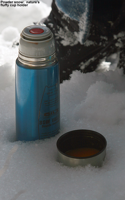
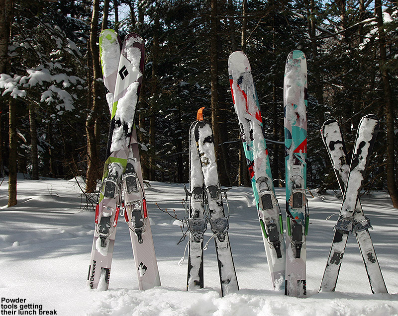
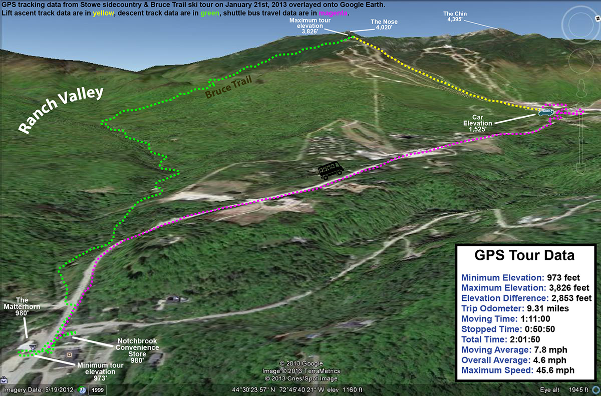
Today turned out to be a day of actual “Alpine Touring” in the high elevations of Mt. Mansfield. Although Stowe picked up a foot of snow earlier this week, the freezing level eventually rose fairly high over the past few days, and that brought the lower elevation snow surfaces back into spring time cycling. There wasn’t going to be much spring softening of the snow today though – highs in the Bolton Valley Village at ~2,100’ were predicted to be below freezing, and up in the peaks the temperatures weren’t supposed to get out of the 20s F. That sounded like a frozen granular recipe for those elevations that had gone above freezing, so it seemed like a prime time to head to the high elevations up near 4,000’. I’ve been waiting for a day to get up into the alpine areas of The Chin so that I could explore some lines to ski with the boys, and today’s conditions were the perfect excuse. It was crystal clear, and visibility is always something to consider if you’re going to go exploring around above tree line.
“The snow was
definitely all
winter up there…”
I laughed to myself as I was driving to the mountain around midday and saw that even in the valleys the temperature was below freezing. There definitely wasn’t going to be much in the way of softening today. If the alpine areas had been warmed, it was going to be a short outing, because there was no need to play around up there on bad snow that had been refrozen. Despite the sub-freezing temperatures all the way down to the valleys, there was still the occasional reminder of spring. As I was driving near The Gables Inn on the Mountain Road, I was momentarily distracted as a red fox was chasing a skinny, dark black animal (perhaps a mink) all over the place alongside and across the road. The mink didn’t seem especially scared, and it actually wasn’t all the much smaller than the fox; it was almost as if the two were simply engaging in some sort of springtime frivolity.
I parked at the Midway Lodge, hopped on the Gondola, and began my hike right up above the Cliff House once the lift dropped me off. I’ve hiked that route in the fall before with E and the boys – it’s the hiking route called Cliff Trail (not to be confused with Stowe’s ski trail called “Cliff Trail”. There’s quite a dramatic difference in what one experiences up there in the warmer months – the trail wraps around, under, and over 20-foot tall boulders and other sorts of obstacles. However, in the winter it’s essentially buffed smooth with meters and meters of snow. That’s pretty amazing, and speaks to just how deep the snow gets up there. On my ascent from the Cliff House at ~3,600’, the surface of the snow initially had a thick layer on top that seemed to be some sort of melt and/or wind crust, but at around the 3,800’ level, the snow began to get better and pockets of powder were starting to appear. Before I knew it, I’d hit the ridge around 4,100’. Relative to similar warm weather hikes, it felt like no time at all had passed, and it’s a testament to just how much easier it is to hike that route when all the huge rocks are covered with a nice, smooth surface of snow. I did get to follow someone else’s boot pack though, and that certainly helped with the pace.
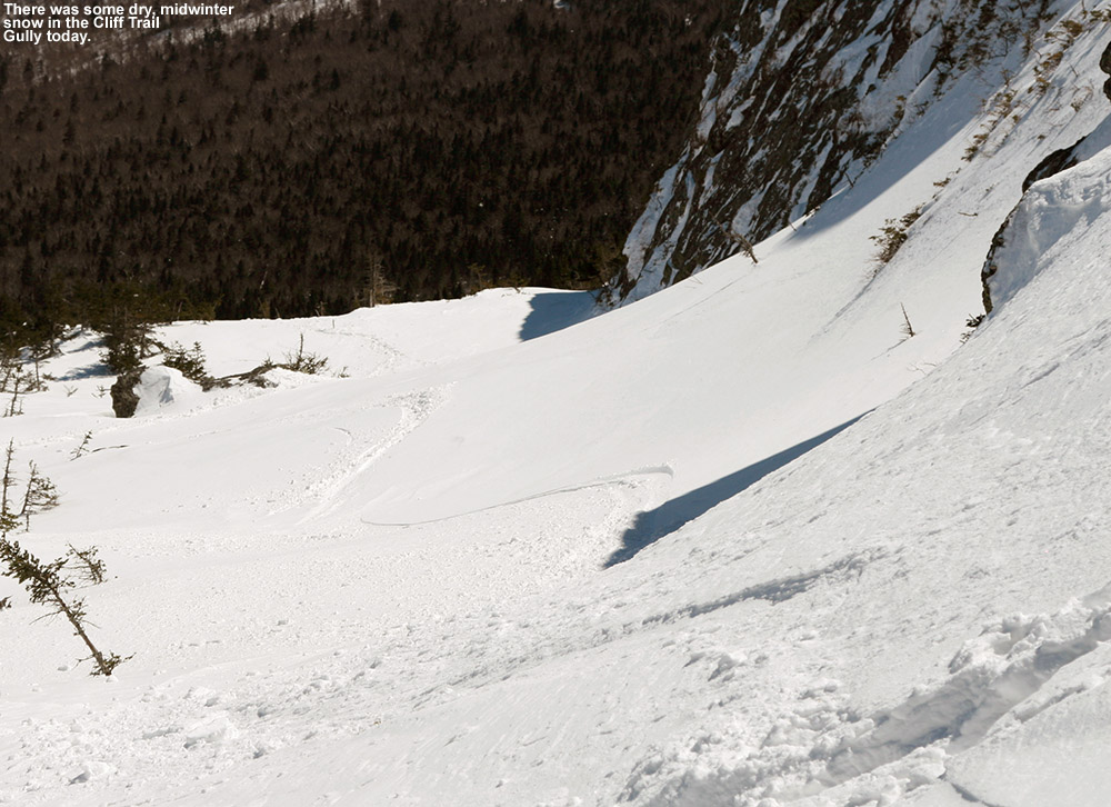
I spent a few minutes on the ridgeline, and then dropped in for some turns. The snow was definitely all winter up there, I’d say the bigger enemy had been the winds. I got in some nice turns, and once I’d dropped a couple hundred feet and the snow quality started to deteriorate, I popped my skis back on my pack and headed skier’s left to see where it brought me. The travel was very easy with all the snow, and I quickly came to the next gully over. I hiked up that one to the top, but didn’t find the snow to be up to the best stuff I’d found over in the Cliff Trail Gully. I made a short descent in that gully, just enough to get me access to keep moving to the left, and then came to a third gully. By the time I topped out in that one I was actually starting to get close to The Chin, so I decided to just continue up and poke around to see what descents might have good snow.
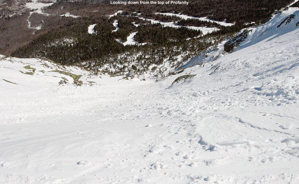
I checked out both Profanity Chute and Hourglass Chute, and they both appeared to have good winter snow in them. I haven’t been down Hourglass since I skied it about 15 years ago, but as I watched people side-slipping their way through the crux, it didn’t seem all that appealing. The snow quality looked decent, it didn’t quite have the appealing look that Profanity did, so I ended up going down Profanity Chute for my descent. Taking that option was a bonus as well, because I don’t think I’ve ever skied it before. It’s definitely a fun line, and it’s not excessively steep at probably 30 degrees or so, it gives you a nice ride with an alpine feel. The snow was generally packed powder, although there were a few slick spots in there. I cut left and followed the main line down through the subalpine areas, and outside the main track there were good shots of powder – I was often finding depths of 10 to 11 inches and it was quality stuff. The snow definitely started to deteriorate below 4,000’. It was mostly in the main lines where there had been traffic, but those spots were certainly slick. Following the lower connection of the chute through the evergreens was notably more challenging than the crux up at the top, in part due to the firmer snow in those lower elevations. I made my way back toward Chin Clip, and connected onto Gondolier. Conditions were pretty bad as far as I was concerned, it was a lot of frozen granular, with the best relief from that being the loose granular that people had pushed around. I’m not sure how much day tickets cost at Stowe today, but I’m surprised how busy the mountain was. The parking lots were reasonably full, so apparently there are plenty of folks out there that didn’t mind the conditions. We’re heading back to Stowe tomorrow for BJAMS ski program, and the potential is there for some warmer temperatures. It feels like we’ll either need some of those warm temperatures, or enough new snow to soften up the surfaces.


