Sterling Forest and Sterling Range, VT 21JAN2024

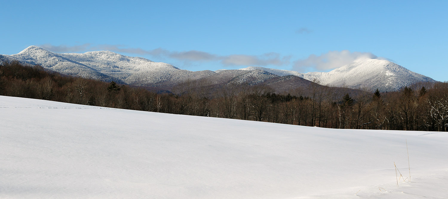
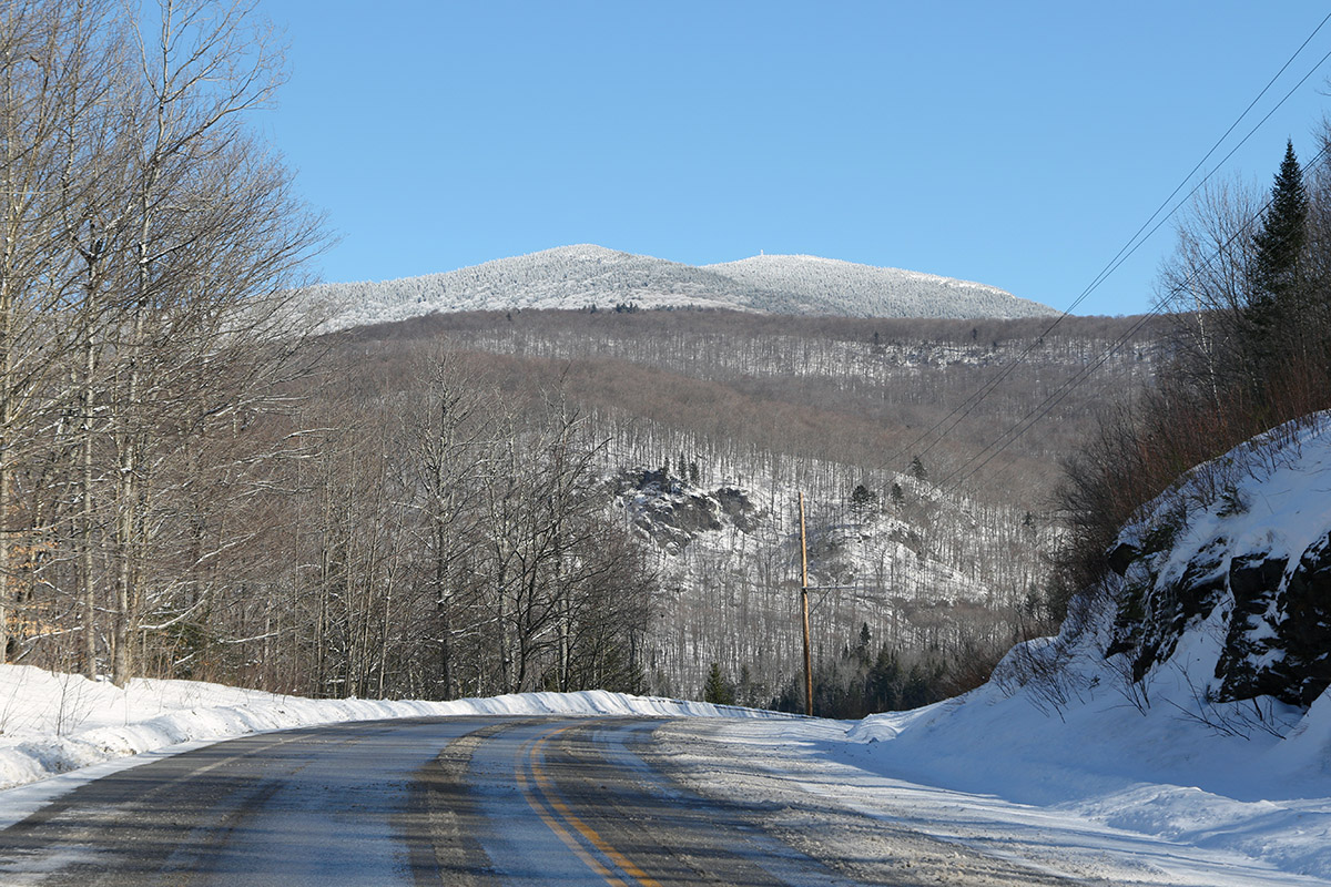
A view of the Sterling Mountain Range in Northern Vermont in January while approaching from the southeast
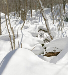
An image of glades during a January backcountry ski tour up through the Sterling Forest and into the Sterling Range of the Northern Green Mountains of Vermont
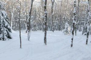
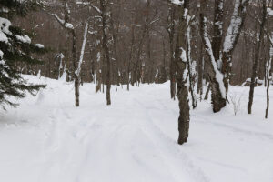
A view down through some of the many glades available on today’s backcountry ski tour up through the Sterling Forest into the Sterling Range

Today the temperatures were still quite cold, so I again opted to stick to ski touring instead of riding the lifts, but it was a bit warmer than yesterday, and I decided to go a bit farther afield and higher in elevation. I set my sights on skiing in the Sterling Range, an area that has been on my list of ski touring spots for quite a while, but I just hadn’t gotten around to making the trip. A very convenient access point to the range is through the Sterling Forest area, and they have a really nice parking lot that’s maintained at the top of Sterling Valley Road.

I’d been up to the area in the warm season for mountain biking, but I haven’t been up there much in the winter. The snowpack around the houses up there is impressive, and you can tell that the area gets, and holds, a lot of snow. I guess it shouldn’t be too surprising with a number of houses that are well above elevations of 1,000’. Indeed there’s some good elevation there as you approach the Sterling Forest – the parking area is around 1,700’, which is 500’ higher than where I began my tour yesterday.

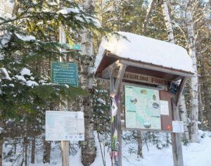
An image showing the trailhead area for the Upper Gorge Loop Trail of the Sterling Town Forest in Stowe, Vermont
A view of the trailhead area near the Sterling Forest parking lot as I start off on today’s ski tour

Most people I’ve talked to, as well as reports and videos I’ve seen, use the Upper Gorge Loop trail area as their main thoroughfare for touring. It serves as the approach and as a collector trail if you’re skiing the north side of the basin. For my approach I followed the northerly section of the Upper Gorge Loop Trail, which seemed to be the most popular based on the levels of traffic packing the snow. Following the trail, I began to see skin tracks branch off to head up the north side of the basin, but I continued on the loop trail until I hit its apex, just so I could get the lay of the land. I then skinned back a couple of minutes and took the highest skin track that was available. That brought me to the top of the ridge on the north side of the basin, and along the way I passed numerous open glades that had very few tracks and offered a lot of impressive skiing. I topped out around 2,900’ along the ridge, and descended through the glades back to the Upper Gorge Loop Trail.
Powder depths were very similar to what I found yesterday with respect to similar elevations. I was curious if there might be a difference in surface snow depths since I was about 12 miles farther north in the Northern Greens, but my measurements didn’t reveal any substantial differences.  I did ascend substantially higher on this tour though, so it let me add on to what I’d found yesterday. The powder depth profile I found today was as follows:

1,700’: 7-8”
2,000’: 7-8”
2,200’: 8-9”
2,500’: 10-11”
2,700’: 11-12”
2,900’: 12-13”

There are other options for nice touring out there, such as dropping down the back side of the ridge into the next drainage, but the approach to the slopes in the main basin is already a couple of miles even before you begin the main ascent through the glades, so I couldn’t really tack on more with the time I had. It was a gorgeous midwinter day though, with lots of sunshine, and that definitely helped to bring the temperature up that extra notch relative to yesterday.

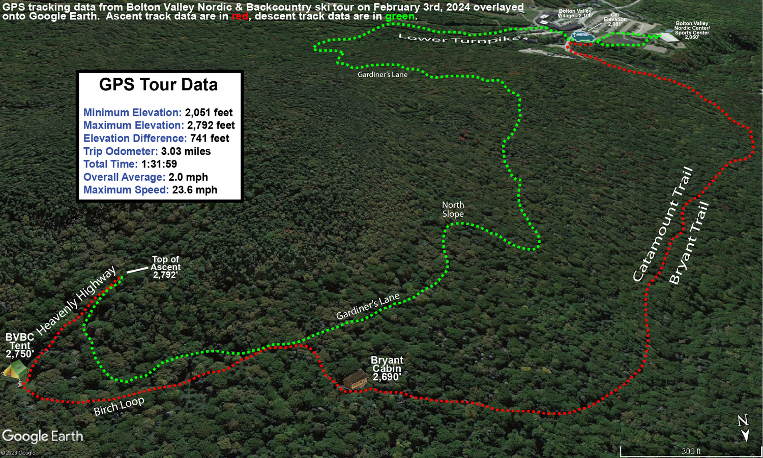
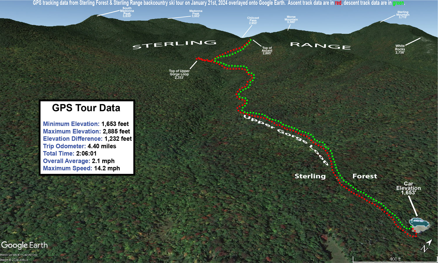
A Google Earth map with GPS tracking data for a backcountry ski tour in the Sterling Forest area and Sterling Range in the Northern Green Mountains of Vermont
A Google Earth map with GPS tracking data from today’s backcountry ski tour in the Sterling Forest and Sterling Range in the Northern Green Mountain of Vermont

Bolton Valley Nordic & Backcountry, VT 20JAN2024

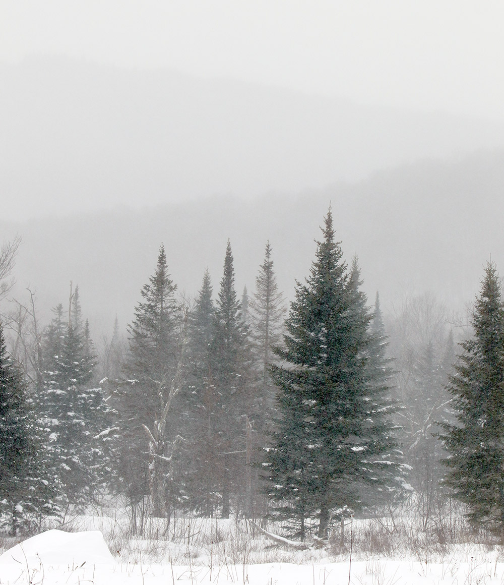
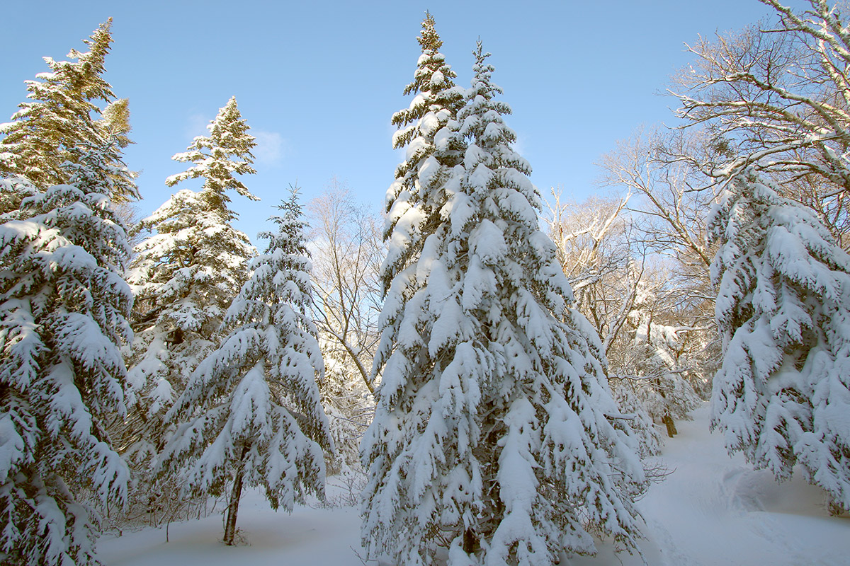
An image of evergreens and mountains obscured by snowfall in the Beaver Pond area of the Nordic and Backcountry Network at Bolton Valley Ski Resort in Vermont
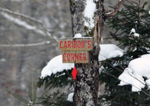
An image of the Caribou's Corner sign in the Beaver Pond area of the Nordic and Backcountry Network at Bolton Valley ski Resort in Vermont
Passing by Caribou’s Corner on my ski tour today in the Beaver Pond area of Bolton Valley’s Nordic and Backcountry Network

Since today’s forecast was in the single digits F, and there was the possibility of wind as well, ski touring seemed like the natural choice vs. riding the lifts. In addition, our current weather system, while certainly enough to freshen up surfaces, isn’t expected to be large enough to really reset the powder in areas that had been recently skied.

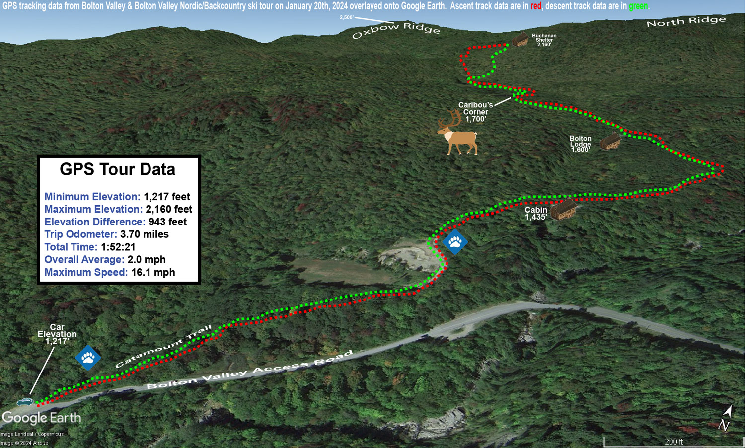
With the cold temperatures, and the way the depth and quality of the snowpack has been improving over the past week or two, I decided that I’d tour in some relatively low elevations nearby to see what potential they held. I started my tour at the Catamount Trail access area at roughly 1,200’ on the Bolton Valley Access Road, and did a ski tour up to the Buchanan Shelter near the 2,200’ elevation. That’s not a heavily used part of the Bolton Valley Backcountry Network, so I suspected that untracked powder would be relatively plentiful.

While I was out touring in the afternoon, light snow fell continuously, and throughout the tour I checked powder depths above the highest detectable subsurface layer in the snowpack. The powder depth profile I found with respect to elevation was as follows:

1,200′: 6-8”
1,500′: 6-8”
1,800′: 7-8”
2,000′: 7-8”
2,200′: 8-9”

Even with cold temperatures, powder of the 3-4% H2O variety that we recently received from Winter Storm Heather can’t sustain that level of loft forever. Indeed, the powder I encountered today had settled down to something more in the 6-8% H2O range, so the numbers above are the depths to which the surface snow has currently settled. Obviously all these recent storms continue to push the useful snowpack to lower and lower elevations, so overall snowpack depth wasn’t an issue even down to the 1,200’ mark. It’s hard to get estimates of the total snowpack depth because the lower layers are so settled and thick, but the snowpack is maybe a couple feet deep down at 1,200’? While I don’t have an exact number, even if there was only a foot of base below the powder, it’s so consolidated and flush with liquid equivalent that it would easily do the job.

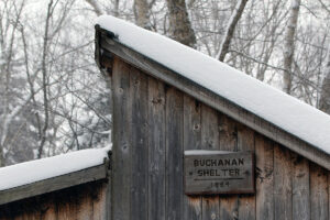
An image of the roofline of the Buchanan Shelter out on the Nordic and Backcountry Network at Bolton Valley Ski Resort in Vermont
A shot of the Buchanan Shelter while I transition for my descent

In terms of the skiing, the best turns were certainly up in the slopes just below the Buchanan Shelter where there is some solid pitch up into the black diamond realm. The approach portions of the tour have enough pitch to make a nice glide out and grab a few low-angle turns in certain spots, but with the current depths and density of the powder, descent speed is on the slower side right now. Also, cold temperatures like these reduce ski glide somewhat due to less melting, so that factors in as well. In the slopes up by the Buchanan Shelter I had the run of the area though in terms of fresh tracks. One person had recently skied back down the Beaver Pond Access Trail, but that was even a bit old, so it must have been from a couple of storms ago. Off in the trees, there were no prior tracks of any kind, so I had my pick of the most open lines, streambeds, chutes, etc. Fat skis were the call, and turns were definitely bottomless, but the best turns came from hitting those correct areas that appropriately accommodated the pitch, powder depth, cold snow, tree spacing, and all that.  There were some excellent powder turns on the tour though, so even down to the lower elevations in the ~1,000’ range, the current snowpack is really delivering.

A Google Earth map with GPS tracking data of a ski tour up to the Buchanan Shelter on the Nordic and Backcountry Network at Bolton Valley Ski Resort in Vermont
A Google Earth map with GPS tracking data of today’s ski tour out on Bolton Valley’s Nordic & Backcountry Network

Bolton Valley Nordic & Backcountry, VT 15JAN2024

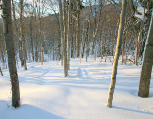
An image of evergreens along the Birch Loop trail past the Bryant Cabin on the Nordic and Backcountry Network at Bolton Valley Ski Resort in Vermont
An image of some of the glades below the Gotham City area with lots of untracked powder snow in the Nordic and Backcountry Network of Bolton Valley Ski Resort in Vermont
Heading down through some of the glades below Gotham City today during my tour on the Bolton Nordic and Backcountry Network

In this morning’s update, Bolton Valley  was reporting an additional 3-5” of snow from yesterday’s lake-effect snow and snow squalls. The other recent snowfall numbers they had in their report looked solid, with 12” in the last two days, 27″ since Tuesday night and more than 48” for the first half of the month. The season snowfall for the resort currently stands at 157”, and that’s very respectable since it’s already about half their annual snowfall average when we’re not even halfway through the snowfall season.  What makes that pace more impressive is that they’ve had all that snowfall despite the second half of December being quite lean on snow. That really speaks to how much has been falling up there during the snowier periods.

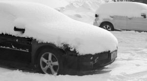
An image showing cars with snow in one of the Village parking lots at Bolton Valley Ski Resort in Vermont
A view of the cars nearby my parking spot showing the accumulations from recent snows in the area

There was no new snow falling today, which was somewhat notable because this morning’s snow report also indicated that if the current forecast for tomorrow’s snow comes through, they’ll be looking at 14 out of the first 16 days of 2024 with snowfall. With today’s break in the falling snow, I figured it was time to head out for a tour on the backcountry network as a reliable route to untracked powder.

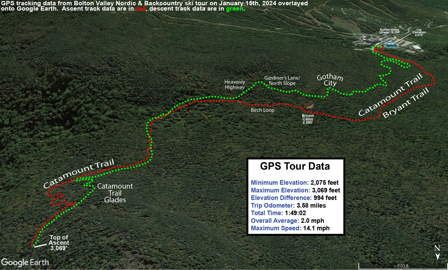
I decided to head up the Bryant Trail to Bryant Cabin in the afternoon, and play it by ear with respect to lengthening my tour, depending on how my supply of daylight was looking. I was well ahead of sunset when I was up at Bryant Cabin, therefore I just continued on up to the Catamount Trail Glades so I could get in some turns in the higher elevations. Based on my recent outings at the resort, I knew that conditions improved a lot with elevation, so I wanted to get a good sampling of the powder up high. I topped out at an elevation of about 3,100’ on the back side of Bolton Mountain, descended through the Catamount Trail Glades, and then traversed back above Bryant Cabin and navigated a route through another half dozen different glades back to the base. Today definitely had a nice midwinter vibe, with bright afternoon sun, temperatures somewhere around 20 F, and great powder.

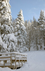
An image from the bottom of the Devil's Drop area showing the nearby platform structure out on the Nordic and Backcountry Network at Bolton Valley Ski Resort in Vermont
Passing below the Devil’s Drop area while out on today’s ski tour

The surface powder and upper snowpack analysis was really interesting today. Starting my tour around 2,000’ in the Village, I found 4-5” of surface powder, and then there was a fairly solidified layer below it. That layer marks the wet snow that recently came from Winter Storm Gerri, which hardened up somewhat as temperatures dropped back below freezing. The surface snow above it is from the snow on the back side of the storm, plus the additional drier snows that have fallen over the past couple of days. As you ascend to higher elevations though, that firmer layer gradually begins to soften, and then above 2,500’ it starts to disappear altogether. At that point there is another substantial subsurface layer, which I suspect comes from Winter Storm Finn. So, monitoring the elevation profile for the depths of the powder was bit unusual. Compared to the 2,000’ elevation, I didn’t detect any notable increase in the powder depths at 2,250’, but at 2,500’ it finally started to deeper, and as I continued higher, I could still sort of detect an interface from Winter Storm Gerri, but it eventually became hard to discern. So, what I’ve done for the surface snow depth elevation profile below is to indicate those different layers, with the first depth being snow down to the dense layer from Winter Storm Gerri, and the second being the depth of the snow down to the dense layer from Winter Storm Finn.

2,000’: 4-5”
2,250’: 4-5”
2,500’: 5-6”/8-10”
2,750’: 6-7”/10-12”
3,000’: 7-8”/14-16”

At some point between 2,500’ and 3,000’ that first depth number sort of becomes moot, and you’re essentially skiing in the 8-16” of powder depending on elevation, so go I’d say go in with that mentality. In terms of getting out there in the backcountry around this part of the Northern Greens, I’d recommend touring above 2,500’ if you can for the best turns. I went with mid-fats on today’s tour, but you could easily go with fat skis if you’re going to spend most of your time above 2,500’.  When I was up in the Catamount Trail Glades in the 3,000’ range, fat skis would have been nice, except in some of the denser areas of evergreens where they have trapped so much of the snowfall on their boughs, that you actually notice the deficiency of powder below.

An image containing a Google Earth map with GPS tracking data from a ski tour on the Nordic and Backcountry Network of trails at Bolton Valley Ski Resort in Vermont
A Google Earth map with GPS tracking data of today’s ski tour on the Bolton Valley Nordic and Backcountry Network

The system that is expected to come into the area tomorrow is name Winter Storm Heather, and any snow from that should really be icing on the cake in terms of the ski conditions. Temperatures are forecast to stay cold, so you can pretty much take the powder depths I have above and then tack on whatever new snow comes next.

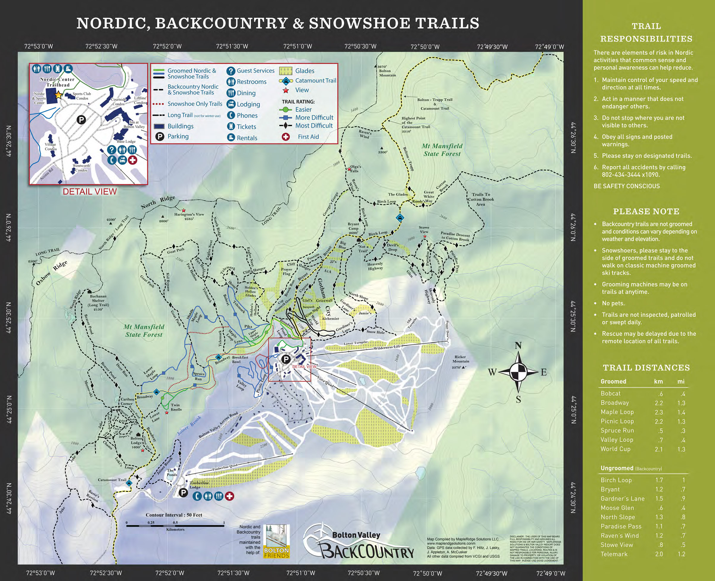
A copy of the 2018-2019 Nordic and Backcountry trail map from Bolton Valley Ski Resort in Vermont
A copy of Bolton Valley’s Nordic & Backcountry trail map which lists the trails and many of the official glades

Bolton Valley Nordic & Backcountry, VT 15DEC2023

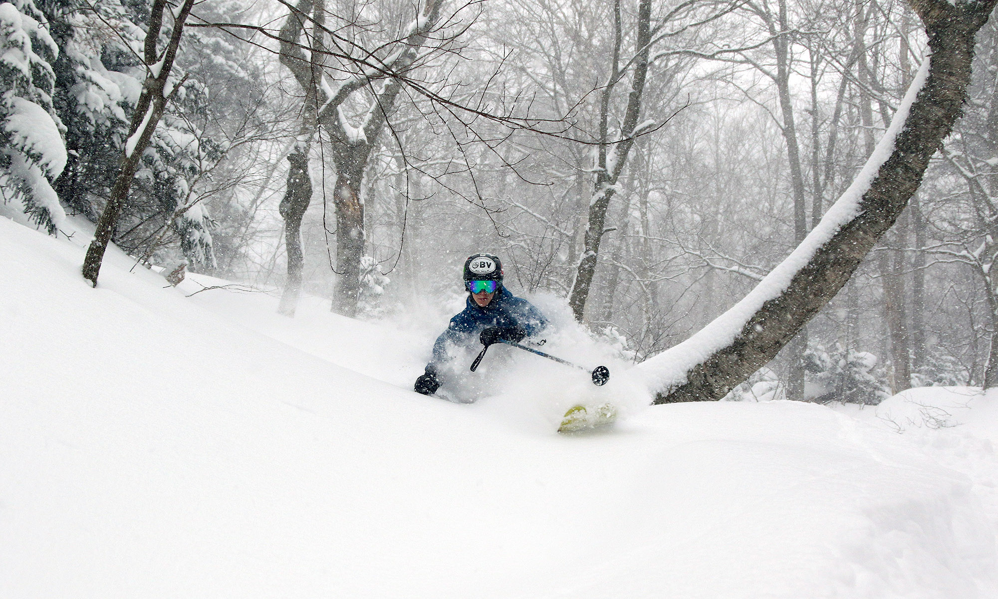
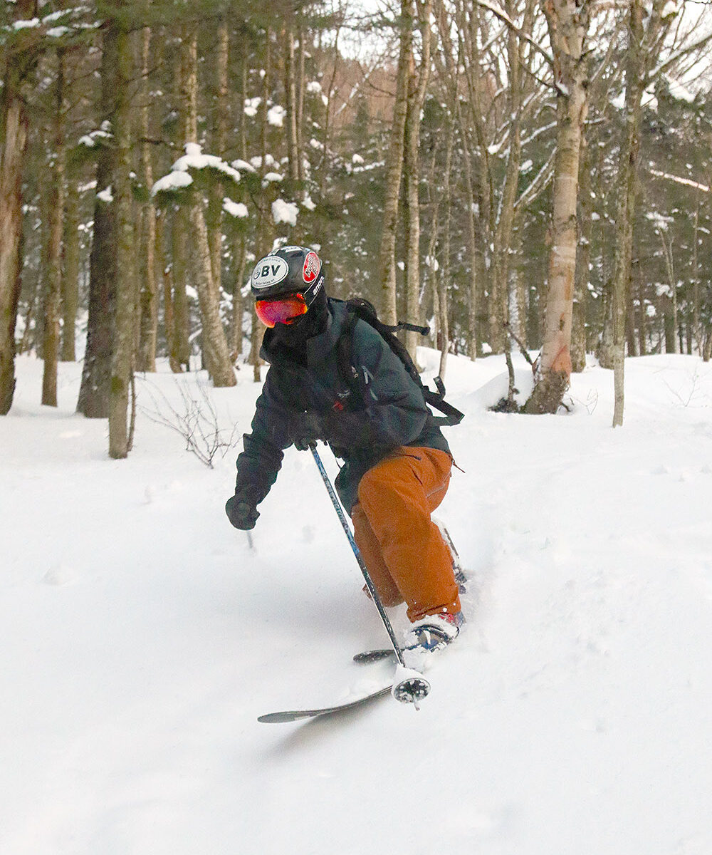
An image of Ty Telemark skiing in powder in mid-December in one of the glade areas on the Nordic and Backcountry Network at Bolton Valley Ski Resort in Vermont
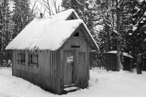
An image of the Bryant Cabin in mid-December during a ski tour out on the Nordic & Backcountry Network at Bolton Valley Ski Resort in Vermont
A view of the Bryant Cabin while Ty and I were out on our backcountry ski tour at Bolton Valley today

I haven’t been up to the mountain since Tuesday, but Dylan was out for some lift-served turns on Wednesday with friends and he said that Bolton’s conditions were fantastic. Similar to what I’d observed on Tuesday, he said there was a still a lot of roped terrain due to various hazards, but he also noted that his group was able to ski lower down on Preacher, and the untracked powder was going strong. That area is well protected from winds, and with the lower traffic due to the current need to traverse in, he said that conditions in there were better than he often sees in midwinter. The resort had also opened up the lower part of Wilderness that can be easily accessed from Vista, and he said the powder there was excellent as well.

Since it hasn’t snowed for a couple of days, I decided that the timing would be good to head out onto Bolton’s Backcountry Network. This was my first time out on the Network this season, so it was a great opportunity to see where the snowpack stands. In terms of skiing the glades, coverage is quite good, and there are no major issues there. Out in the glades is feels like something that is approaching a midwinter snowpack, but what gives it away that we’re not quite there yet are the water bars on the main access trails. Some water bars are fine, but there are many that seem like they are stuck in early season condition, probably because they got blown out somewhat by the warm start to the last system. I haven’t noticed that issue quite as much on the lift-served terrain, likely because the grooming and greater skier traffic help to pack in the water bars more, but those factors aren’t there to tamp down the snow on the backcountry terrain. There are a number of spots on the Bryant Trail where people have diverted the skin track around the water bar area instead of trying to bridge it.

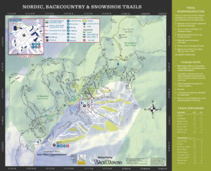
A copy of the 2018-2019 Nordic and Backcountry trail map from Bolton Valley Ski Resort in Vermont
The Bolton Valley Nordic & Backcountry trail map which lists a lot of the glades.

Today we toured up the classic route to the Bryant Cabin, and then descended through some of the more popular glades. I was surprised to find that even above 2,000’ the temperature was edging above the freezing mark, so the snow was getting a bit thick in some areas. This effect seemed to diminish with elevation, and thankfully most of the powder skied well and wasn’t sticky, probably because the air is still fairly dry. As we descended below 2,500’, we started to run into areas where the powder became sticky, and I figured it was due to elevation, but we got back into drier powder in lower areas and that makes me think the stickiness was just in areas that had seen the sun. In any event, even with the temperatures being a bit marginal, there’s still plenty of good powder out there at elevation if you avoid areas that got hit by the sun.

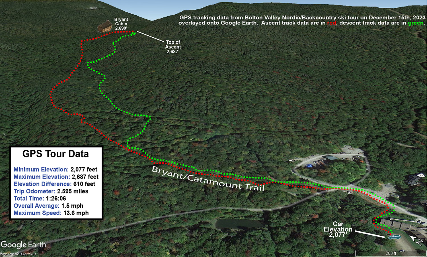
A an image of a Google Earth map with GPS tracking data from a ski tour on December 15th, 2023 on the Nordic and Backcountry Network at Bolton Valley Ski Resort in Vermont
A Google Earth map with GPS tracking data from today’s ski tour out on the Bolton Valley Nordic & Backcountry Network

It’s not surprising that the backcountry snowpack is getting a midwinter feel, because the snowpack depth at the Mt. Mansfield Stake is at 40 inches, and that’s the depth at which people start to feel comfortable skiing most off piste terrain around here. Those water bars in certain areas do seem to give it away that we’re still in early season though. Bolton’s snow report indicates that they are just shy of 100 inches of snow on the season, and I see that Jay Peak is reporting 115 inches on the season, so both resorts seem to have done well with these early season storms we’ve had thus far. We’re within a couple inches of average snowfall to date down at our site in the valley, but I bet those numbers from the resorts are ahead of their average pace due to the substantial elevation-dependence we’ve see with these recent systems. In any event, 100” of snow by mid-December is a solid start to the season, even at elevation in the Northern Greens.

Bolton Valley Nordic & Backcountry, VT 25FEB2023

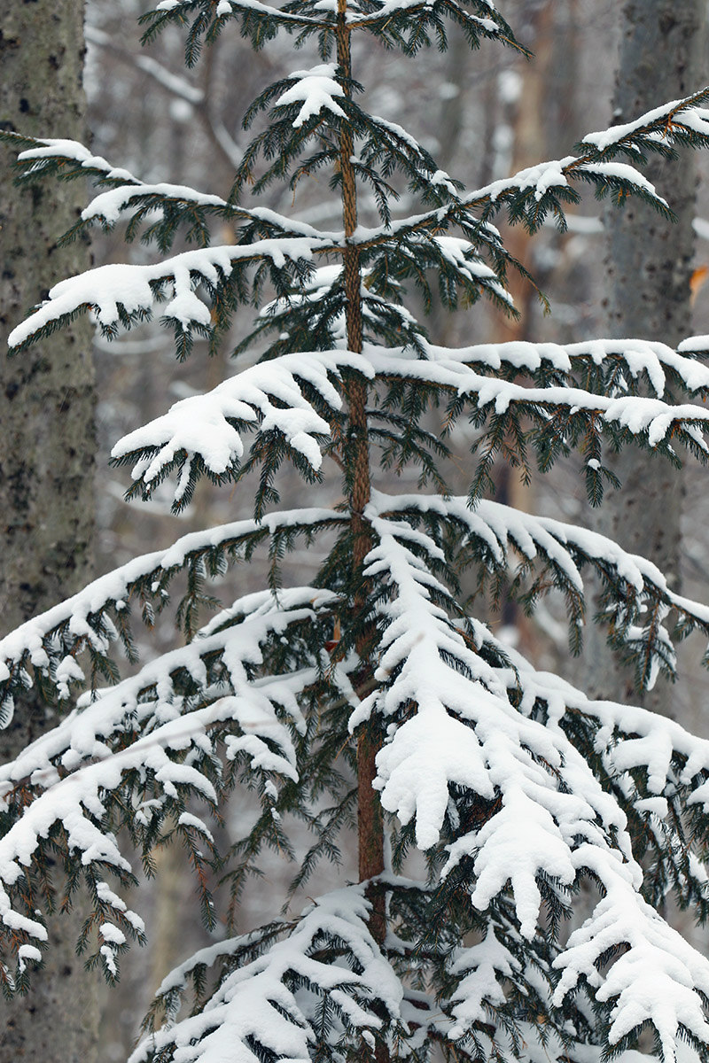
An evergreen with a light accumulation of snow on the Nordic and Backcountry Network at Bolton Valley Ski Resort in Vermont
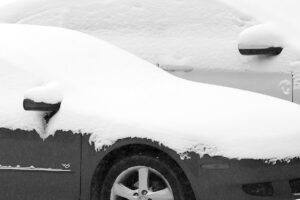
An image of cars with fresh snow on them in the Village area of Bolton Valley Ski Resort in Vermont
Gearing up in the Bolton Valley Village today for my ski tour, I could see the signs of recent snows from the past few days.

The very cold air was still in place today here in the Northern Greens, but we also had some fresh snow moving in with a bit of weak upper-level vorticity pushing through the area.  Temperatures at elevation looked like they would stay in the single digits F, so ski touring once again seemed to be the call vs. riding the lifts.

An image of a car with a light accumulation of snow in the Village area of Bolton Valley Ski Resort in VermontWe’d picked up a half-inch or so of new snow down at the house when I headed up to Bolton Valley in the mid to late afternoon.  Flakes had been small throughout the storm, so accumulations were coming in a bit on the denser side at around 10 to 12% H2O.  I found the same type of snowfall up on the hill, although it was coming down with a bit more intensity.  You could see that vehicles had taken on some decent accumulations from the day’s snowfall up to that point.

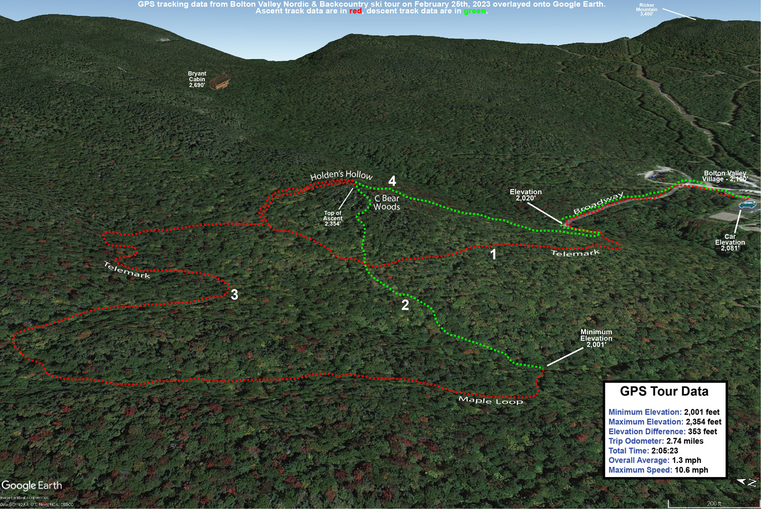
My ski tour was over in the Holden’s Hollow area, and my initial descent was down through some of the C Bear Woods and Holden’s Hollow West Side Glades that I’ve hit many times before.  Based on yesterday’s Wilderness tour, the sweet spot for best turns based on the depth and consistency of the powder seemed to be those mid-angle slopes, so that’s what I was seeking out.  Today I was touring at relatively low elevation in the 2,000’ to 2,500’ range, and depth measurements revealed a similar 8 to 10” of powder to what I’d seen yesterday.  That surface snow was bolstered a bit by what was falling, but the liquid equivalent from that snow was only about a tenth of an inch, so it wasn’t a major addition.  Those mid-angle slopes delivered once again though, with generally bottomless turns on 115 mm fat skis.  I mixed things up a bit on the tour to explore some new terrain and continued my descent on the back side of the ridge down below the Telemark trail to the Maple Loop area.  I then joined back on to a lower part of the Telemark trail and looped back around to the Holden’s Hollow area again to finish off with a front side descent.

A Google Earth map with GPS tracking data from a ski tour on the Nordic and Backcountry Network at Bolton Valley Ski Resort in Vermont
The Google Earth map with GPS tracking data for today’s tour on the Bolton Valley Nordic and Backcountry Network

Although temperatures weren’t supposed to be all that different from what they were on Friday, I think they were a few degrees warmer, and with the absence of those 30 to 50 MPH winds, the difference was dramatic.  The air was quite calm while I was touring, and the snow was falling straight down, so the overall conditions were just much more comfortable and easy to handle.
Big Jay Basin, VT 11FEB2023

An image from near the town of Eden in Vermont after a February storm dropped 5 to 7 inches in the Northern Green Mountains
An image of a stream with fresh snow during a ski tour in the Big Jay Basin area of Vermont
The fresh snow and plentiful sunshine out there today provided some beautiful midwinter views throughout today’s ski tour.

The back side of this most recent storm cycle seemed to show some promising potential for upslope snow in the Northern Greens, so this morning I made a quick survey of the snow reports from the resorts along the northern spine to see how things had worked out.  With the Jay Peak snow report indicating 4 to 7 inches of new snow, and bwt’s measurement of 5.5 inches at 1,900’ from his place at Jay Peak, things were looking good there.  Bolton, Smugg’s, and Stowe were reporting totals in the 2 to 4-inch range, so the Jay Peak area really seemed to be a cut above the other resorts.  Temperatures rose above freezing in some areas during the middle of the storm though, so maximizing that resurfacing snow/liquid equivalent could make a substantial difference in the quality of the ski surfaces.
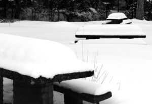
An image of picnic tables covered with snow along Route 118 in the Montgomery area of Vermont
Picnic tables at a roadside park along Route 118 in the Montgomery area today showing some of the recent snow accumulations

E was heading up to Morrisville to deliver some food to a colleague and do some snowshoeing, so I decided to pop up to the Jay Peak area for a bit of touring, and we coordinated our trip.  New accumulations of snow were present everywhere from Waterbury on northward, but they really started to pick up once I got to Eden and points father north.  You could tell that the storm had hit harder up there.  With road maintenance and some sun, I was generally dealing with slushy accumulations on road surfaces, but those usual spots on Route 118 along Belvidere Pond and through the notch areas into Montgomery were wall-to-wall winter snow and required some extra caution.

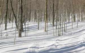
An image of some of the ski terrain in the hardwoods during a ski tour below Little Jay in the Big Jay Basin area of Vermont
Checking out some of the ski terrain below Little Jay on my ascent today.

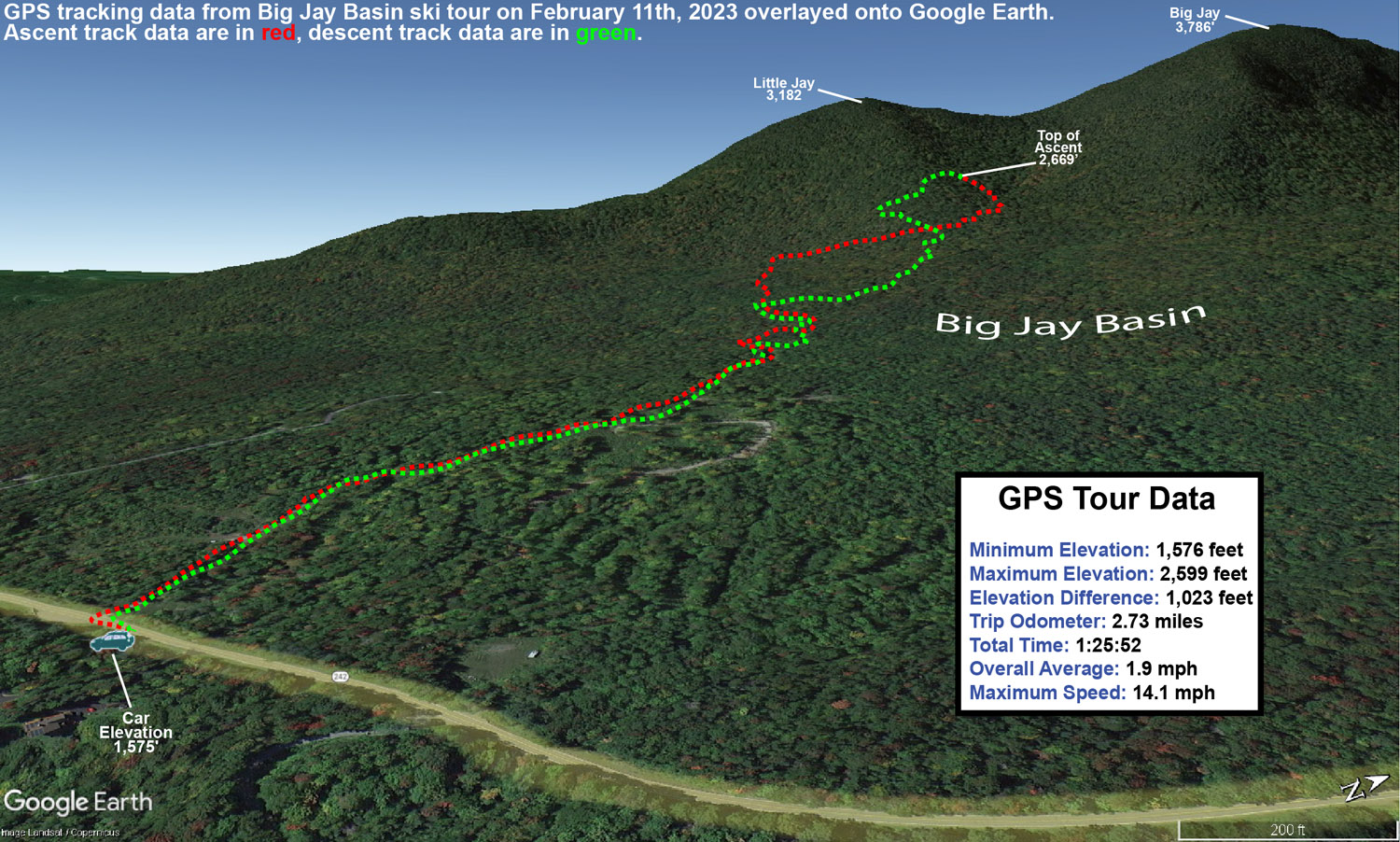
My tour was in the Big Jay Basin area that I’ve visited various times before, since it has convenient parking and some decent lower to moderate angle slopes along with its steeper lines.  It also has that leeward exposure from Jay Peak, Big Jay, and Little Jay, so it absolutely reels in the snow.  The past couple of times we’ve visited the basin, we’ve toured the terrain more toward the north side below Big Jay, but for this tour I decided to favor a bit more toward Little Jay to the south.  I’d heard good things from some of my students about the terrain there, so as skin tracks diverged on my ascent, I generally opted for those heading more southward toward Little Jay.  As I approached Little Jay, I could see that the terrain was getting steeper than I was looking for with the most recent accumulations, and slightly less pitched terrain was more prevalent off to the north, so I followed a skin track that was heading right through the terrain that looked the best for my plans.  That skin track brought me into that drainage below the col between Big Jay, and Little Jay, and the lower sections there do have some nice pitches that avoid the really steep stuff.  My goal was to get in a moderate tour’s worth of skiing and exercise with about 1,000’ of vertical, so with the trailhead elevation a bit shy of 1,600’, I was shooting to stop my ascent around 2,500-2,600’.  Once I’d hit that level, I contoured back toward the south a bit along the side of Little Jay to get into more untouched snow, and dropped in from there.

A Google Earth map with GPS tracking data from a ski tour in the Big Jay Basin area of Vermont
A Google Earth Map with GPS tracking data from today’s backcountry ski tour in the Big Jay Basin area

In terms of the snow quality, it far exceeded my expectations.  Accumulations of new snow were very much as expected – I measured about 5 inches of new snow around 1,600’ at the trailhead, and that matched up perfectly with what the resort and bwt had reported in the morning.  Accumulations probably increased by another inch about 1,000’ higher, but this didn’t appear to be one of those storms with heavy snow accumulation gains as elevation increased.  What impressed me most was when I encountered at least a couple feet of bottomless powder in the drainage below the col.  In that area, there were no signs that there had been any sort of significant warmth or rain.  It was great to watch all the skiers and riders out there taking advantage of the great snow, and their whoops and hollers could be all over the place throughout the basin, just as you’d expect with great conditions.  Aspect mattered in terms of snow quality though.  The farther I wrapped around Little Jay toward southern exposure, the more I was skiing on just the new snow, and there was actually a detectable layer atop the old snowpack.  Seeing this, I moved back toward the north as I descended in order to get into the best snow.  I just found it surprising that it was really only southern aspects where the snowpack had consolidated, because that would represent more effects from sun vs. general warmth.  Whatever the case, non-southerly aspects held some excellent bottomless powder out there. 

Temperatures on the day were perfect, with mid to upper 20s F keeping the snowpack wintry.  Skies were clear and sunny though, and you could tell that the mid-February sun was trying to work on that powder on southern exposures.  Temperatures seemed just cold enough, and/or the air was just dry enough, to keep that from happening.

It looks like we might have a system coming through the area tomorrow night that could do something similar to what the back side of this system did, so we’ll see if that adds another few inches to freshen things up again.

Bolton Valley Nordic & Backcountry, VT 05FEB2023

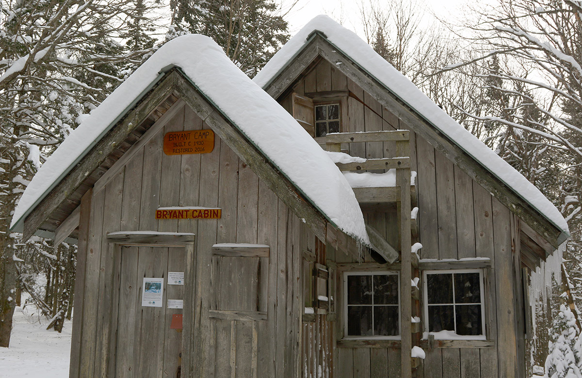
An image of the Bryant Cabin during a ski tour on the Nordic & Backcountry Network at Bolton Valley Ski Resort in Vermont
An image of the Alchemist glade on the Nordic and Backcountry Network at Bolton Valley Ski Resort in Vermont
The quality of the powder out on the mountain today was excellent – even south-facing Alchemist had soft, fluffy conditions.

I hadn’t been out for any turns since last Sunday when I toured in the Nebraska Valley, so I was eager to see what the mountains had to offer yesterday once the arctic cold departed.  At the end of my tour last weekend, temperatures had risen above freezing in the lower elevations, and then we had those potent winds with the arctic front, both of which could have been insults to the quality of the snow surfaces.

An image of upslope snow clinging to a tree branch on the Nordic and Backcountry Network at Bolton Valley Ski Resort in Vermont
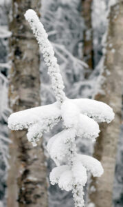
Some of the snow formations out there in the forest today that were left behind by recent upslope snows.

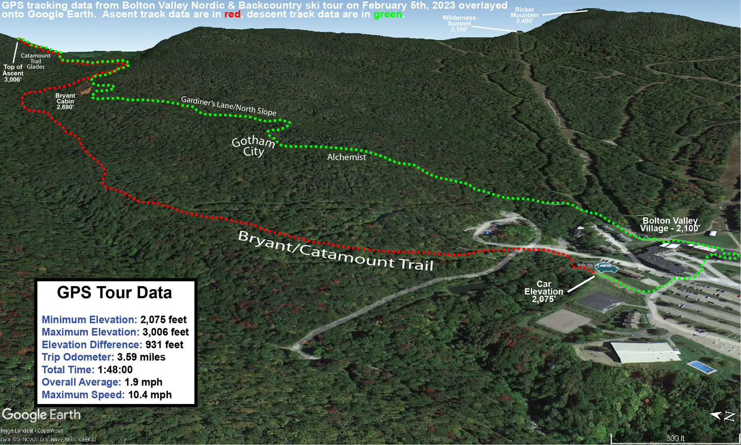
Today my plan was to keep my skiing fairly simple and close to home, and I decided to tour on the Bolton Valley Nordic and Backcountry Network.  I figured I’d tour up to Bryant Cabin, check out the snow quality, and decide from there if I was going to go any farther.  I was brining minimal camera gear for this outing, so I borrowed Dylan’s backcountry ski pack instead of using my larger one, and I opted for mid-fat Teles instead of going with full fats.  I was definitely feeling light and fast with that setup, and hit Bryant Cabin in under 30 minutes, so I felt that I easily had time to extend my tour.  In addition, the quality of the snow was far better than I’d expected.  We haven’t had a major storm cycle since Winter Storm Kassandra about a week ago, so I didn’t really expect the powder to be very fresh.  Those concerns were sidelined right at the start of my tour though – I did numerous depth checks on my ascent, and even down at 2,000’, the surface snow was 15-20” deep above the base.  Whatever warming had taken place last weekend was clearly below the 2,000’ elevation range.  I’d heard secondhand that the freezing level was somewhere down around the Timberline Base (1,500’), and I guess it never rose much higher than that.  The other concern about the snow had been the effects of the wind, but any drifting and wind crusts were few and far between on the terrain I covered up to Bryant Cabin and beyond.  I ran into many areas where the trees were just caked and choked with upslope snow clinging to every branch at various crazy angles, and snow doesn’t stay like that when it’s been hit by heavy winds.

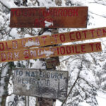
An image of signs for the Cotton Brook area and nearby locations on the Nordic and Backcountry Network at Bolton Valley Ski Resort in VermontFinding the snow quality so impressive, I actually decided to continue my tour all the way up to the top of the Catamount Trail Glades around 3,000’ and the powder just kept getting deeper.  Estimates of surface snow depths that I found on my tour were as follows:


2,000’: 15-20”
2,500’: ~20”
3,000’: 20-25”

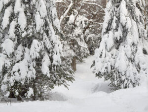
An image of evergreens laden with snow from recent storms along the Catamount Trail on the Nordic and Backcountry Network at Bolton Valley Ski Resort in Vermont
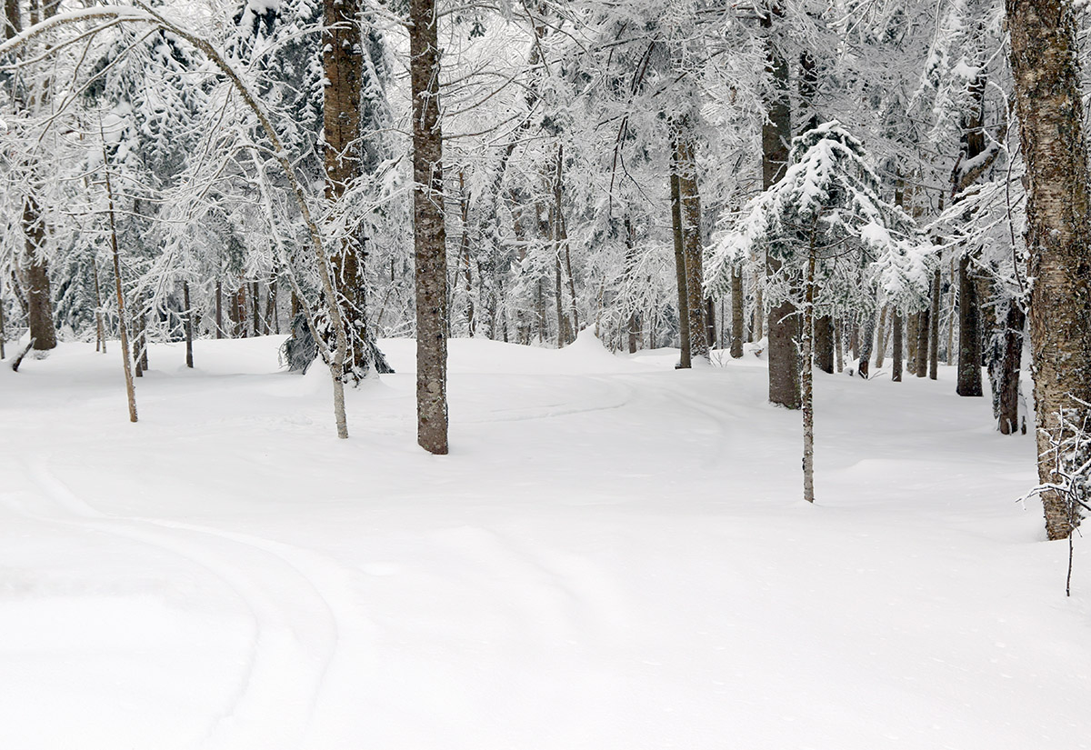
The evergreens were loaded with snow from recent storms, making for quite a winter wonderland out on the Bolton Valley Nordic and Backcountry Network today.

Untracked areas up in the Catamount Trail Glades were two feet of bottomless powder, and you could easily be fooled into thinking we’d just had a major storm cycle in the past couple of days, not a week ago.  For the rest of my descent I headed down past Bryant Cabin along Gardiner’s Lane and North Slope, and finished off with a connect to Wilderness via Alchemist.  The conditions on Alchemist were perhaps the biggest testament to the quality of the snow, because that area has a hard-core southerly exposure, and things have to be prime to get real quality powder turns there.  I’d say that today I encountered some of the best conditions I’ve ever seen on Alchemist, so the snow over the past week or so has been extremely well preserved.

A Google Earth map showing GPS tracking data from a ski tour on February 5th, 2023 at Bolton Valley Ski Resort in Vermont
A Google Earth map with GPS tracking data of today’s ski tour on the Bolton Valley Nordic and Backcountry Network.

It was hard to get a sense for the total snowpack depth while I was out on my tour because it’s getting too deep to probe easily, but the Mansfield snowpack at the stake is at 42”, so the snowpack depth is probably just a bit less than that as you drop to around 3,000’.  While that Mansfield snowpack is a foot below average, we’re getting to the point in the season where being below average is less and less relevant in terms of off piste coverage and skiing quality.  We’re past that 40” mark at the stake, and all the terrain I encountered yesterday was game on, regardless of pitch or obstacles.  I ran the snowpack liquid analysis this morning down at our site in the valley for CoCoRaHS, and there’s 3 inches of liquid equivalent in our snow.  The local mountains probably have double that amount at elevation, so it’s easy to see why the off piste skiing is so good.  If you have 6 inches of liquid equivalent under your feet, that’s going to take care of a lot of terrain, even relatively steep terrain.

Overall, today was fantastic, both in terms of the temperatures and in terms of the snowpack/snow quality.  Temperatures were in the 25-30 F range when I hit the mountain in the afternoon, which was perfect for comfortable skiing while retaining those soft, midwinter snow surfaces.

Nebraska Valley, VT 29JAN2023

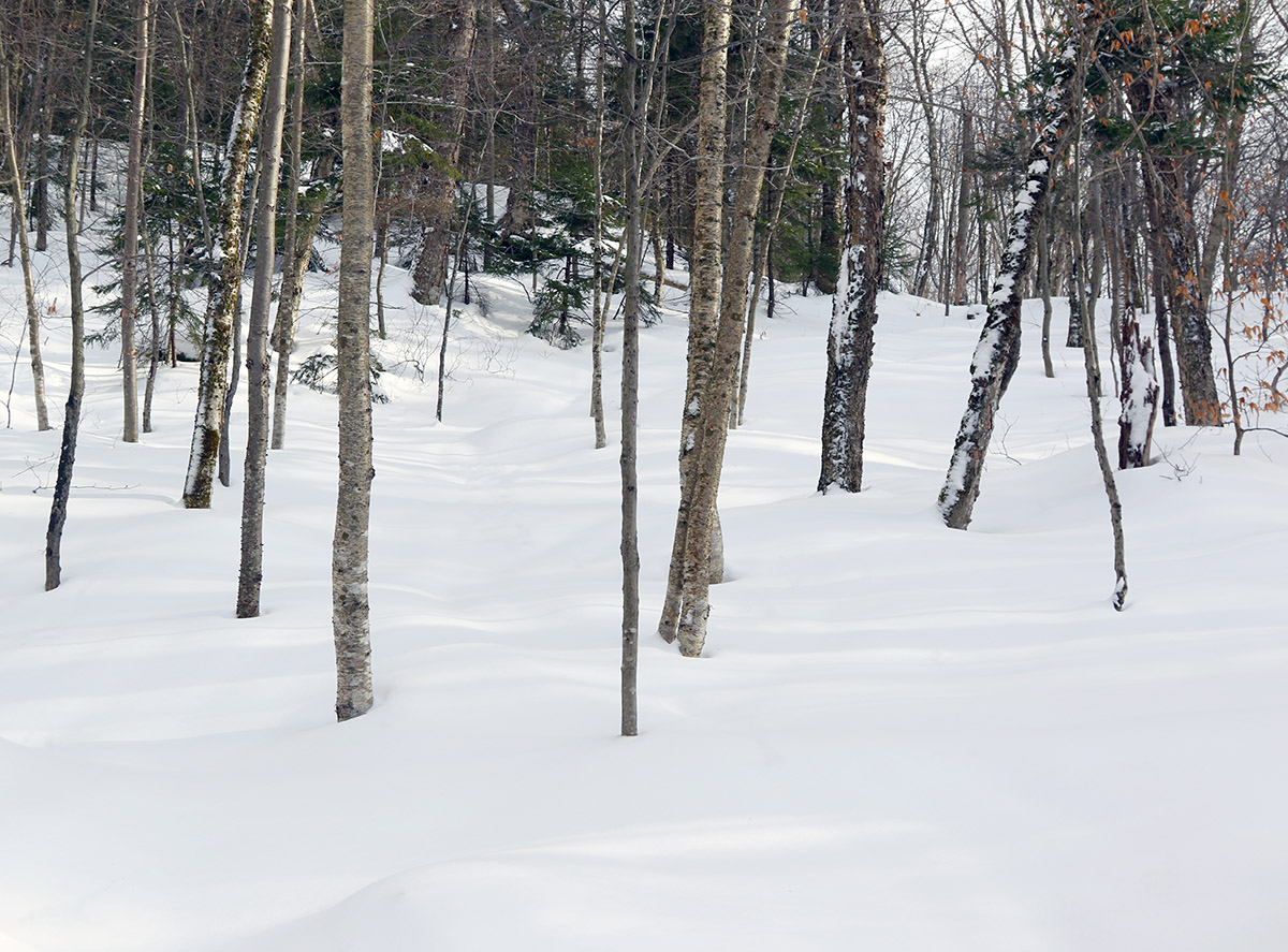
An image showing some of the ski terrain above the Catamount Trail on the south side of the Nebraska Valley in Vermont
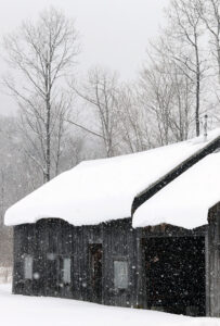
An image of a building covered in snow with snow falling in January in the Nebraska Valley of Vermont
Some of today’s snowfall as I enjoy the views on my trip through the Nebraska Valley up to the Catamount Trail

With the strong snowpack in the area now, I decided to head out to the Nebraska Valley for some ski touring today.  The last time I toured in the Nebraska Valley I was on the valley’s north side, but I’ve now heard from multiple students of mine that the south side of the valley offers some great skiing off the Catamount Trail.  I didn’t have too much information beyond the fact that you can just use the Catamount Trail as a collector for the ski terrain in the area, but it sounded pretty straightforward, fun, and convenient.

I was able to park right at the Catamount Trail parking area on the south side of Nebraska Valley Road, so the trail access was very easy.  It had started snowing around midday, and there was steady snowfall through much of my tour in the afternoon.  Following the Catamount Trail southward, the options for great backcountry skiing are indeed very obvious.  From the trailhead at an elevation of ~1,000’, the trail rises at a moderate grade for about 400 feet of vertical over the course of perhaps ¾ of a mile, and then the terrain flattens out into a relatively broad valley with the main drainage on your left, and steep slopes rising up to your right.  The slopes consist of very open hardwood forest throughout, with tree spacing in many areas as much as 20 or 30 feet.  I couldn’t see all the way to the top of the terrain, but there must be hundreds of acres there with very obvious ski lines, and the fact that there were tracks coming down out of this terrain suggested that it held good potential.  At around a mile from the trailhead I came to the first obvious skin track that headed up off the Catamount Trail into these slopes, so using that was a clear option for some great runs.

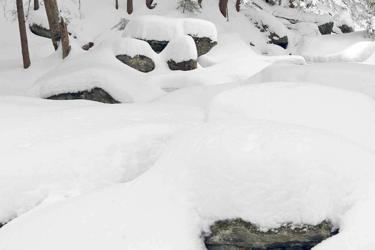
An image of January snow on one of the tributaries of Miller Brook in the Nebraska Valley of Vermont
I was able to enjoy gorgeous midwinter views of the ice and snow on the local tributary of Miller Brook as I made my way up the Catamount Trail.

I just happened to run into one of my students descending on the Catamount Trail as he and his group were finishing up their session for the day, and he said that if I had the time, I should head higher up because the snow was better.  Being my first time in the area, I did want to take a long enough tour to get the lay of the land, so I continued another mile or so and toured up to around 2,500’.  The snow was indeed even better higher up, but the tree lines weren’t as open as the beautiful looking terrain I’d seen lower down.  That higher elevation terrain was plenty steep, and certainly offered decent skiing, but I’d say those initial slopes rising from the valley at around 1,500’ are the best bang for your buck as long as the snowpack and snow quality are good at those elevations.

It was snowing quite hard up at 2,500’ when I began my descent, hard enough that I would have been worried about being out there in such weather if I didn’t know the forecast wasn’t calling for sustained accumulations.  The snow had added another couple of inches to top off the snowpack, which certainly helped make the powder even a bit fresher.  Temperatures had been cold much of the afternoon, but on my descent I quickly realized that the freezing level had risen.  I descended out of the heavy snowfall down into mixed precipitation by ~1,500’, and just sprinklings of rain down at the trailhead elevations of ~1,000’.  I was glad that I’d finished my tour by that point because the lower elevation snow was definitely getting sticky and more difficult to ski.

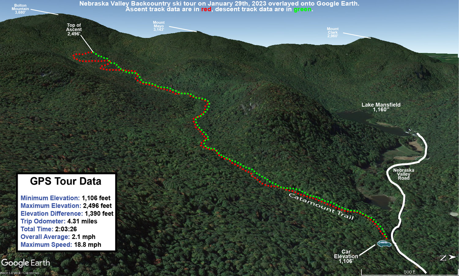
A Google Earth map with GPS tracking data from a backcountry ski tour along the Catamount Trail in the Nebraska Valley of Vermont
A Google Earth map with GPS tracking data of today’s backcountry ski tour along the Catamount Trail in the Nebraska Valley

Bolton Valley Nordic & Backcountry, VT 29DEC2022

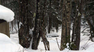
An image of one of the glades in the Holden's Hollow area on the Nordic and Backcountry Network at Bolton Valley Ski Resort in Vermont
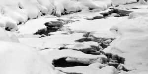
An image of a frozen river while on a ski tour of the Nordic and Backcountry Network at Bolton Valley Resort in Vermont
A frozen river view out on my tour of the Bolton Nordic and Backcountry Network today

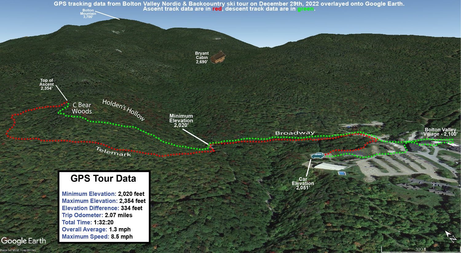
I wasn’t exactly sure where on Bolton’s backcountry network today’s ski tour was going to take me, but my plan was to start with an ascent up to the start of the C Bear Woods, and then go from there.  I haven’t toured in that part of the Network yet this season, but the ridgeline there tops out around 2,400’, so starting in the lower Village, it would give me a good sampling of the snowpack in the 2,000’ to 2,400’ elevation range.

For my tour back on Monday on some of the lower sections of the Network I topped out around 1,800’ and generally found 6 to 12 inches of powder, and the tenor of the powder skiing was that something with a bit more pitch would be appropriate for the snow depth.  With continued rounds of snow accumulation over the past couple of days (and an additional 2 to 3 inches reported in the past 24 hours at Bolton as of this morning’s update), I figured the powder might even be a notch up from where it had been at that point.

It was midmorning by the time I arrived at the Village, and temperatures were very comfortable in the lower 30s F.  Being the big holiday week, the resort was really humming, and they were already parking folks in the lower Nordic Center parking lot.  That worked out well for me though, since it’s right on the Broadway Trail that links in nicely with the heart of the Backcountry Network.

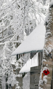
A winter image from the Joiner Brook bridge area on the Nordic and Backcountry Network at Bolton Valley Ski Resort in Vermont
A view during today’s tour down by the Joiner Brook bridge showing the snowpack from recent storms

Around 2,000’ in the open areas of the Village, the depth of the surface snow was quite variable between the effects of the wind and sun, but in general I found 5 to 6 inches of powder over a consolidated base.  There wasn’t any obvious rain crust, but there was a denser layer below the powder.  That layer generally wasn’t present in the trees, so I assume it was from wind and sun.  Up at 2,400’ I’d say powder depths were about the same as what I found in the 1,500’ to 1,800’ elevation range on Monday, so between additional accumulations and settling, I guess things roughly held pat at that level.  The pitches near the top of the ridge there are up in the black diamond range, and I think the uppermost parts of the ridgeline were a bit windswept because the snowpack wasn’t sufficient for confident turns in that area.  Noticing that, I headed southward to the right of the main C Bear Woods entrance into some other areas of glades to shallow out my overall run.  Intermediate pitches offered nice turns, and the snowpack easily supported that type of skiing.  The best turns of that descent were in the lower slopes among the moderate and lower angle pitches as I got back toward Brook Run.

I’d left the option open to extend my tour up toward some of the Bryant Trail terrain, but it was approaching midday and the powder was already started to get denser and a bit sticky as the temperatures pushed above freezing.  As I headed to the main base area, it was turning into a fantastic day with breaks of sun and temperatures moving into the 30s F.  That’s a pretty nice combination for the holiday visitors to have comfortable temperatures and some decent snowpack, and it will be interesting to see how this holiday week plays out overall for visitation at the local resorts.  It’s been pretty sweet to have some daily refresher snowfalls recently to bolster the snowpack, and the snow reports I’ve seen from the resorts around here have indicated that it’s been allowing them to continue to open new terrain and expand the trail count.  Visitors to the slopes should generally be treated to some comfortable temperatures for the remained of the holiday week, which I think many would take over the subzero spells that can often occur around the start of the new year.  It looks like anyone going out on Sunday might have to dodge a bit of rain though based on the current forecast.

This may be one of the nicer holiday week’s we’ve had recently in terms of the quality of the skiing.  Looking at my notes, I’ve had a half dozen backcountry ski tours in about the past ten days, and that’s pretty decent because sometimes the backcountry doesn’t even get rolling until January or February.  On average, it should get going (at least on low and moderate angle terrain) in mid-December here in the Northern Greens, but the past three seasons haven’t hit 24 inches at the Mt. Mansfield Stake until January.  Technically, the stake only hit the 24-inch mark for the first time this season on Tuesday, but it’s been hovering in the 20-inch range since mid-month when Winter Storm Diaz hit, and the snowpack came together in such a way that those 20-ish inches were sufficient to put a lot of the local backcountry terrain in play for quality turns.

A Google Earth map with GPS tracking data from a ski tour on the Nordic and Backcountry Network at Bolton Valley Resort in Vermont
A Google Earth map with GPS tracking data for today’s ski tour out on Bolton’s Nordic and Backcountry Network

Bolton Valley Nordic & Backcountry, VT 26DEC2022

An image of the Mt. Mansfield State Forest sign on the Broadway trail entering the Nordic and Backcountry Network at Bolton Valley Ski Resort in Vermont
An image of snow on evergreens during a ski tour on the Nordic and Backcountry Network at Bolton Valley Resort in Vermont
Enjoying some of the snow on the evergreens along the route of my backcountry tour today

I hadn’t been out to the mountain since Winter Storm Elliot finished up, and although it was a mixed system in terms of precipitation, I was encouraged by how it played out for the local snowpack.  The storm brought roughly 8 inches of snow to our place down in the valley, and represented a net gain in both snowpack depth and snowpack liquid equivalent.  Bolton Valley was reporting 12 inches of new snow from the system, so the mountains must have fared at least as well as the valleys.

With some rain during the middle part of the system, I was wondering about the condition of the snow surfaces, so today I decided on a relatively low angle tour on the Bolton Valley Backcountry Network to get a feel for how the new snow had settled in.  I started at the Catamount Trail access point on the Bolton Valley Access Road, which is down around 1,200’, and toured up to around the 1,800’ elevation a bit above Caribou Corner.  Those are relatively low elevations overall, and 1,200’ is below even the Timberline Base, so it would certainly be a challenging stress test to speak to the quality and utility of the snowpack.

At 1,200’ at the parking area I found about 4 to 5 inches of powder above the base snow, and most notably, I couldn’t really find a rain crust.  There was a clear demarcation between the consolidated base and the surface snow, at least around the parking area where the snowpack is a bit more exposed to snow maintenance and sunshine.  The depth of the powder quickly increased as I ascended, and by about 1,500’ I was easily finding 6 to 12 inches of powder.  It became hard to judge the depth of the surface snow though, because I typically couldn’t even find an interface between the new snow and the underlying snowpack; the wetter precipitation from the storm must have either drained well or transitioned smoothly to snow.  I’d say total snowpack depth was probably around 10 to 12 inches at 1,200’ and 12 to 16 inches at 1,800’, but there’s plenty of substance to it, so it’s quite skiable up to moderate angles in maintained areas, and obviously it’s going to be notably deeper up above 2,000’.

An image of a cabin during a ski tour on the Nordic and Backcountry Network at Bolton Valley Ski Resort in Vermont
A snowy view of a cozy cabin along the route of my ski tour today

In terms of the skiing, the powder was actually too deep for the lowest angle sections on the tour, and I’d have to use existing skin tracks or other skier tracks to maintain or pick up speed.  The next tier of pitches skied great with the snow though.  I typically like that tour up to Caribou Corner when there’s about 4 to 6 inches of powder over a consolidated base, so this really was a bit deeper than that, and I’d say folks should move on up to moderate angle terrain for the best backcountry turns, especially with additional snow falling over the next couple of days.  There was light snow falling during my tour in the form of those big fluffy flakes, and I see that the resort reported an inch of new this morning.

The season snowfall seems roughly on track at our house observations site as of Christmas.  Snowfall to date on the 25th was 40.1” vs. a mean of 40.4”, and snowpack depth at 10.5” was a few inches above average.  The SDD for the season were a little behind average pace at 146.5 SDD vs. the 162.2 SDD average.  I can see in the data that the SDD deficiency is largely due to that slow first half of December, because we were still ahead of average SDD as of the end of November, and then the pace started to fall off before picking up again in the second half of the month.

A Google Earth map with GPS tracking data of a ski tour on the Nordic and Backcountry Network at Bolton Valley Resort in Vermont
A Google Earth map with GPS tracking data for today’s ski tour out on Bolton Valley’s Nordic and Backcountry Network