Gilpin Mountain/Domey’s Dome, VT 18JAN2025

An image of Dylan, Jack, Dylan, and Ronan pausing for a picture at the South Peak of Gilpin Mountain on the Long Trail during a ski tour in the Jay Peak backcountry.
An image of Dylan Telemark skiing in powder snow in the trees during a January ski tour in the Gilpin Mountain/Domey's Dome area of the Jay Peak backcountry in Vermont
Dylan was back on his Telemark skis gliding through the powder today. We had a great ski tour today in the Gilpin Mountain/Domey’s Dome area of the Jay Peak backcountry with great snow and many acres of nicely spaced tree skiing.

A couple weeks back there was some great discussion in the Northern New England thread at the American Weather Forums about the Jay Peak backcountry conditions in areas like Gilpin Mountain and Domey’s Dome, so I was certainly looking to head up to that part of the Northern Greens for some touring when the opportunity arose. Prodigious amounts of snow have simply continued to fall through much of this past week, with Jay Peak now at 200 inches of snowfall on the season. So, the powder has been staying fresh and the snowpack just keeps getting deeper. I was thinking of heading up for a tour in the Gilpin/Domey’s area this weekend, and out of the blue, Dylan called to see if I’d bring him and some of his college friends on a backcountry ski tour since some of their passes were in blackout mode due to the holiday weekend. I told him where I was already thinking on touring, and that’s all it took – the plan was in place to head out Saturday morning.

An image of Dylan Telemark skiing in deep powder snow in the trees during a January ski tour in the Gilpin Mountain/Domey's Dome area of the Jay Peak backcountry in Vermont
The powder was deep and bottomless throughout the descent today.

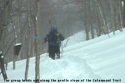
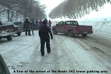
The forecast for the day was looking great – temperatures in the upper 20s F are perfect because it’s warm enough to be quite comfortable out in the backcountry, but below the freezing mark to avoid any temperature effects on the powder. I was concerned about parking since it’s a holiday weekend, but there were plenty of parking spots up at Jay Pass on Route 242. I arrived about 20 minutes before Dylan and his friends, so I poked around at the pass, and checked out the snow conditions and trail access points until they arrived.

An image of a skier jumping off a rock during a January ski tour in the Gilpin Mountain/Domey's Dome area of the Jay Peak backcountry in Vermont
Along with the powder, Mother Nature also supplied plenty of terrain features for a bit of extra fun during the descent.

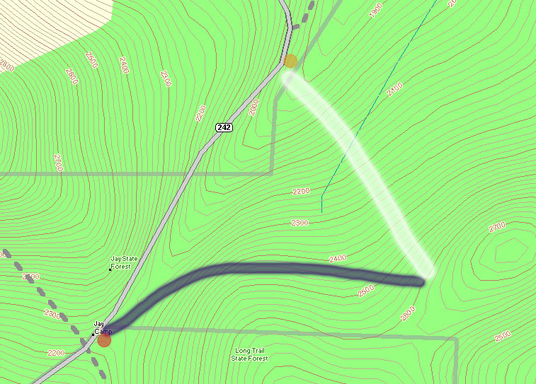
I’ve skied the terrain north of the pass on Gilpin Mountain before, but this time I wanted to check out the terrain to the south. My plan for our tour was to use the Long Trail to head up Gilpin Mountain and out along the ridgeline toward Domey’s Dome, then descend the west face of the range and catch the Catamount Trail for the return trip. With regard to ski touring, that side of the range is, in theory, set up beautifully – the Long Trail follows the ridgeline, and the Catamount Trail roughly parallels it down in the valley near Route 242. So, you can head out on the Long Trail to whatever point you want, then drop in for a descent and use the Catamount Trail as a collector for returning to Jay Pass. I say it’s a great setup “in theory”, with the caveat that the Long Trail can be tough to follow at this time of year. The Long Trail uses white blazes on the trees to mark its route for hikers, and the trees up along the ridgeline there can be absolutely loaded with snow. So, following the trail can be quite challenging if someone hasn’t already put a track in place. Also, as the snowpack continues to rise, the blazes can be more and more difficult to find. As of now, the blazes are at about waist level, so they’re still visible if you can find them behind the inches of snow caked to the trees, but even at the current height they are getting hard to see. One could certainly head out to an ascent of Domey’s Dome using the Catamount Trail from below, but after traversing the Catamount Trail in that area for the return on our tour (there are plenty of undulations and meanderings), that approach feels like more work than it needs to be unless you park farther down on Route 242.

An image of a skier turning in the powder and surrounded by snowy trees during a January ski tour in the Gilpin Mountain/Domey's Dome area of the Jay Peak backcountry in Vermont
In many areas of the tour, the terrain and trees were just choked with fluffy snow.

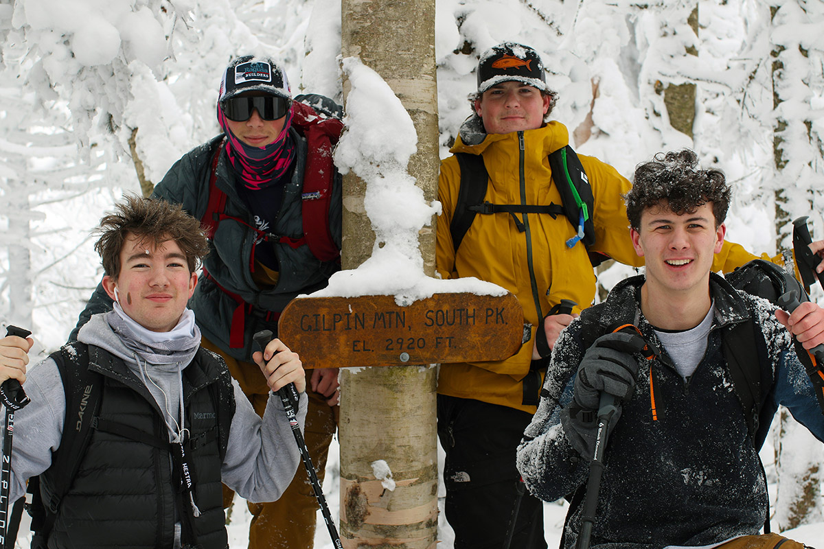
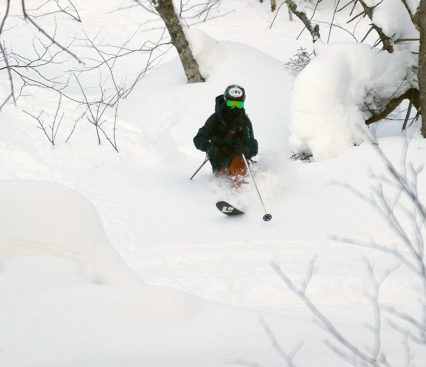
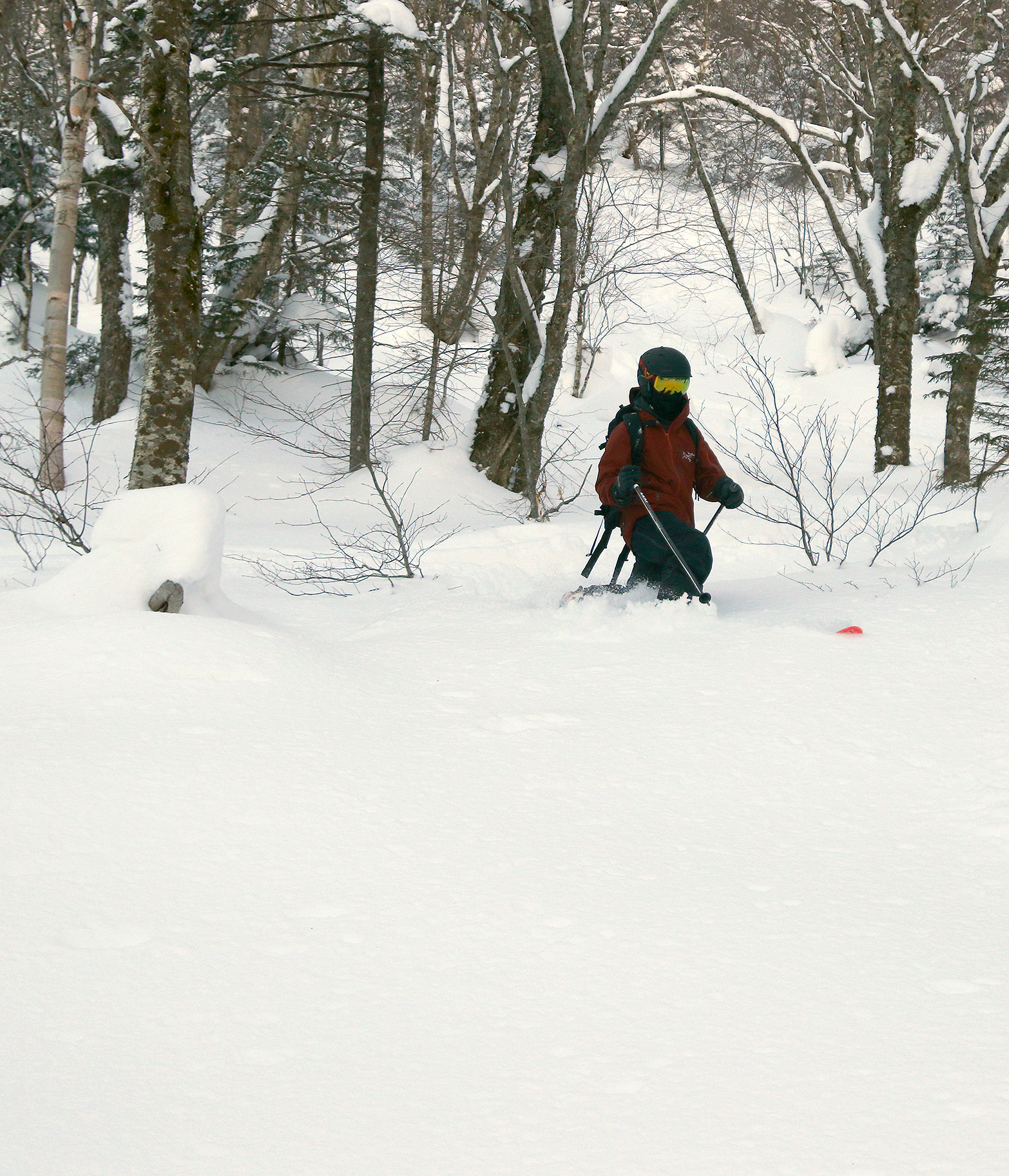
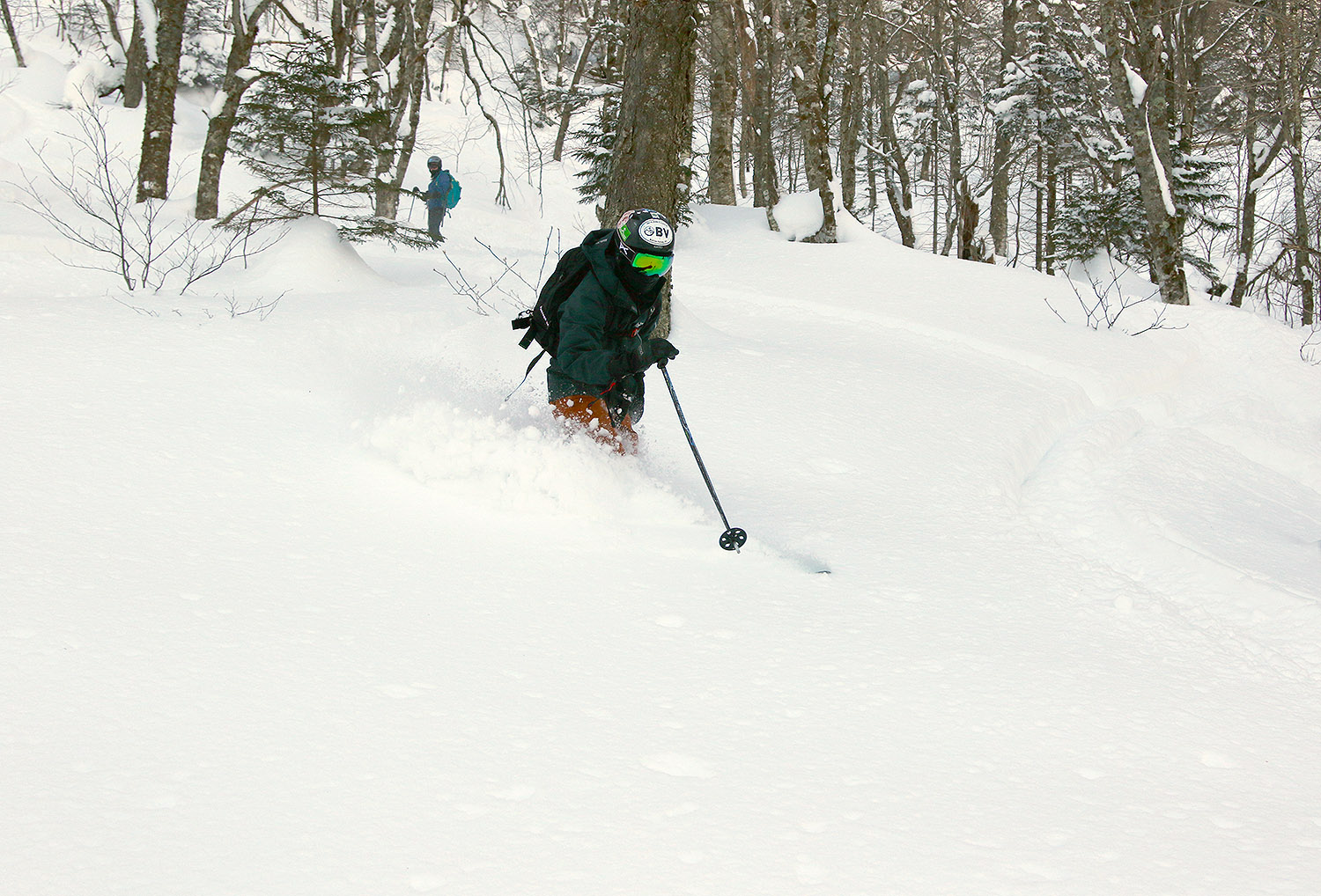
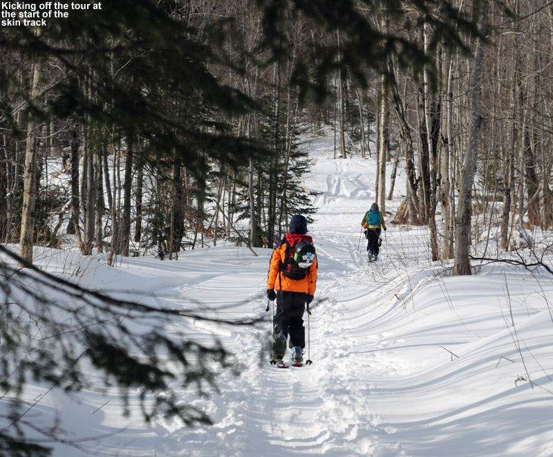
While it was breezy in the open area of Jay Pass, with the anemometers at the weather station area buzzing right along, the wind disappeared as soon as we entered the forest on our ascent. Following the Long Trail upward from the pass to Gilpin Mountain was fairly easy – it was well set as a skin track from plenty of skier traffic, so even without being able to see the blazes, it’s simple to follow. Once we were up at the Gilpin Mountain ridgeline, we took a quick jaunt to the north to check out the official summit of Gilpin Mountain at 3,021’ then moved southward and reached the South Peak of Gilpin Mountain, which is slightly lower at 2,993’. From there, we headed south on the Long Trail toward Domey’s Dome. We ran into a couple of guys from Quebec (based on their accents) who were setting up to descend a steep, sweet looking gully on the back side of the range. They joked with us about not stealing it from them, but we would never have done that, and we had other plans anyway. After that, we didn’t run into anyone, because skier traffic seems very light once you get past the general Gilpin Mountain area. We were able to follow the Long Trail southward for a little while, with the help of one track from a previous skier, but as we descended into the col between Gilpin and Domey’s, it became more and more difficult to hold the ridgeline and not get pulled into descending on one side of the ridge of the other. Nobody had broken trail on the Long Trail across the ridgeline, so the route finding took time. We had access to multiple GPS units, and when the Long Trail is obscured with deep snow like it is now, you certainly want to have your GPS and compass. Not wanting to waste too much of the session trying to navigate the traverse, we eventually decided to hug the western side of the ridge as we headed southward, with the intention of beginning a descent if we saw some appealing ski terrain. It wasn’t too long before we found a relatively steep line that dropped through some open trees, and we decided it was as good a time as any to begin skiing.

An image of Dylan Telemark skiing in the powder in the trees with friends looking on during a January ski tour in the Gilpin Mountain/Domey's Dome area of the Jay Peak backcountry in Vermont
The boys would line up, drop into their lines, and let ’em rip.

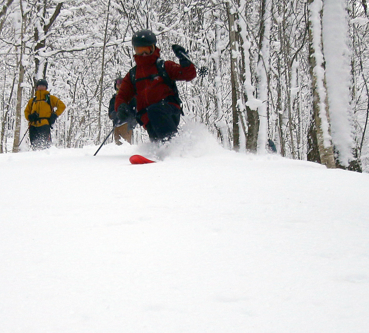
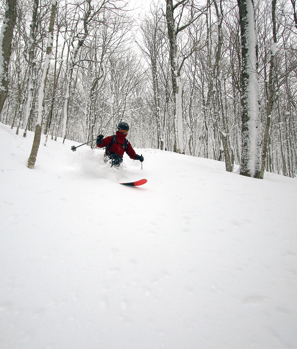
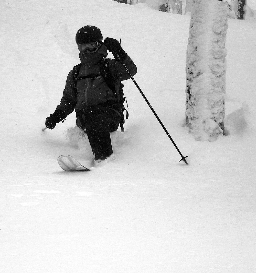
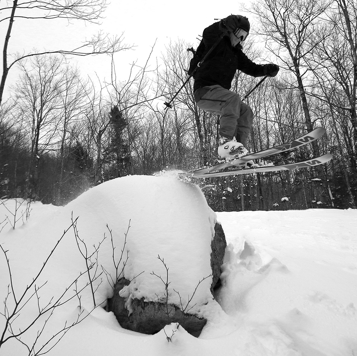
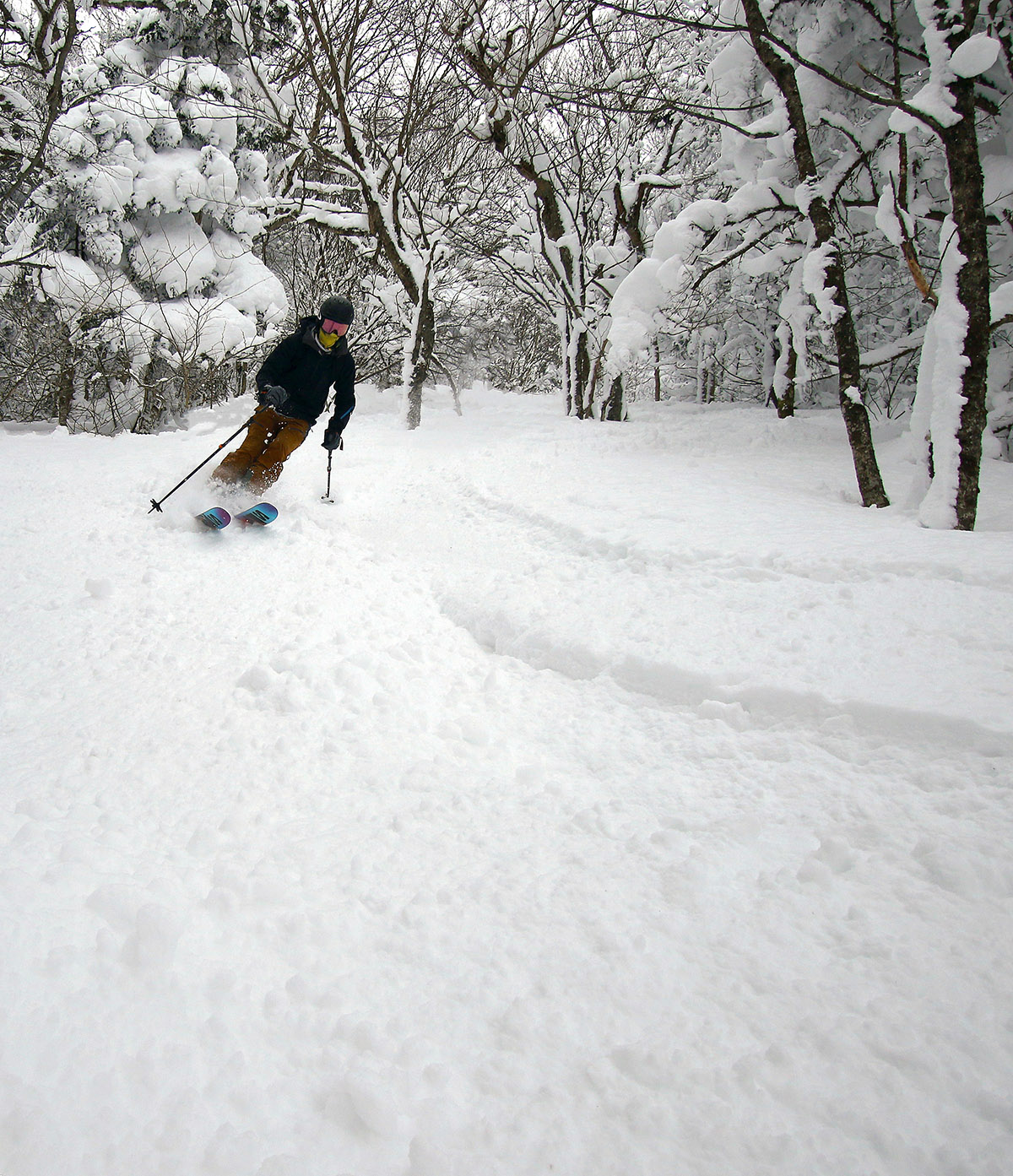
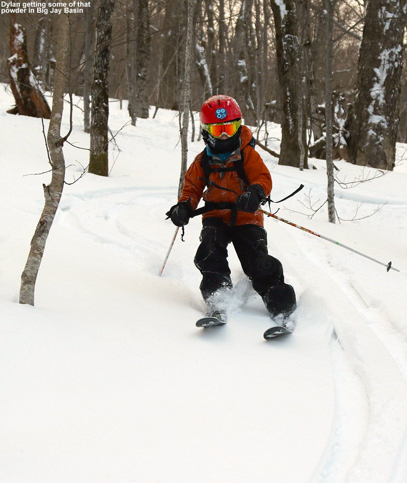
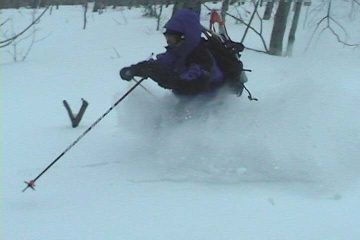
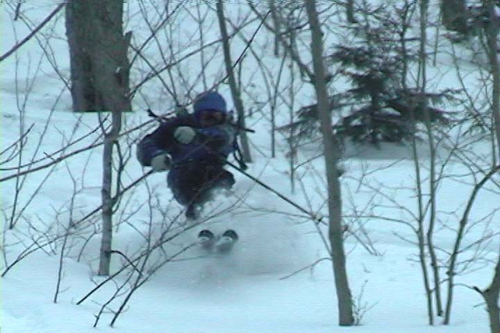
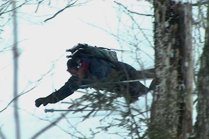
Our descent from the col between Gilpin and Domey’s featured some nice areas with reasonably open trees, spots with excellent natural glades, and some terrain that had been logged and maintained for logging access. The powder was fantastic – there was typically 1 to 2 feet of bottomless powder over a deep base. I would frequently check the depth of the snowpack, and my ski pole would go below the surface of the snow, which means the snowpack depth was in excess of 45 inches. The powder was in a very nice right-side-up density gradient starting with snow in roughly the 6 to 8% H2O range on top. The only thing that could have really made the powder better would have been to throw on several more inches of fresh 3-6% H2O champagne, but that’s really getting picky, because it skied incredibly well. Everyone was on fat skis with widths over 100 mm, and the skis were definitely in their element out there today. Dylan was on his Telemark skis for the first time in 2 or 3 seasons because he’s been looking for a good pair of boots to replace the current ones that are too tight, but it didn’t look like his Telemark skiing had missed a beat. I was happy to see that, and so were his friends.

A Google Earth map with GPS tracking data for a ski tour in the Gilpin Mountain and Domey's Dome area of the Jay Peak backcountry in Vermont
A Google Earth map with GPS tracking data for today’s ski tour in the Gilpin Mountain and Domey’s Dome area of the Jay Peak backcountry.
An image of the Omakase Asian fusion restaurant on Route 242 near Jay Peak in Vermont with snow on the roof and huge icicles hanging down to the ground.
The Omakase Asian fusion restaurant on Route 242 really fit the look of the Jay Peak area with its snow on the roof and huge icicles hanging down to the ground.

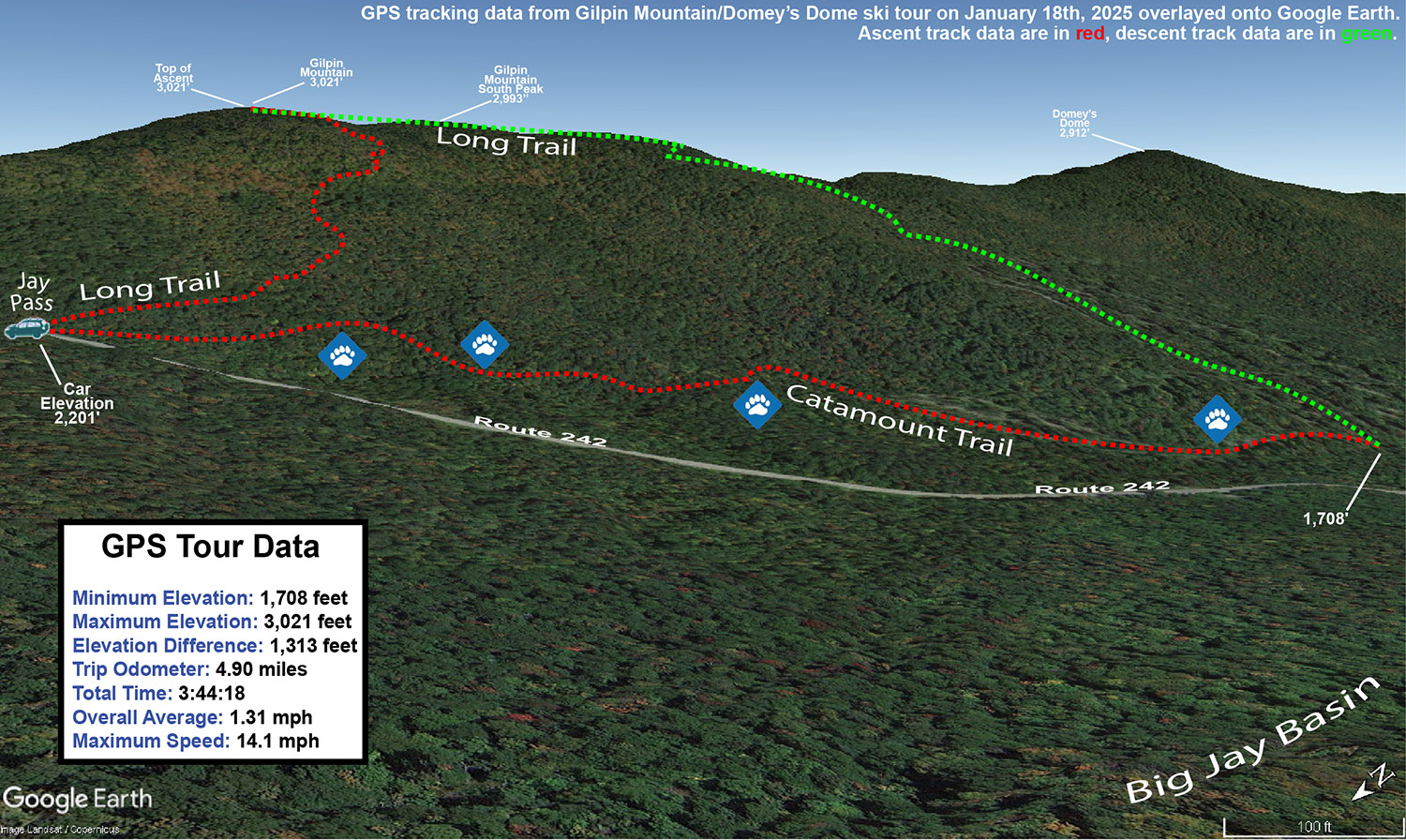
As of this morning, Jay Peak is reporting 203 inches of snowfall on the season, and you can really feel it when you’re out there in the nearby backcountry. The snowpack depth at the Mt. Mansfield Stake at 3,700’ is around 55 inches, but based on what I found out there on our tour in the Gilpin/Domey’s area, that snowpack depth is probably obtained at a lower elevation in the Jay Peak area. We weren’t even out in the Big Jay Basin area, which seems to collect some of the most snow in the area due to its leeward position, so I bet the snowpack is quite deep out there. Dylan and his friends are planning to head out to Alyeska in March for some skiing during spring break, and he mentioned that as of now they apparently have the most snowfall for the season of any ski area in the U.S. at 346 inches. That got me wondering about how things are going for some of the well-known, snowier resorts in western North America with respect to snowfall, and I saw that Steamboat is at 143 inches, Whistler Blackcomb is at 197 inches, Grand Targhee is at 211 inches, and Alta is at 233 inches. So, Jay Peak’s 203 inches is certainly in that ballpark, and the area’s snowpack is definitely doing well. I’d say what’s really helped with making Jay Peak’s snowfall perform in terms of building the snowpack is that they haven’t had to deal with many thaws, especially in the past few weeks when they’ve has so much continuous snowfall.

Big Jay Basin, VT 21FEB2021

An image of Ty Telemark skiing in deep powder from Winter Storm Viola in the Big Jay Basin backcountry near Jay Peak Resort in Vermont
An image of Dylan dropping into a Telemark turn in powder during a backcountry ski tour out in the Big Jay Basin area near Jay Peak Resort in Vermont
Dylan dropping into a Telemark turn in the powder during our ski tour out in Big Jay Basin today.

When I headed up to Jay Peak yesterday and found that quality subsurface base snow with up to 16” of new Champlain Powder™ on top, it was hard not to think about going back for another visit.  The snow just kept accumulating throughout the time I was there yesterday, but that wasn’t the end of it.  Here at the house, the snowfall really ramped up overnight, and I figured it had to really be unloading up there in Big Jay Basin.  So, I told the family all about it, and we all headed out for a tour today.

The weather was quite a contrast between yesterday and today – yesterday was relatively low visibility with constant snowfall, but today there was hardly a cloud in the sky.  The basin area had definitely picked up more snow since I’d left yesterday, but it was most notable above the road elevation (~1,500’).  Yesterday I found powder in the 8-12” range down in that elevation range, and we found something closer to a consistent 12” today.  Up higher, I’d found 12-16” in the 2,500’ range, but my measurements show that the powder depth had increased to roughly 20” when we were there today.  If one considers how dry that snow was, and whatever settling occurred, that was obviously another impressive shot of snow overnight.

An image of Ty skiing powder in the Big Jay Basin backcountry area near Jay Peak Resort in Vermont
Ty drops into another turn in the powder on today’s Big Jay Basin tour, while E looks on from above.

Based on my adventures yesterday, I had no plans to bring E and the boys way up toward the east face of Big Jay; the terrain is really too steep for efficient skinning, and there’s so much great ski terrain in Big Jay Basin itself, that there was little point anyway.  As I mentioned in yesterday’s report, during the approach, it was somewhere above 2,000’ when I found the first obvious split in the main skin track – I literally came to a “T” junction with a skin track to the left, and the other option to the right.  It was interesting guiding the family around today though, as the situation with visible routes was quite different.  There had been a lot more skier traffic, so there were skin tracks and descent tracks all over the place, and the obvious distinction of those skin track routes had been obliterated.  There were so many ski tracks and descent tracks around that the most efficient one’s I’d taken yesterday got missed in a couple of places, but they were all generally leading to where we wanted to go.

“Yesterday I found powder in the 8-12” range down in that elevation range, and we found something closer to a consistent 12” today. Up higher, I’d found 12-16” in the 2,500’ range, but my measurements show that the powder depth had increased to roughly 20” when we were there today”

The skiing, as expected, was excellent.  We topped out at an elevation of roughly 2,700’ in the basin, and worked our way generally back toward the parking area following the typical routes.  There was plenty of powder, although since the area had seen additional skier traffic, we didn’t quite have the run of the place like I did yesterday, and we had to move around a bit more for fresh lines.  I brought up the idea of just skiing straight down the basin to Route 242 and making the short walk back to the car on the road, because I saw some people that seemed to have taken that approach on my outing yesterday.  E and the boys wanted to hit some of that open terrain that’s available near the bottom of the approach though, so we headed that way.  Heading straight down out of the basin will be something I’ll have to try on a future trip, but it could be a nice way to avoid having to traverse to the right as much during the ascent and get a more direct fall line run.

A map showing GPS data on Google Earth for a backcountry ski tour in the Big Jay Basin area near Jay Peak Resort in Vermont
A map of our backcountry ski tour in the Big Jay Basin area today with GPS data mapped onto Google Earth

Since the trip is an hour or so from home, we used it as an opportunity to get Dylan some of his required driving hours, and that was a win-win.  There was still some snow to navigate on the roads so that he could work on dealing with slushy areas, but it was probably good that he wasn’t dealing with the heavy snowfall and low visibility that I had frequently encountered yesterday.

Big Jay Basin, VT 10JAN2015

An image of Vermont license plates on the wall at Howie's restaurant at Jay Peak Resort
An image of Dylan skiing in some powder snow out in the Vermont backcountry in Big Jay Basin
Out for some backcountry powder in Big Jay Basin today

All of Vermont has seen a number of modest snowfalls this past week, and with the squally nature of some of them, snow totals were quite variable at the ski resorts up and down the spine of the Greens. As is often the case though, the Jay Peak area did quite well in the snowfall department, with a seven day snow total of over two feet. After seeing a couple of photos showing the delectable powder at Jay Peak on Thursday, and knowing that even more was on the way for Friday, a visit the Jay Peak area backcountry was sounding very appealing. I mentioned the idea to borderwx on the American Weather Forum, since he lives right in the area and is a regular at the resort and local backcountry, and he got back to me with a number of options. Previously we’ve skied Gilpin Mountain using a car shuttle off Route 242, and I was initially thinking of a variation on that theme, but borderwx also mentioned some options for tours in Big Jay Basin. There were variations starting from Jay Pass, as well as the parking areas down on Route 242 where Big Jay Basin drains out. After weighing the options, and consulting the nice Google Earth map of the Big Jay area put together by Guru Gered in his Big Jay Powder Day trip report at the Nor’easter Backcountry Blog, E and I decided that an out-and-back tour from the lower parking area at the outlet of the basin was the most practical with the boys. We really didn’t want to drive two cars to set up a shuttle, temperatures were expected to only be in the 10 to 15 F range, and this was our first tour in the area. A simple out-and-back meant that we could stop and descend at any time should the need arise.

“The quality of the powder remained very good all around, with just a few windswept areas, and the depth had quickly increased to the 8 to 12-inch range.”

Temperatures were right around 20 F in the Waterbury area as we left at noontime today, but the thermometer gradually dropped with our travel northward until it was 12 F at the Big Jay Basin parking area at ~1,500′. There were about a half dozen cars parked there, and we saw one guy just prepping his gear and starting on a tour. We could see he was using the prominent skin track right across the road, so as soon as we’d geared up, we followed suit. An initial depth check right there at the base of the skin track revealed 7 to 8 inches of powder, so even down at that elevation, the Jay Peak area had clearly picked up a decent amount of new snow this week. The powder was cold, fluffy, midwinter stuff… just like you’d expect out of January.

An image of Dylan, Erica, and Ty on a skin track heading up toward Big Jay Basin in Vermont at the start of a backcountry ski tour
The skin track began in the rather open surrounds of a logging road and surrounding fields.

The skin track was indeed well established, and easy to follow as it worked its way up at a gentle pace on what appeared to be a logging road. We traveled along the road through areas of dense and sparse vegetation, as well as some acreage cleared by logging. The quality of the powder remained very good all around, with just a few windswept areas, and the depth had quickly increased to the 8 to 12-inch range. I’m not actually sure how deep the base snow was, but aside from a few windswept areas it was quite plentiful; we never really had to deal with underlying obstacles due to thin snow. Along with the skin track, we could see that people also used this route for descent out of the bowl, and that was clearly evident when we had to make way for a couple of groups skiing down. They appeared to be having a really good time as judged by their greetings and attitudes.

“It turns out that the bowl we were seeing off to our east wasn’t the main expanse of Big Jay Basin, but a smaller bowl below the col between Big Jay and Little Jay.”

After about a half mile, the skin track left the logging road and headed off generally to the right into the trees. From here the pitch increased a bit, and the skin track wound through the slightly tighter confines of the forest. Around 2,150′ we came to an obvious open spot that seemed to be the base for a broad collection of skiable lines. The skin track continued off to the left, and there were no longer ski tracks around it – it seemed like this was the point where people were converging to the track from the various ski routes above during their descents. It also seemed to be a popular spot to use for people skiing laps above the final runout back to the road. The skin track steepened here, and there were a few spots where it was a little steeper than it probably should have been, but we managed our way through them. Since I knew the boys wouldn’t want to do a huge tour, I’d set an elevation mark of ~2,500′ as a good stopping point from which to descend. That would make for a respectable descent in the range of 1,000′ of vertical. At an elevation of ~2,450′, we came across a very nice flat area along the western edge of a bowl somewhere below Big Jay on the western fringe of Big Jay Basin. The spot had a nice view down into the various areas of open ski terrain within the bowl itself. It was slightly shy of the 2,500′ mark, but a quick look around revealed that it was the obvious choice for a comfortable respite and preparation for descent in the immediate area. It turns out that the bowl we were seeing off to our east wasn’t the main expanse of Big Jay Basin, but a smaller bowl below the col between Big Jay and Little Jay. For perspective, our route can be seen on the Google Earth map available at the end of this report.

“All of us made a lot of alpine turns though, since the confines were just a bit too tight to really open it up all the time with slower, Telemark turns.”

We had some hot soup and cocoa that we’d brought along, removed our skins, and generally geared up for the descent, but we didn’t linger long because it was definitely chilly. While we were there though, we saw a few skiers descend through the more open terrain in the middle of the bowl, and the skiing looked nice. As soon as we were ready, we dropped into the bowl. The snow quality was excellent, there was about a foot of powder over a generally smooth base. There were a few windswept spots with hard snow here and there, which was sort of strange because the area was generally sheltered. I’d say that the tree spacing and amount of smaller saplings was a bit too constraining though. It looked better a bit up from where we were, so I think that we’ll explore up there the next time we head into the bowl. A couple more feet of base would really help in those lower reaches of the bowl that we skied, since it would bury some of the smaller saplings and open up more lines. With that said, there were some nice lines in there and we managed some good turns. All of us made a lot of alpine turns though, since the confines were just a bit too tight to really open it up all the time with slower, Telemark turns. We made our way generally back in the direction of the logging road, and once we got there we skied a combination of on and off-road lines, depending on the pitch and spacing of the trees. The trees were actually pretty tight down along the logging road, and although the pitch was fairly shallow, it’s about as much as you’d want. There were some areas where the pitch was shallow enough that skiing on the partially packed logging road was the only option, but there were still shots of powder along the edges of the road to catch.

“We were the last car in the lower parking lot, so he was really thankful that we were there and able to give him a ride back up to the top of the pass.”

As we were packing up our gear back at the car, a group of four skiers emerged from the forest about 100 yards up the road from where we were. One of them grabbed my attention and asked if he could get a lift up to the top of the pass where his vehicle was parked. He’d started a tour from there, and had intended to finish there as he’d done in the past, but somehow he got into a different drainage or something. He’d actually run into the other skiers along the way, who were presumably in a similar predicament, and they teamed up to make sure they all got out OK. We were the last car in the lower parking lot, so he was really thankful that we were there and able to give him a ride back up to the top of the pass. He let the other guys know that he’d be back soon to pick them up. The delivery to his car went fine, and he was happy to have avoided a 1.5-mile hike up the road. There was a good amount of traffic on the road though, so I’m sure he could have found a ride pretty quickly if we hadn’t been there. I’m just glad we had space in the car for one more!

An image of the Jay Peak tram docking at its summit station back lit by light of the setting sunOn our drive to the area earlier in the day, we’d taken the Montgomery Center route, since it was closer to where we were touring, but on the way home we continued east down the pass and stopped in at Jay Peak Resort for a bite to eat. We went to Howie’s at the Stateside Base, which we’d last visited about a year ago during our Christmas trip to Jay Peak with my family. We had some appetizers (including poutine of course) and got to watch the start of the Patriots playoff game against the Ravens. There were a number of people at the bar, but we had the table area to ourselves as the resort wound down from the day and darkness descended. This evening when I was at a work function in Burlington, a colleague mentioned that he’d heard the trails at Bolton Valley were really icy, and I said that we’d suspect that might be the case and headed up to the Jay Peak backcountry for a tour. After hearing his comment, I’d say we made the right choice today and got some good powder skiing out of it.

An image showing GPS tracking data on a Google Earth map for a backcountry ski tour in the Big Jay Basin area near Jay Peak Ski Resort in Vermont
The GPS tracking data from today’s backcountry ski tour plotted on Google Earth: our tour took us up into terrain below the col separating Big Jay and Little Jay, along the west edge of Big Jay Basin.

Looking at the Google Earth map of our GPS track, it’s really easy to see that we were quite far on the western fringe of Big Jay Basin, so we’ll certainly want to explore a bit farther to the east in the big bowl next time we visit the area. A start from Jay Pass would certainly get us in there, I just think spotting a car appropriately for the exit might be difficult. Aside from the large parking area that we used on the south side of Route 242, we didn’t see any other obvious spots between it and the pass. Another option would be to simply tour out and back to the pass, but of course that means finishing with an ascent.

Gilpin Mountain, VT 18FEB2001

An image of Jay, Erica, James, and Dave setting out on the Catamount Trail off Route 242 during a backcountry ski tour of Gilpin Mountain near Jay Peak Resort in Vermont
An image of Jay skiing in powder snow in February during a backcountry ski tour of Gilpin Mountain near Jay Peak Resort in Vermont
Jay enjoying some powder during today’s ski tour on Gilpin Mountain after Jay Peak recently received 2 1/2 feet of new snow

For years I’ve driven along Route 242 to get to Jay Peak, often remarking about the intriguing ski terrain that dropped to the road from both sides. This was always on the way to ski the resort of course, and thoughts of exploring those backcountry goodies had to wait. Since Jay Peak had received 2 ½  feet of new snow in the past few days (much more than anyone else locally for us), and it was a holiday weekend, I decided it was time to explore the goods off Route 242. This realization came to me on Friday morning when I awoke, and I soon sent out a secret message to a local band of agents informing them of a Mission Impossible. This mission, which James, Erica, and Dave chose to accept, wasn’t really all that impossible, it was more just unknown. Mission Impossible sounded fun though.

A topographic map showing Route 242 and approximate ascent and descent routes for a backcountry ski tour of Gilpin Mountain near Jay Peak Resort in Vermont
A topographic map of the Gilpin Mountain area showing Route 242 (gray) and the approximate ascent (thick blue line) and descent (thick white line) routes used during today’s ski tour

At the crest of Route 242 (elevation ~2,250′), The Long Trail crosses the road, and along with the trailhead there’s a parking area (see the red dot at the lower left corner of the topographic map provided with this report), so this appeared to be a good place to start a hike. My initial plan was to head south along The Long Trail (note on the map where the gray-dashed Long Trail heads south from the red dot) toward Domeys Dome (elevation 2,913’ – not visible on map) and ski down from there to Route 242 where we would have a second car waiting (elevation ~1,500′ – off the map to the south). This would provide a roughly 1,400′ vertical run, with a calculated pitch of around 23 degrees.

When we actually arrived to surveil the area though, we discovered that what looked good on paper didn’t look as enticing in real life. The parking at the bottom was quite far away, and the slope leveled out too quickly to a very low angle. In 10 degree temperatures and brisk winds, we gathered together in one of our cars at the top of Route 242 and consulted the maps for new guidance.

We decided to drive the car along Route 242 to the northeast (in the direction of the Jay Peak base area) as the road descended toward the resort, while we looked for potential ski lines. There were plenty of lines off to our right, as well as a second parking area for cars (yellow dot on the map) at the next low point of Route 242 (elevation ~1,950′). This setup seemed almost too perfect. I say “almost”, because unfortunately The Long Trail doesn’t go in that direction at all, and we assumed we’d have to blaze our own path through deep powder to get to where we wanted to go. We had seen what appeared to be a trail heading off in the direction we wanted, very wide (10 feet or so on average), but we were still unsure if it would work for us. As we got closer, we could see that someone already had a skin track heading that way; we’d found our hiking route.

An image of a trail sign for the Catamount Trail showing the Catamount Trail logoFrom the top of Route 242, we got our gear together, threw on our snowshoes, and headed out along the trail (our ascent route is roughly marked by the thick blue line on the map). The image of the group heading out shows the general look of the terrain at the start of the trail. I soon noticed from the blazes that this was The Catamount Trail (the HUGE cross-country ski trail that travels the whole length of the state). The upward slope of the trail was very slight, but as we continued on our ascent, Route 242 quickly fell away to our left and we could watch the vertical drop for our potential ski run grow rapidly. At an elevation of around 2,400′, we broke uphill of The Catamount Trail (following the switchbacks of another skin track) to gain some additional vertical. It turned out that other folks had been in the area today, as shown by the skin tracks, ski tracks, and the people themselves. We continued to hike up to around the 2,600′ mark, and then as the slope started to mellow out, we decided to boot up and test out the terrain. A group of about five Telemark skiers passed by on their way up, one of them deciding to cash in at that point and start his descent as well.

An image of Dave skiing among some trees during a backcountry ski tour on Gilpin Mountain near Jay Peak Resort in Vermont
Dave slices his way through some branches as he encounters a brushy area on one of our ski runs.

It’s amazing to think that last weekend had been a situation of rain, warm temperatures, and a refreeze that turned the entire snowpack into a solid, crusty mess. From where we were standing, it was basically bottomless powder, a situation in which removal of snowshoes or skis meant trouble standing. The pitch of our descent started off mellow, with various areas of hardwood glades and some underbrush at times. The snow was nice and light; I’d estimate its density at somewhere in the 5-7% H2O range. The slope gradually got steeper as we picked lines along the way that looked good and headed in the general direction of our lower shuttle vehicle. Our general descent route is marked by the thick white line on the map. Even with the deep snow, some areas had enough underbrush that they made picking lines difficult. Some areas we quite clear, but a bit of scouting was needed to find them. James picked direction with his usual finesse, and guided us right down to the parking area and our waiting vehicle (Dave’s pickup truck).

An image of a parking area on Route 242 used by backcountry and sidecountry skiers finishing their runs in the terrain near Jay Peak Ski Resort in Vermont
A scene from the lower parking area on Route 242 where many people finished off their ski runs, with skiers of all types constantly coming and going

Our total vertical skied was approximately 700 feet, which was a nice run for only about 400 vertical feet of very easy hiking. At the parking area it felt like the local version of Grand Central Station for backcountry skiing. There were numerous cars, lots of people hanging out, and skiers pouring down off of both sides of the road enjoying the powder. James said it felt like a local backcountry Mecca (in reference to the number of people). Although a few of the people were from our side of the road, most came down from the Jay Peak side, riding the lifts and then catching a beautiful long run all the way down to Route 242. Some people had cars waiting for them, some hitched rides, and some looked like they had no idea where they were. It was an awesome scene to see though, with all those folks out there enjoying the snow. I’m thankful we weren’t skiing the other side of the road though (the Jay Peak side), as the number of skiers on those slopes had even that vast amount of terrain tracked up quite well. I had always thought of heading that way when skiing Jay Peak, and had no idea how many people did it. There was a continuous flux of people coming through that area all day long, with cars pulling in, parking, leaving, people looking for rides, giving rides, looking for people that they had lost, etc. etc. etc.

An image of Jay catching a ride in the back of Dave's pickup truck returning to the top of the pass on Route 242 while backcountry ski touring on Gilpin Mountain near Jay Peak Resort in Vermont
Catching a ride back up to the top of the pass in the back of Dave’s pickup truck

Using our vehicles, we shuttled our crew up to the top of the pass, and started for another run from the upper parking area. Unlike the lower parking area, there were only a few cars there, and no people. The wind was blowing and the temperature had stayed around 10 degrees the whole day, but the sun had come out for a while during our first trek, and it had made that a great hike. We had a snack in the car, and headed off along The Catamount Trail for round two. Our first run had tuned us into the lay of the land its terrain nuances even better, and now James had plans for some even sweeter lines. We hiked the same general route (much easier at this point with the presences of our tracks and those of numerous others who had been up). We cut upward off The Catamount Trail a bit earlier, and topped off near the same elevation as before. This time we found some lines that were even more open, although we did still had to pass through some brushy sections.

An image of James crashing in the powder while backcountry ski touring on Gilpin Mountain near Jay Peak Resort in Vermont
James helping out with some footage for our crash reel!

I’m not sure how good the ski touring in this area would be with low snowpack, since even with four feet of base, there was still brush in some areas, but it was certainly good skiing with our usual midwinter base depths. Some of the most fun we had was due to spectacular falls, with all four of us getting in on the act by diving into the powder. We shot about 30 minutes of video, hopefully enough to have a segment in this year’s ski movie. We’ll have to see, but either way, we got some of our best falls for this season’s crash reel! 🙂