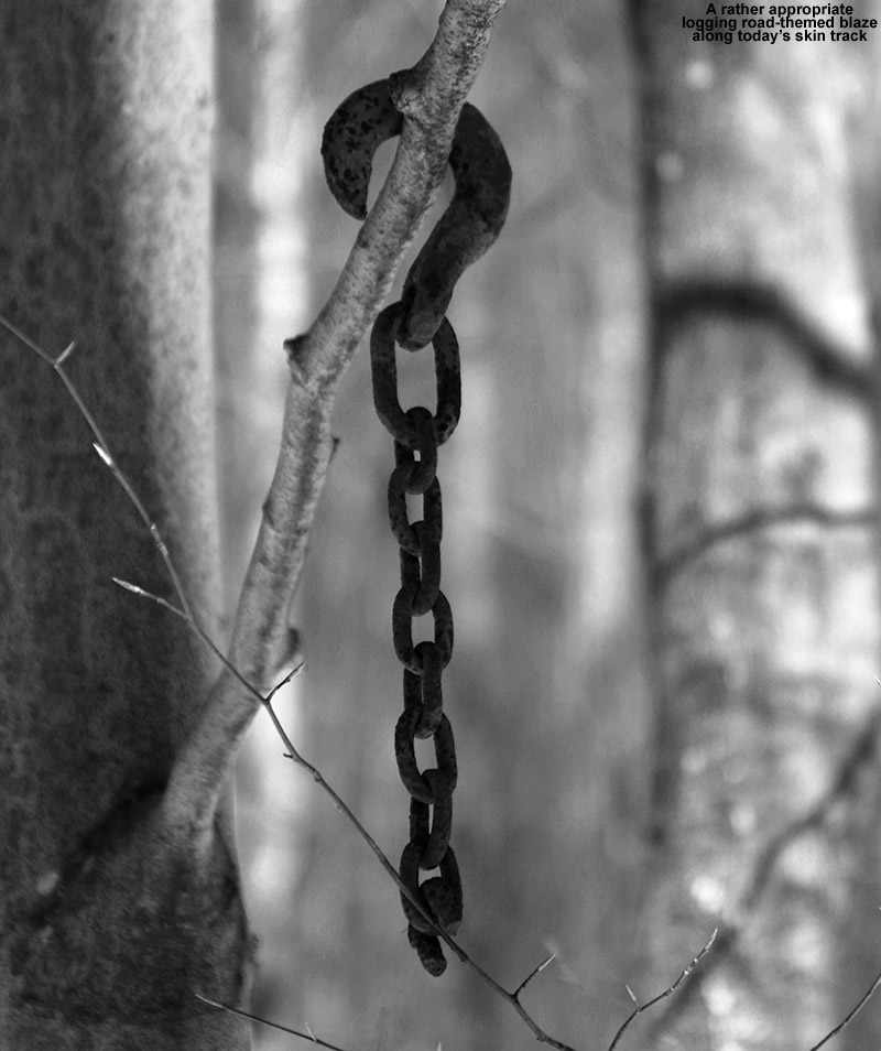
Gliding through some backcountry powder in the Nebraska Valley area today
The weather yesterday was very comfortable, with highs in the local mountains around 30 F at ski resort base elevations. Today was a different story though; mountain temperatures were expected to start in the single digits and drop in the afternoon to produce wind chills well below zero. With that forecast looming, E and Claire decided to cancel today’s BJAMS ski program at Stowe to avoid any frostbite issues with the students. The program can make up the session later in the spring anyway, hopefully on a nice warm day.
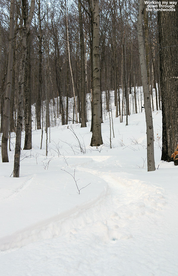
“The ski lines were obvious and everywhere, there’s no hunting around necessary if you’re looking for some moderate angle powder to ski.”
With the chilly forecast and some extra time in the afternoon, I decided to head out for a backcountry ski tour in the Nebraska Notch area. Some of the higher elevations of the Northern Greens did pick up as much as 4 to 6 inches of snow overnight, so that added a little extra incentive to get out and see how conditions were faring. I’ve wanted to do an exploratory tour near Nebraska Notch for a while, and I’m familiar with the tour highlighted in David Goodman’s book that starts on the west side of the notch. I’d been through some of that area this past summer when our family was on a backpacking trip with the Handler’s, so I thought that something on the east side would be a fun alternative. From Jacquie, I’d heard about the backcountry skiing potential above the overnight parking area near the Lake Mansfield Trout Club, so I decided I’d give that a shot. It’s a quick trip from our house in Waterbury, and I’d be able to take care of some necessary grocery shopping on the way home as well.
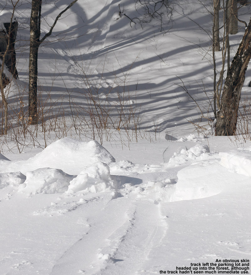
“I’m not sure how deep the base was, but surface powder was 13-14″ in the trees just above the parking area (~1,100′), and pushing two feet up high depending on prior wind and sun exposure in underlying layers.”
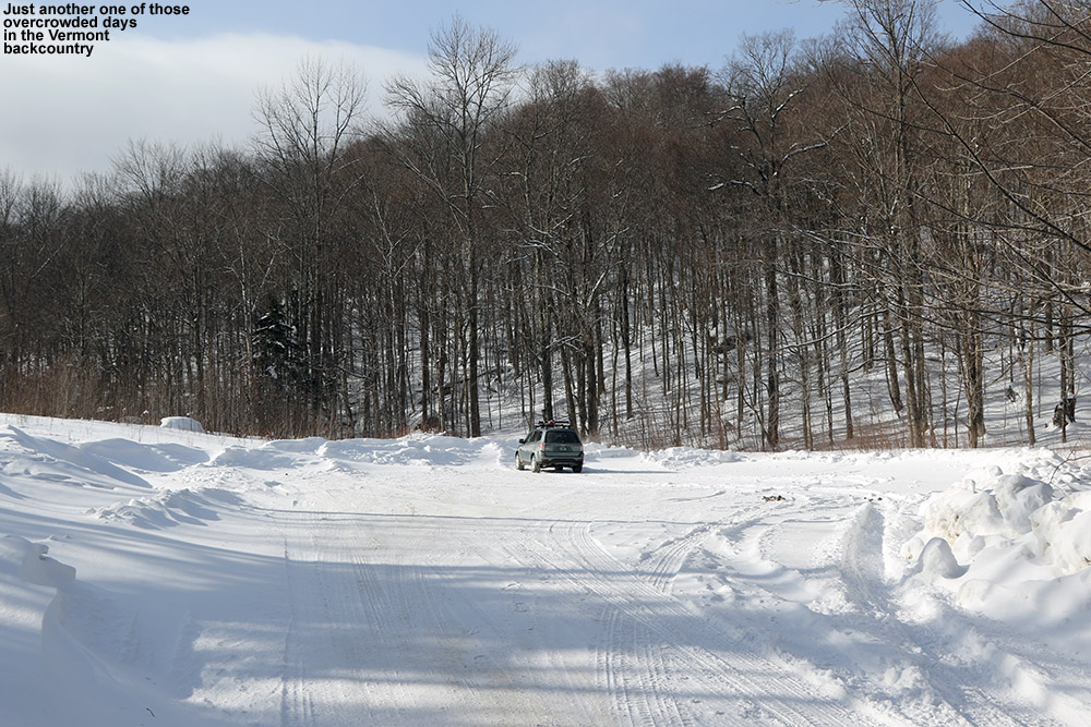
Heading up Nebraska Valley Road, I noticed that as I approached the 1,000′ elevation mark, the snowpack really took a jump. It went from the 8-12″ that we’ve currently got in many of the lower mountain valleys of the Northern Greens to something more, and you could really see how the higher elevations of the Nebraska Valley were holding the snow. I pulled into the lot for overnight recreational parking, and it was empty. There was probably space for 20 cars, but mine was it. I guess it’s just another one of those harbingers of the overuse and overcrowding associated with skiing in the Vermont backcountry. In any event, I could see an obvious, although apparently lightly used skin track off to the right heading up into the forest. More importantly, I could see the associated ski terrain looming right above me; well-spaced hardwoods appeared to fill the entire slope, and you could immediately see that there was some great skiing right down to the parking area.
An old skin track from the parking area marked an obvious route of ascent.
The skin track ascended through the hardwoods on what appeared to be an old logging road, and it sliced right through an impressive chunk of ski terrain. The ski lines were obvious and everywhere, there’s no hunting around necessary if you’re looking for some moderate-angle powder to ski. After looking at the area on Google Earth this morning, I’d decided to explore a drainage off to the northwest of the parking area, and conveniently that’s just where the logging road and skin track headed. After a few hundred feet of ascent I could see that there were a number of ski options, but three main ones were very evident: You could ski the logging road itself, which was relatively narrow and contained the skin track, but would serve up some decent turns. Much more expansive options were to either contour off to the east and make turns in the vast face of terrain containing the hardwoods, or head westward and ski steep gullies down into the drainage. I had plenty of time to survey the topography and decide on descent routes as I continued up the skin track; it’s set at a very nice, consistent pitch with none of these steep spots that might promote slipping.
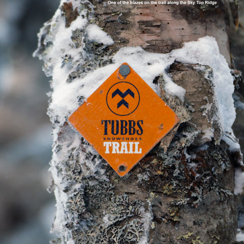
At around 2,100′, evergreens began to mix in with the hardwoods, and the logging road gradually gave way to a skin track that worked its way more tightly through the forest and ascended small streambeds. By 2,500′ I was into exclusively evergreens, and the available snow was getting deeper. I’m not sure how deep the base was, but surface powder was 13-14″ in the trees just above the parking area (~1,100′), and pushing two feet up high depending on prior wind and sun exposure in underlying layers. I hit the ridge line (Sky Top Ridge east of Dewey Mountain) at an elevation of roughly 2,800′, and headed off to the east on the ridge line trail. Appropriately, the trail on the ridge is known as the Skytop Trail, and David Goodman’s Backcountry Skiing Adventures: Vermont & New York book has a specific chapter on touring there. I found it marked with red blazes, but I also noticed a “Tubbs Snowshoe Trail” sign as well. I continued on the Skytop Trail for another few minutes until I hit a local high point where I decided to halt my ascent.
“Some exploring would have been fun, but with the time of day, cold temperatures, and being solo, there really wasn’t much margin for messing around.”
Up there on the ridge it was cold, noticeably colder than the 10 F at the parking area. I was out of the wind, but it wasn’t a temperature to hang around in. I poured some soup and let it cool a bit while I changed over for the descent. My plan was to head back down in the area of the skin track for that first chunk of the descent, since I hadn’t come across any obvious lines in other areas. Some exploring would have been fun, but with the time of day, cold temperatures, and being solo, there really wasn’t much margin for messing around. During the ascent I’d seen that there were plenty of steep, ledgy areas above the open hardwoods. Those ledges and some dense evergreens lay right below me, and from what I’d seen it would be very easy to get cliffed out up there. Any exploration of that terrain will have to wait for another time.
“Being south-facing, it’s not the kind of terrain that one would want to ski on sunny days when temperatures are getting marginal, but on a midwinter day like today, the snow was great.”
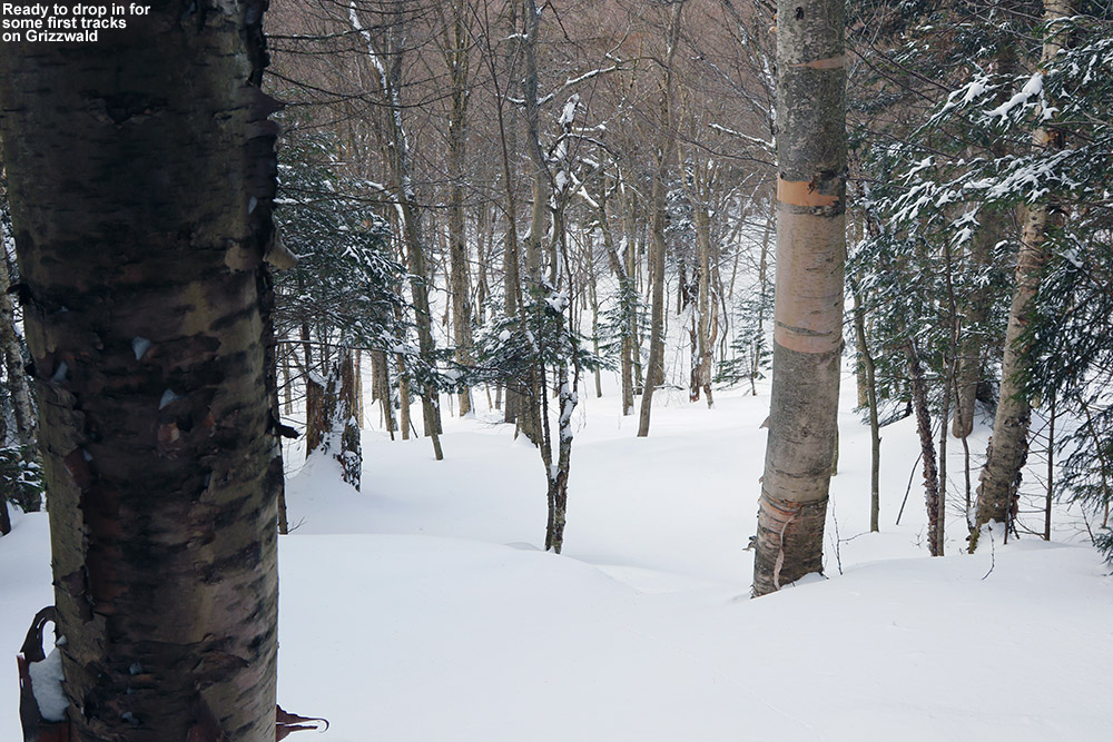
The descent up high along the general area of the skin track was very nice – the powder was deep and there were occasional options of ski lines that cut corners or veered away temporarily from the track. When I was back into the open areas of hardwoods, I cut left of the track following a previous skier’s lead, and traversed out into the face of terrain that sat well above the parking area. It was classic Vermont hardwood ski terrain; there weren’t any obvious maintained lines, but you didn’t need them. It was pretty much see it and ski it. The powder was a little shallower on some pitches, no doubt a function of that fact that the terrain faces south and can get plenty of sun due to the leafless deciduous trees. Being south-facing, it’s not the kind of terrain that one would want to ski on sunny days when temperatures are getting marginal, but on a midwinter day like today, the snow was great. I eventually ran into the skin track again, and cut to the other side as I saw some attractive ski lines heading in that direction. I finally had to do a short traverse to get back to the last pitch above the parking area, but with the open nature of the forest, navigation was pretty easy.
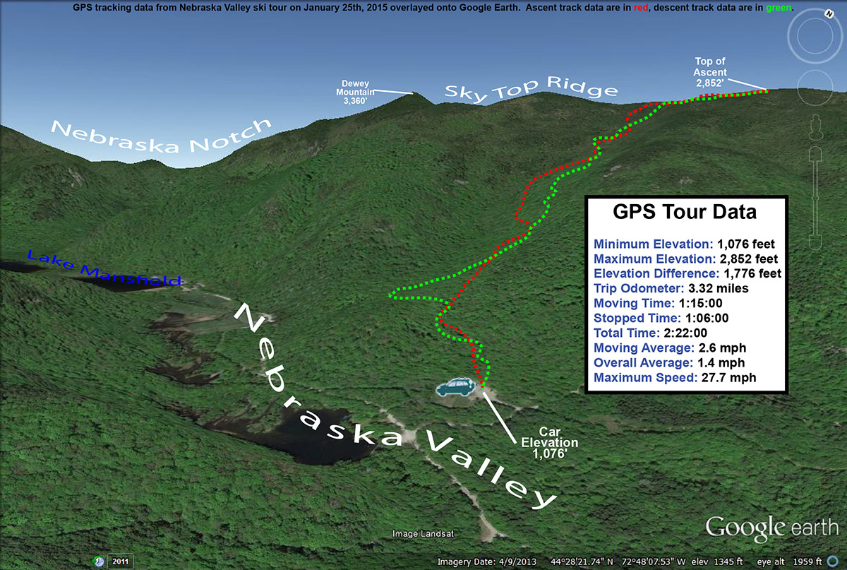
The GPS tracking data of today’s backcountry ski tour in the Nebraska Valley of Vermont plotted on Google Earth
I’d say today was a great first visit to the area; those hardwoods are exceedingly skiable, with the main downside being that it’s south-facing, so the quality of the snow needs to be watched with respect to recent weather trends. The snowpack isn’t even especially deep right now, and I only encountered the occasional underlying obstacle to contend with. As usual, if you throw another couple feet of base down, more and more lines will simply open up and get even cleaner as additional saplings and other trees get buried. On that note, there’s another winter storm (Juno) coming into the area over the next couple of days – it sounds like the bull’s-eye areas are down to the south, but it’s expected to give us a moderate shot of synoptic snow up here as well, which should further improve base depths.
Heading down into the Cotton Brook area on today’s backcountry ski tour near Bolton Valley.
Best… Bolton… backcountry… tour… ever. That’s really the only way to start this trip report, because even after years of exploring the backcountry around Bolton Valley, that’s what today’s tour was for me. I can’t say that this tour was tops in every category; the powder was fantastic, but there have been numerous days that top it, and E and the boys weren’t with me, so it was a solo outing. What made the tour so great though was the combination of great powder on all aspects, the good distances covered to provide a nice workout, but most importantly, the breadth of the backcountry network used and the substantial number and variety of glades visited. The tour spanned all the way from the alpine trails of Wilderness to the Cotton Brook area, and featured nine different glades. What also made the tour so outstanding was that I could use my knowledge of the area to connect all those glades very efficiently; in terms of powder turns that meant getting the most bang for my buck.
“…we just keep getting “small” snowfalls to freshen the slopes and top off the powder, but of course around here that’s meant 1 to 2 feet in the past week.”
It’s a holiday weekend, which typically means lots of visitors to the ski resorts, and the forecast today called for fairly chilly temperatures in the single digits for the mountains. That’s a combination that just calls out for some backcountry touring, and that’s the plan that gradually evolved this past week as I watched the forecast. Although we haven’t had any huge storms in the past week or two, the snow out there in the Northern Greens is simply fantastic – we just keep getting “small” snowfalls to freshen the slopes and top off the powder, but of course around here that’s meant 1 to 2 feet in the past week. And, the January weather just keeps all that powder pristine.
Ty was out at a dance until late last night, and friends came back to our house and stayed overnight to play with him and Dylan. I wasn’t about to pull them away from that this morning, and in fact, I wasn’t really planning to ask anyone if they wanted to ski with only single digits in the mountain forecast. I knew it was going to be one of those days where it could be uncomfortably cold if you didn’t keep moving, so going out by myself meant that I could keep the tour at whatever pace I chose. Knowing that I was going out solo also let me devise a more ambitious tour than if I was heading out with the whole family. After considered the many options, I decided that a lift-assisted tour out toward the Cotton Brook area would be a good option. There are glades farther to the north there that I’ve yet to explore, and at a decent pace, it looked like I’d be able to put together a solid tour out to that area and back in the three to four hour window of time I had.
The Wilderness Chair was scheduled to start running at 10:00 A.M., so I headed up to the mountain a bit after that and found that parking had reached the third tier of the main Village lot. That’s actually less than I’d expect for a Saturday on a holiday weekend, but I think the cold weather kept some folks away. I was able to wrap around and get a spot in the first tier, and then headed right over to the base of the Wilderness Chair to start my tour with a lift assist. Temperatures were certainly on the chilly side, probably somewhere in the single digits, but there was no wind, and that made quite a difference in terms of sitting out there lift. The lift ride gave me a chance to check out the on piste conditions, since I haven’t been to the resort since our trip back on the 4th of the month, and what I saw today looked really good. I didn’t hear any hard sounds as some snowboarders passed below me, and off in the Wilderness Woods to my left, I watched a boy glide through the powder in silence. I’d say ¾ of the terrain in Wilderness Woods was still untracked, so there was a lot of good skiing to be done there. I was even tempted to take a run, but keeping on track for my tour was a necessity.
From the Wilderness Summit I skied down the top of Peggy Dow’s to the junction with the backcountry network at Heavenly Highway. I let my momentum carry a bit of the way into the forest, and then stopped to put on my skins. At that point I definitely felt the cold – it had the bite of below zero cold up there around 3,000′, and having just sat on the lift for a while meant that I wasn’t producing much heat. As I got my skins on another skier appeared, coming from Heavenly Highway. We exchanged greetings and I saw that he was heading for a descent on the alpine terrain. I got my skins on quickly, and headed northward on the trail. My goal was to head down Devil’s Drop and get on the Catamount Trail, and I made good time through those high elevations. I checked the depth of the surface powder as I moved across the ridge line on Heavenly Highway, and generally I found about 13 inches. I saw a couple other skiers along the way toward Devil’s Drop, but as usual it was pretty quiet. For Devil’s Drop, I debated taking off my skins and really having some fun on the descent, but opted to just keep them on. I did switch my binding to ski mode so that I could make some Telemark and alpine turns as needed. I actually had first tracks Devil’s Drop, and if I’d been with others it probably would have been worth pulling off the skins and skiing it hard with some pictures.
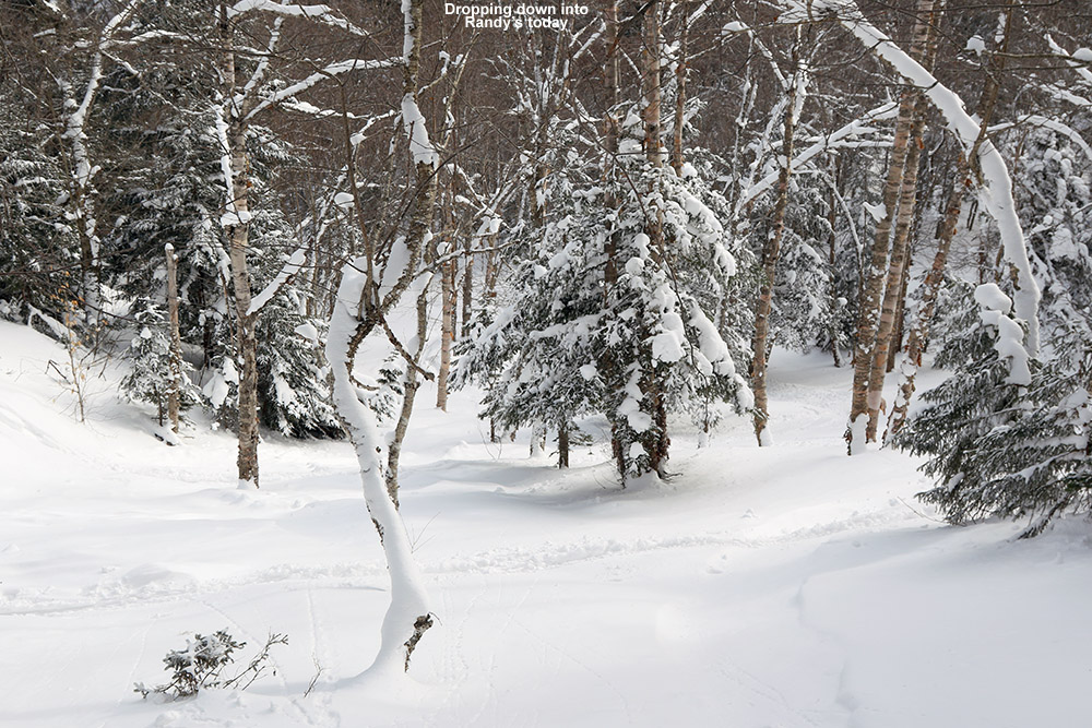
As I neared the bottom of Devil’s Drop I saw a group of eight skiers below heading northward on the Catamount Trail. That’s one of the larger groups I’ve seen out there, and then seemed pretty organized; as I caught up to them they all pulled over to the right in near unison and let me pass. Within another few minutes I’d passed Birch run and reached the border of the Bolton Valley Backcountry Network. I continued on a bit more until I was just below “The Glades”. My goal actual goal was down below, but I had the time and energy, and there were few tracks in The Glades, so I continued up to add another couple hundred vertical to my descent. That’s when I really started to warm up, and I had to hit the side zips on my pants and open the vents in my helmet. I actually think the air temperature was starting to warm a bit as well as southerly flow was starting to kick in ahead of our next storm. The ascent overall there was really quick though, and soon I was at the top of The Glades switching over to descent mode.
I hadn’t really gotten the feel of the skiing since I’d had my skins on at Devil’s Drop, but now I had them off and could dive into those turns in the Glades. The turns were excellent; there was a good foot or more of midwinter powder that easily kept me floating on my fat skis. I continued straight on below the Catamount trail onto “Randy’s”, which began with a modest pitch, and then dropped right off into a nice steep, open drainage. The pitch was close to 30 degrees in spots, and I can imagine this is quite a spot after big dumps of snow. The powder there was the deepest I’d seen on the day, but even that wasn’t quite enough to keep from touching down to the subsurface in a few spots because it was just so steep. That’s some really sweet terrain down there though, and there was just one or two other ski tracks in there, so the untracked lines were plentiful. Below that I got into “Great White Way”, where the pitch mellowed out a bit relative to Randy’s. The route just kept going, and as far as I understand, you can essentially take it all the way down to Waterbury Reservoir if you want, but after about 700-800′ of vertical I decided to call it a descent so that I could stay on track with the rest of my tour.
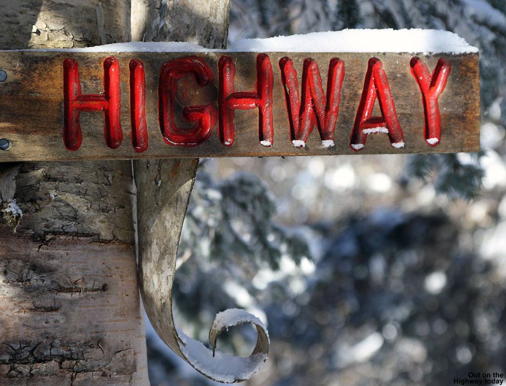
I skinned up along the edge of Great White Way, using a skin track that others had put in place. It would great to have a skin track that was totally out of the way of the trail, but the pitch is reasonable enough that you can head straight up the trail. As I approached Randy’s, the pitch really steepened of course, and the skin track had to make some pretty tight switchbacks. Fortunately, a more official, off trail skin track is quickly offered that heads up toward Birch Loop; there’s even a sign to let skiers know where that ascent route is, and it’s marked by blue blazes. That ascent was excellent, with a well-established skin track, and it delivers you right back that the Catamount trail just below The Glades.
“The depth and consistency of the powder came together perfectly for the pitch, and by the time I hit World Cup I was saying “Yes, Yes, that’s what I’m talking about!”… mostly to myself of course.”
I left my skins on and zoomed across the flats toward Bryant Cabin. I didn’t stop inside, but instead continued along Gardiner’s Lane and up to North Slope to set up my final descent of the day. I stopped at the top of Upper JJ’s as my starting point. Since it was my final descent, I pulled out some tomato soup from my thermos, let it cool while I removed my skins, and then chugged the soup down and got on my way. The turns were beautiful, and I continued on Gardiner’s Lane, noting that there was a nice line above A1A that I hadn’t recalled seeing. I’ll have to check that out in the future. When I got to Grizzwald’s I found it completely untracked, and bounded my way down the steep pitch with some deep, fluffy turns. I contemplated a look at Alchemist, since it faces south and might be well preserved in this cold weather, but I saw what looked like just a track or two heading toward Gotham City and my skis just ended up pulling me that way. I skied Girls, and I think those might have been my favorite turns of the day. The depth and consistency of the powder came together perfectly for the pitch, and by the time I hit World Cup I was saying “Yes, Yes, that’s what I’m talking about!”… mostly to myself of course. I hit two more glades on the descent before I was down to Broadway, but I don’t really know the names of those – the snow was good to the very last drop though.
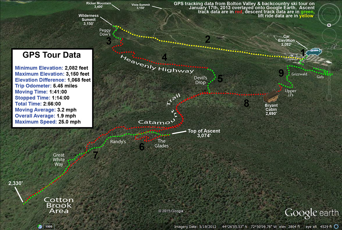
The GPS tracking data from today’s tour in the Bolton Valley backcountry plotted on Google Earth
I really can’t think of a tour I’ve done in the Bolton Valley backcountry that delivered such a huge amount of perfect turns in so many different areas, so this one really does go down as my best tour in that regard. The lift assist really allowed this tour to fit into a reasonable window of time while covering some good distances. There are really limitless combinations to do out there in terms of tours, but I know I’ll visit parts of this one again because it delivered so well.
Out for some powder on the east side of Camel’s Hump today
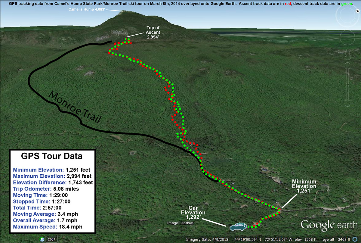
It’s been a light week for snowfall here in the Northern Greens; since the storm that hit the area last Sunday, we’ve had generally cold and dry weather, with just one small round of snow in the Tuesday-Wednesday timeframe. That got me thinking about a backcountry tour for today. My initial inclination was to head northward, since as our snowy Sunday outing at Stowe confirmed, the northern mountains had really picked up the most snow, and accumulations tapered off as you headed southward. With that in mind, I was thinking of heading to Nebraska Notch for some turns. However, yesterday’s and today’s weather history also needed to be factored into the mix. Temperatures reached above freezing in some spots yesterday, and today was looking similar, so I figured that something sheltered and with relatively high elevation was the way to go for the best snow. I decided to head to some of the skiing around the Monroe Trail, on the Waterbury/Duxbury side of Camel’s Hump. I had planned to have Ty come with me, but at the last moment he decided that he didn’t want to skin today, so I said we’d head up to Bolton Valley for some lift-served turns when I got back from the tour.
It’s been over four years since I last visited the Monroe Trail area of Camel’s Hump for skiing. On that outing, I followed the Monroe Trail up to the large cliffs beneath the peak of Camel’s Hump, then traversed somewhat northward to set up for a descent fairly distant from the trail and toward the glades that drop down near the trailhead. I got in some good skiing in the trees, but really just caught the end of the glades, so I knew there would be more lines to explore. This time, my plan was to simply skin up one of the descent tracks made by skiers coming down through the glades, since it would save a lot of time traversing around up high to find the best starting points.
I headed out from the house a bit before noon, and temperatures were in the mid 30s F. The temperature fell as I headed up Camel’s Hump Road, dropping to 31 F by the time I reached the winter parking area at ~1,200’. Just a couple hundred feet below the parking area, I’d seen the first flakes of snow from a small system that was expected to come through in the afternoon. From the trailhead at ~1,500’, I skinned up the Monroe Trail for a few more minutes and then as the trail started to bend southward, I jumped onto one of the ski tracks coming down out of the obvious glades in the terrain above. The tracks traversed northward for a bit, but then gradually began to make a more direct ascent up toward the east face of Camel’s Hump. I was a little worried about the snow quality, because although it was below freezing and most snow that wasn’t in the sun was still wintry and dry, there were only a few inches of powder above an old crust. I wasn’t quite sure how that was going to ski. But, the snow got better and better as I ascended, with the powder on top of any crust getting deeper and deeper. It was really nice skinning though – the temperatures were just below freezing, the wind was calm, and light snow was falling in association with the afternoon’s storm. I hiked in just a vest over my polypropylene base layer, and quickly had my hat off as well.
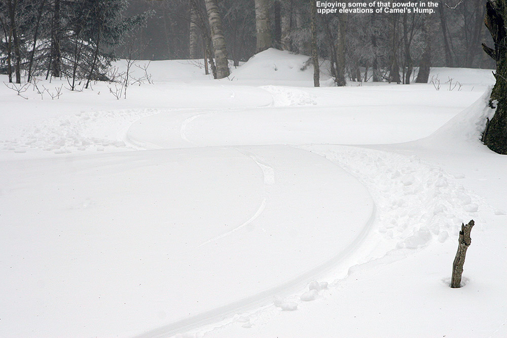
As I ascended, it became obvious that the lower parts of the glades represented a common track to regain the Monroe Trail, but in the higher elevations, there were a number of interconnected glades from which to choose. About halfway through the ascent, I stuck with a glade that was generally on the skier’s right of the area that had seen very little traffic. There was just one very old descent track in it, and that track was actually hard to find at times because so much snow had fallen on it since it had been made. I knew that there were other glades around to my north, because I saw a couple of skiers descending in that area. After generally rejoining with tracks from some of the other glades, I traveled for a bit through more gently sloped terrain until I hit the trail for the Camel’s Hump Challenge at roughly 2,800’. I followed that northward a bit more until I topped out around the 3,000’ mark in some of the upper glades just below the Cliffs of Camel’s Hump. The quality of the snow had definitely improved up at that elevation, with any crust buried below several inches of powder.
I had a snack, switched my gear over, and then began my descent. There were some decent turns above the Camel’s Hump Challenge Trail, but the best turns were definitely when I got onto that lesser used glade below that point. The highest quality snow was in the top half of the vertical, and with my fat skis it was generally soft, bottomless turns. On the lower half of the descent, even my fat skis weren’t enough to always keep me floating, as the depth of the powder decreased to just a few inches; to best handle any partially tracked and/or narrower sections of terrain, I had to inject a lot more alpine turns into the mix vs. just Telemark turns. I did venture off the main glade that I was on at times, and there was plenty of skiing to be had right in the natural trees all around. I saw one other skier as I was descending – he was ascending through the glades as I’d done. He and his dog moved out of the way when he saw me off in the trees beyond the glade, but after I let him know that I was solo and nobody else would be coming down behind me, he quickly resumed his ascent.
Just as I’d experienced on my last outing in the area, from the bottom of the glades it was an easy downhill ski on the Monroe Trail itself. I was even able to catch some turns in the powder off to the side of the snow-covered roadway below the trailhead, then shouldered my skis to walk the last tenth of a mile back to the parking area. The temperature was 31 F just as it had been when I arrived, and the light snow had mostly tapered off down at that elevation. Despite the deeper snow and lack of a defined skin track in the glades relative to the beautifully packed nature of the Monroe Trail, I almost wonder if it’s more efficient to ascend in some cases because it’s a much shorter distance due to the way the Monroe Trail wraps around so far to the south. In terms of preserving the powder and ascending if the unconsolidated snow is deep and there aren’t many descent tracks, the Monroe Trail is the way to go, but now that I’ve gone up via both routes, I’d say they are both pretty convenient options. Hopefully I can get E and the boys along on one of these Monroe Trail trips – now that I’ve had a couple of sessions out there, I think I could guide them on a great tour.
The GPS data from today’s backcountry ski tour overlaid onto Google Earth
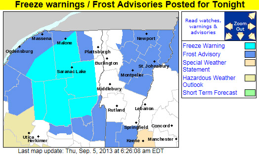
AS OF 454 AM EDT THURSDAY…HIGH PRESSURE WILL CREST OVER THE REGION TONIGHT. GIVEN CLEAR SKIES AND NEALY CALM WINDS WILL ALLOW FOR IDEAL CONDITIONS FOR RADIATIONAL COOLING…WITH TEMPERATURES FALLING INTO THE 30S IN MOST LOCATIONS…WITH SOME TEMPERATURES APPROACHING NEAR RECORD LOWS FOR SEPTEMBER 6TH. EXPECTING TEMPERATURES TO FALL INTO THE UPPER 20S IN THE SHELTERED VALLEYS OF MOST OF THE ADIRONDACKS LATE TONIGHT. THUS…HAVE PUT OUT A FREEZE WARNING FOR THOSE AREAS. ELSEWHERE…HAVE PUT UP A FROST ADVISORY FOR MOST OF THE REMAINDER OF NORTHERN NEW YORK…AS WELL AS NORTH CENTRAL AND NORTHEAST VERMONT FOR PATCHY FROST. NOT EXPECTING ANY FROST OVER THE CHAMPLAIN VALLEY AS LAKE CHAMPLAIN WATER TEMPERATURES STILL IN THE LOW 70S…WHICH WILL KEEP THE VALLEY RELATIVELY WARM WITH MOST TEMPERATURES IN THE UPPER 30S IN THE CHAMPLAIN VALLEY.
Dylan up in Stowe’s alpine today, dropping into his line
I didn’t have high hopes for the overall ski conditions today after what I experienced during yesterday’s outing at Stowe. Snow surfaces in the lower elevations had warmed earlier in the week, followed by plenty of cold nights, and the temperatures yesterday just weren’t warm enough to get the snow to soften. Gondolier was quite firm yesterday afternoon when I made my final descent to the base, with generally frozen granular and a bit of loose granular. Fortunately there was some refuge up in the alpine elevations above ~3,800’ where the snow was still wintry, but it would take some sun and/or warmth to get the lower elevations in shape today, and sun didn’t appear to be in the forecast. Whatever the case, we’d be able to head back up into the alpine to get to the good snow if necessary; today was our final BJAMS ski day of the season, and if the right group of willing students came together, my plan was to make use of the reconnaissance I’d done yesterday and get them up for some fun turns in the area of The Chin.
“…he dropped in with gusto and led into a huge sweeping turn…”
Throughout the morning today, E was getting various calls and text messages from folks letting her know that they weren’t going to be making it to ski program. Those students in the BJAMS theatre program have been putting in many long days of preparation over the past 10 weeks, and this weekend was the culmination of those efforts with shows on Friday and Saturday. Most of those students were so sapped of energy from long days and very late nights, that skiing just wasn’t in the cards. Luke was one of those students, but fortunately Claire had made it out for the day. After combining the usual number of absences for various reasons with the ugly-looking weather forecast and the many students resting up from the play, the end result was eventually just a handful of students and adults meeting at the base of Spruce Peak today. When the dust and reorganization had settled, it turned out that both E and Claire were free to go with our group, and the only kids that we’d have would be Ty, Dylan, and Jack.
Ty and Dylan were raring to go for some hiking and turns in the alpine, and it turned out that Jack was more than ready as well. Somehow, a little bird had told him that I’d been out on the mountain yesterday doing some reconnaissance in the alpine near The Chin… and that I just might be planning to take the ski group up there today. He came ready with his backpack holding a couple bottles of water, and an attitude that said “Let’s get up there!” Ty, Dylan, and I grabbed our ski packs, E and Claire joined us, and we headed up the Gondola for a visit to the wilds of The Chin. Everyone in the group had been up on The Chin and other alpine areas of Mt. Mansfield extensively for hiking in the warmer months, but for everyone but me, this was going to be their first experience up there with winter snowpack and skis. We hoped that Mother Nature was going to make the experience a good one.
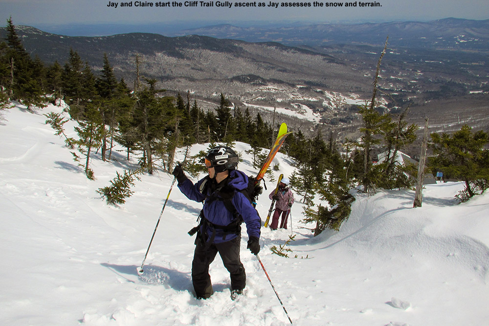
Ascending into the alpine today
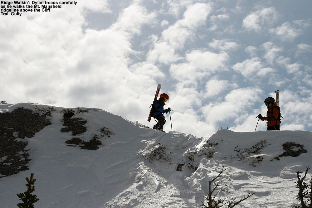
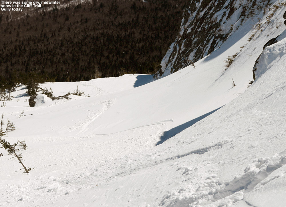
Indeed the weather was ultimately on our side today, and skies that might have been cloudy became blue and almost cloudless as we set off on our midday adventures. Claire was unsure of how long she wanted to hike and ski, but when I told her we’d be starting off with and ascent and some turns in the Cliff Trail Gully, which was a fairly quick ascent to the ridgeline, she was game. While I was finishing with the other boy’s packs, Dylan led the charge upward, and blazed the ascent using a combination of the boot pack I’d used yesterday and some variations of his own. It was immediately obvious that we were going to be dealing with a different kind of snow today. The snow that had been firm with a bit of wind or sun crust yesterday was now softening in the sun. The ascent was absolutely delightful; there were occasional bouts of gusty winds, but for the most part the temperature was perfect, the snow supportive, and the boy’s attitudes positive. Although notably slower than my solo pace yesterday, we probably gained the ridge at around 4,100’ in roughly 30 minutes.
Ridgeline Walkin’
The views from the ridgeline were tremendous, and Claire was absolutely loving her decision to join us for the full ascent. The boys were already feeling in their element, as we watched them traverse higher on the craggy rocks farther south along the ridgeline. We hung out for about 20 minutes for drink and snacks, where we conversed about the season’s skiing, and just generally enjoyed the scenery and weather. We could have just as easily been up there in gray and cloudy conditions, but apparently the sun wanted to make its presence know.
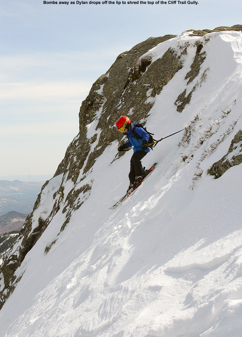
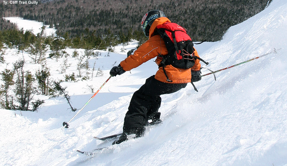
Ty carves up some great snow in the Cliff Trail Gully.
To begin the descent, the boys headed over to the lip of the gully so that they could drop in on the steep terrain. The snow that was protected against the ridgeline was somewhere between spring and winter, but generally dry and edgeable; it was going to support some nice turns. Dylan was chomping at the bit to drop in, and after heading to the highest part of the lip, he dropped in with gusto and led into a huge sweeping turn that send him flying right down the gully into the terrain below. Ty and Jack followed suit, and within moments the boys were whooping and hollering about how great the turns were as they made their way down the upper sections of the gully. Indeed once I dropped in myself I found the snow to be well worthy of their praise. One could stick next to the protection of the rocky wall of the ridge for the driest snow, or head left out into more sunshine for more spring-like surfaces. We mixed it up with turns in various part of the gully until we’d dropped a couple hundred vertical feet, right to the spot where I’d descended yesterday that at that time marked the transition to lower-quality snow. That wasn’t the case today thanks to the assistance of the sun, but as we stood atop one of the overlooks and Jack saw the Cliff House below, he lamented the fact that we’d already descended so far and would soon be back to the bottom of the gully. I told him not to worry – we didn’t have to descend if we just wanted to keep touring.
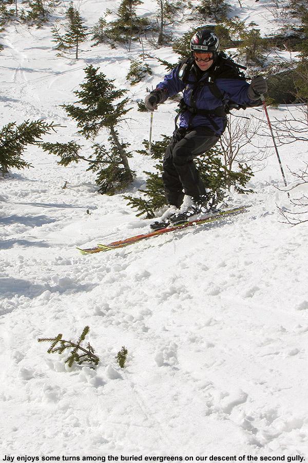
Great turns in our second gully today
Instead of descending the rest of the gully, I led the group on a traverse across to the next gully southward (see stage 4 in the detailed Google Earth GPS map from yesterday’s outing), and we were able to follow the same track that I’d used yesterday. I told the group that one option was to make another ascent here and ski this gully from the top of they wanted. The boys weren’t all that enthusiastic about another ascent, so after a few moments of discussion, we decided to descend the new gully and see how it went. We saw some great terrain below us, but I warned them that I hadn’t scouted the bottom of this gully yesterday. I told them that we could end up having to hike back out and descend via the Cliff Trail Gully if the trees got too tight or we got ran into cliffs. The acknowledged my advice, and then it was time to drop in. The descent of the second gully started with some nice steep terrain among sparse, buried evergreens. There were really a lot of fun terrain options such as rollovers and small ledges in there that will lend themselves to a lot of future exploration. As we continued downward, the trees began to get tight, and Dylan seemed to be having quite a time blazing a trail through the evergreens using a combination of his own ideas and the tracks of a previous skier that had passed through the area. With all the experience they continue to build, it really is inspiring to watch how confidently the boys navigate their way through challenging terrain like a maze of subalpine evergreens. They were inspecting options and helping each other out all while they were well ahead of the adults. Eventually my spider sense told me that that we needed to break right toward the Cliff Trail Gully, and after some tight squeezes through a few spots, we found ourselves in a pleasant spot atop a rock outcropping among the sea of evergreens. About 100-200 feet below we could see the Gondola summit area, and it felt as if we were on a balcony overlooking a show of skiers and boarders starting their way down the slopes. We spent another few minutes there on the knoll while everyone gathered back together via their own routes through the evergreens, and then we cut right about a dozen yards to get back to the Cliff Trail Gully. We finished our descent to the Cliff House there, and that bottom section of the gully served up some nice turns. It was ski pole-style high fives all around for the folks that had just completed their first descent from the alpine areas of Mt. Mansfield. I didn’t track our outing today by GPS, but for visual details, refer to stages 3 through 5 shown on the detailed Google Earth/GPS map from yesterday – today though, instead of ascending the gully shown in stage 5, we descended it.
“Indeed the weather
was ultimately on
our side today…”
It was around 3:00 P.M as we began the next phase of our descent through the resort. We took Perry Merrill, and didn’t see another soul on the entire descent. The late season date, the fact that it was Sunday afternoon, and the ominous forecast had really cleared out the mountain. With the terrain entirely to ourselves, I led the boys in some huge GS-style turns that took up the whole width of the trail, and they had a lot of fun with that. Ty said that he had used up all his patience for going slow during the hiking portion of the day, so with that in mind it was a great time to let him really open it up. The snow was in fact fantastic, not too firm, not too sticky; it was just what you’d want in corn snow to sink in those edges and let the skis ride. Whatever the sun had not been able to do yesterday in terms of softening up the snow surfaces, it had done it in spades today. We had time to squeeze in one more run of Gondolier before calling it a day and heading back to Spruce Camp. Today is the end of the season for the Gondola and for Spruce Peak, and it ultimately turned out to be a great one. The weather was extremely changeable though – once we were back at Spruce Camp, gray clouds had come in and sleet began to fall.
We finished off the day with a visit to Frida’s for dinner, since we hadn’t been there at all this season. The guacamole was excellent as usual, with a real good dose of lemon today. Despite the fairly spring-like atmosphere out there, the boys both went for hot chocolate, which Frida’s does Mexican-style with some interesting extra flavor. It looks like this week is going to have more precipitation coming in, although not necessarily a lot of snow. It doesn’t look especially warm though, so it looks like it could be OK for snow preservation. It’s great to be going into the month with such a strong snowpack, because it looks like there a lot more great skiing to come.
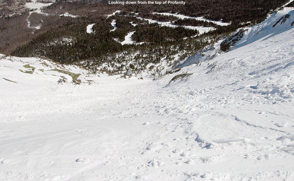
Looking down from the top of Profanity Chute at some nice winter snow
Today turned out to be a day of actual “Alpine Touring” in the high elevations of Mt. Mansfield. Although Stowe picked up a foot of snow earlier this week, the freezing level eventually rose fairly high over the past few days, and that brought the lower elevation snow surfaces back into spring time cycling. There wasn’t going to be much spring softening of the snow today though – highs in the Bolton Valley Village at ~2,100’ were predicted to be below freezing, and up in the peaks the temperatures weren’t supposed to get out of the 20s F. That sounded like a frozen granular recipe for those elevations that had gone above freezing, so it seemed like a prime time to head to the high elevations up near 4,000’. I’ve been waiting for a day to get up into the alpine areas of The Chin so that I could explore some lines to ski with the boys, and today’s conditions were the perfect excuse. It was crystal clear, and visibility is always something to consider if you’re going to go exploring around above tree line.
“The snow was definitely all winter up there…”
I laughed to myself as I was driving to the mountain around midday and saw that even in the valleys the temperature was below freezing. There definitely wasn’t going to be much in the way of softening today. If the alpine areas had been warmed, it was going to be a short outing, because there was no need to play around up there on bad snow that had been refrozen. Despite the sub-freezing temperatures all the way down to the valleys, there was still the occasional reminder of spring. As I was driving near The Gables Inn on the Mountain Road, I was momentarily distracted as a red fox was chasing a skinny, dark black animal (perhaps a mink) all over the place alongside and across the road. The mink didn’t seem especially scared, and it actually wasn’t all the much smaller than the fox; it was almost as if the two were simply engaging in some sort of springtime frivolity.
I parked at the Midway Lodge, hopped on the Gondola, and began my hike right up above the Cliff House once the lift dropped me off. I’ve hiked that route in the fall before with E and the boys – it’s the hiking route called Cliff Trail (not to be confused with Stowe’s ski trail called “Cliff Trail”. There’s quite a dramatic difference in what one experiences up there in the warmer months – the trail wraps around, under, and over 20-foot tall boulders and other sorts of obstacles. However, in the winter it’s essentially buffed smooth with meters and meters of snow. That’s pretty amazing, and speaks to just how deep the snow gets up there. On my ascent from the Cliff House at ~3,600’, the surface of the snow initially had a thick layer on top that seemed to be some sort of melt and/or wind crust, but at around the 3,800’ level, the snow began to get better and pockets of powder were starting to appear. Before I knew it, I’d hit the ridge around 4,100’. Relative to similar warm weather hikes, it felt like no time at all had passed, and it’s a testament to just how much easier it is to hike that route when all the huge rocks are covered with a nice, smooth surface of snow. I did get to follow someone else’s boot pack though, and that certainly helped with the pace.
The Cliff Trail Gully today offering some winter snow
I spent a few minutes on the ridgeline, and then dropped in for some turns. The snow was definitely all winter up there, I’d say the bigger enemy had been the winds. I got in some nice turns, and once I’d dropped a couple hundred feet and the snow quality started to deteriorate, I popped my skis back on my pack and headed skier’s left to see where it brought me. The travel was very easy with all the snow, and I quickly came to the next gully over. I hiked up that one to the top, but didn’t find the snow to be up to the best stuff I’d found over in the Cliff Trail Gully. I made a short descent in that gully, just enough to get me access to keep moving to the left, and then came to a third gully. By the time I topped out in that one I was actually starting to get close to The Chin, so I decided to just continue up and poke around to see what descents might have good snow.
I checked out both Profanity Chute and Hourglass Chute, and they both appeared to have good winter snow in them. I haven’t been down Hourglass since I skied it about 15 years ago, but as I watched people side-slipping their way through the crux, it didn’t seem all that appealing. The snow quality looked decent, it didn’t quite have the appealing look that Profanity did, so I ended up going down Profanity Chute for my descent. Taking that option was a bonus as well, because I don’t think I’ve ever skied it before. It’s definitely a fun line, and it’s not excessively steep at probably 30 degrees or so, it gives you a nice ride with an alpine feel. The snow was generally packed powder, although there were a few slick spots in there. I cut left and followed the main line down through the subalpine areas, and outside the main track there were good shots of powder – I was often finding depths of 10 to 11 inches and it was quality stuff. The snow definitely started to deteriorate below 4,000’. It was mostly in the main lines where there had been traffic, but those spots were certainly slick. Following the lower connection of the chute through the evergreens was notably more challenging than the crux up at the top, in part due to the firmer snow in those lower elevations. I made my way back toward Chin Clip, and connected onto Gondolier. Conditions were pretty bad as far as I was concerned, it was a lot of frozen granular, with the best relief from that being the loose granular that people had pushed around. I’m not sure how much day tickets cost at Stowe today, but I’m surprised how busy the mountain was. The parking lots were reasonably full, so apparently there are plenty of folks out there that didn’t mind the conditions. We’re heading back to Stowe tomorrow for BJAMS ski program, and the potential is there for some warmer temperatures. It feels like we’ll either need some of those warm temperatures, or enough new snow to soften up the surfaces.
A close up view of the Google Earth/GPS map of today’s tour – click for the full size image.
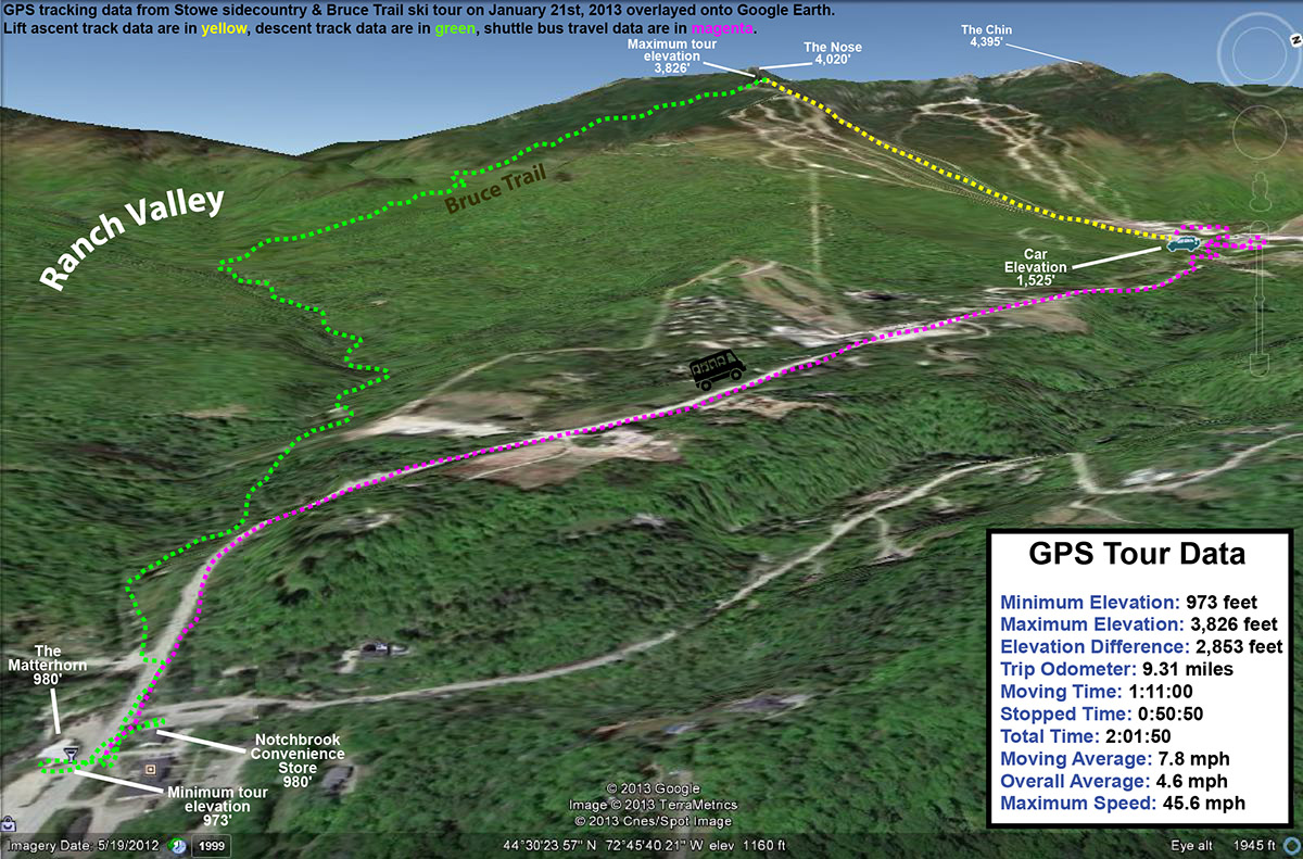
Some of the Northern Vermont ski areas have picked up close to (or in the case of Jay Peak, substantially more than) a foot of snow in the past seven days, and while that’s actually a fairly modest pace for snow accrual in the mountains this time of year, it’s helped to get surfaces back to packed powder since they hardened up last week. The snow has generally been dry and fluffy, so even with all that accumulation it hasn’t been a thorough resurfacing for all slopes. However, my explorations Saturday on the Bolton Valley Backcountry Network revealed that the powder is building and there are some nice turns to be had. Temperatures were expected to be in the single digits in the highest elevations today, so it seemed like a good opportunity for some sidecountry exploration instead of riding lifts. And, since Claire and I have been talking about bringing our Stowe ski group for a trip on the Bruce Trail one of these days, this seemed like an excellent opportunity for some reconnaissance. There’s no doubt that everyone in the group is ready for the skiing on the Bruce, but I still wanted to familiarize myself with the route to ensure that the trip would go smoothly with all the boys in tow.
“In general, I found 6 to 7 inches of powder down to the 2,000’ elevation, and at some point below there it dropped down more toward the 5-inch range.”
Temperatures hovered right around 10 F all the way to the base of the resort, and there was sun and no wind, so it wasn’t feeling too frigid at the point. The resort had snow guns going on various trails, no doubt taking advantage of the temperatures to bolster base depths that were probably brought down a bit by the warmth earlier in the month. I rode the Fourrunner Quad with a guy who had already been out for some runs, and he said the conditions were quite good. Listening to the turns of the skiers below us, it did sound pretty quiet. I could see the occasional icy spot, but the surface seemed to be mostly packed powder just as the snow report had indicated. The snow over the past week has definitely been having an effect in terms of softening up surfaces.
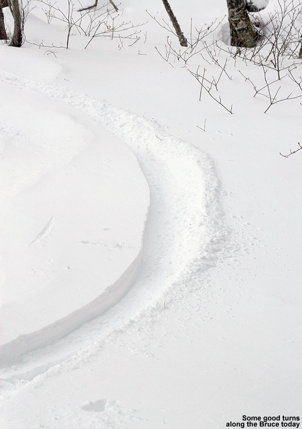
“While I’m sure the steeper top sections of the Bruce are great with a good dump of snow, the skiing today was far superior once I got down out of the evergreens and into the hardwood forest.”
From the quad summit I headed over to the top of the Bruce Trail – a few tracks indicated that some skiers had already skied it today, but I dropped in via an alternate entrance to get an untracked line. The line was pretty steep and I was definitely touching down on the subsurface, but I could tell that I’d be able to get in some good powder turns on some lower angle terrain. The top part of the Bruce wasn’t really all that inspiring today – it’s pretty steep, a lot of pitches face southward, and it’s narrower than I’d thought it would be. I’d say it’s only 10 to 12 feet wide on average in the upper sections, which means that in reality it’s going to be tracked out and packed down after just a few skiers hit it. With its somewhat southern aspect making for spots of poor coverage here and there, it skied even narrower today. The snow was generally skier packed, so my fat Telemark skis were indeed feeling slow edge to edge, and I had to throw in a good number of alpine turns to fit in some of those small spaces dictated by the trail width and coverage.
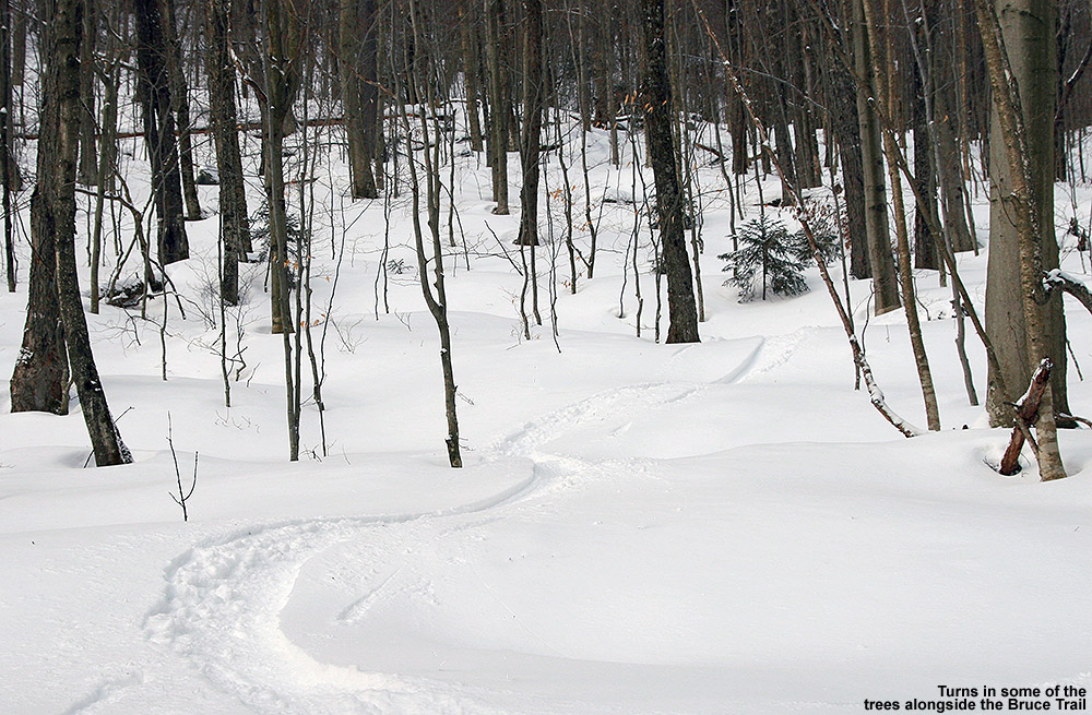
Catching turns down in the lower elevations among the hardwoods
While I’m sure the steeper top sections of the Bruce are great with a good dump of snow, the skiing today was far superior once I got down out of the evergreens and into the hardwood forest. The trail is notably wider in that area, and there are a lot more glade options for venturing off the sides of the main route. In general, I found 6 to 7 inches of powder down to the 2,000’ elevation, and at some point below there it dropped down more toward the 5-inch range. All those depths were definitely enough for some nice powder turns on moderate angle terrain though. With the narrow nature of the Bruce Trail in the top sections, it’s really not a trail that’s going to offer up much in terms of fresh powder, so those looking for a sidecountry experience with real untracked snow would probably be best served by using the Bruce as a jumping off point for explorations of the Ranch Valley. The snowpack isn’t even especially deep right now (right around the 40” mark), but I could see a multitude of ski options all around during my descent. I noted a couple of potential areas for exploration up in the evergreen areas, but choices really exploded once down in the hardwoods. It would be easy to make a day of it out there, or, ski the resort in the morning and then tour out in the Ranch Valley in the afternoon and finish off the day by skiing out to Route 108.
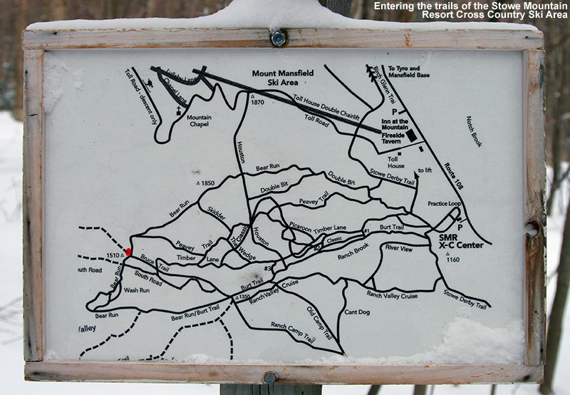
Stowe XC Map – Click for full size image
At around the 1,500’ elevation, I entered the trails of the Stowe Mountain Resort Cross Country Ski Center. This is the part I’d been concerned about in terms of making the correct choices to get out to Route 108 and the Matterhorn. It turns out that it’s much easier than I’d thought; you simply stay on the Bruce, and Burt Trails, following the signs that say “Ski Lift”. Even though you may not be planning to head back to the Toll House Lift, those “Ski Lift” signs are the way to go. Eventually you’ll get to a junction where following the “Ski Lift” route is a very obvious (and somewhat arduous looking) uphill, so you won’t want to go that way. By that point there are signs that indicate “Route 108”, and those will get you right out to the Matterhorn area. At every intersection you essentially go straight through, so in a worst case scenario, go with that. The trek through Stowe’s Nordic trails, and a small portion of the trails that belong to the Trapp Family Lodge Cross Country Ski Center, is slightly downhill, but there’s plenty of poling and skating to be done. I was happy to have my Telemark gear, even if I looked funny with my skis being three times the width of the other Nordic skiers ambling around on the trails. I generally took it slow and enjoyed the scenery, which included some marvelous views of the Ranch Brook. The brook had that winter look with some flowing water, but also lots of ice, and snow pillows covering the rocks.
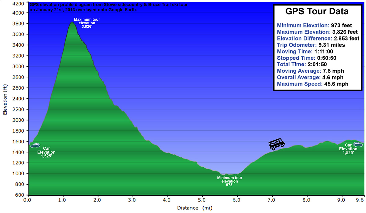
Elevation profile of today’s tour – click for full size image
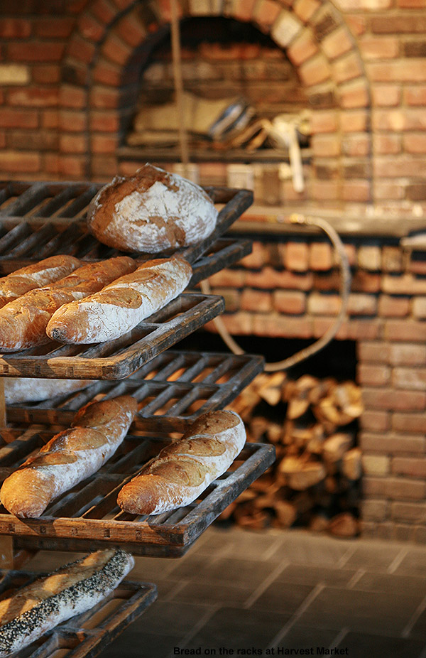
The final leg of the descent on Ranch Brook Road brings your right out on the “Ski Inn” driveway, next door to the Matterhorn, and across the street from The Notchbrook Convenience Store. I had time before the next uphill Mountain Road Shuttle arrived, so I stopped into the Matterhorn to get some sushi… only to discover that they don’t have sushi on Mondays. Clearly I’m going to have to hit the Bruce again with the boys on a different day so that we can finish that part of the adventure. So instead, I popped across the street to the store and got a snack before catching the shuttle back up to my car in the Mt. Mansfield lot. One thing I should note about the shuttle – the ski slots on the outside are still fairly old school, so if you’ve got fat and/or twin tip skis, you might have to bring them on the bus with you. Apparently that happens a lot, because the driver immediately knew what my issue was when I inquired. Missing out on the sushi, I did stop off at Harvest Market for a couple of samosas on the way home, and that definitely filled the void. So, today’s outing offered up some good turns in the powder, and was certainly a successful reconnaissance. The route down to the Matterhorn is easy, and I can tell that the biggest hurdle is going to be getting the boys through the flatter terrain at the end of the run. If that’s the toughest part we have to deal with though, it should be a lot of fun.
Harvest Market
Weather-wise, the day turned out much warmer than the forecast seemed to suggest – it was 20 F once I was back down in the valley, and before I’d realized that, I couldn’t figure out why it felt so comfortable. The sunny skies from earlier in the day had clouded over ahead of another small snowfall event that’s supposed to hit us tonight into tomorrow – these are the sorts of storms we’ve got for now until something bigger comes along, but at least we’re getting something.
Today’s Tour viewed in Google Earth – Click for full size image
Freeze Warnings and Frost Advisories are up throughout much of the state of Vermont tonight.
Parts of the Northeast have had bouts of sub-freezing temperatures since the end of August, but tonight looks like the first widespread occurrence of the season throughout Vermont. We’ve got a frost advisory here in Washington County, but it sounds like some of the colder areas of the state up in the Northeast Kingdom could get down into the middle 20s F, and freeze warnings are in place. It’s certainly time to cover up those gardens in the usual cold spots.
Sub-freezing temperatures are forecast for much of Vermont tonight.
The National Weather Service in Burlington has put out Winter Weather Advisories and Winter Storm Warnings for the upcoming winter storm in our area.
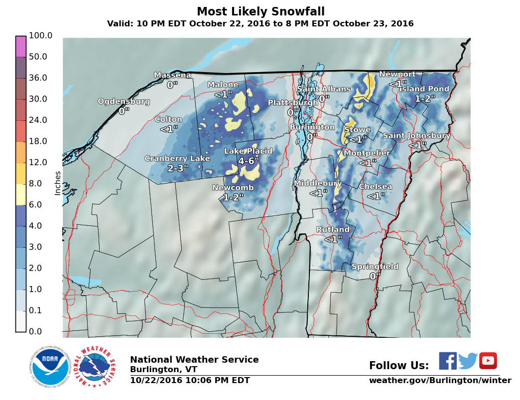
With our recent return to wintrier weather, three storms have been in the forecast, and thus far each one has been topping the previous one in terms of mountain snowfall. The first one came through Tuesday night into yesterday, and dropped 1.7” of snow here at the house and a few inches in the mountains. The second system started up yesterday, and while we picked up 0.5″ at our house in the valley, it was definitely a step up in accumulation for the northern mountains. With the addition of this second storm, two-day snow totals are just shy of the 1 foot mark at some of the Northern resorts like Jay Peak and Smuggler’s Notch, with totals tapering to the 5 to 8-inch range in the Sugarbush through Stowe stretch of the spine. I caught some turns yesterday at Bolton and the skiing was already excellent. The third storm in this triumvirate is expected to start today, and depending on how it plays out with the mountain upslope snow, another 1 to 2 feet could be added in the mountains on top of what was already received from the first two storms. Winter Storm Warnings are up for many areas, and this morning’s Storm Total Snowfall Map from the National Weather Service Office in Burlington is added below. In any event, with the moderate density snow already down from the first two systems, whatever this storm delivers, the potential is there for a great weekend on the slopes.
The Storm Total Snowfall Forecast map for the morning of February 24, 2012 for the upcoming winter storm – 1 to 2 additional feet of snow are expected in the mountains.
Snow totals from this storm were quite impressive. I’ve put together the north to south snowfall totals I’ve seen from the Vermont ski areas for this storm (list 1) and the sum of all three storms we’ve had since midweek (list 2).
As is often the case, there’s a very clear north to south gradient for snowfall, this time with the northern resorts measuring in feet, while the southern resorts are measuring in inches. This was a great enhancement to the snow depths in the northern and central resorts, and it looks like roughly 2 inches of liquid went into the snowpack on Mansfield. You know it’s a decent storm cycle period when the depth of snowpack at the stake goes from a below average 49 inches on Wednesday, to an above average 81 inches as of today.


